Christmas Island Map
Discover the remote beauty of Christmas Island with our detailed map. Explore the island's pristine beaches, lush rainforest, and unique wildlife. Check out our Christmas Island map and start planning your next adventure to this off-the-beaten-path destination.
- Capital : Flying Fish Cove
- Population : 1,402
- GDP : N/A
- Per Capita : N/A
- Calling Code : +61
- Jobless Rate : N/A
- Time Zone : +7
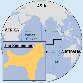
Where is located Christmas Island on the Map
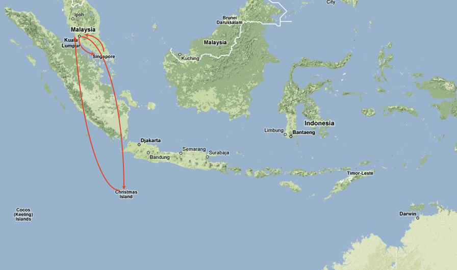
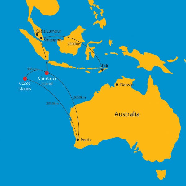
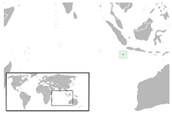
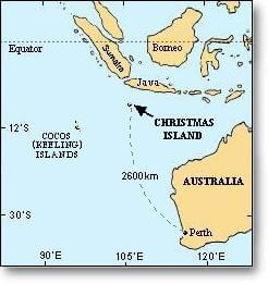
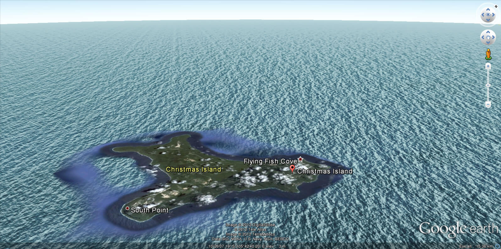
Christmas Island is a small Australian territory located in the Indian Ocean, approximately 2600 kilometers (1600 miles) northwest of Perth, Western Australia, and around 500 kilometers (310 miles) south of Jakarta, Indonesia. It is situated at 10 degrees 29 minutes south latitude and 105 degrees 38 minutes east longitude.
Christmas Island is a small but fascinating Australian territory located in the Indian Ocean. Known for its pristine beaches, lush rainforest, and unique wildlife, this remote island is a nature lover's paradise. Our detailed map will help you explore all the island's hidden corners and plan your perfect getaway. Whether you're looking to go snorkeling in the crystal-clear waters of the Indian Ocean, hike through the jungle, or simply relax on a secluded beach, Christmas Island has something for everyone. So start exploring our map and get ready to discover the wonders of this beautiful island!
For more about Christmas Island >>
MAP OF CHRISTMAS ISLAND
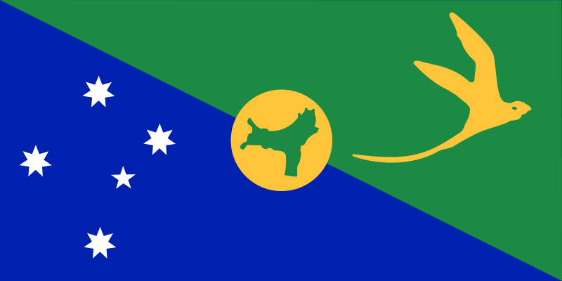
CHRISTMAS ISLAND MAP AUSTRALIA
Brief information about Christmas Island
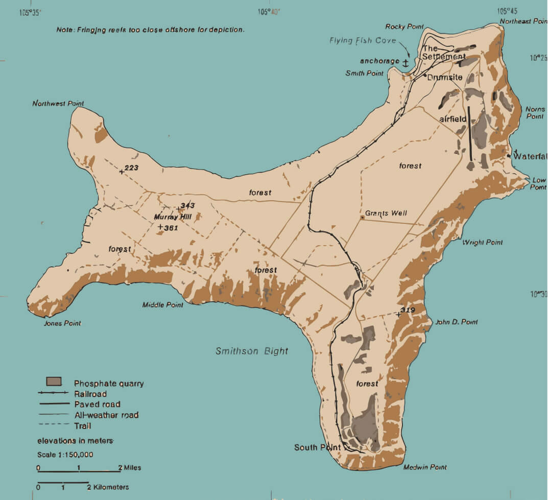
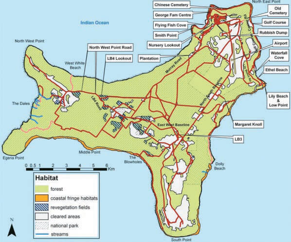
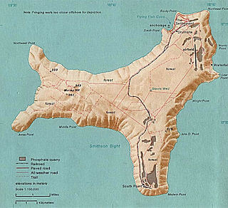
Christmas Island is a small Australian territory located in the Indian Ocean. The island has an area of about 135 square kilometers (52 square miles) and a population of around 2,000 people. The island is known for its unique natural environment, with rainforest, coral reefs, and a number of endemic species of flora and fauna, including the famous red crab. The island's economy is largely based on the phosphate mining industry, which has been active since the early 20th century. In addition to mining, tourism is also an important industry on the island, with visitors attracted to its natural beauty and wildlife.A Collection of Christmas Island Maps and Christmas Island Satellite Images
MAP OF CHRISTMAS ISLAND

RELIEF MAP OF CHRISTMAS ISLAND
WHERE IS CHRISTMAS ISLAND IN THE WORLD
CHRISTMAS ISLAND MAP AUSTRALIA
CHRISTMAS ISLAND MAP WORLD
CHRISTMAS ISLAND MAP
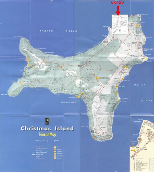
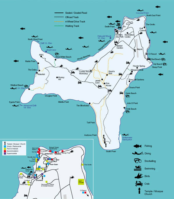
CHRISTMAS ISLAND TOURIST MAP
CHRISTMAS ISLAND MAP

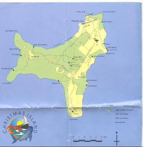
CHRISTMAS ISLAND NATIONAL PARK MAP

CHRISTMAS MAP
CHRISTMAS ISLAND AUSTRALIA MAP

CHRISTMAS ISLAND MAP
CHRISTMAS ISLAND MAP OCEANIA
MAP OF CHRISTMAS ISLAND OCEANIA
MAP OF CHRISTMAS ISLAND

MAP OF CHRISTMAS ISLAND 1976
CHRISTMAS ISLAND EARTH MAP
- Head of Performance Marketing
- Head of SEO
- Linkedin Profile: linkedin.com/in/arifcagrici
Largest Cities' Map of Christmas Island
Copyright WorldMap1.com 2006 - 2023. All rights reserved. Privacy Policy | Disclaimer