Map of Iowa, United States
Navigate Iowa map, Iowa country map, satellite images of Iowa, Iowa largest cities, towns maps, political map of Iowa, driving directions, physical, atlas and traffic maps in United States.
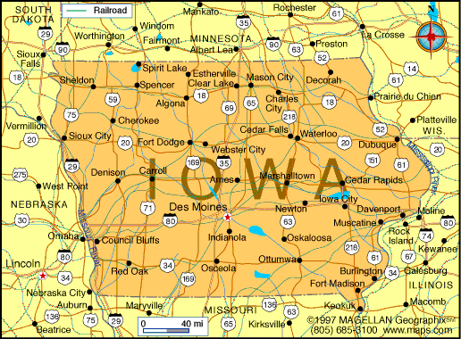
MAP OF IOWA
A Collection of Iowa Maps and Iowa Satellite Images
MAP OF IOWA

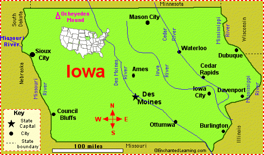
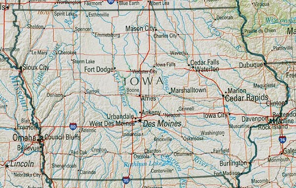
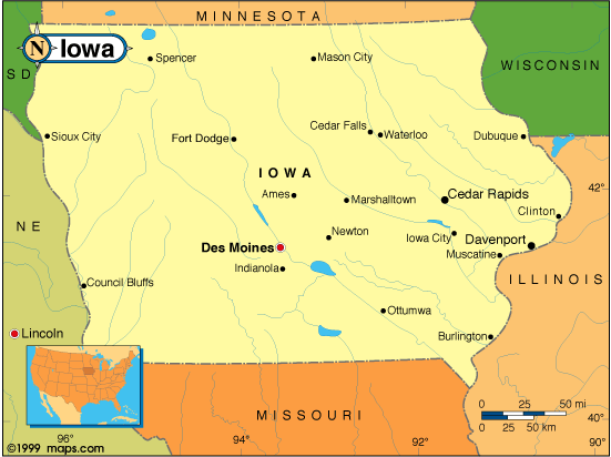
IOWA CITIES MAP

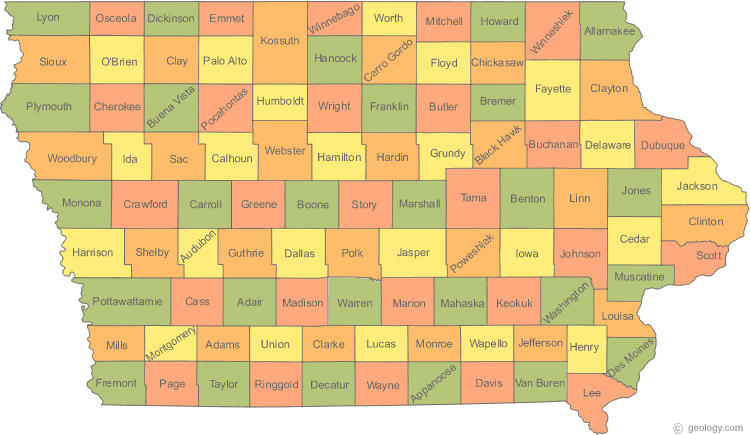
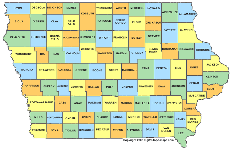
IOWA COUNTY MAP

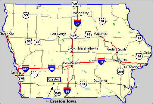
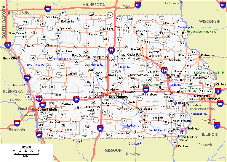
IOWA HIGHWAYS MAP

IOWA PHYSICAL MAP

IOWA RIVER MAP

IOWA ROAD MAP

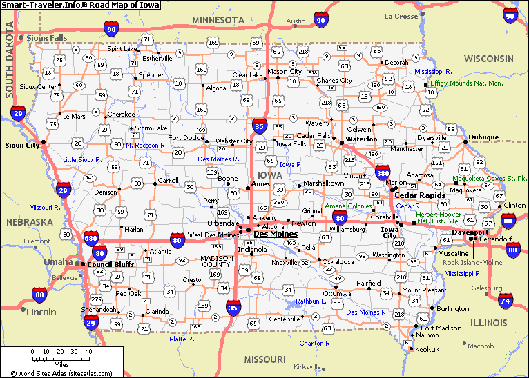
IOWA ROUTE MAP

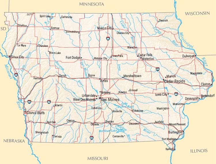
IOWA STATE MAP

STATE MAP OF IOWA

Largest Cities Map of Iowa and Population
Des Moines - 203,433 Cedar Rapids - 126,326 Davenport - 99,685 Sioux City - 82,684 Waterloo - 68,406 Iowa City - 67,862 Council Bluffs - 62,230 Ames - 58,965 Dubuque - 57,637 West Des Moines - 56,609 Ankeny - 45,582 Urbandale - 39,463 Cedar Falls - 39,260 Marion - 34,768 Bettendorf - 33,217For All Iowa Cities Map
- Head of Performance Marketing
- Head of SEO
- Linkedin Profile: linkedin.com/in/arifcagrici
See Also
Iowa Google Map, Street Views, Maps Directions, Satellite Images
WorldMap1.com offers a collection of Iowa map, google map, Iowa atlas, political, physical, satellite view, country infos, cities map and more map of Iowa.
United States Largest Cities Map by Population
New York City Map Los Angeles Map Chicago Map Brooklyn Map Houston Map Philadelphia Map Manhattan Map Phoenix Map San Antonio Map San Diego Map Dallas Map San Jose Map Jacksonville Map Indianapolis Map San Francisco Map Austin Map Columbus Map Fort Worth Map Charlotte Map Detroit MapCopyright WorldMap1.com 2006 - 2023. All rights reserved. Privacy Policy | Disclaimer