Discover the Show-Me State with our Missouri Map!
Explore the diverse landscapes and rich history of Missouri with our interactive map. From the iconic Gateway Arch in St. Louis to the stunning Ozark Mountains, our map provides detailed information and navigation to help you plan your next adventure. Whether you're interested in exploring the state's bustling cities or its peaceful countryside, our map has got you covered. Start exploring Missouri today!
For all Missouri Cities Map
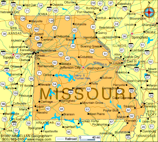
MAP OF MISSOURI
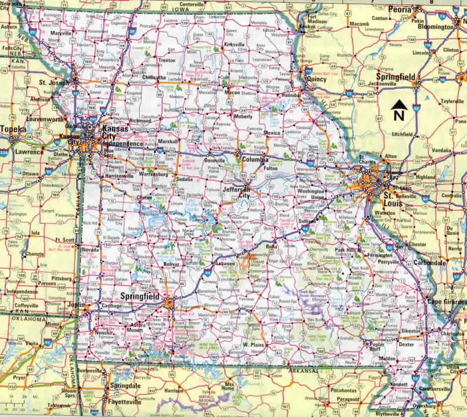
MAP OF MISSOURI
Brief information about Missouri, US
Missouri is a state located in the Midwestern region of the United States. With an area of approximately 69,704 square miles (180,533 square kilometers), it is the 21st largest state in the US. As of 2020, the estimated population of Missouri was approximately 6.1 million people.A Collection of Missouri Maps and Missouri Satellite Images
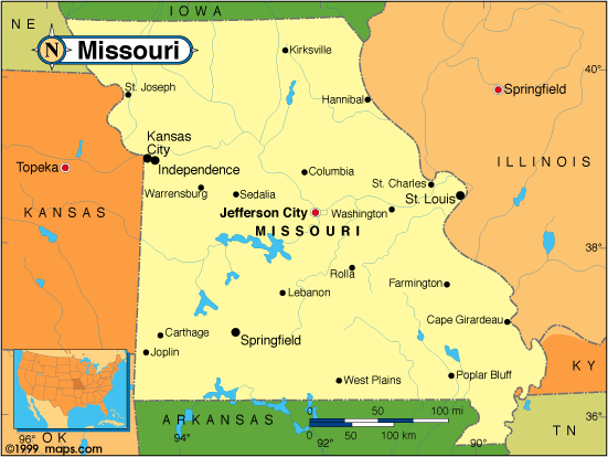
MAP OF MISSOURI
MAP OF MISSOURI
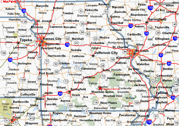
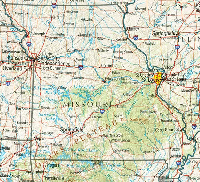
MAP OF MISSOURI

MAP OF MISSOURI
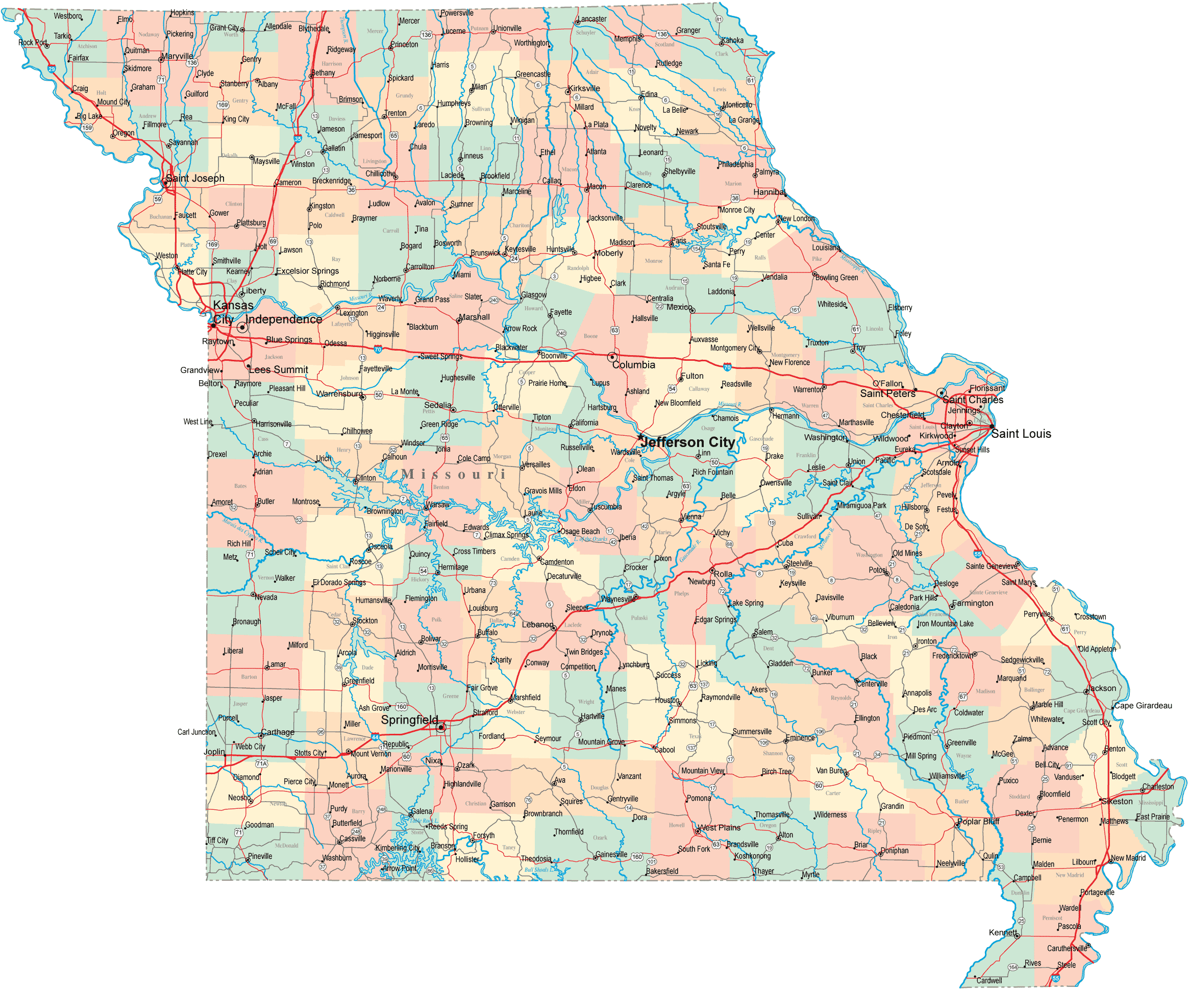
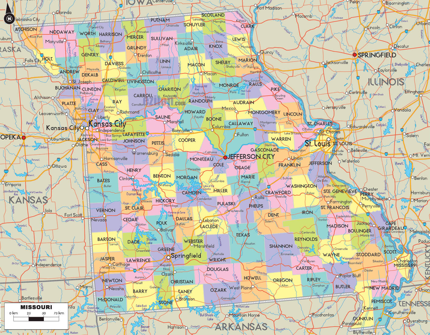
MISSOURI COUNTY MAP

MISSOURI COUNTY MAP

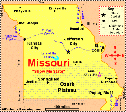
MISSOURI MAP
MISSOURI MAP

MISSOURI COUNTY MAP

MISSOURI MAP
MISSOURI MAPS

MISSOURI POLITICAL MAP
MISSOURI RIVERS MAP

MISSOURI STATE MAP
A collection of Missouri Maps
- Head of Performance Marketing
- Head of SEO
- Linkedin Profile: linkedin.com/in/arifcagrici
Largest Cities Map of Missouri and Population
Kansas City Map - 459,787 St. Louis Map - 319,294 Springfield Map - 159,498 Independence Map - 116,830 Columbia Map - 108,500 Lee's Summit Map - 91,364 O'Fallon Map - 79,329 St. Joseph Map - 76,780 St. Charles Map - 65,794 Blue Springs Map - 52,575 St. Peters Map - 52,575 Florissant Map - 52,158 Joplin Map - 50,150 Chesterfield Map - 47,484 Jefferson City Map - 43,079Copyright WorldMap1.com 2006 - 2023. All rights reserved. Privacy Policy | Disclaimer