
- Capital :
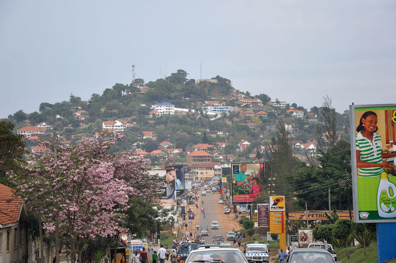
Kampala
- Population :
35,873,253
- GDP :
$16.810 billion
- Per Capita :
$477
- Calling Code :
+256
- Jobless Rate :
4.20%
- Time Zone :
+3
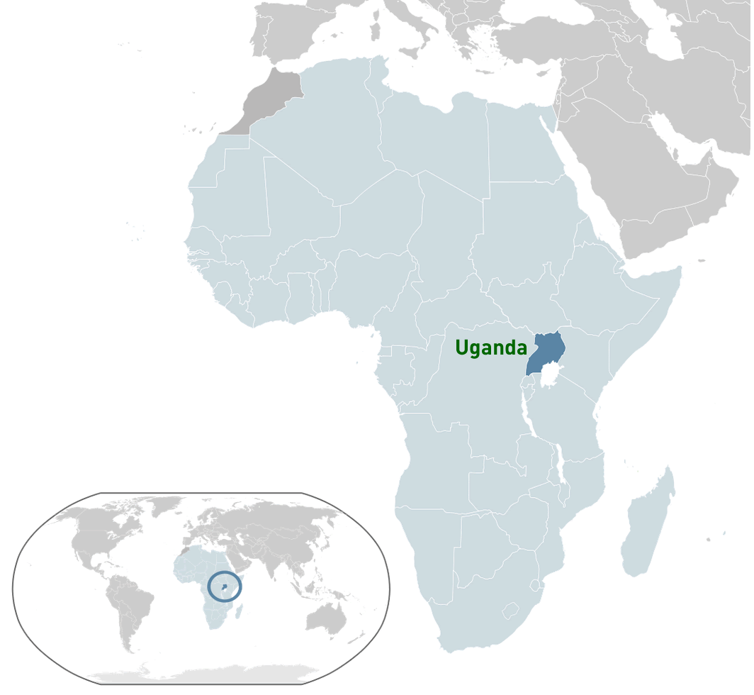
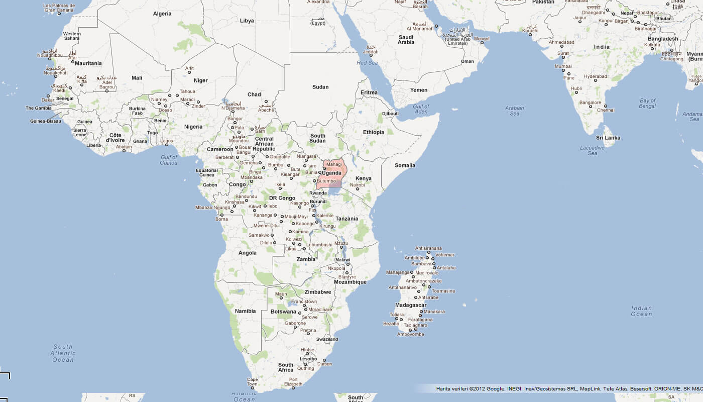
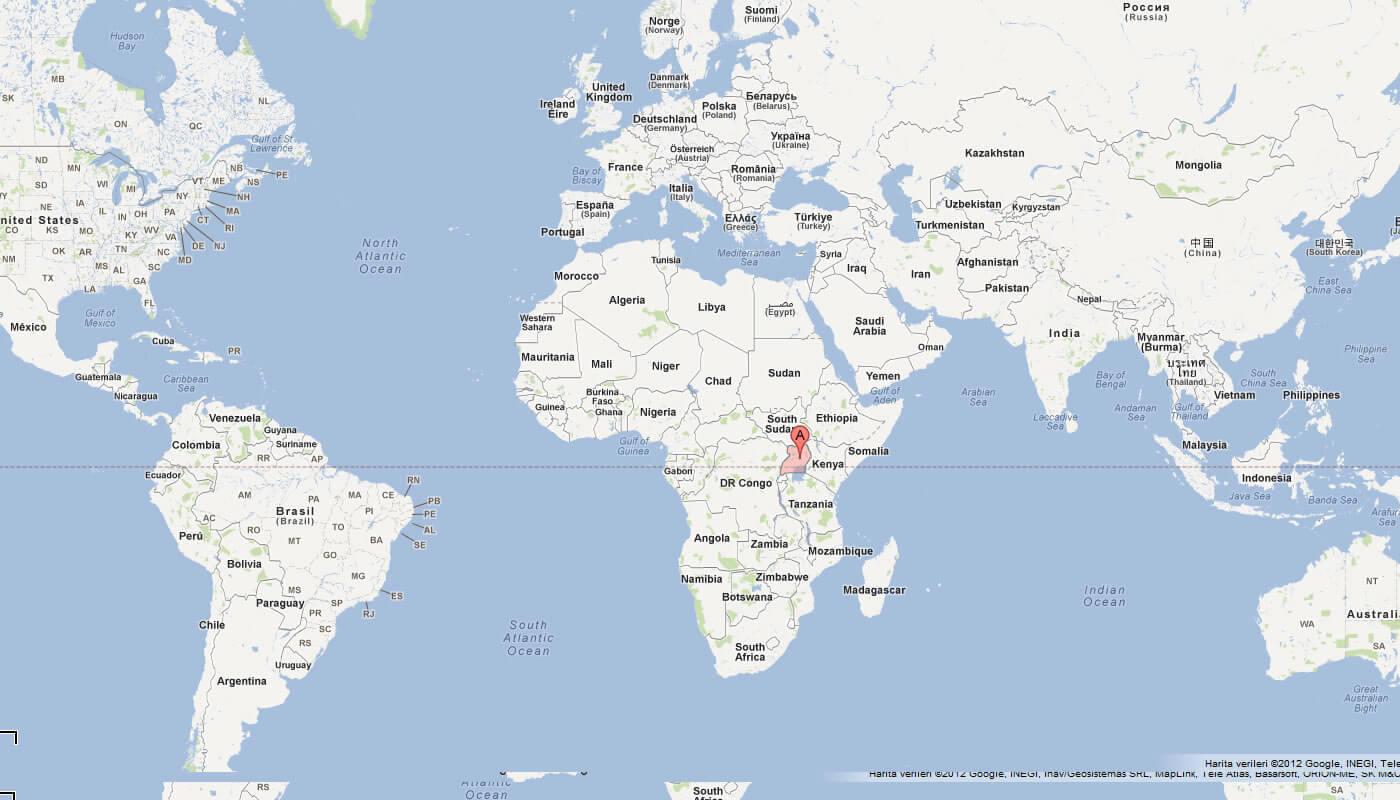
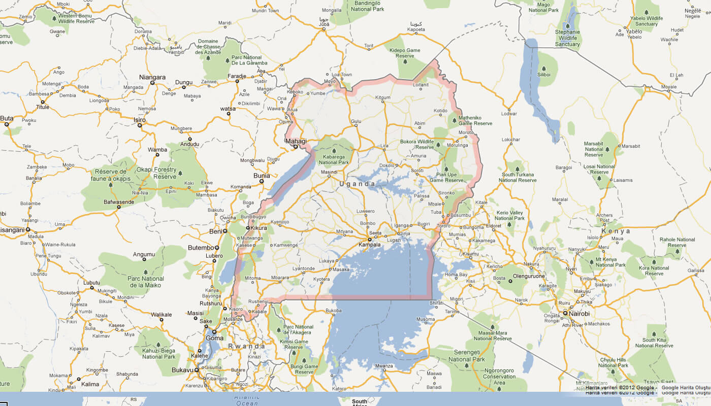
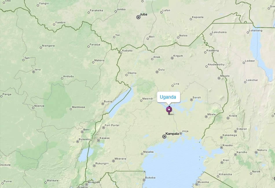
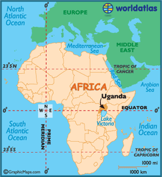
Where is located Uganda on the Map
Uganda is located in East Africa, situated right on the equator. It's a landlocked country surrounded by five countries:
- South Sudan to the north.
- Kenya to the east.
- Tanzania to the south.
- Rwanda to the southwest.
- Democratic Republic of Congo to the west.
Uganda lies within the eastern hemisphere of the Earth. One of its significant geographic features is Lake Victoria, which it shares with Kenya and Tanzania. This lake is the source of the Nile, the longest river in the world.
This landlocked nation, tucked away in the heart of East Africa, is a destination of diverse cultures, breathtaking landscapes, and an array of unique wildlife. With this interactive map, you have the chance to virtually traverse the majestic mountains, extensive savannahs, and sparkling lakes that this equatorial nation has to offer.
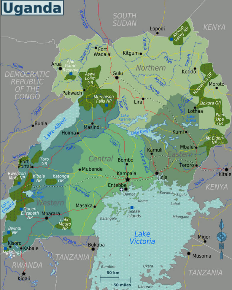
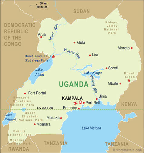
Uganda map is designed to help you navigate through the myriad attractions of Uganda. From the bustling streets of Kampala, the capital, to the tranquil waters of Lake Victoria, the world's second-largest freshwater lake, this map is your key to unlocking the treasures of Uganda. The country's stunning national parks, including the Bwindi Impenetrable Forest, famous for gorilla tracking, and Queen Elizabeth National Park, known for its incredible biodiversity, are all at your fingertips.
Whether you're a globe-trotter planning your next adventure, a student researching for a project, or just a curious soul eager to explore the World, Uganda map provides a comprehensive and engaging way to discover Uganda. So embark on your journey across this vibrant land, immersing yourself in its rich heritage, varied ecosystems, and the warmth of its people. Welcome to your virtual exploration of Uganda - the Pearl of Africa awaits!"
With interactive Uganda Map, view regional highways maps, road situations, transportation, lodging guide, geographical map, physical maps and more information. On Uganda Map, you can view all states, regions, cities, towns, districts, avenues, streets and popular centers' satellite, sketch and terrain maps.
For more about Uganda >>
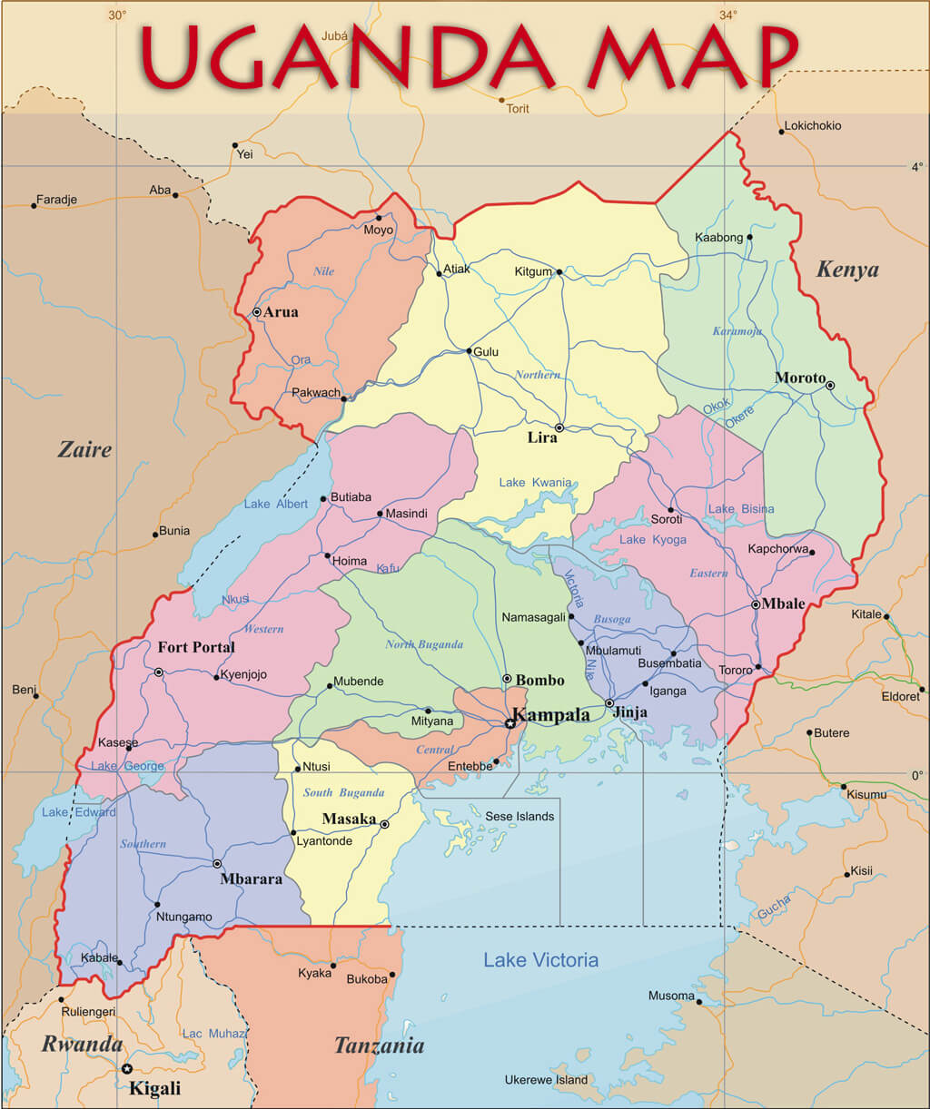
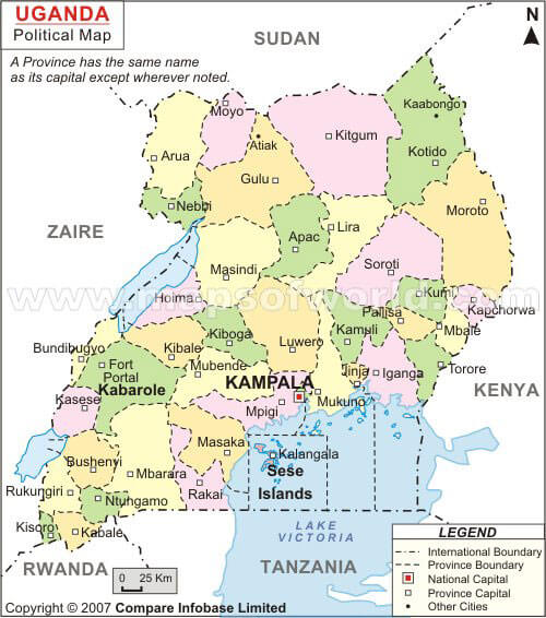
MAP OF UGANDA

UGANDA REGIONS MAP
Brief information about Uganda
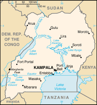
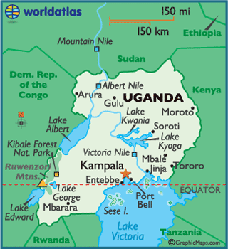
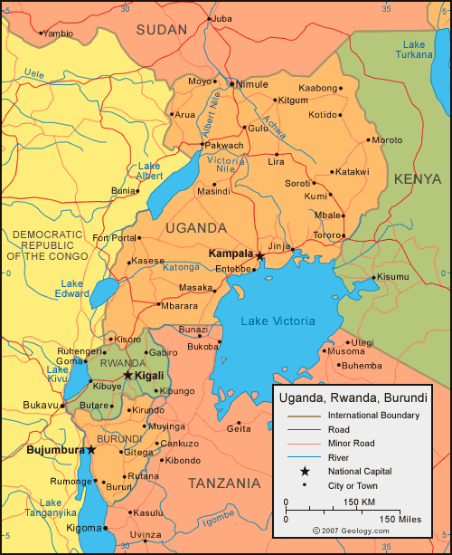
Uganda, officially the Republic of Uganda, is a landlocked country in East Africa. It is bordered to the east by Kenya, to the north by South Sudan, to the west by the Democratic Republic of the Congo, to the southwest by Rwanda, and to the south by Tanzania. Uganda is the world's second most populous landlocked country after Ethiopia.
With an area of 241,038 square kilometers, Uganda is characterized by diverse geographical features. It's crossed by the equator and has a tropical climate. Its landscape consists of mountains, plateaus, and lakes, including a substantial part of Lake Victoria, the second largest freshwater lake in the world.
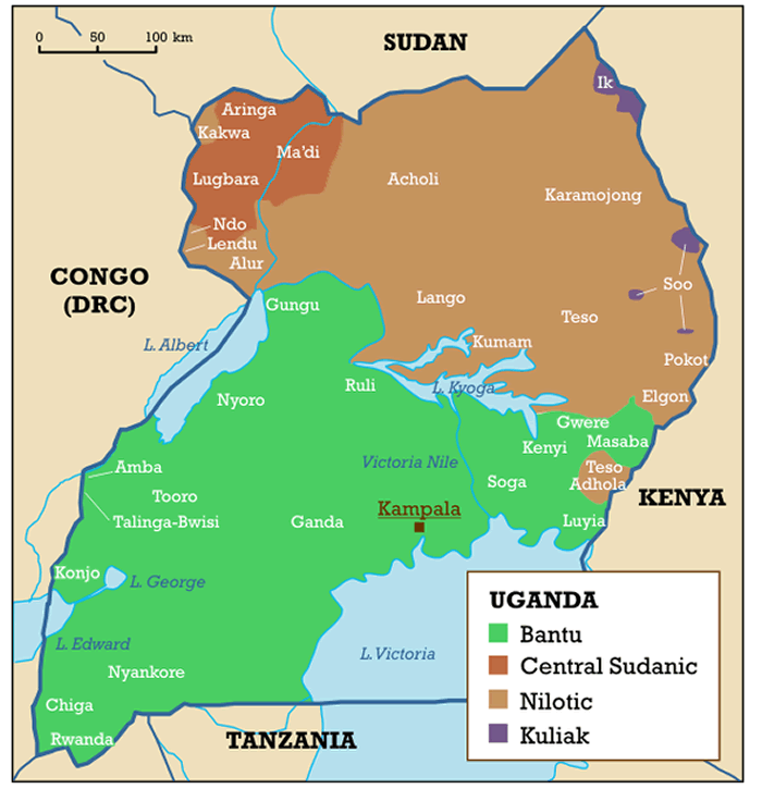
The population of Uganda is approximately 45 million people as of 2021. The country is home to many different ethnic groups, the largest of which are the Baganda. The official languages are English and Swahili, although multiple other languages are spoken across the country.
Uganda has a rich cultural history with a blend of various Bantu, Nilotic, and Sudanic ethnic groups. The country was a British protectorate from 1894 until it gained independence on October 9, 1962. The post-independence period was marked by political instability and military conflicts, but the situation has been more stable in recent years.
Economically, Uganda is considered a low-income country. Its economy is largely based on agriculture, which employs the majority of the workforce. The main crops include coffee, tea, corn, millet, and beans. The country also has considerable natural resources, including copper, cobalt, and recently discovered oil reserves.
Despite its challenges, Uganda is renowned for its biodiversity and is home to many unique species of animals and plants. The country's wildlife is a significant attraction for tourists, with national parks offering safari tours, gorilla tracking, and bird watching.
Here is some statistical information about Uganda. Please note that this information is up to date as of my last training cut-off in September 2021. For the most recent statistics, you may need to check the latest resources:
Area: Uganda covers an area of approximately 241,038 square kilometers (93,065 square miles). It is a landlocked country located in East Africa.
Population: As of 2021 estimates, the population of Uganda is around 45 million people.
Demographics: Uganda is a multicultural and multilingual country, home to more than 40 different indigenous ethnic groups. The Baganda are the largest group, making up approximately 16.5% of the population. Other significant groups include the Banyankole, Basoga, and Bakiga. English and Swahili are the country's official languages, but several indigenous languages are also spoken.
History: Uganda has a rich and diverse cultural history, with evidence of human habitation dating back to the Stone Age. It was colonized by the British in the late 19th century and gained independence in 1962. The post-independence period was marked by political instability, but conditions have generally improved in recent years.
Economy: Agriculture dominates Uganda's economy, accounting for over 70% of employment. Key agricultural exports include coffee, tea, and fish. The country is also rich in natural resources, with substantial deposits of copper and cobalt. In recent years, significant oil reserves have been discovered. Despite these resources, Uganda remains a low-income country, with a GDP (PPP) estimated at around $115 billion in 2021.
A Collection of Uganda Maps and Uganda Satellite Images
MAP OF UGANDA

WHERE IS UGANDA IN THE WORLD
SPOKEN LANGUAGES IN UGANDA
UGANDA REGIONS MAP
KAMPALA UGANDA
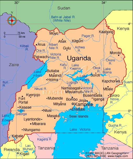
ADMINISTRATIVE MAP OF UGANDA
MAP OF UGANDA AFRICA
MAP OF UGANDA WORLD
MAP OF UGANDA
MAP UGANDA
UGANDA CITIES MAP
UGANDA MAP
UGANDA MAP
UGANDA POLITICAL MAP
UGANDA AFRICA MAP
UGANDA MAP

UGANDA MAP KAMPALA

UGANDA REGIONAL MAP
UGANDA REGIONS MAP
UGANDA EARTH MAP

Author: Arif Cagrici