Aland Islands Map
Discover the beautiful Åland Islands with our interactive map. Located between Sweden and Finland in the Baltic Sea, the Aland Islands are an autonomous region of Finland with a unique cultural identity and stunning natural beauty. Explore the islands' geography, history, and attractions with our map, which allows you to zoom in and out, search for specific locations, and toggle between different map layers. Whether you are planning a trip to the region or simply interested in learning more about this fascinating archipelago, our map is a valuable resource.

- Capital : Mariehamn
- Population : 28,355
- GDP : $1.563 billion (2007)
- Per Capita : $55,829
- Calling Code : +358
- Jobless Rate : N/A
- Time Zone : +2
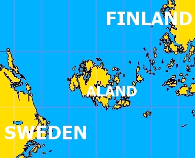
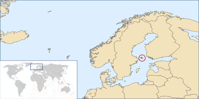
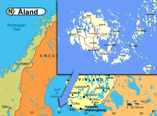
Where is located Aland Islands on the Map
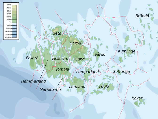
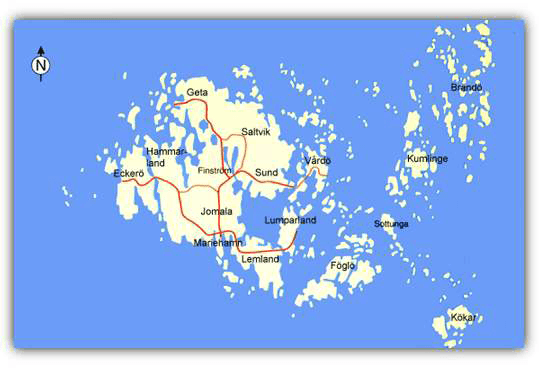
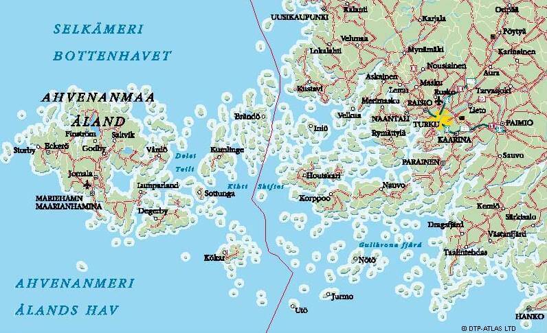
The Aland Islands, also known as Aland, is an autonomous territory of Finland located in the Baltic Sea. The islands are located between Finland and Sweden and are composed of over 6,500 islands, of which only around 60 are inhabited. The capital city of the Aland Islands is Mariehamn, which is located on the main island of Fasta Åland. To find the Åland Islands on a map, you can look for the coordinates 60.1785° N, 19.9156° E.
Åland Islands is located in the Baltic Sea between Sweden and Finland, the Åland Islands are an archipelago of over 6,500 islands and skerries, with a total land area of approximately 1,600 square kilometers (620 square miles). Despite being an autonomous region of Finland, the Aland Islands have their own unique cultural identity and language, with Swedish being the primary language spoken.
With Aland map, you can explore the beautiful geography of the Aland Islands, from the rocky coastlines and pristine beaches to the lush forests and rolling countryside. Our map allows you to zoom in and out, search for specific locations, and toggle between different map layers, including satellite imagery and topographic maps. You can also discover the islands' rich history and cultural attractions, such as the Maritime Museum and the Castle of Kastelholm.
Whether you are planning a trip to the Åland Islands or simply interested in learning more about this fascinating region, our map is a valuable resource. So, come and explore the Åland Islands with us!
For more about Aland Islands >>
aland islands political map
ALAND ISLANDS EARTH MAP

Brief information about Aland Islands
The Aland Islands is an autonomous region of Finland located in the Baltic Sea, between Sweden and Finland. The archipelago consists of over 6,500 islands and skerries, of which around 60 are inhabited. The total land area of the Aland Islands is approximately 1,600 square kilometers (620 square miles), with a population of around 30,000 people. The primary language spoken in the region is Swedish, and the culture and identity of the islands are strongly influenced by its Swedish heritage.A Collection of Aland Islands Maps and Aland Islands Satellite Images
aland islands political map
where is aland islands in the world

historical province of aland in finland
Aland Islands Earth Map

Aland Islands map baltic region

Aland Islands map

aland islands map
aland islands

Aland Islands map
aland islands map sweden finland
aland islands world map
map of Aland Islands

map of Aland Islands
- Head of Performance Marketing
- Head of SEO
- Linkedin Profile: linkedin.com/in/arifcagrici
Copyright WorldMap1.com 2006 - 2023. All rights reserved. Privacy Policy | Disclaimer