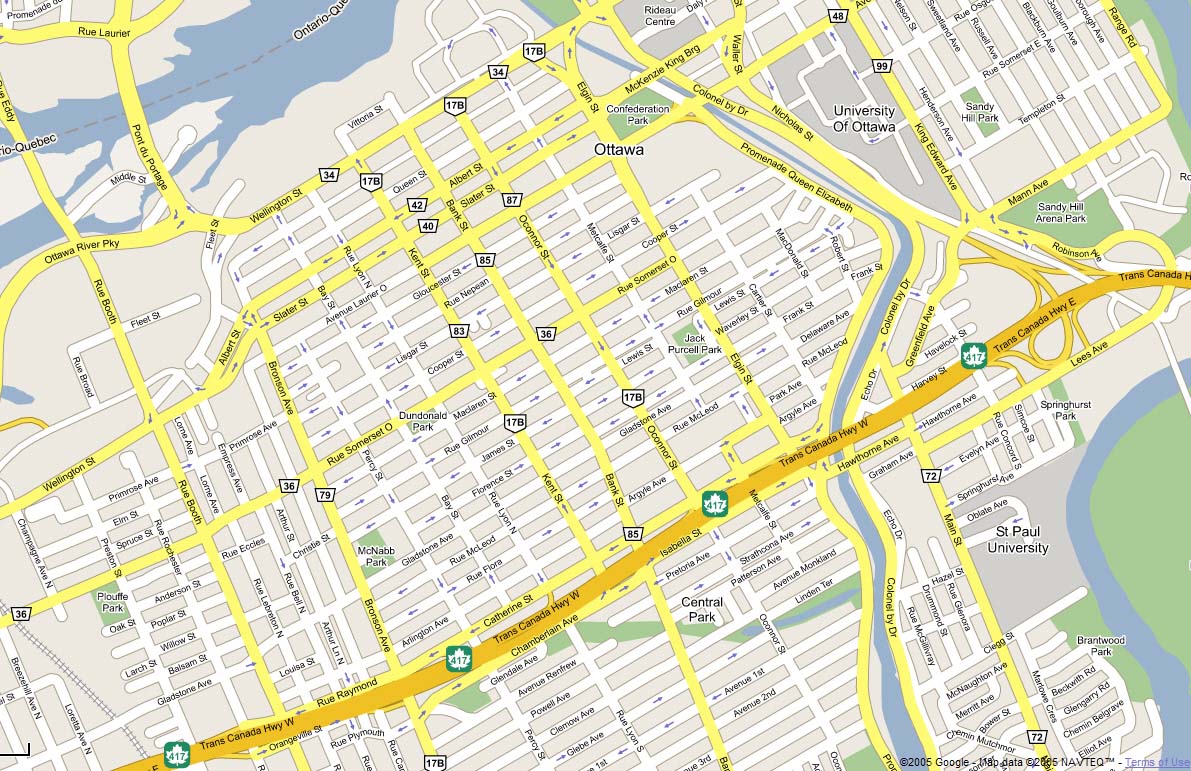
Ottawa Map
Navigate Ottawa Map, Ottawa city map, satellite images of Ottawa, Ottawa towns map, political map of Ottawa, driving directions and traffic maps.
For more >> Canada Maps
For more info >> Canada
Ottawa Map - Political, Physical, Touristic City Maps and Satellite Images
DOWNTOWN OTTAWA MAP

Top 10 Must-See Destinations for Every Montreal Visitor
Please subscribe on "World Guide" channnel on Youtube at youtube.com/c/WorldGuide
10 Best Visit Destinations for Every Tourist in Vancouver
A Collection of Ottawa and Satellite Images
DOWNTOWN OTTAWA MAP

MAP OF OTTAWA

OTTAWA MAP

OTTAWA DELIVERY AREA MAP

OTTAWA DETAIL MAP

OTTAWA MAP

OTTAWA MAP

OTTAWA

OTTAWA CITY MAP

OTTAWA ONTARIO MAP

OTTAWA TOURIST MAP

OTTAWA HIGHWAY AND ROAD MAP WITH SATELLITE VIEW

OTTAWA HIGHWAY AND ROAD MAP

- Head of Performance Marketing
- Head of SEO
- Linkedin Profile: linkedin.com/in/arifcagrici
See Also
Ottawa Google Map, Street Views, Maps Directions, Satellite Images
WorldMap1.com offers a collection of Ottawa map, google map, Ottawa atlas, political, physical, satellite view, country infos, cities map and more map of Ottawa.
- Head of Performance Marketing
- Head of SEO
- Linkedin Profile: linkedin.com/in/arifcagrici
Largest Cities' Map of Canada
Toronto Map Montreal Map Vancouver Map Calgary Map Edmonton Map Ottawa Map Quebec City Map Winnipeg Map Kitchener Map London Map Victoria Map St. Catharines Map Halifax Map Oshawa Map Windsor Map Saskatoon Map Regina Map Barrie Map St. John's Map Abbotsford Map Kelowna Map Sherbrooke Map Guelph Map Kingston Map Moncton Map Sudbury Map Chicoutimi Jonquiere Map Thunder Bay Map Kanata Map Saint John Map Brantford Map Red Deer Map Nanaimo Map Lethbridge Map Saint Jean sur Richelieu Map White Rock Map Peterborough Map Sarnia Map Milton Map Kamloops Map Chateauguay Map Sault Ste. Marie Map Hamilton Map Chilliwack Map Drummondville Map Saint Jerome Map Medicine Hat Map Prince George Map Belleville Map Fredericton Map Fort McMurray Map Granby Map Grande Prairie Map North Bay Map Beloeil Map Cornwall Map Saint Hyacinthe Map Shawinigan Map Brandon Map Vernon Map Chatham Map Bowmanville Map Joliette Map Charlottetown Map Airdrie Map Victoriaville Map St. Thomas Map Courtenay Map Georgetown Map Salaberry de Valleyfield Map Rimouski Map Woodstock Map Sorel Tracy Map Penticton Map Prince Albert Map Campbell River Map Moose Jaw Map Cape Breton Map Midland Map Leamington Map Stratford Map Orangeville Map Timmins Map Orillia Map Walnut Grove Map Spruce Grove Map Lloydminster Map Alma Map Bolton Map Saint Georges Map Keswick Elmhurst Beach Map Stouffville Map Okotoks Map Duncan Map Parksville Map Leduc Map Val d'Or Map Rouyn Noranda Map Buckingham Map Brockville Map Sept Iles Map Truro Map Owen Sound Map Thetford Mines Map Trois Rivieres MapCopyright WorldMap1.com 2006 - 2023. All rights reserved. Privacy Policy | Disclaimer

