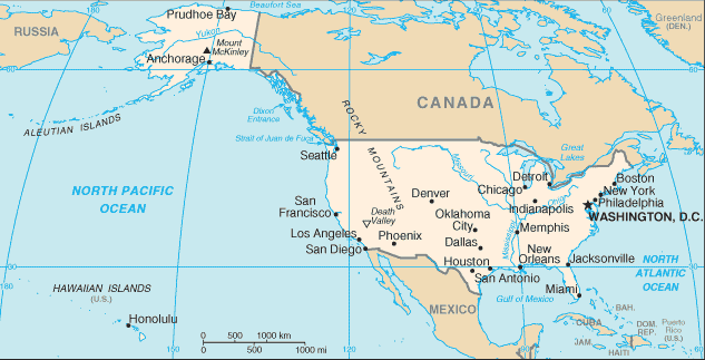
Check Out United States Map to see where the United States is located
Explore the United States with our map. Discover the geography and diversity of this vast country. The United States is located in North America, bordered by Canada to the north and Mexico to the south. The country is also surrounded by the Atlantic Ocean to the east and the Pacific Ocean to the west. The United States is located in the Northern Hemisphere and spans a vast area of land from the Atlantic Ocean on the east coast to the Pacific Ocean on the west coast.

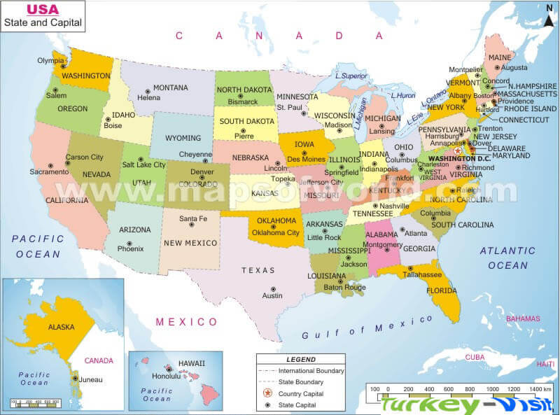
- Capital : Washington, D.C.
- Population : 315,276,000
- GDP : $15.6097 trillion (1st)
- Per Capita : $49,601 (15th)
- Calling Code : +1
- Jobless Rate : 7.90%
- Time Zone : -5 -10
Where is located United States on the Map
The United States is located in North America, bordered by Canada to the north, Mexico to the south, the Atlantic Ocean to the east, and the Pacific Ocean to the west.
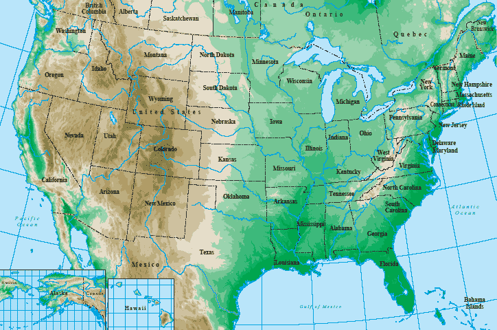
The United States is a country located in North America and is the third largest country in the world by both land area and population. The country has a diverse geography, including mountains, plains, forests, and coastlines, and is home to a wide variety of plant and animal life. The United States is also a melting pot of cultures, with a rich history shaped by indigenous people, European settlers, and immigrants from around the world. On this map page, you can explore the states and territories of the United States, learn about their locations, and discover some of the many attractions and landmarks that make this country a popular destination for travelers from around the globe.
United States
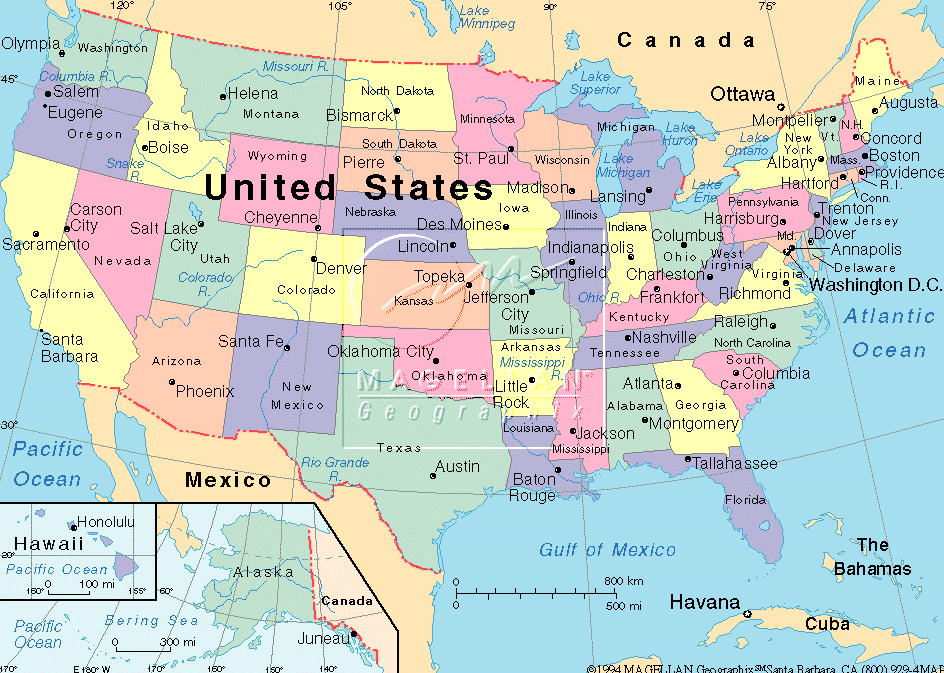
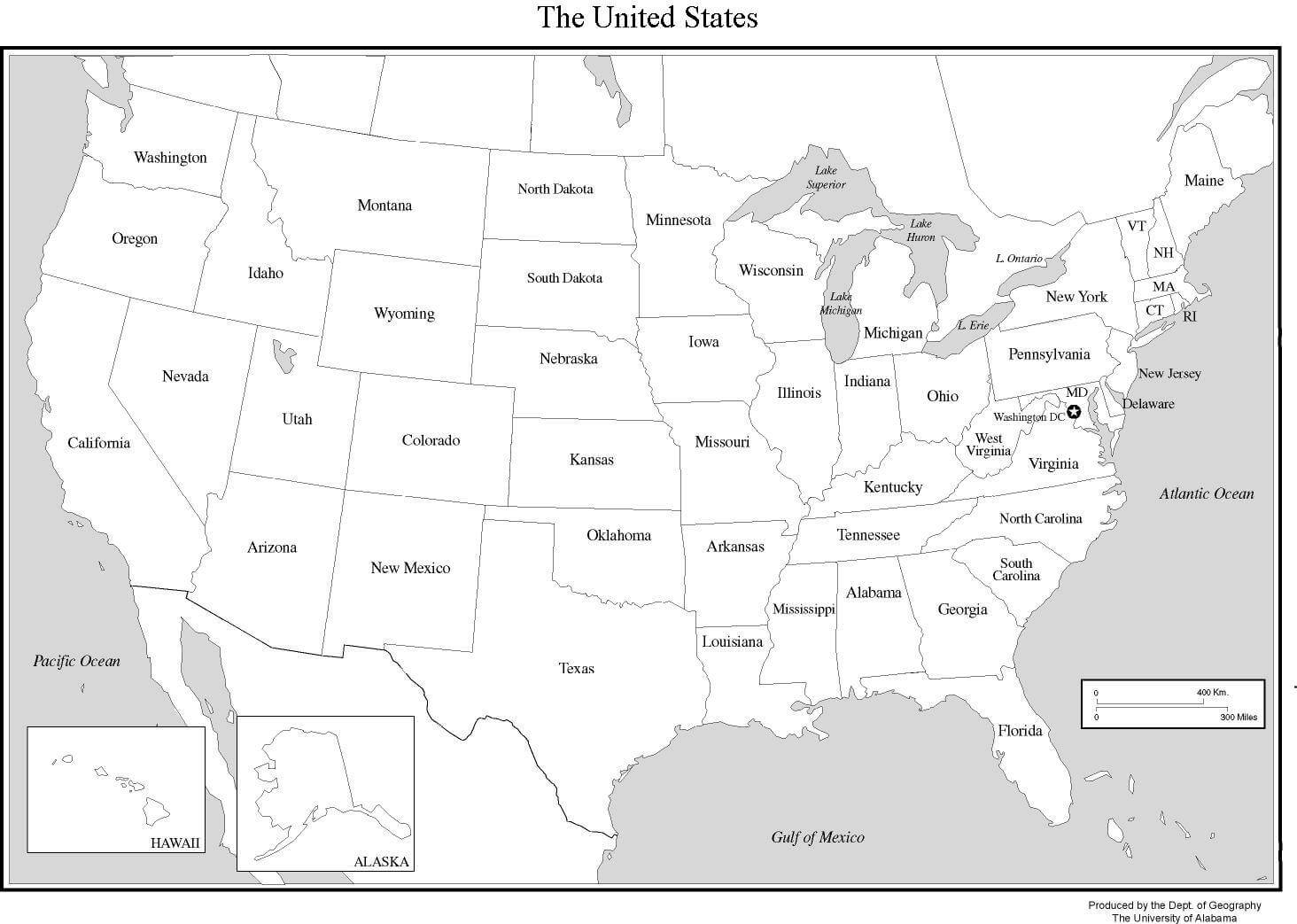
United States Map
Map of United States
Map of the United States
Large Free HD United States Map for free Download

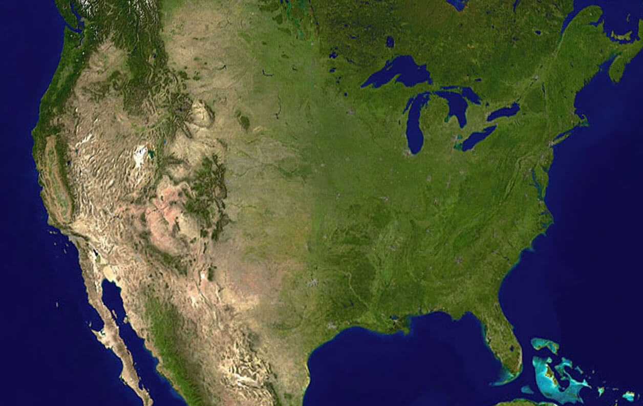
United States Map & United States Satellite Images

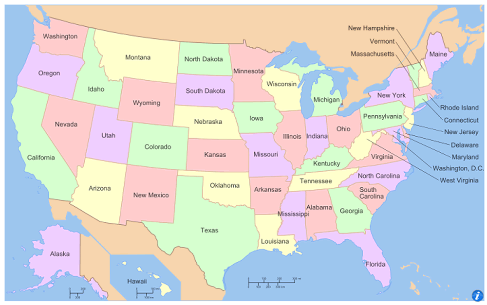
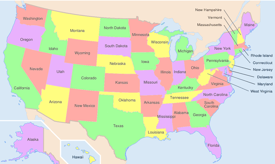
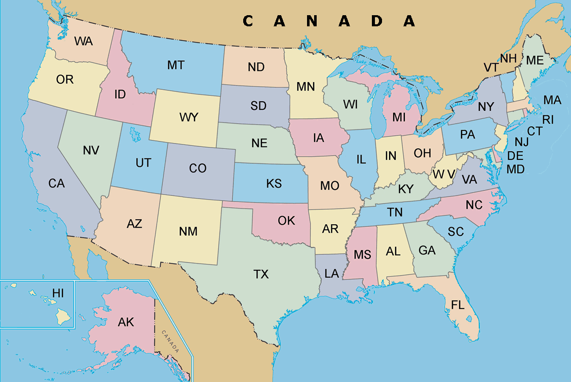
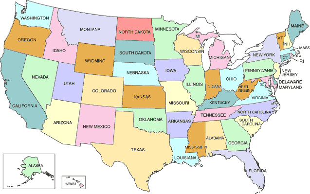
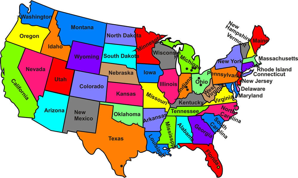
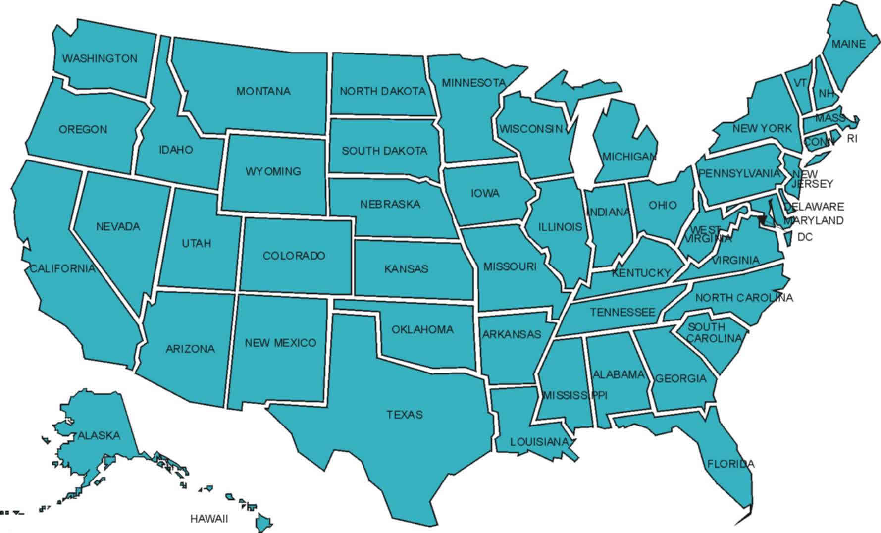
States Map of United States
State - Population - Capital - Miles Square - Map Coordinate- California Map - 37253956 - Sacramento - 587,878 ms
- Texas Map - 25145561 - Austin - 266,874 ms
- New York Map - 19378102 - Albany - 158,648 ms
- Florida Map - 18801310 - Tallahassee - 147,047 ms
- Illinois Map - 12830632 - Springfield - 121,599 ms
- Pennsylvania Map - 12702379 - Harrisburg - 114,007 ms
- Ohio Map - 11536504 - Columbus - 110,567 ms
- Michigan Map - 9883640 - Lansing - 104,1 ms
- Georgia Map - 9687653 - Atlanta - 97,818 ms
- New Jersey Map - 8791894 - Trenton - 97,052 ms
- North Carolina Map - 9535483 - Raleigh - 84,905 ms
- Virginia Map - 8001024 - Richmond - 84,397 ms
- Massachusetts Map - 6547629 - Boston - 83,574 ms
- District of Columbia Map - 6724540 - Olympia - 82,282 ms
- Indiana Map - 6483802 - Indianapolis - 77,359 ms
- Tennessee Map - 6346105 - Nashville - 77,122 ms
- Arizona Map - 6392017 - Phoenix - 70,704 ms
- Missouri Map - 5988927 - Jefferson City - 69,903 ms
- Maryland Map - 5773552 - Annapolis - 69,709 ms
- Washington Map - 5686986 - Madison - 68,126 ms
- Minnesota Map - 5303925 - St. Paul - 58,681 ms
- Colorado Map - 5029196 - Denver - 58,513 ms
- Alabama Map - 4779736 - Montgomery - 58,39 ms
- Louisiana Map - 4533372 - Baton Rouge - 56,343 ms
- South Carolina Map - 4625364 - Columbia - 56,276 ms
- Kentucky Map - 4339367 - Frankfort - 56,145 ms
- Oregon Map - 3831074 - Salem - 53,183 ms
- Oklahoma Map - 3751351 - Oklahoma City - 52,672 ms
- Connecticut Map - 3574097 - Hartford - 51,718 ms
- Iowa Map - 3046355 - Des Moines - 49,112 ms
- Mississippi Map - 2967297 - Jackson - 47,72 ms
- Arkansas Map - 2915918 - Little Rock - 47,695 ms
- Kansas Map - 2853118 - Topeka - 45,31 ms
- Utah Map - 2763885 - Salt Lake City - 42,146 ms
- Nevada Map - 2700551 - Carson City - 41,328 ms
- New Mexico Map - 2059179 - Santa Fe - 40,598 ms
- West Virginia Map - 1859815 - Charleston - 24,230 ms
- Nebraska Map - 1826341 - Lincoln - 36,185 ms
- Idaho Map - 1567582 - Boise - 33,128 ms
- Maine Map - 1328361 - Augusta - 31,117 ms
- New Hampshire Map - 1316470 - Concord - 24,231 ms
- Hawaii Map - 1360301 - Honolulu - 10,455 ms
- Rhode Island Map - 1052567 - Providence - 9,615 ms
- Wyoming Map - 563626 - Cheyenne - 97,814
- Montana Map - 989415 - Helena - 9,283 ms
- Delaware Map - 897934 - Dover - 8,262 ms
- South Dakota Map - 814180 - Pierre - 7,79 ms
- Alaska Map - 710231 - Juneau - 6,459 ms
- North Dakota Map - 672591 - Bismarck - 5,006 ms
- Vermont Map - 563626 - Montpelier - 2,026 ms
- Wisconsin Map - 5686986 - Cheyenne - 65,497 ms
Brief information about United States
The United States, also known as the US or USA, is a country located in North America. It is the third largest country in the world by land area, covering approximately 9.8 million square kilometers. The population of the United States is over 332 million people, making it the third most populous country in the world after China and India. The country has a diverse demographic, with people of various ethnicities and nationalities.Geography:
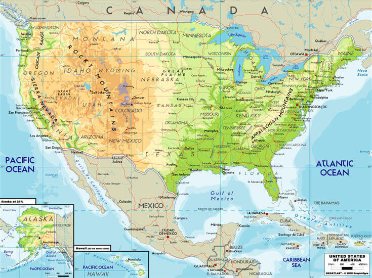
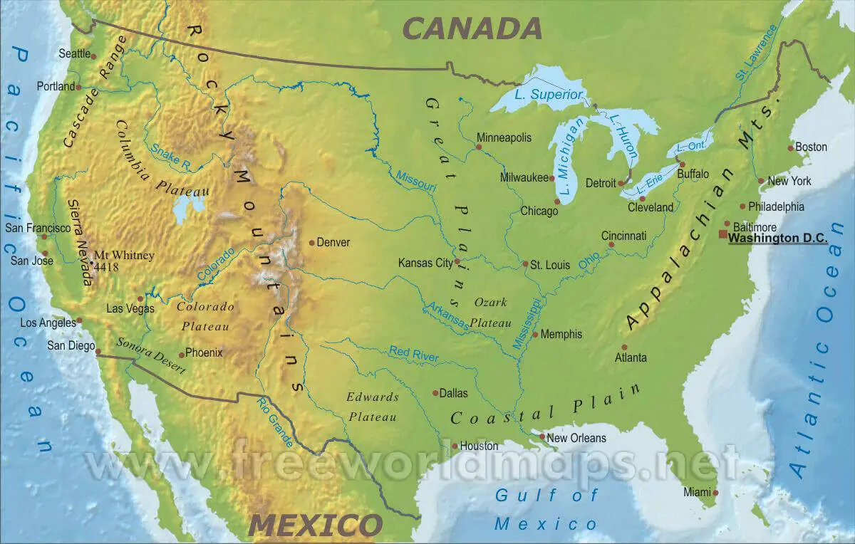
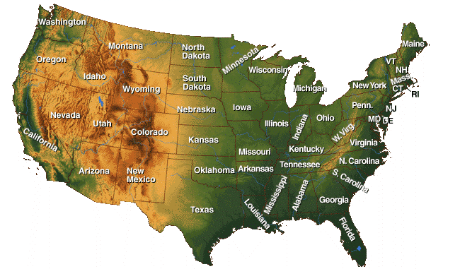
The United States has a diverse geography that includes various landforms such as mountains, plains, forests, deserts, and coastlines. The country is the third-largest by land area, spanning over 3.8 million square miles. The Appalachian Mountains run along the eastern coast, while the Rocky Mountains run along the western coast. The country is also home to numerous rivers, lakes, and national parks.Demographics and Population:
The United States has a population of approximately 332 million people, making it the third most populous country in the world. The largest ethnic groups in the country are White Americans, Hispanic and Latino Americans, and African Americans. The population is diverse, with a mix of ethnicities and cultures. English is the most commonly spoken language, but Spanish and other languages are also prevalent, reflecting the country's history of immigration.Economy:
The economy of the United States is the largest in the world, with a Gross Domestic Product (GDP) of over $22 trillion. It is a market-oriented economy with a strong emphasis on innovation and technological advancements. The US is home to some of the world's largest companies, including Apple, Microsoft, and Amazon, among others. The country has a diverse economy, with major industries including finance, healthcare, technology, and manufacturing.History
The United States has a rich history, dating back to the 16th century when European settlers first arrived. It gained independence from Great Britain in 1776 and went on to become a world superpower. The country has played a significant role in world affairs and is a founding member of several international organizations, including the United Nations and NATO.Free Printable High Detailed United States Map with States
Please subscribe on "World Guide" channnel on Youtube at youtube.com/c/WorldGuide
Please view more USA Maps
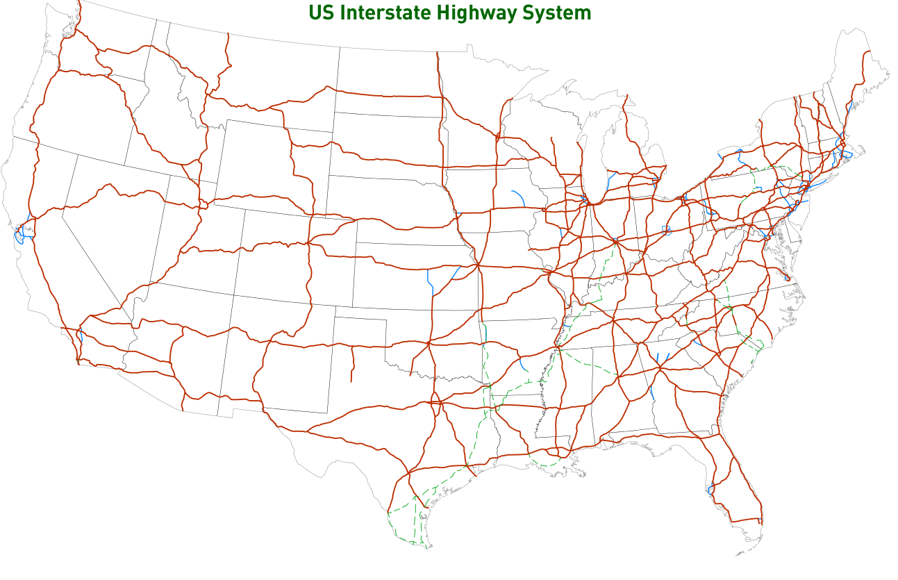
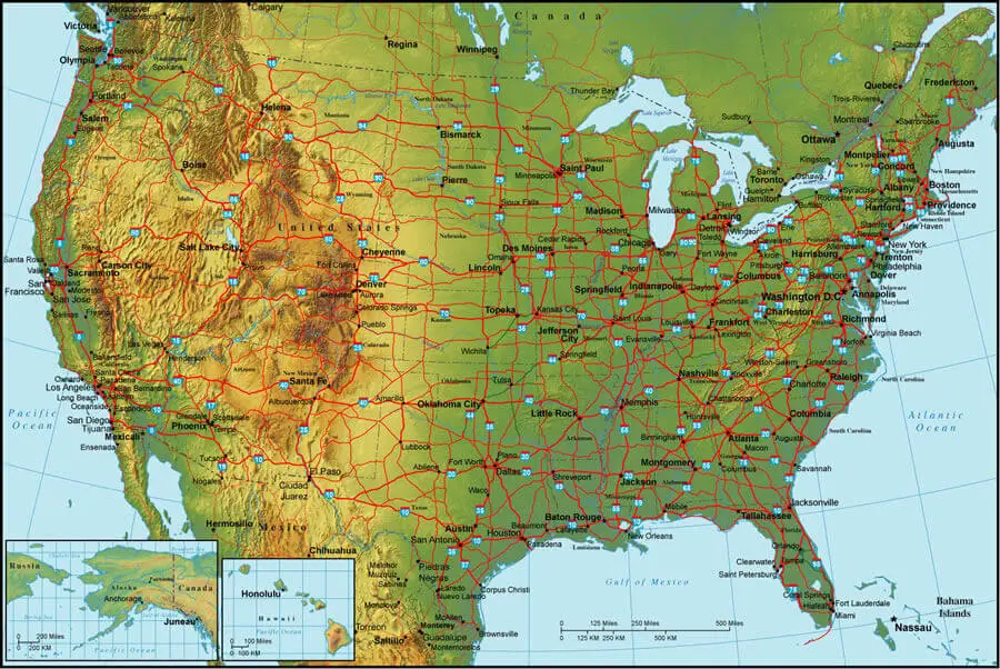
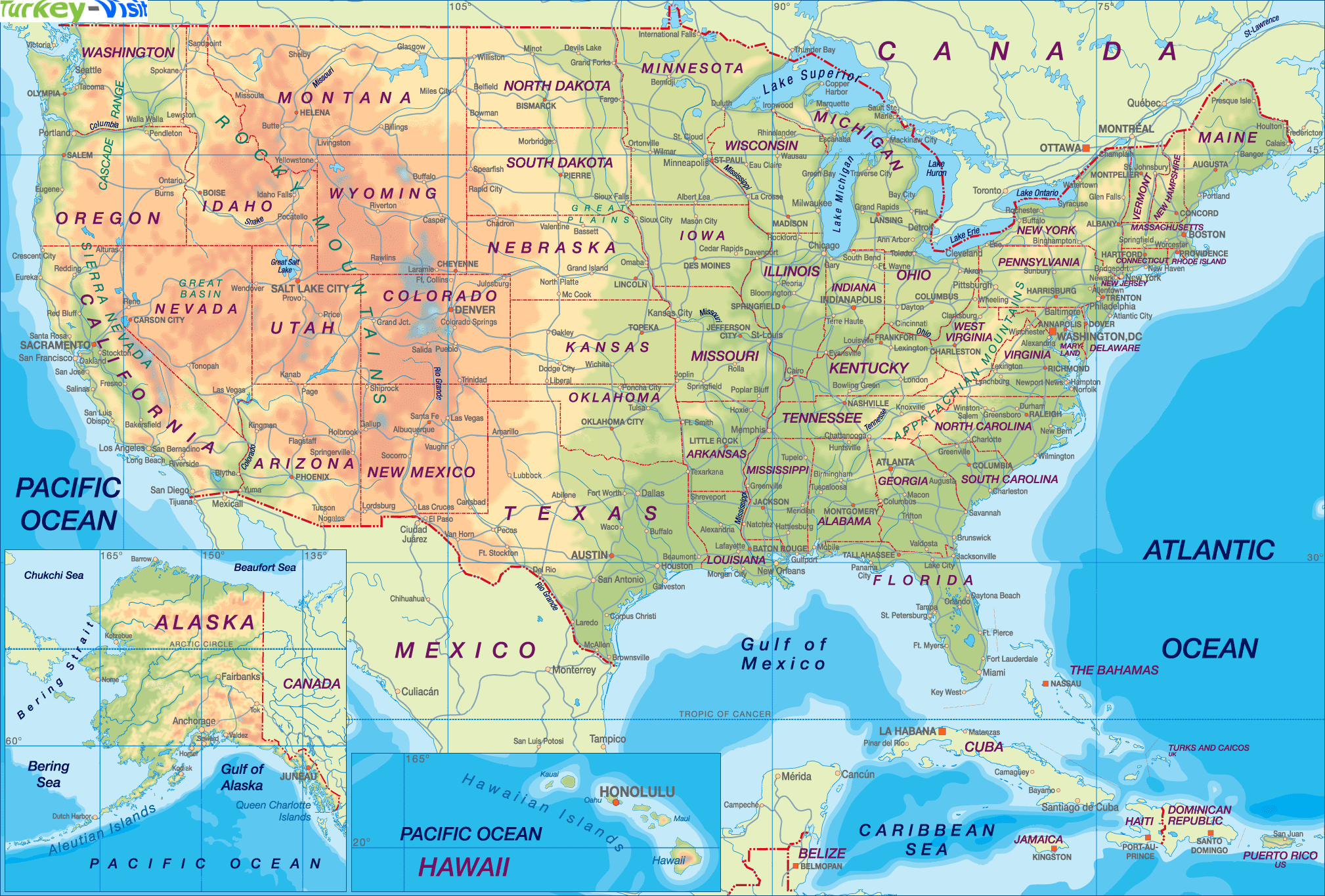
High Detailed United States of America Road Map Large Color Map of the USA Free Printable United States Map with States The Map of The United States United States Earth Map and Satellite Images US Interstate Highway Map with Major Cities US Political Map with Capital Washington, Most Important Cities Rivers and LakesUnited States Travel Guide
The United States is a vast and diverse country with numerous attractions, landmarks, and cultural experiences to explore. Here are some travel tips and destinations to consider when planning a trip to the United States:- New York City - A bustling metropolis filled with iconic landmarks such as the Statue of Liberty, Empire State Building, and Central Park. The city is also known for its museums, art galleries, and world-class restaurants.
- Grand Canyon National Park - A breathtaking natural wonder located in Arizona that offers hiking, camping, and stunning views of the canyon.
- San Francisco - A picturesque city located in Northern California that is famous for its Golden Gate Bridge, Alcatraz Island, and diverse neighborhoods.
- Disney World - A popular family vacation destination located in Orlando, Florida, with theme parks, water parks, and other attractions.
- Las Vegas - A city located in the Nevada desert known for its casinos, shows, and nightlife.
- Hawaii - A group of islands in the Pacific Ocean with beautiful beaches, hiking trails, and water sports.
- National Mall and Memorial Parks - A park in Washington, D.C., that includes famous landmarks such as the Lincoln Memorial, Washington Monument, and National World War II Memorial.
- Yellowstone National Park - A natural wonder located in Wyoming that is home to geysers, hot springs, and wildlife.
- Route 66 - A historic highway that spans from Chicago to Santa Monica, California, and is known for its roadside attractions and Americana culture.
- New Orleans - A city located in Louisiana known for its music, food, and Mardi Gras celebrations.
A Collection of United States Maps and United States Satellite Images
MAP OF USA
WHERE IS UNITED STATES IN THE WORLD

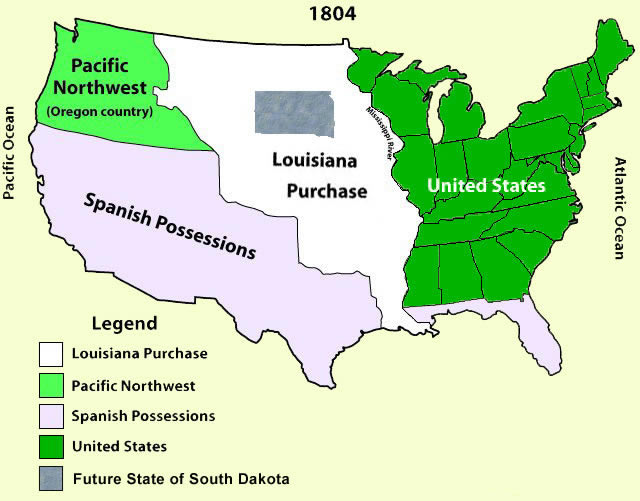
US TERRITORIAL ACQUISITIONS MAP

UNITED STATES SATELLITE IMAGE MAP
US ANCESTRIES BY COUNTY CENSUS MAP 2000

POLITICAL SYSTEM MAP OF THE UNITED STATES

USA FEDERAL DEBT HELD 1790 2013

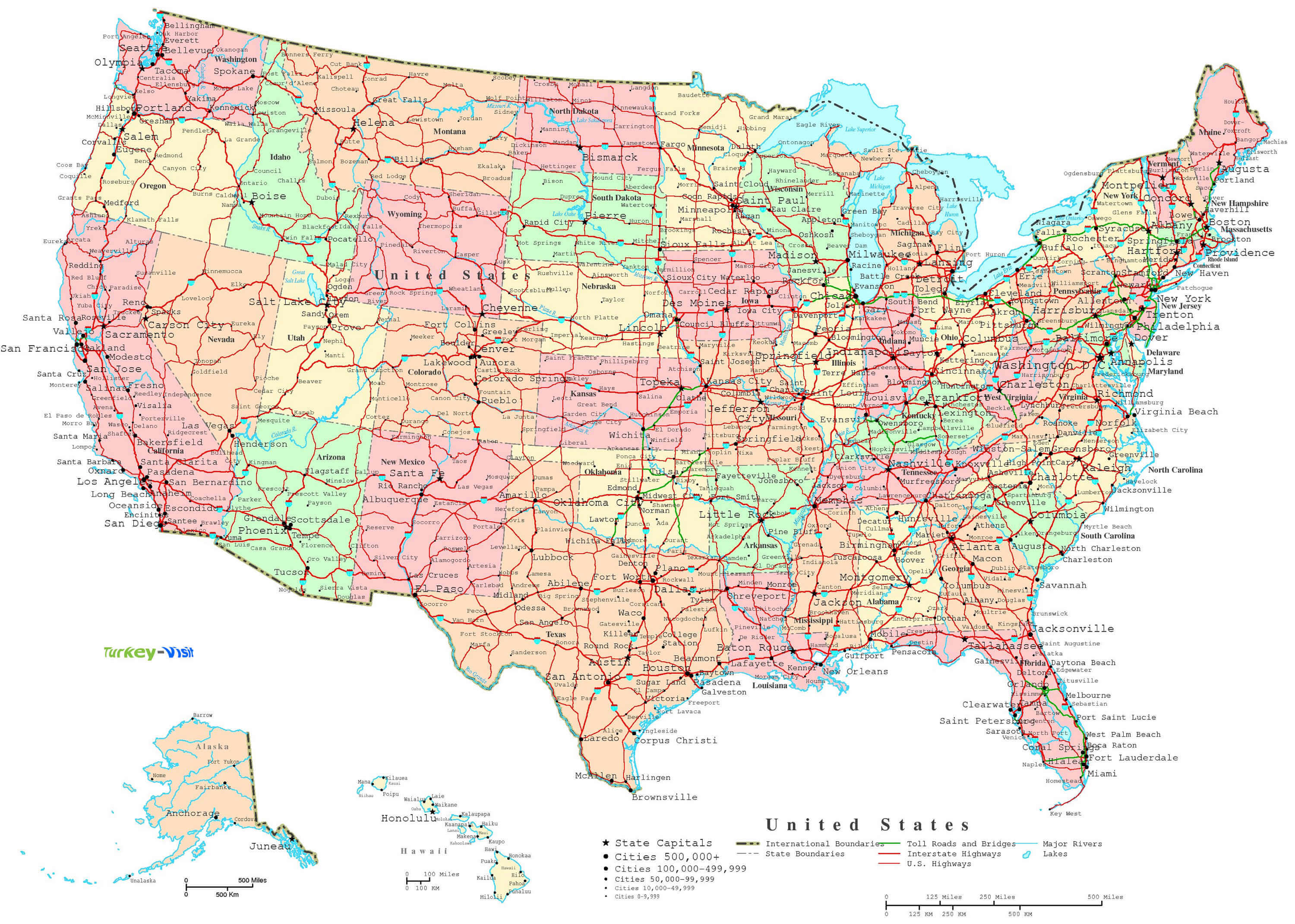
US INTERSTATE HIGHWAY SYSTEM MAP
US INSULAR AREAS MAP

US POLITICAL DIVISIONS MAP
USA RELIGIOUS 2014 LANGUAGES SPOKEN 2010

MAP OF UNITED STATES
MAP OF UNITED STATES
MAP OF UNITED STATES

MAP OF UNITED STATES
MAP OF USA
MAP OF USA B

MAP OF USA CITIES

MAP OF USA WALL

MAP OF USA WALL B

MAPS OF UNITED STATES

MAPS OF UNITED STATES
MAPS OF USA

PHYSICAL MAP OF UNITED STATES
STATES MAP USA
UNITED STATES HIGHWAY MAP

UNITED STATES MAP PHYSICAL

UNITED STATES MAP PHYSICAL B
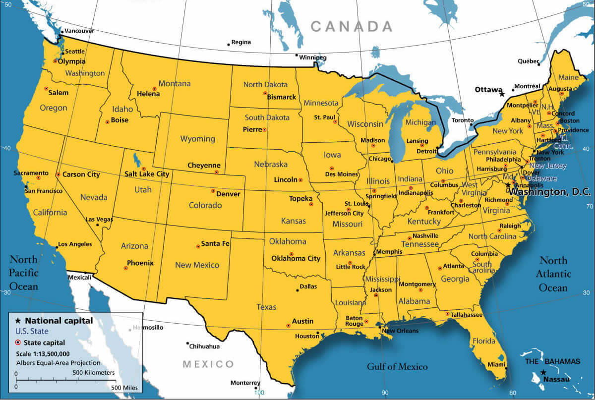
UNITED STATES MAP

UNITED STATES MAP

UNITED STATES MAPS

UNITED STATES BIOMASS MAP

UNITED STATES CATHOLIC MAP

UNITED STATES CITIES MAP

UNITED STATES CITIES MAP B
UNITED STATES ELECTORAL VOTES

UNITED STATES GAS PRICES MAP

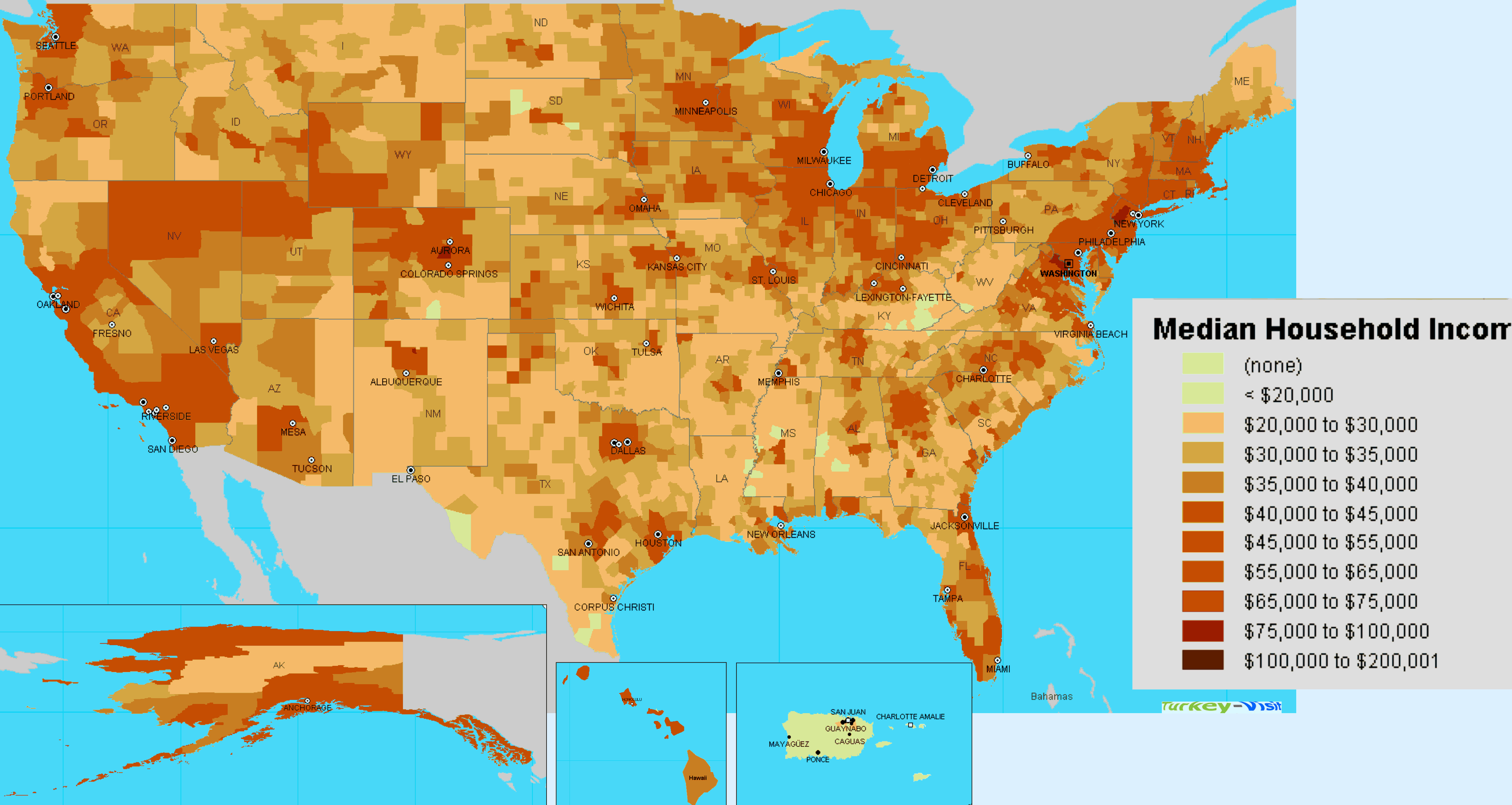
UNITED STATES INCOME MAP

UNITED STATES INCOME MAP B
UNITED STATES INDIAN TRIBES MAP
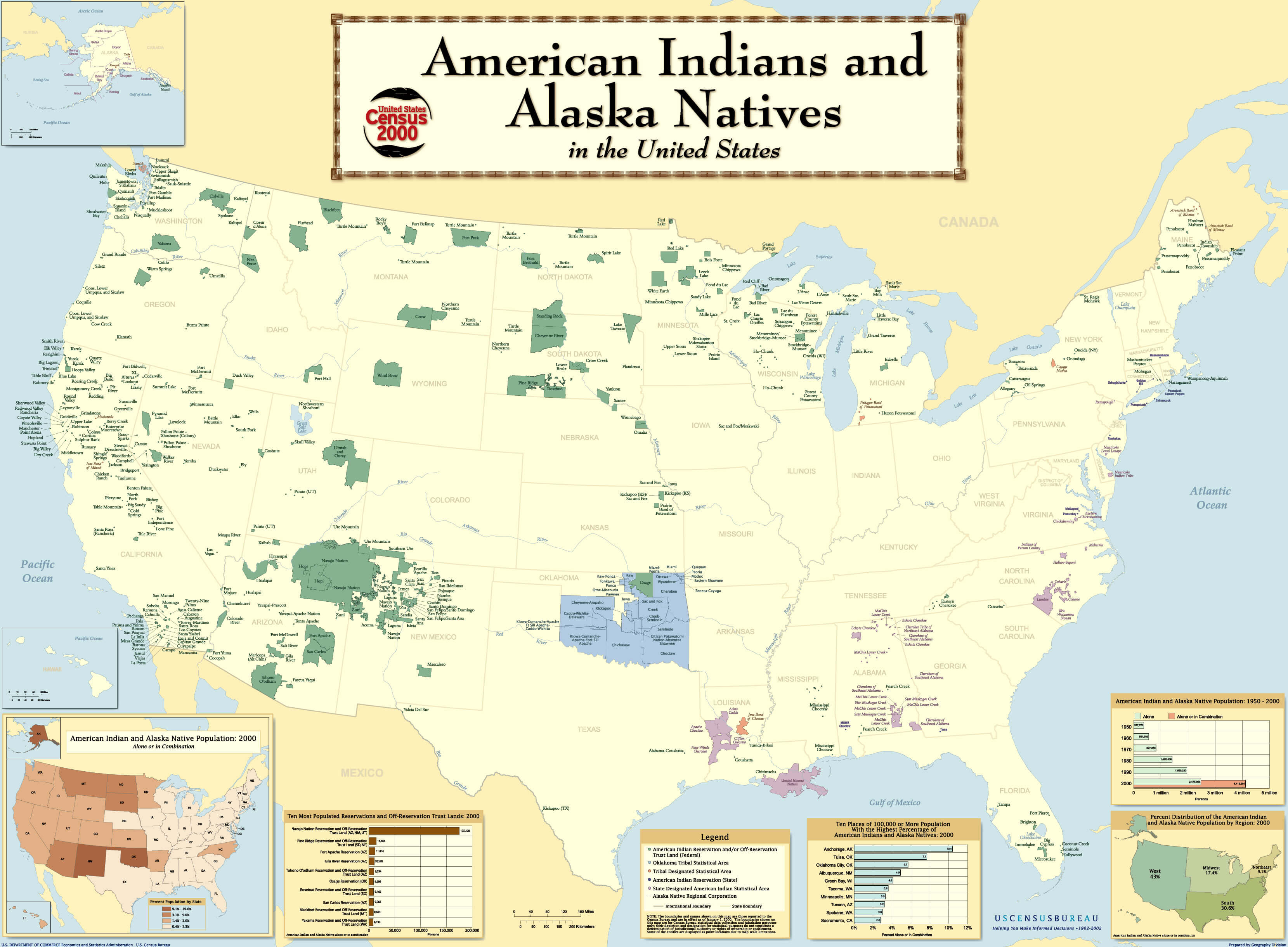
UNITED STATES INDIAN TRIBES MAP B

UNITED STATES MAP

UNITED STATES MAP
UNITED STATES MAP 1804
UNITED STATES MAP EMPTY

UNITED STATES MAP PHYSICAL

UNITED STATES MAPS

UNITED STATES MOUNTAIN MAP

UNITED STATES OF AMERICA MAP
UNITED STATES OIL SHALE MAP

UNITED STATES PHYSICAL MAP
UNITED STATES POPULATION DENSITY MAP

UNITED STATES POPULATION MAP

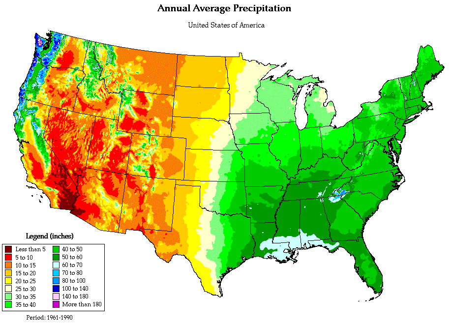
UNITED STATES PRECIPITATION MAP
UNITED STATES RENEWABLE RESOURCES

UNITED STATES TIMEZONES

UNITED STATES WALL MAP

UNITED STATES WALL MAP B

USA MAP
USA POPULATION MAP

USA STATES MAP
USA H1N1 MAP

USA MAP

USA MAP

USA MAP EMPTY

USA MAPS

USA PHYSICAL MAP
USA RELIGION MAP

USA RIVER MAP

USA SOLAR MAP

USA STATES MAP WHITE
USA STATES REGIONS MAP

USA WIND MAP

USAMAP
UNITED STATES EARTH MAP

A collection of USA Maps


- Head of Performance Marketing
- Head of SEO
- Linkedin Profile: linkedin.com/in/arifcagrici
Largest Cities' Map of United States
New York City Map Los Angeles Map Chicago Map Brooklyn Map Houston Map Philadelphia Map Manhattan Map Phoenix Map San Antonio Map San Diego Map Dallas Map San Jose Map Jacksonville Map Indianapolis Map San Francisco Map Austin Map Columbus Map Fort Worth Map Charlotte Map Detroit Map El Paso Map Memphis Map Baltimore Map Boston Map Seattle Map Nashville Map Denver Map Louisville Map Milwaukee Map Portland Map Las Vegas Map Oklahoma City Map Albuquerque Map Tucson Map Fresno Map Sacramento Map Long Beach Map Kansas City Map Mesa Map Virginia Beach Map Atlanta Map Colorado Springs Map Omaha Map Raleigh Map Miami Map Cleveland Map Tulsa Map Oakland Map Honolulu Map Minneapolis MapCopyright WorldMap1.com 2006 - 2023. All rights reserved. Privacy Policy | Disclaimer