- Capital :
Washington, D.C.
- Population :
315,276,000
- GDP :
$15.6097 trillion (1st)
- Per Capita :
$49,601 (15th)
- Calling Code :
+1
- Jobless Rate :
7.90%
- Time Zone :
-5 -10
For more about United States »
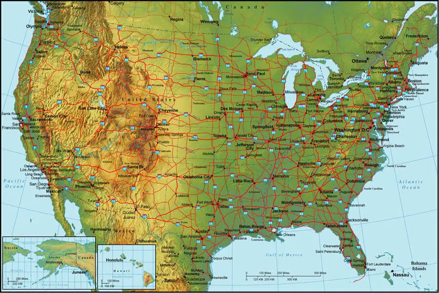
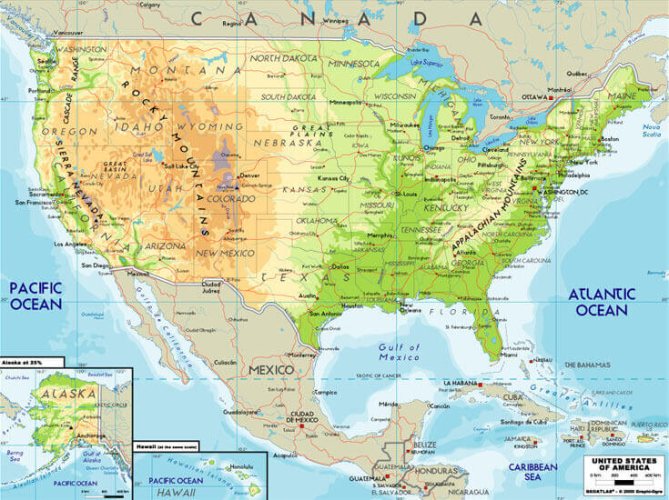
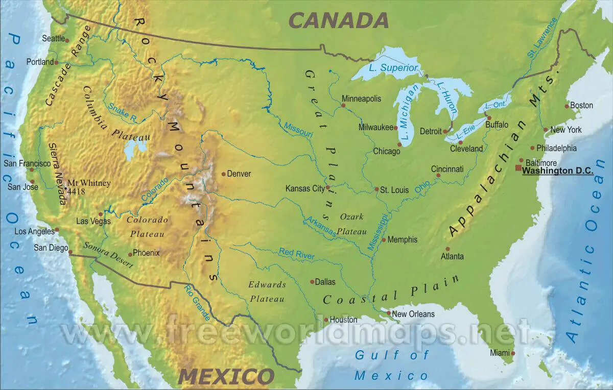
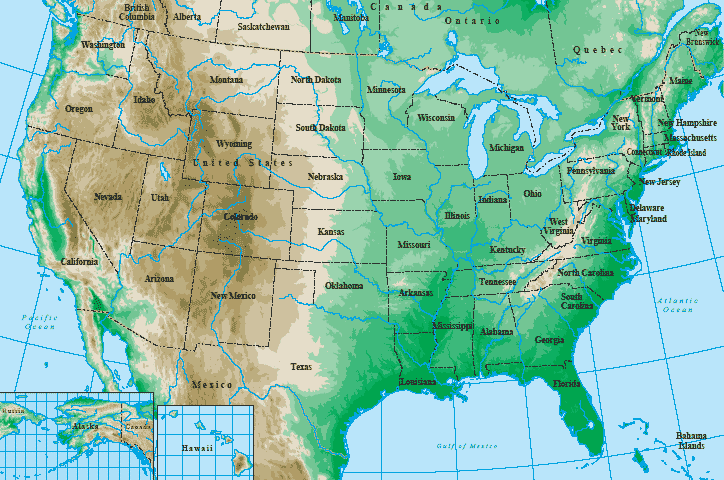
The geography of the USA is diverse, with several major mountain ranges, including the Rocky Mountains and the Appalachians, as well as vast plains and deserts. The Mississippi River is the longest river in the country and divides it into two main regions, the East and the West.
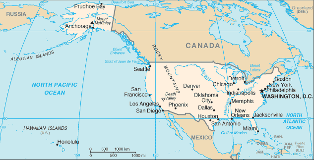
Major cities in the USA include New York City, Los Angeles, Chicago, Houston, and Philadelphia, among others. The country is also home to several famous landmarks, such as the Statue of Liberty, the Golden Gate Bridge, and the Grand Canyon.
The political capital of the USA is Washington, D.C., which is located on the East Coast and is home to the White House, the Capitol Building, and other government institutions.
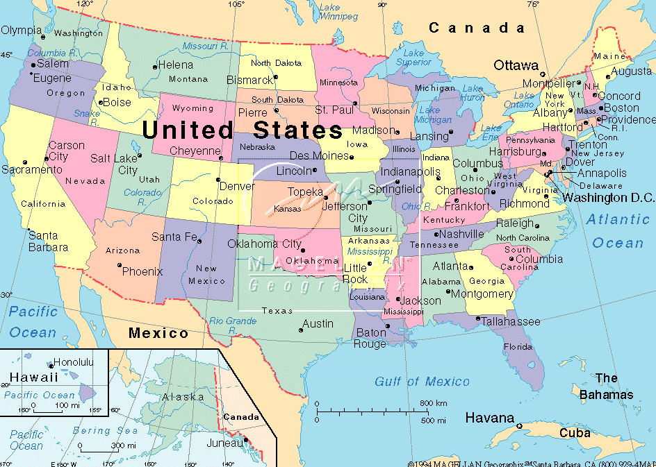
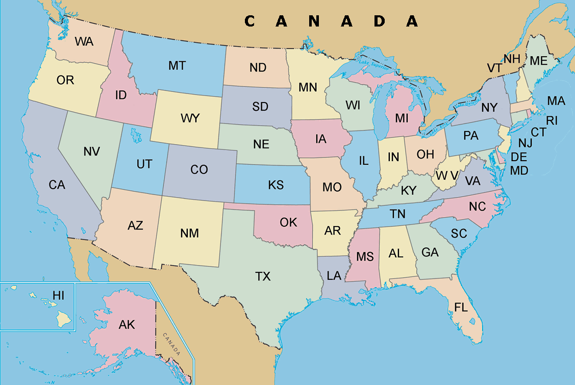
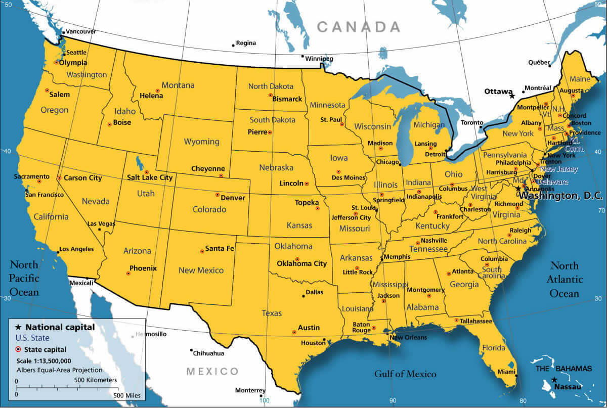
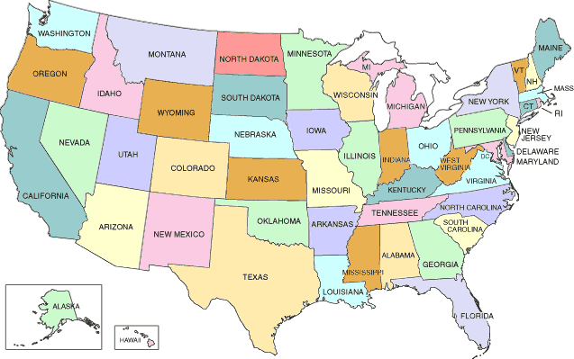
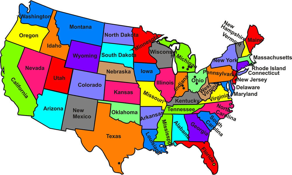
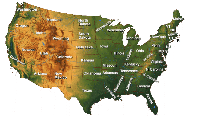
Maps of USA

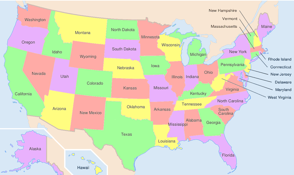
Blue Color US MAP with States

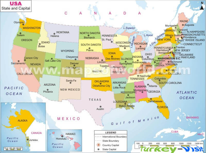
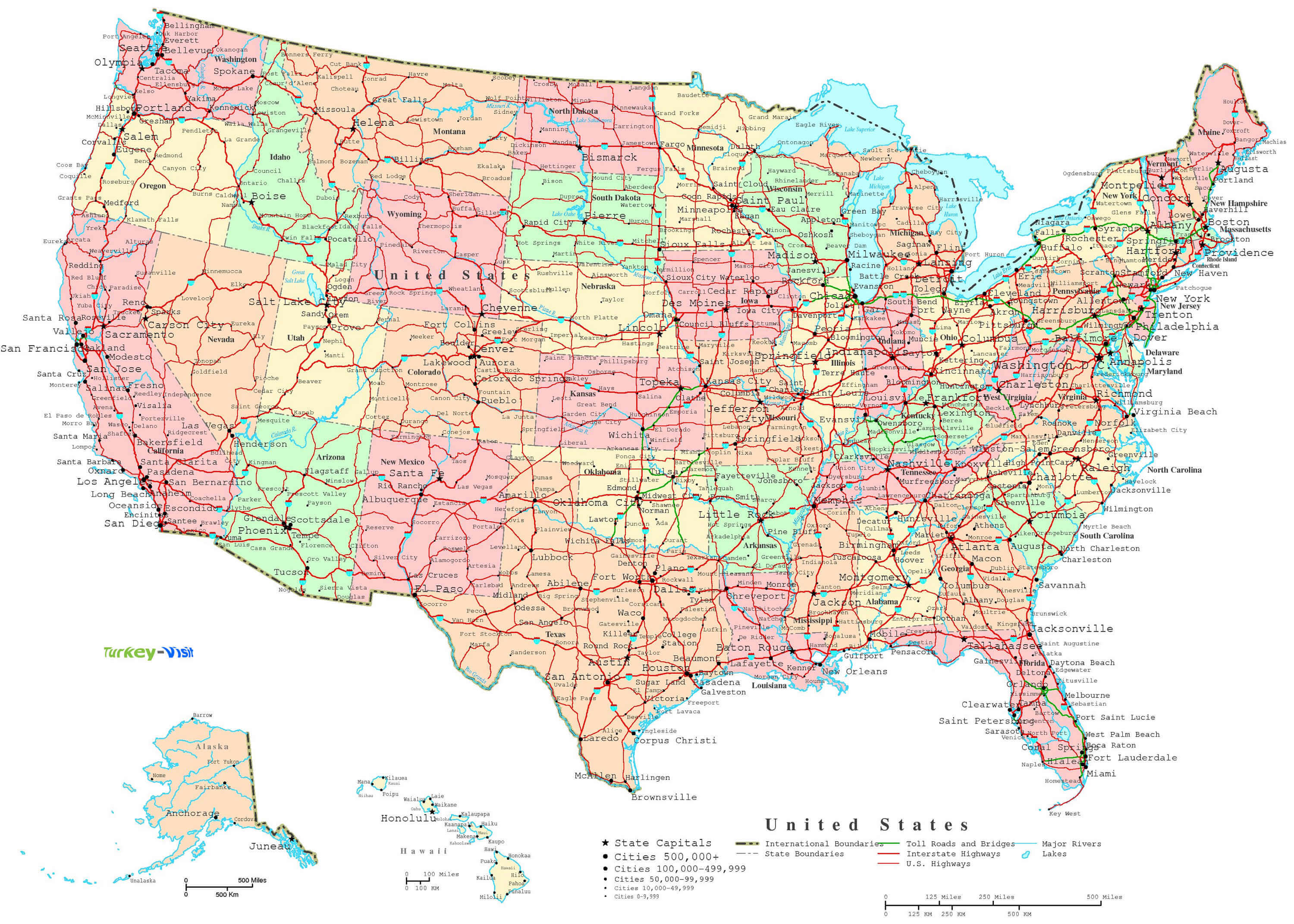
USA States Capital and Main Cities Map

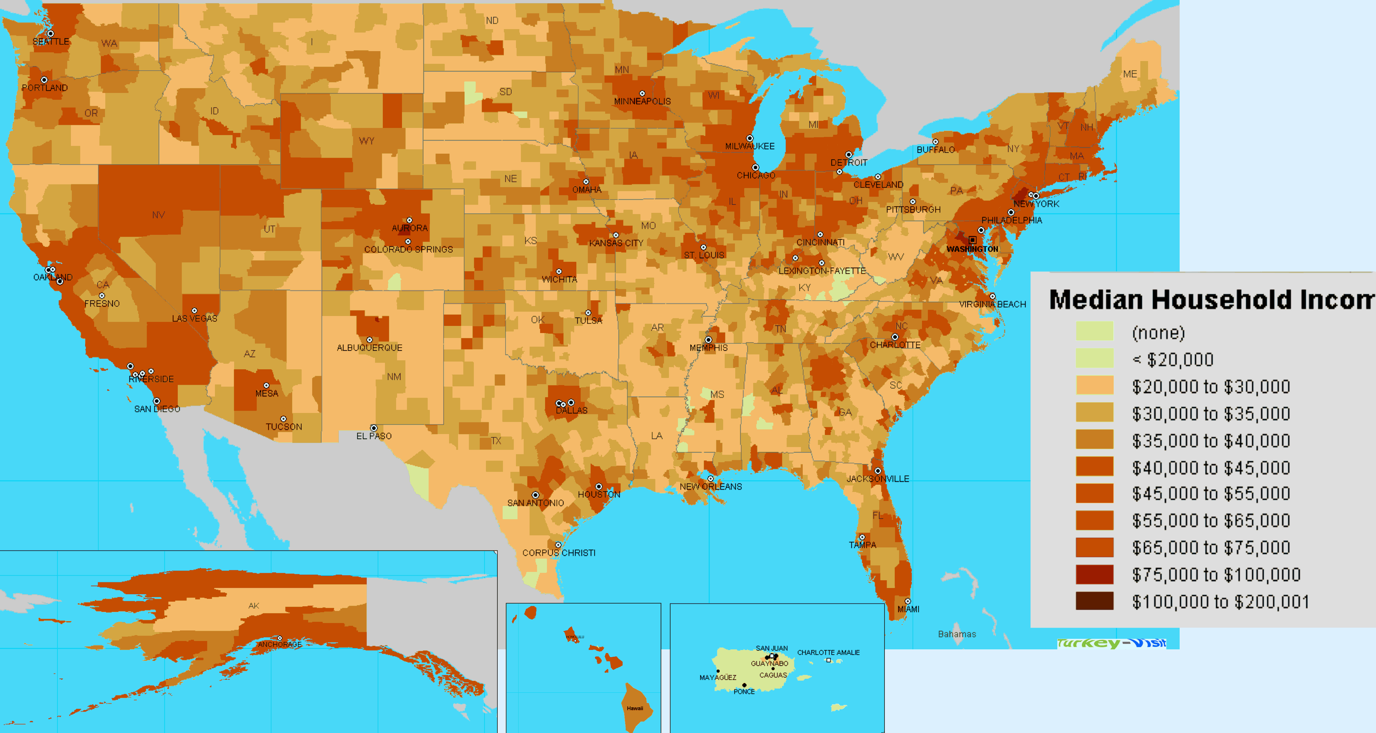
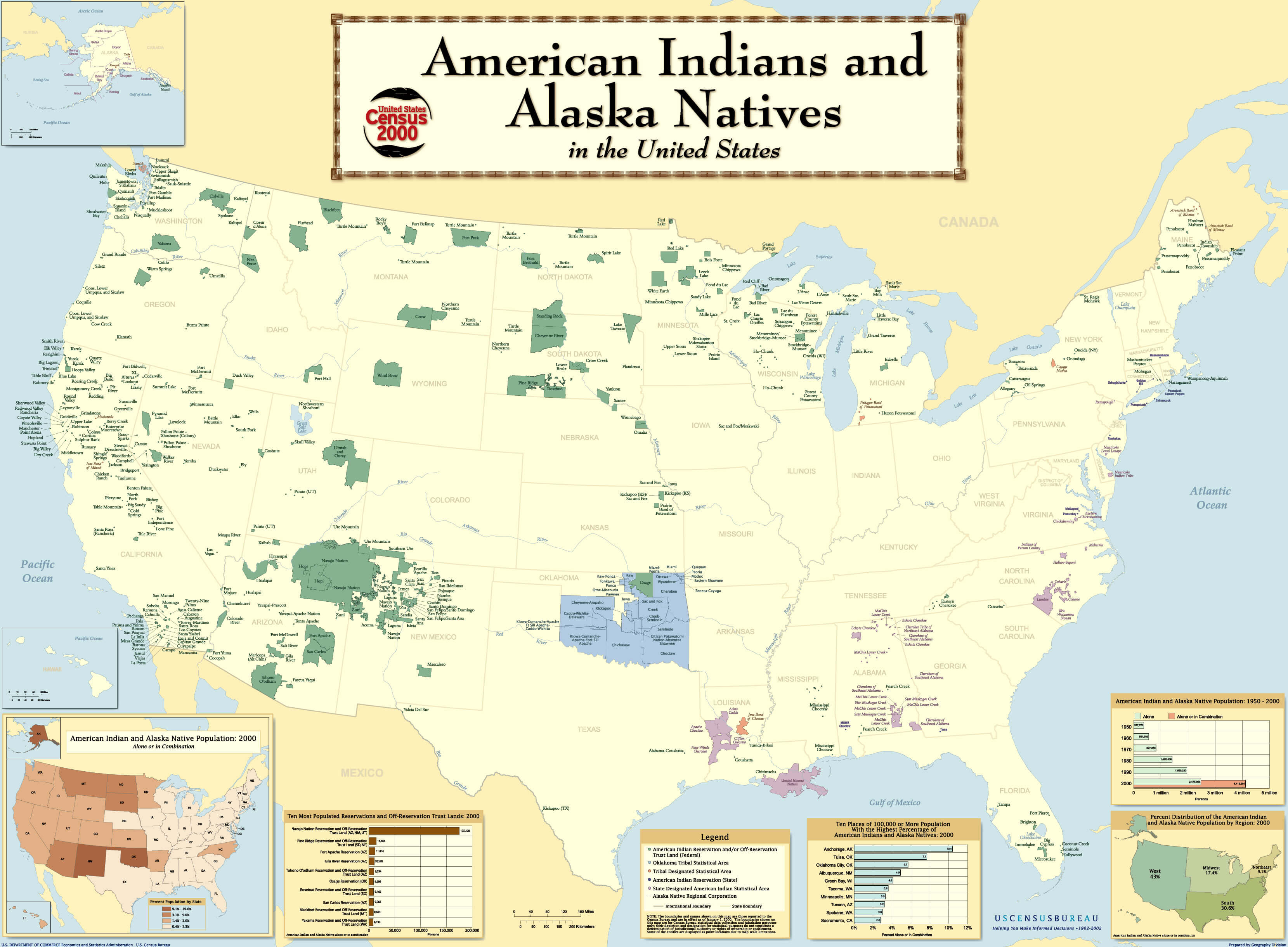
A collection of USA Maps; US Map, United States Atlas, Interactive USA Map, US States Map, USA Political, Phyiscal, Blank, Cities, Capitals, Black, White, Road, River Maps
Free Printable High Detailed United States Map with States
Please subscribe on "World Guide" channnel on Youtube at youtube.com/c/WorldGuide
The United States is a country in North America, lying between Canada and Mexico. Its capital is Washington, D.C.
Please view more USA Maps
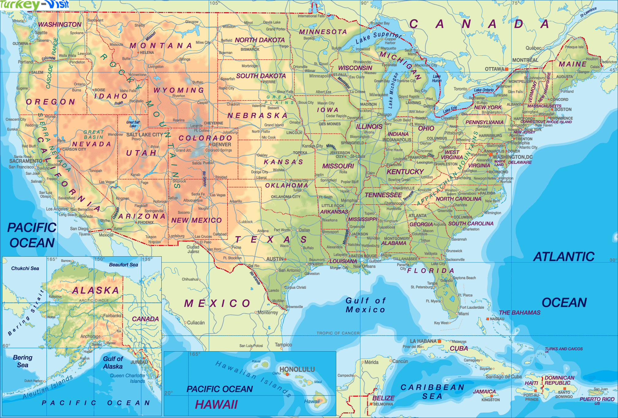
High Detailed United States of America Road Map
Large Color Map of the USA
Free Printable United States Map with States
The Map of The United States
United States Earth Map and Satellite Images
US Interstate Highway Map with Major Cities
US Political Map with Capital Washington, Most Important Cities Rivers and Lakes
States Map of United States
State - Population - Capital - Miles Square - Map Coordinate
- California Map - 37253956 - Sacramento - 587,878 ms
- Texas Map - 25145561 - Austin - 266,874 ms
- New York Map - 19378102 - Albany - 158,648 ms
- Florida Map - 18801310 - Tallahassee - 147,047 ms
- Illinois Map - 12830632 - Springfield - 121,599 ms
- Pennsylvania Map - 12702379 - Harrisburg - 114,007 ms
- Ohio Map - 11536504 - Columbus - 110,567 ms
- Michigan Map - 9883640 - Lansing - 104,1 ms
- Georgia Map - 9687653 - Atlanta - 97,818 ms
- New Jersey Map - 8791894 - Trenton - 97,052 ms
- North Carolina Map - 9535483 - Raleigh - 84,905 ms
- Virginia Map - 8001024 - Richmond - 84,397 ms
- Massachusetts Map - 6547629 - Boston - 83,574 ms
- District of Columbia Map - 6724540 - Olympia - 82,282 ms
- Indiana Map - 6483802 - Indianapolis - 77,359 ms
- Tennessee Map - 6346105 - Nashville - 77,122 ms
- Arizona Map - 6392017 - Phoenix - 70,704 ms
- Missouri Map - 5988927 - Jefferson City - 69,903 ms
- Maryland Map - 5773552 - Annapolis - 69,709 ms
- Washington Map - 5686986 - Madison - 68,126 ms
- Minnesota Map - 5303925 - St. Paul - 58,681 ms
- Colorado Map - 5029196 - Denver - 58,513 ms
- Alabama Map - 4779736 - Montgomery - 58,39 ms
- Louisiana Map - 4533372 - Baton Rouge - 56,343 ms
- South Carolina Map - 4625364 - Columbia - 56,276 ms
- Kentucky Map - 4339367 - Frankfort - 56,145 ms
- Oregon Map - 3831074 - Salem - 53,183 ms
- Oklahoma Map - 3751351 - Oklahoma City - 52,672 ms
- Connecticut Map - 3574097 - Hartford - 51,718 ms
- Iowa Map - 3046355 - Des Moines - 49,112 ms
- Mississippi Map - 2967297 - Jackson - 47,72 ms
- Arkansas Map - 2915918 - Little Rock - 47,695 ms
- Kansas Map - 2853118 - Topeka - 45,31 ms
- Utah Map - 2763885 - Salt Lake City - 42,146 ms
- Nevada Map - 2700551 - Carson City - 41,328 ms
- New Mexico Map - 2059179 - Santa Fe - 40,598 ms
- West Virginia Map - 1859815 - Charleston - 24,230 ms
- Nebraska Map - 1826341 - Lincoln - 36,185 ms
- Idaho Map - 1567582 - Boise - 33,128 ms
- Maine Map - 1328361 - Augusta - 31,117 ms
- New Hampshire Map - 1316470 - Concord - 24,231 ms
- Hawaii Map - 1360301 - Honolulu - 10,455 ms
- Rhode Island Map - 1052567 - Providence - 9,615 ms
- Wyoming Map - 563626 - Cheyenne - 97,814
- Montana Map - 989415 - Helena - 9,283 ms
- Delaware Map - 897934 - Dover - 8,262 ms
- South Dakota Map - 814180 - Pierre - 7,79 ms
- Alaska Map - 710231 - Juneau - 6,459 ms
- North Dakota Map - 672591 - Bismarck - 5,006 ms
- Vermont Map - 563626 - Montpelier - 2,026 ms
- Wisconsin Map - 5686986 - Cheyenne - 65,497 ms
Author: Arif Cagrici