Connecticut Map
Explore the charming state of Connecticut with our detailed map. Find major cities, landmarks, and attractions, and learn about the history and culture of this fascinating New England state. Discover all that Connecticut has to offer today!
On this page, you will find a detailed map of Connecticut that highlights the state's major cities, landmarks, and attractions. Whether you are planning a trip to Connecticut or simply want to learn more about this fascinating state, our map has all the information you need.
So, come explore Connecticut with us! From the bustling cities of Hartford and Bridgeport to the idyllic towns of Mystic and Litchfield, there is something for everyone in this unique and captivating state. Let our map be your guide as you discover all that Connecticut has to offer.
Map of Connecticut
For all Connecticut Cities Map
MAP OF CONNECTICUT

CONNECTICUT HISTORICAL MAP

Brief information about Connecticut, US
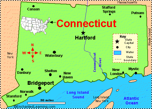
Connecticut is a state in the northeastern region of the United States. It is bordered by Massachusetts to the north, Rhode Island to the east, New York to the west, and Long Island Sound to the south. Connecticut has a population of approximately 3.6 million people and covers an area of 5,567 square miles, making it one of the smallest states in the country.A Collection of Connecticut Maps and Connecticut Satellite Images
MAP OF CONNECTICUT
CONNECTICUT COUNTY MAP
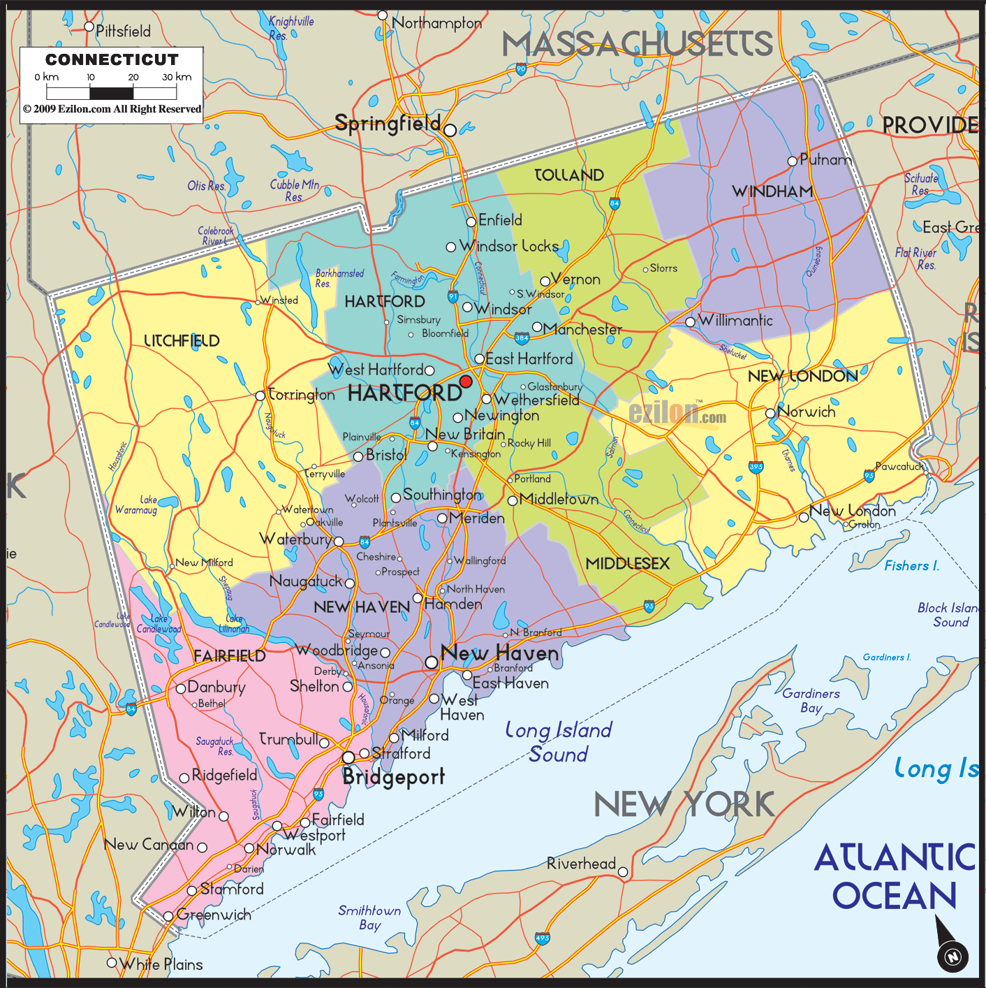
CONNECTICUT COUNTY MAP

CONNECTICUT HISTORICAL MAP
CONNECTICUT LAND MAP

CONNECTICUT MAP

CONNECTICUT POLITICAL MAP

CONNECTICUT REFERENCE MAP

CONNECTICUT ROAD MAP

CONNECTICUT ROAD MAP
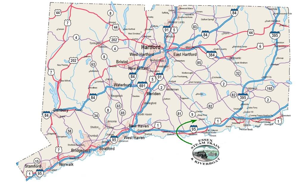
INTERSTATE 95 CONNECTICUT MAP

MAP OF CONNECTICUT

MAPS OF CONNECTICUT
A collection of Connecticut Maps

Largest Cities Map of Connecticut and Population
Bridgeport Map - 144,229 New Haven Map - 129,779 Hartford Map - 124,775 Stamford Map - 122,643 Waterbury Map - 110,366 Norwalk Map - 85,603 Danbury Map - 80,893 New Britain Map - 73,206 West Hartford Map - 63,268 Meriden Map - 60,868 Bristol Map - 60,477 West Haven Map - 55,564 Stratford Map - 51,384 Milford Map - 51,271 East Hartford Map - 51,252Copyright WorldMap1.com 2006 - 2023. All rights reserved. Privacy Policy | Disclaimer