Maryland Map FQA
How many cities are in Maryland ?
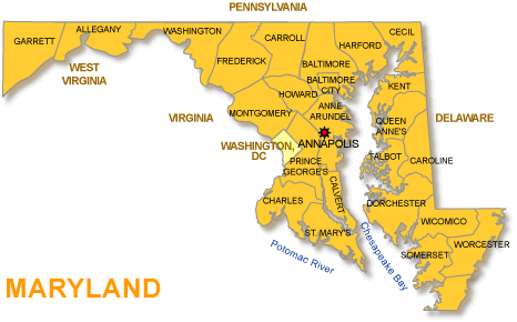
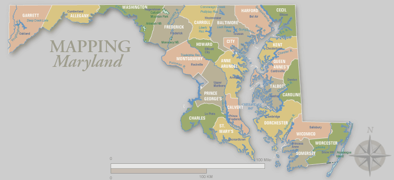
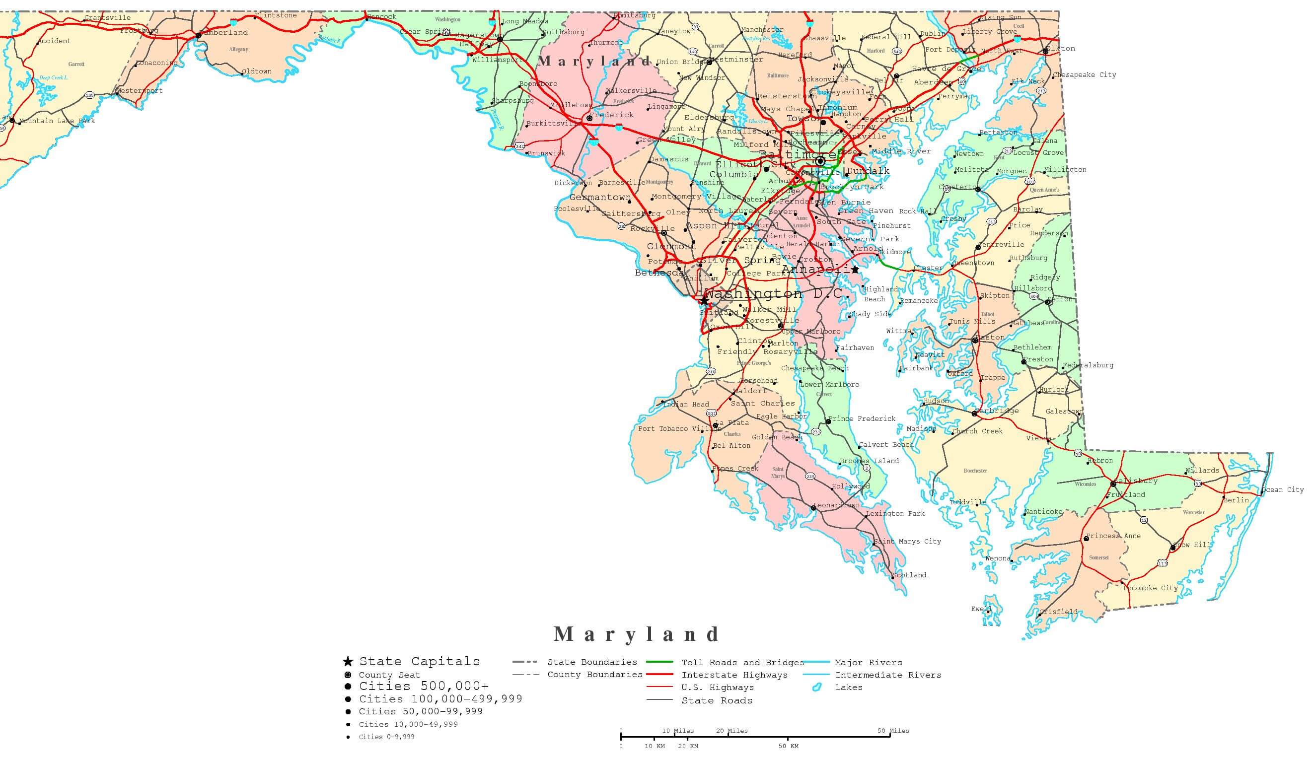
Maryland has 23 counties and 1 independent city. The largest by population are: Montgomery County; Prince George’s County; Baltimore County; Baltimore City; Anne Arundel County; Howard County; Frederick County; Harford County; Carroll County; Charles County.
What are the major geographical features of Maryland ?
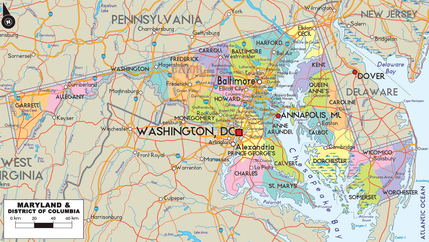
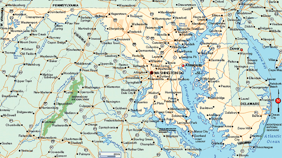
Maryland has the Appalachian Mountains in the west, the Piedmont Plateau in the center, and the Atlantic Coastal Plain in the east. It also borders the Chesapeake Bay and has rivers such as the Potomac.
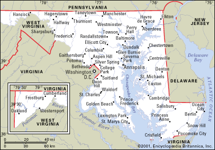
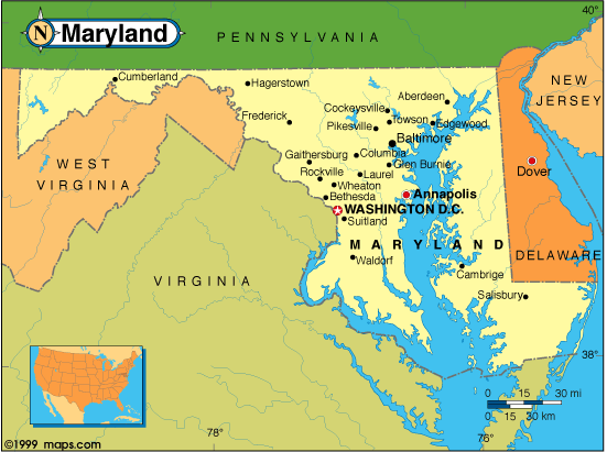
MAP OF MARYLAND

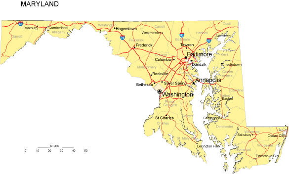
MARYLAND CITY MAP

Welcome to our comprehensive Maryland map page, where you can explore the diverse geography of this unique state. Maryland is located in the Mid-Atlantic region of the United States and is known for its charming coastal towns, historic landmarks, and scenic highways. With our detailed and interactive Maryland map, you can navigate the state with ease and discover all the beauty and excitement it has to offer.
Whether you're a resident, visitor, or student, our collection of Maryland maps has something for everyone. From political and physical maps to road maps and more, we provide you with the resources you need to explore Maryland like never before. So, start your journey today and discover the wonders of Maryland!
Navigating Baltimore's Best Kept Secrets
Please subscribe on "World Guide" channnel on Youtube at youtube.com/c/WorldGuide
The Earth, North America and Countries View from Space - Day Time and in the Night
Brief information about utah, US
Brief information about Maryland, US
Maryland is a state located in the Mid-Atlantic region of the United States. It is the 19th most populous state in the US and covers an area of approximately 12,406 square miles. The state is bordered by Virginia to the south, West Virginia to the west, Pennsylvania to the north, and Delaware and the Atlantic Ocean to the east.
Maryland is known for its diverse geography, ranging from the Appalachian Mountains in the west to the Chesapeake Bay in the east. The state is also home to several major cities, including Baltimore, the largest city in Maryland, and Annapolis, the state capital.
Maryland played a significant role in American history, being one of the original 13 colonies and the site of several important battles during the American Revolution and the Civil War. Today, Maryland's economy is diverse and includes significant contributions from industries such as biotechnology, aerospace, and defense. The state is also home to several prestigious universities, including Johns Hopkins University and the University of Maryland.
Here's some statistical information about the area, population, demographics, history, and economy of Maryland:
Area: 12,406 square miles (32,133 square kilometers)
Population: 6,177,224 (as of 2020)
Demographics: Maryland has a diverse population, with a mix of ethnicities and races. According to the US Census Bureau, the state's racial makeup is as follows: White (52.4%), Black or African American (31.5%), Asian (7.0%), and Hispanic or Latino (10.1%). The state also has a significant population of people of two or more races.
History: Maryland was founded in 1634 as a proprietary colony and was one of the original 13 colonies that formed the United States. The state played a significant role in the American Revolution and the Civil War. In the 20th century, Maryland's economy shifted from agriculture to manufacturing and later to services, including healthcare, education, and technology.
Economy: Maryland's economy is diverse and includes significant contributions from industries such as biotechnology, aerospace, and defense. According to the Bureau of Economic Analysis, the state's gross domestic product (GDP) was $403 billion in 2020, making it the 15th largest economy in the US. The state is also home to several federal government agencies and military installations, contributing to its economy.
A Collection of Maryland Maps and Maryland Satellite Images
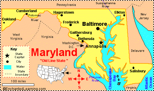
MAP OF MARYLAND
MARYLAND BLANK PHYSICAL MAP

MARYLAND CITIES MAP
MARYLAND CITY MAP
MARYLAND COUNTY MAP
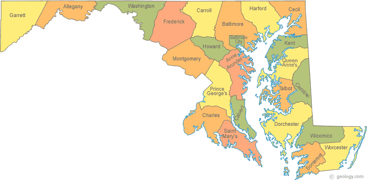
MARYLAND COUNTIES MAP

MARYLAND COUNTY MAP
MARYLAND HISTORICAL MAP

MARYLAND MAP BALTIMORE
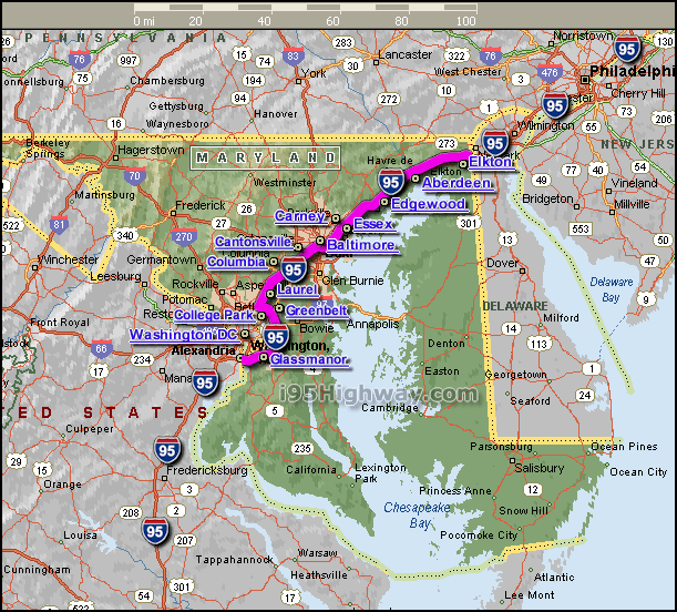
MARYLAND MAP INTERSTATE 95
MARYLAND MAP USA
MARYLAND PRINTABLE MAP
MARYLAND ROAD MAP

MARYLAND SATELLITE IMAGE MAP

MARYLAND STATE MAP
A collection of Maryland Maps
Author: Arif Cagrici