
- Capital :
Berlin
- Population :
81,799,600
- GDP :
$3.367 trillion (4th)
- Per Capita :
$41,168 (19th)
- Calling Code :
+49
- Jobless Rate :
6.70%
- Time Zone :
+1
With interactive Germany Map, view regional highways maps, road situations, transportation, lodging guide, geographical map, physical maps and more information. On Germany Map, you can view all states, regions, cities, towns, districts, avenues, streets and popular centers' satellite, sketch and terrain maps.
A Collection of Germany Maps
Germany Road Map
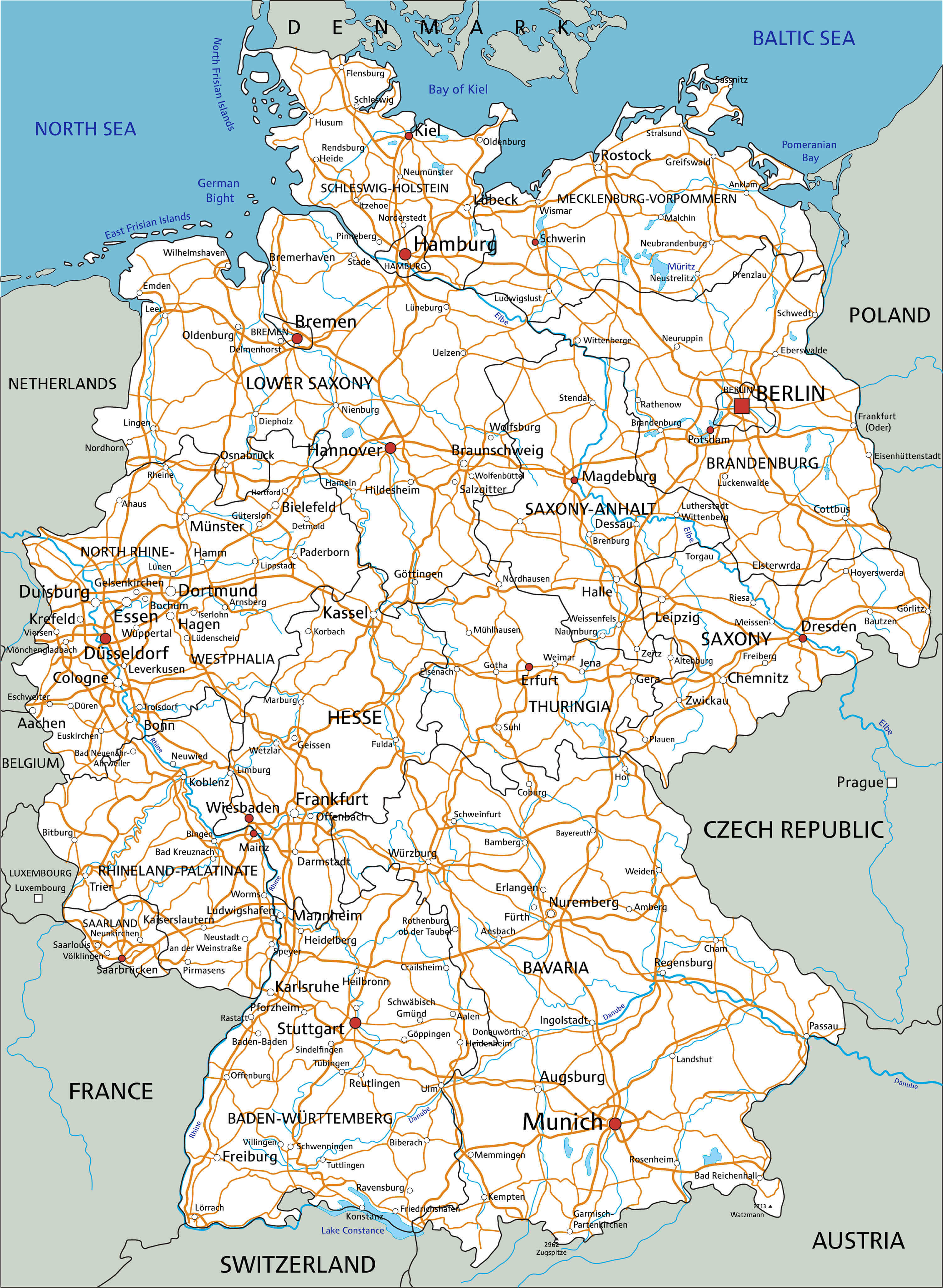
High detailed Germany road map with labeling, major cities and towns.
Germany Cities Map
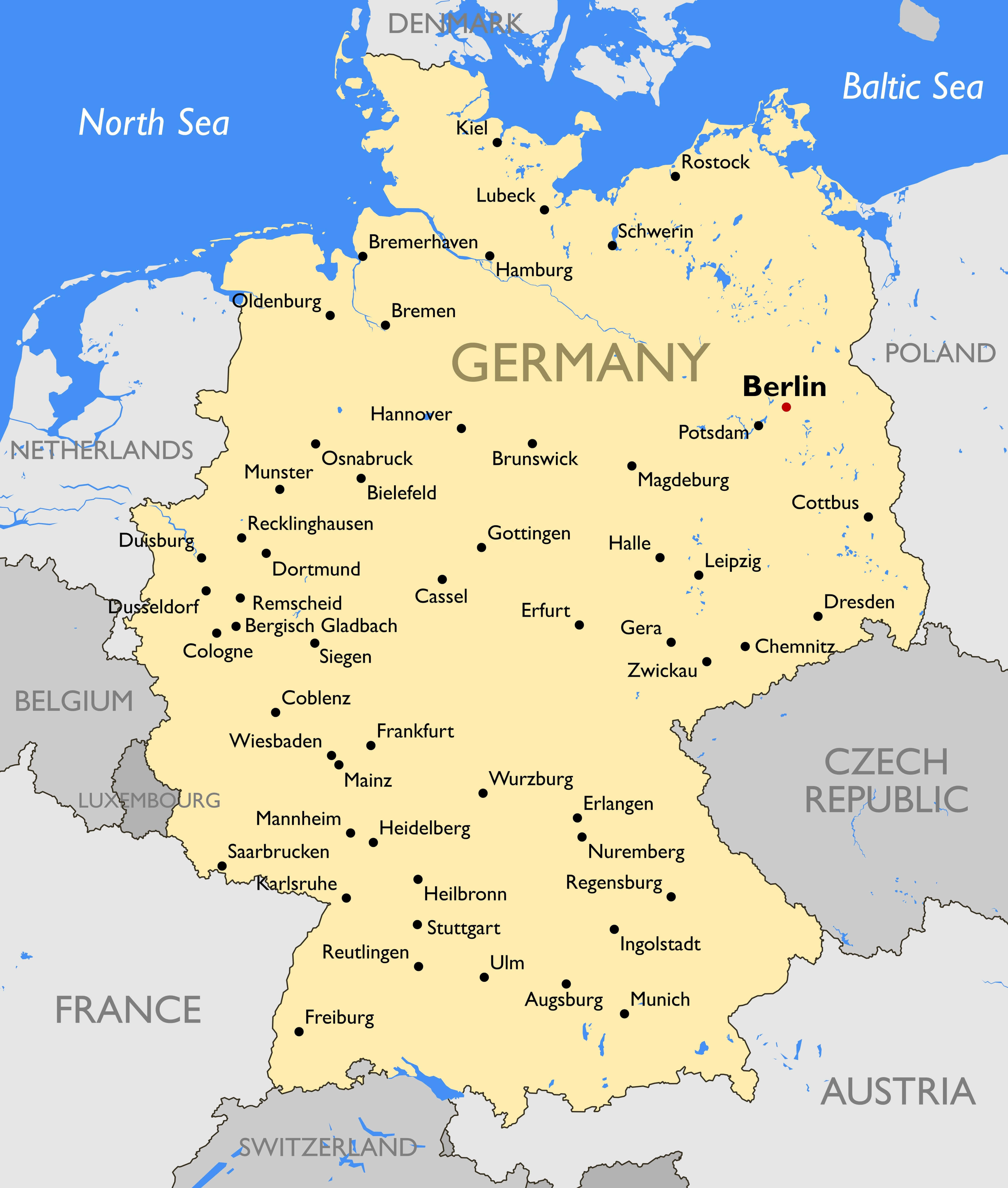
Germany Cities Map
Germany Blank States Map
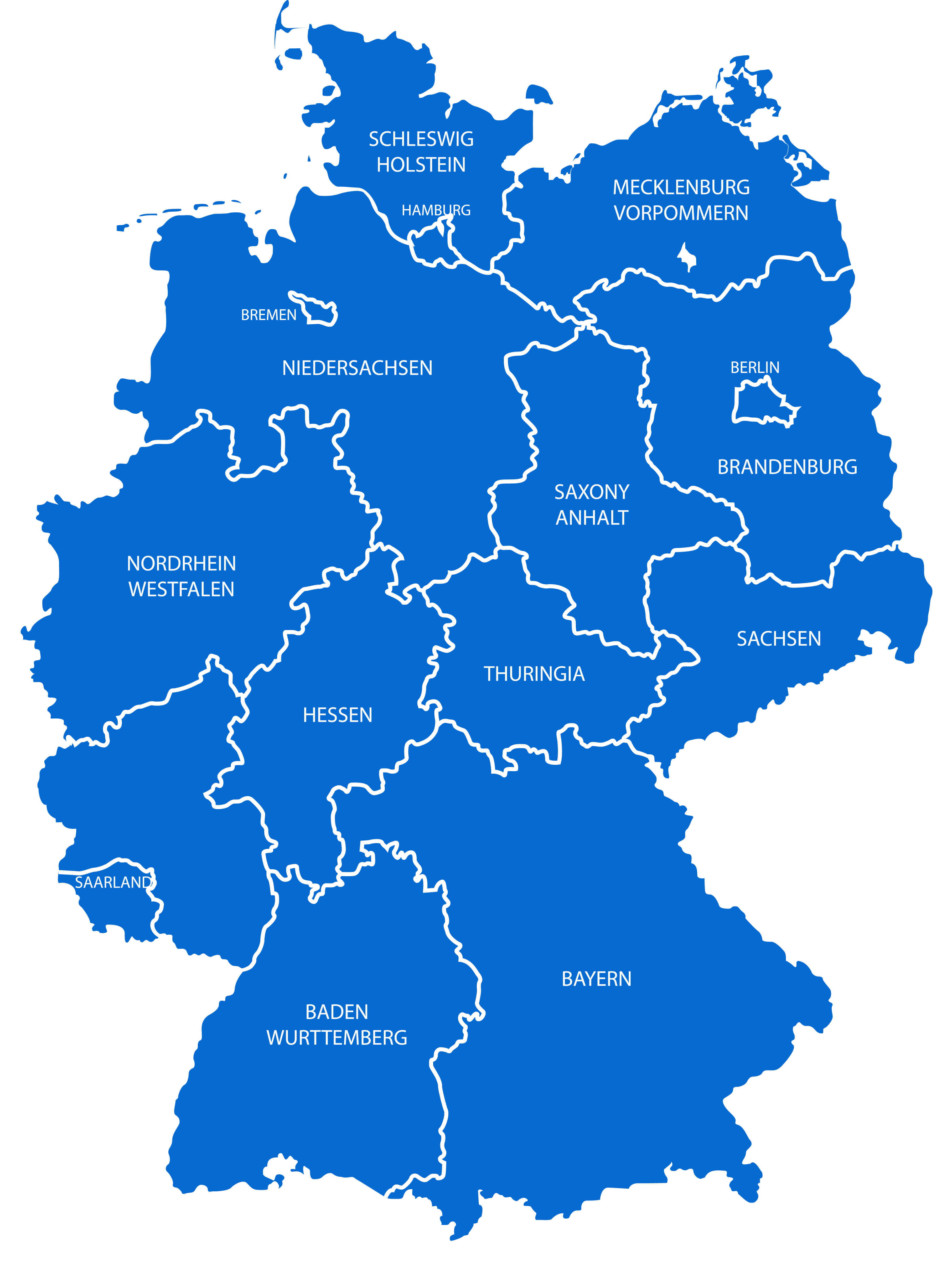
Germany Blank States Map
Germany Main Cities Map
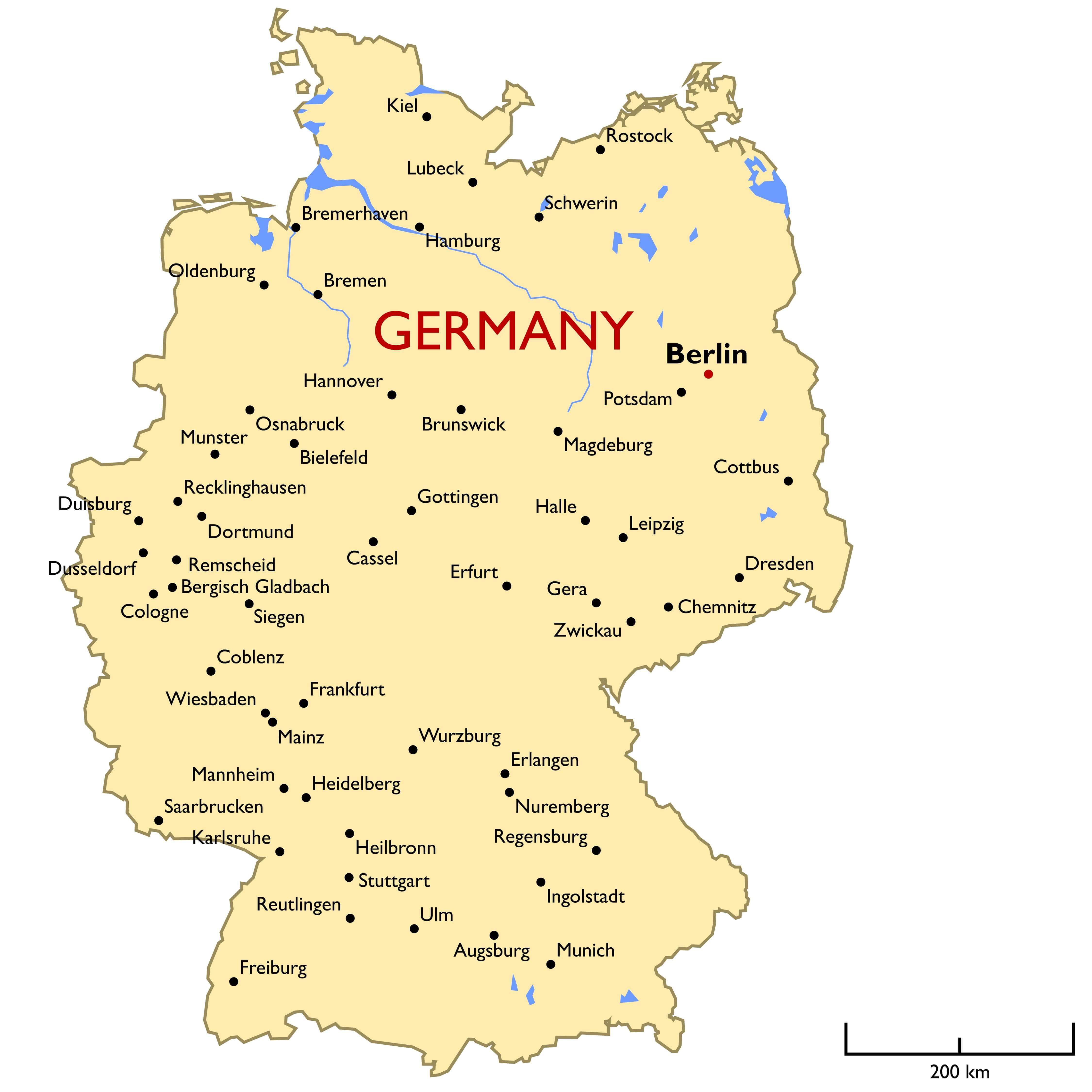
Germany Main Cities Map
Germany Detailed Regions Map

Germany highly detailed regions map.
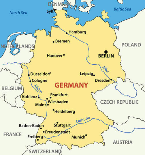
Germany Major Cities Rivers Map

Germany Major Cities Rivers Map
Germany Blank Map

Germany Blank Map
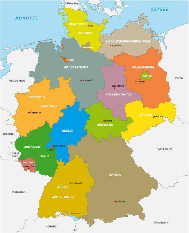
Germany Regions Cities Map

Germany Main Regions Cities Map
Germany Political Map

Germany Political Map with capital Berlin, national borders, most important cities, rivers and lakes in English labeling and scaling.
Administrative Map of Germany

Administrative Map of Germany
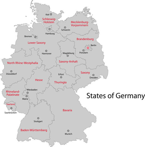
Germany State Map
Germany State Map
Germany National Map
Germany National Map
Germany Regions Map
Gray Germany map with regions and main cities.
Map of Germany

Map of Germany, national boundaries and national capitals