Chilean Maps
Chile, a country that stretches over 4,300 kilometers from north to south, encompasses a remarkable variety of landscapes ranging from the arid Atacama Desert to the lush rainforests of the Patagonia region. "A Comprehensive Guide to Chilean Maps" is an essential tool for anyone looking to navigate this diverse and breathtaking terrain. This guide offers an in-depth look at the geographical complexity of Chile, providing detailed maps that cover its extensive coastline, high Andean peaks, and everything in between. It serves not only as a navigational aid but also as a window into the country's rich cultural and natural heritage, highlighting Chile's national parks, ancient sites, and vibrant cities. 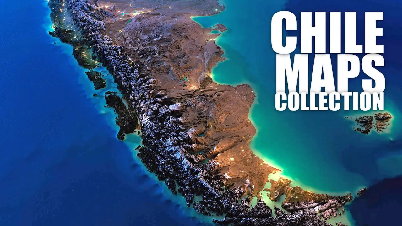
Click for Content Detail »
Chile Explored: A Visual Journey Through Maps
Please subscribe on "World Guide" channnel on Youtube at youtube.com/c/WorldGuide
Delving into this guide, readers will find a collection of maps that cater to various interests and needs, from the outdoor adventurer seeking to explore Chile's untamed wilderness to the urban explorer intrigued by the historical and modern contrasts of Santiago and Valparaíso. The guide also includes specialized maps focusing on geological features, climatic zones, and biodiversity, offering valuable insights for researchers and environmental enthusiasts. Through "A Comprehensive Guide to Chilean Maps," explorers can plan their journeys with precision, gaining a deeper understanding of the country's environmental and cultural landscapes. This comprehensive resource is indispensable for anyone eager to discover the many facets of Chile, providing the knowledge to navigate its terrains with confidence.
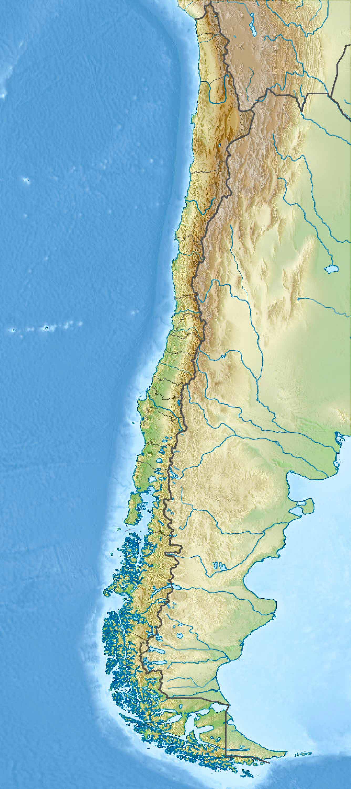
1. Chile Physical Map
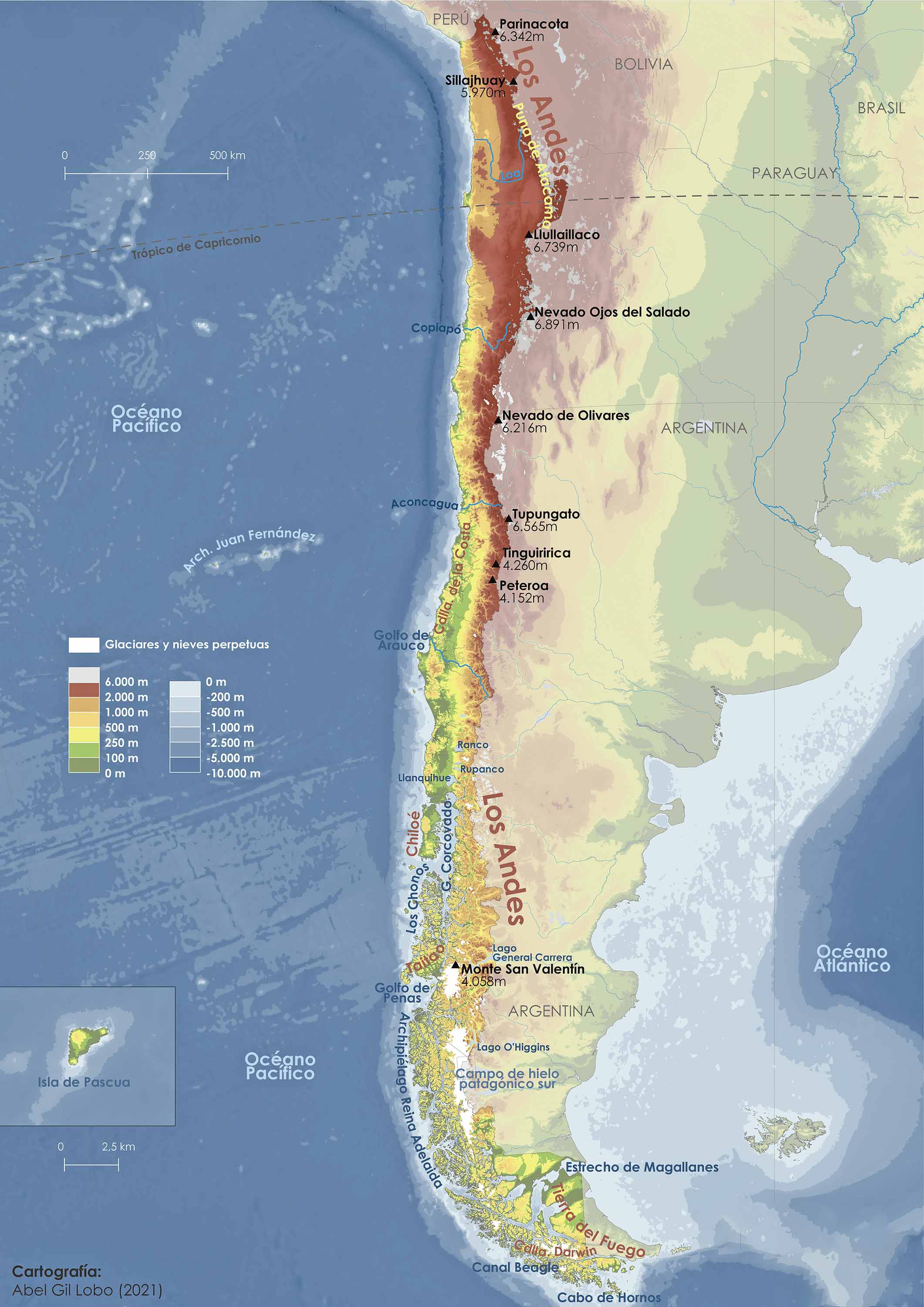
The physical map of Chile highlights the country's natural physical landscape. You'll see the towering Andes Mountains, vast deserts, lengthy coastlines, and expansive forests, presenting a vivid depiction of Chile's natural terrain.
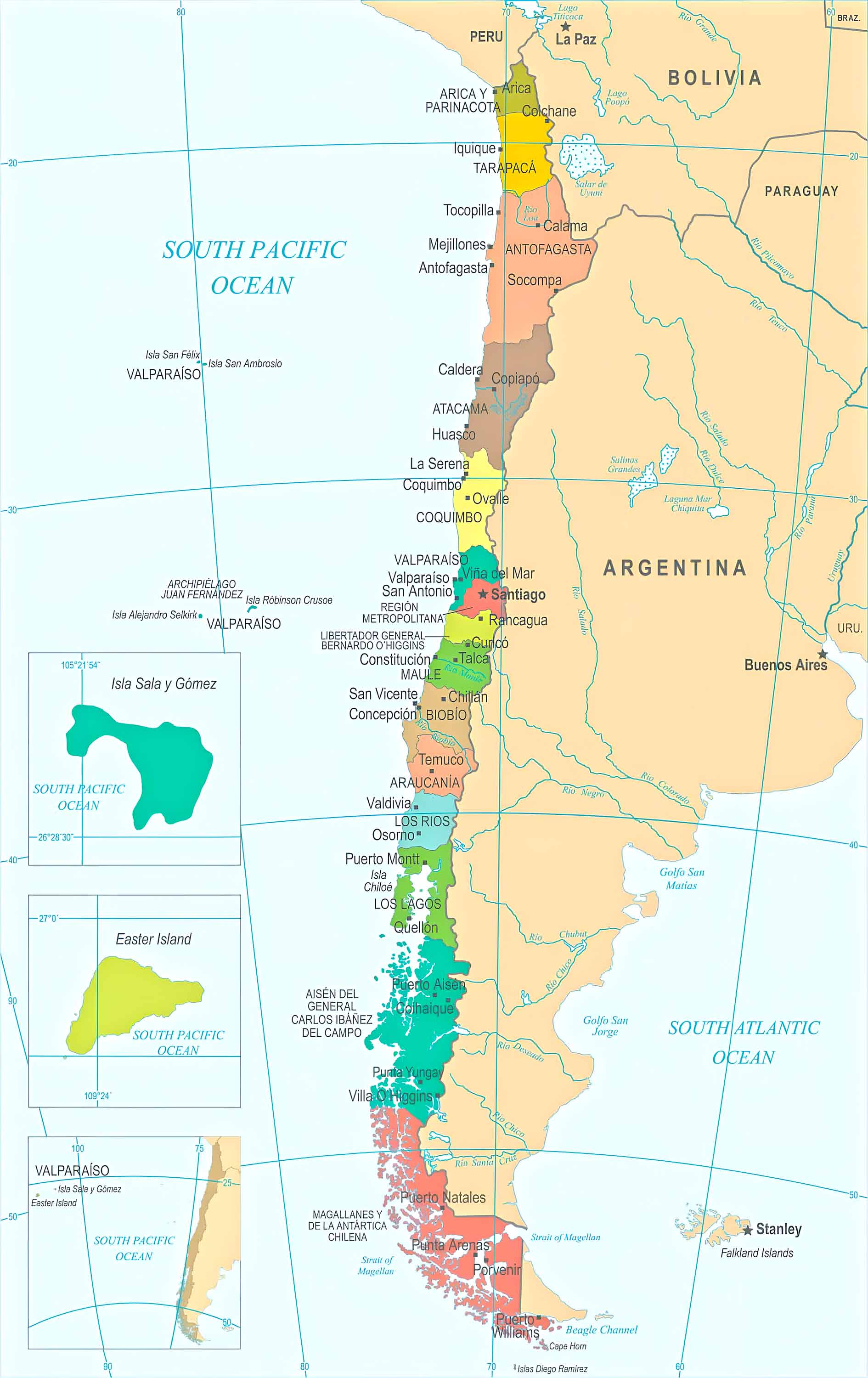
2. Chile Political Map
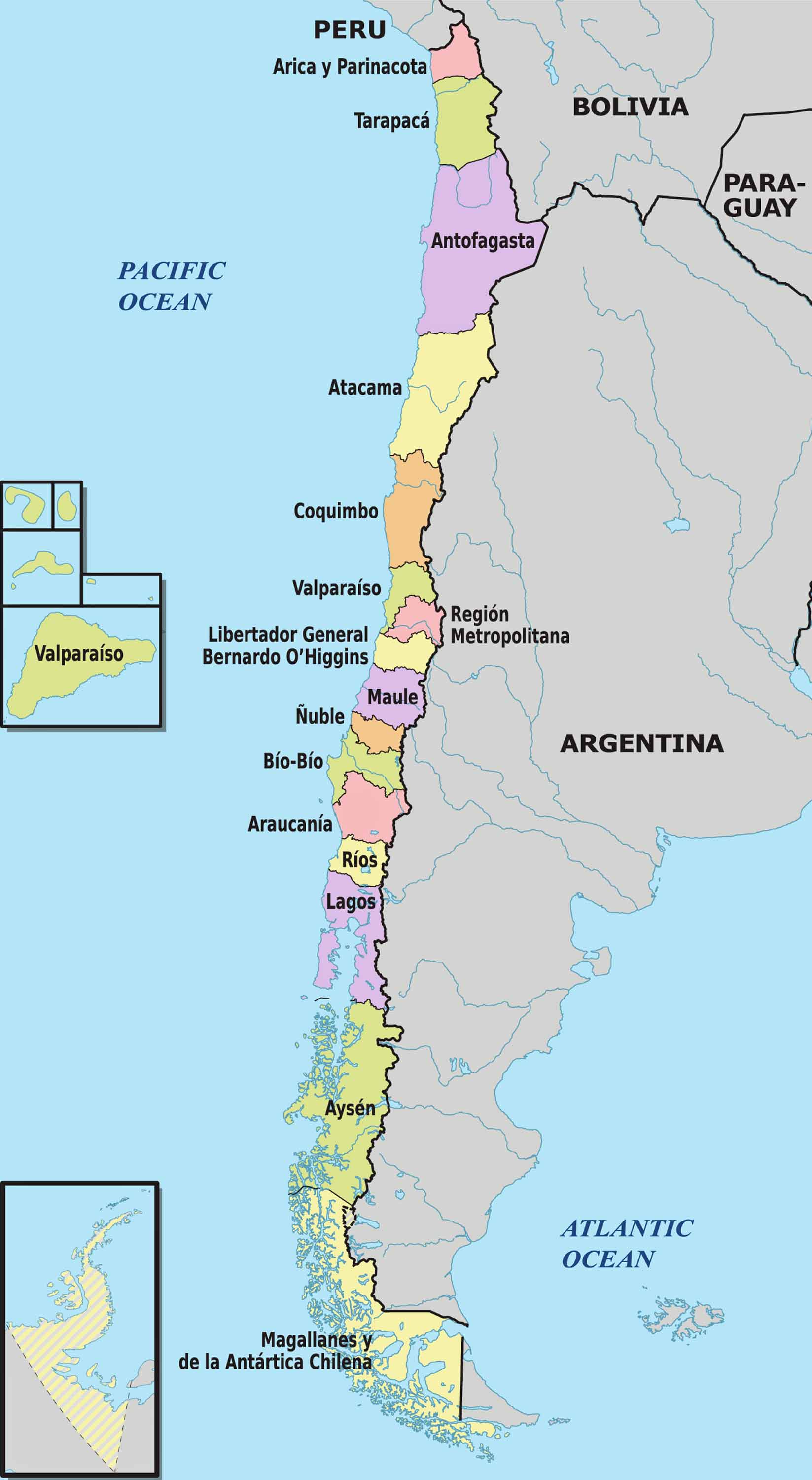
Chile's political map outlines the country's provinces and regions, showcasing its political boundaries. It's a clear representation of how the country is structured politically, highlighting major cities including the capital, Santiago.
3. Chile Topographic Map
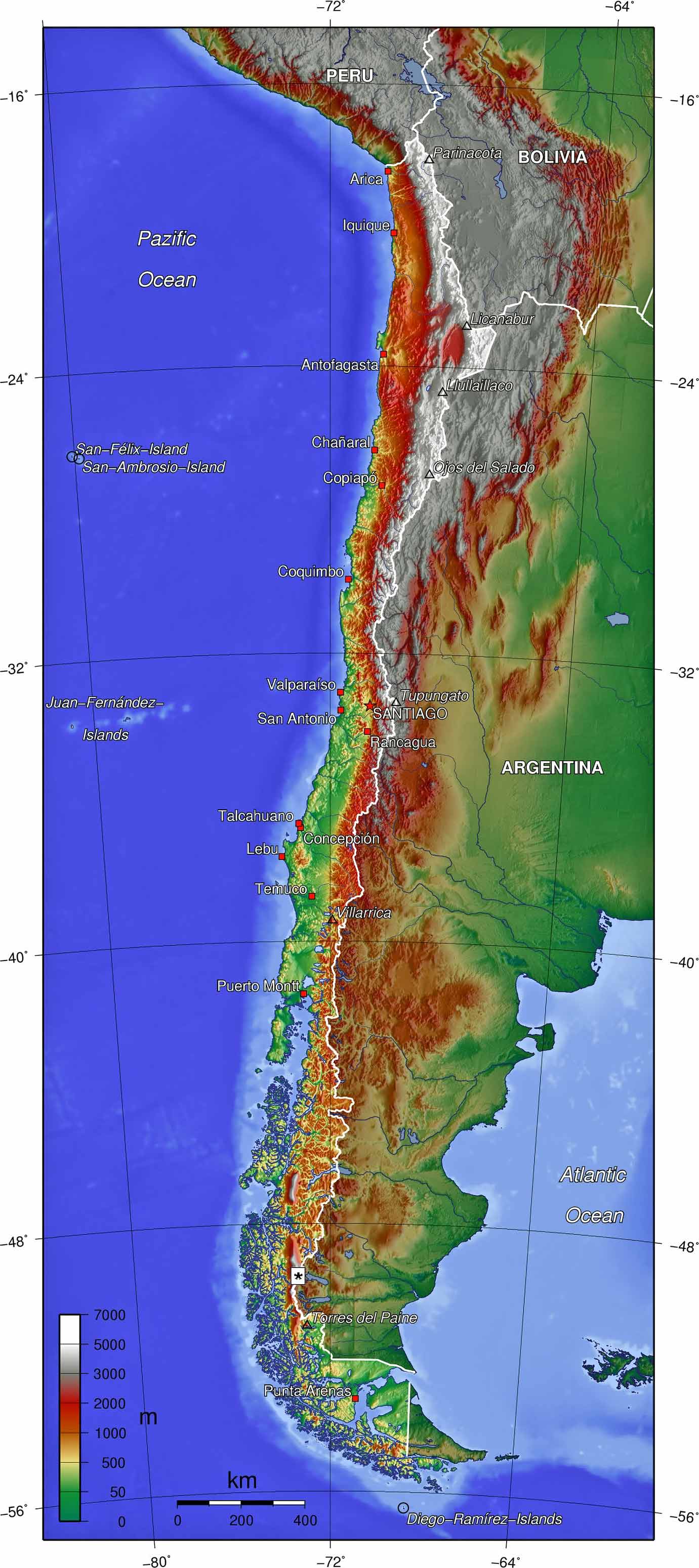
A topographic map of Chile offers a detailed 3D representation of the country's terrain. It includes elevations, mountains, valleys, and plains, perfect for understanding the varied landscapes.
4. Chile Relief Map
The relief map brings a realistic view of Chile's physical features. This 3D map accentuates mountains, valleys, and plains, offering a tactile sense of Chile's diverse topography.
5. Chile Geological Map
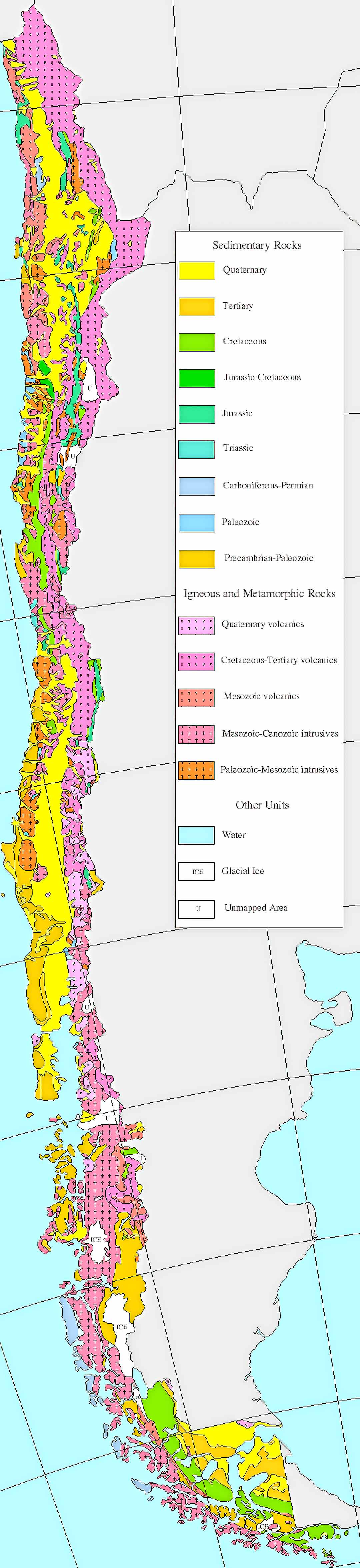
Chile's geological map is a window into the country's rich geological history. It shows the distribution of different rock types and geologic features, crucial for understanding Chile's seismic activity and mineral resources.
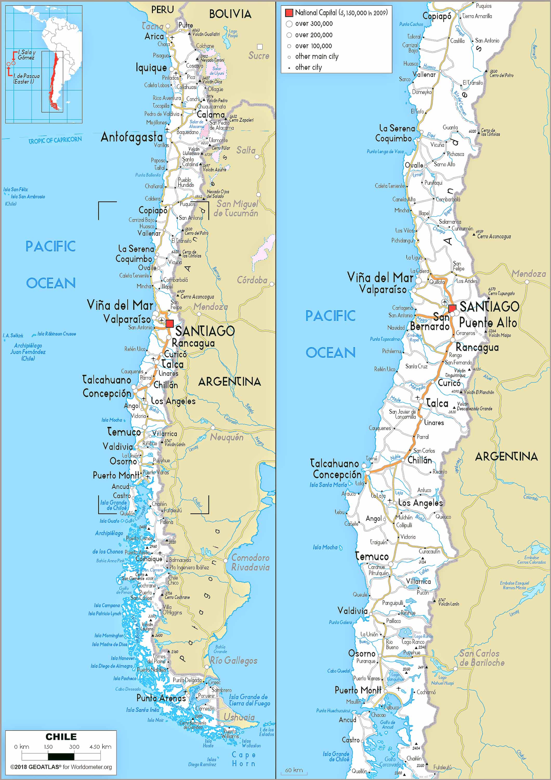
6. Chile Cities, Counties, Capitals Map
This map focuses on Chile's urban landscape, particularly its major cities. It provides detailed information on city layouts, including neighborhoods, main streets, and significant landmarks.
7. Chile Historical Map (1937)
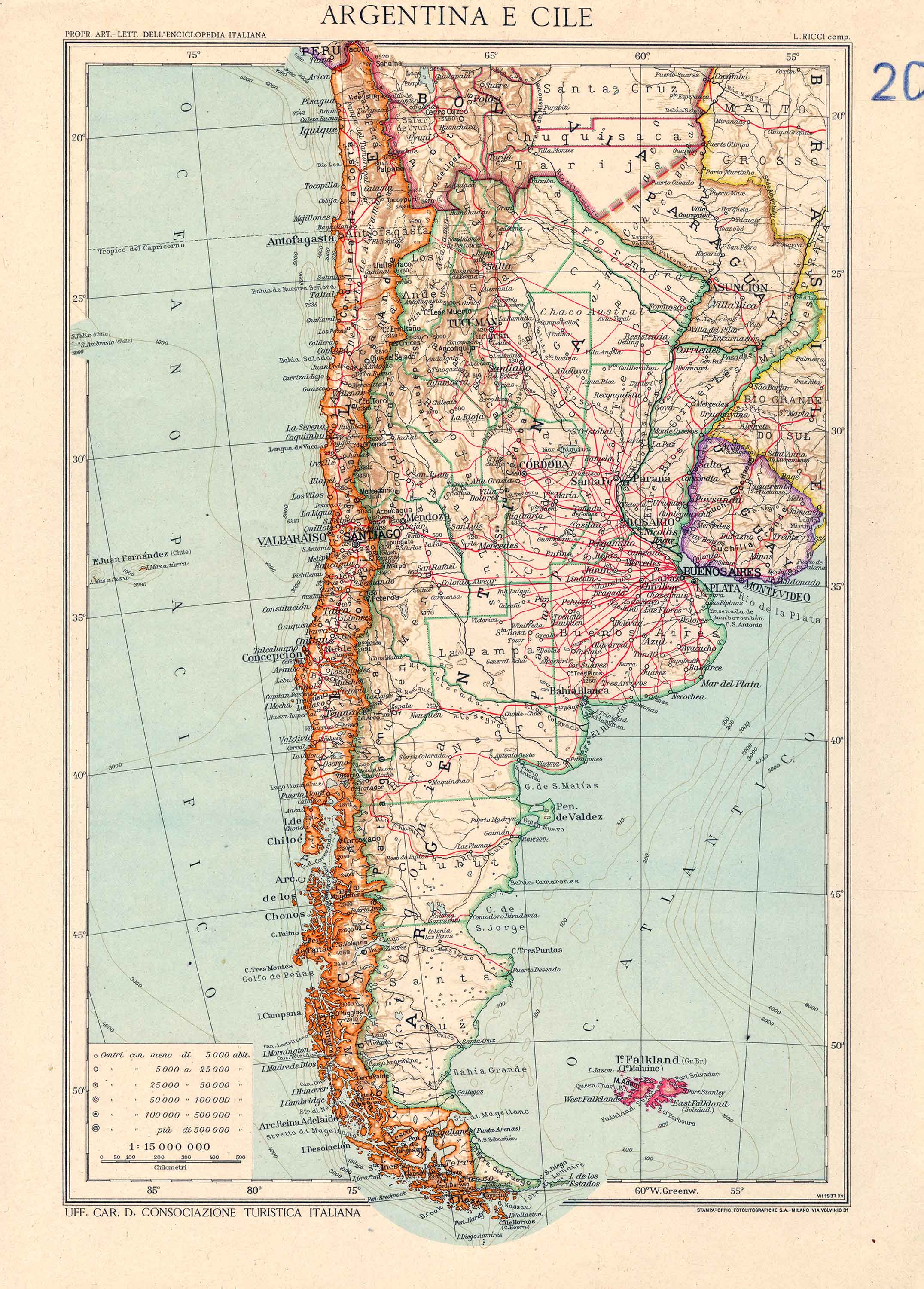
The historical maps of Chile take you on a journey through the country's rich and tumultuous history, showing territorial changes, historical events, and the evolution of its boundaries.
8. Chile Regions Map
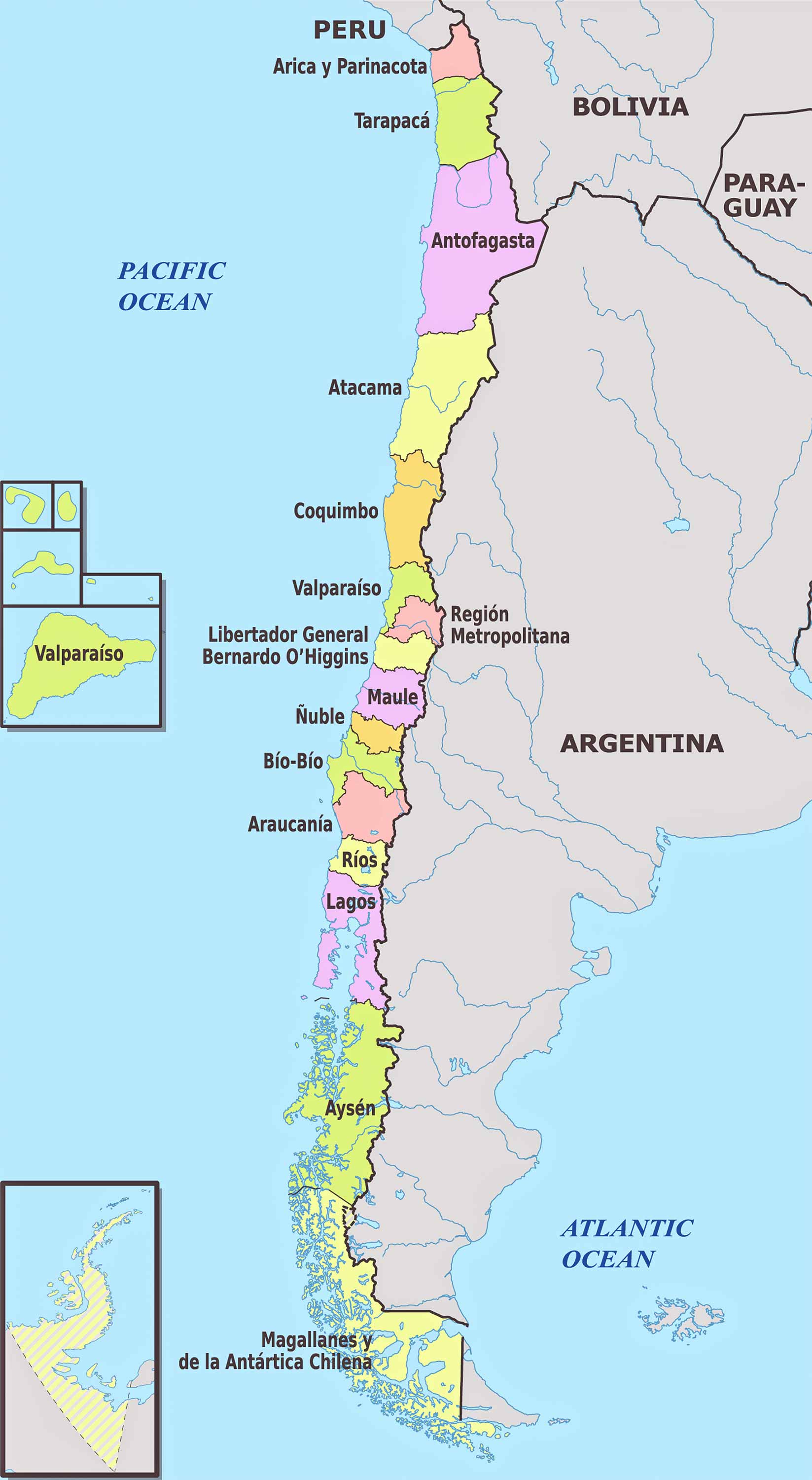
Chile is divided into multiple regions, each with its own unique characteristics. This map highlights these regions, offering insights into their geographical and cultural distinctions.
9. Chile Administrative Divisions Map
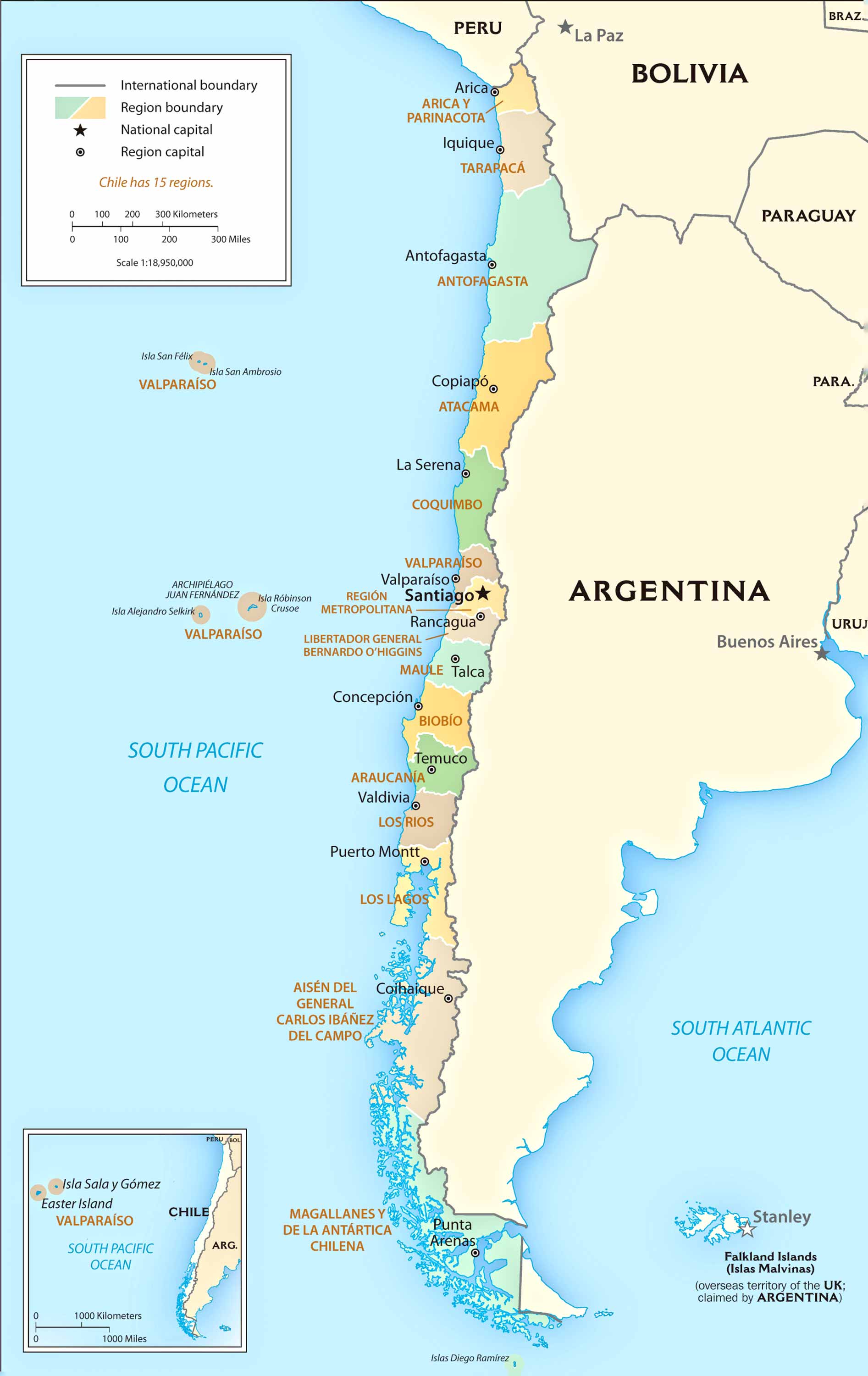
This map details Chile's administrative divisions, showing how the country is organized into regions, provinces, and communes, illustrating the layers of governance.
10. Chile Transit Map
Chile's transit map provides an overview of the country's public transportation systems, including metro, bus, and other local transit options, particularly in major cities like Santiago.
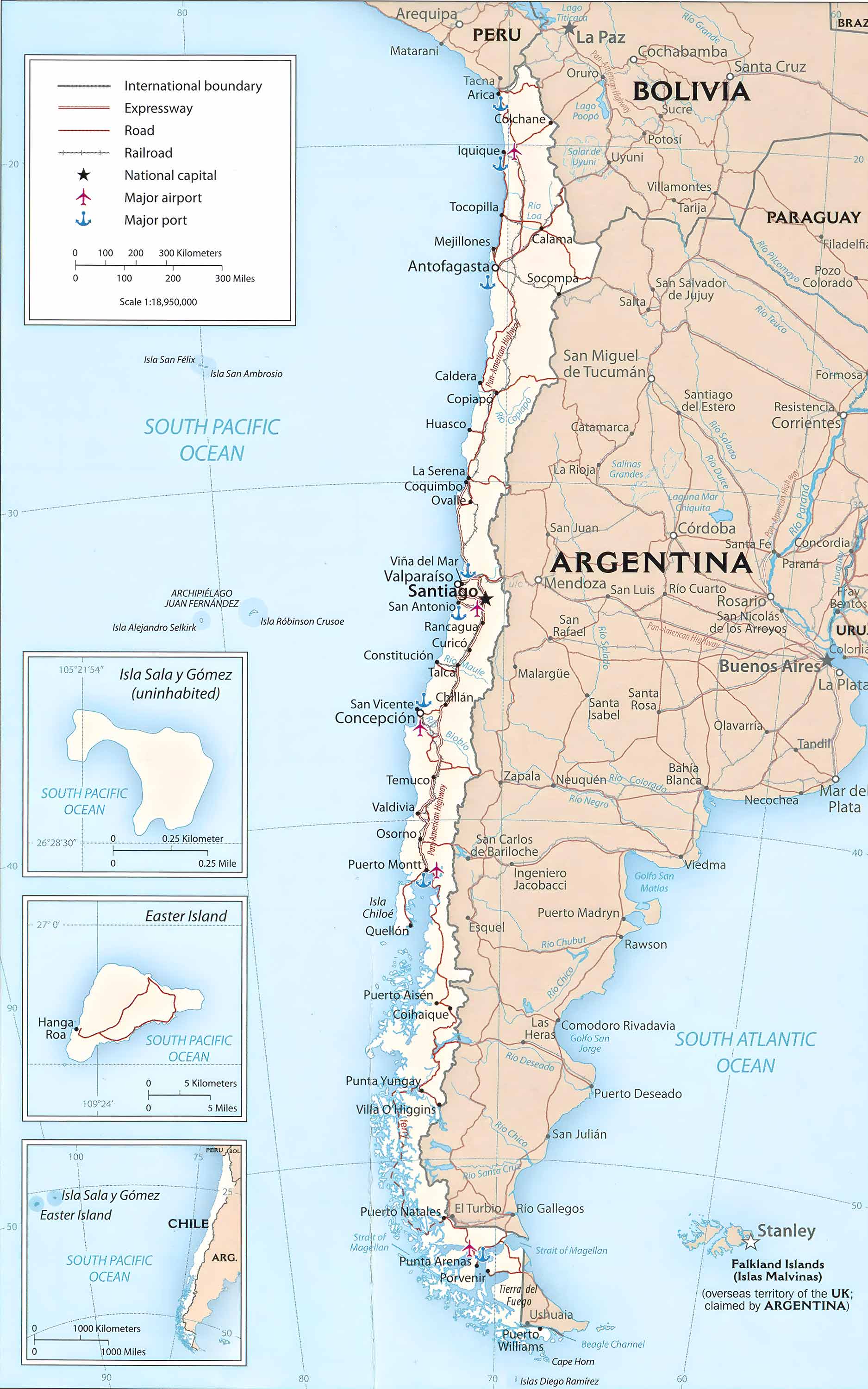
11. Chile Road Map
The road map of Chile is essential for travelers, showing major highways and roads, ideal for planning road trips and exploring the country's vast landscapes.
12. Chile Train-Railway Map
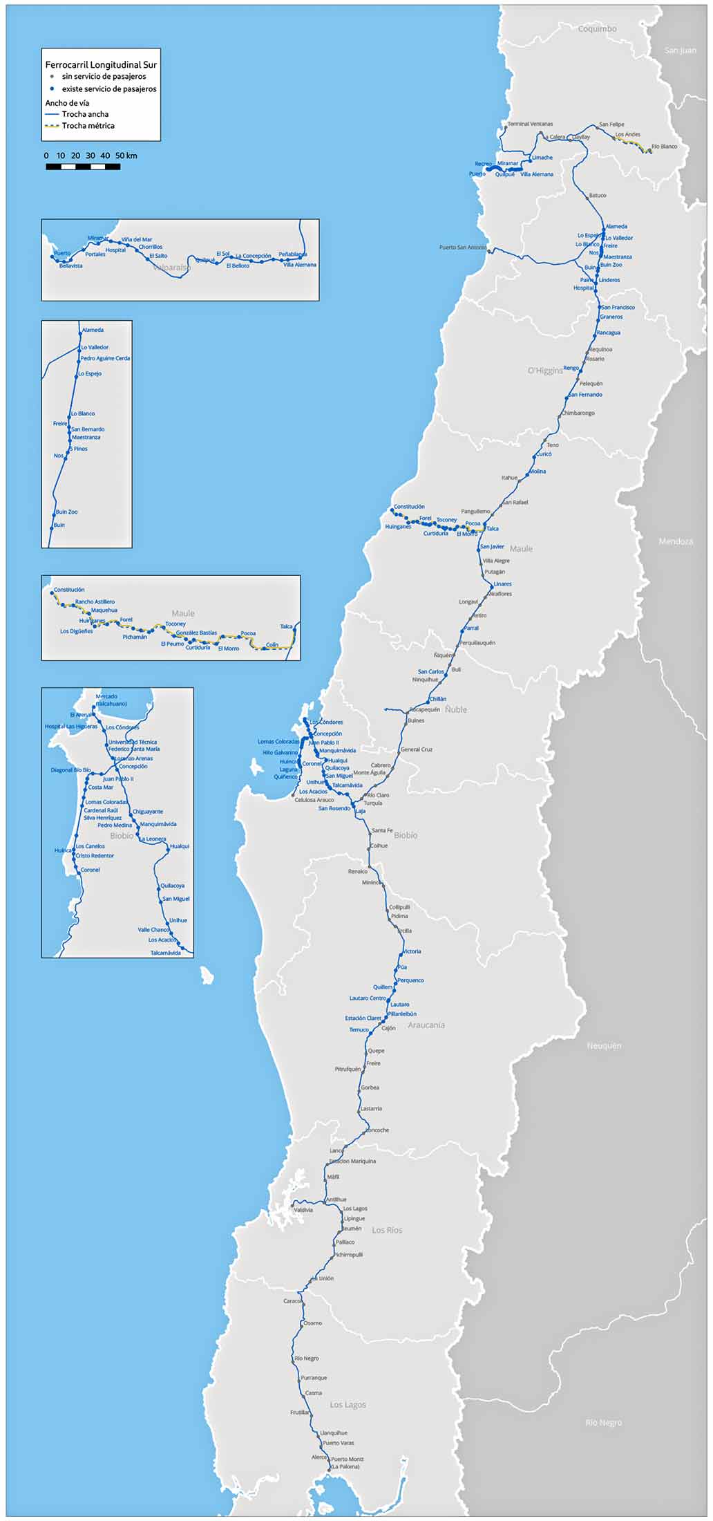
Explore Chile's railway system with this map, highlighting the main train routes, including long-distance and regional lines, an important aspect of the country's transport infrastructure.
13. Chile Climatic Map
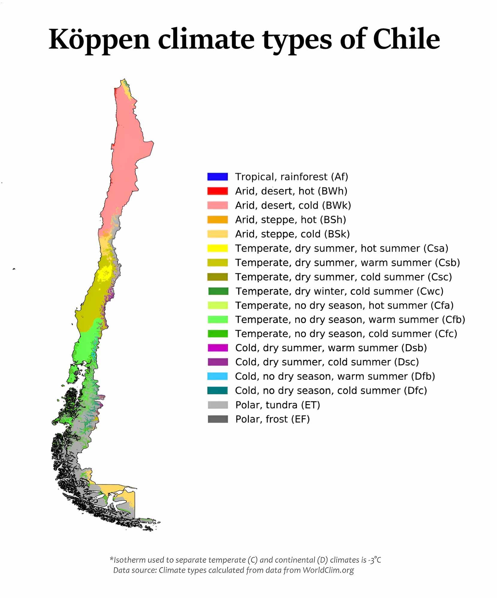
Chile's climatic map illustrates the varied climate zones across the country, from the desert climate in the north to the polar climates in the south.
14. Chile Blank Map
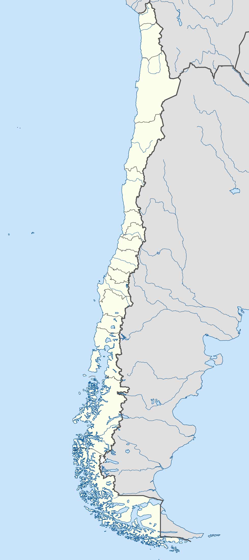
A blank map of Chile is a versatile tool, useful for educational purposes or for creating customized maps.
15. Chile Flag Map
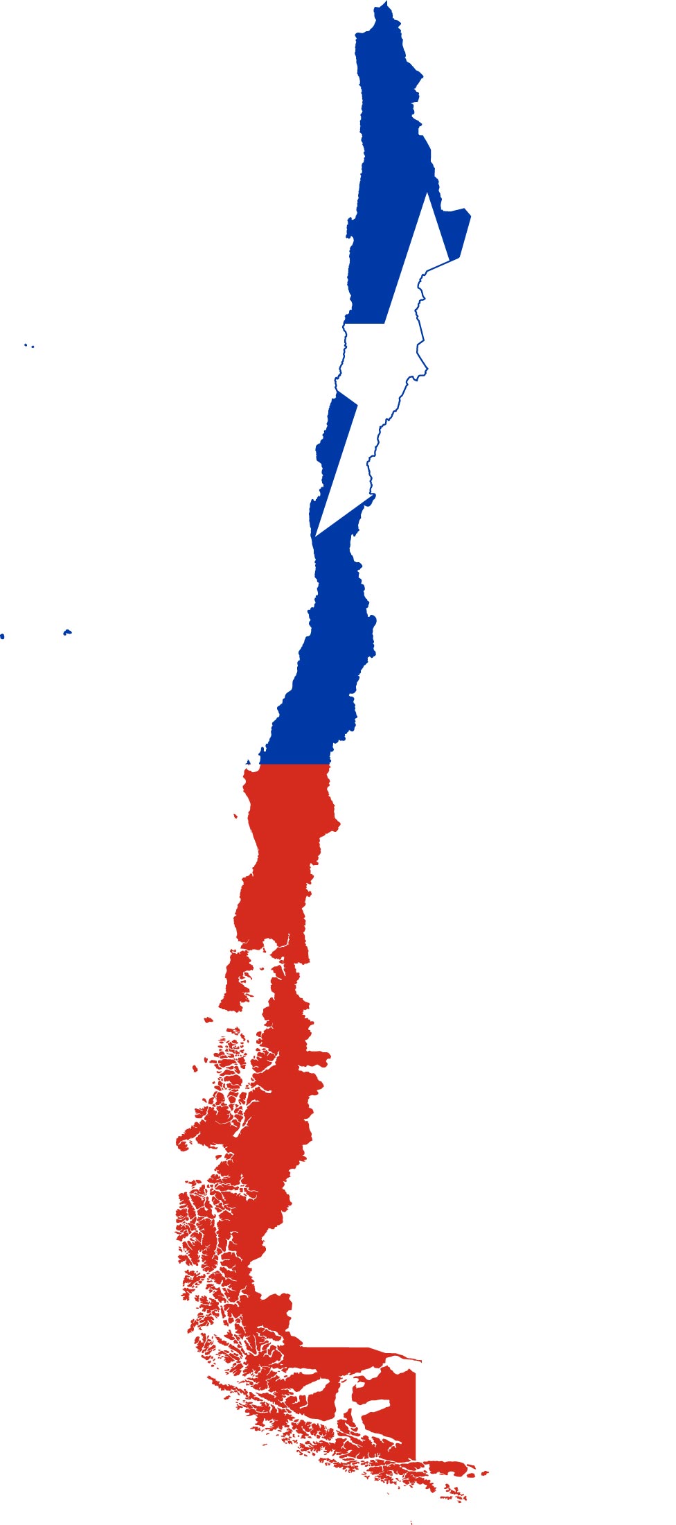
This creative map integrates the Chilean flag with the country's outline, symbolizing national pride and identity.
16. Chile Travel-Tourist Map
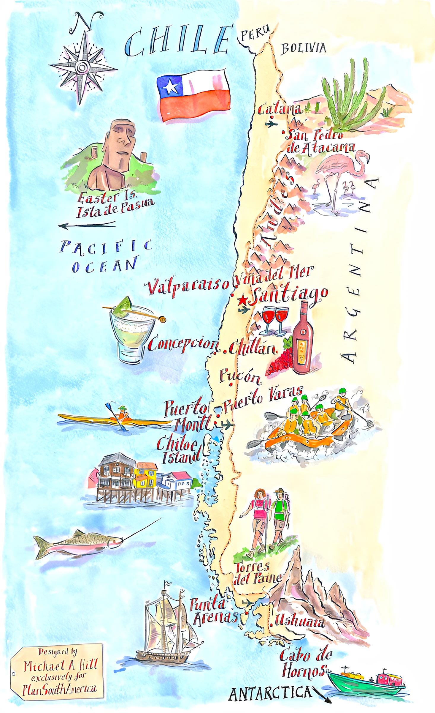
Designed for travelers, this map highlights tourist attractions, popular destinations, and travel routes, making it a handy guide for anyone exploring Chile.
17. Map of Chile's Location in the Word Map
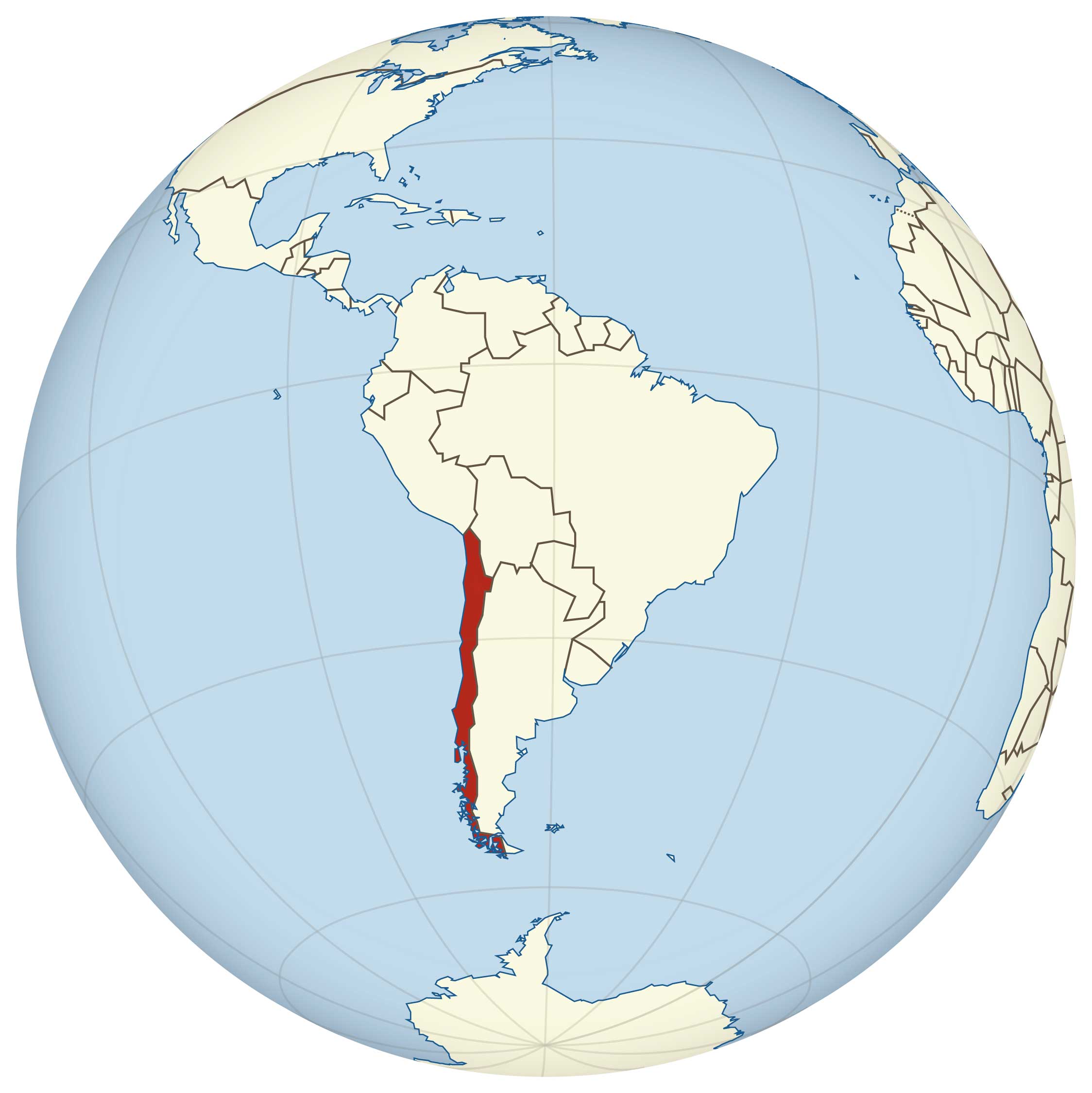
This global perspective shows Chile's position on the world map, emphasizing its unique location along the southwestern coast of South America.
17. Chile Earth Satellite Map
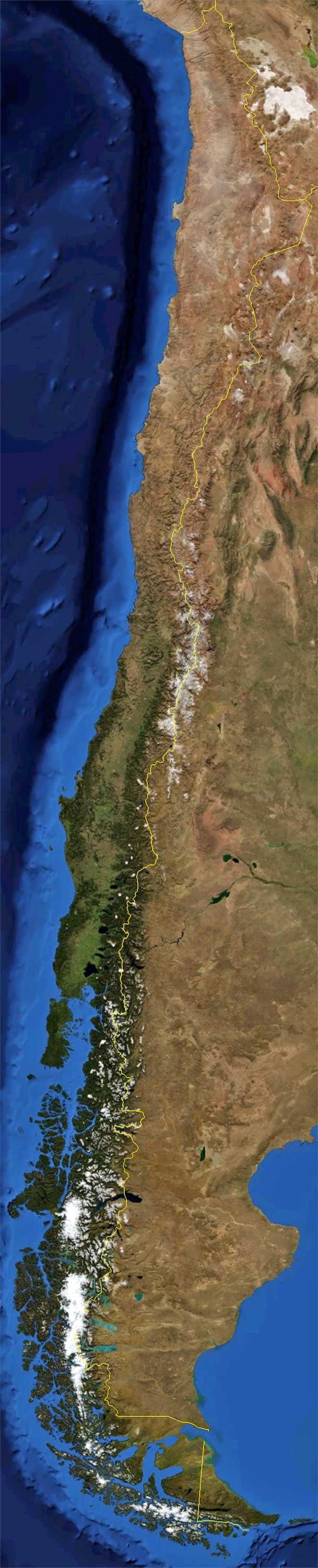
An Earth satellite map provides a stunning view of Chile from space, showcasing its geographical features from a unique perspective.
As our journey through Chile's diverse maps comes to a close, we hope these cartographic representations have offered you a deeper appreciation of this remarkable country. From its complex geography to its rich cultural tapestry, each map has been a window into the many layers that make up Chile. Whether you're planning a visit, studying its geography, or simply exploring from afar, these maps serve as a guide and inspiration. Thank you for joining us on this enlightening expedition through Chile's landscapes, both natural and man-made. Until our next adventure, keep exploring and discovering the world through its many maps!