Nantes Map
Navigate Nantes Map, Nantes city map, satellite images of Nantes, Nantes towns map, political map of Nantes, driving directions and traffic maps.
For more >> France Maps
For more info >> France
Nantes Map FQA
Can I download a high-resolution map of Nantes ?
Yes. Download high-resolution political and physical maps of Nantes for personal or educational use. Redistribution is subject to the terms of our license.Nantes Map - Political, Physical, Touristic City Maps and Satellite Images
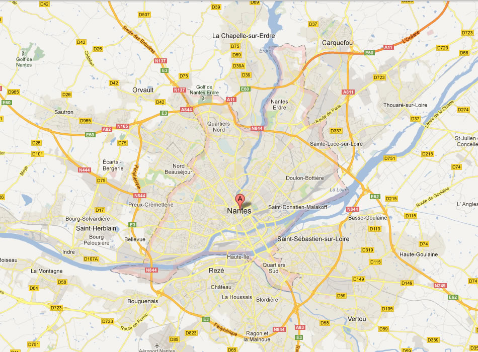
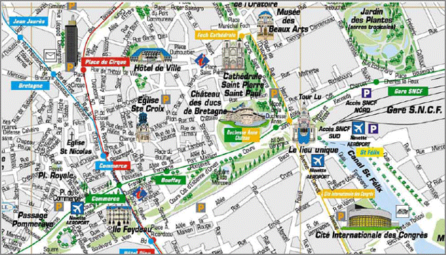
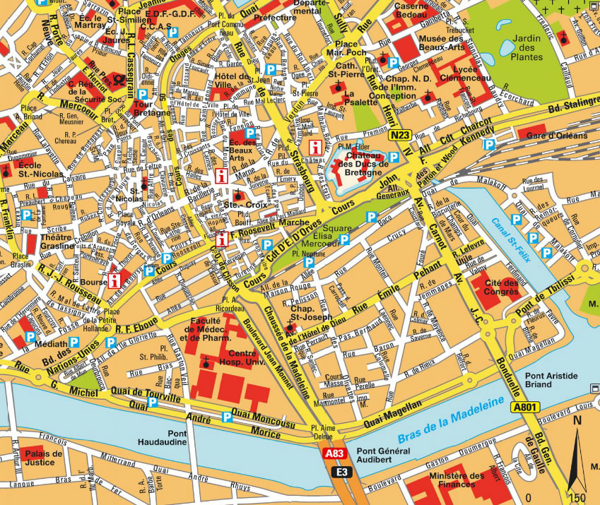
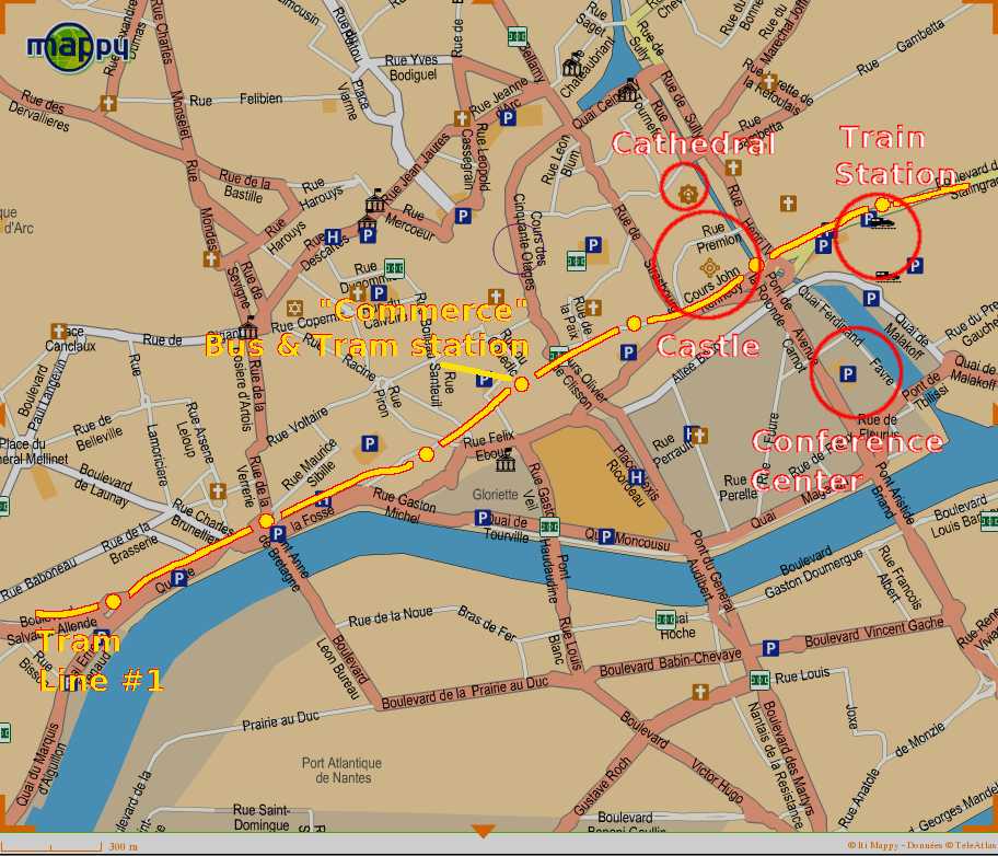
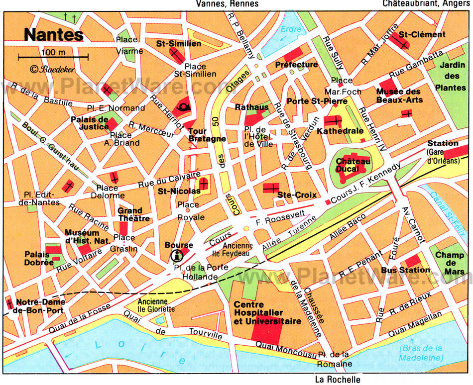
MAP OF NANTES
A Collection of Nantes Maps
MAP OF NANTES

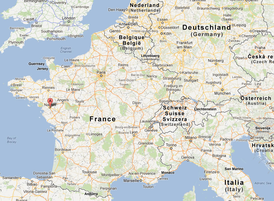
FRANCE NANTES MAP
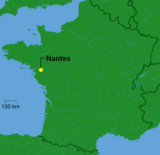
MAP OF NANTES FRANCE
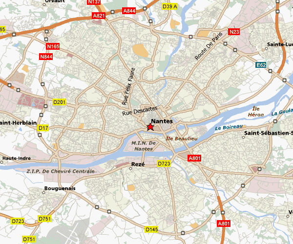
NANTES MAP
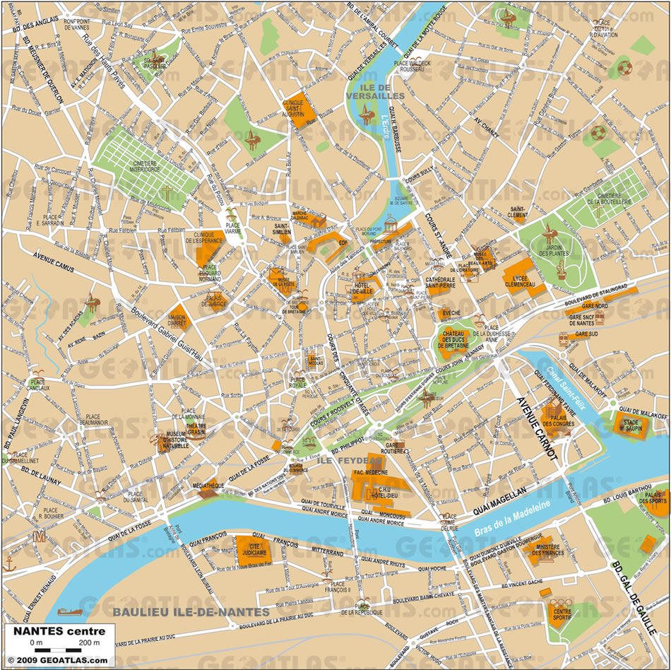
NANTES CENTER MAP
NANTES DOWNTOWN MAP
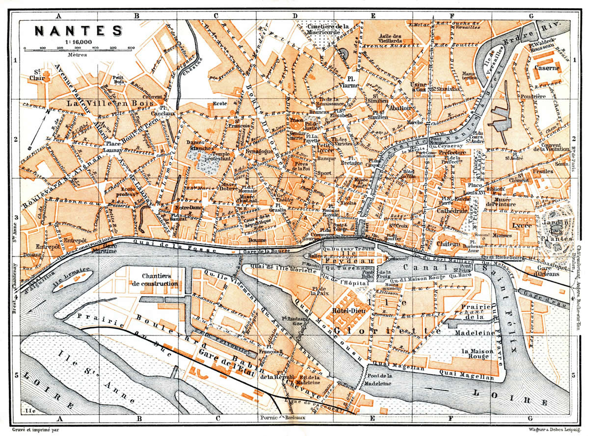
NANTES MAP 1899
NANTES MAP
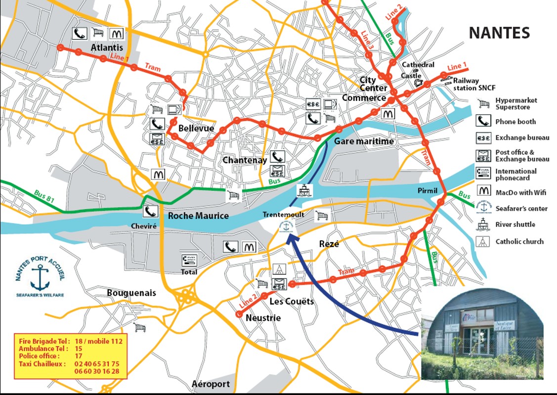
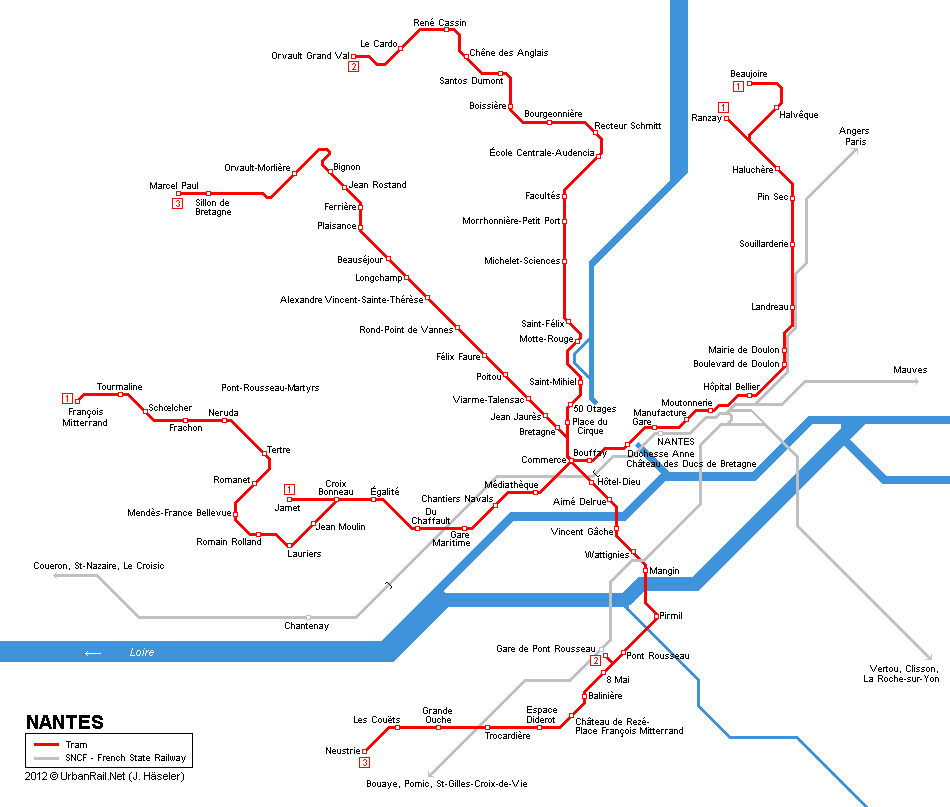
NANTES TRAIN MAP
NANTES CITY CENTER MAP
NANTES DOWNLOAD MAP
NANTES MAP
NANTES METRO MAP
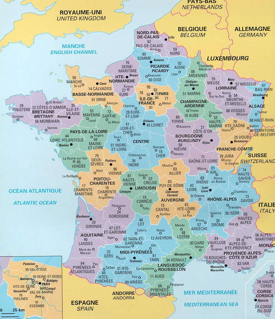
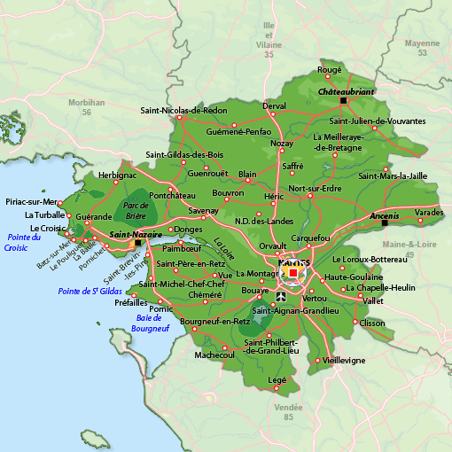
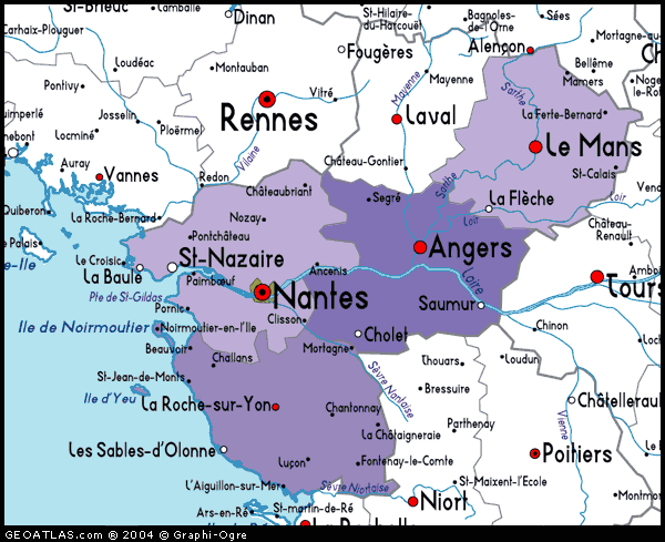
NANTES PROVINCE MAP
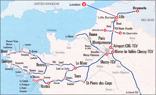
NANTES TGV MAP
PAYS DE LA LOIRRE NANTES MAP
Top 10 Tourist Attractions in Paris
Please subscribe on "World Guide" channnel on Youtube at youtube.com/c/WorldGuide
Nice's 10 Must-Visit Spots for Tourists
- Head of Performance Marketing
- Head of SEO
- Linkedin Profile: linkedin.com/in/arifcagrici
See Also
Nantes Google Map, Street Views, Maps Directions, Satellite Images
WorldMap1.com offers a collection of Nantes map, google map, Nantes atlas, political, physical, satellite view, country infos, cities map and more map of Nantes.