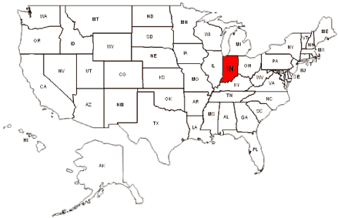
Indiana Map FQA
How many cities are in Indiana ?
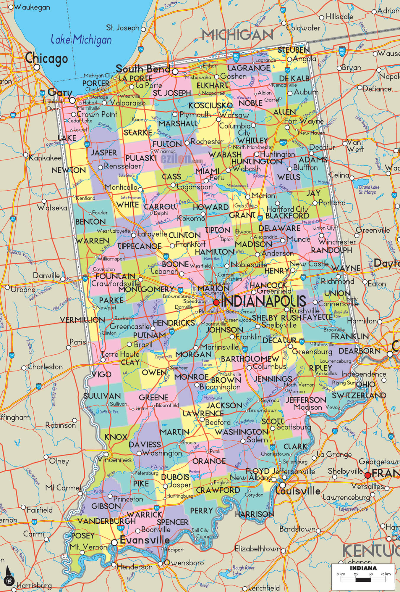
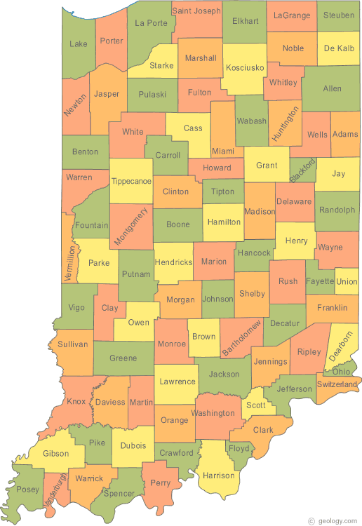
Indiana has 92 counties. The largest by population are: Marion County; Lake County; Allen County; Hamilton County; St. Joseph County; Elkhart County; Tippecanoe County; Vanderburgh County; Hendricks County; Johnson County.
What are the major geographical features of Indiana ?
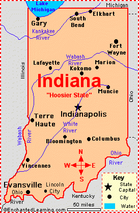
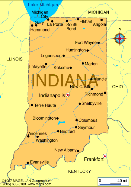
Indiana consists mostly of fertile plains and rolling hills, with the Wabash and White Rivers flowing through the state. It also has Lake Michigan shoreline in the northwest and low plateaus in the south.
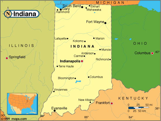
MAP OF INDIANA
INDIANA MAP
From the bustling city of Indianapolis to the rolling hills of southern Indiana, our map provides a comprehensive view of the state's diverse regions. So whether you're a resident of Indiana or a visitor, use our map to navigate with ease and discover all that this great state has to offer.
A Collection of Indiana Maps and Indiana Satellite Images
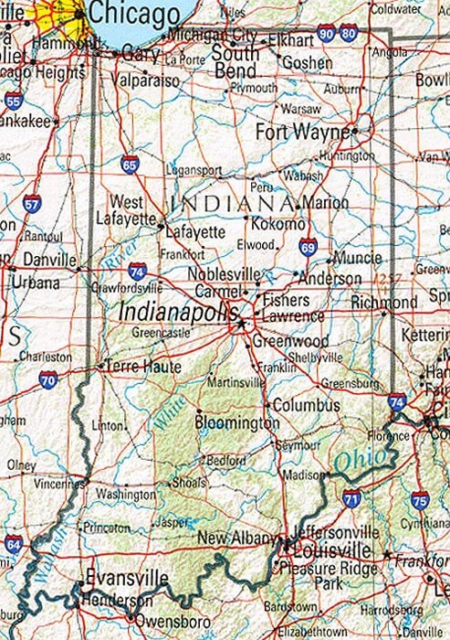
MAP OF INDIANA
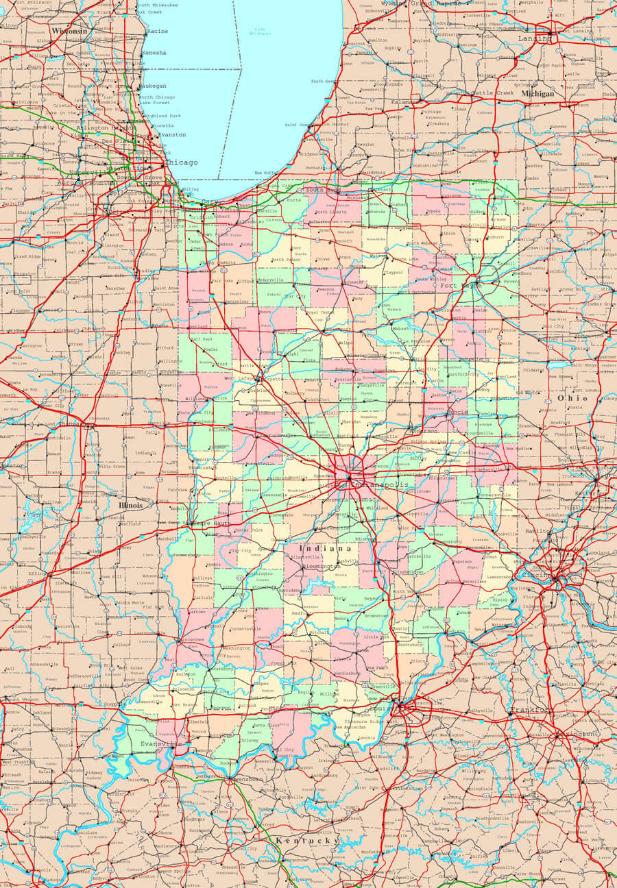
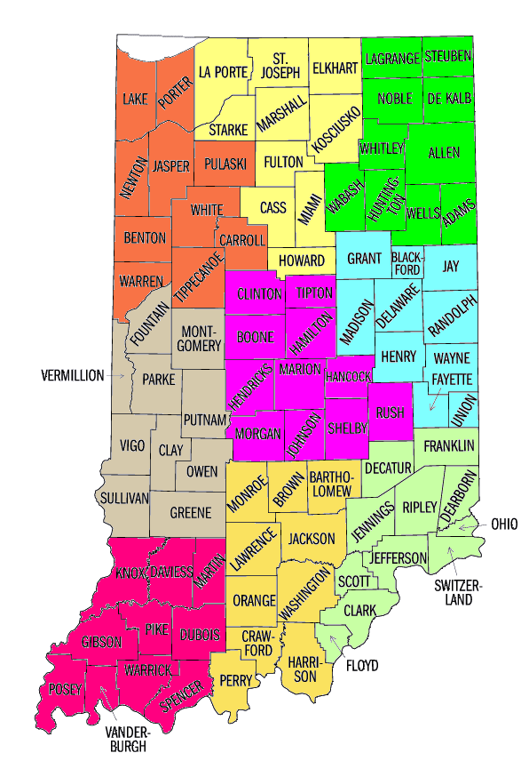
INDIANA COUNTY MAP
INDIANA MAP USA
INDIANA MAP
INDIANA MAP
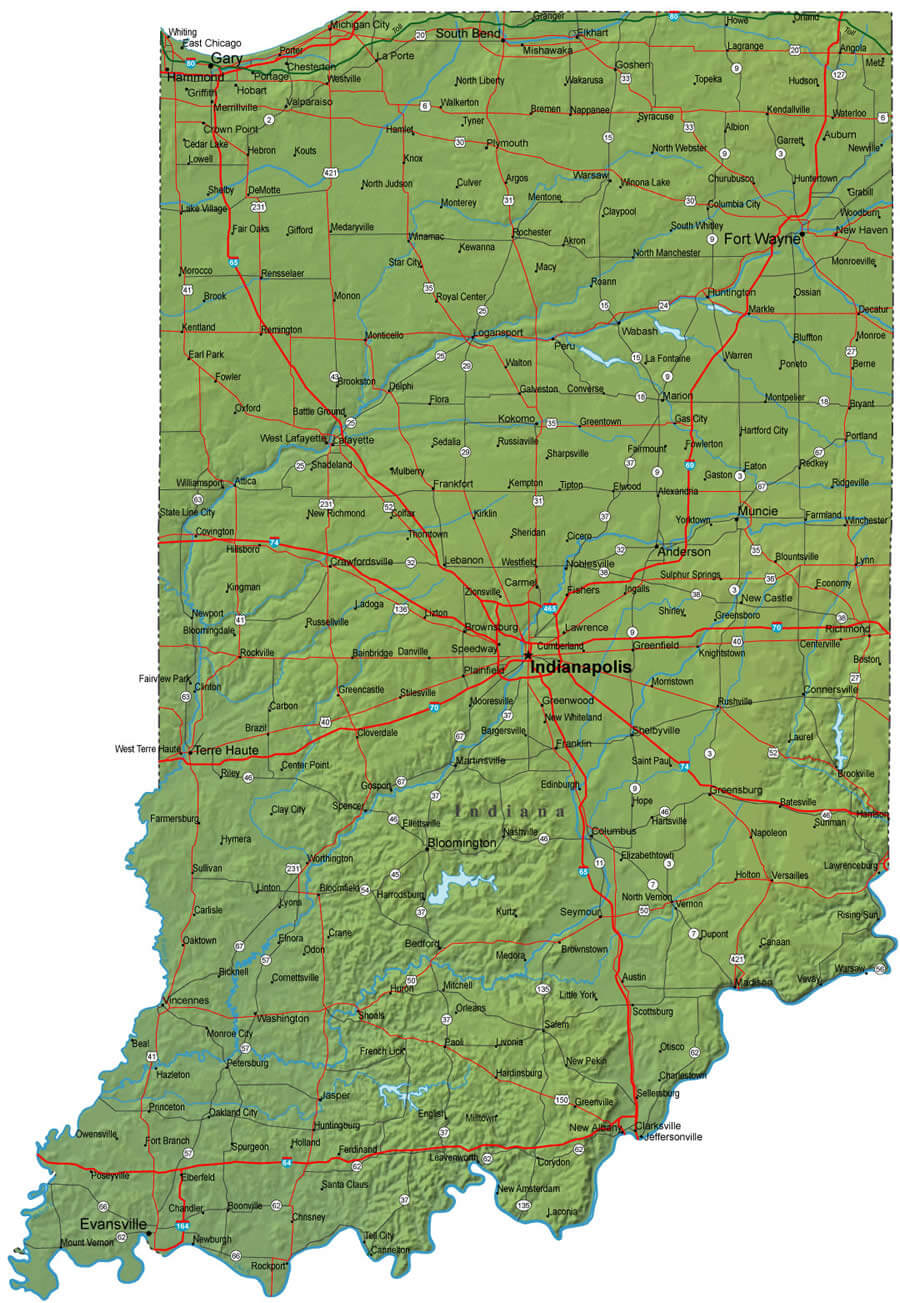
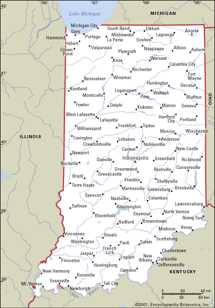
INDIANA PHYSICAL MAP
INDIANA POLITICAL MAP
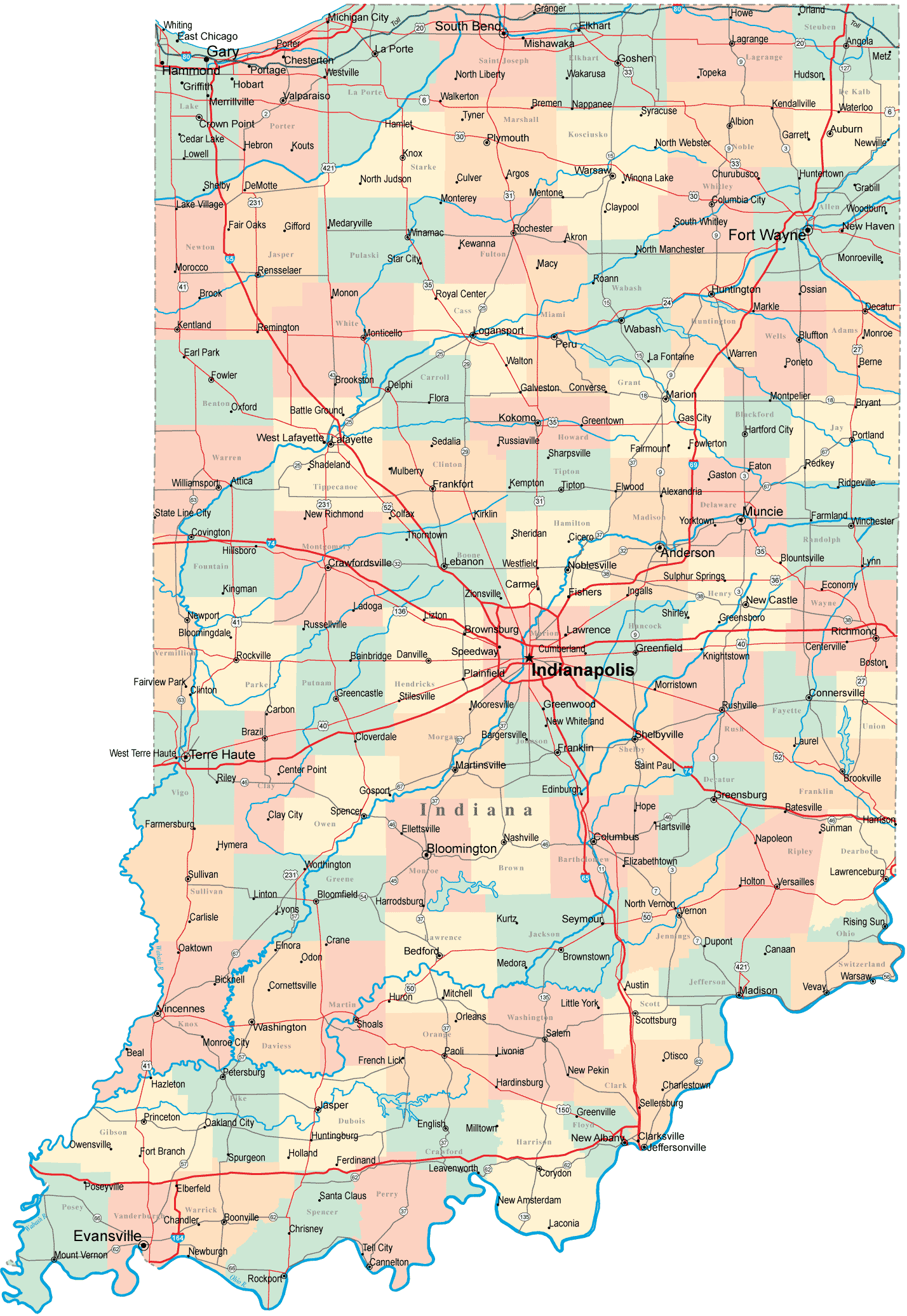
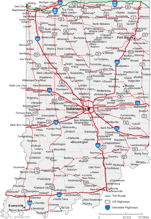
INDIANA ROAD MAP

INDIANA COUNTIES MAP
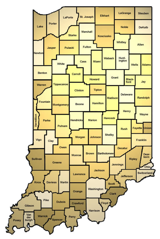
INDIANA COUNTY MAP
INDIANA MAP
INDIANA ROAD MAP
MAP OF INDIANA
ROAD MAP OF INDIANA
A collection of Indiana Maps
Brief information about Indiana, US
Indiana is a state located in the Midwestern region of the United States. It is the 38th largest state in terms of land area and the 17th most populous state, with a population of approximately 6.7 million people. The state's capital and largest city is Indianapolis, which is known for hosting the Indy 500, one of the world's most famous auto races.
Indiana is known for its diverse economy, which includes manufacturing, agriculture, and healthcare industries. The state is home to a number of top-ranked universities, including Purdue University and Indiana University, as well as several Fortune 500 companies such as Eli Lilly and Company and Cummins Inc.
Indiana is also rich in natural beauty and outdoor recreational opportunities, with attractions such as the Indiana Dunes National Park, the Hoosier National Forest, and the Indianapolis Zoo. Additionally, the state has a rich cultural heritage and is home to several museums, theaters, and historic landmarks, including the iconic Indianapolis Motor Speedway and the historic French Lick Resort.
Here is some statistical information about the area, population, demographics, history, and economy of Indiana:
Area: Indiana has a total area of 36,418 square miles (94,321 square kilometers), making it the 38th largest state in the United States.
Population: As of 2020, the estimated population of Indiana was 6.73 million people, according to the U.S. Census Bureau.
Demographics: Indiana is a predominantly white state, with non-Hispanic whites making up around 81% of the population. African Americans, Hispanics, and Asians make up smaller portions of the population. The state has a median age of 38.1 years, and a male-to-female ratio of approximately 49.5% to 50.5%.
History: Indiana was admitted to the Union as the 19th state on December 11, 1816. The state played an important role in the Underground Railroad, a network of secret routes and safe houses used by slaves to escape to freedom. During the Civil War, Indiana contributed over 200,000 soldiers to the Union Army. In the 20th century, Indiana became a major center for manufacturing and industry.
Economy: Indiana has a diverse economy, with major industries including manufacturing, agriculture, healthcare, and education. The state is known for its automotive manufacturing, and is home to the global headquarters of several automakers. Other top industries in Indiana include pharmaceuticals, medical devices, and logistics. The state has a GDP of around $377 billion and a per capita income of $48,974 (as of 2021).