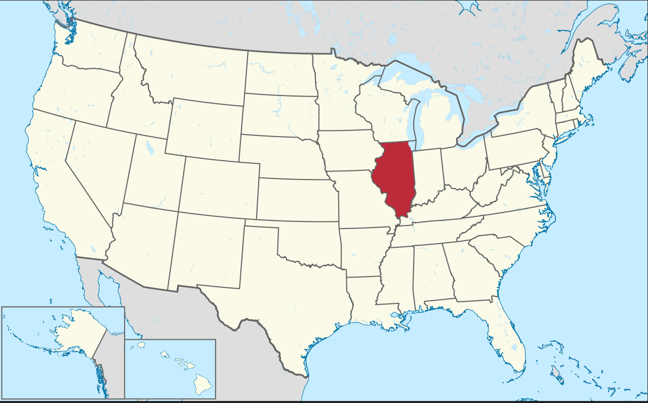
Illinois Map in United States
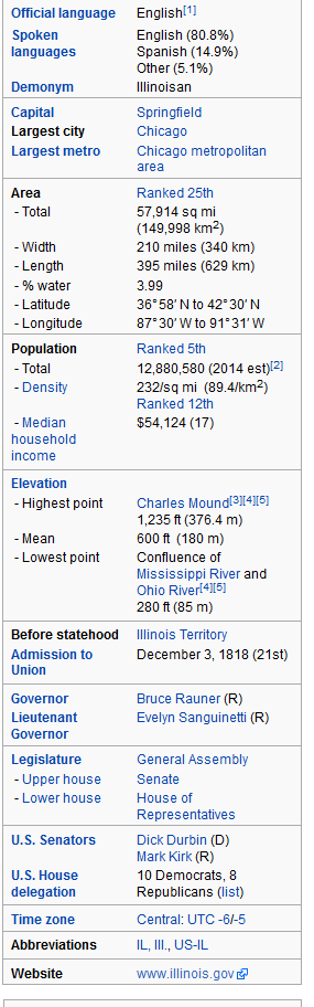
Illinois is a state in the Midwestern United States. Illinois is the 5th most populous state and 25th largest state in terms of land area, and is often noted as a microcosm of the entire USA. With Chicago in the northeast, small industrial cities and great agricultural productivity in central and northern Illinois, and natural resources like coal, timber, and petroleum in the south, Illinois has a diverse economic base and is a major transportation hub.
Click for Content Detail »
Largest Cities Map of Illinois and Population
- Chicago Map - 2.695.598 - (41.878114, -87.629798)
- Aurora Map - 197.899 - (41.761,-88.32)
- Rockford Map - 152.871 - (42.271,-89.094)
- Joliet Map - 147.433 - (41.525,-88.082)
- Naperville Map - 141.853 - (41.786,-88.147)
- Springfield Map - 116.250 - (39.802,-89.644)
- Peoria Map - 115.007 - (40.694,-89.589)
- Elgin Map - 108.188 - (42.037,-88.281)
- Waukegan Map - 89.078 - (42.364,-87.845)
- Cicero Map - 83.891 - (41.84558770000,-87.75394480000)
- Champaign Map - 81.055 - (40.116420, -88.243383)
- Bloomington Map - 76.610 - (40.484203, -88.993687)
- Decatur Map - 76.122 - (39.840315, -88.954800)
- Arlington Heights Map - 75.101 - (42.088360, -87.980626)
- Evanston Map - 74.486 - (42.041141, -87.690059)
- Schaumburg Map - 74.227 - (42.033361, -88.083406)
- Bolingbrook Map - 73.366 - (41.698642, -88.068395)
- Palatine Map - 68.557 - (42.110304, -88.034240)
- Skokie Map - 64.784 - (42.033364, -87.733393)
- Des Plaines Map - 58.364 - (42.033362, -87.883399)
Click for Google Map »
Where Illinois Map in United States on World Map
Click for Direction »
Illinois Map in United States Road Map and Direction