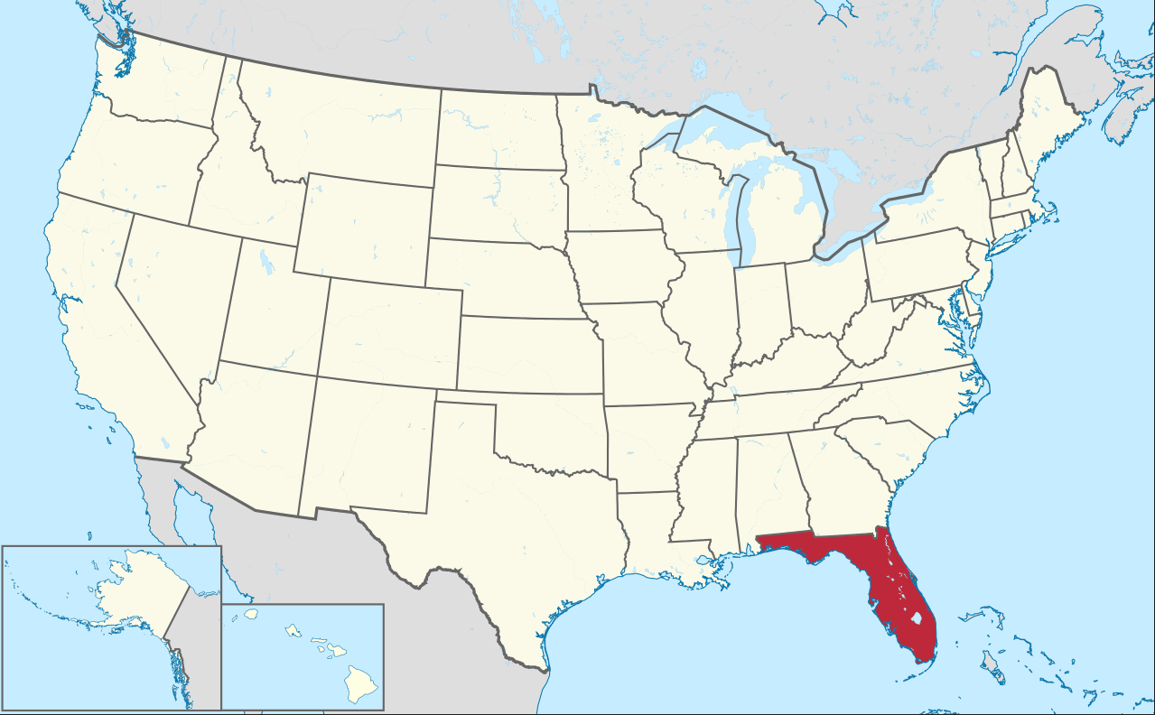
Florida Map USA
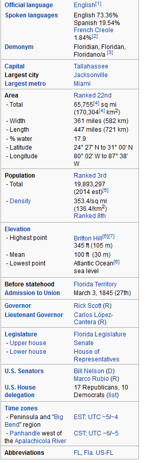
Florida is a state in the southeastern region of the United States, bordered to the west by the Gulf of Mexico, to the north by Alabama and Georgia, to the east by the Atlantic Ocean, and to the south by the Straits of Florida. Florida is the 22nd most extensive, the 3rd most populous, and the 8th most densely populated of the 50 United States. The state capital is Tallahassee, the largest city is Jacksonville, and the largest metropolitan area is the Miami metropolitan area.
Click for Content Detail »
Largest Cities Map of Florida and Population
- Jacksonville Map - 821.784 - (30.332,-81.656)
- Miami Map - 399.457 - (25.774,-80.194)
- Tampa Map - 335.709 - (27.948,-82.458)
- St. Petersburg Map - 244.769 - (27.771,-82.679)
- Orlando Map - 238.300 - (28.538,-81.379)
- Hialeah Map - 224.669 - (25.858,-80.278)
- Tallahassee Map - 181.376 - (30.438,-84.281)
- Fort Lauderdale Map - 165.521 - (26.122,-80.143)
- Port St. Lucie Map - 164.603 - (27.294,-80.35)
- Pembroke Pines Map - 154.750 - (26.003,-80.224)
- Cape Coral Map - 154.305 - (26.562854, -81.949533)
- Hollywood Map - 140.768 - (26.011201, -80.149490)
- Gainesville Map - 124.354 - (29.651634, -82.324826)
- Miramar Map - 122.041 - (25.975670, -80.286750)
- Coral Springs Map - 121.096 - (26.271192, -80.270604)
- Clearwater Map - 107.685 - (27.965853, -82.800103)
- Miami Gardens Map - 107.167 - (25.942038, -80.245604)
- Brandon Map - 103.483 - (27.937801, -82.285925)
- Palm Bay Map - 103.190 - (28.034462, -80.588665)
- West Palm Beach Map - 99.919 - (26.715342, -80.053375)
Click for Google Map »
Where Florida Map USA on World Map
Click for Direction »
Florida Map USA Road Map and Direction