State Map of Ohio, USA
Ohio has the nation's 10th largest highway network, and is within a one-day drive of 50% of North America's population and 70% of North America's manufacturing capacity. To the north, Lake Erie gives Ohio 312 miles (502 km) of coastline, which allows for numerous cargo ports.
Click for Content Detail »
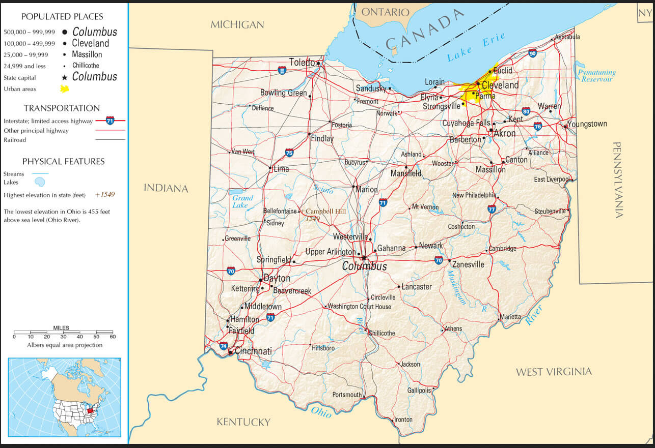
Largest Cities Map of Ohio and Population
- Columbus Map - 787.033 - (39.961,-82.999)
- Cleveland Map - 396.815 - (41.499,-81.695)
- Cincinnati Map - 296.943 - (39.162,-84.457)
- Toledo Map - 287.208 - (41.664,-83.555)
- Akron Map - 199.110 - (41.081,-81.519)
- Dayton Map - 141.527 - (39.759,-84.192)
- Parma Map - 81.601 - (41.405,-81.723)
- Canton Map - 73.007 - (40.799,-81.378)
- Youngstown Map - 66.982 - (41.1,-80.65)
- Lorain Map - 64.097 - (41.453,-82.182)
- Hamilton Map - 62.477 - (39.399501, -84.561335)
- Springfield Map - 60.608 - (39.924227, -83.808817)
- Kettering Map - 56.163 - (39.689504, -84.168827)
- Elyria Map - 54.533 - (41.368380, -82.107649)
- Lakewood Map - 52.131 - (41.481993, -81.798191)
- Cuyahoga Falls Map - 49.652 - (41.133945, -81.484559)
- Euclid Map - 48.920 - (41.593105, -81.526787)
- Middletown Map - 48.694 - (39.515058, -84.398276)
- Mansfield Map - 47.821 - (40.758390, -82.515447)
- Newark Map - 47.573 - (40.058121, -82.401264)
Click for Google Map »
Where State Map of Ohio, USA on World Map
Click for Direction »
State Map of Ohio, USA Road Map and Direction