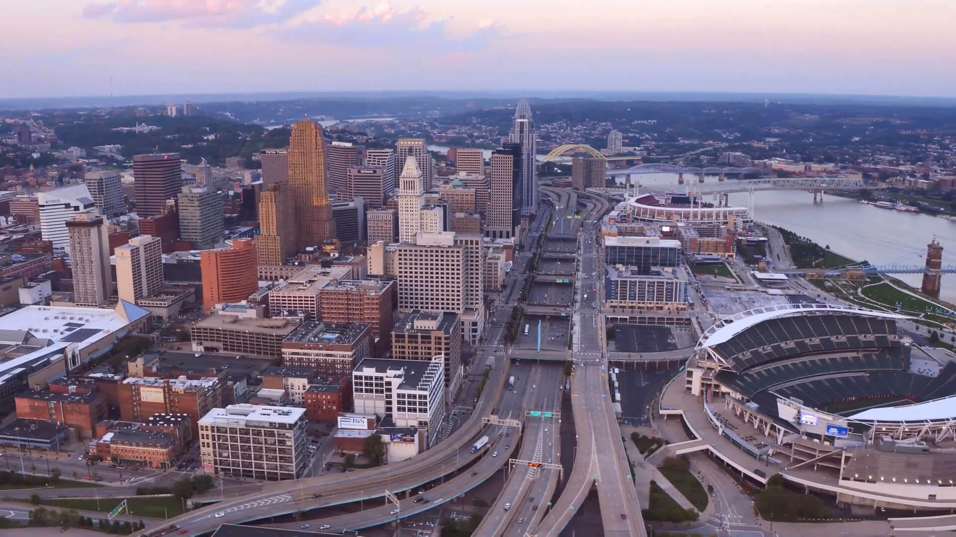
Cincinnati, Ohio
Settled in 1788, Cincinnati is a main city in Ohio and is located at the northern side of the confluence of the Licking and Ohio rivers.

Click for Content Detail »
Columbus, Cincinnati, and Cleveland, Ohio - US 4K Drone Footage
Please subscribe on "World Guide" channnel on Youtube at youtube.com/c/WorldGuide
Cincinnati's estimated population of 2,190,209, it is Ohio's largest metropolitan area and the US 29th-largest city, and with a city population estimated at 303,940, Cincinnati is the third-largest city in Ohio and 64th in the United States.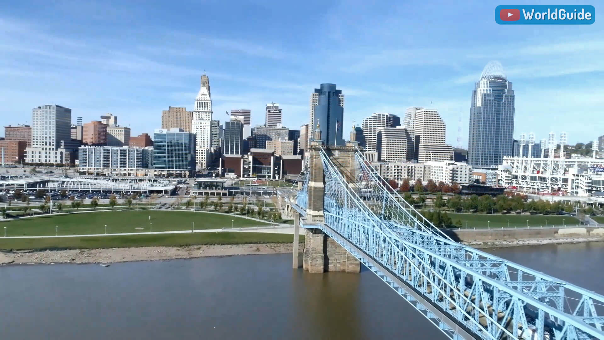
US State of Ohio and Largest Cities 4K Drone Footage
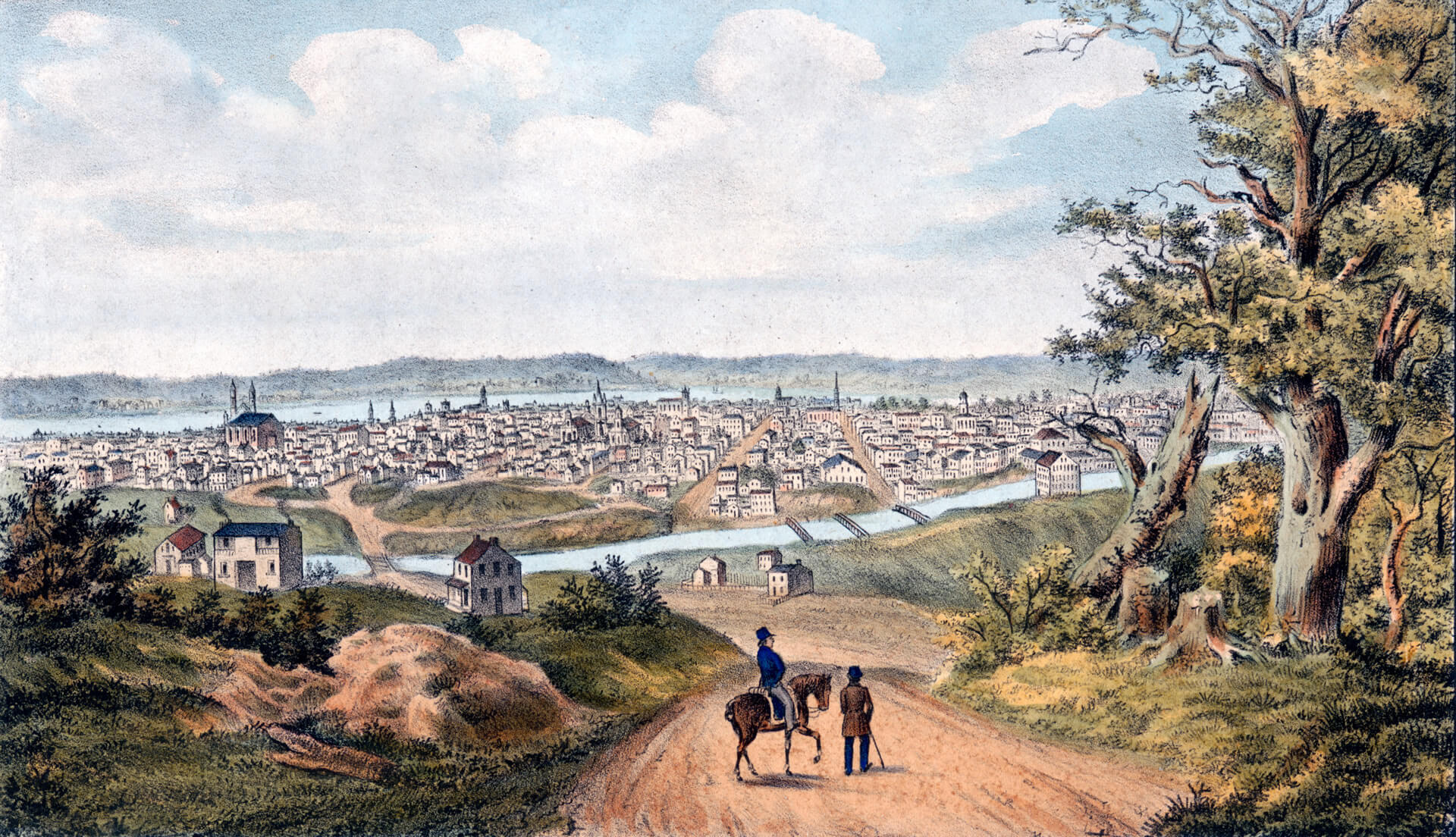
Cincinnati in 1841 with the Miami and Erie Canal in the Foreground
Geography
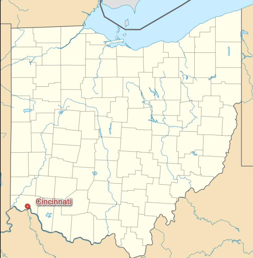
Cincinnati is home to numerous embankments that are noteworthy due to their architectural characteristics or historic associations, as well as the Carew Tower, the Scripps Center, the Ingalls Building, Cincinnati Union Terminal, and the Isaac M. Wise Temple.[98] Notable historic public parks and landscapes include the 19th-century Spring Grove Cemetery and Arboretum, Eden Park, and Mount Storm Park, all designed by Prussian émigré landscape architect Adolph Strauch.Where is located Ohio in the US
Area
- Total : 79.56 sq mi (206.07 km2)
- Land : 77.84 sq mi (201.59 km2)
- Water : 1.73 sq mi (4.47 km2)
- Area Rank :
- Climate :
Elevation :
- Highest Elevation : 959 ft (293 m)
- Lowest Elevation :
Time Zone
- UTC : UTC-5 (EST)
- ZIP Codes : 513
- Calling Code : +
- Latitude :
- Longitude :
- Driving Side:
Government
- Country : United States
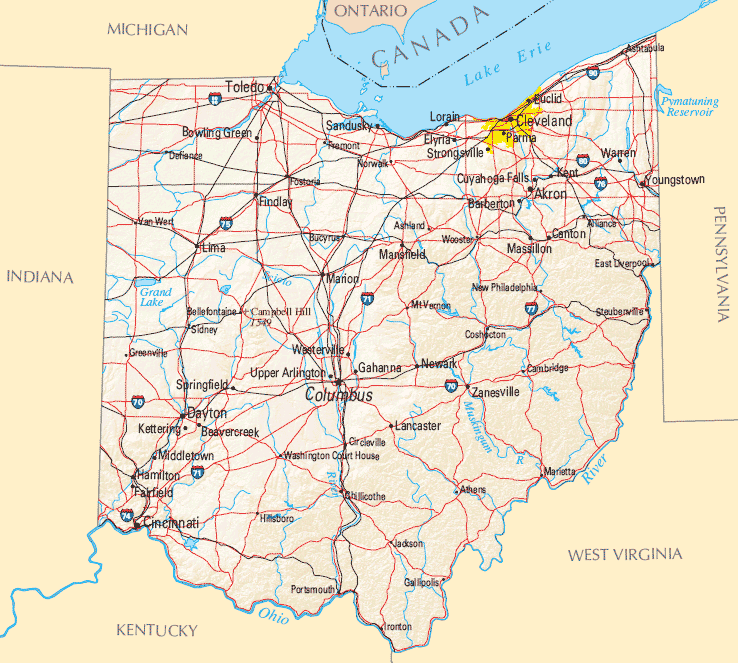
- State : Ohio
- County : Hamilton
- Capital :
- Largest Metro :
- Anthem :
- Motto(s) : Juncta Juvant
- Major : John Cranley
- Lieutenant Governor :
- Website : cincinnati-oh.gov
Climate
Cincinnati is at the southern limit (considering the 0 °C or 32 °F isotherm) of the humid continental climate zone, bordering the humid subtropical climate zone. Summers are hot and humid, with significant rainfall in each month and highs reaching 90 °F (32 °C) or above on 21 days per year, often with high dew points and humidity. July is the warmest month, with a daily average temperature of 75.9 °F (24.4 °C).Demographics
Population

- Population : 296,945
- Metro Population : 2,137,406 (US: 28th)
- Population Rank in the US :
- Density : 3,904.88/sq mi (1,507.68/km2)
- Density Rank :
- Official Languages :
- Spoken Languages :
- Rank : US: 65th
Economy
 Metropolitan Cincinnati has the twenty-eighth largest economy in the United States and the fifth largest in the Midwest, after Chicago, Minneapolis-St. Paul, Detroit, and St. Louis. In 2016, it had the fastest-growing Midwestern economic capital. The gross domestic product for the region was $127 billion in 2015. The median home price is $158,200, and the cost of living in Cincinnati is 8% below national average. The unemployment rate is also below the average at 4.2%.
- Currency :
- GDP : $119 billion USD
- Unemployment Rate:
- Median Household Income :
- Income Rank :
Top 10 Largest Cities in Ohio by population

- Columbus Map - 787,033 - (39.961,-82.999)
- Cleveland Map - 396,815 - (41.499,-81.695)
- Cincinnati Map - 296,943 - (39.162,-84.457)
- Toledo Map - 287,208 - (41.664,-83.555)
- Akron Map - 199,110 - (41.081,-81.519)
- Dayton Map - 141,527 - (39.759,-84.192)
- Parma Map - 81,601 - (41.405,-81.723)
- Canton Map - 73,007 - (40.799,-81.378)
- Youngstown Map - 66,982 - (41.1,-80.65)
- Lorain Map - 64,097 - (41.453,-82.182)
Xavier University, a private Jesuit university in Cincinnati and Norwood, Ohio

Colleges and Universities
- The University of Cincinnati
- Xavier University
- The Art Academy of Cincinnati
- The Cincinnati Public Schools
- Cincinnati Christian University
- Cincinnati Art Museum
Cincinnati Images & Maps
Cincinnati Ohio

Cincinnati US

Cincinnati USA
Roebling Suspension Bridge Cincinnati

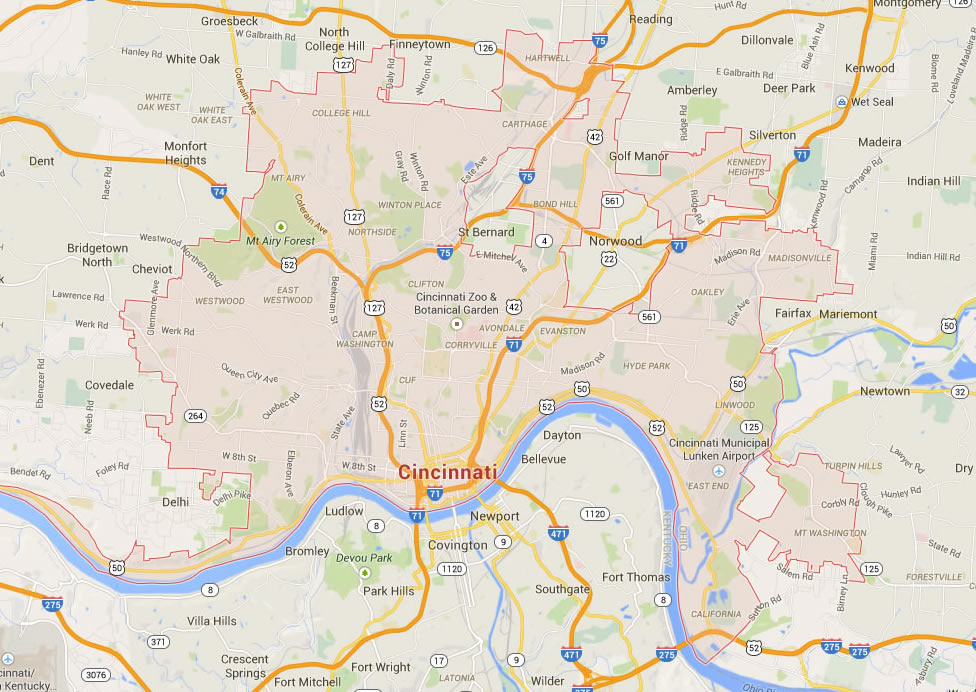
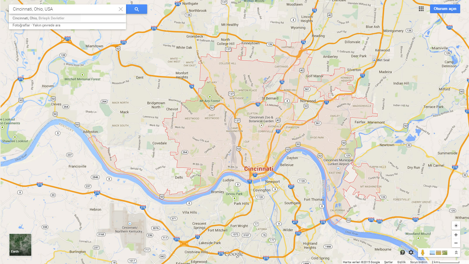
Cincinnati Map
Cincinnati Map Ohio US
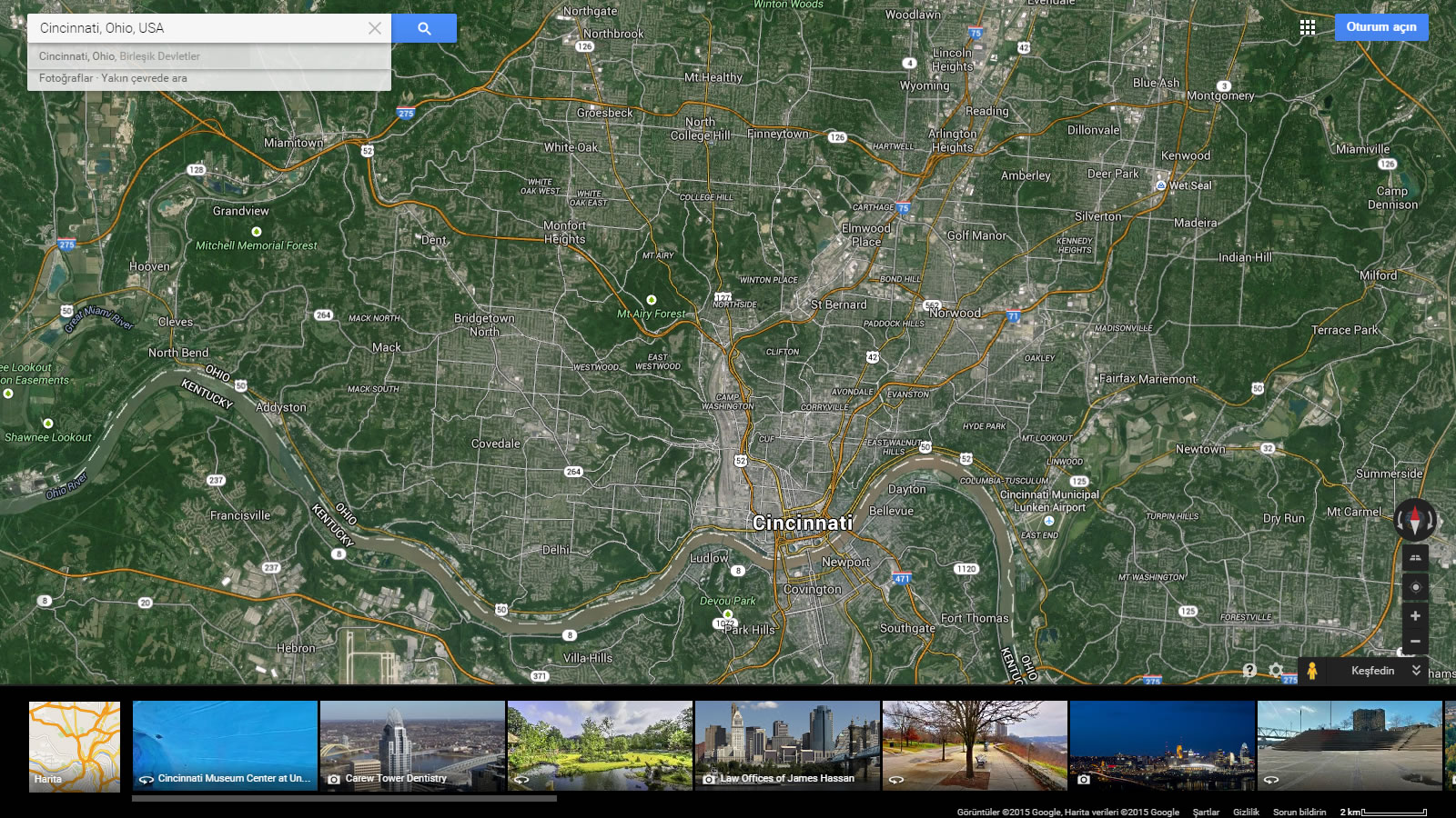
Cincinnati Map Ohio US Satellite
Cincinnati Ohio Map USA