Map of Estonia, Estonia
Navigate Estonia map, Estonia country map, satellite images of Estonia, Estonia largest cities, towns maps, political map of Estonia, driving directions, physical, atlas and traffic maps in Estonia.
MAP OF ESTONIA

Estonia City Maps
Tallinn Tartu Narva Kohtla Jarve ParnuA Collection of Estonia Maps and Estonia Satellite Images
MAP OF ESTONIA

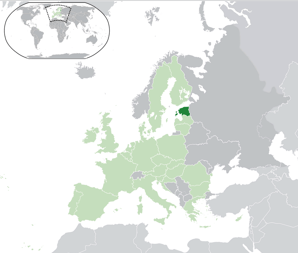
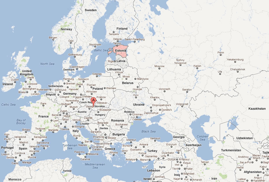
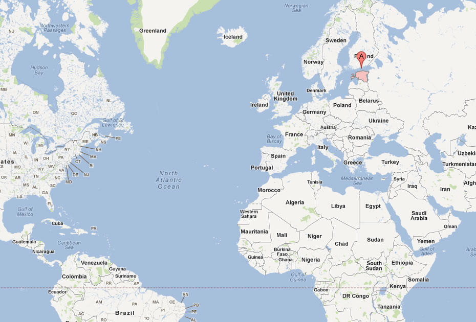
ESTONIA LOCATION MAP
WHERE IS ESTONIA IN THE WORLD
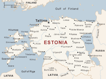
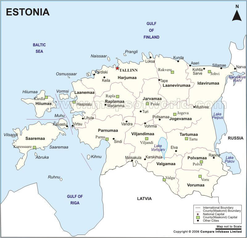
CITIES MAP OF ESTONIA
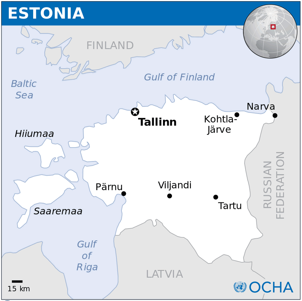
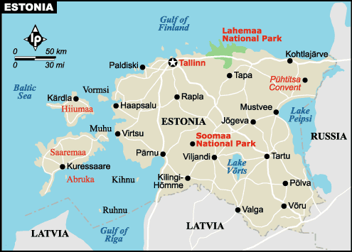
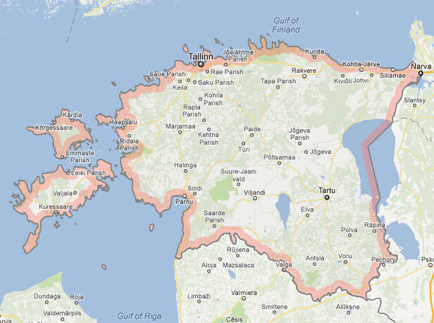
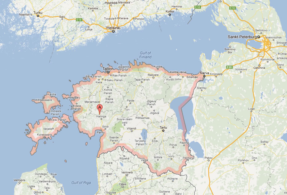
ESTONIA MAP
ESTONIA CITIES MAP
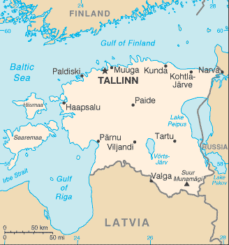
ESTONIA MAP
ESTONIA MAP
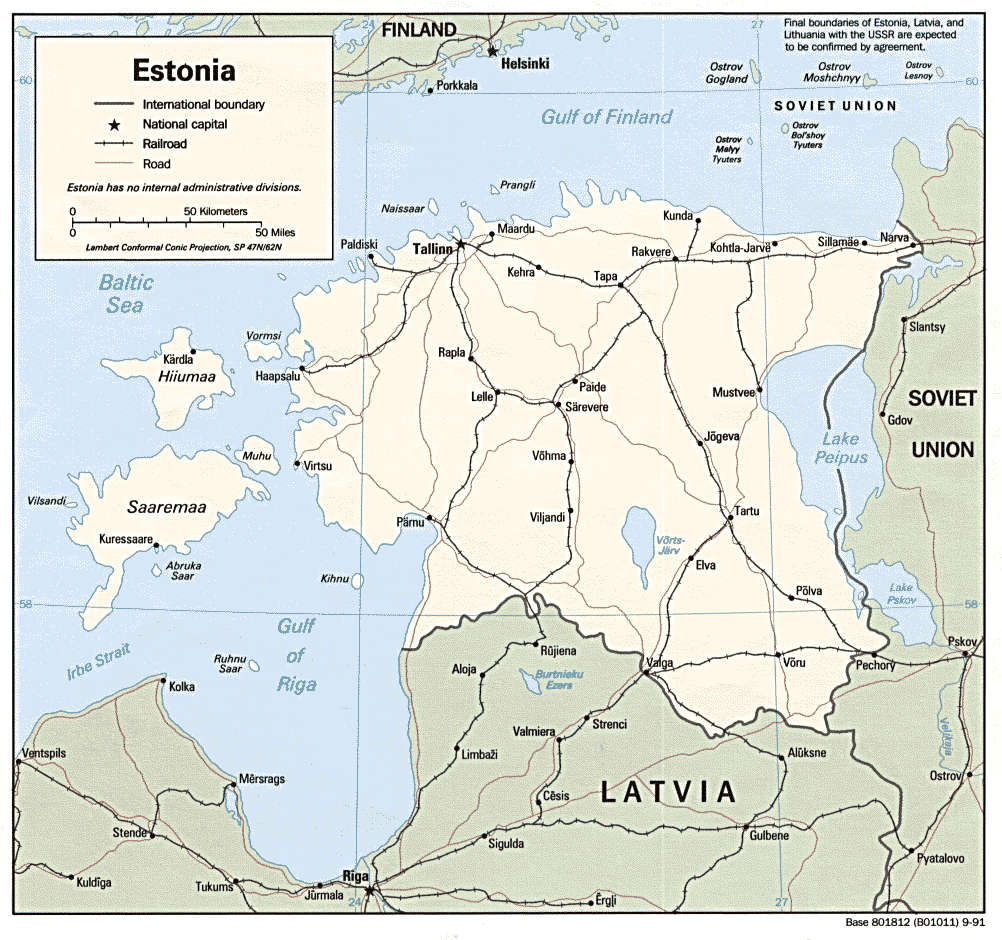
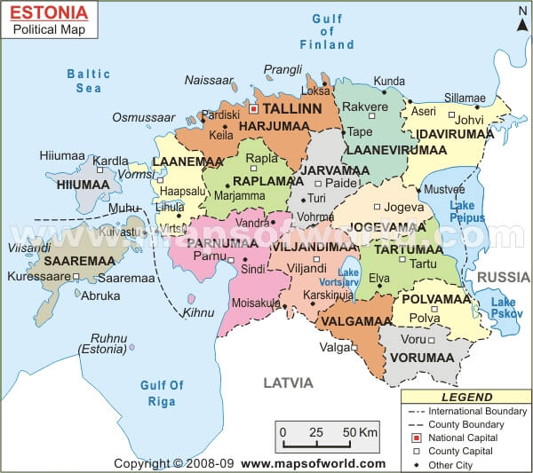
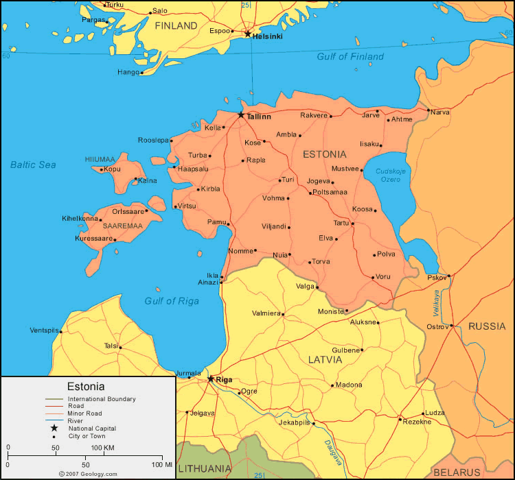
ESTONIA POLITICAL MAP
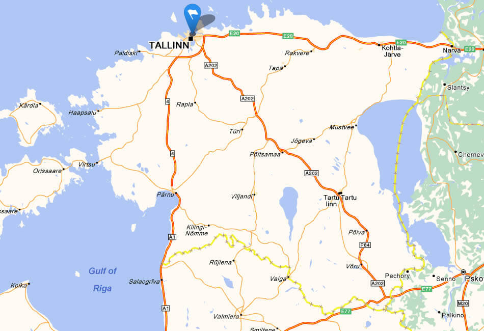
ESTONIA GOOGLE MAP
ESTONIA MAP BALTIC
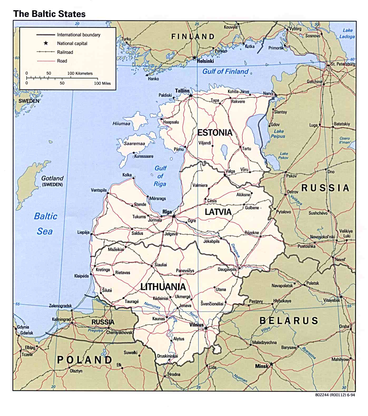
MAP OF ESTONIA EUROPE
MAP OF ESTONIA WORLD
MAP OF ESTONIA
MAP ESTONIA
POLITICAL MAP OF ESTONIA
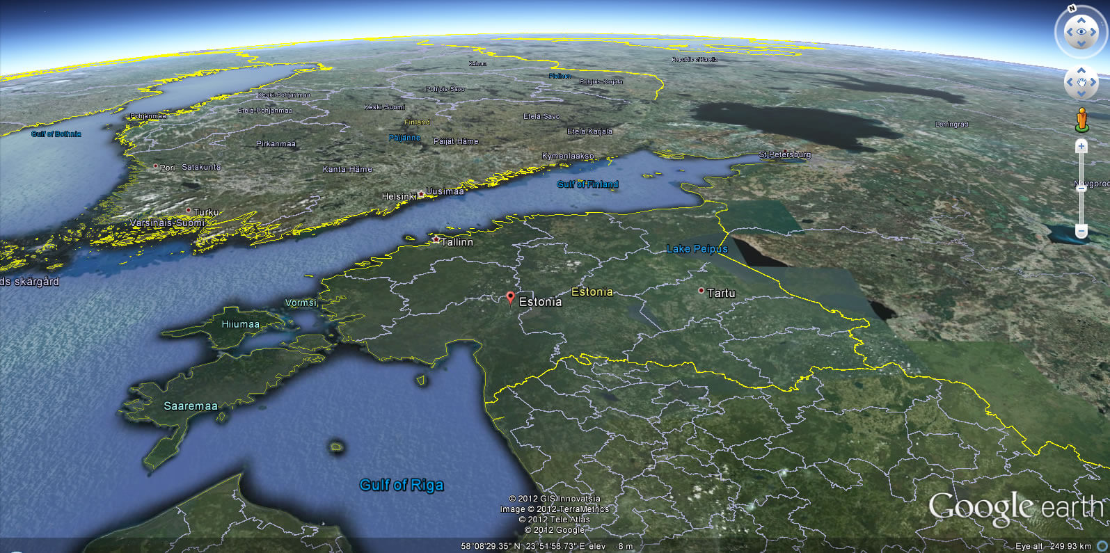
ESTONIA EARTH MAP
Where is Estonia in Europe, Is Estonia in NATO and EU
Please subscribe on "World Guide" channnel on Youtube at youtube.com/c/WorldGuide
Where is Estonia in Europe, Is Estonia in NATO and EU
Please subscribe on "World Guide" channnel on Youtube at youtube.com/c/WorldGuide
See Also
Estonia Google Map, Street Views, Maps Directions, Satellite Images
WorldMap1.com offers a collection of Estonia map, google map, Estonia atlas, political, physical, satellite view, country infos, cities map and more map of Estonia.