Take a closer look at Belgium and discover where it's located on the map!
Discover Belgium's geographical location with our detailed Belgium map. Explore major cities, tourist attractions, and topography of this Western European country.
Belgium is a country known for its canals, castles, and beer. Discover the country's landscape, rich history and its people. Brussels is the largest city in Belgium. The official languages of Belgium are Flemish and French.
Belgium Map FQA
How many cities are in Belgium ?
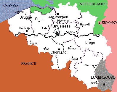
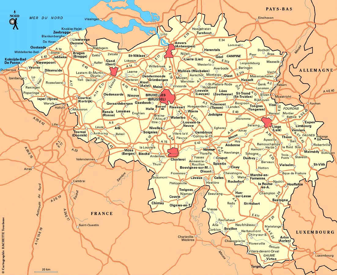
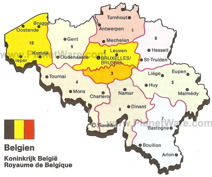
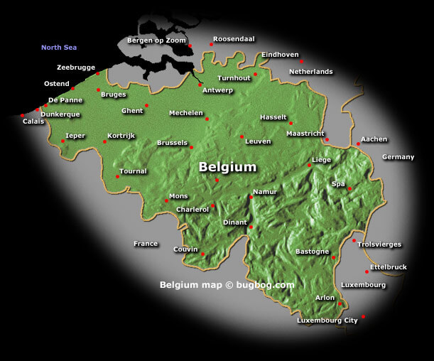
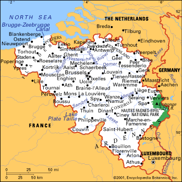
Belgium has over 100 cities. The 10 largest are: Brussels, Antwerp, Ghent, Charleroi, Liège, Bruges, Namur, Leuven, Mons, and Aalst.What are the major geographical features of Belgium ?
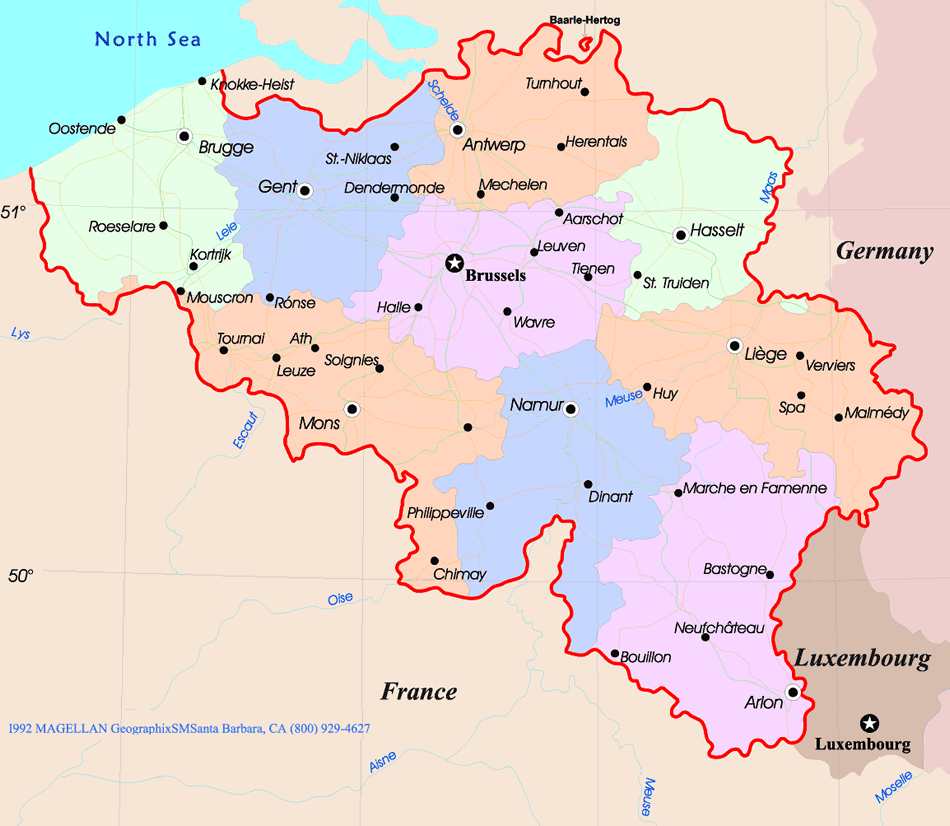
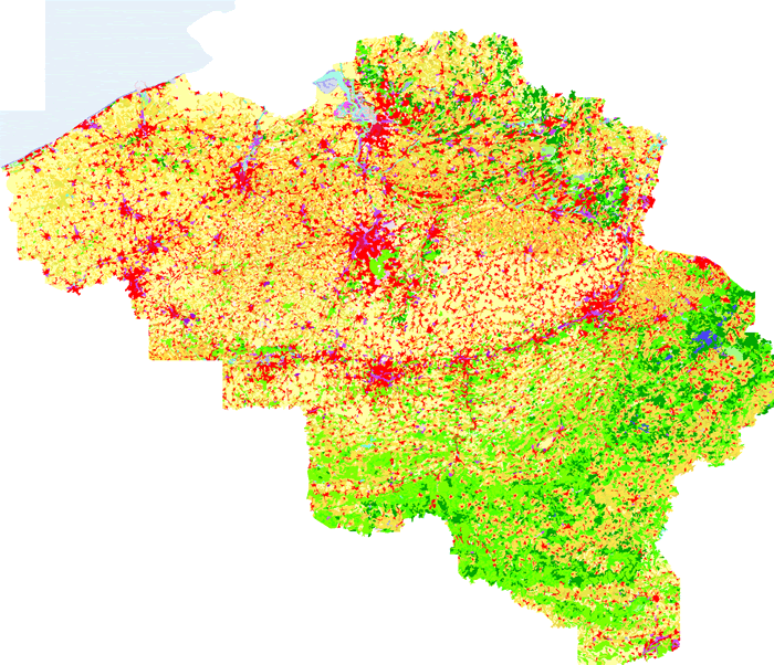
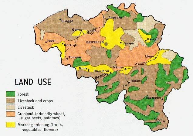
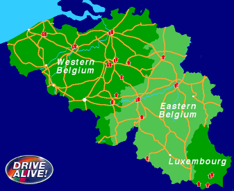
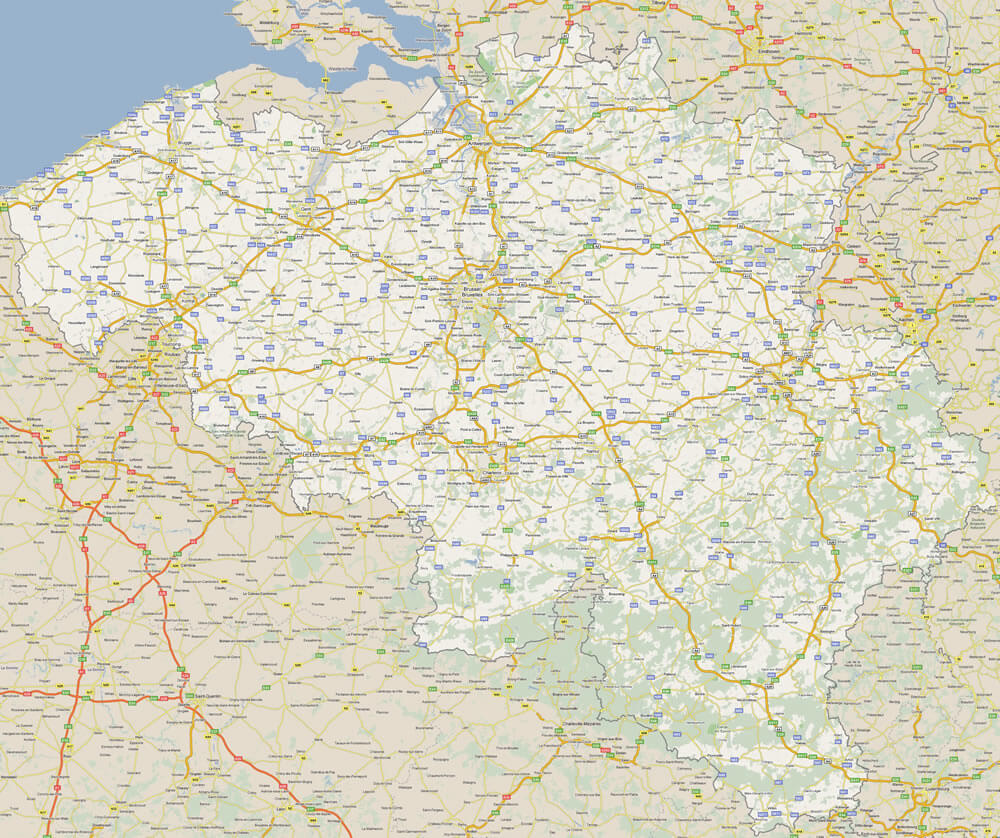
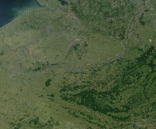
Belgium has diverse geography, with coastal plains in the northwest, rolling hills and fertile valleys in the central region, and the Ardennes forested highlands in the southeast. The Meuse and Scheldt are the major rivers.MAP OF BELGIUM

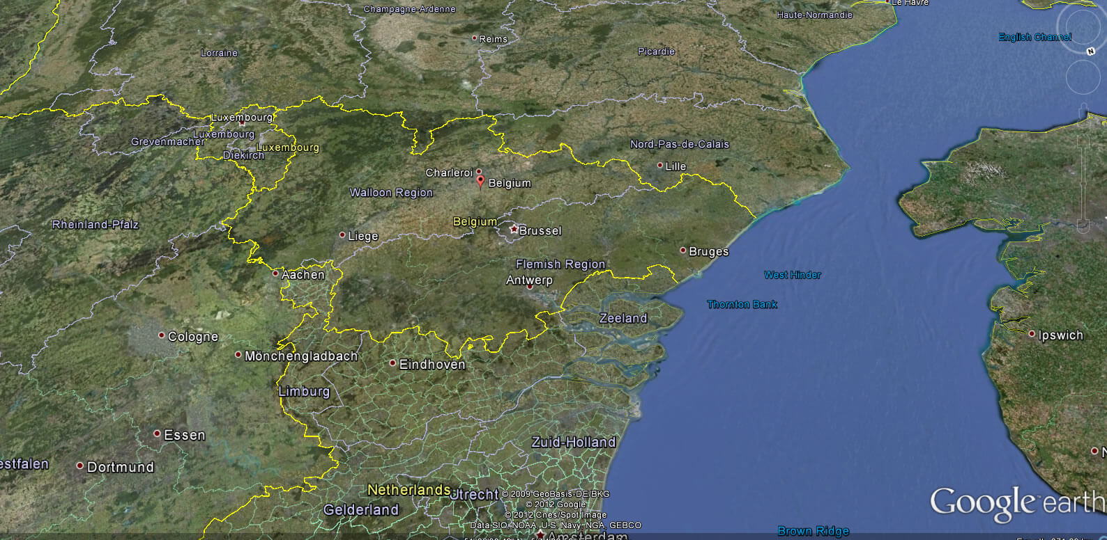
BELGIUM LOCATION MAP
WHERE IS BELGIUM IN THE WORLD
Can I download a high-resolution map of Belgium ?
Yes. Download high-resolution political and physical maps of Belgium for personal or educational use. Redistribution is subject to the terms of our license.
- Capital : Brussels
- Population : 11,041,266
- GDP : $513.396 billion (21st)
- Per Capita : $46,878 (16th)
- Calling Code : +32
- Jobless Rate : 7.40%
- Time Zone : +1
Where is located Belgium on the Map
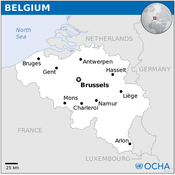
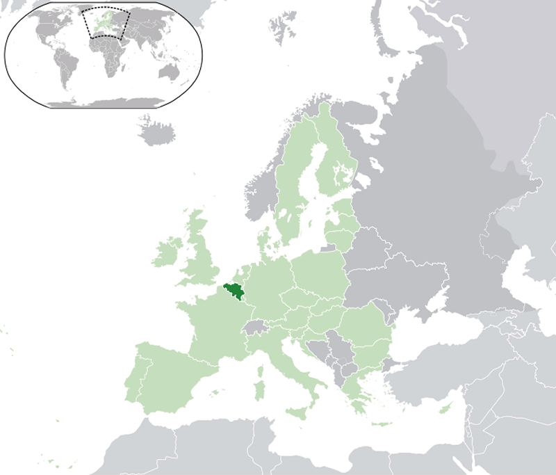
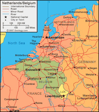
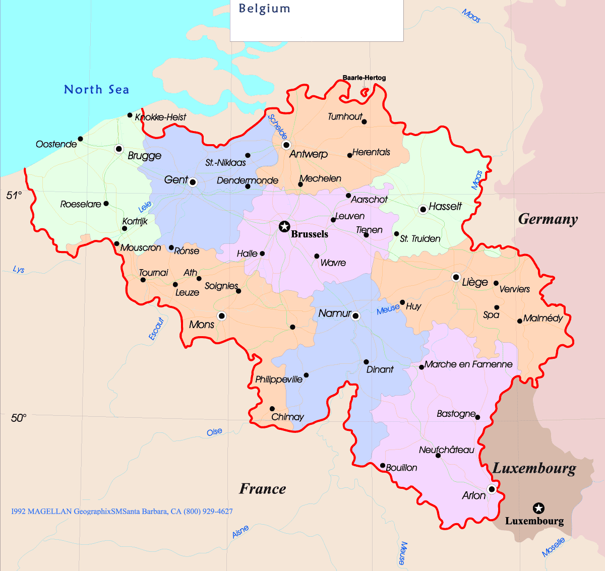
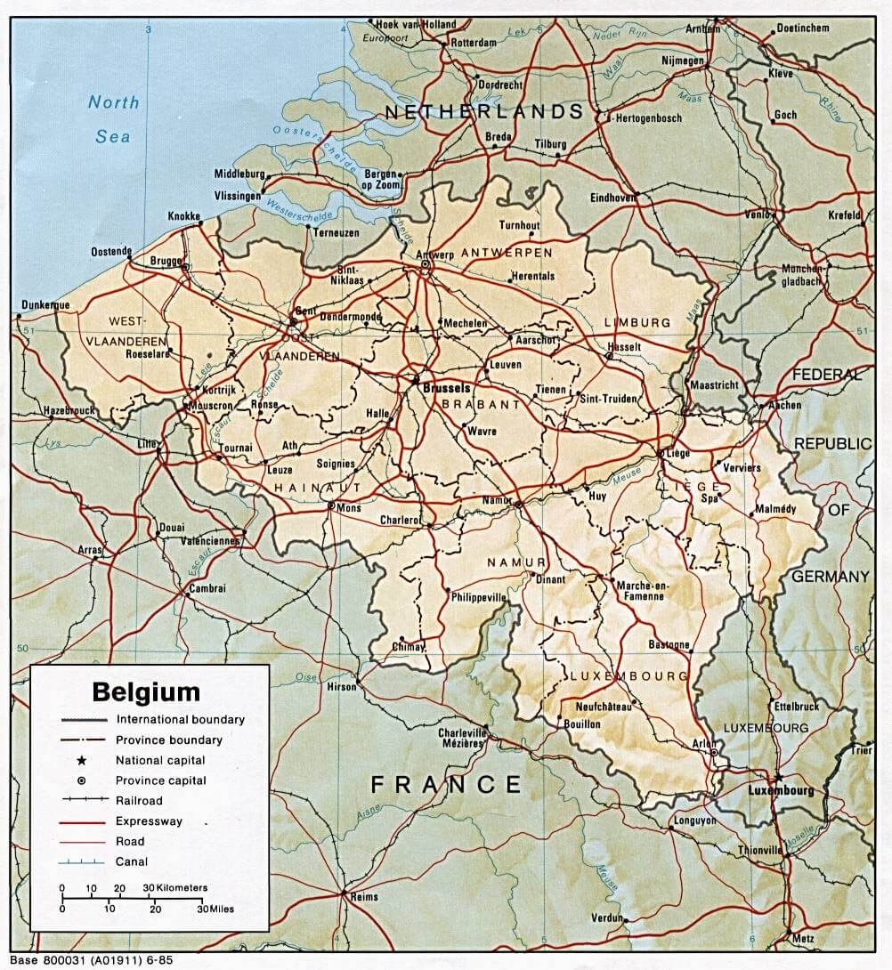
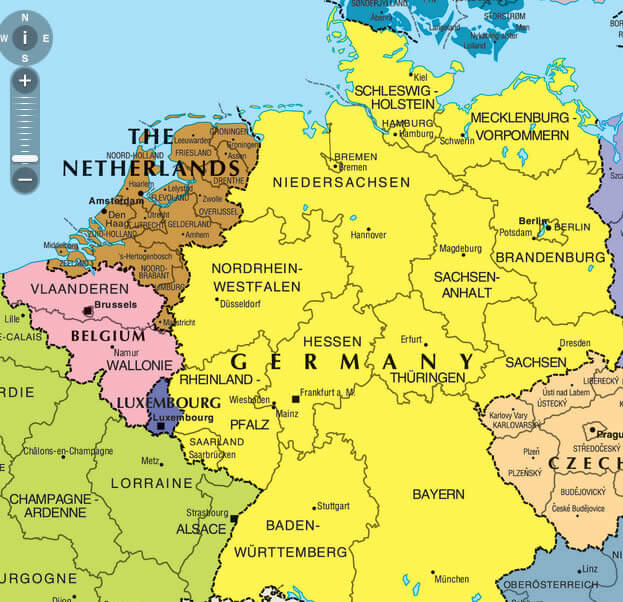
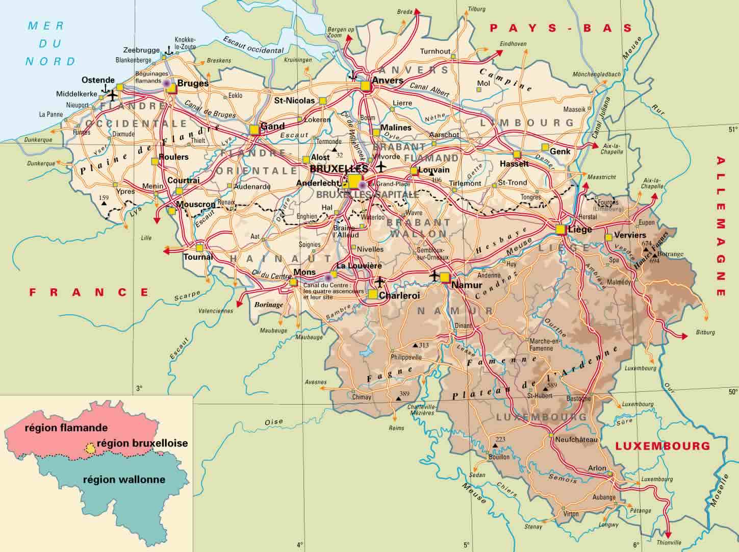
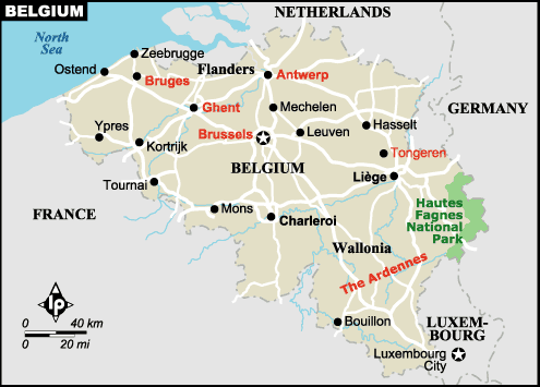
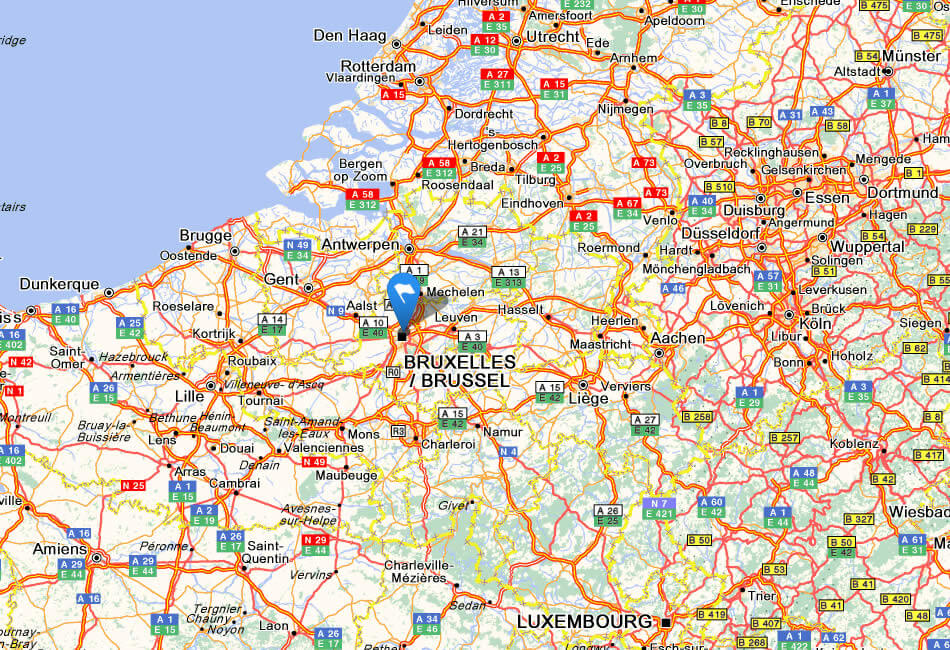
Belgium is located in Western Europe. It is bordered by the Netherlands to the north, Germany to the east, Luxembourg to the southeast, France to the southwest, and the North Sea to the northwest.
Antwerp: Where Timeless Elegance Meets Modern Vibrancy
Please subscribe on "World Guide" channnel on Youtube at youtube.com/c/WorldGuide
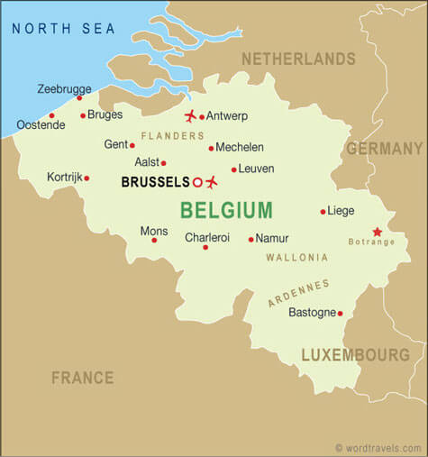
Brussels is the capital of Belgium and the European Union. Other main cities are Antwerp, Ghent and Charleroi. The country's population is around 11.5 million people.
What are some facts about Belgium
- Area: 30,528 km2 (11,787 sq mi)
- Population: 11,584,008 (2022)
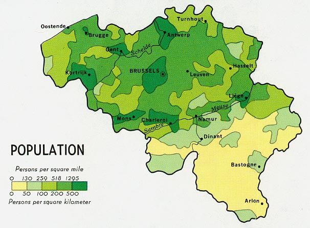
- Population Density: 376/km2 (973.8/sq mi)
- GDP (nominal): $589 billion (2022 est)
- GDP per capita: $50,598 (2022 est.)
- Religions:
Christianity 60%
No religion 31%
Islam 7% - Largest Cities:
Brussels
Antwerp
Ghent
Charleroi
Liege
Bruges
Namur
Leuven
Mons
Aalst
For more about Belgium >>
Brief information about Belgium
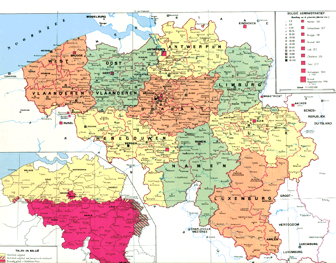
Belgium is a Western European country that borders France, the Netherlands, Germany, and Luxembourg. Its total area is 30,528 square kilometers, and as of 2021, its population is estimated to be around 11.7 million people. The country is known for its diverse population, with Dutch-speaking Flemish people in the north, French-speaking Walloons in the south, and a small German-speaking community in the east.A Collection of Belgium Maps and Belgium Satellite Images
MAP OF BELGIUM
BELGIUM LOCATION MAP
WHERE IS BELGIUM IN THE WORLD
BELGIQUE POPULATION MAP
BELGIUM COUNTRY MAP
BELGIUM MAP
BELGIUM MAP
BELGIUM ECONOMY MAP
BELGIUM LAND MAP
BELGIUM MAP
BELGIUM MAP
BELGIUM MAP GERMANY
BELGIUM MAP LUXEMBOURG
BELGIUM MAP NETHERLANDS LUXEMBURG

BELGIUM PHYSICAL MAP
BELGIUM POPULATION MAP
BELGIUM POPULATION MAP
BELGIUM ROAD MAP
KINGDOM OF BELGIUM MAP
MAP BELGIUM
MAP OF BELGIUM
MAP OF BELGIUM
MAP OF BELGIUM
MAPS OF BELGIUM
REGIONS MAP OF BELGIUM
SATELLITE IMAGE OF BELGIUM
BELGIUM EARTH MAP
- Head of Performance Marketing
- Head of SEO
- Linkedin Profile: linkedin.com/in/arifcagrici