Montana Map FQA
How many cities are in Montana ?
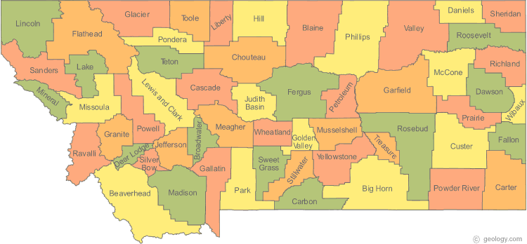
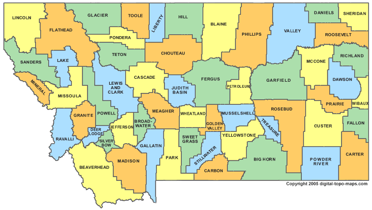
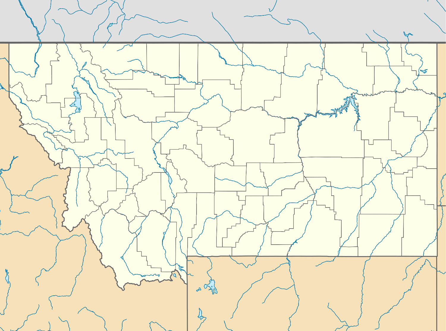
Montana has 56 counties. The largest by population are: Yellowstone County; Missoula County; Gallatin County; Flathead County; Cascade County; Lewis and Clark County; Silver Bow County; Ravalli County; Lake County; Lincoln County.
What are the major geographical features of Montana ?
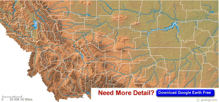
Montana is in the northwestern United States, bordered by Canada. Its geography includes the Rocky Mountains in the west and the Great Plains in the east. Major rivers include the Missouri and Yellowstone, and it is home to Glacier National Park. Wide valleys, plateaus, and forests define the state.
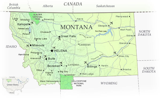
MAP OF MONTANA
MONTANA BLANK PHYSICAL MAP
Montana is a state located in the northwestern region of the United States, known for its rugged landscapes, vast wilderness areas, and abundant wildlife. From the soaring peaks of the Rocky Mountains to the sweeping prairies of the Great Plains, Montana offers a diverse array of natural beauty to explore. On this page, you can discover an interactive map of Montana and its major cities, highways, national parks, and other landmarks. Whether you're planning a road trip, studying geography, or simply curious about this remarkable state, our Montana map has everything you need to get started.
A Collection of Montana Maps and Montana Satellite Images
MAP OF MONTANA
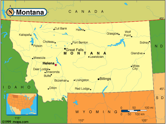
MONTANA MAP
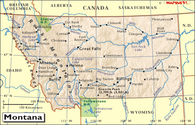
MONTANA PHYSICAL MAP
MONTANA BLANK PHYSICAL MAP
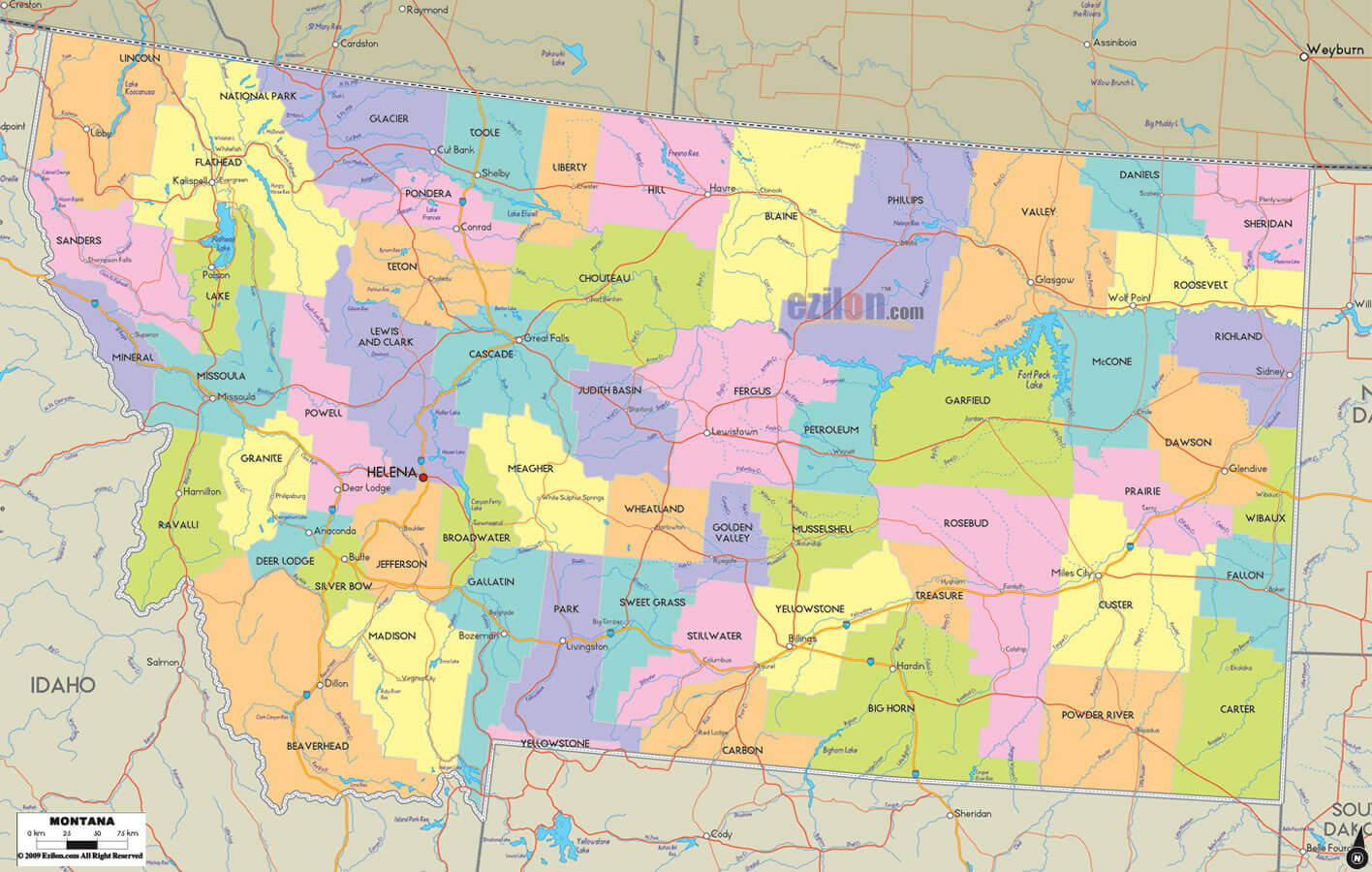
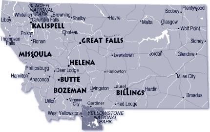
MONTANA CITIES MAP
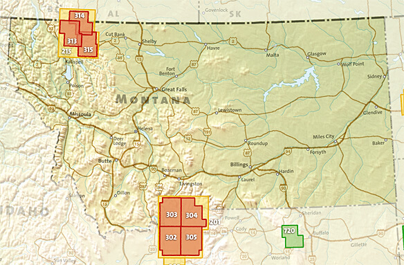
MONTANA COUNTY MAP
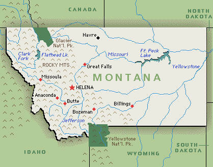
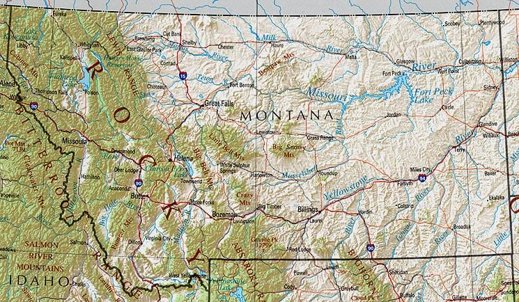
MONTANA GEOGRAPHIC MAP
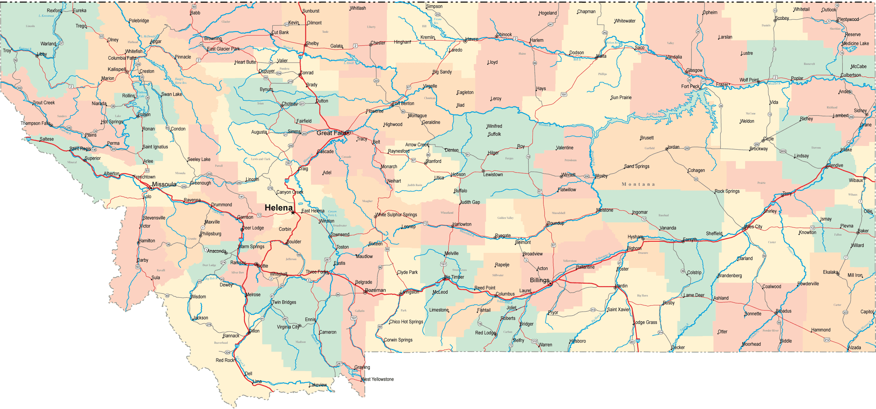
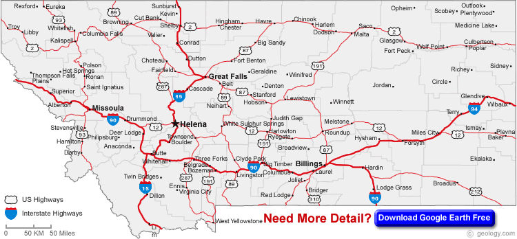
MONTANA HIGHWAYS MAP
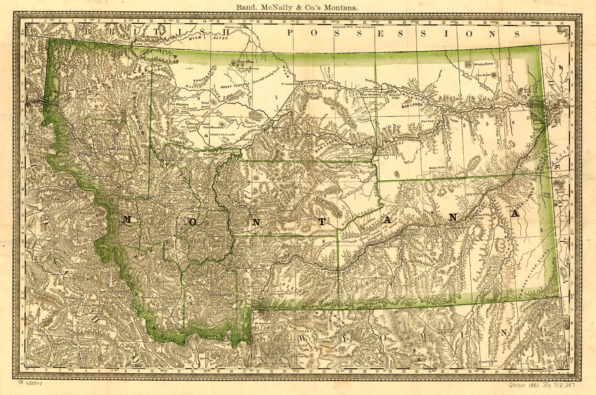
MONTANA HISTORICAL MAP
MONTANA MAP
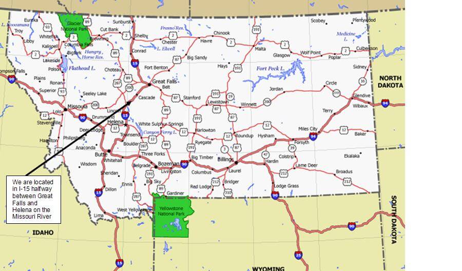
MONTANA MAP GREAT FALLS
MONTANA NATIONAL PARK MAP
MONTANA PHYSICAL MAP
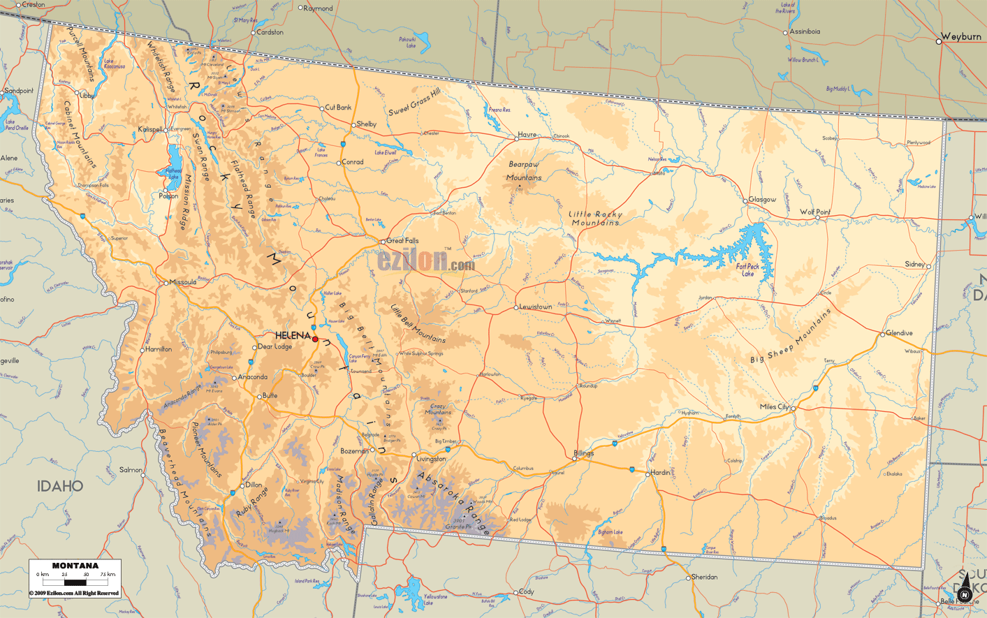
MONTANA PHYSICAL MAP
MONTANA POLITICAL MAP
MONTANA RIVERS MAP
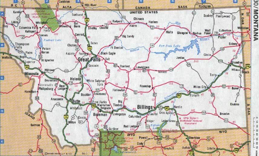
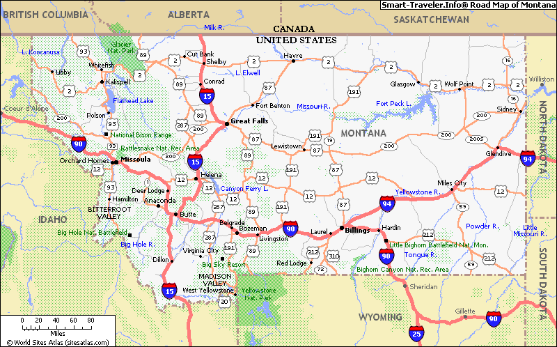
MONTANA ROUTE MAP
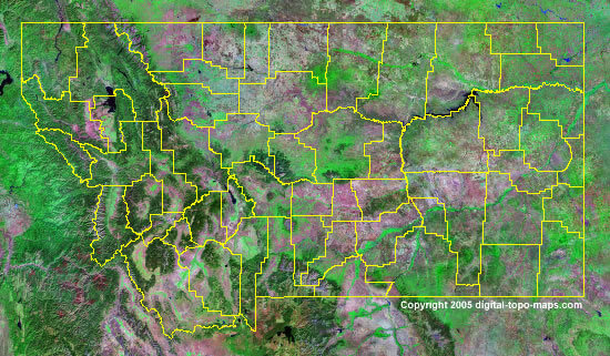
MONTANA SATELLITE IMAGE
ROAD MAP OF MONTANA
A collection of Montana Maps
Brief information about Montana, US
Montana is a state located in the northwestern region of the United States. It is the fourth largest state by land area, covering an area of 147,040 square miles (380,800 square kilometers). The state is known for its stunning natural beauty, which includes Glacier National Park, Yellowstone National Park, and the Rocky Mountains. Montana is also home to a diverse array of wildlife, including grizzly bears, elk, and bison.
As of 2020, Montana has an estimated population of 1.08 million people. The state has a predominantly rural population, with several small cities and towns scattered throughout the state. Helena is the state capital, while Billings is the largest city.
Montana has a rich history, with a significant Native American presence dating back thousands of years. The first European explorers arrived in the region in the 18th century, and the state was later part of the Louisiana Purchase in 1803. Montana became a state in 1889, and its economy has historically been based on agriculture, mining, and timber. Today, the state's economy is more diverse, with industries including tourism, healthcare, and technology.
Here are some statistical facts about Montana, US:
Area: Montana covers an area of 147,040 square miles (380,800 square kilometers), making it the fourth largest state in the United States.
Population: As of 2020, the estimated population of Montana is around 1.08 million people, according to the US Census Bureau.
Demographics: The racial and ethnic makeup of Montana is predominantly non-Hispanic White (86.9%), followed by Native American and Alaska Native (6.7%), Hispanic or Latino (4.7%), and Black or African American (0.6%). The state also has a small Asian and Pacific Islander population.
History: Montana has a rich history that dates back thousands of years, with evidence of human habitation dating back to the last ice age. The area was later inhabited by Native American tribes, including the Blackfeet, Crow, and Cheyenne. The first European explorers arrived in the late 18th century, and the state later became part of the Louisiana Purchase in 1803. Montana became a state in 1889 and has played an important role in the development of the western United States, including during the mining boom of the late 19th and early 20th centuries.
Economy: Montana's economy is diverse, with major industries including agriculture, mining, tourism, and healthcare. The state is a major producer of wheat, barley, and beef, and has significant reserves of coal, oil, and natural gas. Montana is also known for its scenic beauty and outdoor recreational opportunities, which draw millions of visitors each year. In recent years, the state has also seen growth in technology and manufacturing industries. Despite its natural resource wealth, Montana has a relatively low median household income compared to other states, but also a relatively low cost of living.