Explore Pennsylvania and Where is Pennsylvania on the Map
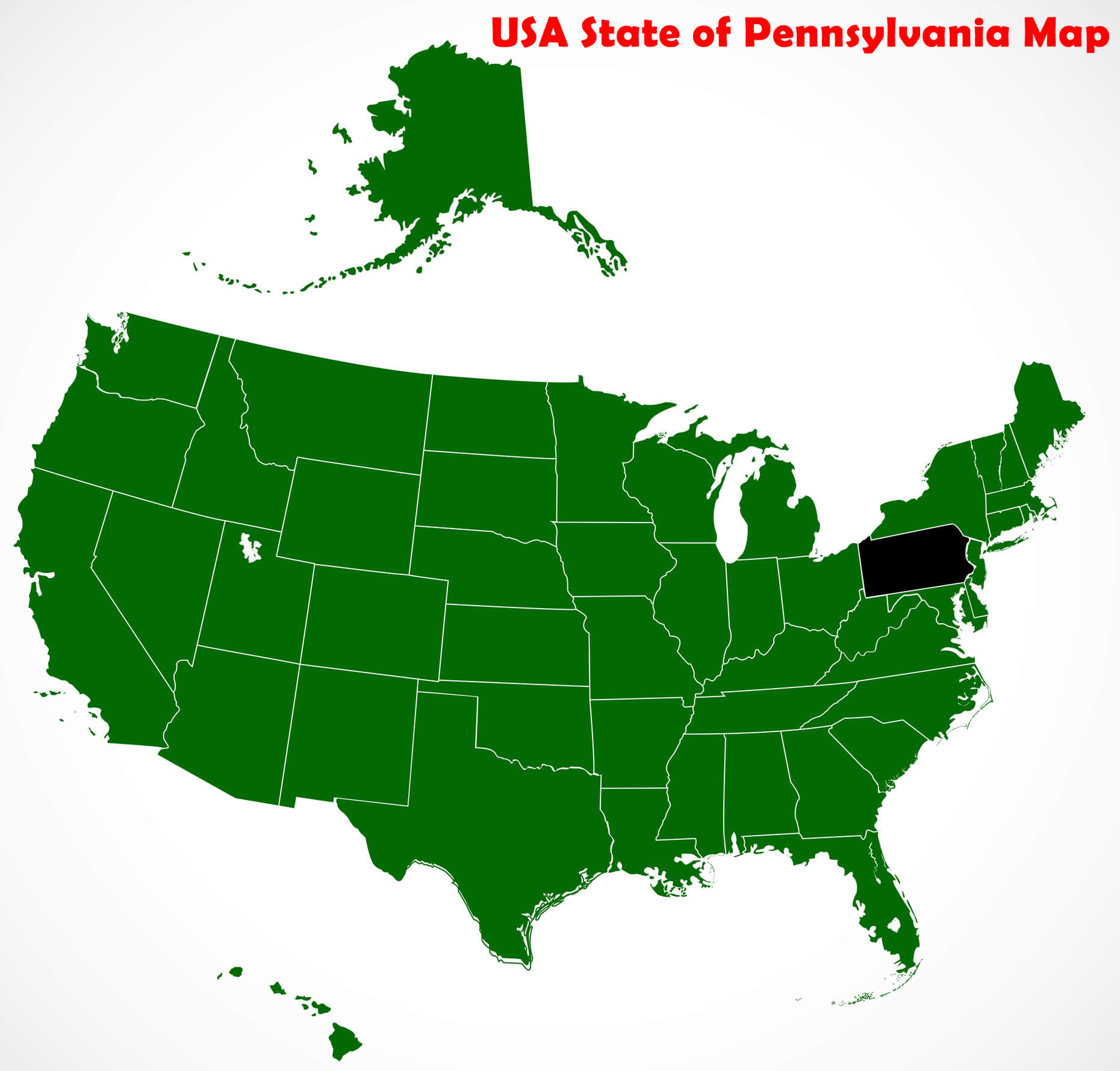
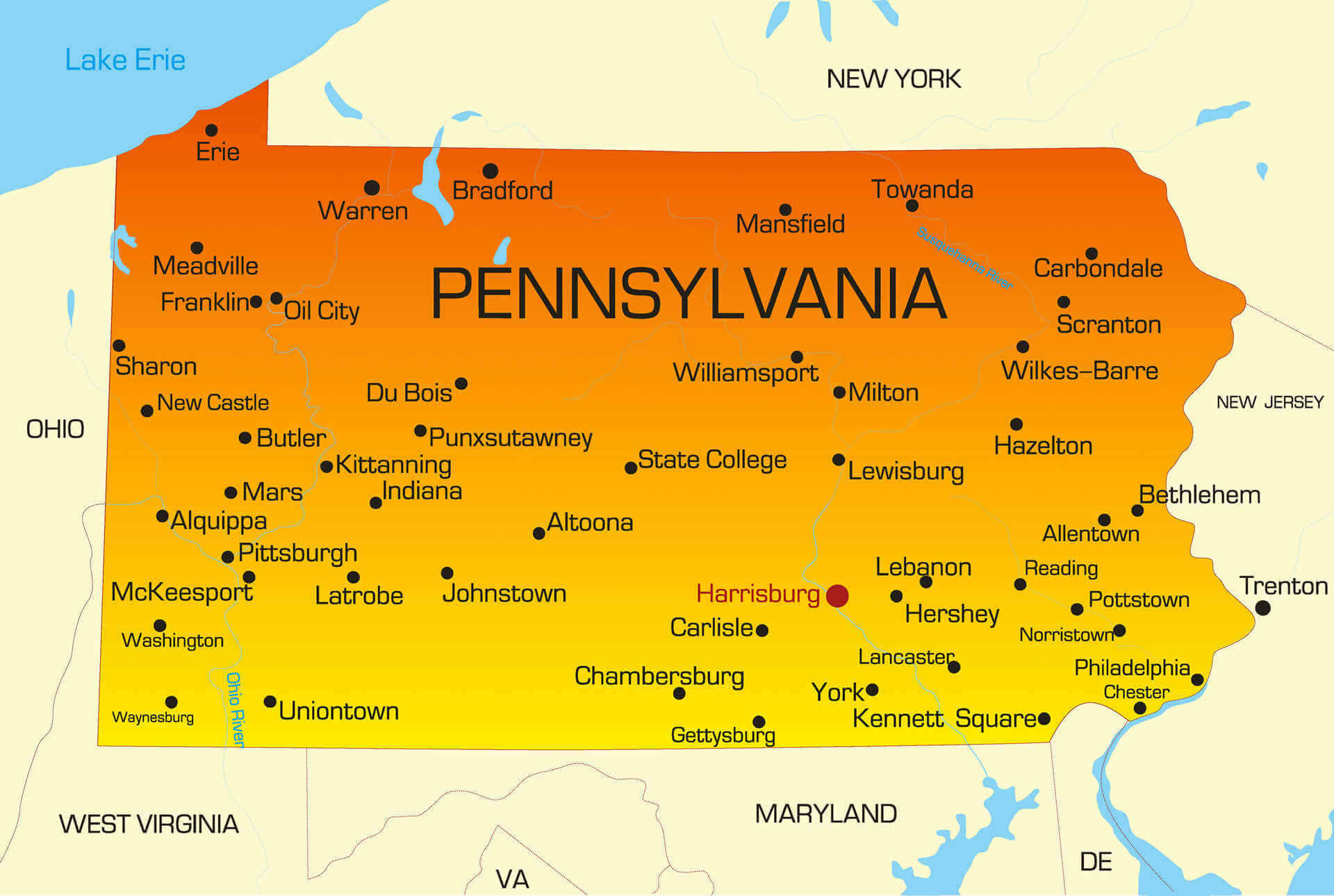
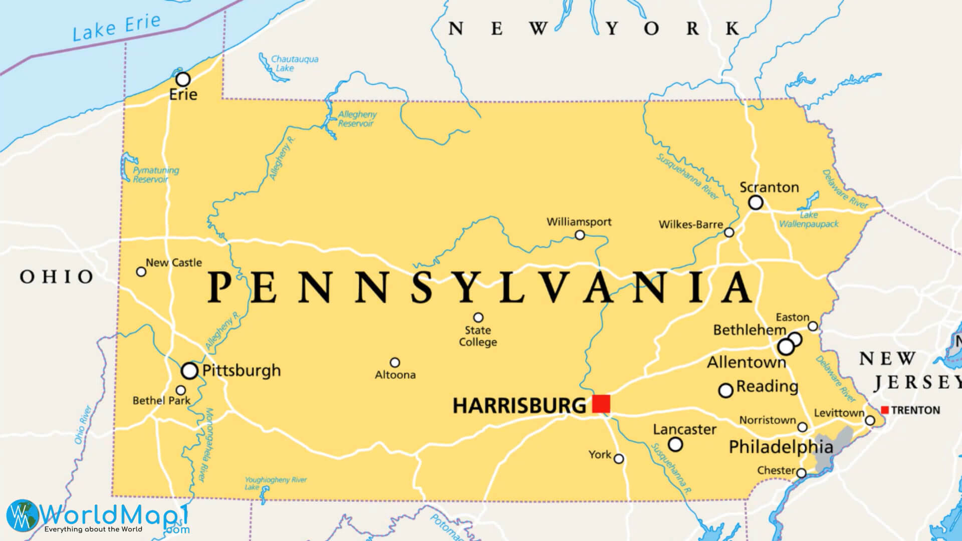
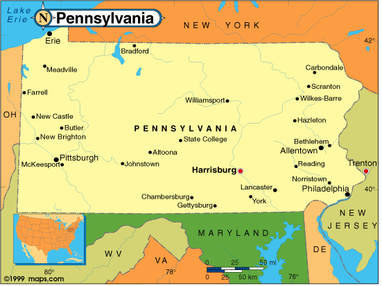
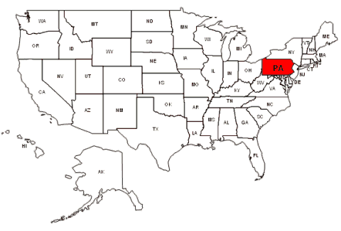
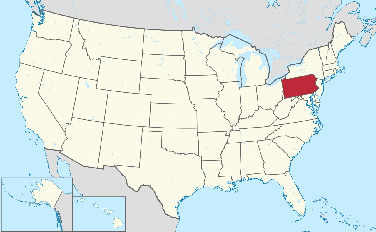
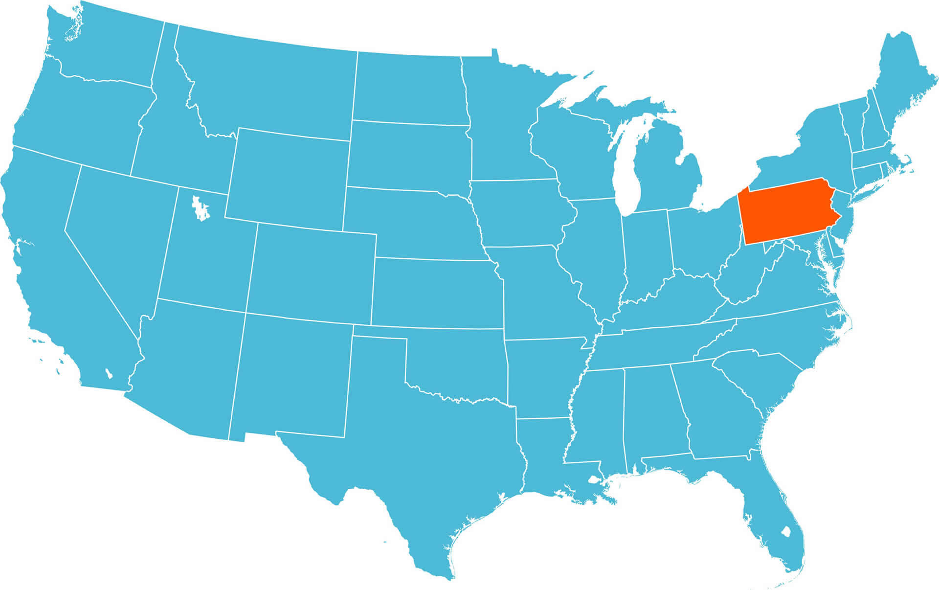
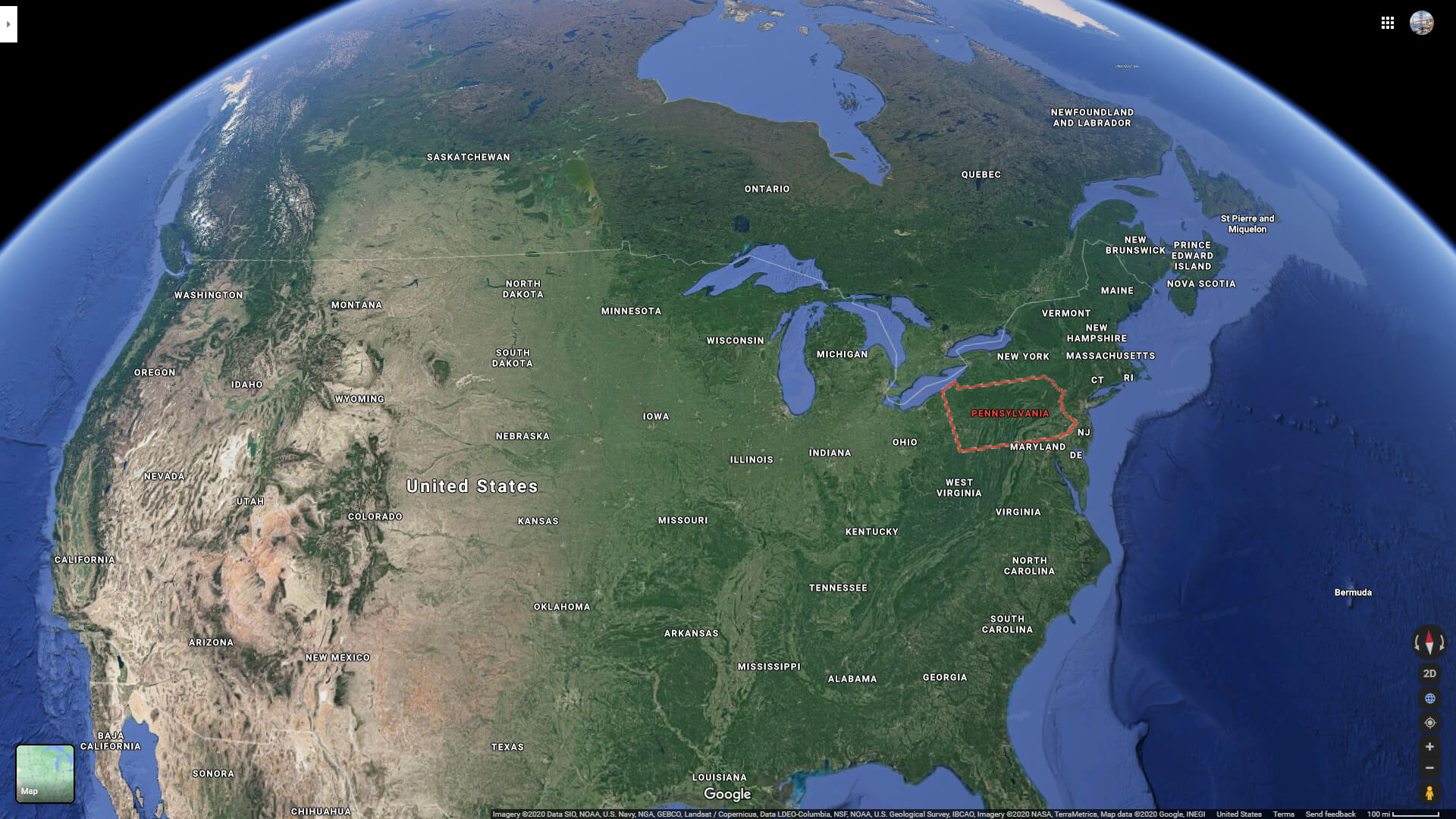
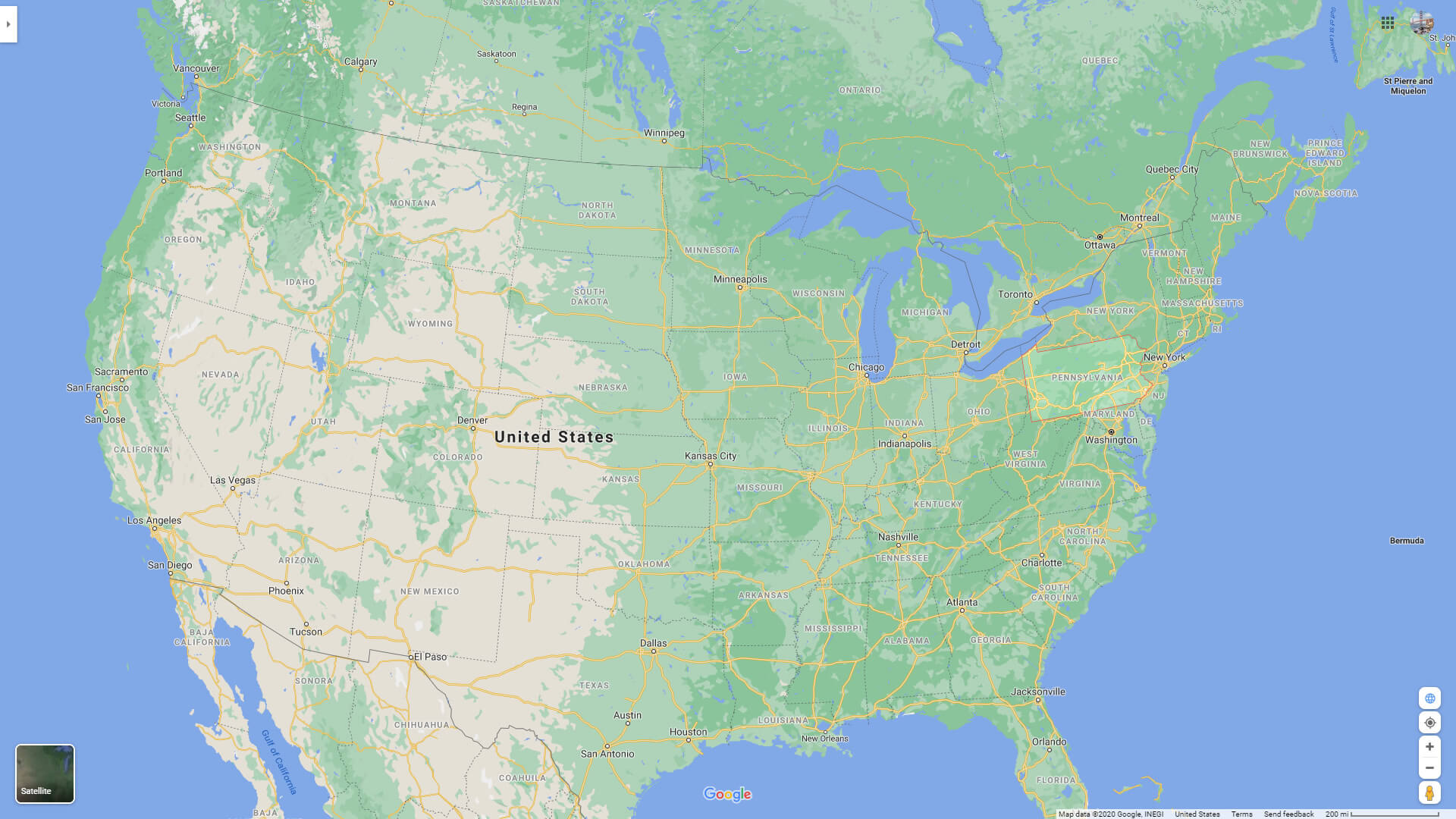
Pennsylvania is located in the northeastern region of the United States. Philadelphia is the state capital of Pennsylvania and its largest city. This state is located between New York, New Jersey, Maryland and West Virginia.
Discover the diverse geography of Pennsylvania through our interactive map. Navigate through the state's cities, counties, and notable landmarks with ease. Our detailed Pennsylvania map is perfect for planning trips, studying geography, or simply exploring the Keystone State from the comfort of your home. Start exploring now!
Pennsylvania Map FQA
How many cities are in Pennsylvania ?
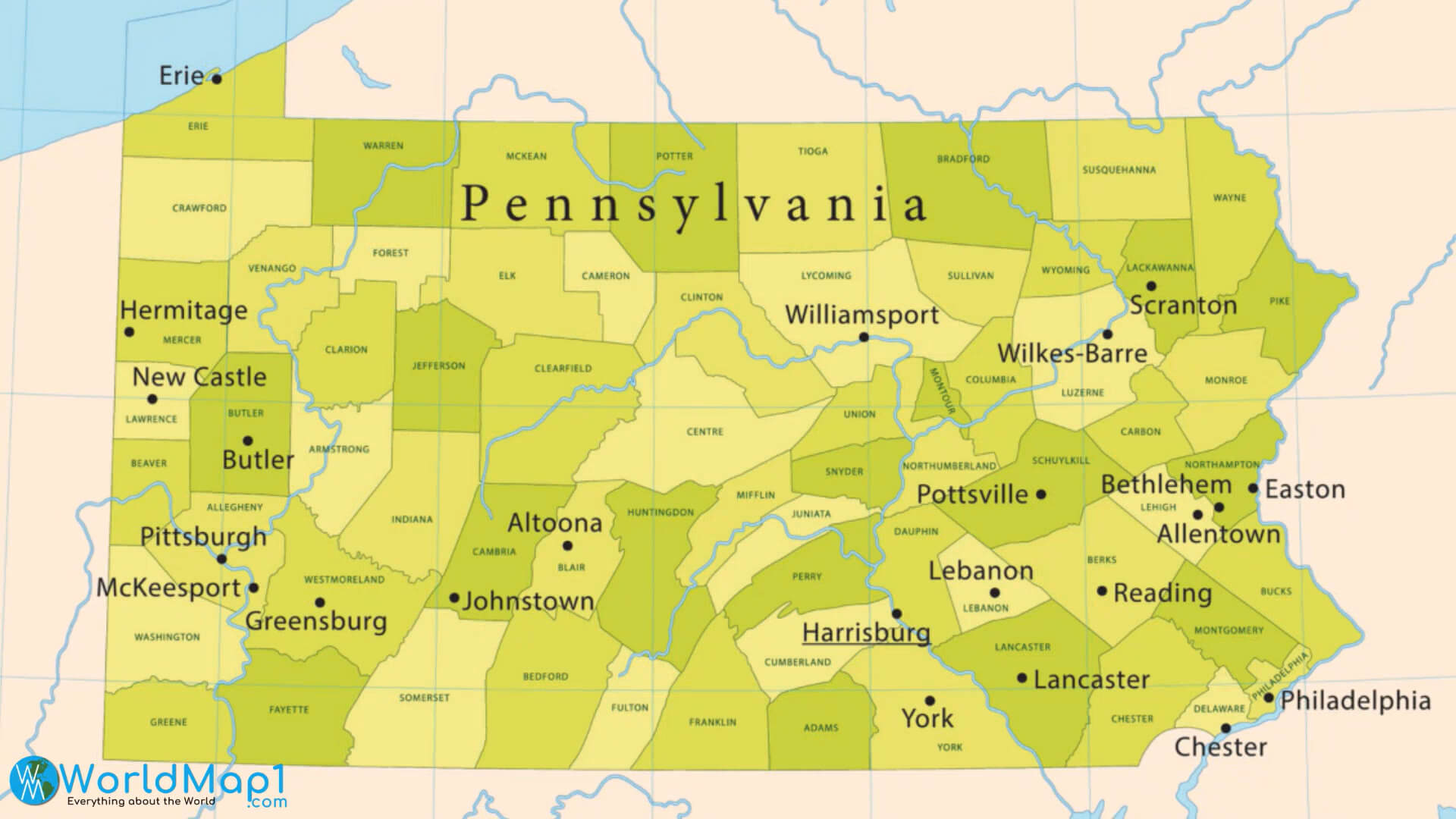
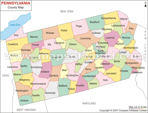
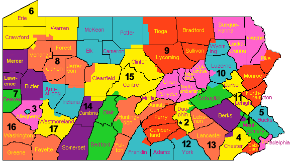
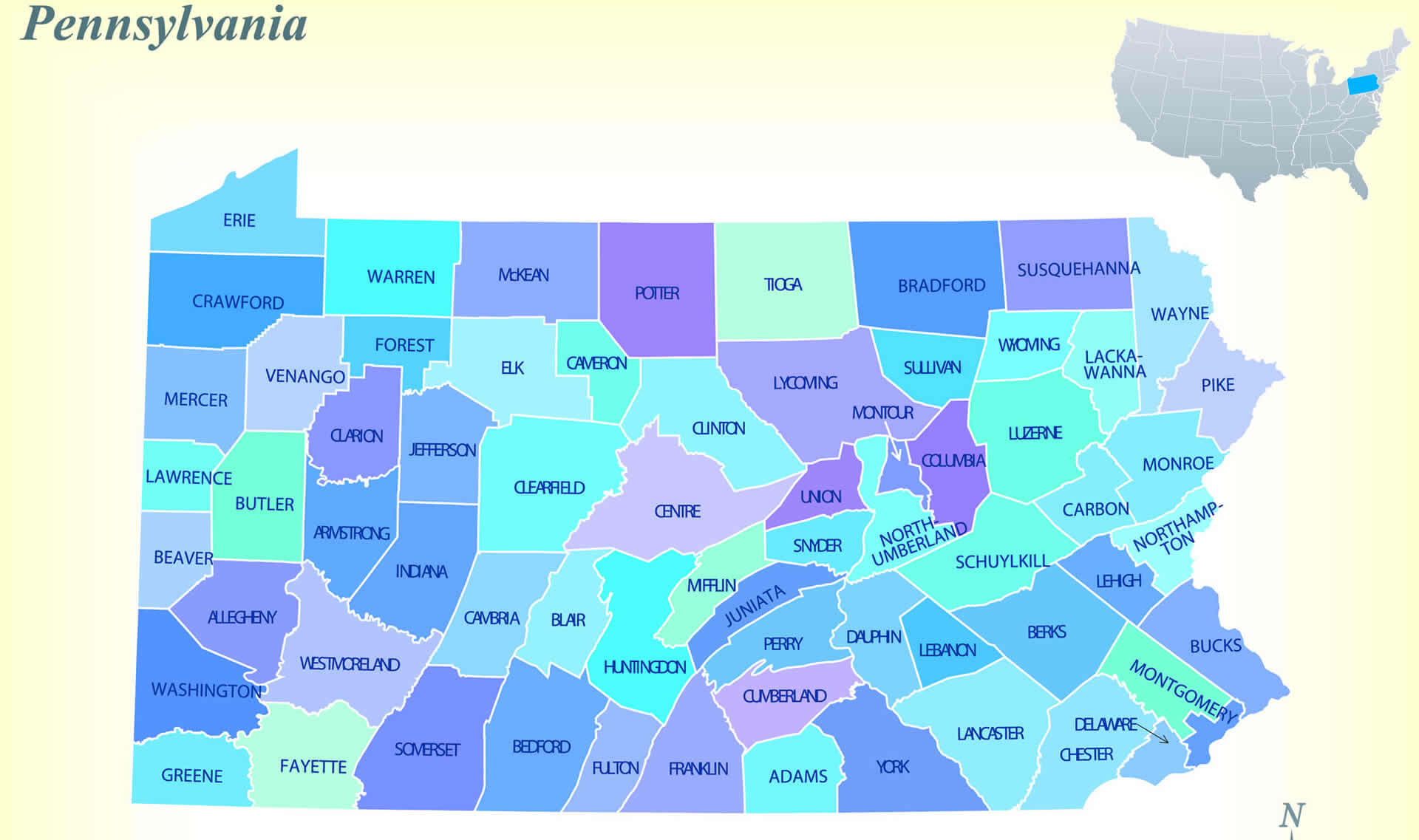
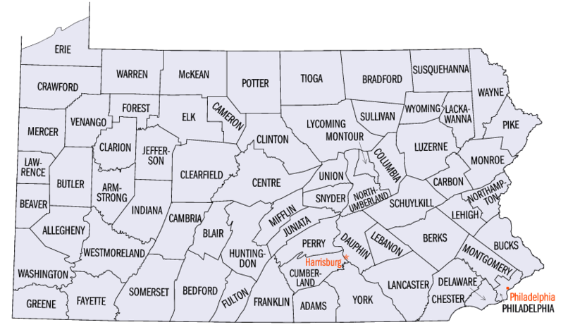
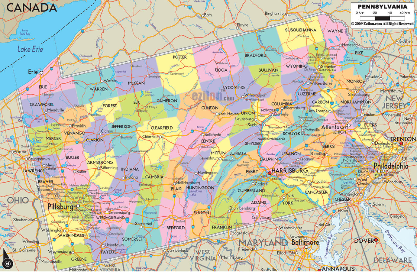
Pennsylvania has 67 counties. The largest by population are: Philadelphia County; Allegheny County; Montgomery County; Bucks County; Delaware County; Lancaster County; Chester County; York County; Berks County; Lehigh County.What are the major geographical features of Pennsylvania ?
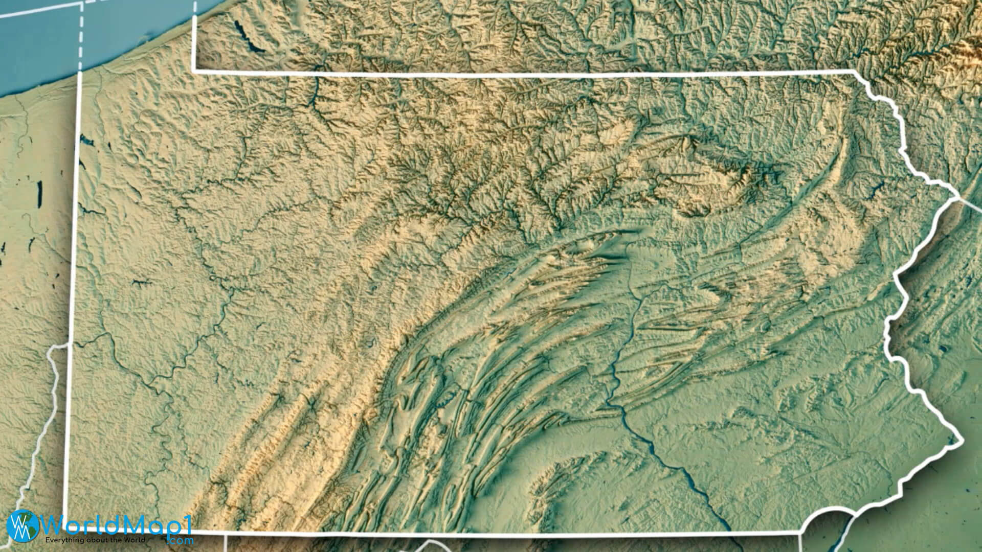
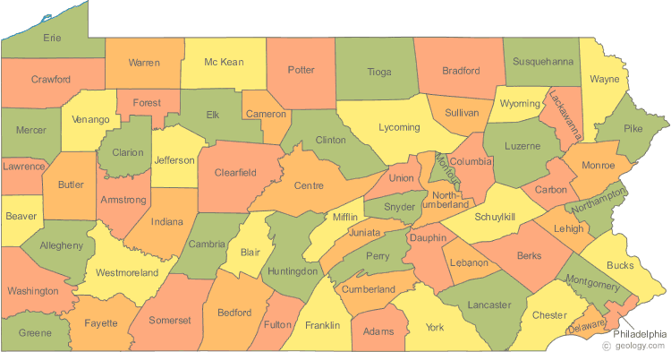
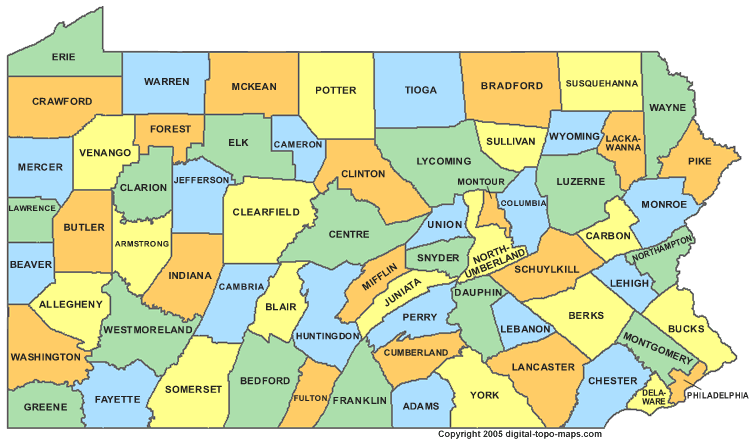
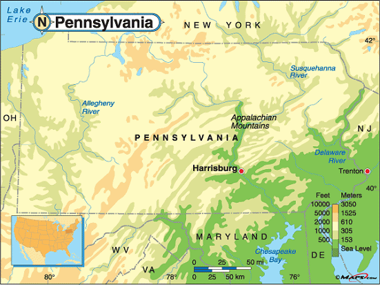
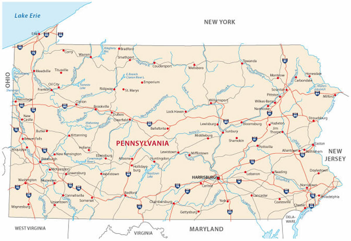
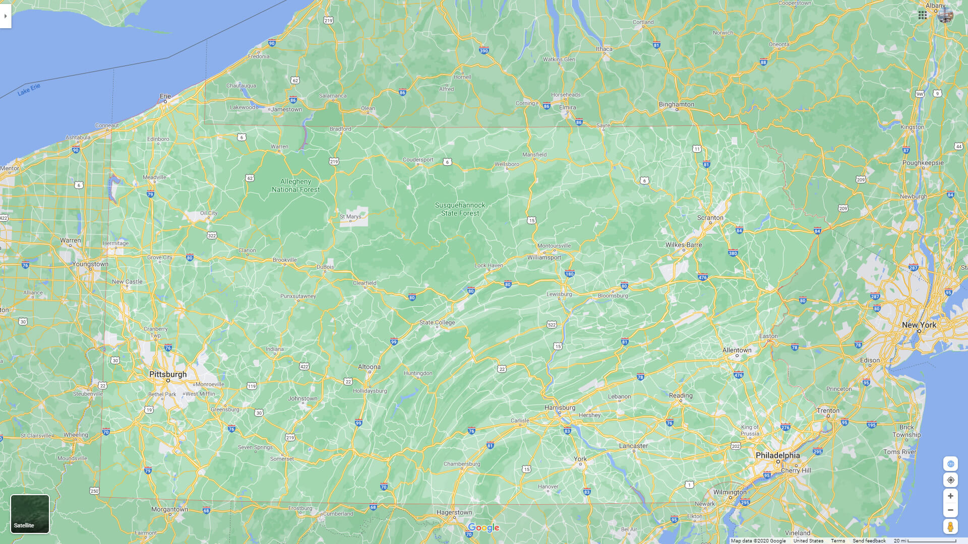
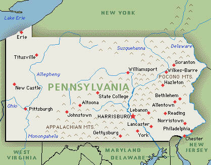
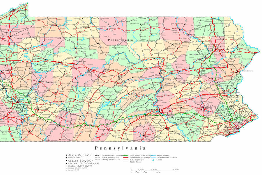
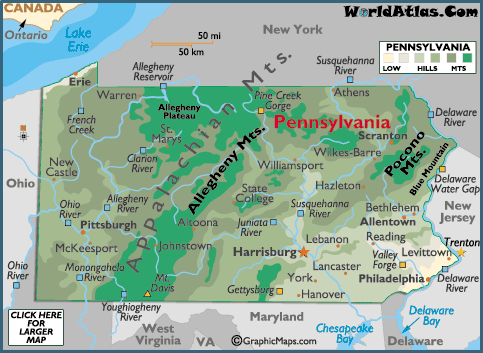
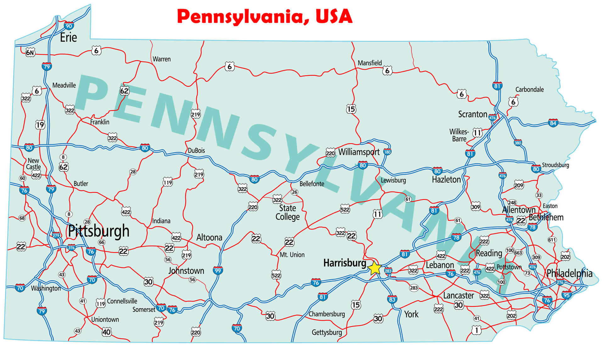
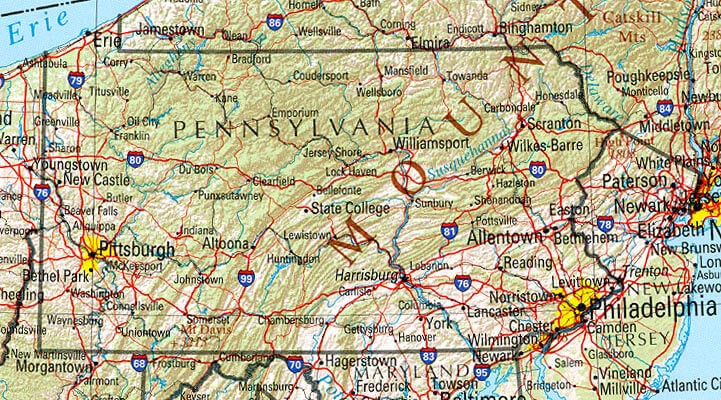
Pennsylvania features the Appalachian Mountains, the Allegheny and Pocono ranges, fertile valleys, and rivers such as the Delaware and Susquehanna. It also has part of Lake Erie shoreline.COLOR MAP OF PENNSYLVANIA
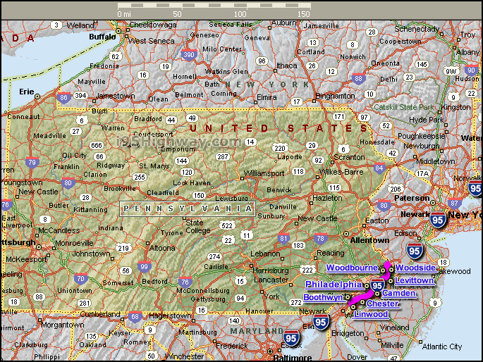
INTERSTATE 95 PENNSYLVANIA MAP
Pennsylvania has a diverse economy with industries including healthcare, education, technology, manufacturing, and agriculture. The state is also known for its historical significance, as it played a key role in the American Revolution and was home to several founding fathers. Pennsylvania is home to several notable landmarks, including the Liberty Bell, Independence Hall, and Gettysburg National Military Park.
Our detailed Pennsylvania map allows you to explore the state's cities, counties, and landmarks with ease. Whether you're planning a trip, studying geography, or simply curious about the state, our map provides a comprehensive overview of Pennsylvania's geography. So start exploring and discover all that the Keystone State has to offer!
What are some facts about Pennsylvania
- Area: 46,055 sq mi (119,283 km2)
- Population: 13,011,844 (2020)
- Population Density: 290/sq mi (112/km2)
- GDP (nominal):
- GDP per capita:
- Religions:
Protestantism: 47%
Catholicism: 24%
Hindu: 1%
Judaism: 2%
Jewish: 0.8%
Islam: 0.8% Other: 2% - Largest Cities:
Philadelphia Map
Pittsburgh Map
Allentown Map
Erie Map
Reading Map
Scranton Map
Bethlehem Map
Lancaster Map
Levittown Map
Harrisburg Map
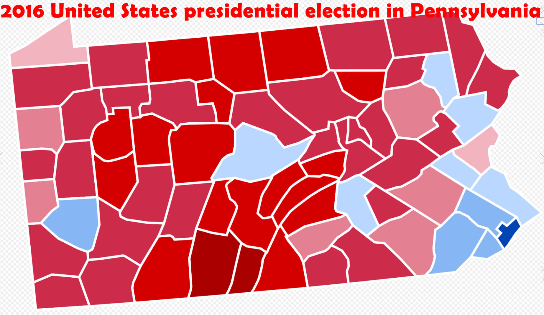
Pennsylvania Election Map
Pennsylvania Images
For all Pennsylvania Cities Map
Pennsylvania Maps
Map of Pennsylvania with Interstate Routes
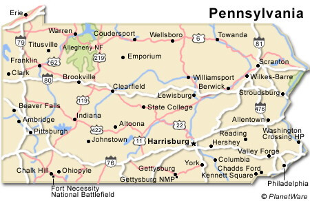
Pennsylvania Main Cities and Counties Map
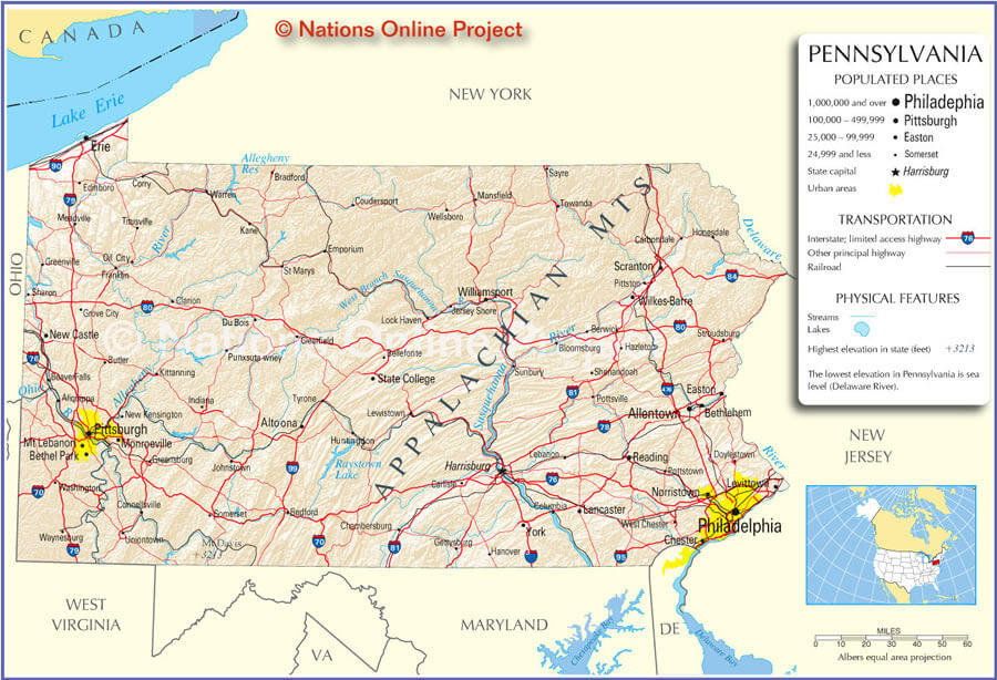
Pennsylvania Map
Pennsylvania State Plate Map
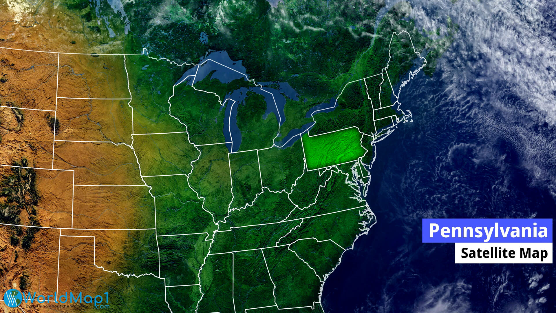
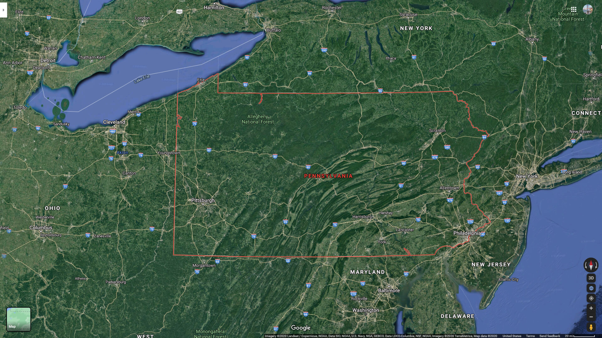
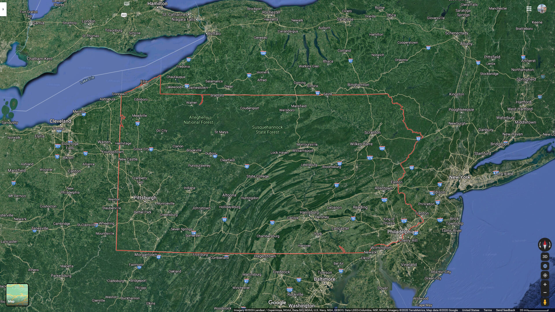
Pennsylvania Satellite Map
Please view more Pennsylvania Cities Aerial Views, Map and Photos
High Detailed Pennsylvania Map Pennsylvania Free Printable Map Where is Located Pennsylvania in the US and Cities Map of PennsylvaniaBrief information about utah, US
A Collection of Pennsylvania Maps and Pennsylvania Satellite Images
COLOR MAP OF PENNSYLVANIA
MAP OF PENNSYLVANIA
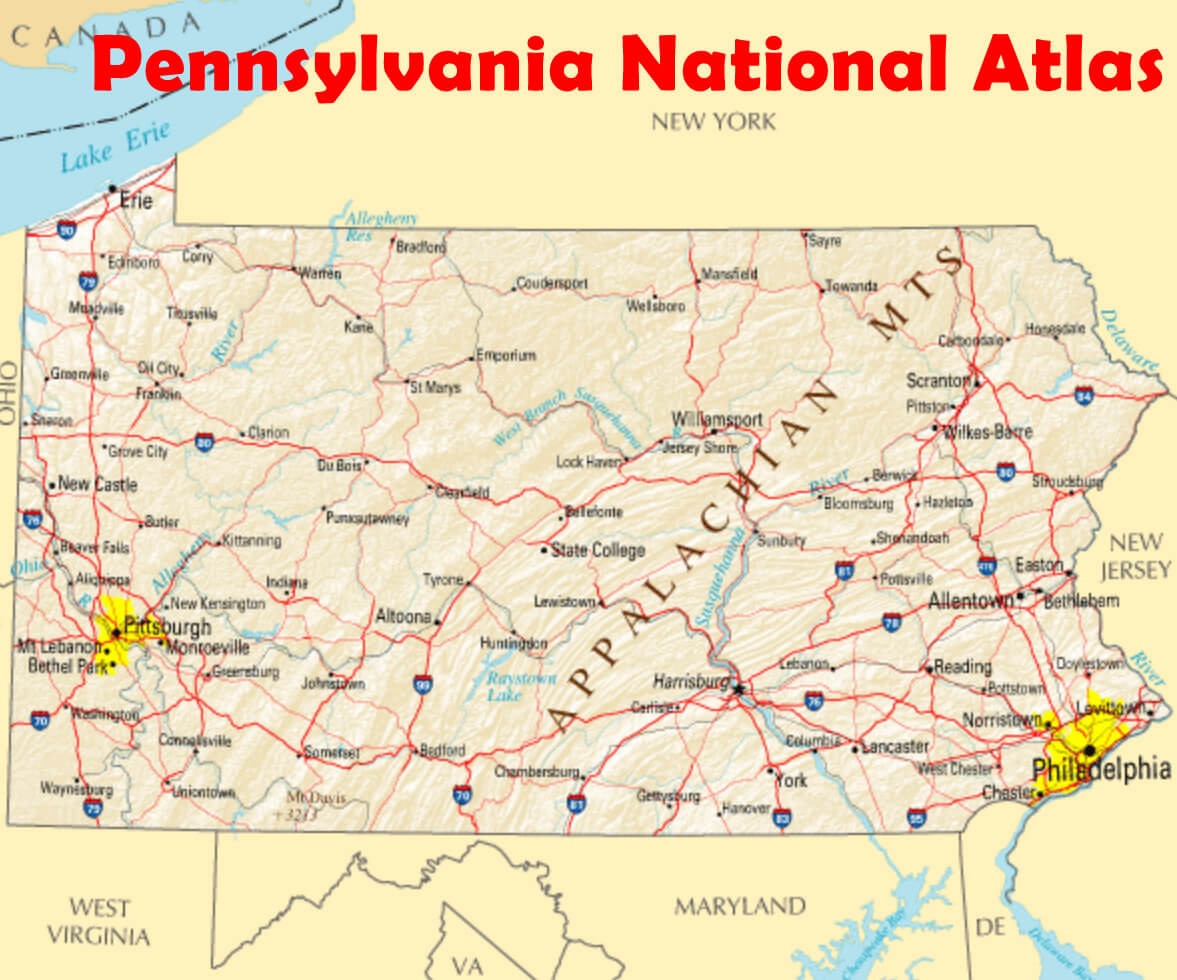
PENNSYLVANIA NATIONAL ATLAS
INTERSTATE 95 PENNSYLVANIA MAP
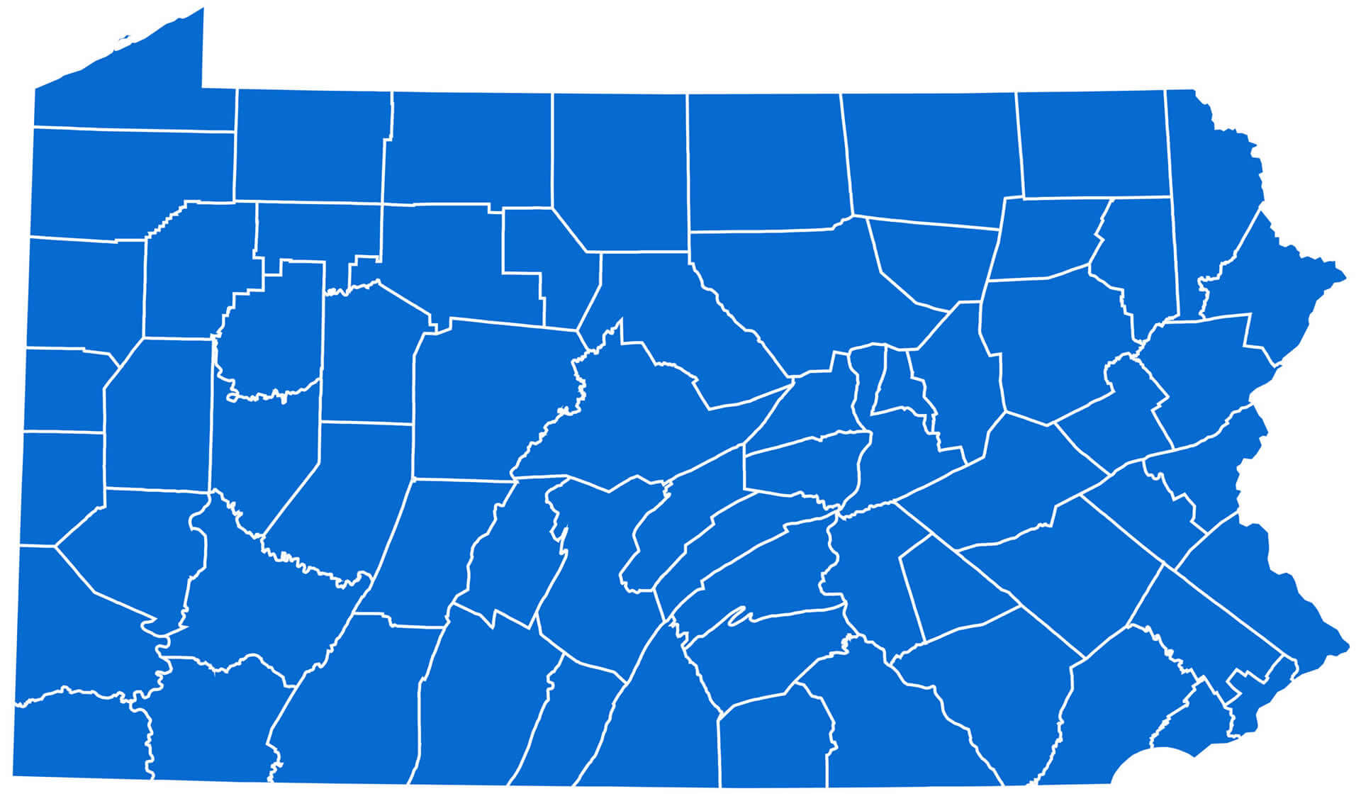
PENNSYLVANIA COUNTY MAP
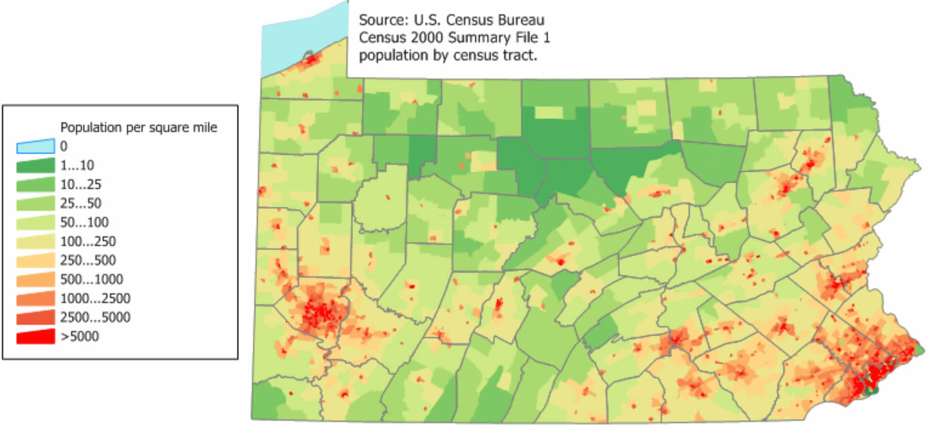
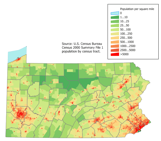
2000 US PENNSYLVANIA CENSUS MAP
PENNSYLVANIA COUNTY MAP
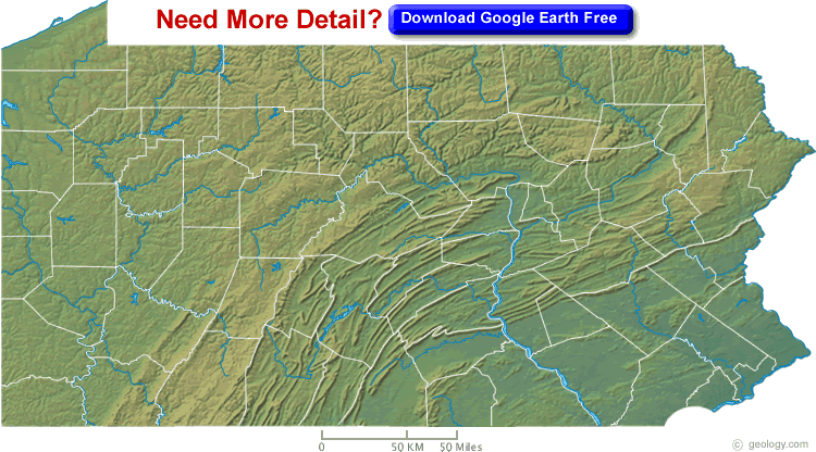
PENNSYLVANIA PHYSICAL MAP
2016 US PRESIDENTIAL ELECTION IN PENNSYLVANIA CLINTON VS TRUMP
PENNSYLVANIA ROAD MAP
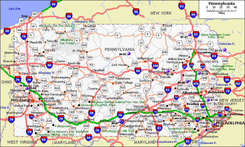
PENNSYLVANIA HIGHWAY MAP
PENNSYLVANIA CITIES MAP
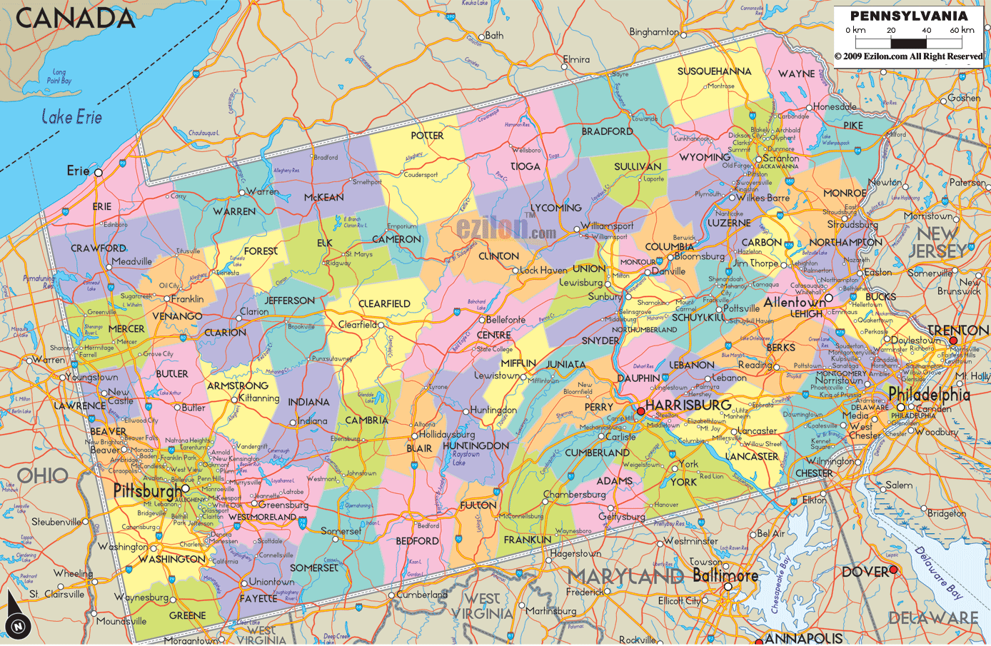
PENNSYLVANIA COUNTY MAP

PENNSYLVANIA MAP
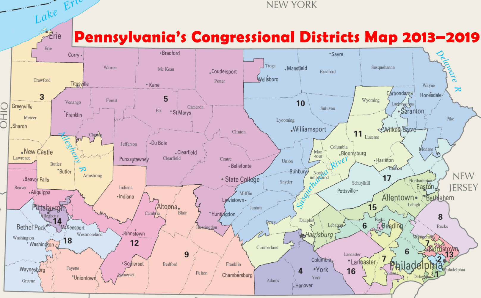
PENNSYLVANIA CONGRESSIONAL DISTRICTS MAP 2013–2019
PENNSYLVANIA MAP TRAIN
PENNSYLVANIA STATE MAP US
PENNSYLVANIA POLITICAL MAP USA
PENNSYLVANIA MAP USA
PENNSYLVANIA NATIONAL PARK MAP
PENNSYLVANIA PHYSICAL MAP
PENNSYLVANIA POLITICAL MAP
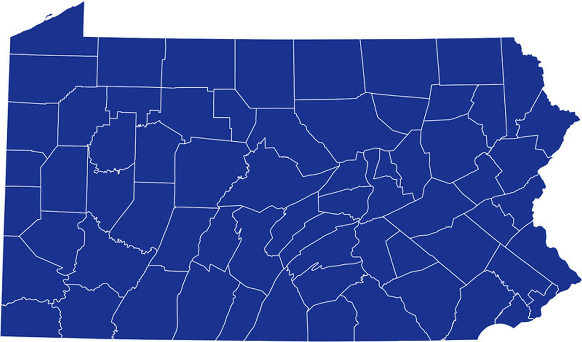
PENNSYLVANIA BLANK MAP
PENNSYLVANIA PRINTABLE MAP
PENNSYLVANIA SATELLITE MAP USA
PENNSYLVANIA RIVER MAP
PENNSYLVANIA ROAD MAP
PENNSYLVANIA BLANK MAP UNITED STATES
PENNSYLVANIA STATE ROAD MAP
PENNSYLVANIA WHERE IN USA MAP
PENNSYLVANIA MAP IN UNITED STATES
PENNSYLVANIA STATE MAP
PENNSYLVANIA COUNTIES MAP USA
PHYSICAL MAP OF PENNSYLVANIA
PENNSYLVANIA NATIONAL ATLAS USA
PENNSYLVANIA MAP US
PENNSYLVANIA GEOGRAPHY LOCATION MAP USA
PENNSYLVANIA COUNTIES ROAD MAP USA
PENNSYLVANIA POPULATION MAP USA
PENNSYLVANIA SATELLITE STATE MAP US
PENNSYLVANIA STATE LOCATION MAP US
PENNSYLVANIA STATE MAP USA
USA STATE OF PENNSYLVANIA MAP