Andorra Map
Explore the charming principality of Andorra on WorldMap1 and discover its picturesque towns, stunning natural landscapes, and world-class ski resorts. Use our interactive map tool to navigate this tiny country nestled in the Pyrenees mountains, and plan your next adventure in this European gem.
Andorra Map FQA
How many cities are in Andorra ?
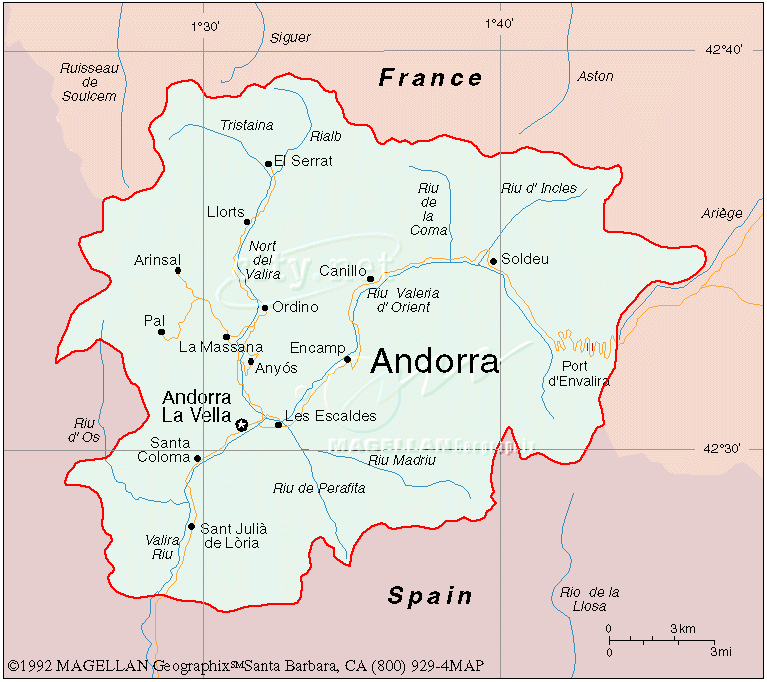
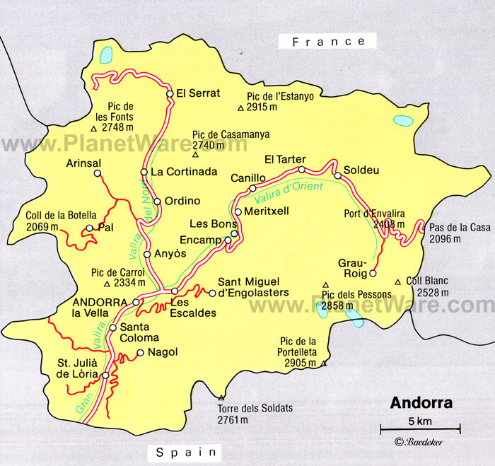
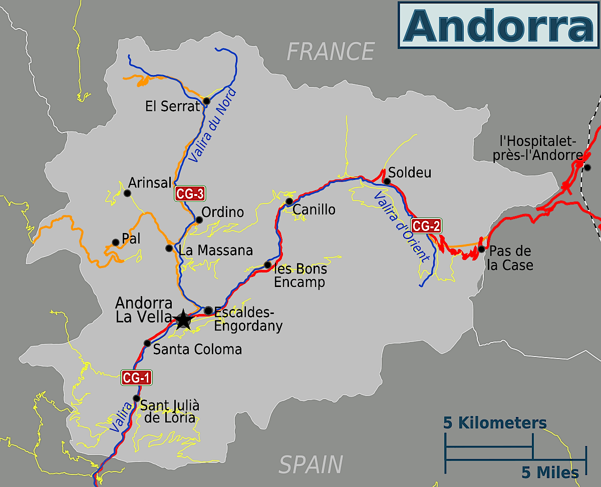
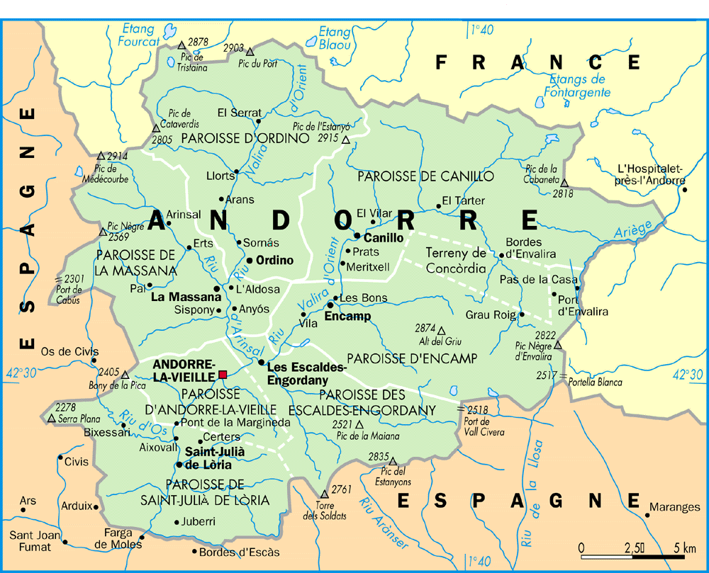
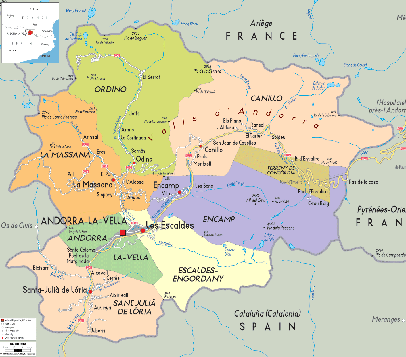
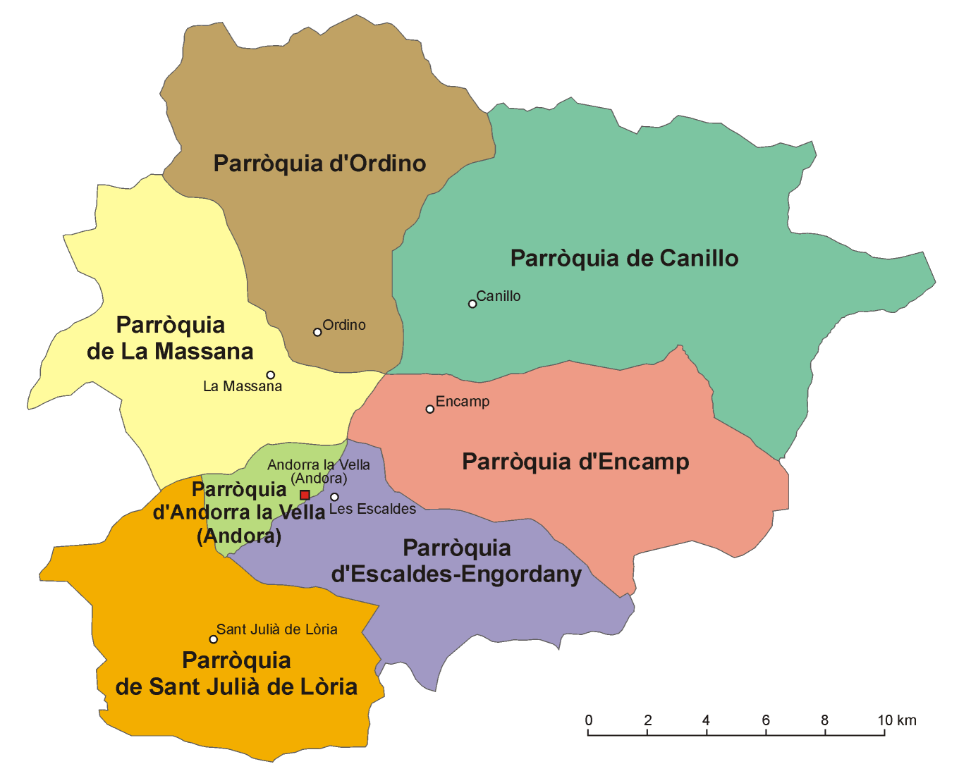
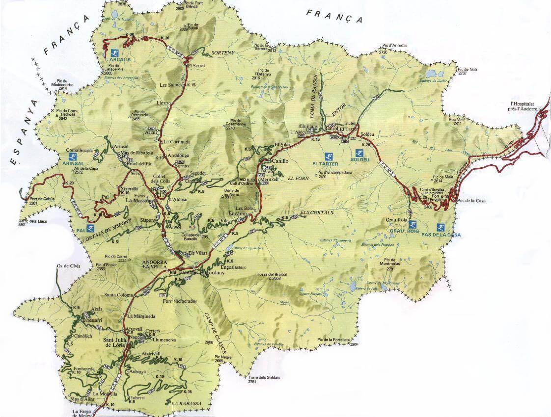
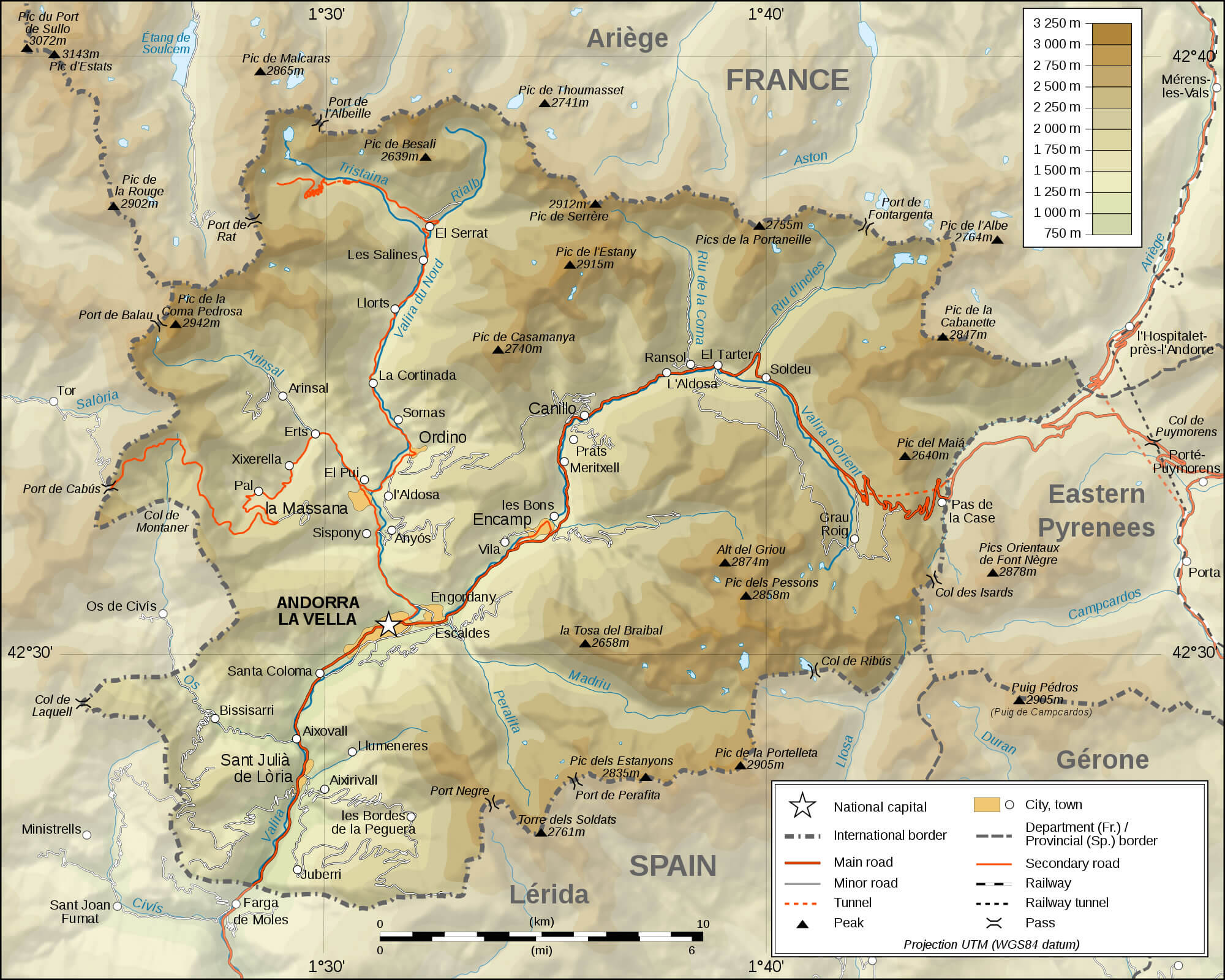
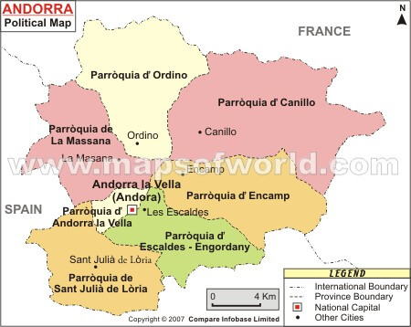
Andorra has 7 main urban centers. Largest towns: Andorra la Vella, Escaldes-Engordany, Encamp, Sant Julia de Loria, La Massana, Ordino, Canillo.What are the major geographical features of Andorra ?
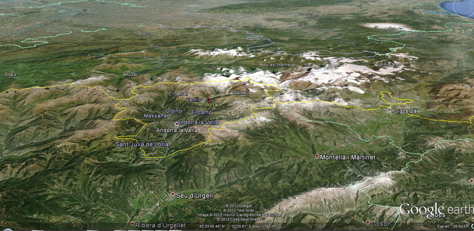
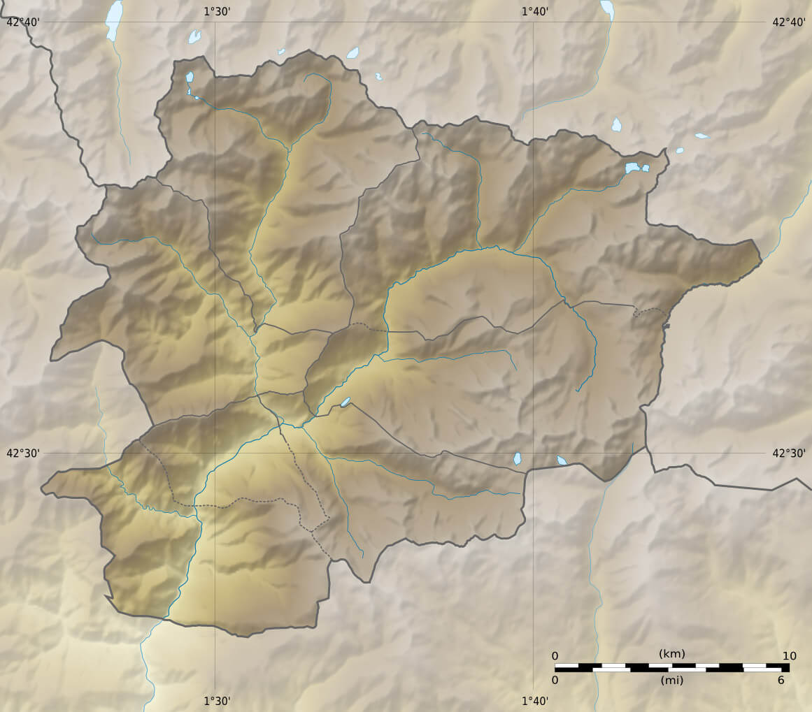
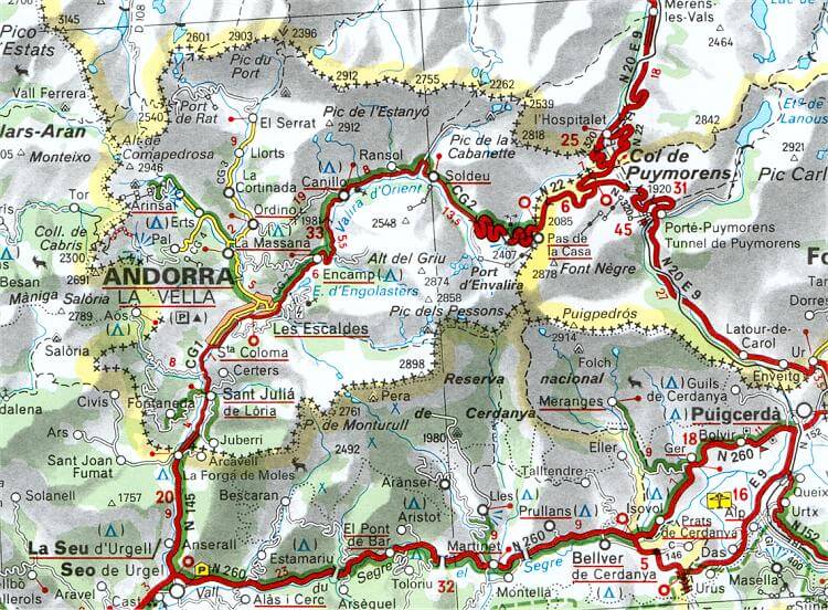
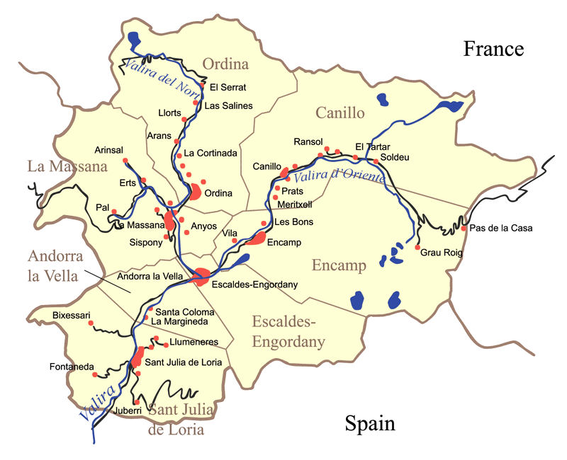
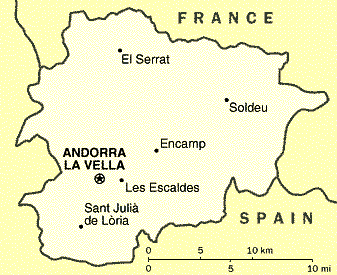
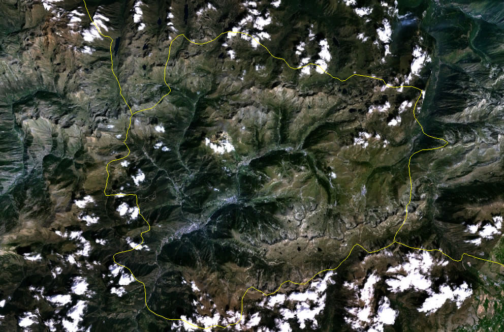
Andorra is a small country located in the eastern Pyrenees mountains between France and Spain. It is dominated by high peaks, narrow valleys, and mountain rivers. Its geography is largely alpine, with limited flat land and a cool mountain climate.MAP OF ANDORRA

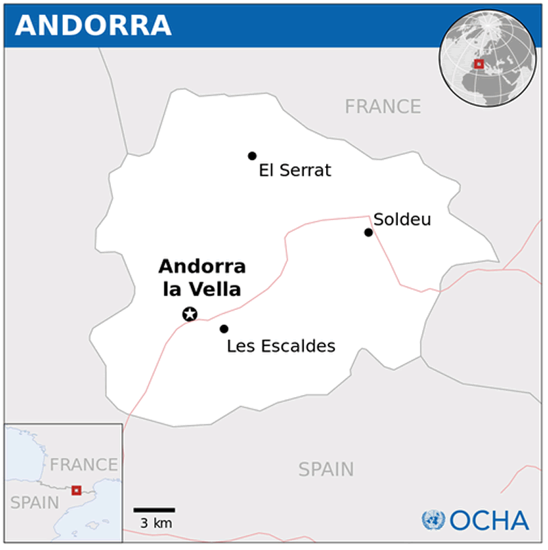
ANDORRA LOCATION MAP
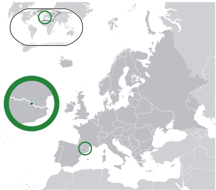
WHERE IS ANDORRA IN THE WORLD
Can I download a high-resolution map of Andorra ?
Yes. Download high-resolution political and physical maps of Andorra for personal or educational use. Redistribution is subject to the terms of our license.
- Capital : Andorra la Vella
- Population : 85,082
- GDP : $4.510 billion (155th)
- Per Capita : $53,383 (9th)
- Calling Code : +376
- Jobless Rate : N/A
- Time Zone : +2
Where is located Andorra on the Map
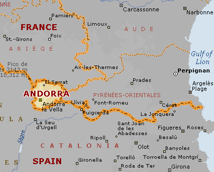
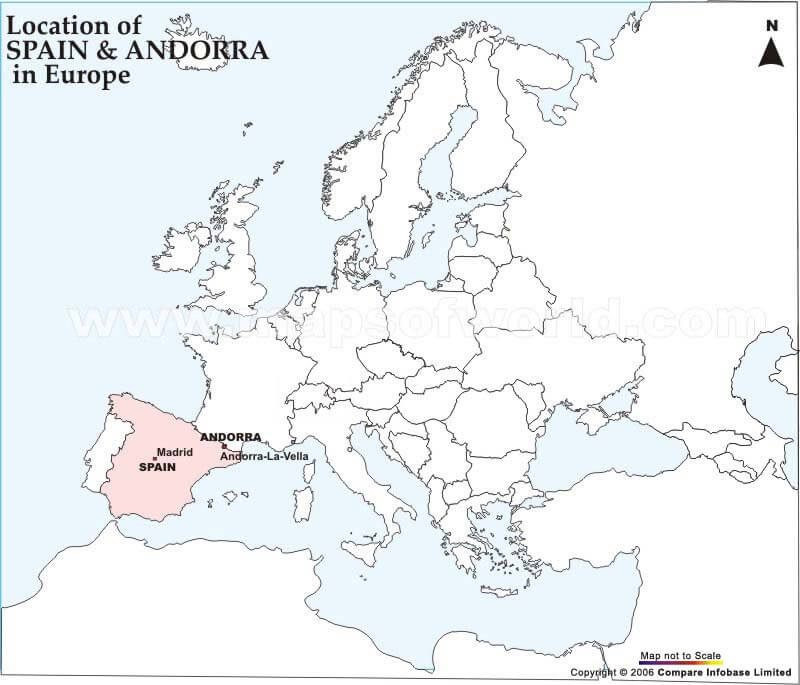
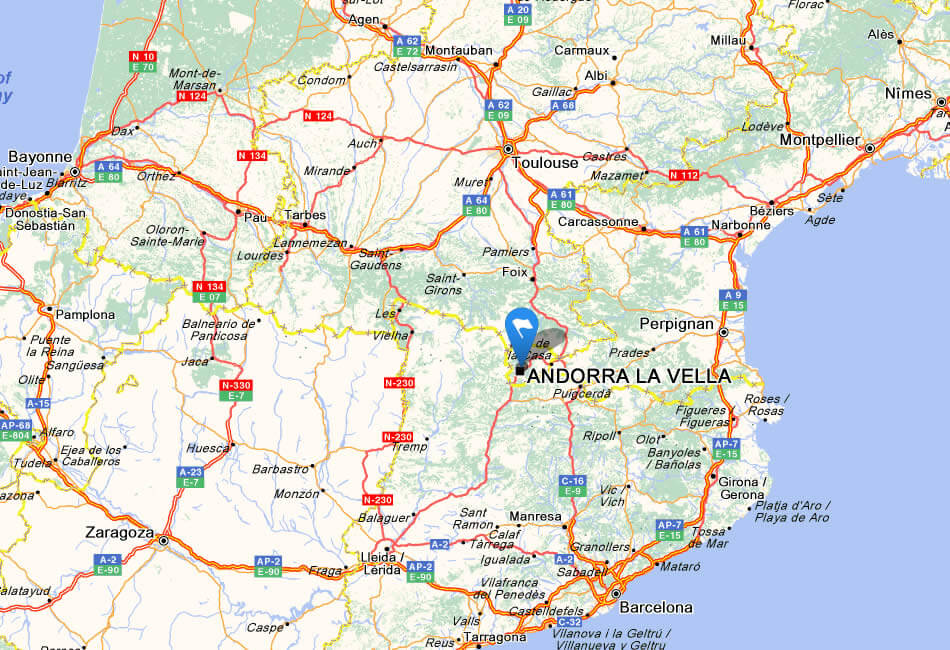
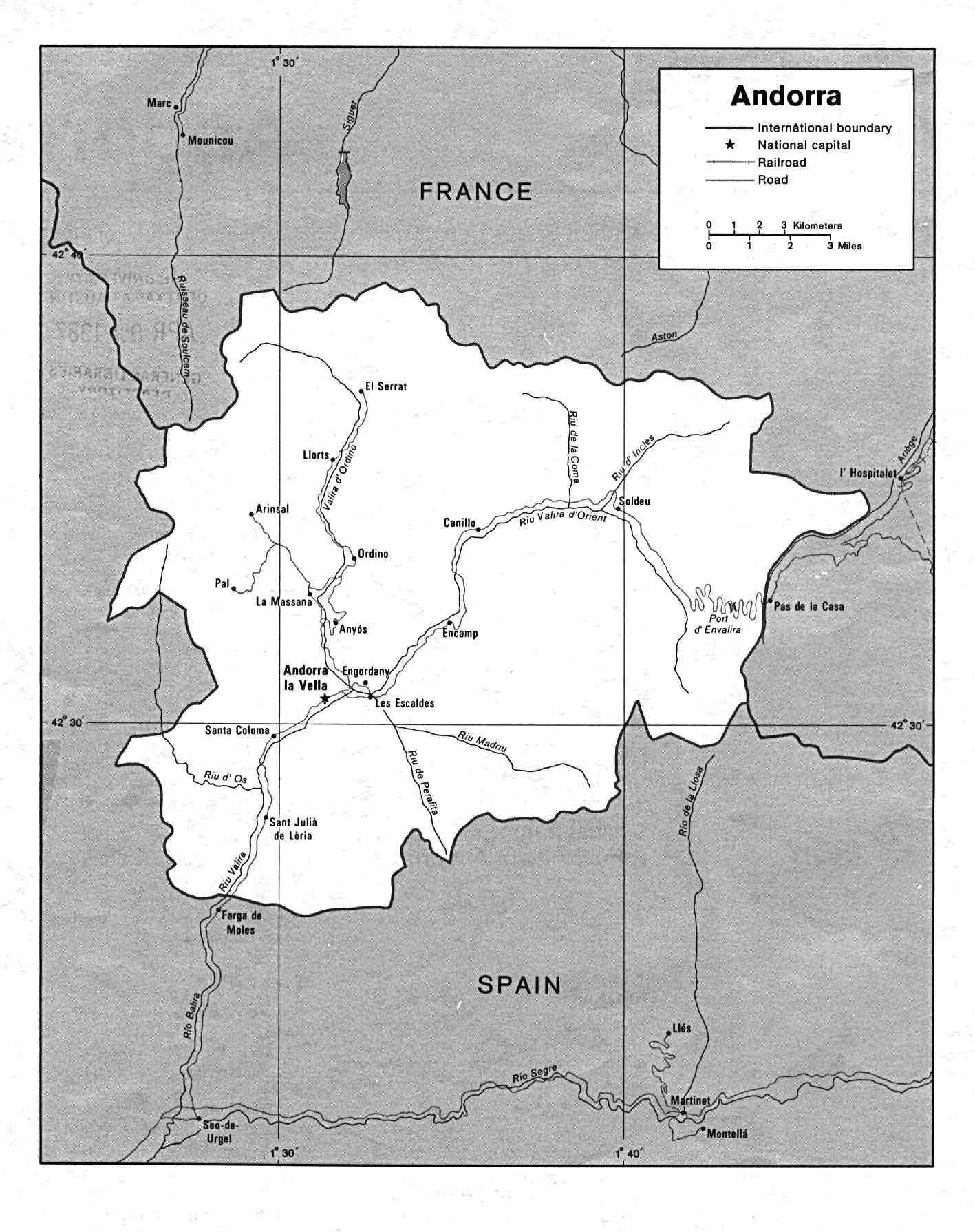
Andorra is a small landlocked country located in the eastern Pyrenees mountains of southwestern Europe, bordered by France to the north and Spain to the south. Its capital and largest city is Andorra la Vella. The country's geography is characterized by a mountainous landscape with a few narrow valleys. To find Andorra on a map, you can look for the coordinates 42.5063° N, 1.5218° E.
Explore the small but beautiful principality of Andorra, nestled in the heart of the Pyrenees mountains between France and Spain. With our interactive map tool, you can zoom in and out to see detailed views of Andorra's charming towns, stunning natural landscapes, and world-class ski resorts.
Despite its small size, Andorra has a lot to offer visitors. Known for its excellent skiing and snowboarding, the country is home to some of the best ski resorts in Europe, including Grandvalira and Vallnord. In the summer, visitors can enjoy hiking, mountain biking, and other outdoor activities in the beautiful Pyrenees mountains.
But Andorra is more than just a destination for outdoor enthusiasts. The country also has a rich history and culture, with a unique blend of Catalan and French influences. Visitors can explore historic churches and museums, shop in tax-free boutiques, and sample delicious local cuisine.
So come explore Andorra on WorldMap1's interactive map and start planning your next adventure in this charming European gem!
For more about Andorra >>
Brief information about Andorra
Andorra is a small landlocked country located in the eastern Pyrenees mountains of Europe, between France to the west and Spain to the east. Here are some key facts about Andorra:A Collection of Andorra Maps and Andorra Satellite Images
MAP OF ANDORRA
ANDORRA LOCATION MAP
WHERE IS ANDORRA IN THE WORLD
ANDORRA EARTH MAP
ANDORRA MAP
ANDORRA BLANK PHYSICAL MAP 2008
ANDORRA CITIES MAP
ANDORRA CITIES ROAD MAP
ANDORRA MAP
ANDORRA MAP 2006
ANDORRA MAP EUROPE
ANDORRA PROVINCES CITIES MAP
ANDORRA ROAD MAP

ANDORRA SEVEN PARISHES MAP
ANDORRA SEVEN PARISHES MAP 2006
ANDORRA TOURISTIC MAP
CITIES MAP OF ANDORRA
COUNTRY PHYSICAL MAP OF ANDORRA
MAP OF ANDORRA
PHYSICAL MAP OF ANDORRA

PHYSICAL MAP OF ANDORRA 2009
POLITICAL MAP OF ANDORRA
POLITICAL MAP OF ANDORRA 1986
SATELLITE IMAGE PHOTO OF ANDORRA
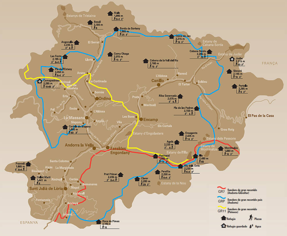
SKIING MAP IN ANDORRA
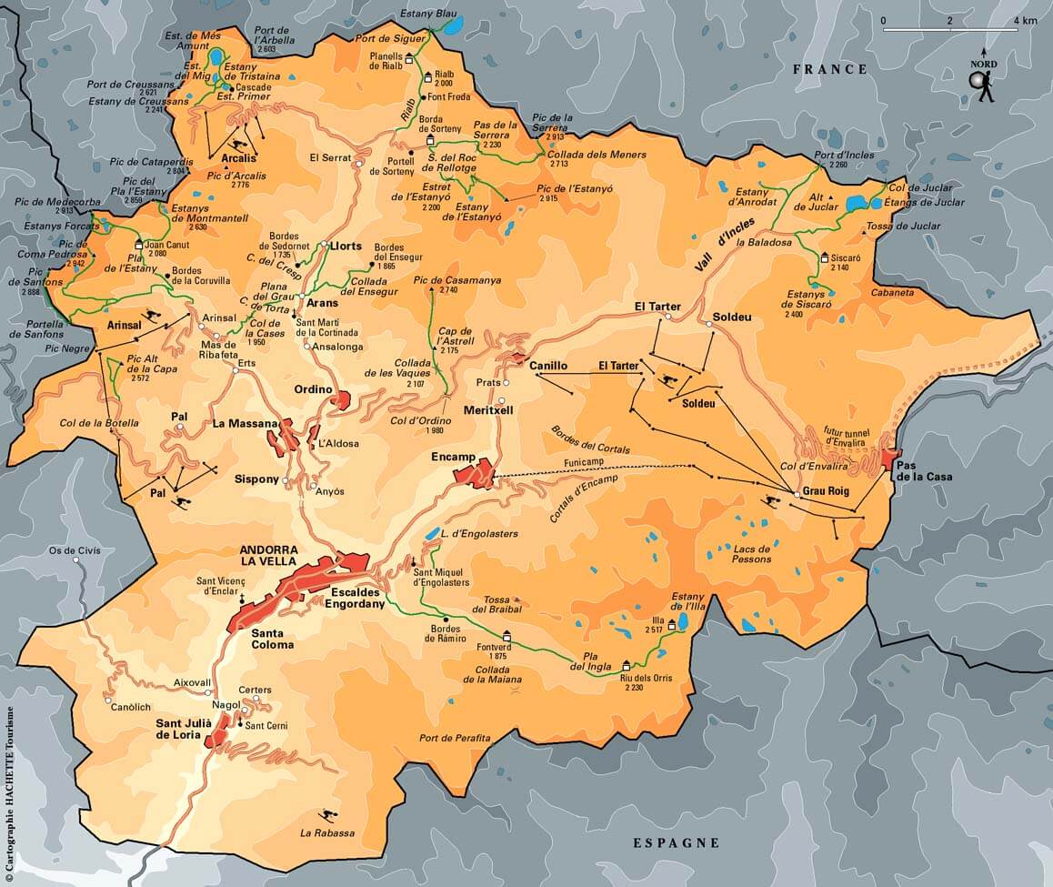
TOURIST MAP OF ANDORRA
- Head of Performance Marketing
- Head of SEO
- Linkedin Profile: linkedin.com/in/arifcagrici