Eritrea Map FQA
How many cities are in Eritrea ?
Eritrea has about 10 cities. The largest are: Asmara, Keren, Massawa, Assab, Mendefera, Barentu, Adi Keyh, Edd, Dekemhare, and Teseney.
What are the major geographical features of Eritrea ?
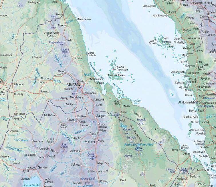
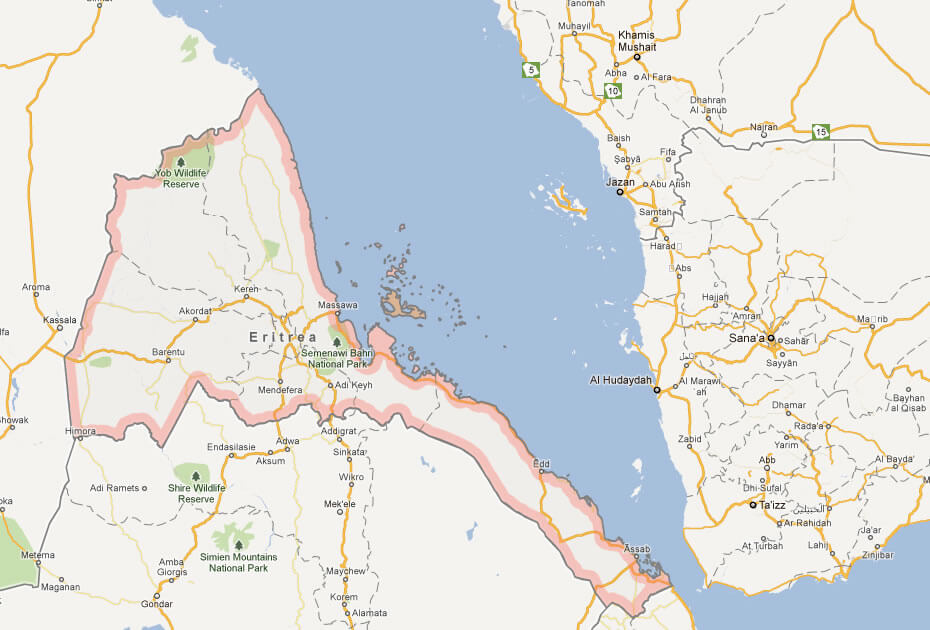
Eritrea in the Horn of Africa has a Red Sea coastline, the Eritrean Highlands, and arid lowlands. Its geography includes escarpments, plateaus, and river valleys such as the Barka and Anseba.
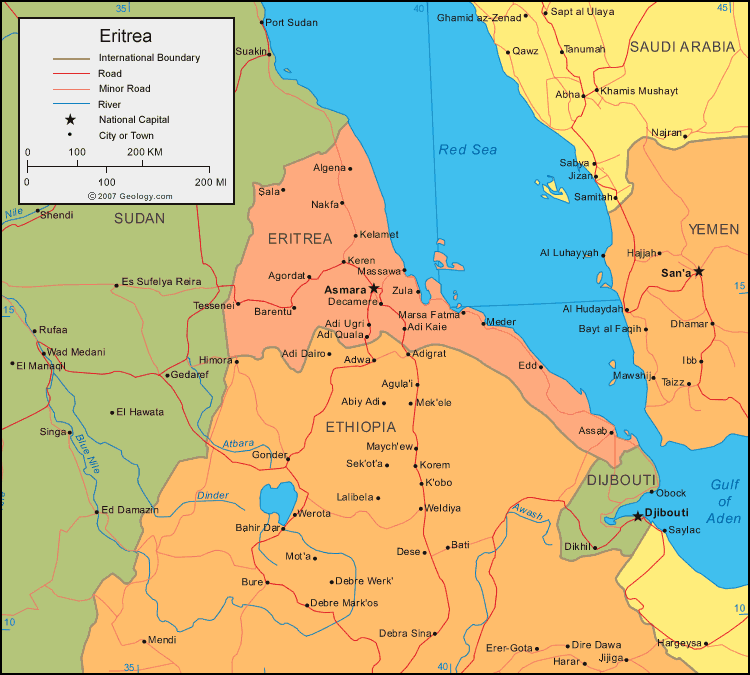
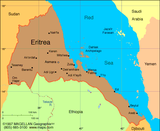
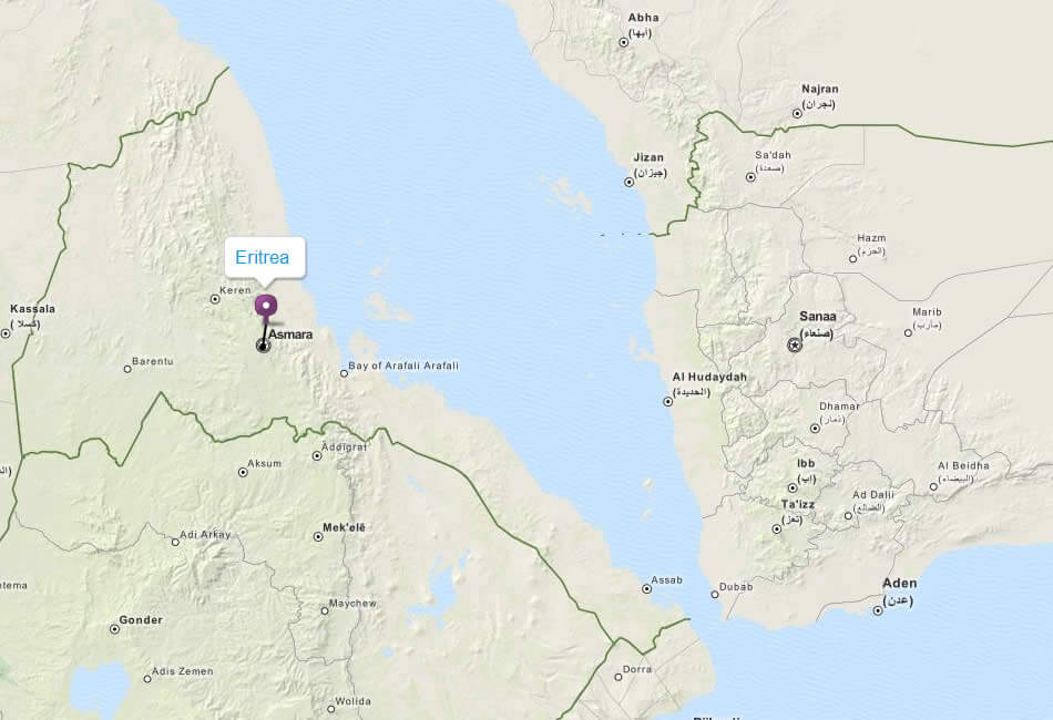
MAP OF ERITREA

ERITREA MAP
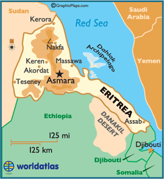
ERITREA LOCATION MAP

Can I download a high-resolution map of Eritrea ?
Yes. Download high-resolution political and physical maps of Eritrea for personal or educational use. Redistribution is subject to the terms of our license.

- Capital :
Asmara
- Population :
6,086,495
- GDP :
$3.108 billion
- Per Capita :
$549
- Calling Code :
+291
- Jobless Rate :
14.50%
- Time Zone :
+3
With interactive Eritrea Map, view regional highways maps, road situations, transportation, lodging guide, geographical map, physical maps and more information. On Eritrea Map, you can view all states, regions, cities, towns, districts, avenues, streets and popular centers' satellite, sketch and terrain maps.
For more about Eritrea >>
A Collection of Eritrea Maps and Eritrea Satellite Images
MAP OF ERITREA
ERITREA MAP
ERITREA LOCATION MAP
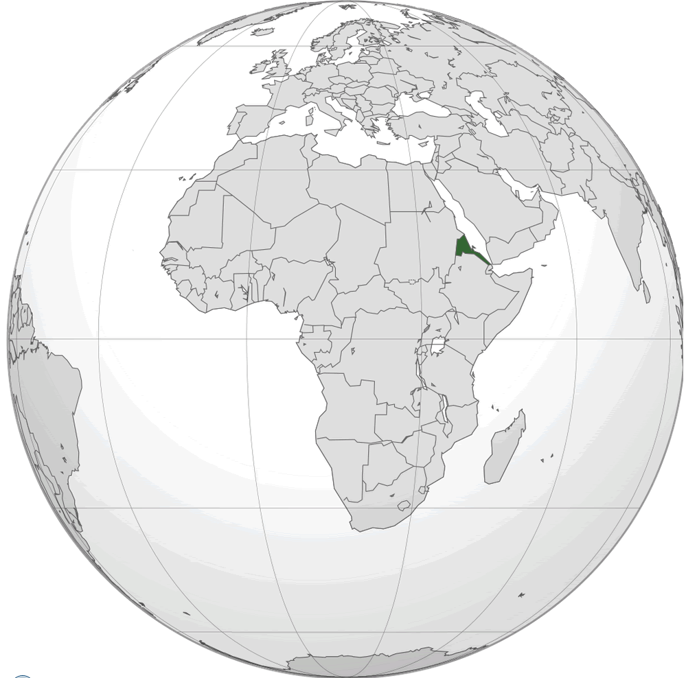
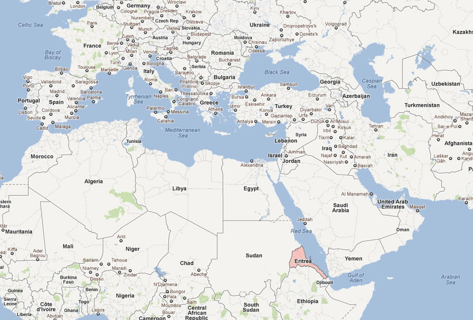
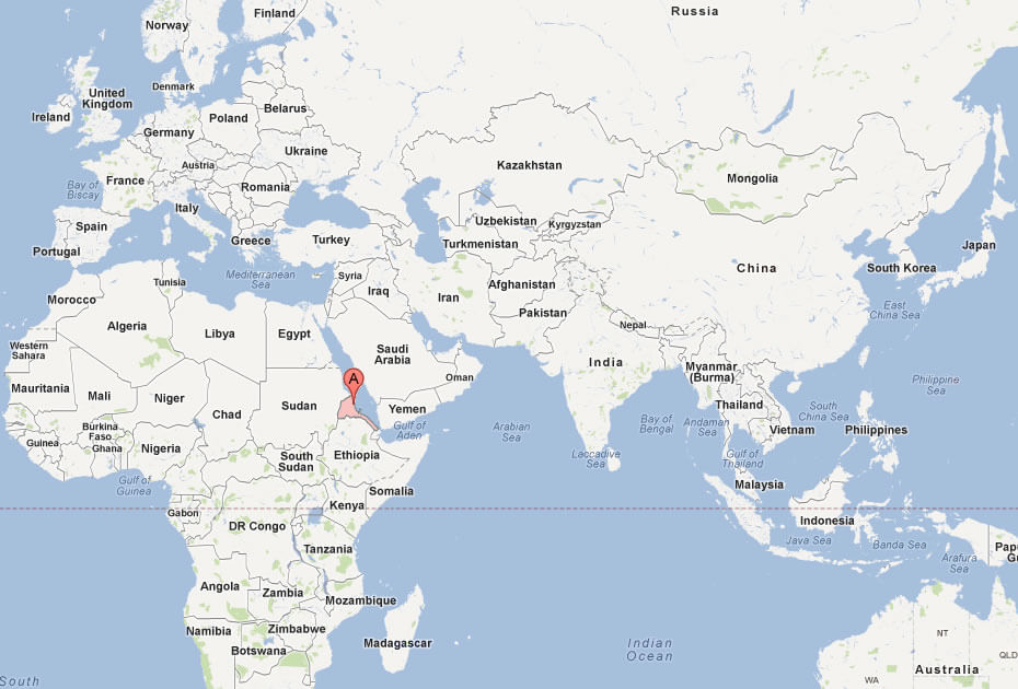
WHERE IS ERITREA IN THE WORLD
ERITREA PHYSICAL MAP
ERITREA POLITICAL MAP

ERITREA MAP

ERITREA
ERITREA MAP

ERITREA ROAD MAP

MAP OF ERITREA AFRICA
MAP OF ERITREA WORLD
MAP OF ERITREA
MAP ERITREA

MAP OF ERITREA
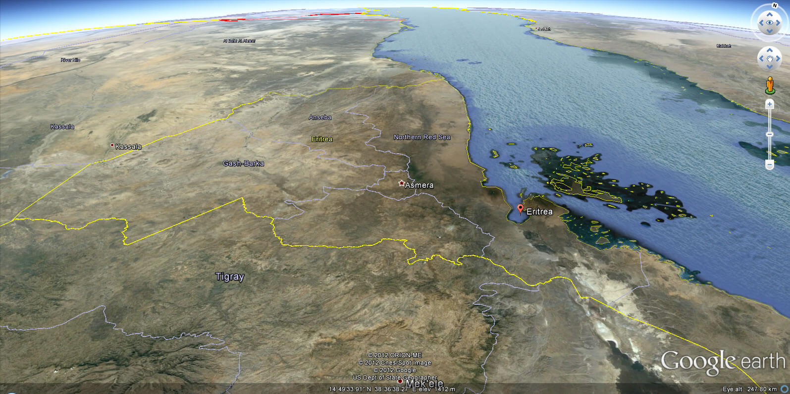
ERITREA EARTH MAP
Author: Arif Cagrici
