Jersey Map FQA
How many cities are in Jersey ?
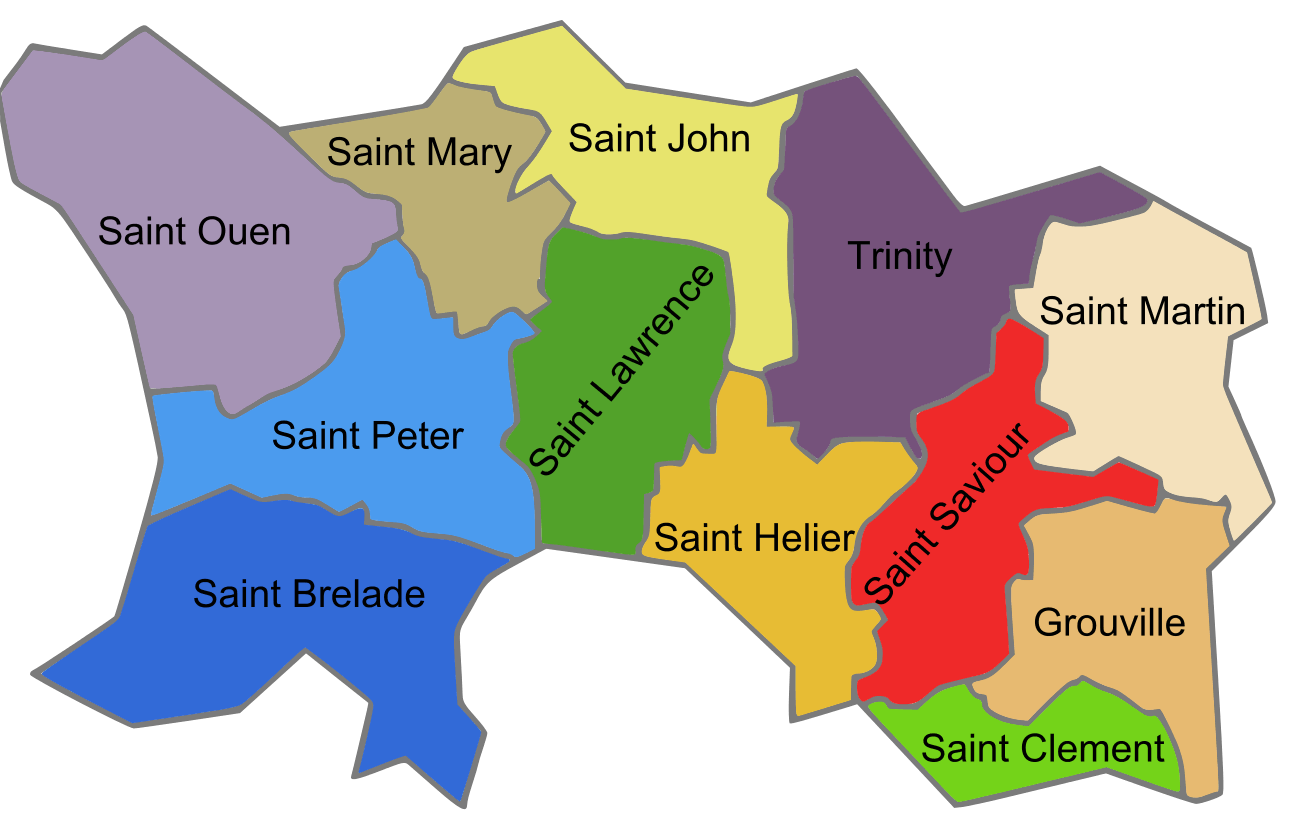
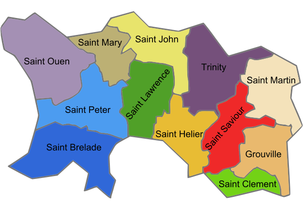
Jersey has no large cities. The main settlements are Saint Helier, Saint Saviour, Saint Clement, Saint Brelade, and Saint Lawrence.
What are the major geographical features of Jersey ?
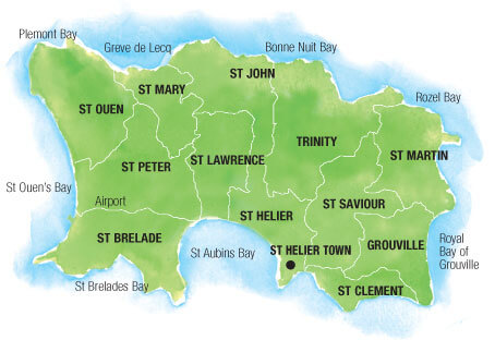
Jersey, one of the Channel Islands, has rugged cliffs on the north coast, sandy beaches to the south, and fertile agricultural land inland. It is characterized by low hills and coastal features.
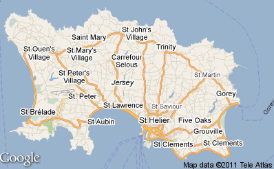
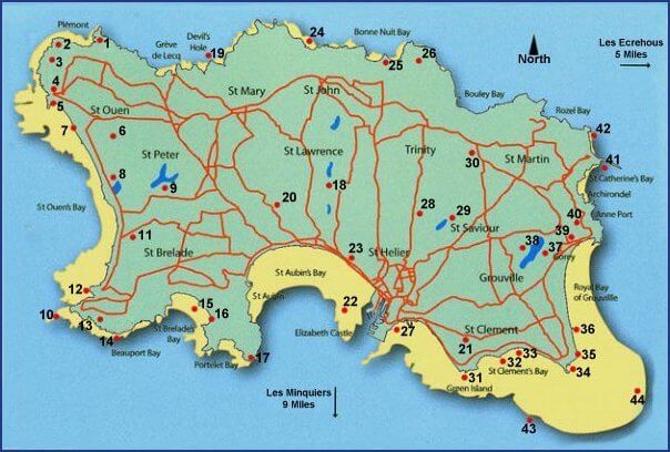
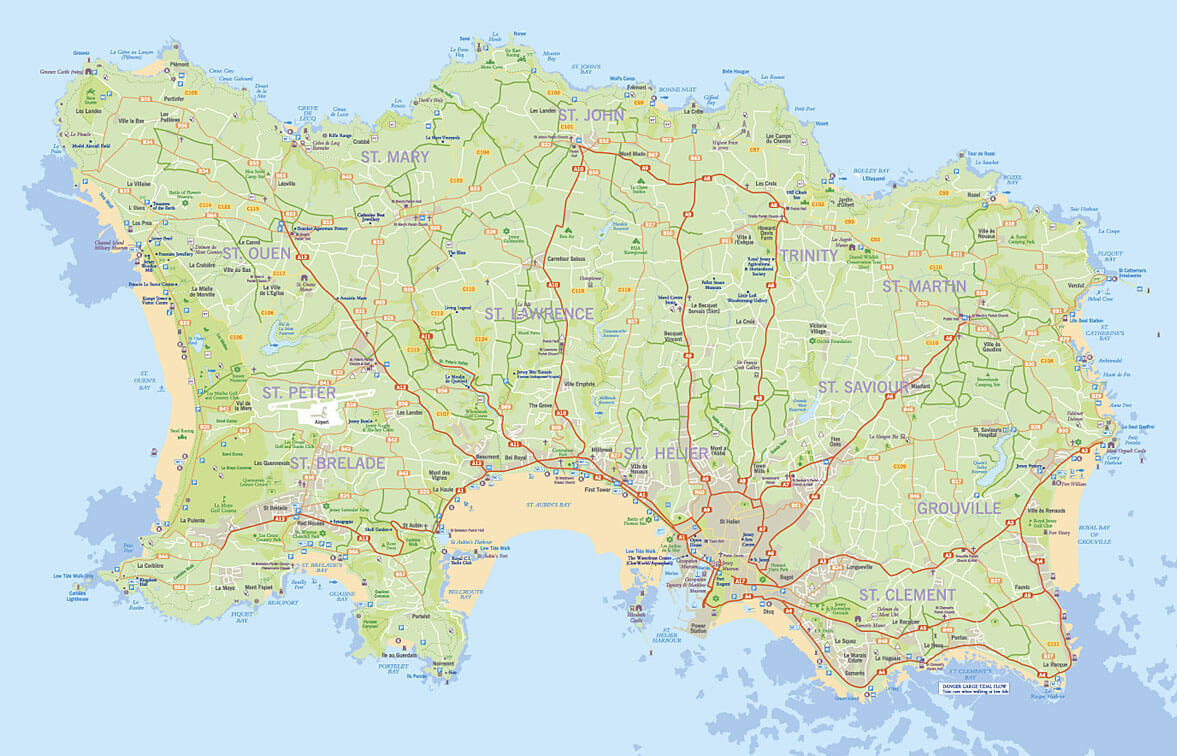
MAP OF JERSEY

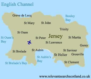
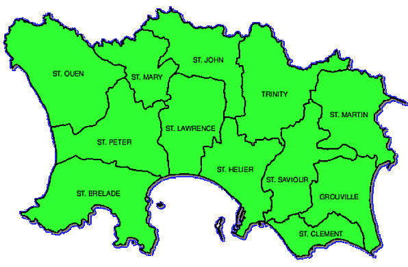
MAP OF PARISHES OF JERSEY
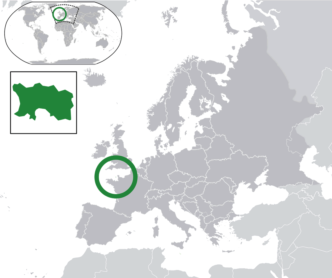
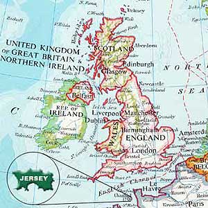
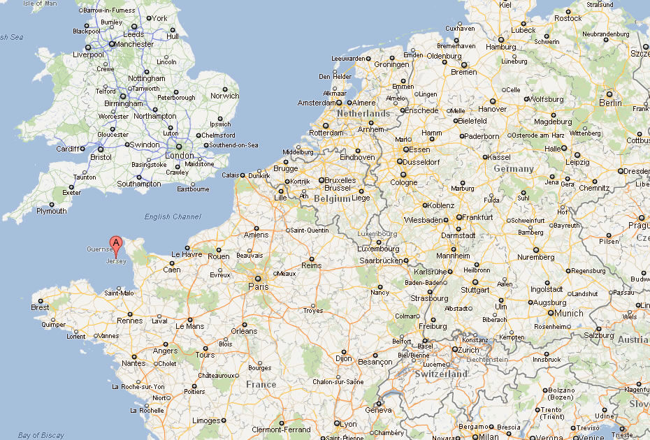
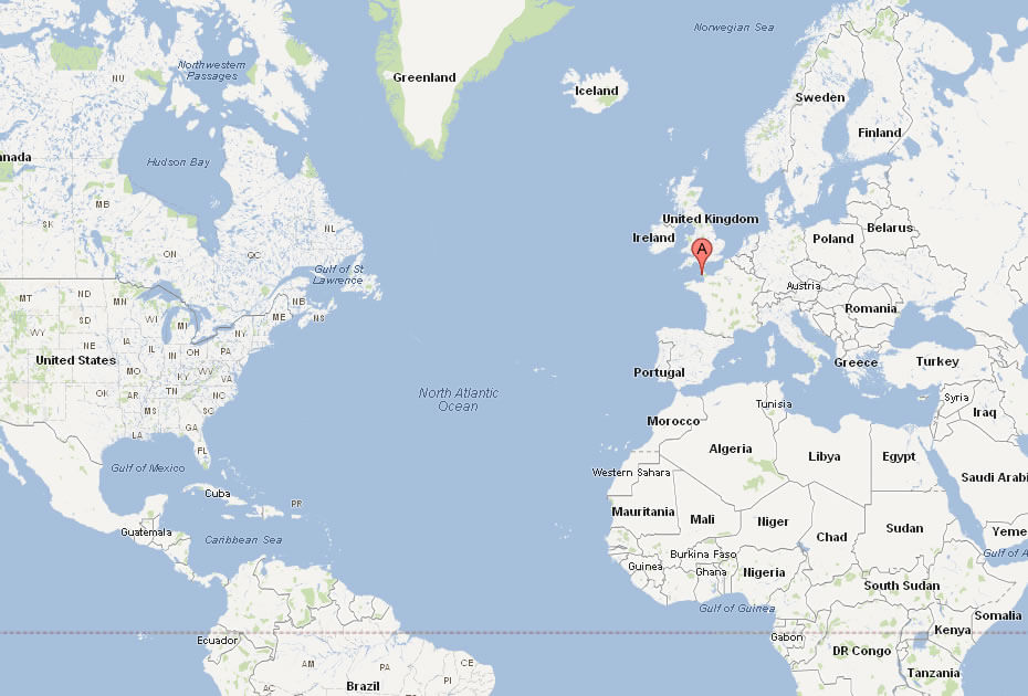
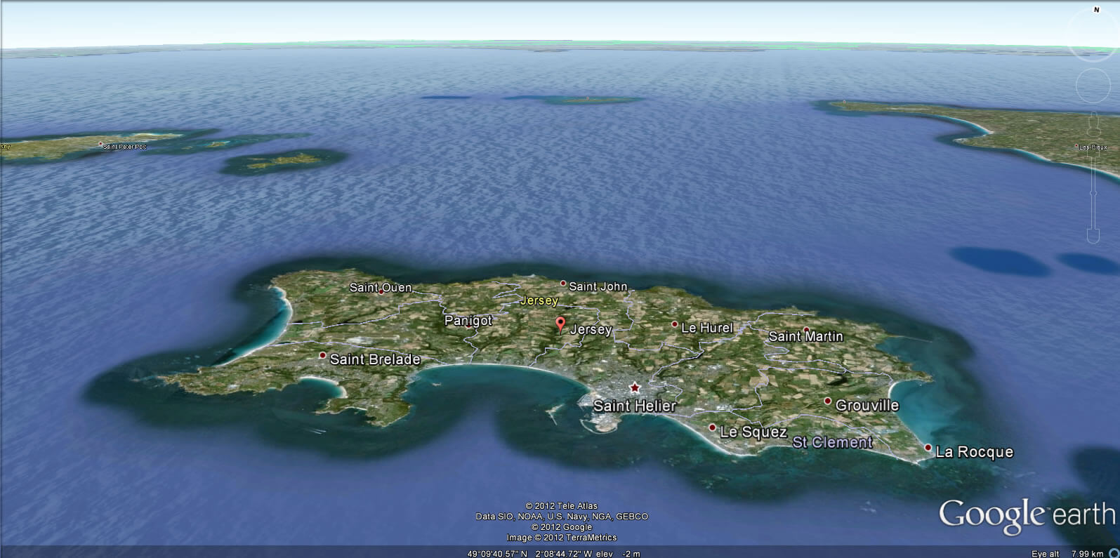
WHERE IS JERSEY IN THE WORLD
Can I download a high-resolution map of Jersey ?
Yes. Download high-resolution political and physical maps of Jersey for personal or educational use. Redistribution is subject to the terms of our license.
- Capital :
Saint Helier
- Population :
97,857
- GDP :
$5.1 billion (166th)
- Per Capita :
$57,000 (6th)
- Calling Code :
+44
- Jobless Rate :
N/A
- Time Zone :
+0
With interactive Jersey Map, view regional highways maps, road situations, transportation, lodging guide, geographical map, physical maps and more information. On Jersey Map, you can view all states, regions, cities, towns, districts, avenues, streets and popular centers' satellite, sketch and terrain maps.
For more about Jersey >>
A Collection of Jersey Maps and Jersey Satellite Images
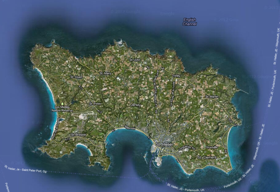
MAP OF JERSEY
MAP OF PARISHES OF JERSEY
WHERE IS JERSEY IN THE WORLD
JERSEY MAP
JERSEY CITIES MAP
JERSEY MAP
JERSEY MAP ENGLAND
JERSEY MAP TOWNS
JERSEYMAP
MAP OF JERSEY ENGLAND FRANCE
MAP OF JERSEY WORLD
MAP OF JERSEY

POLITICAL MAP OF JERSEY
ROAD MAP OF JERSEY
JERSEY EARTH MAP
Author: Arif Cagrici
Largest Cities' Map of Jersey
