Luxembourg Map FQA
How many cities are in Luxembourg ?
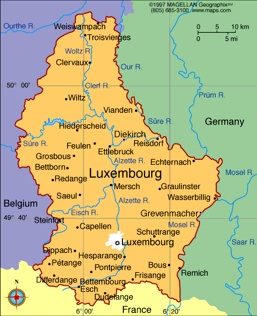
There are 12 cities in Luxembourg. The largest by population are: Luxembourg; Esch-sur-Alzette; Differdange; Dudelange; Pétange; Sanem; Hesperange; Bettembourg; Schifflange; Ettelbruck.
What are the major geographical features of Luxembourg ?
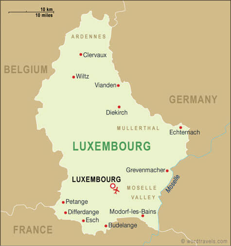
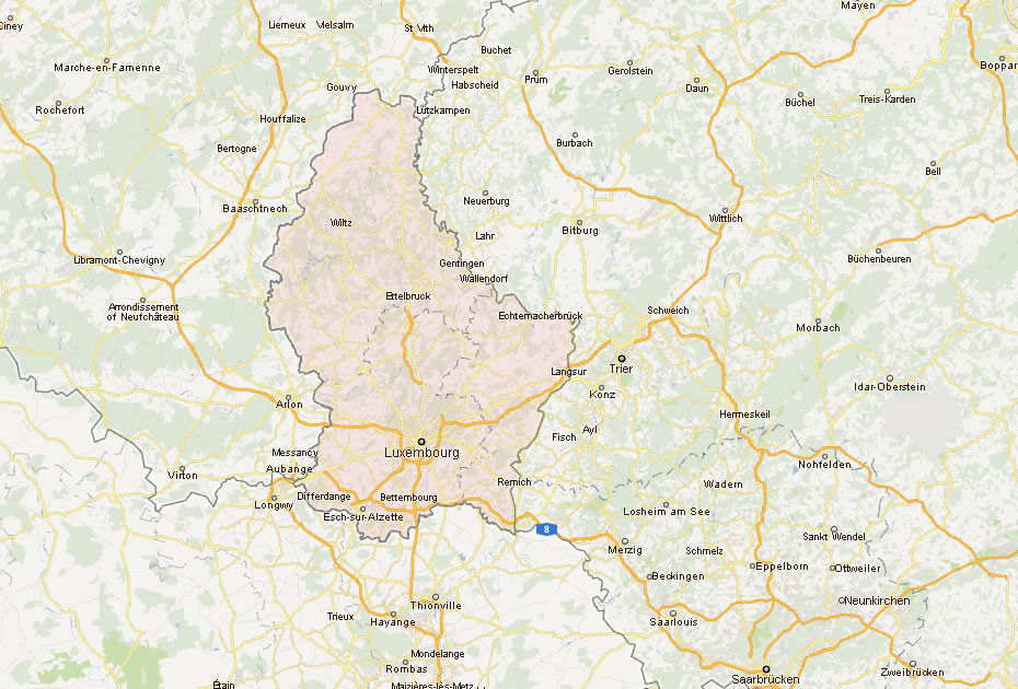
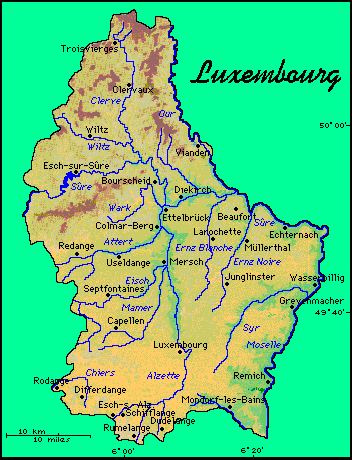
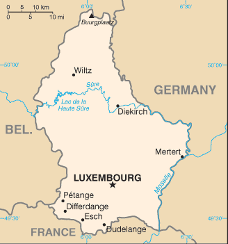
Luxembourg is a small landlocked country in Western Europe. It features the Ardennes highlands in the north, rolling hills in the center, and the Moselle River valley in the southeast.
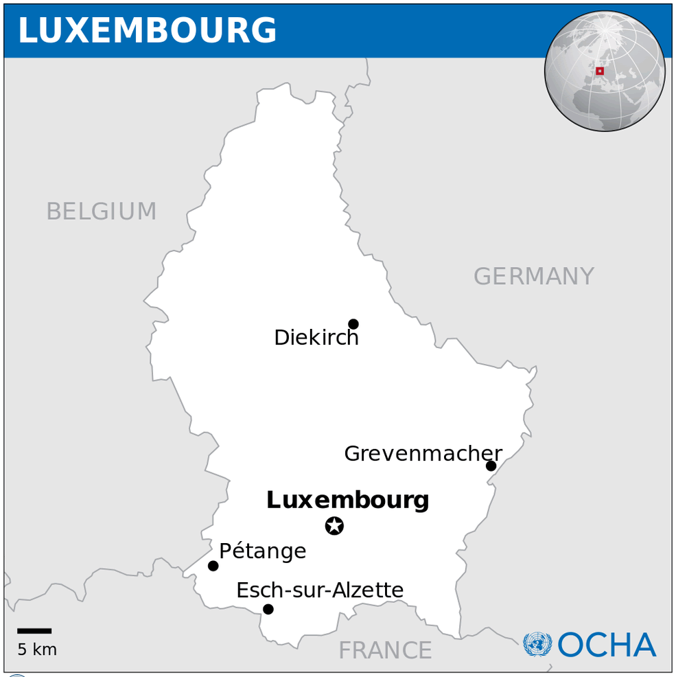
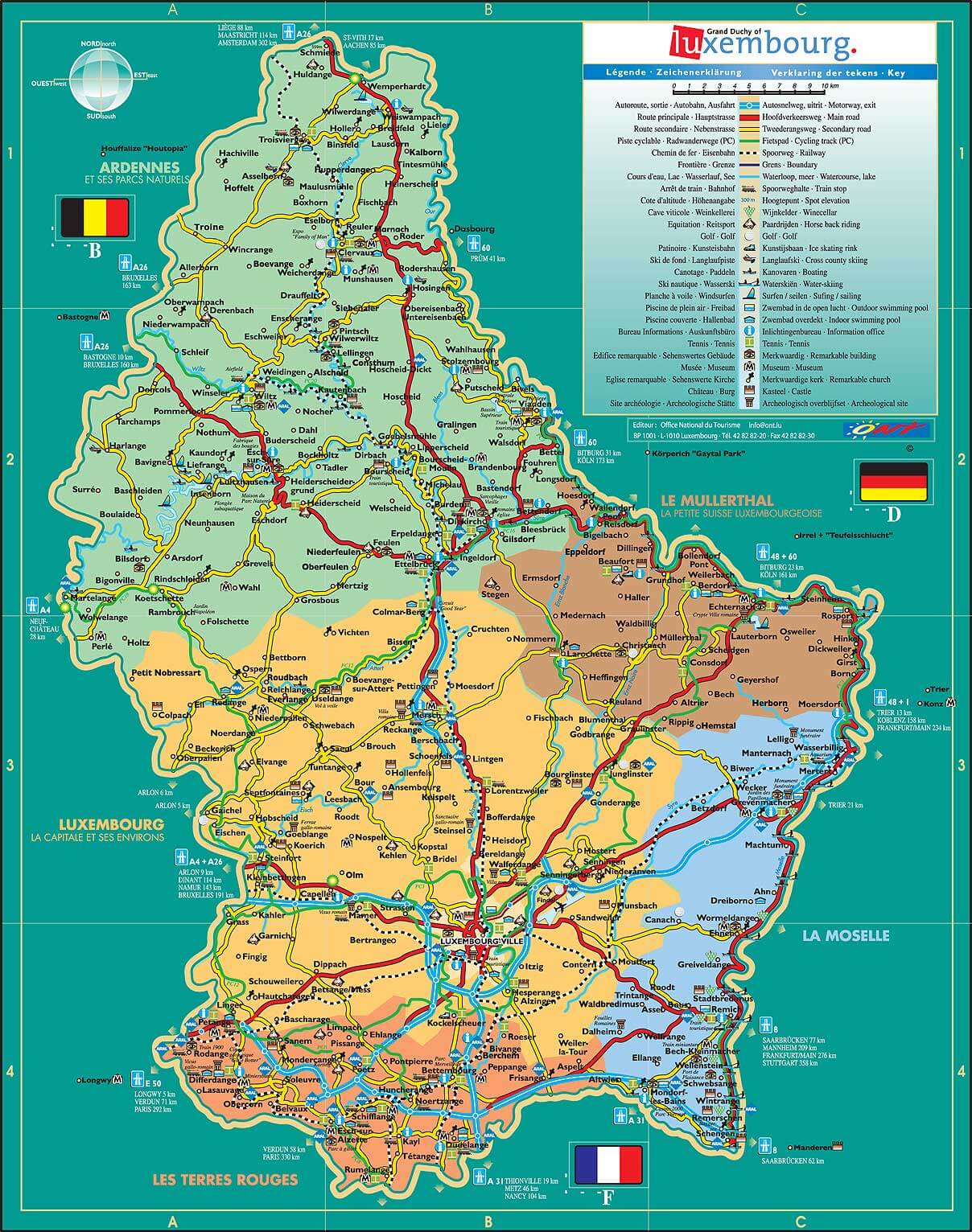
MAP OF LUXEMBOURG

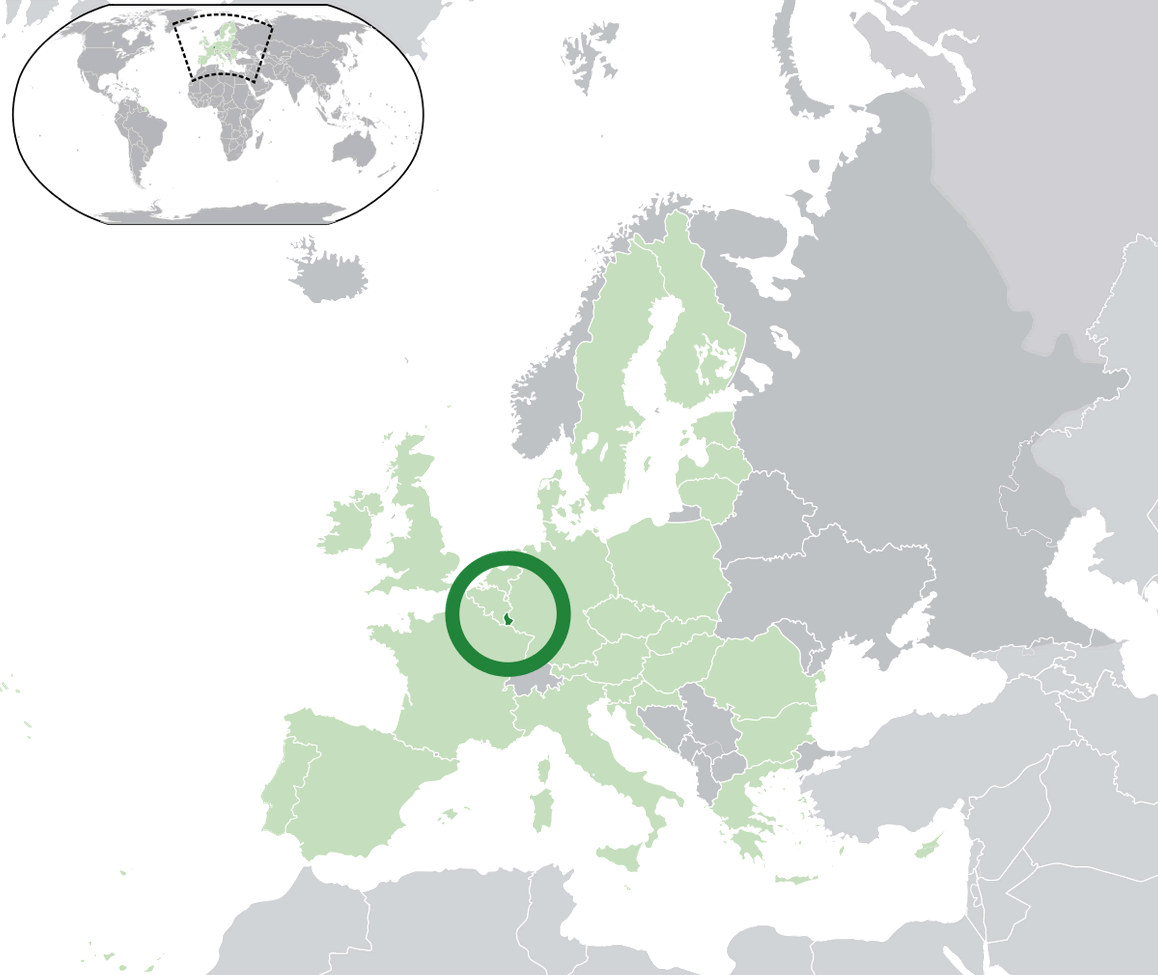
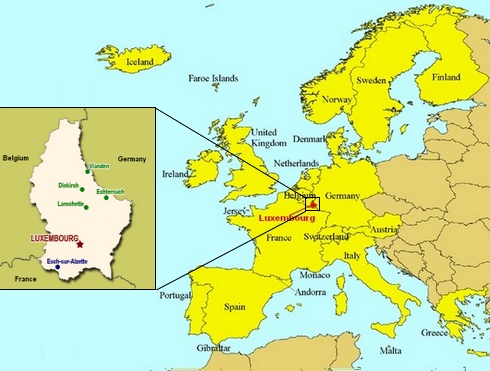
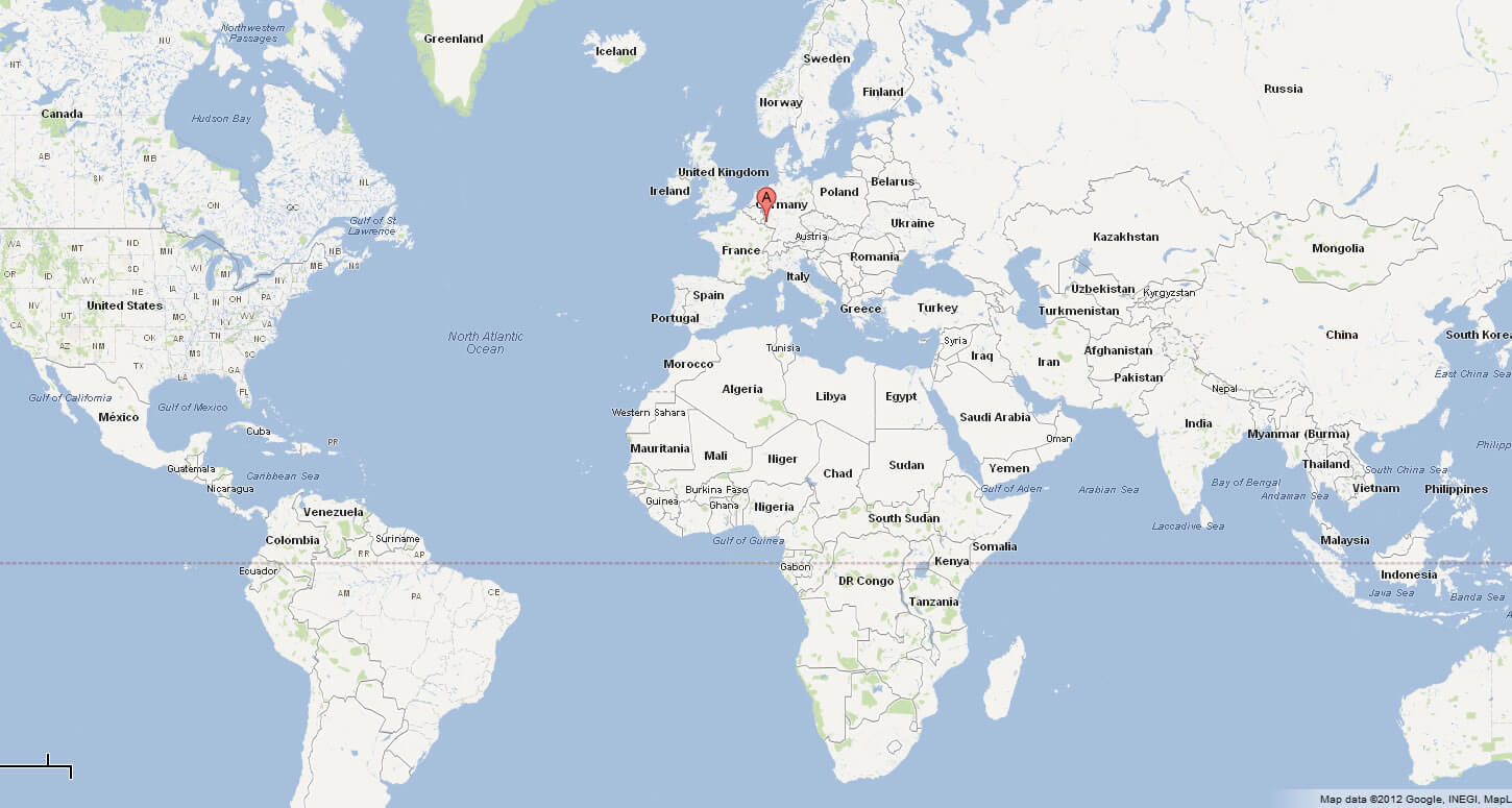
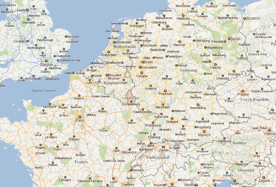
LUXEMBOURG LOCATION MAP
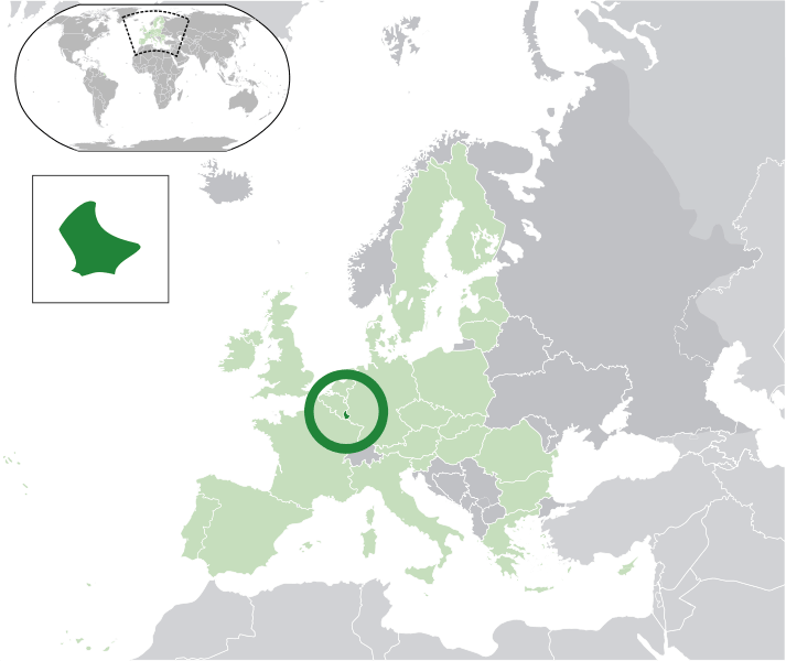
WHERE IS LUXEMBOURG IN THE WORLD
Can I download a high-resolution map of Luxembourg ?
Yes. Download high-resolution political and physical maps of Luxembourg for personal or educational use. Redistribution is subject to the terms of our license.

- Capital :
Luxembourg
- Population :
524,853
- GDP :
$58.412 billion (69th)
- Per Capita :
$113,533 (3rd)
- Calling Code :
+352
- Jobless Rate :
6.40%
- Time Zone :
+1
With interactive Luxembourg Map, view regional highways maps, road situations, transportation, lodging guide, geographical map, physical maps and more information. On Luxembourg Map, you can view all states, regions, cities, towns, districts, avenues, streets and popular centers' satellite, sketch and terrain maps.
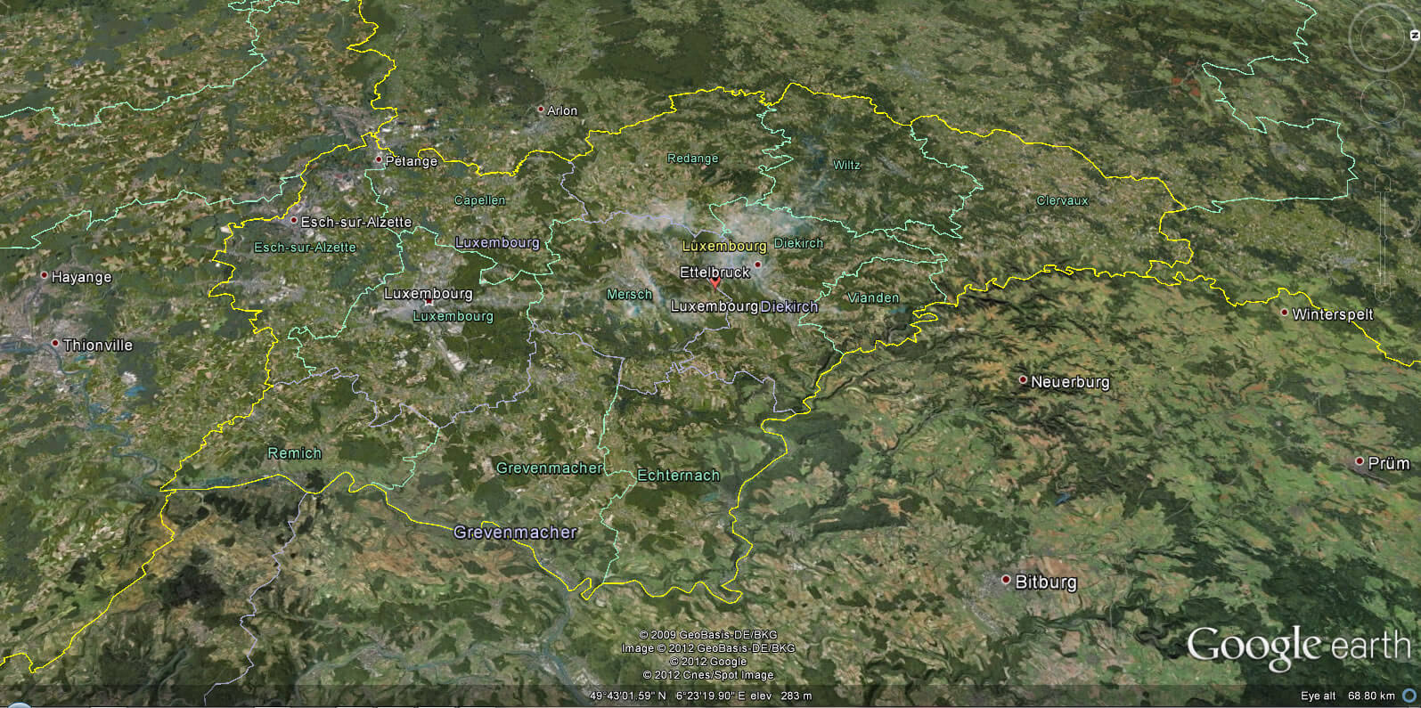
A Collection of Luxembourg Maps and Luxembourg Satellite Images
MAP OF LUXEMBOURG

LUXEMBOURG LOCATION MAP
WHERE IS LUXEMBOURG IN THE WORLD
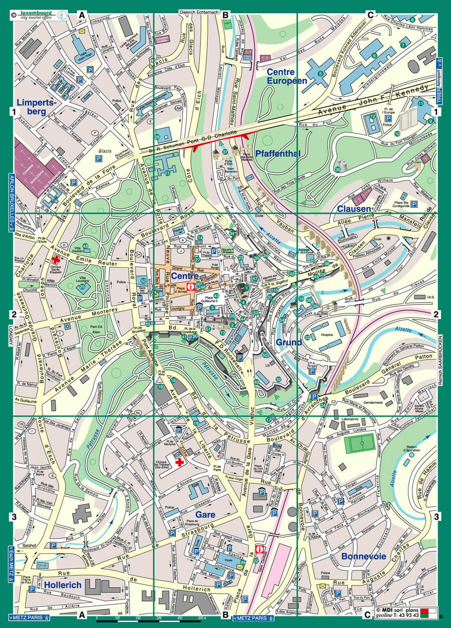
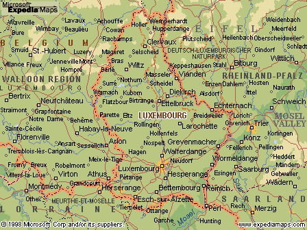
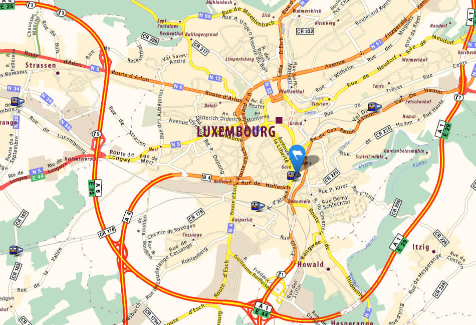
CITY MAP OF LUXEMBOURG
LUXEMBOURG MAP
LUXEMBOURG MAP
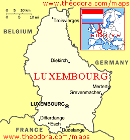
LUXEMBOURG MAP
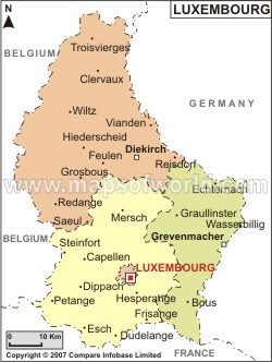
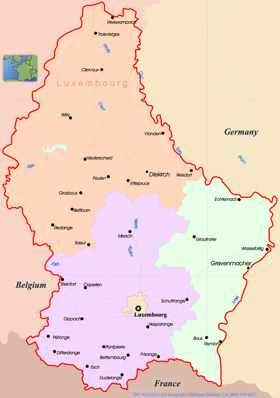
LUXEMBOURG POLITICAL MAP
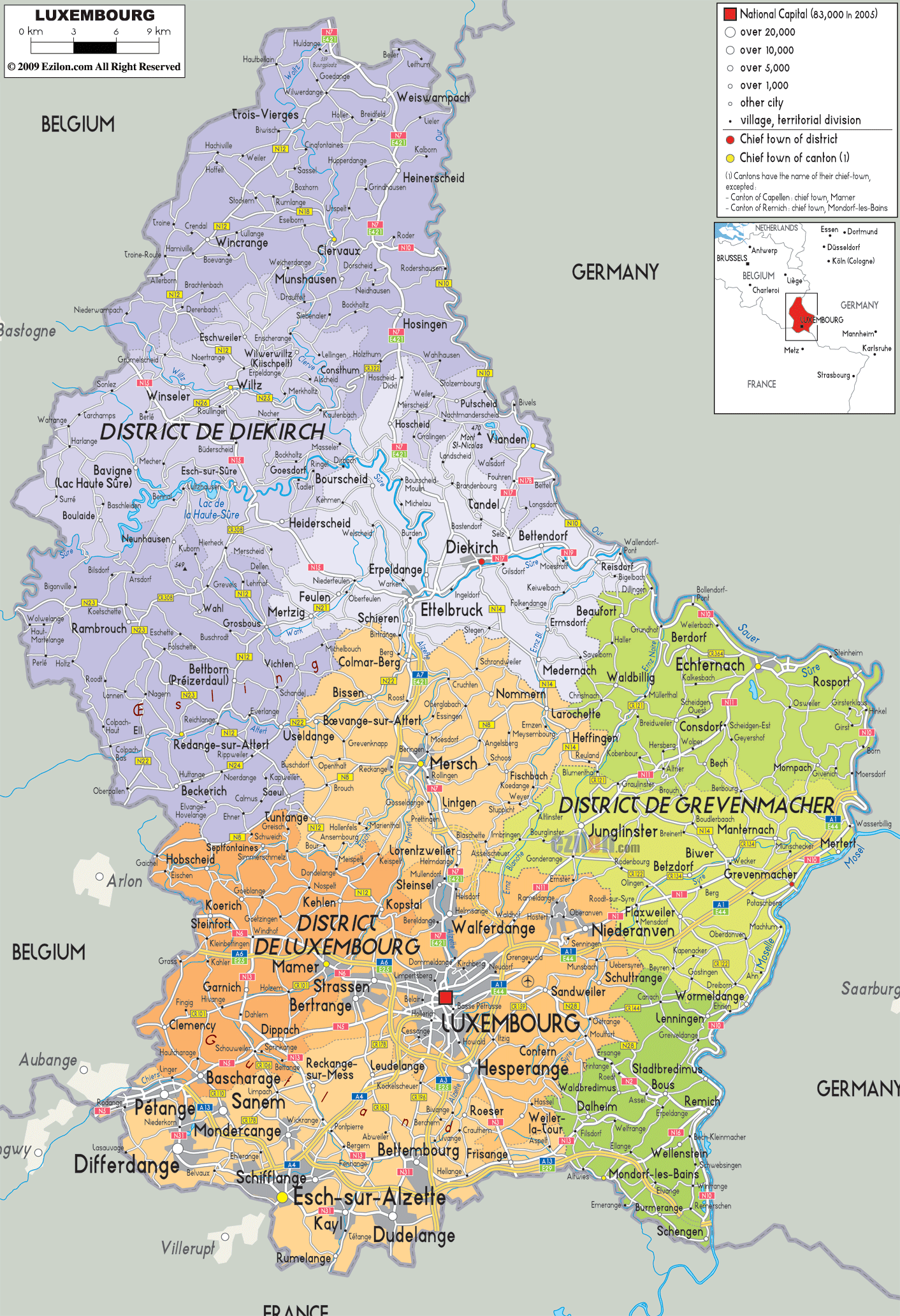
LUXEMBOURG CITIES MAP
LUXEMBOURG MAP
LUXEMBOURG MAP EUROPE
LUXEMBOURG MAPS
LUXEMBOURG POLITICAL MAP
MAP OF LIECHTENSTEIN WORLD
MAP OF LUXEMBOURG EUROPE
MAP OF LUXEMBOURG
MAP LUXEMBOURG
PHYSICAL MAP OF LUXEMBOURG
POLITICAL MAP LUXEMBOURG

LUXEMBOURG EARTH MAP
LUXEMBOURG GERMANY MAP
WHERE IS LUXEMBOURG
FLAG OF LUXEMBOURG

Author: Arif Cagrici
