Mayotte Map FQA
How many cities are in Mayotte ?
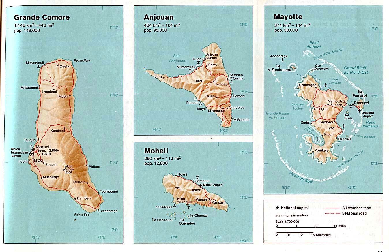
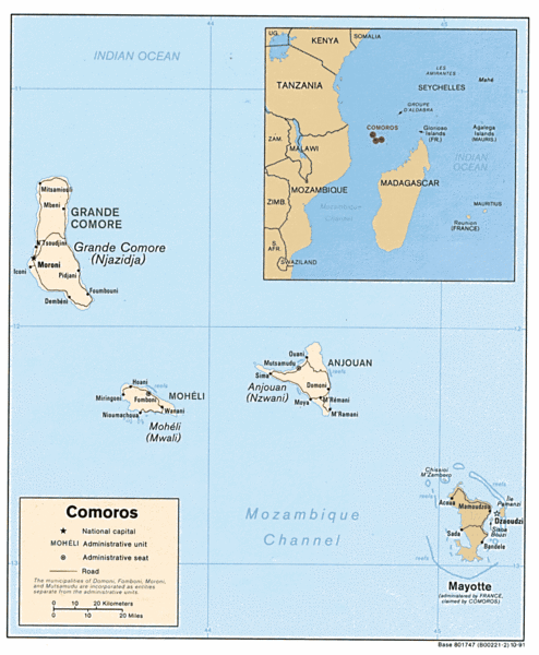
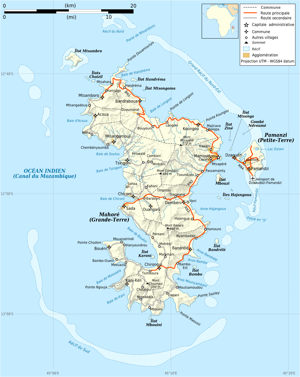
Mayotte has about 5 main towns. The largest are: Mamoudzou; Koungou; Dzaoudzi; Dembeni; Bandrele.
What are the major geographical features of Mayotte ?
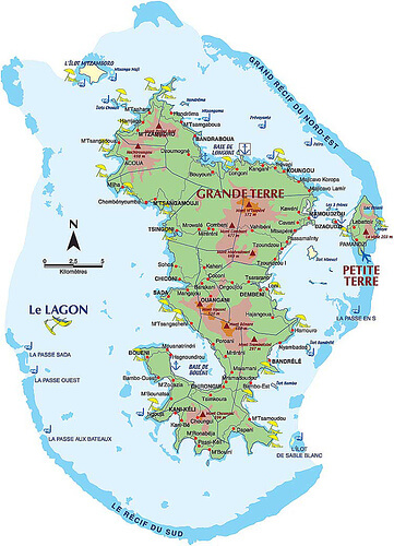
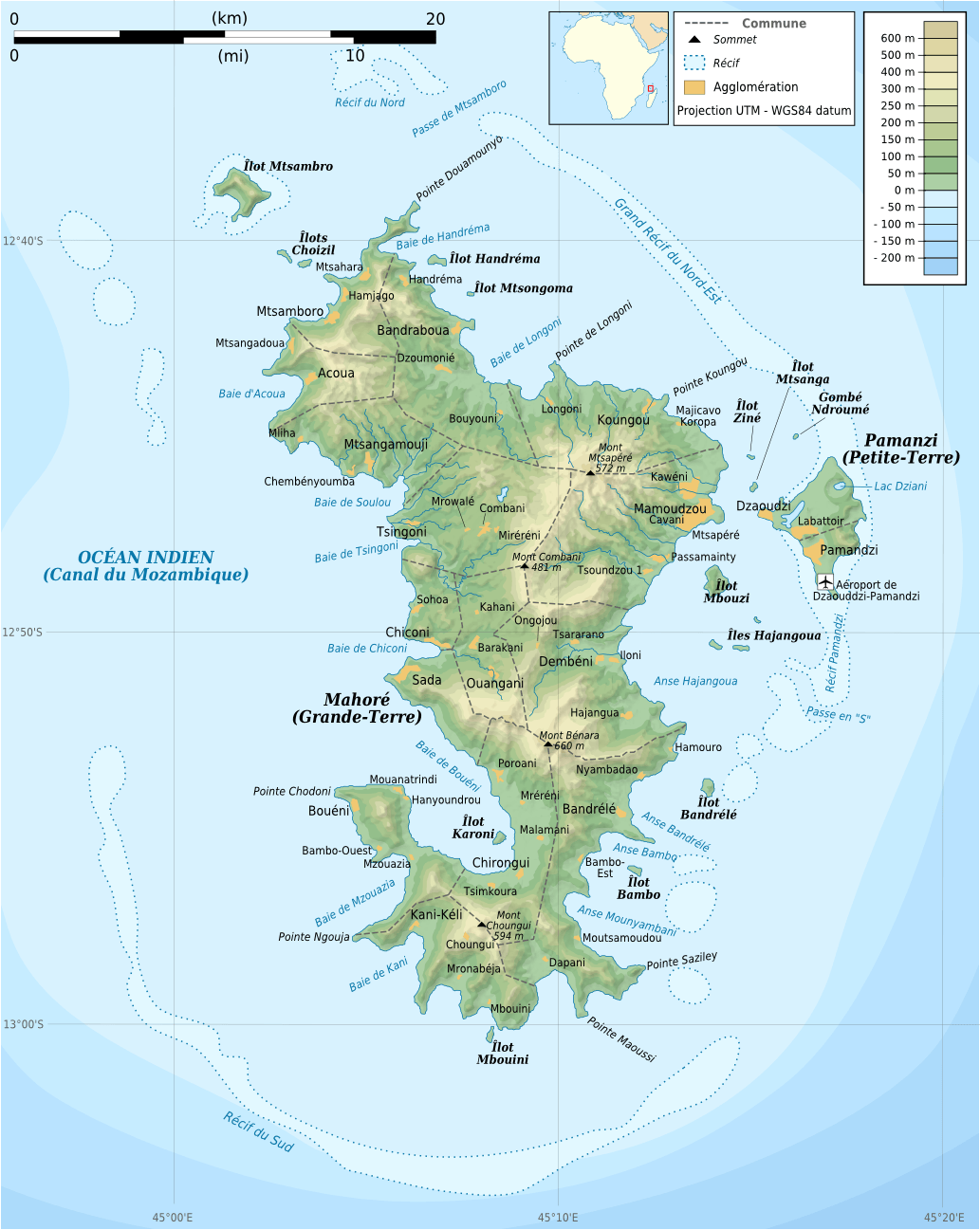
Mayotte, a French overseas territory in the Indian Ocean, consists of volcanic islands. It has mountains, lagoons, and coral reefs.
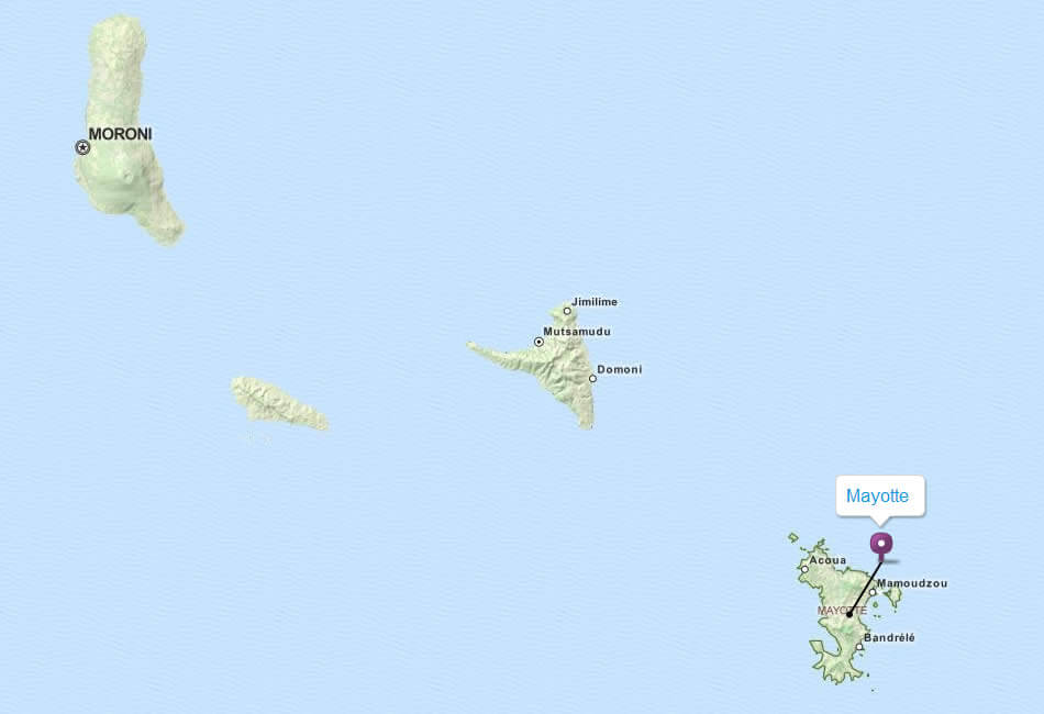
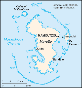
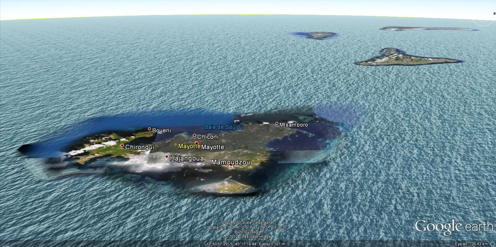
MAP OF MAYOTTE
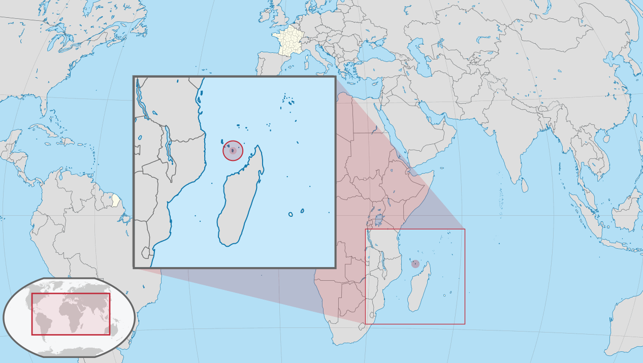
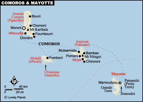
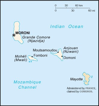
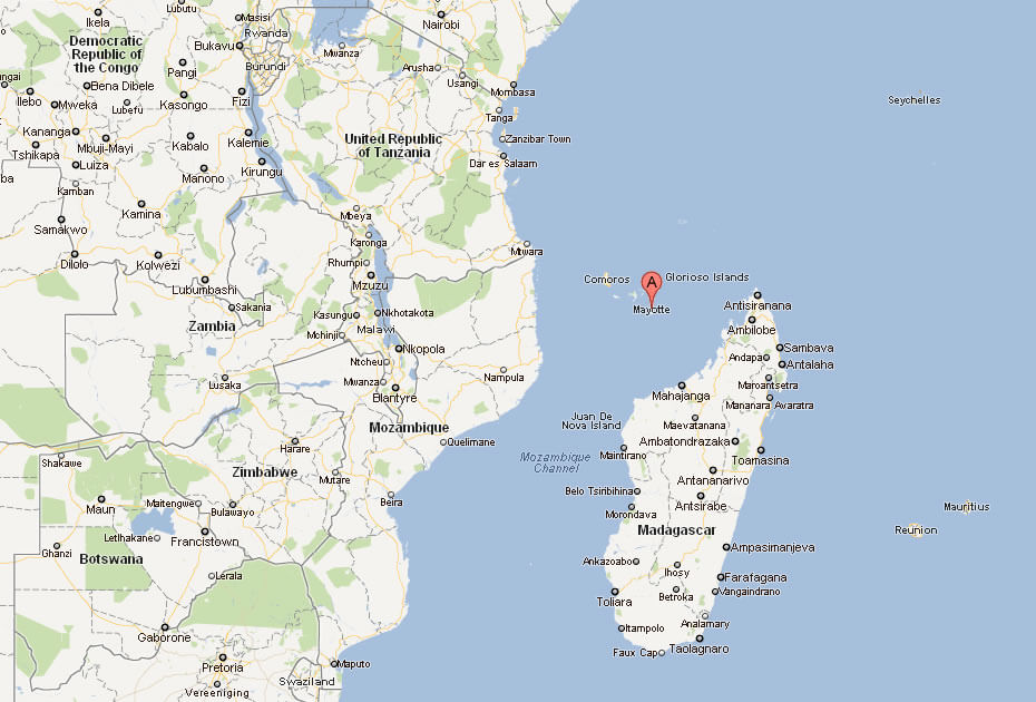
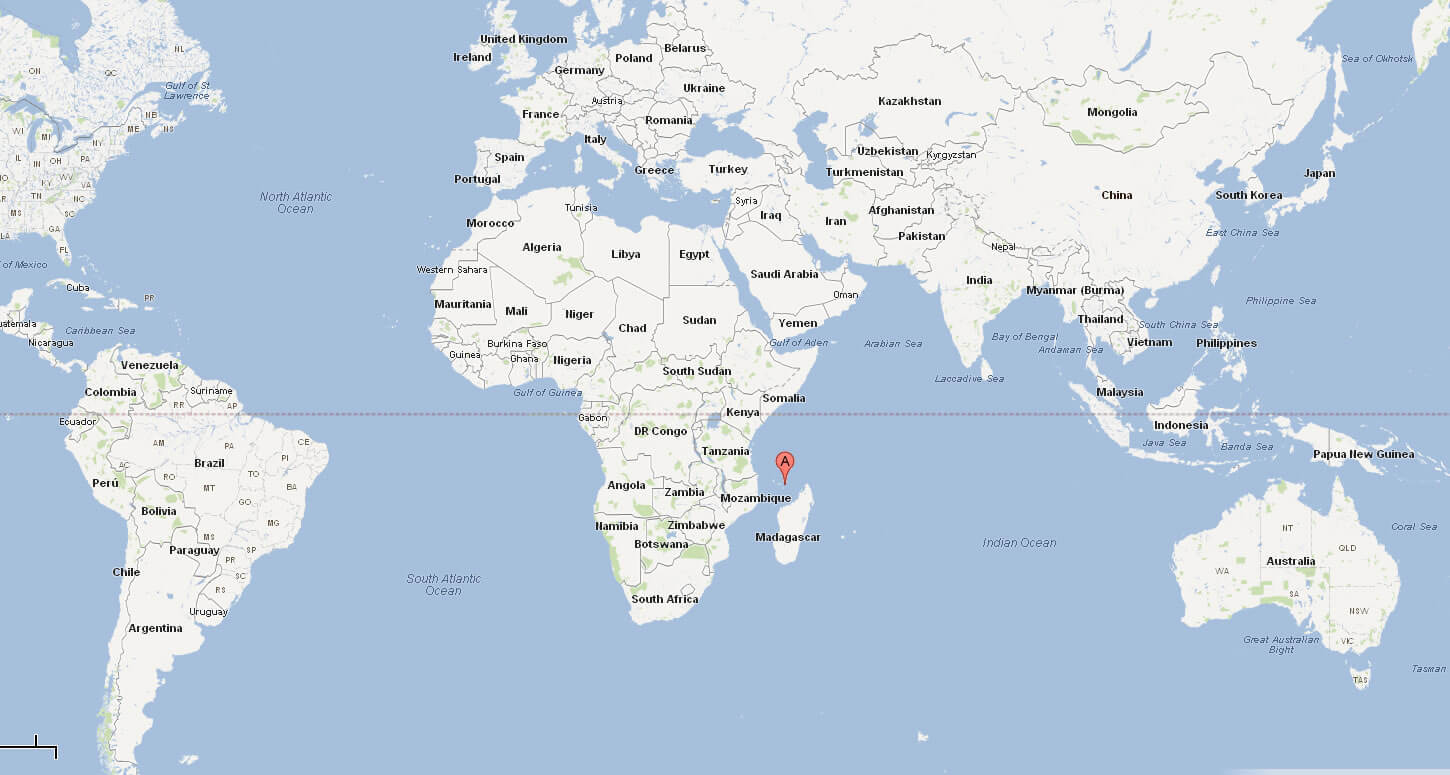
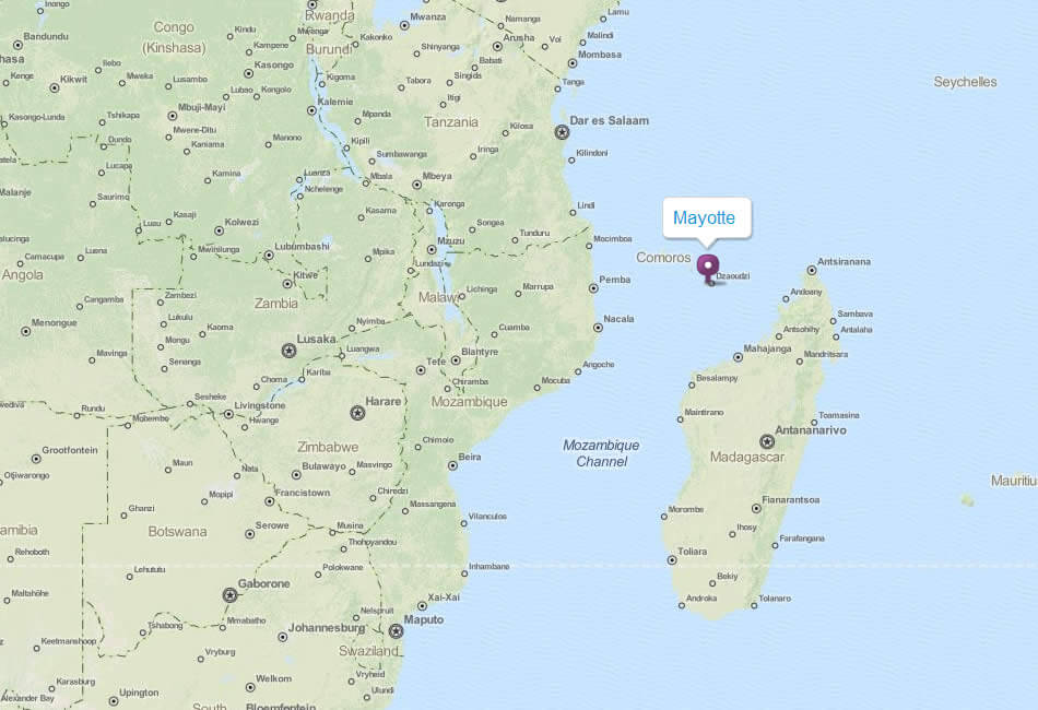
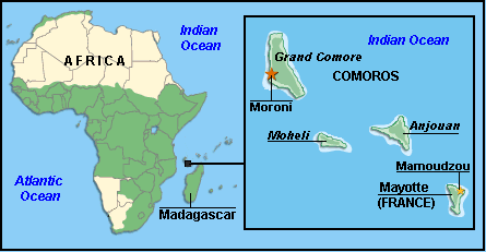
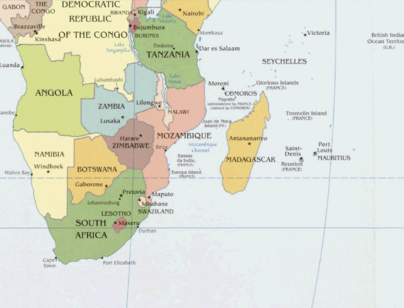
WHERE IS MAYOTTE IN THE WORLD
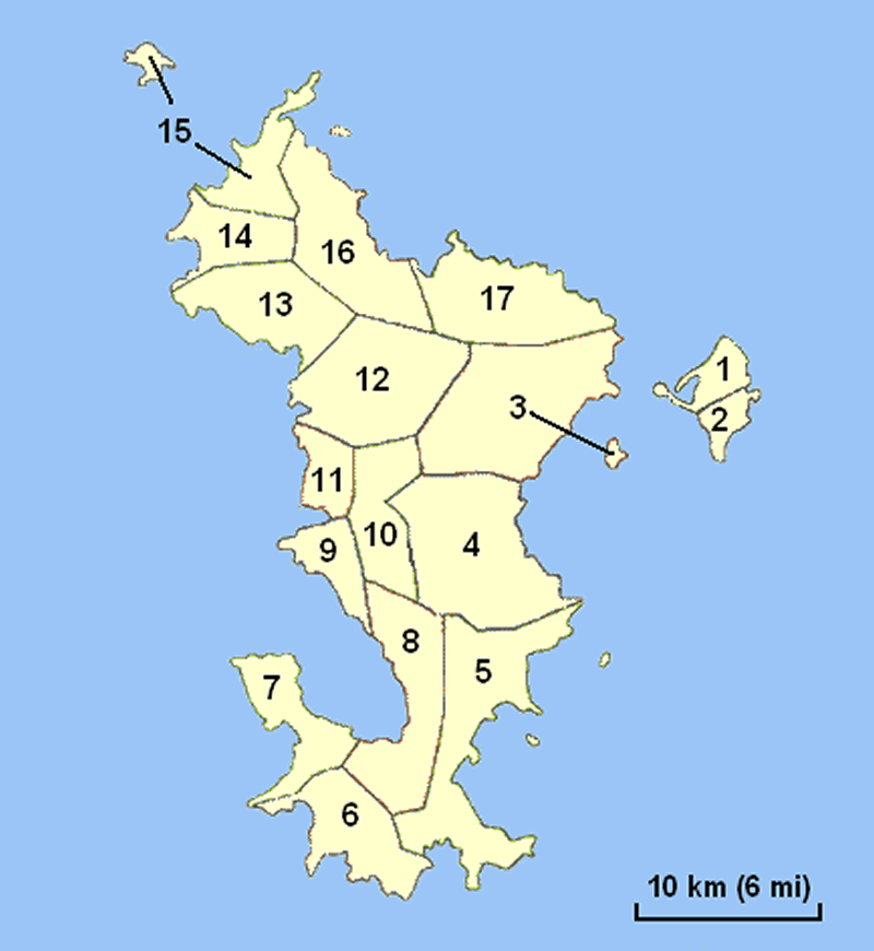
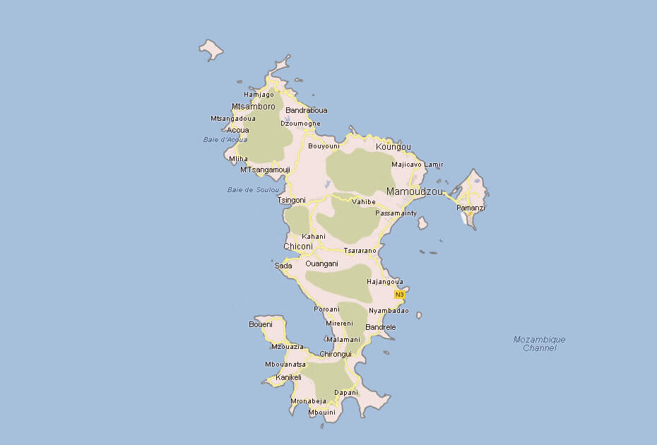
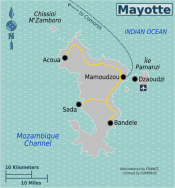
MAYOTTE ADMINISTRATIVE MAP
Can I download a high-resolution map of Mayotte ?
Yes. Download high-resolution political and physical maps of Mayotte for personal or educational use. Redistribution is subject to the terms of our license.
- Capital :
Mamoudzou
- Population :
194,000
- GDP :
$1.13 billion
- Per Capita :
$6,500
- Calling Code :
N/A
- Jobless Rate :
N/A
- Time Zone :
N/A
With interactive Mayotte Map, view regional highways maps, road situations, transportation, lodging guide, geographical map, physical maps and more information. On Mayotte Map, you can view all states, regions, cities, towns, districts, avenues, streets and popular centers' satellite, sketch and terrain maps.
For more about Mayotte >>
A Collection of Mayotte Maps and Mayotte Satellite Images
MAP OF MAYOTTE

WHERE IS MAYOTTE IN THE WORLD
MAYOTTE ADMINISTRATIVE MAP
COMOROS MAYOTTE MAP
COMOROS MAYOTTE MAP
MAP MAYOTTE
MAP OF MAYOTTE AFRICA
MAP OF MAYOTTE WORLD
MAP OF MAYOTTE
MAP OF COMOROS MAYOTTE
MAYOTTE MAP
MAYOTTE REGIONAL MAP
MAYOTTE TOPOGRAPHIC MAP
MAYOTTE COMOROS AFRICA MAP
MAYOTTE MAP
MAYOTTE MAP
MAYOTTE MAP AFRICA
MAYOTTE MAPS
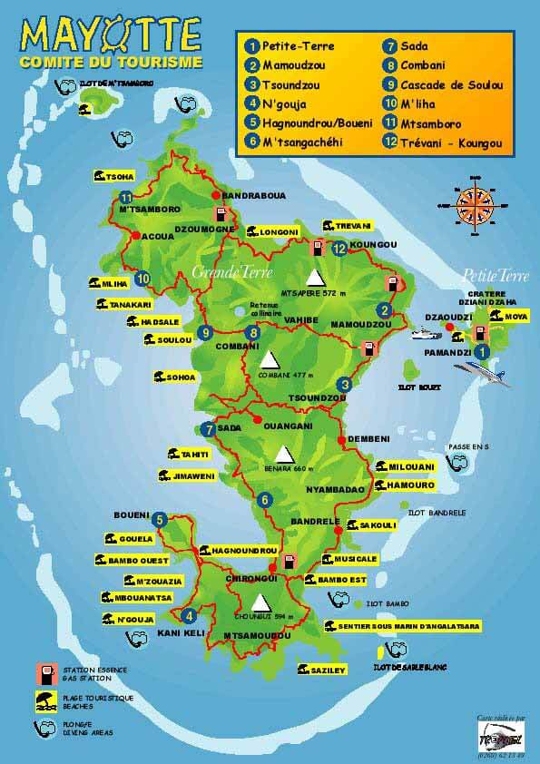
MAYOTTE TOURISM MAP
RELIEF AND POLITICAL MAP OF MAYOTTE ISLAND
MAYOTTE EARTH MAP
Author: Arif Cagrici
Largest Cities' Map of Mayotte
