Netherlands Antilles Map FQA
How many cities are in Netherlands Antilles ?
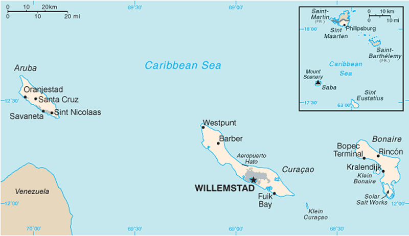
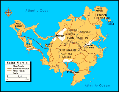
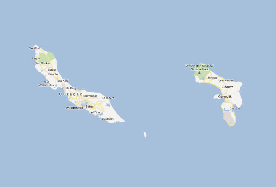
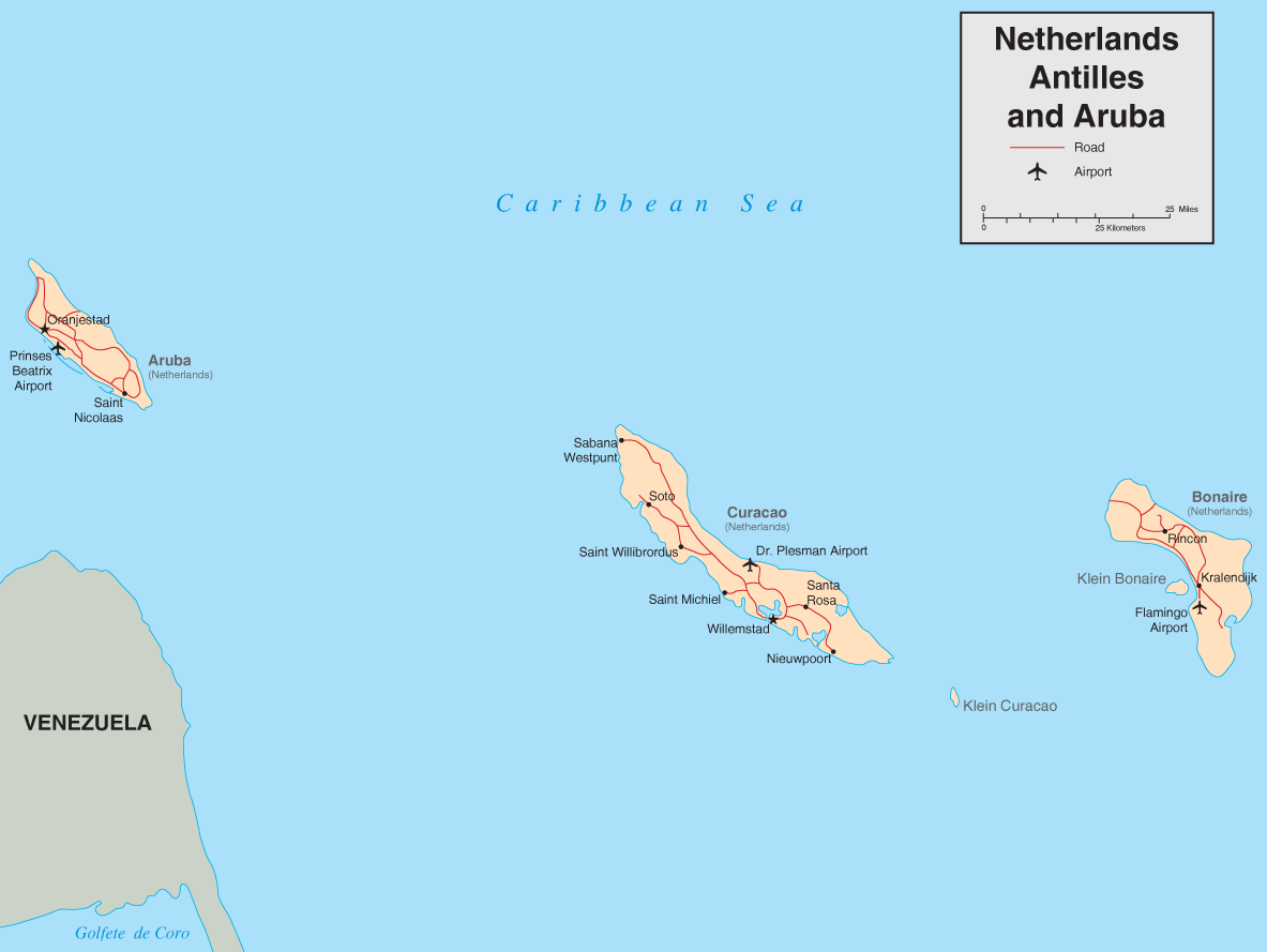
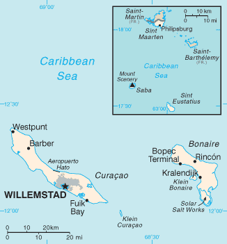
The Netherlands Antilles was dissolved in 2010. Major towns of the former territory included: Willemstad (Curaçao); Philipsburg (Sint Maarten); Kralendijk (Bonaire); Oranjestad (Sint Eustatius); The Bottom (Saba).
What are the major geographical features of Netherlands Antilles ?
The former Netherlands Antilles consisted of several Caribbean islands with varied geography, including volcanic hills on Saba and St. Eustatius, flat terrain on Curaçao and Bonaire, and sandy beaches.
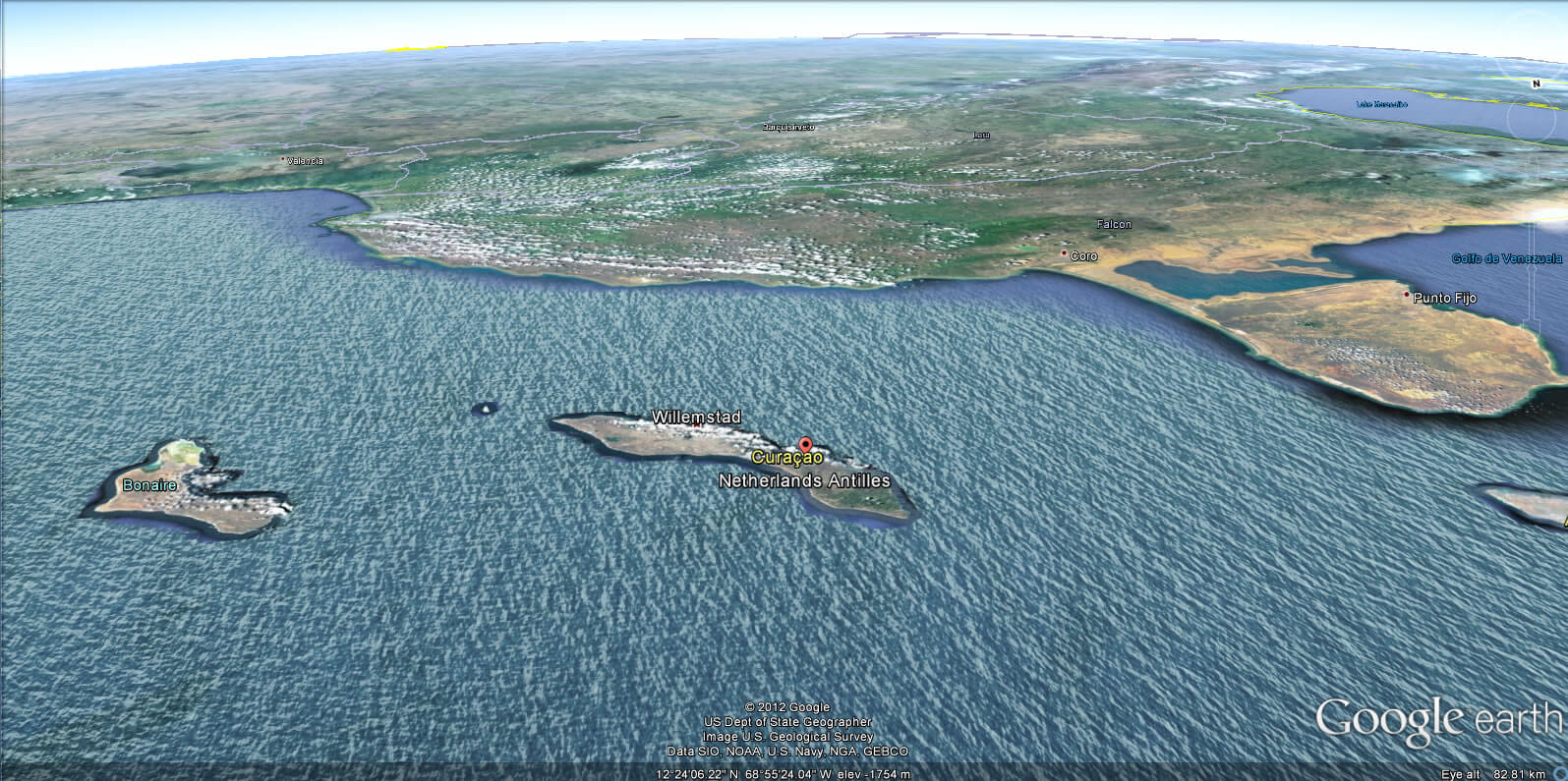
MAP OF NETHERLANDS ANTILLES

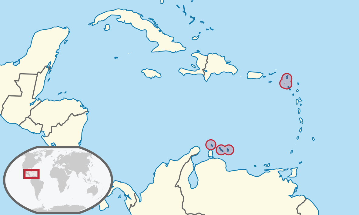
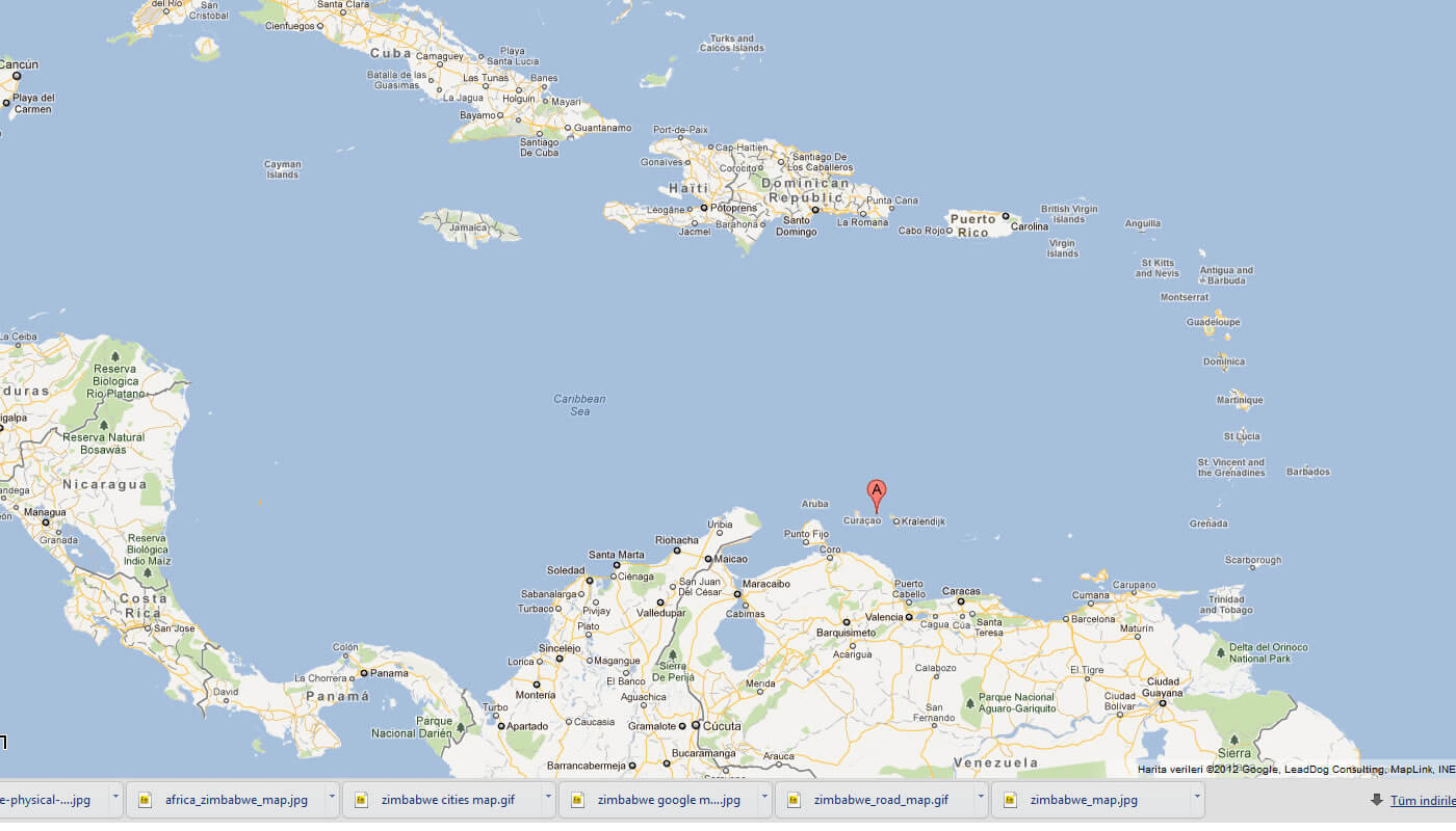
NETHERLANDS ANTILLES LOCATION MAP
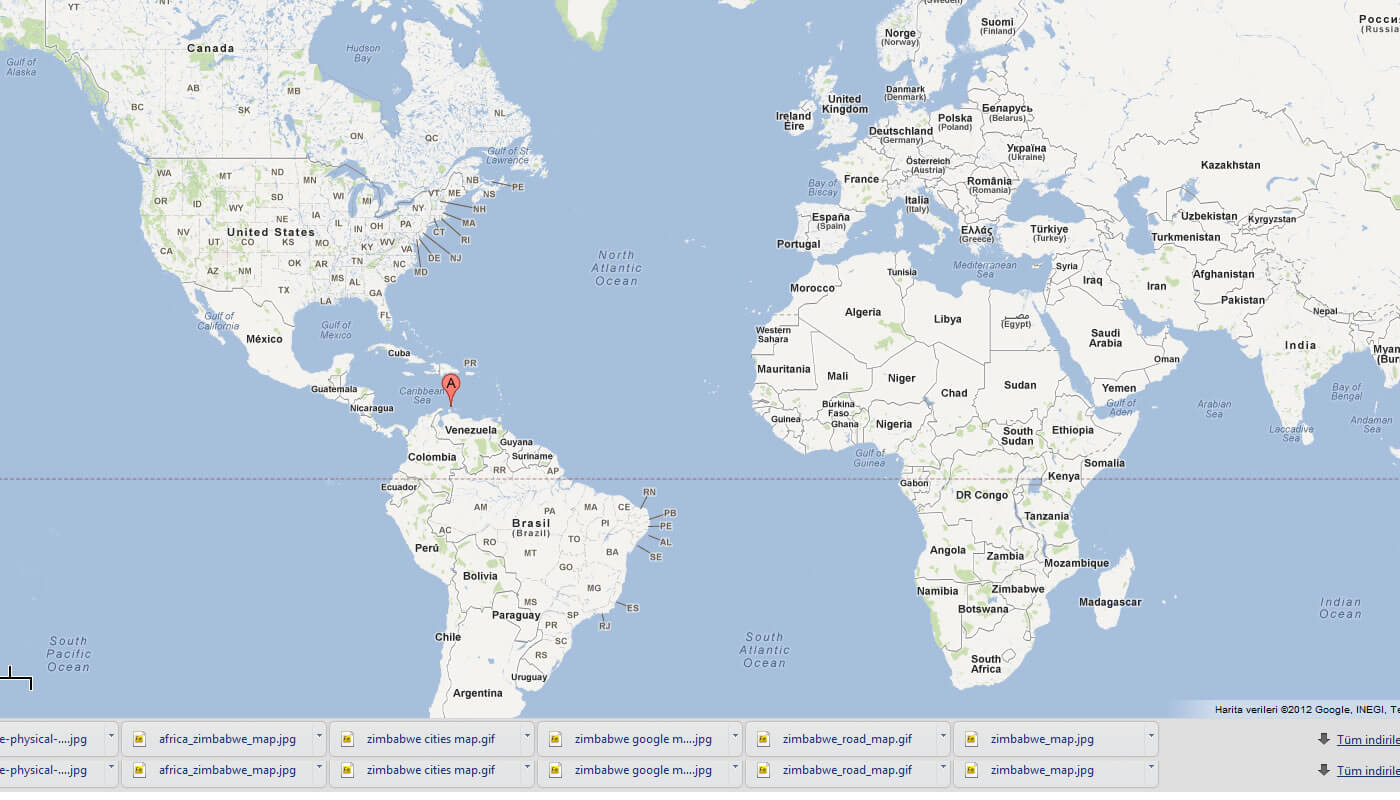
WHERE IS NETHERLANDS ANTILLES IN THE WORLD
Can I download a high-resolution map of Netherlands Antilles ?
Yes. Download high-resolution political and physical maps of Netherlands Antilles for personal or educational use. Redistribution is subject to the terms of our license.

- Capital :
Willemstad
- Population :
175,653
- GDP :
N/A
- Per Capita :
N/A
- Calling Code :
+599
- Jobless Rate :
N/A
- Time Zone :
N/A
With interactive Netherlands Antilles Map, view regional highways maps, road situations, transportation, lodging guide, geographical map, physical maps and more information. On Netherlands Antilles Map, you can view all states, regions, cities, towns, districts, avenues, streets and popular centers' satellite, sketch and terrain maps.
A Collection of Netherlands Antilles Maps and Netherlands Antilles Satellite Images
MAP OF NETHERLANDS ANTILLES
NETHERLANDS ANTILLES LOCATION MAP
WHERE IS NETHERLANDS ANTILLES IN THE WORLD
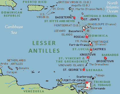
LESSER ANTILLES NETHERLANDS
MAP OF NETHERLANDS ANTILLES CARIBBEAN
MAP OF NETHERLANDS ANTILLES WORLD
MAP OF NETHERLANDS ANTILLES
NETHERLANDS ANTILLES CARIBBEAN ISLANDS

NETHERLANDS ANTILLES CARIBBEAN MAP

NETHERLANDS ANTILLES MAP

NETHERLANDS ANTILLES MAPS

NETHERLANDS ANTILLES

NETHERLANDS ANTILLES MAP
NETHERLANDS ANTILLES MAP

NETHERLANDS ANTILLES MAP WILLEMSTAD
NETHERLANDS ANTILLES VENEZUELA MAP

NETHERLANDS MAP

NETHERLANDS ANTILLES EARTH MAP
Author: Arif Cagrici
Largest Cities' Map of Netherlands Antilles
