Norfolk Island Map FQA
How many cities are in Norfolk Island ?
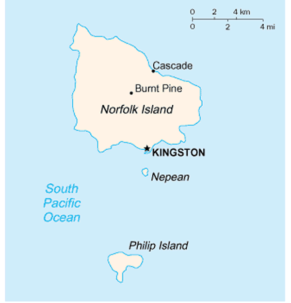
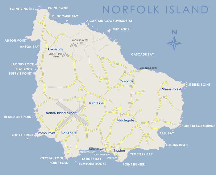
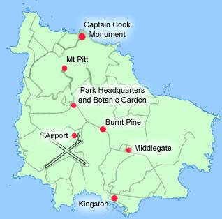
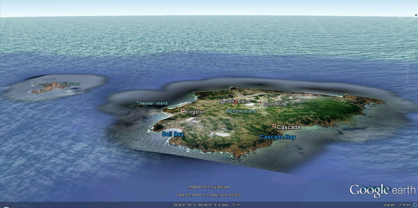
Norfolk Island has 1 main town: Burnt Pine.
What are the major geographical features of Norfolk Island ?
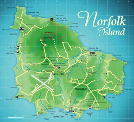
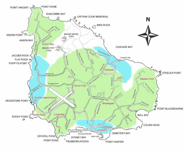
Norfolk Island in the Pacific has volcanic origins, with rolling hills, subtropical forests, and coastal cliffs. Its geography is characterized by fertile soil and small valleys.
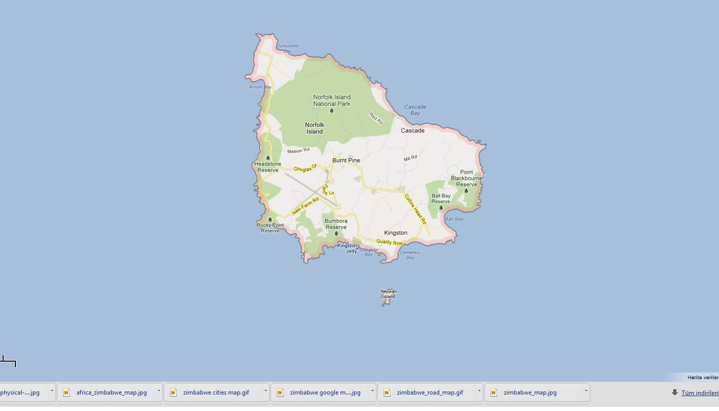
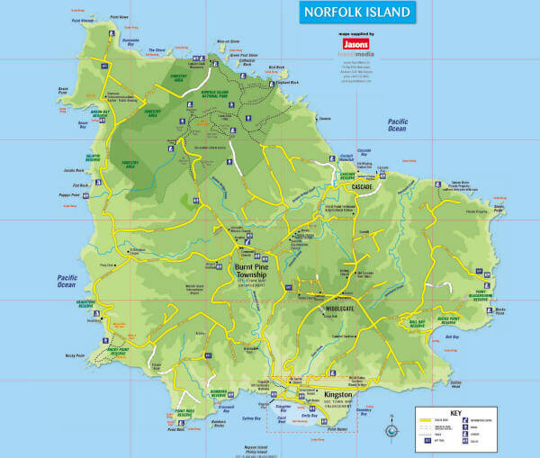
MAP OF NORFOLK ISLAND

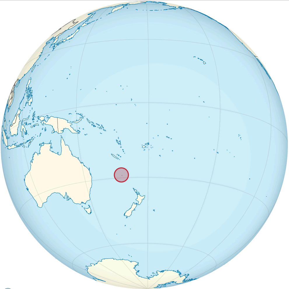
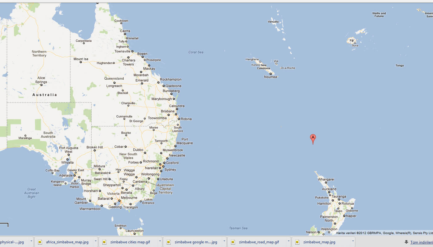
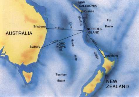
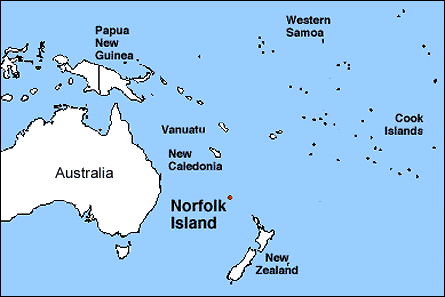
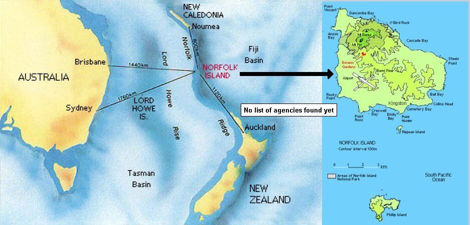
NORFOLK ISLAND LOCATION MAP
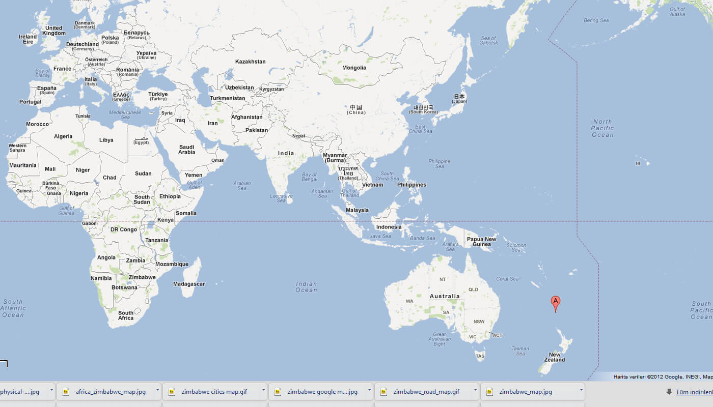
WHERE IS NORFOLK ISLAND IN THE WORLD
Can I download a high-resolution map of Norfolk Island ?
Yes. Download high-resolution political and physical maps of Norfolk Island for personal or educational use. Redistribution is subject to the terms of our license.
- Capital :
Kingston
- Population :
2,302
- GDP :
N/A
- Per Capita :
N/A
- Calling Code :
+672
- Jobless Rate :
N/A
- Time Zone :
+11.30
With interactive Norfolk Island Map, view regional highways maps, road situations, transportation, lodging guide, geographical map, physical maps and more information. On Norfolk Island Map, you can view all states, regions, cities, towns, districts, avenues, streets and popular centers' satellite, sketch and terrain maps.
A Collection of Norfolk Island Maps and Norfolk Island Satellite Images
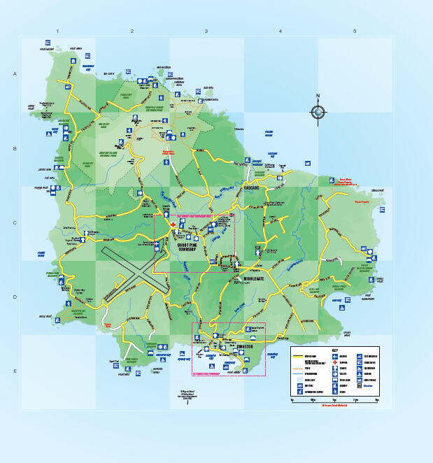
MAP OF NORFOLK ISLAND
NORFOLK ISLAND LOCATION MAP
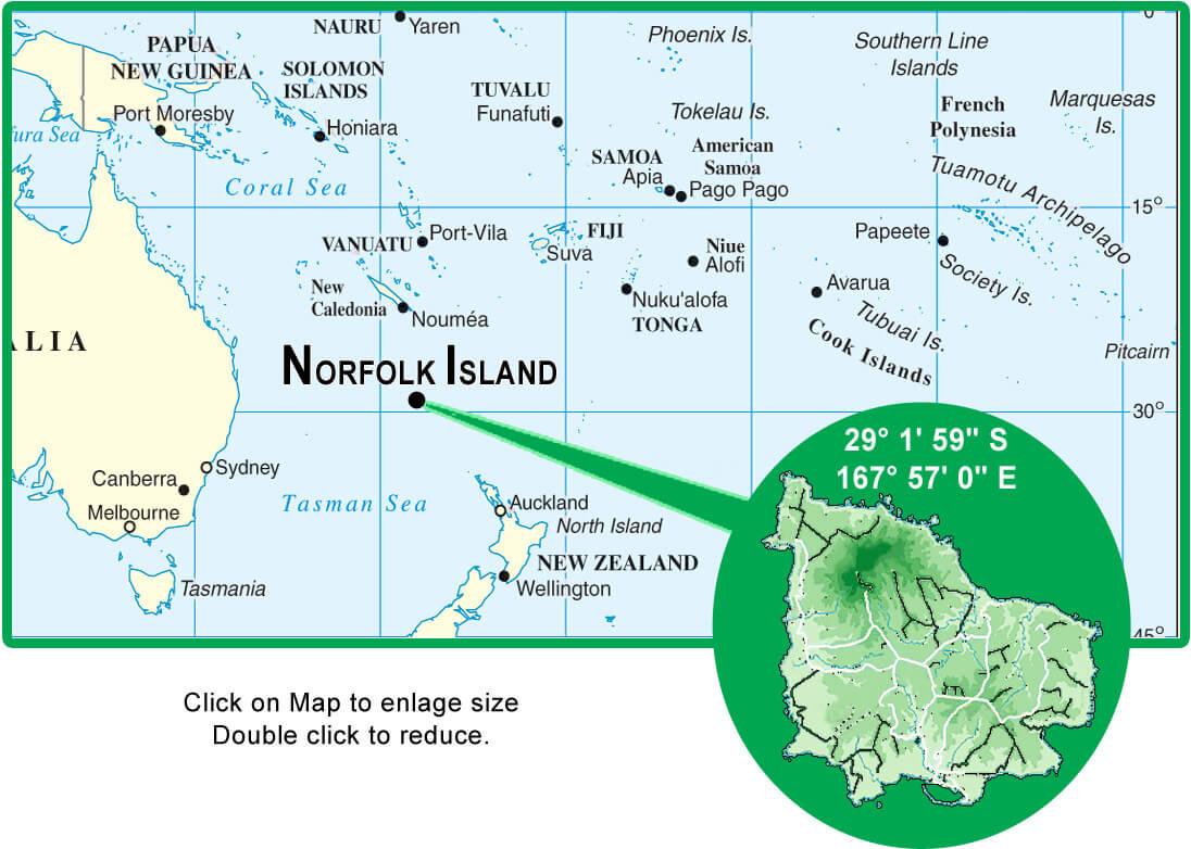
WHERE IS NORFOLK ISLAND IN THE WORLD
MAP OF NORFOLK ISLAND AUSTRALIA
MAP OF NORFOLK ISLAND WORLD
MAP OF NORFOLK ISLAND
MAP NORFOLK ISLAND
NORFOLK ISLAND MAP
NORFOLK ISLAND AUSTRALIA MAP
NORFOLK ISLAND MAP
NORFOLK ISLAND MAP

NORFOLK ISLAND MAP
NORFOLK ISLAND MAP
NORFOLK ISLAND OCENIA MAP
NORFOLK TOURIST MAP
POLITICAL MAP NORFOLK AUSTRALIA
NORFOLK ISLAND EARTH MAP
Author: Arif Cagrici
Largest Cities' Map of Norfolk Island
