Saint Helena Map FQA
How many cities are in Saint Helena ?
Saint Helena has no official cities. The main settlement is Jamestown, followed by smaller villages.
What are the major geographical features of Saint Helena ?
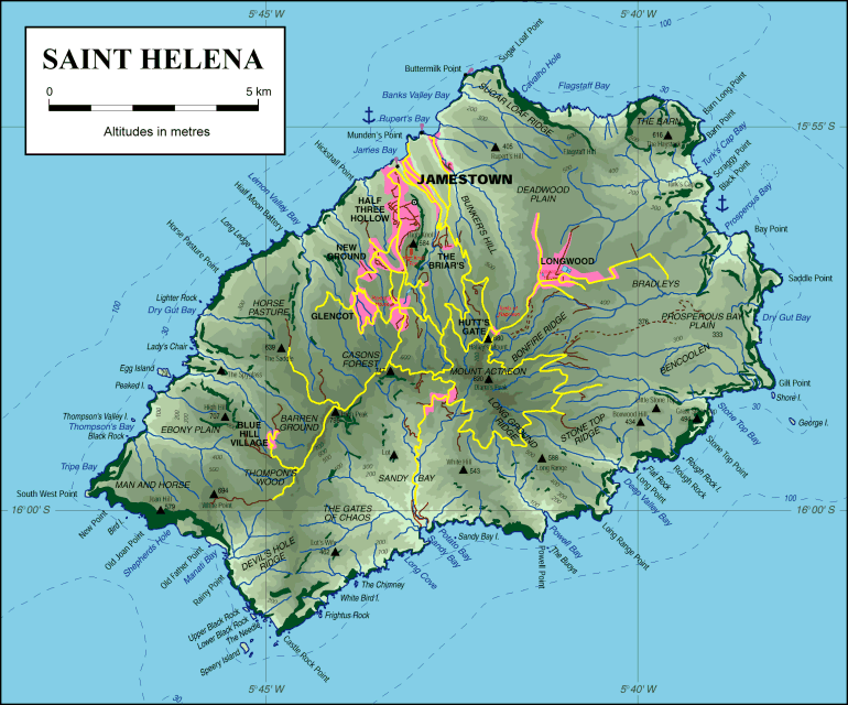
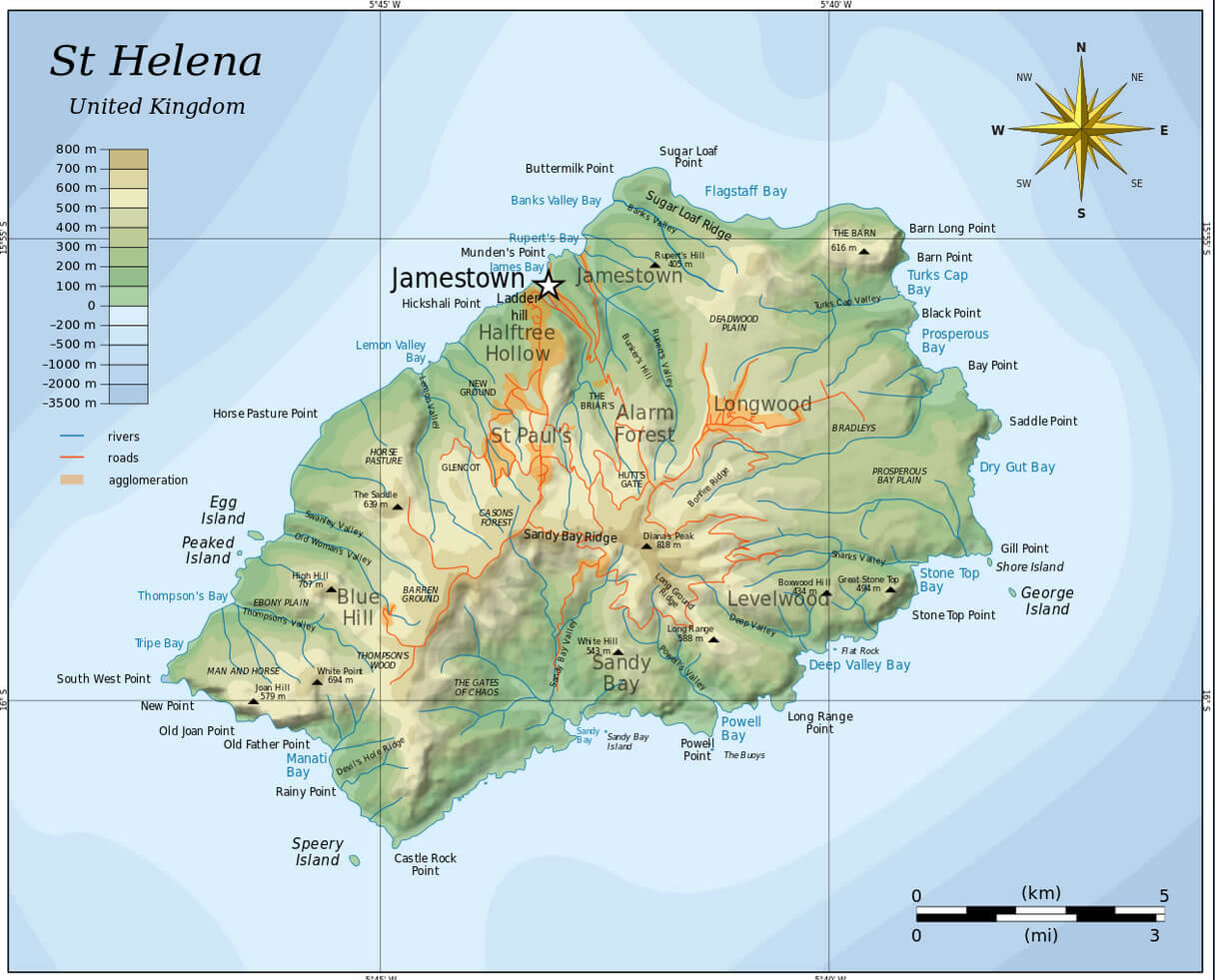
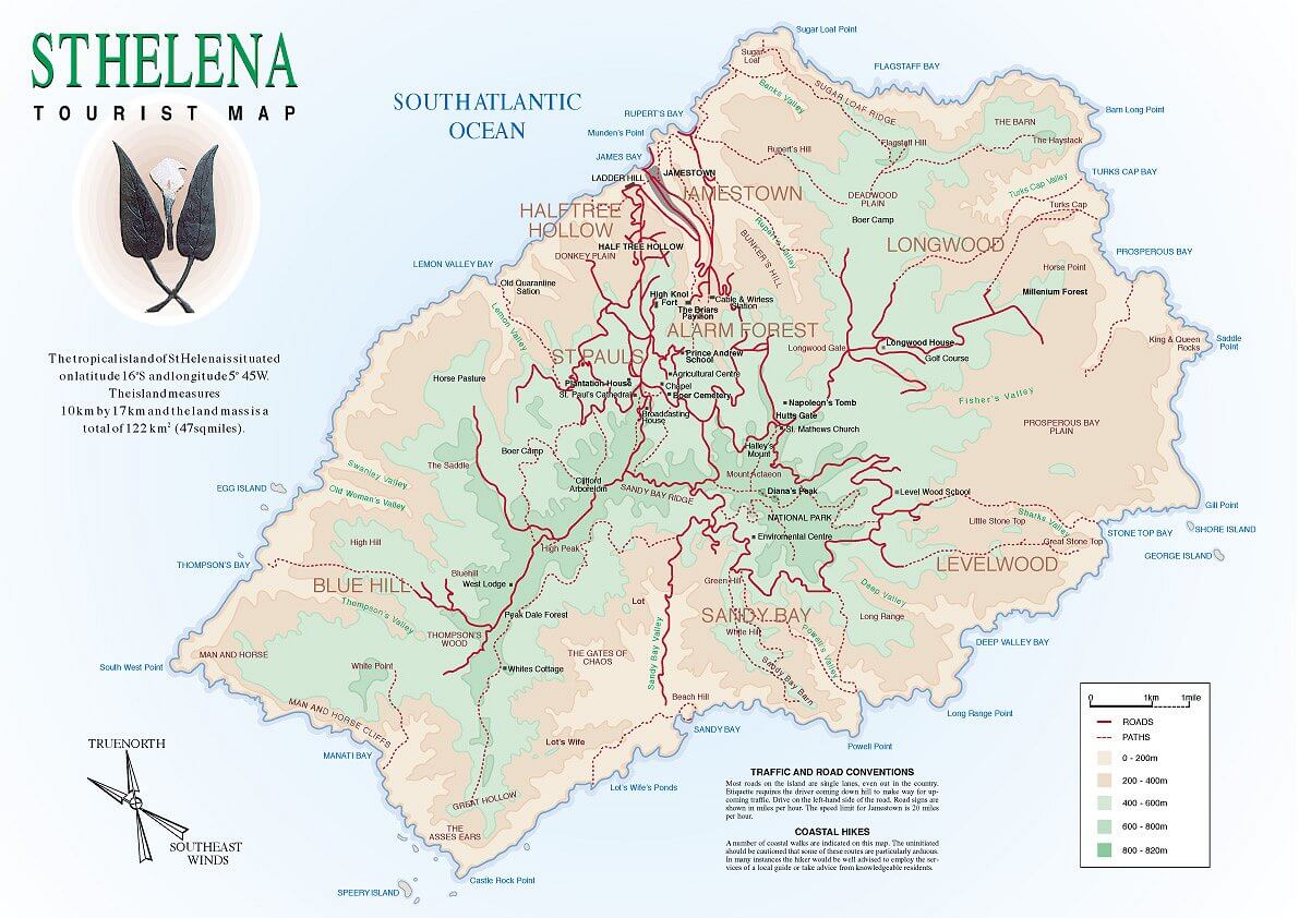
Saint Helena is a remote volcanic island in the South Atlantic Ocean, characterized by rugged mountains, steep cliffs, and narrow valleys. The highest point is Diana’s Peak, and the island has a subtropical climate with limited flat land.
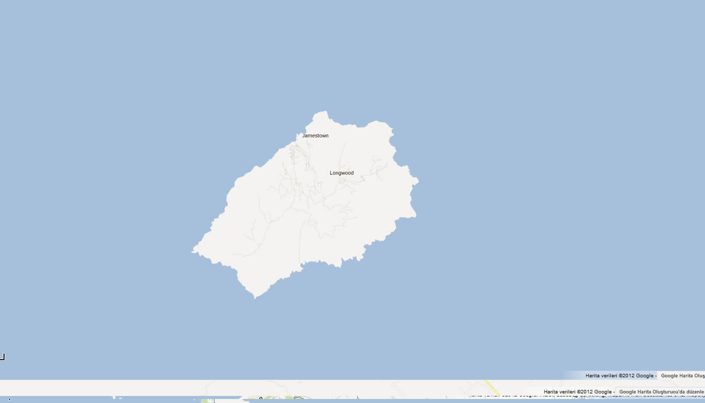
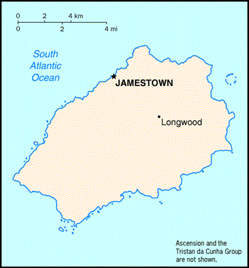
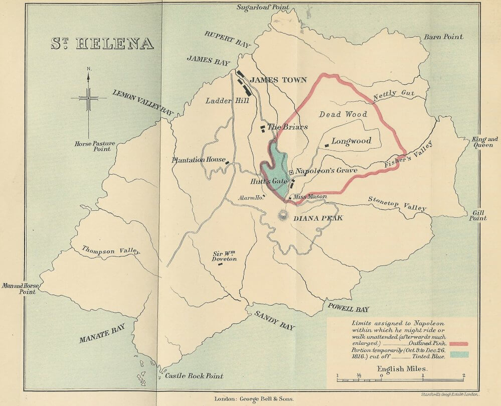
MAP OF SAINT HELENA
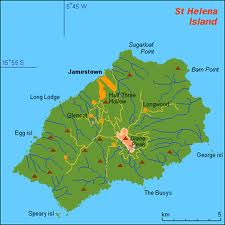
TOPOGRAPHIC MAP OF SAINT HELENA
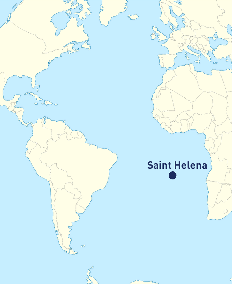
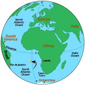
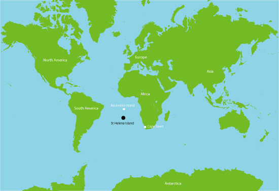
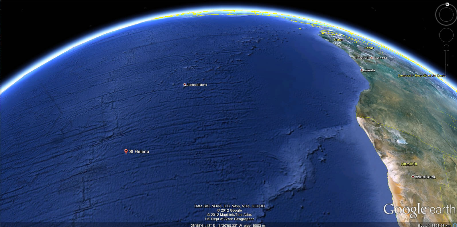
WHERE IS SAINT HELENA IN THE WORLD
Can I download a high-resolution map of Saint Helena ?
Yes. Download high-resolution political and physical maps of Saint Helena for personal or educational use. Redistribution is subject to the terms of our license.
- Capital :
Jamestown
- Population :
4,255
- GDP :
N/A
- Per Capita :
N/A
- Calling Code :
+290
- Jobless Rate :
N/A
- Time Zone :
+0
With interactive Saint Helena Map, view regional highways maps, road situations, transportation, lodging guide, geographical map, physical maps and more information. On Saint Helena Map, you can view all states, regions, cities, towns, districts, avenues, streets and popular centers' satellite, sketch and terrain maps.
A Collection of Saint Helena Maps and Saint Helena Satellite Images
MAP OF SAINT HELENA

TOPOGRAPHIC MAP OF SAINT HELENA
WHERE IS SAINT HELENA IN THE WORLD
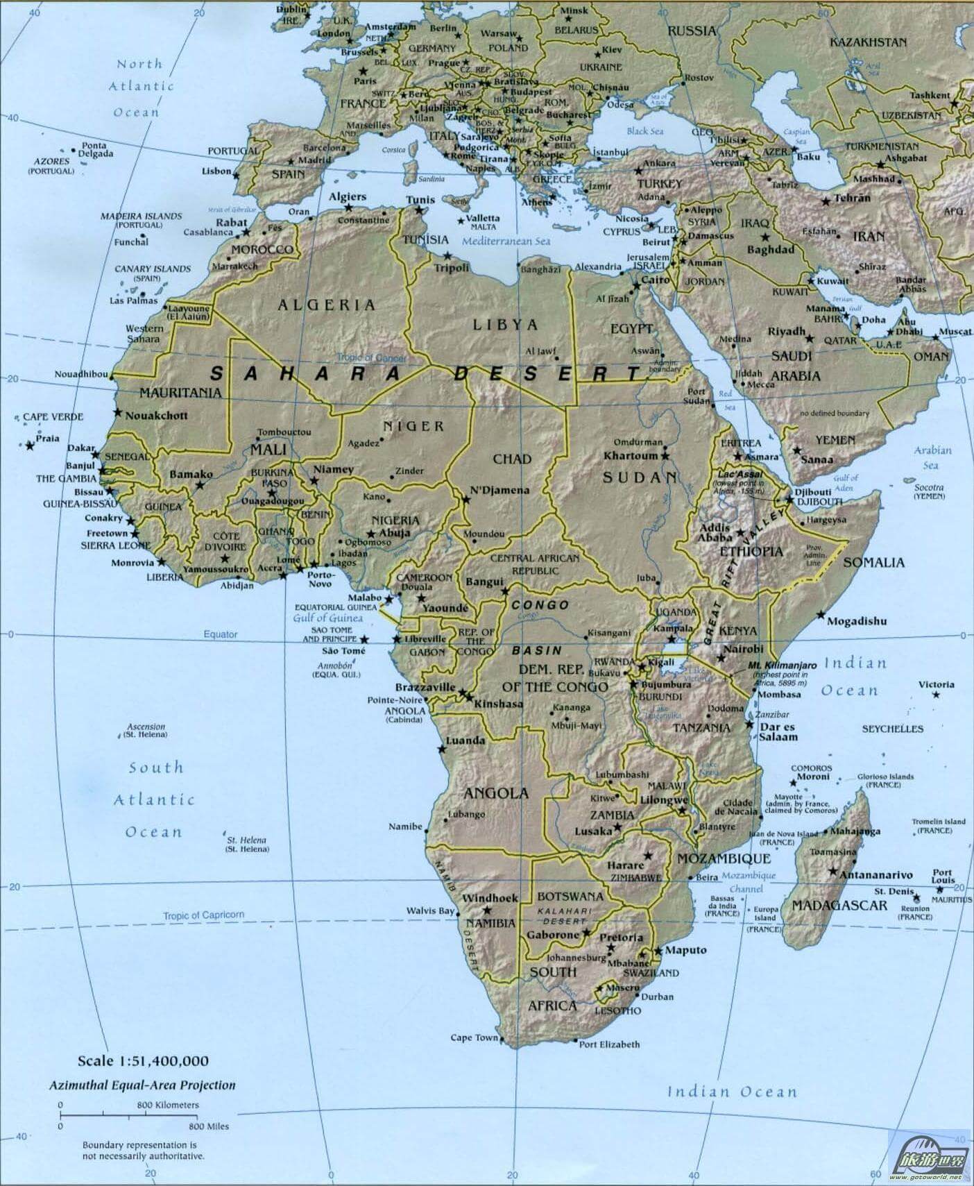
AFRICA MAP ST HELENA
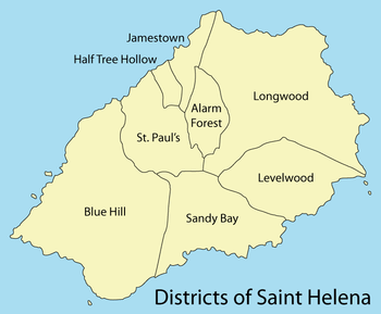
DISTRICT MAP OF SAINT HELENA
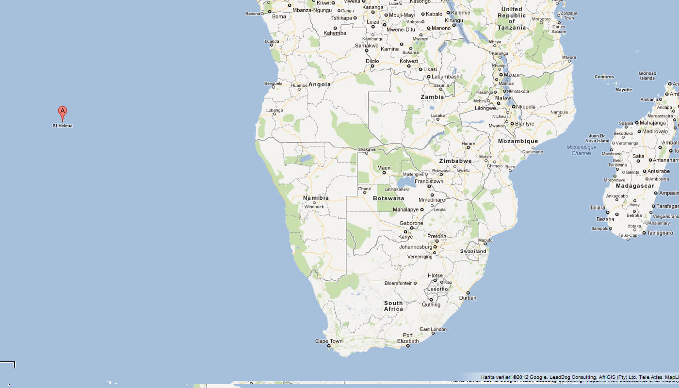
MAP OF SAINT HELENA AFRICA
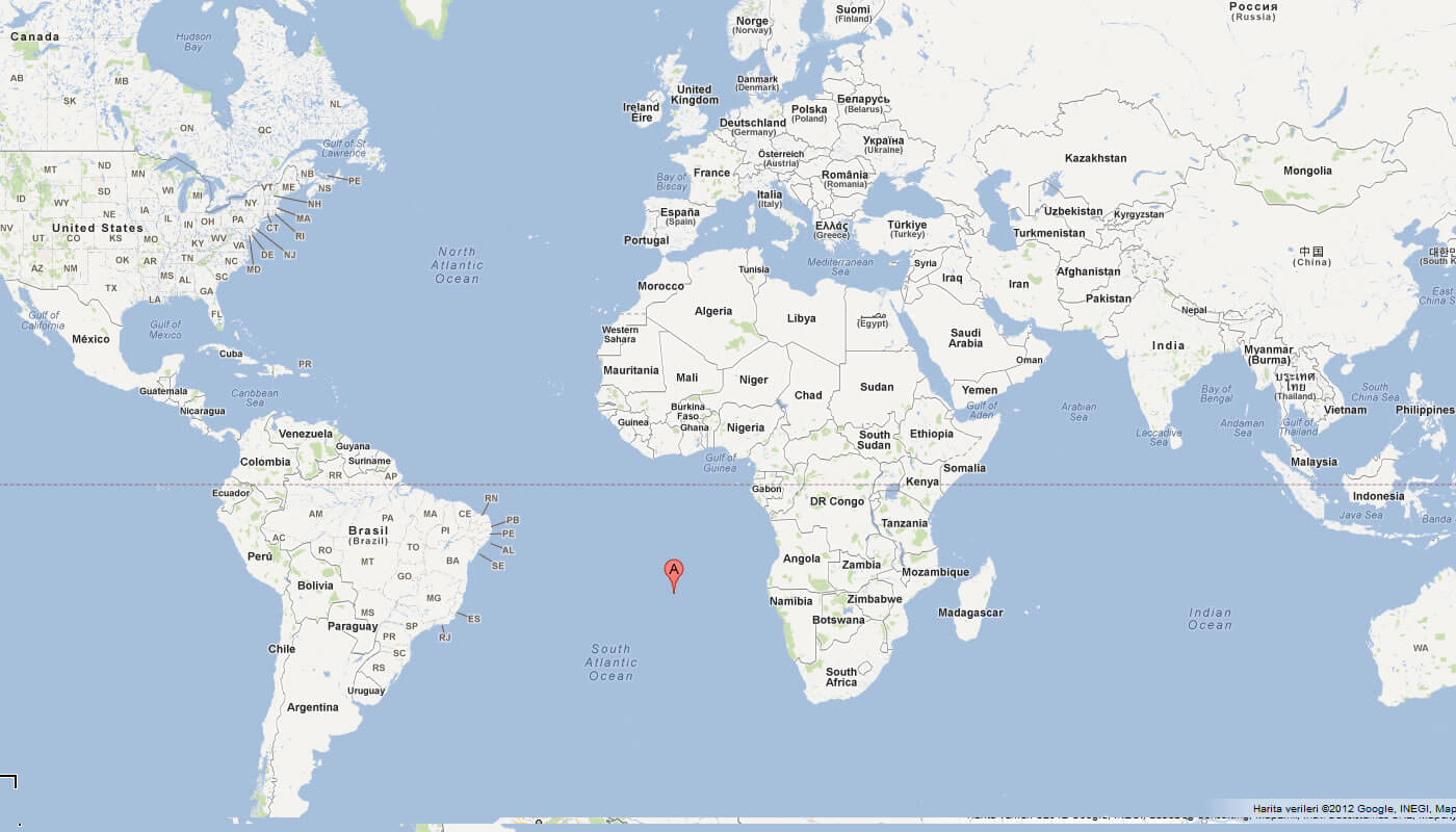
MAP OF SAINT HELENA WORLD
MAP OF SAINT HELENA
SAINT HELENA MAP
SAINT HELENA POLITICAL MAP
SAINT HELENA JAMESTOWN MAP
ST HELENA MAP
ST HELENA MAP

ST HELENA ISLAND MAP
ST HELENA TOURIST MAP
WORLD MAP SAINT HELENA ISLAND
SAINT HELENA EARTH MAP
Author: Arif Cagrici
Largest Cities' Map of Saint Helena
