Somaliland Map FQA
How many cities are in Somaliland ?
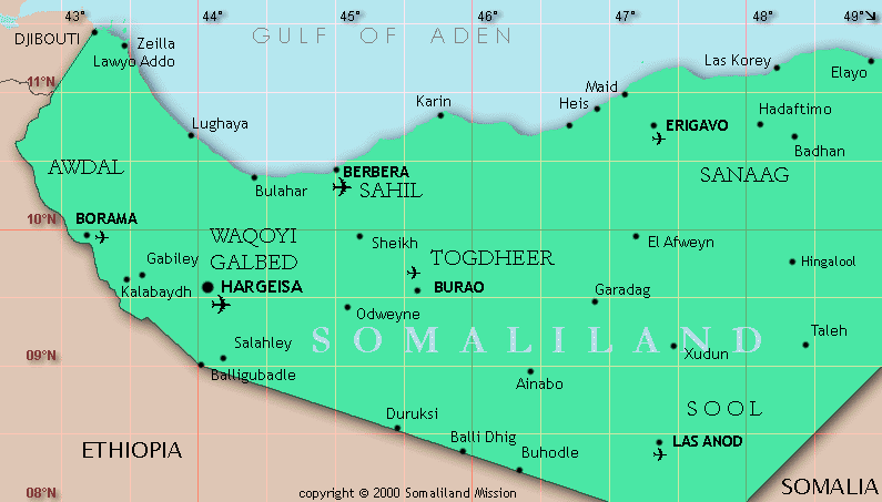
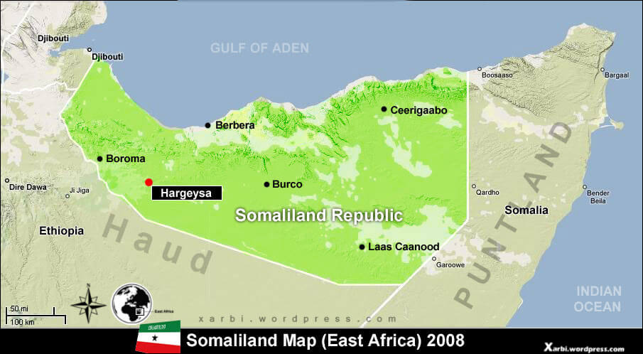
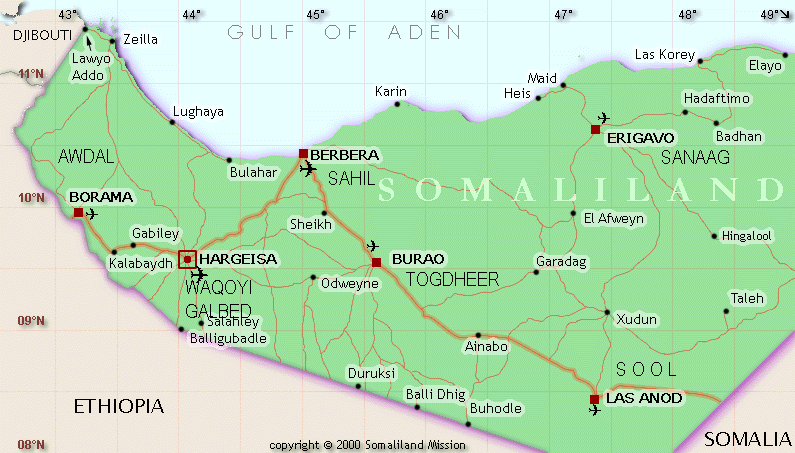
Somaliland (self-declared state) has about 5 main cities. The largest are: Hargeisa; Burao; Borama; Berbera; Erigavo.
What are the major geographical features of Somaliland ?
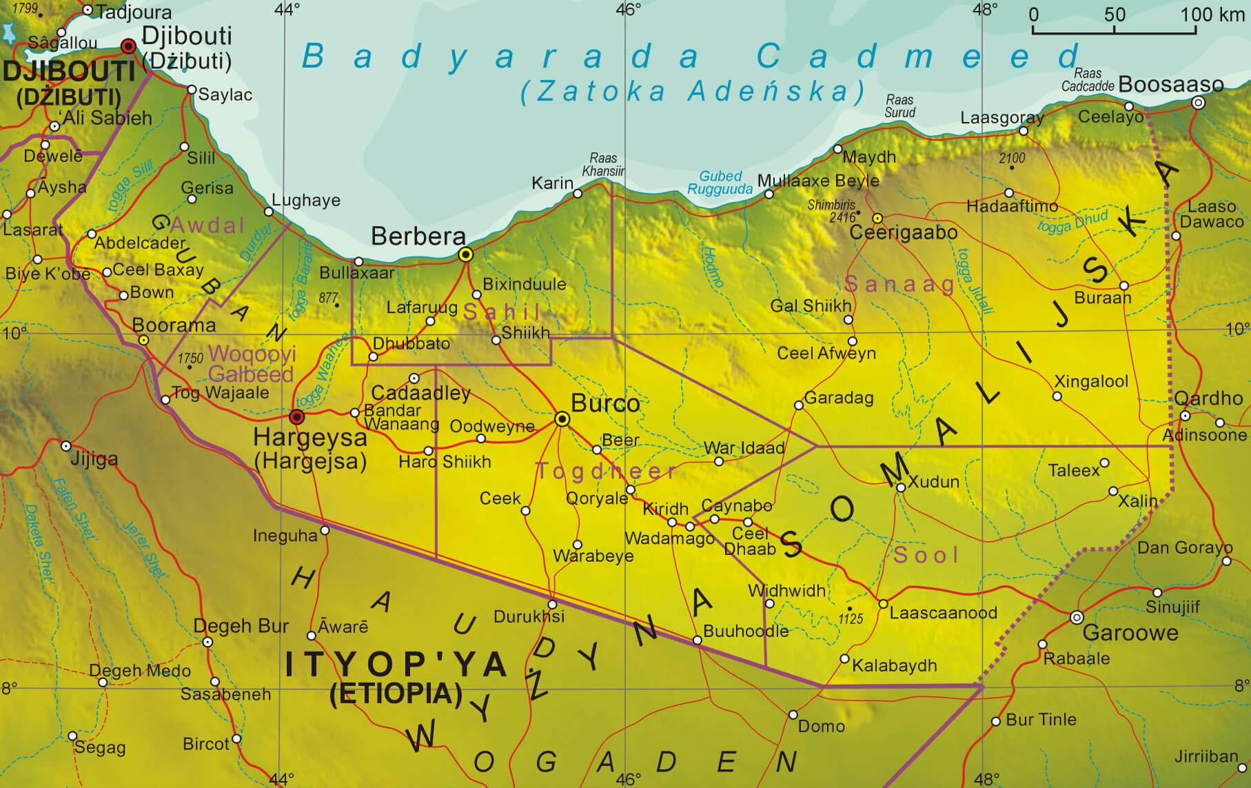
Somaliland, a self-declared state in the Horn of Africa, features coastal plains along the Gulf of Aden, mountain ranges such as the Ogo Mountains, and plateaus in the interior.
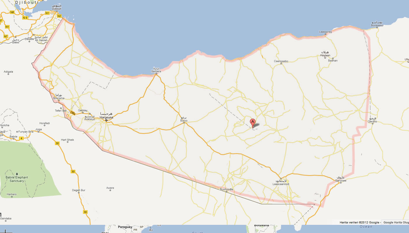
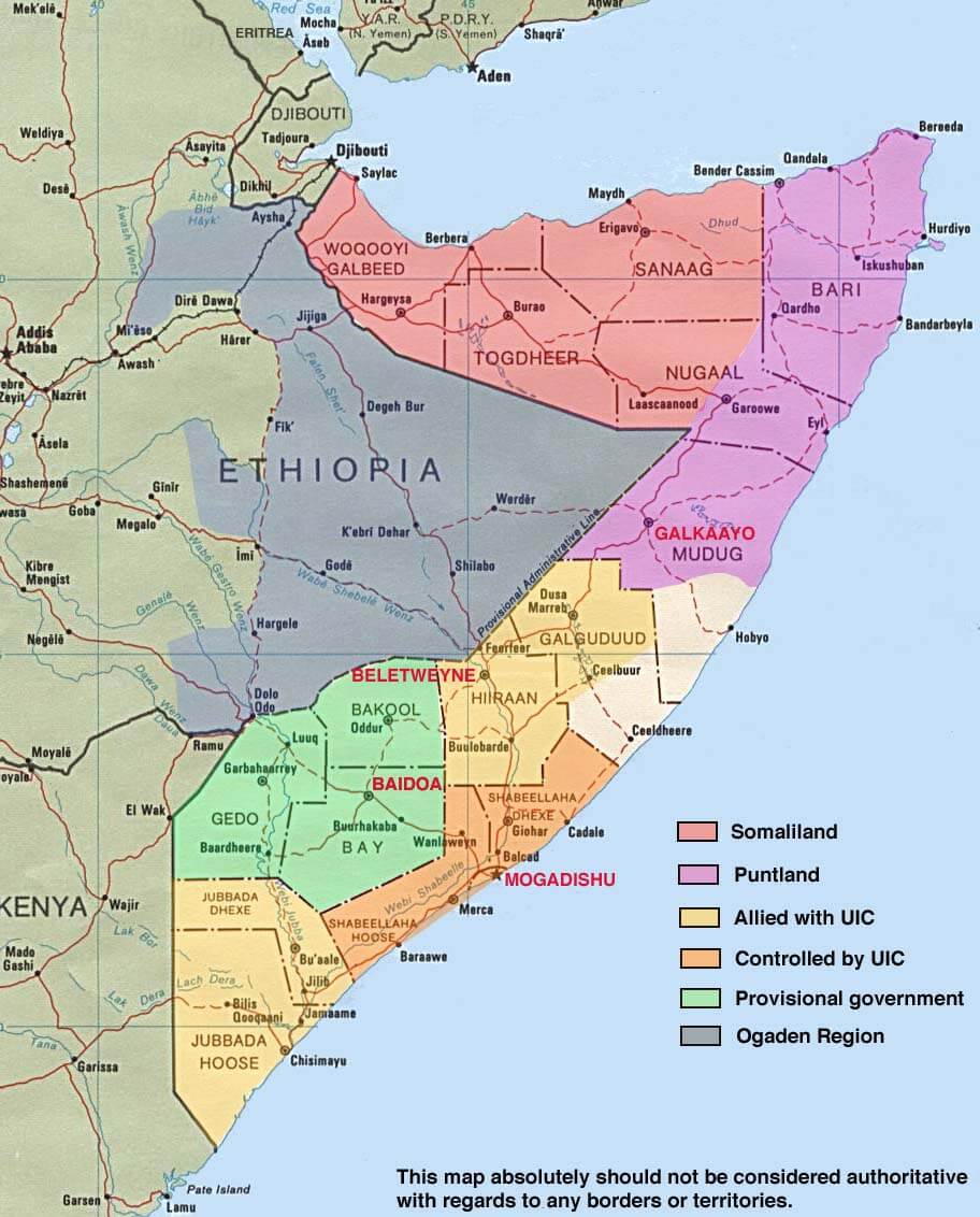
MAP OF SOMALILAND

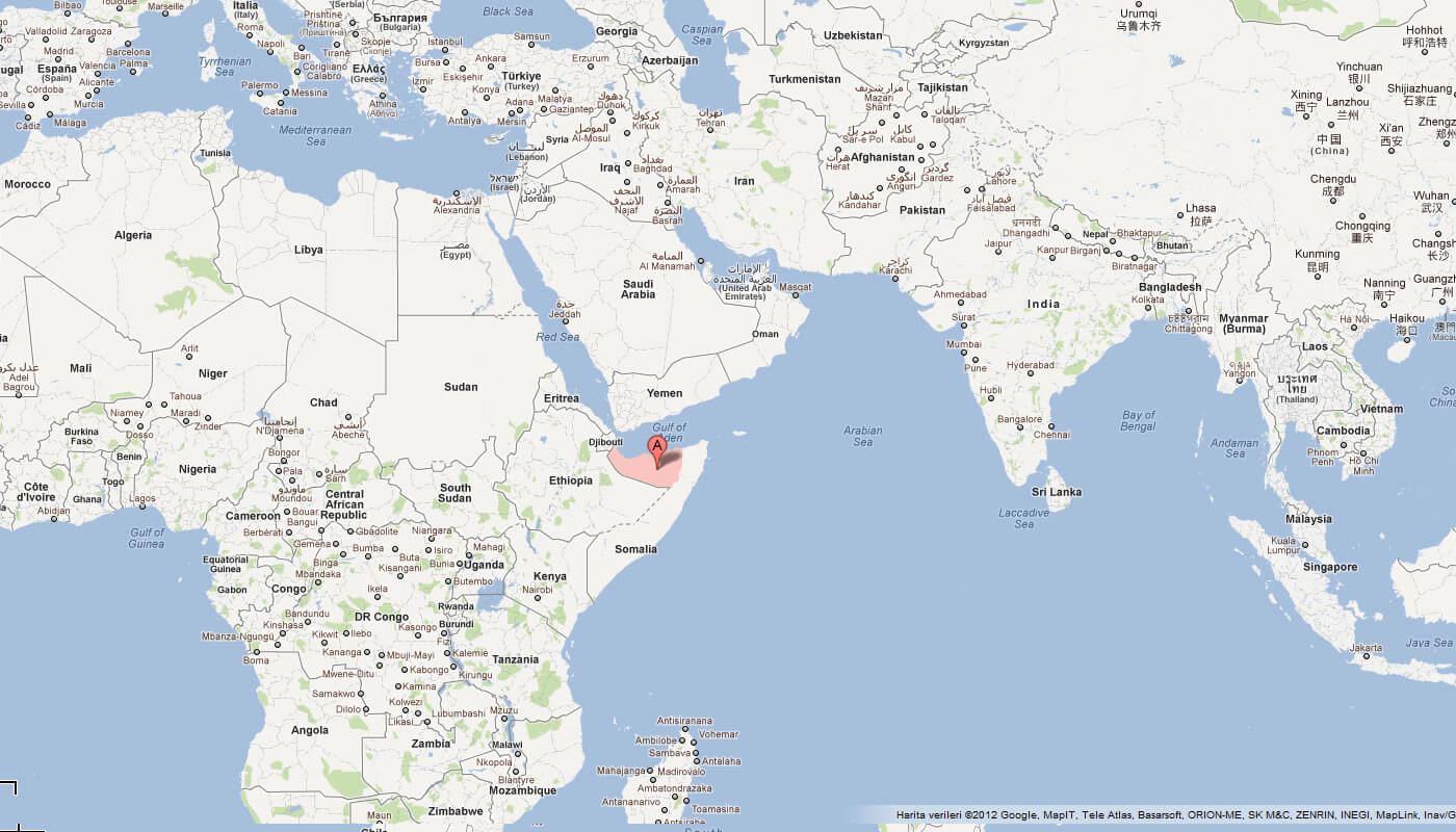
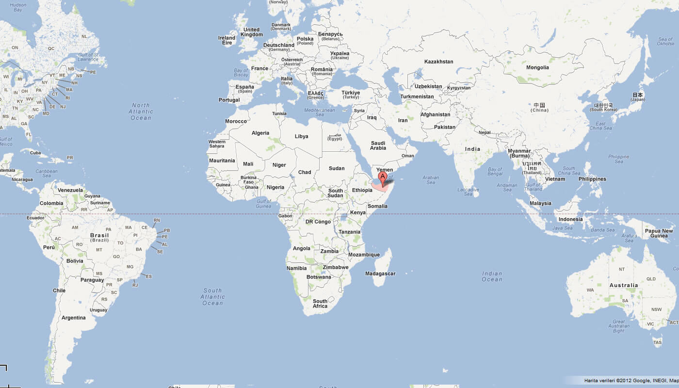
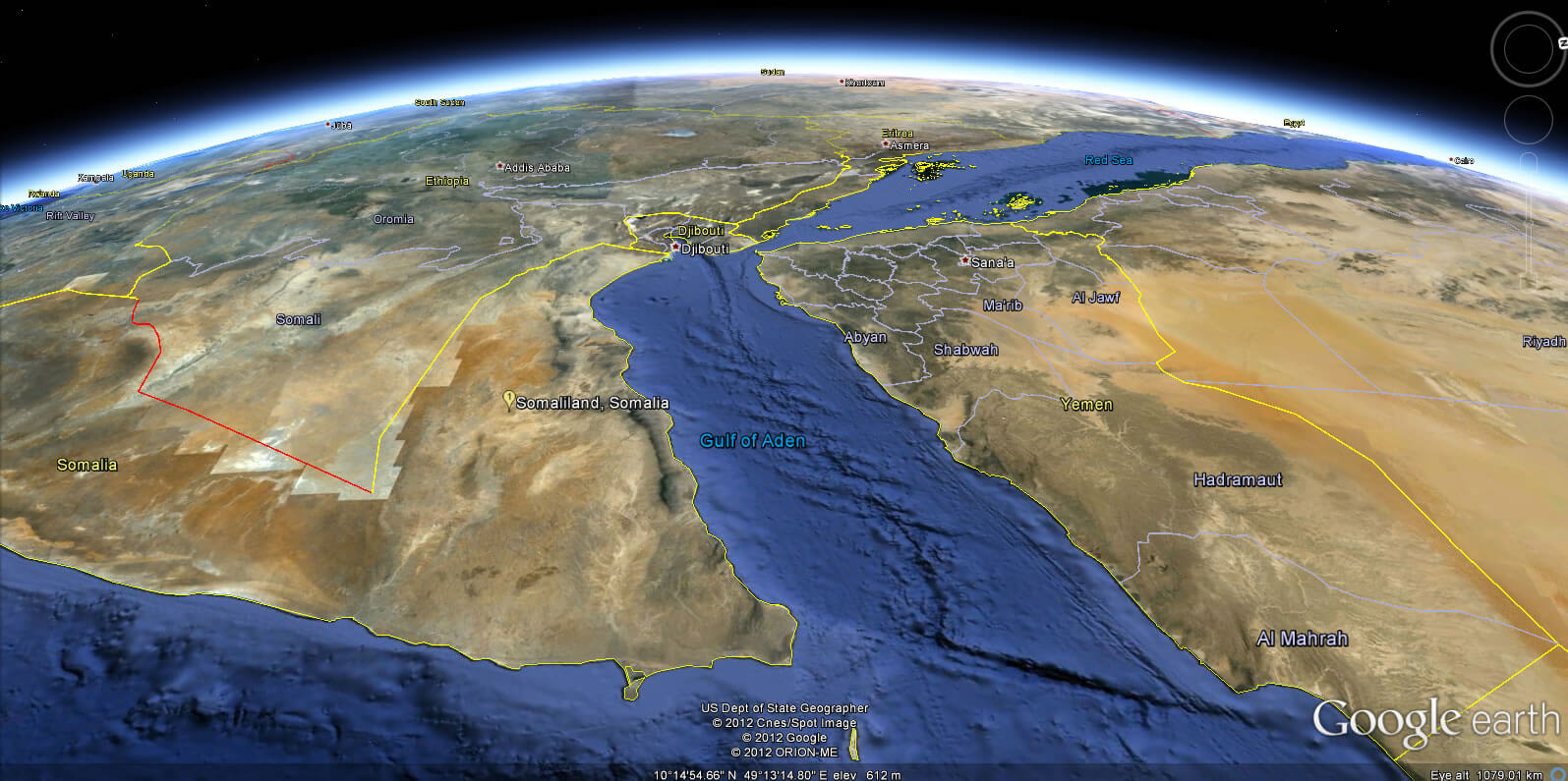
WHERE IS SOMALILAND IN THE WORLD
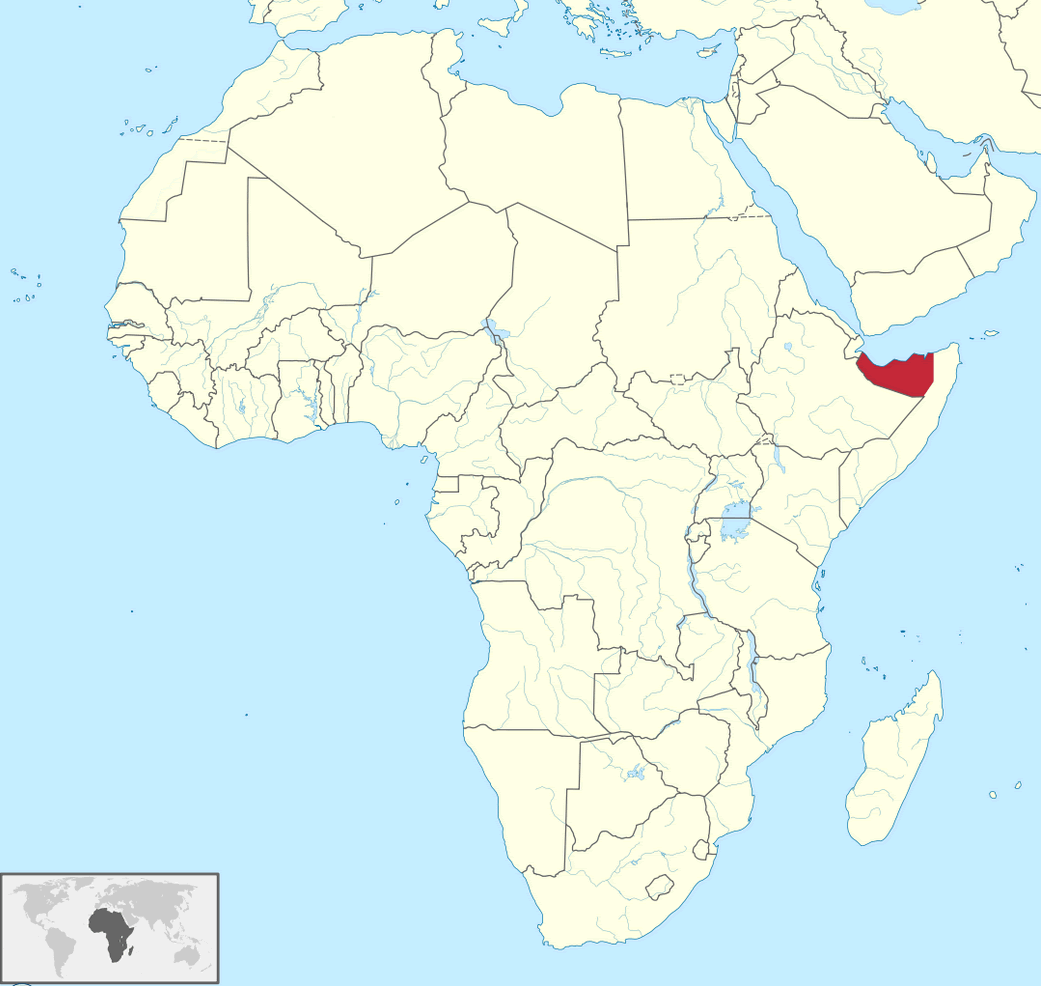
SOMALILAND LOCATION MAP
Can I download a high-resolution map of Somaliland ?
Yes. Download high-resolution political and physical maps of Somaliland for personal or educational use. Redistribution is subject to the terms of our license.
- Capital :
Hargeisa
- Population :
3,500,000
- GDP :
N/A
- Per Capita :
N/A
- Calling Code :
+252
- Jobless Rate :
N/A
- Time Zone :
+3
With interactive Somaliland Map, view regional highways maps, road situations, transportation, lodging guide, geographical map, physical maps and more information. On Somaliland Map, you can view all states, regions, cities, towns, districts, avenues, streets and popular centers' satellite, sketch and terrain maps.
A Collection of Somaliland Maps and Somaliland Satellite Images
MAP OF SOMALILAND
WHERE IS SOMALILAND IN THE WORLD
SOMALILAND LOCATION MAP
MAP OF SOMALILAND AFRICA
MAP OF SOMALILAND WORLD
MAP OF SOMALILAND
PHYSICAL MAP OF SOMALILAND
SOMALIA MAP
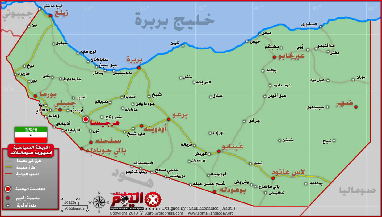
SOMALILAND MAP ARABIC
SOMALILAND RELIEF MAP
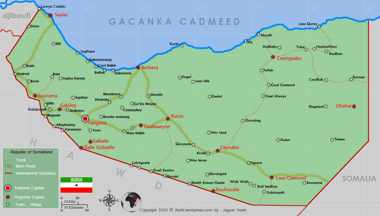
SOMALILAND ROAD MAP
SOMALILAND MAP
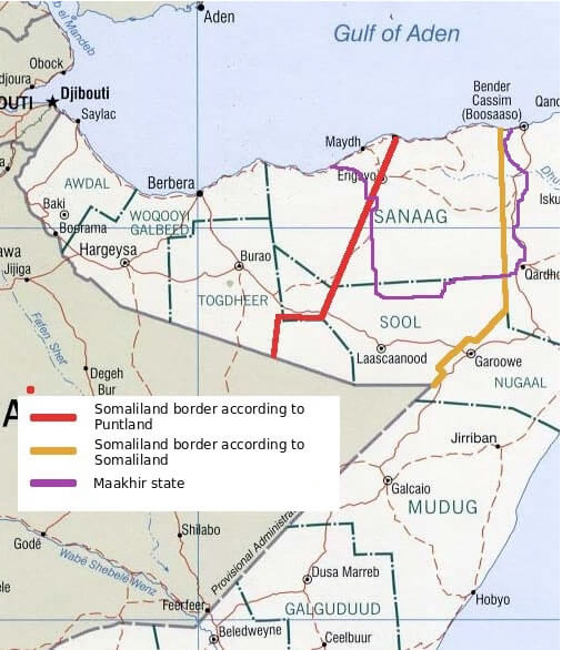
SOMALILAND REGIONS MAP

SOMALILAND EARTH MAP
Author: Arif Cagrici
Largest Cities' Map of Somaliland
