South Ossetia Map FQA
How many cities are in South Ossetia ?
South Ossetia has about 4 towns. The largest are: Tskhinvali; Java; Kvaisi; Leningor.
What are the major geographical features of South Ossetia ?
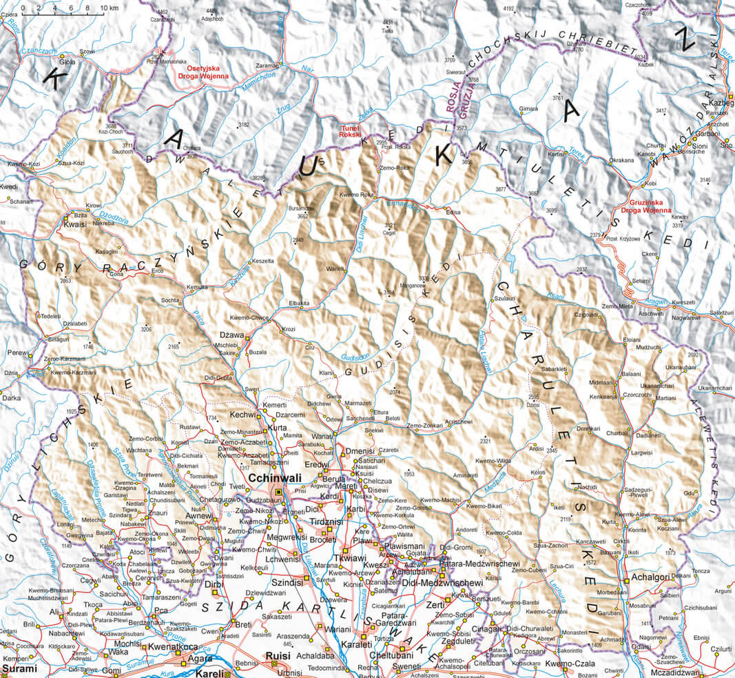
South Ossetia, a region in the South Caucasus, is characterized by its mountainous terrain as part of the Greater Caucasus. It has valleys, rivers, and high-altitude plateaus, with a continental climate.
MAP OF SOUTH OSSETIA
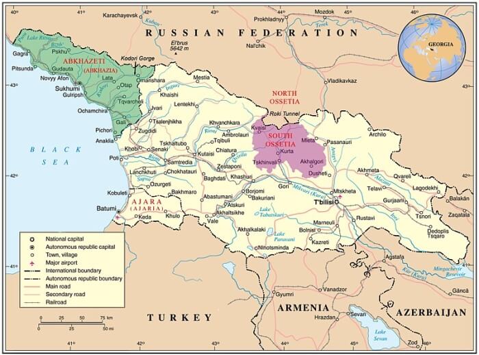
MAP OF SOUTH OSSETIA

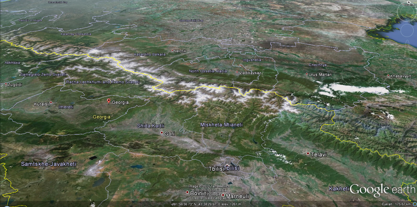
SOUTH OSSETIA EARTH MAP
Can I download a high-resolution map of South Ossetia ?
Yes. Download high-resolution political and physical maps of South Ossetia for personal or educational use. Redistribution is subject to the terms of our license.
- Capital :
Tskhinvali
- Population :
55,000
- GDP :
N/A
- Per Capita :
N/A
- Calling Code :
N/A
- Jobless Rate :
N/A
- Time Zone :
+3
With interactive South Ossetia Map, view regional highways maps, road situations, transportation, lodging guide, geographical map, physical maps and more information. On South Ossetia Map, you can view all states, regions, cities, towns, districts, avenues, streets and popular centers' satellite, sketch and terrain maps.
A Collection of South Ossetia Maps and South Ossetia Satellite Images
MAP OF SOUTH OSSETIA

MAP OF SOUTH OSSETIA

SOUTH OSSETIA EARTH MAP

SOUTH OSSETIA ALANIA MAP 10TH 12TH CENTURY
SOUTH OSSETIA MAP GEORGIA
SOUTH OSSETIA MOUNTAINS MAP
SOUTH OSSETIA REGIONS MAP
WHERE IS SOUTH OSSETIA IN THE WORLD
Author: Arif Cagrici
