Algeria Map
Explore the map of Algeria on WorldMap1 and discover its diverse geography, cities, and attractions. Use our interactive tool to zoom in and out, and plan your next adventure in North Africa's largest country.
Algeria Map FQA
How many cities are in Algeria ?
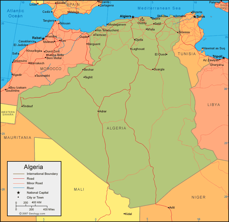
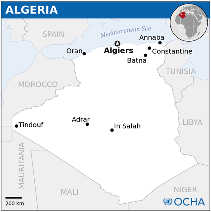
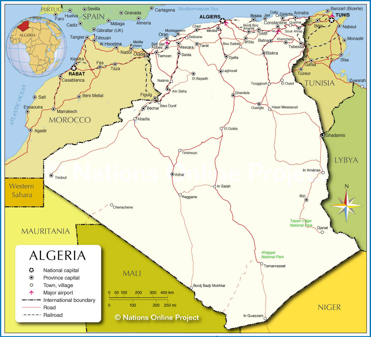
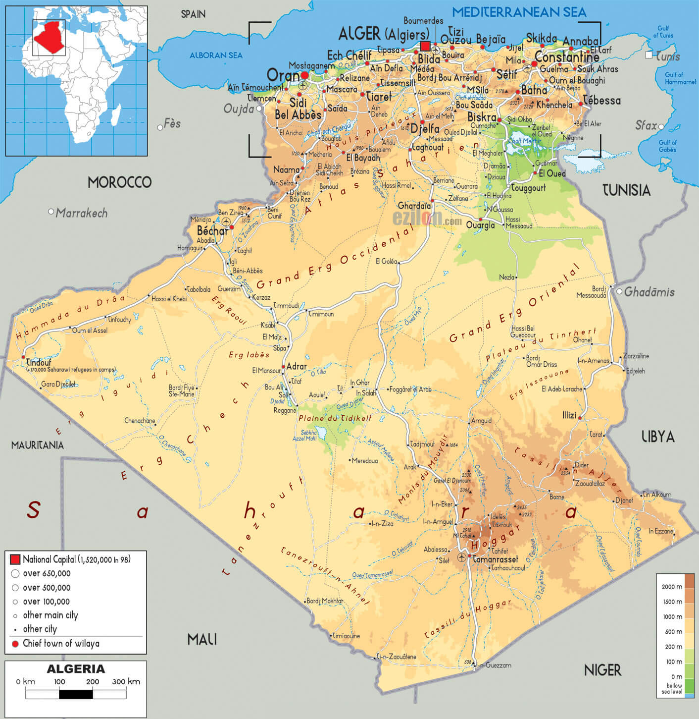
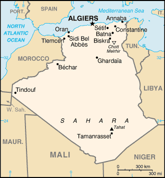
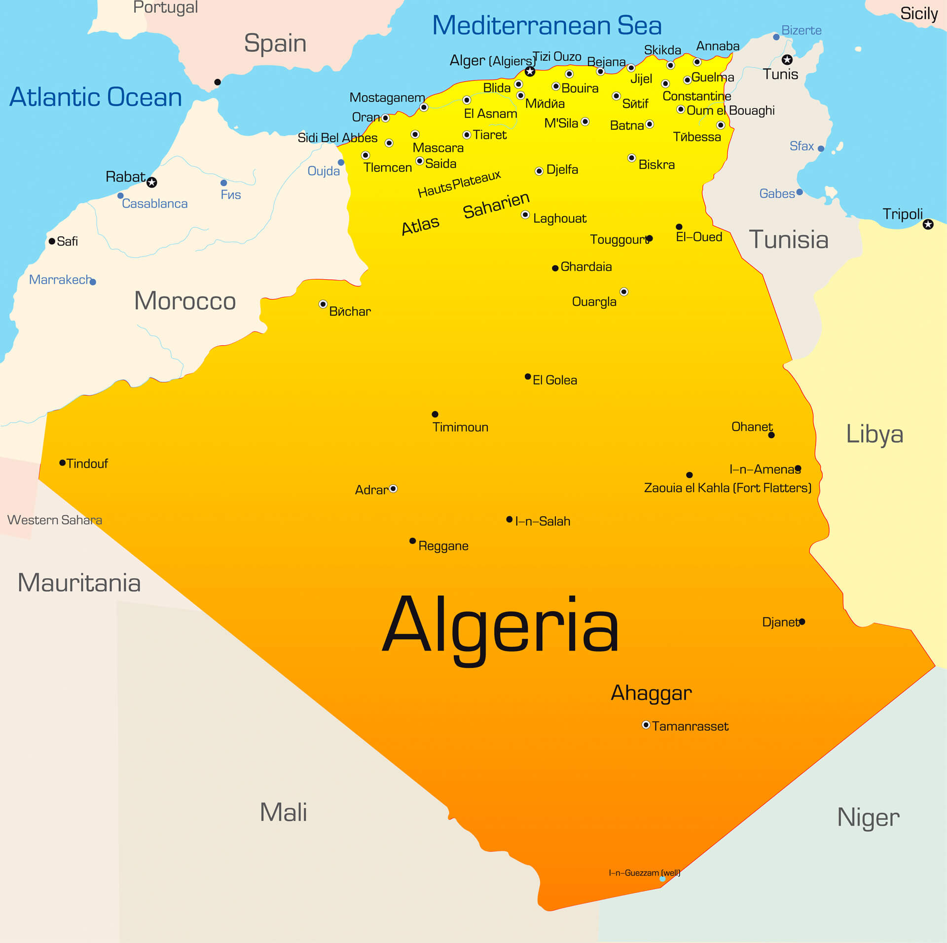
Algeria has over 100 cities. Largest 10 by population: Algiers, Oran, Constantine, Annaba, Blida, Batna, Djelfa, Setif, Biskra, Tlemcen.What are the major geographical features of Algeria ?
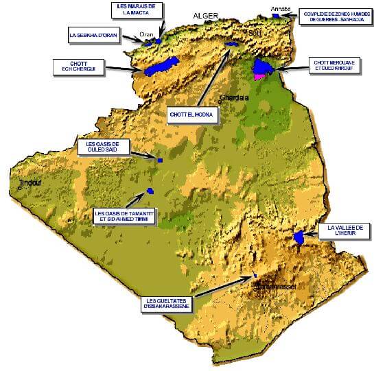
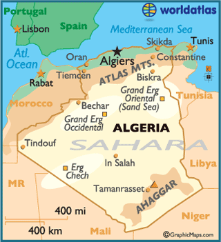
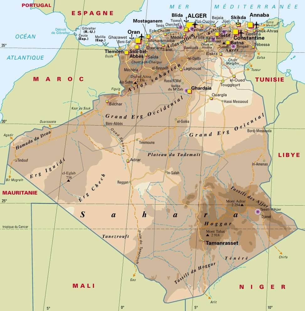
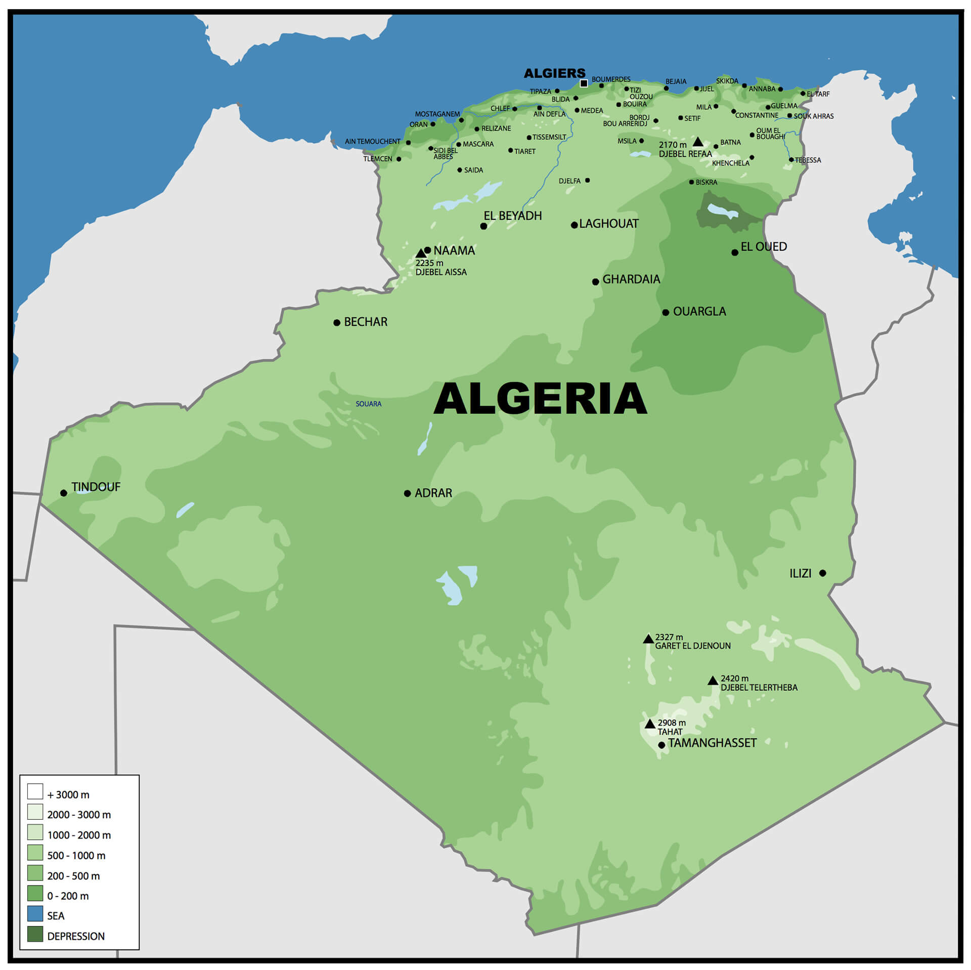
Algeria, the largest country in Africa, features the vast Sahara Desert covering most of its territory. The Atlas Mountains stretch across the north, with fertile coastal plains along the Mediterranean. Major geographical features include sand dunes, plateaus, and oases.MAP OF ALGERIA

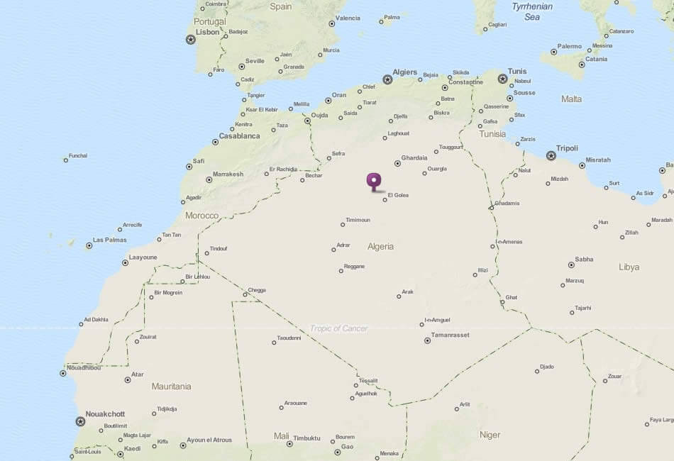
ALGERIA LOCAITION MAP
WHERE IS ALGERIA IN THE WORLD
Can I download a high-resolution map of Algeria ?
Yes. Download high-resolution political and physical maps of Algeria for personal or educational use. Redistribution is subject to the terms of our license.
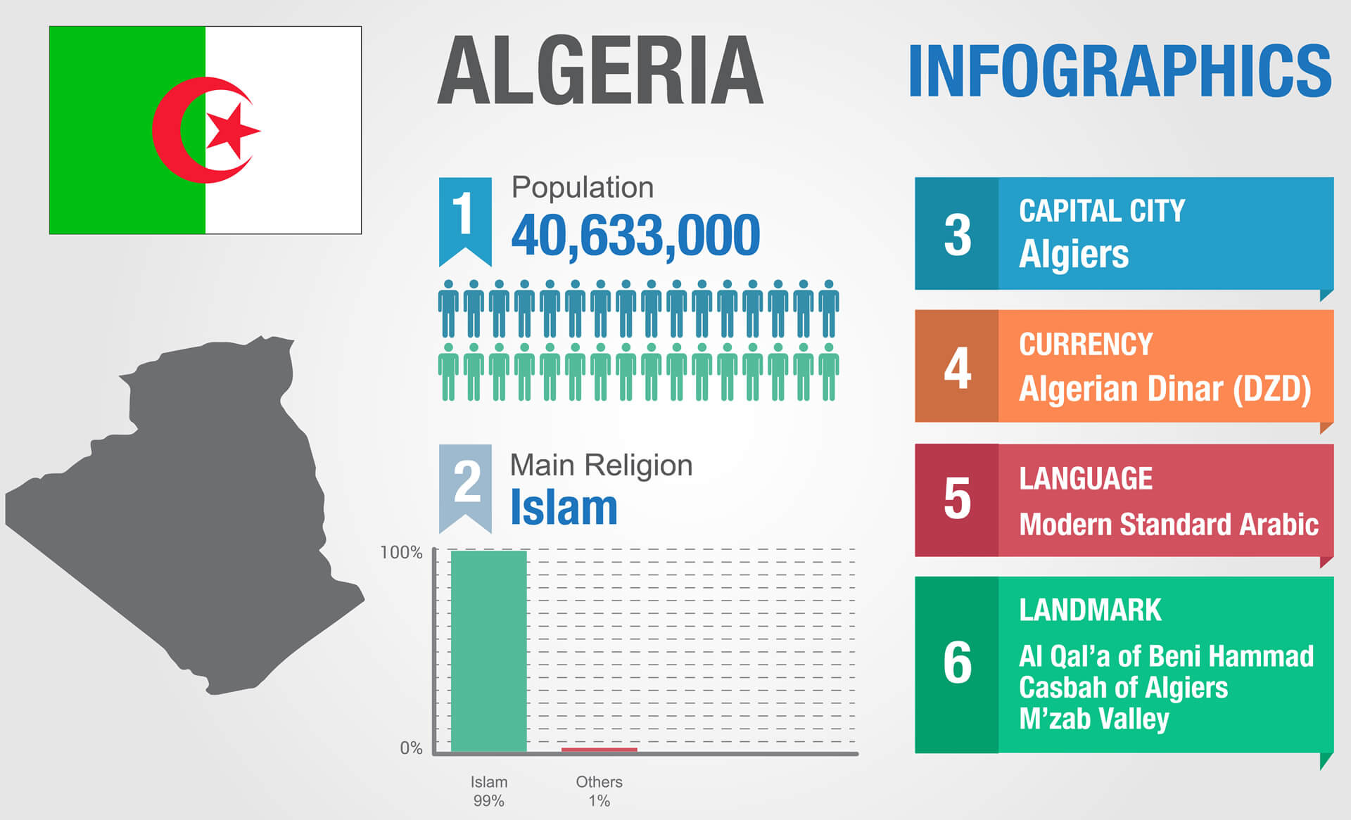
- Capital : Algiers
- Population : 37,100,000
- GDP : $190.709 billion (49th)
- Per Capita : $5,304 (93rd)
- Calling Code : +213
- Jobless Rate : 10.00%
- Time Zone : +1
Where is located Algeria on the Map
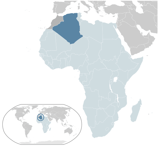
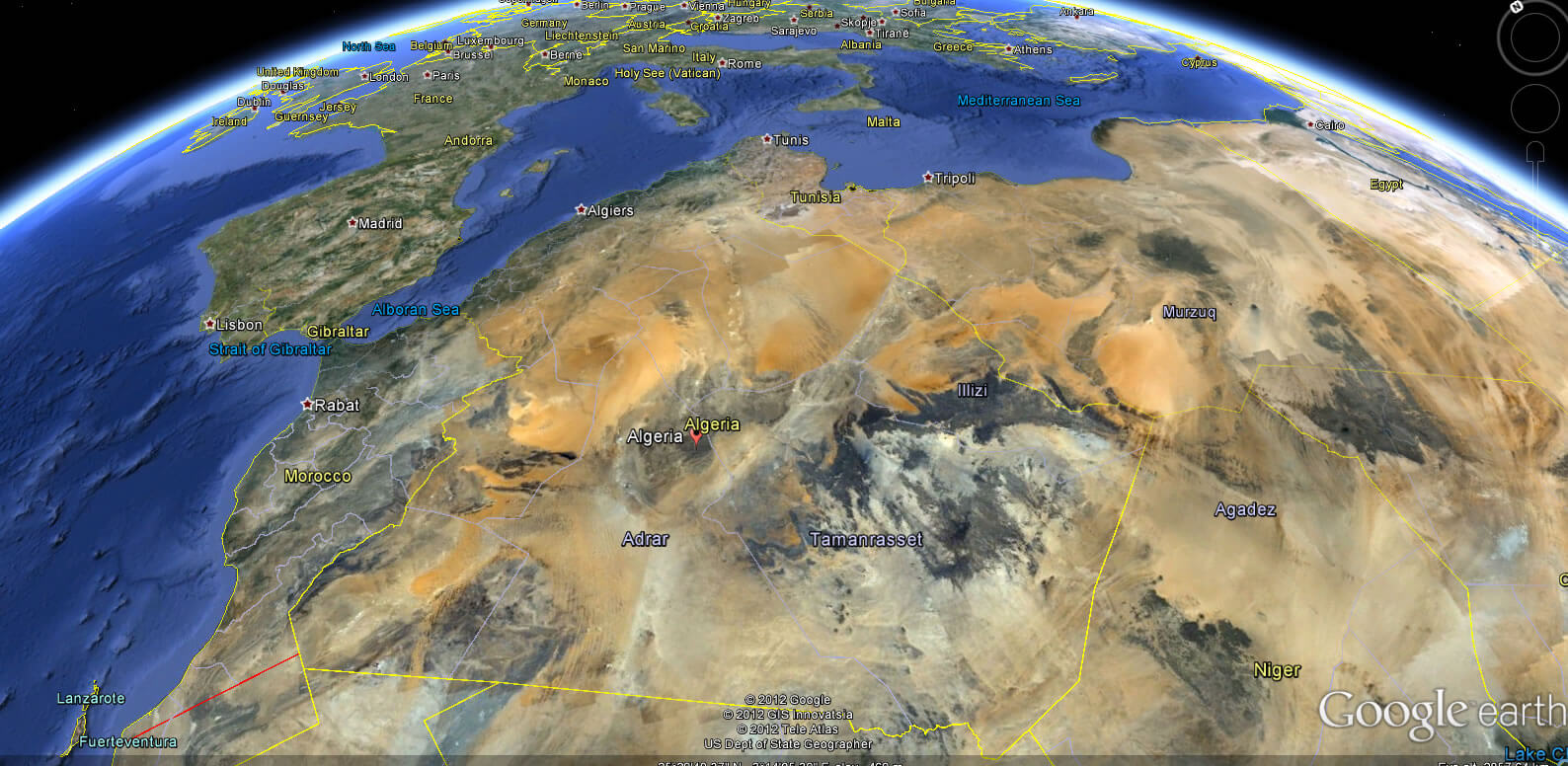
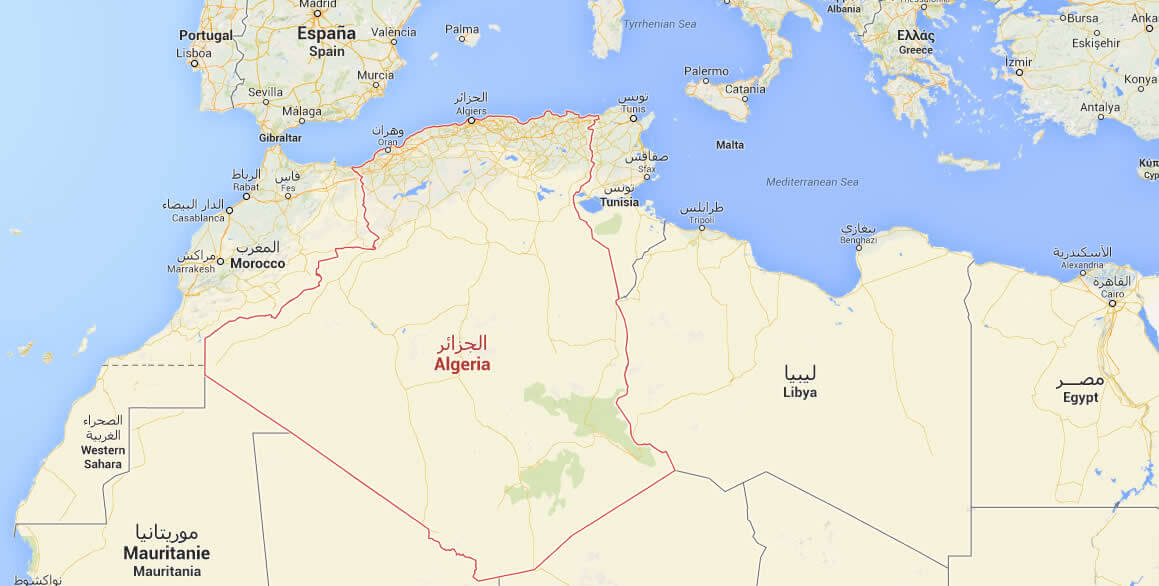
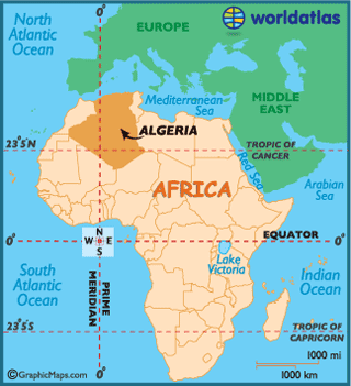
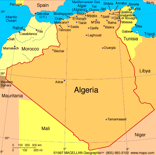
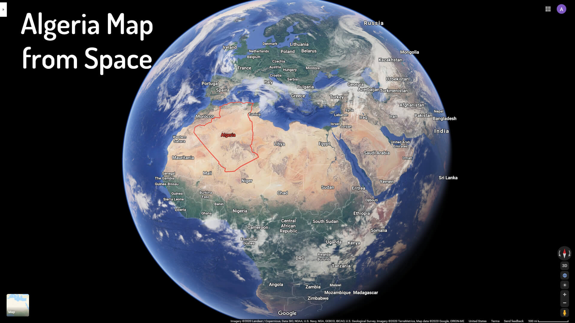
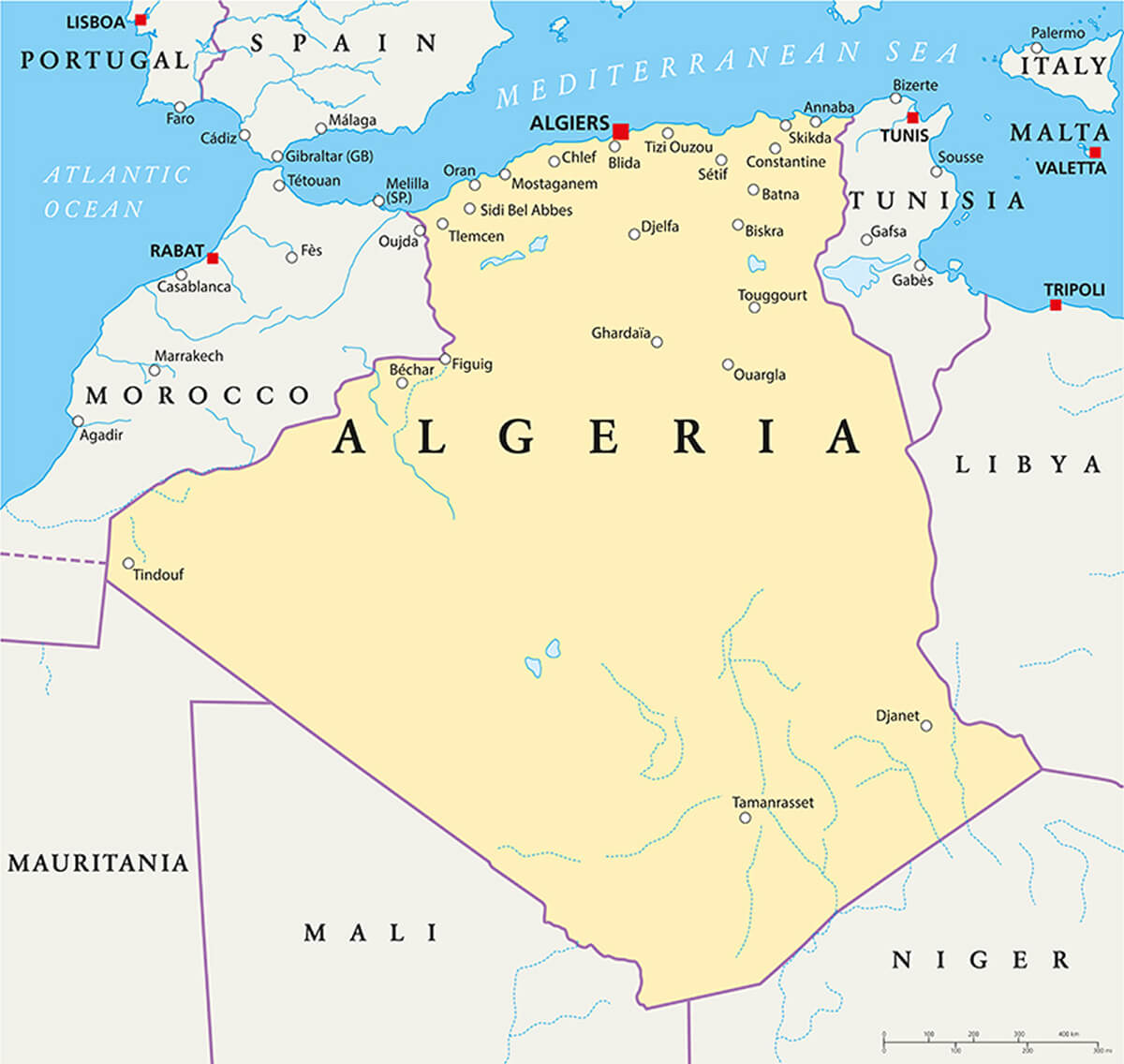
Algeria is a country located in North Africa, bordered by Tunisia to the northeast, Libya to the east, Niger to the southeast, Mali to the southwest, Western Sahara and Morocco to the west, and the Mediterranean Sea to the north. Its capital and largest city is Algiers. The country's geography is characterized by a mix of coastal areas, mountains, and deserts, including the Sahara Desert which covers much of the country's southern region. To find Algeria on a map, you can look for the coordinates 28.0339° N, 1.6596° E.
You can explore the beautiful country of Algeria and discover its diverse landscapes, bustling cities, and rich culture. With our interactive map tool, you can zoom in and out to see detailed views of different regions, and even plan your next adventure in this North African gem. Whether you're interested in exploring the Sahara desert, discovering ancient Roman ruins, or simply immersing yourself in the vibrant local culture, Algeria has something for everyone. So come explore this fascinating country and all it has to offer, right here on WorldMap1's Algeria map page.
Mysteries of the Mediterranean: A Deep Dive into Algiers'' Allure
Please subscribe on "World Guide" channnel on Youtube at youtube.com/c/WorldGuide
AFRICA from Space and African Countries Satellite View
For more about Algeria >>
Brief information about Algeria
Algeria is a country located in North Africa, bordered by the Mediterranean Sea to the north, Tunisia to the northeast, Libya to the east, Niger to the southeast, Mali to the southwest, Mauritania and Western Sahara to the west. It is the largest country in Africa and the 10th largest in the world, with a population of over 44 million people.What is the population of Algeria
The population of Algeria is estimated to be around 45 million in 202212. According to the United Nations, the current population of Algeria is 45,482,295 as of April 26, 202334. The majority of the population is Arab-Berber, with smaller groups of Tuareg, Mozabite, and other ethnicities13. Ninety-one percent of the Algerian population lives along the Mediterranean coast on 12% of the country's total land mass, and 45% of the population is urban1. Algeria is a young country, with 1 in 4 people under the age of 153.What is the population density of Algeria
The population density of Algeria is 19.15 people per square kilometer as of 20231. However, the population density varies greatly across the country, with the majority of the population living along the Mediterranean coast on 12% of the country's total land mass23. The population density in Algiers, the capital city, is much higher, with 2,500 people per square kilometer4. The urbanization rate in Algeria is 45%, and urbanization continues despite government efforts to discourage migration to the cities.A Collection of Algeria Maps and Algeria Satellite Images
MAP OF ALGERIA
ALGERIA LOCAITION MAP
WHERE IS ALGERIA IN THE WORLD
ALGERIA EARTH MAP
ALGERIA MAP
ALGERIA GOOGLE MAP
ALGERIA MAP AFRICA
ALGERIA MAP CITIES
ALGERIA NATIONAL MAP
ALGERIA PHYSICAL MAP

ALGERIA RELIEF MAP

ALGERIA SERAIDI ANNABA
CITIES MAP OF ALGERIA
MAP OF ALGERIA
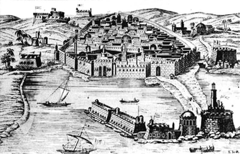
OLD ALGIERS 16TH CENTURY
PHYSICAL MAP OF ALGERIA
PHYSICAL ROAD MAP OF ALGERIA
POLITICAL MAP OF ALGERIA
ALGERIA ADMINISTRATIVE MAP WITH PROVINCES

ALGERIA INFOGRAPHICS MAP
ALGERIA MAP FROM SPACE
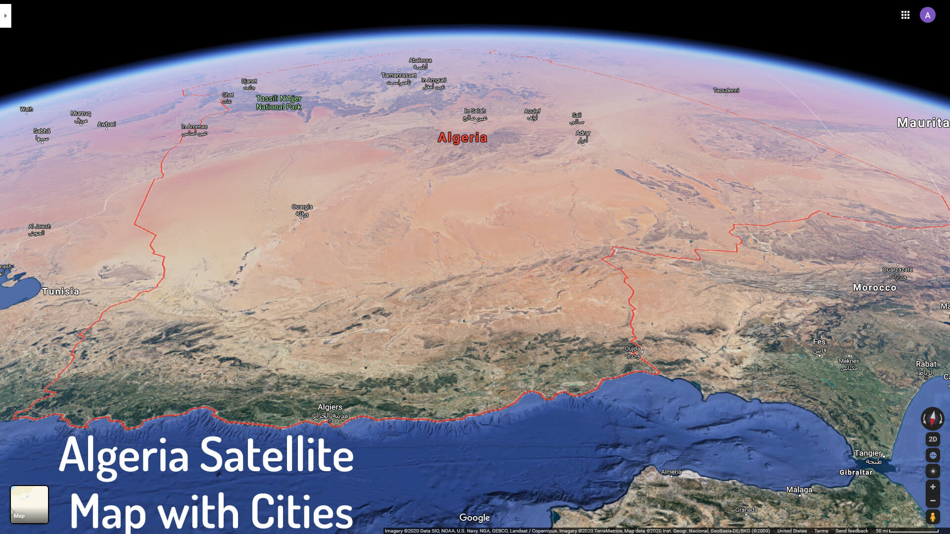
ALGERIA SATELLITE MAP WITH CITIES
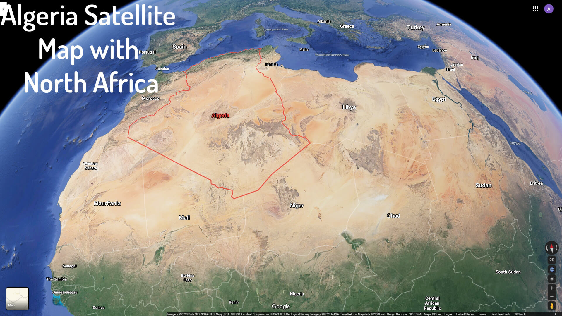
ALGERIA SATELLITE MAP WITH NORTH AFRICA
COLOR MAP OF ALGERIA
PHYSICAL MAP OF ALGERIA WITH CITIES
POLITICAL MAP OF ALGERIA
- Head of Performance Marketing
- Head of SEO
- Linkedin Profile: linkedin.com/in/arifcagrici