Angola Map FQA
How many cities are in Angola ?
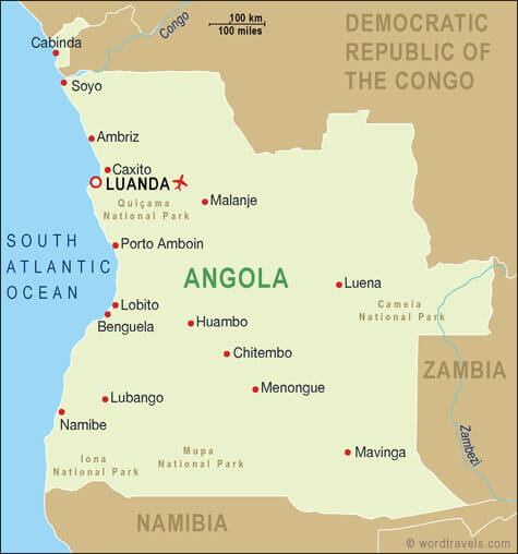
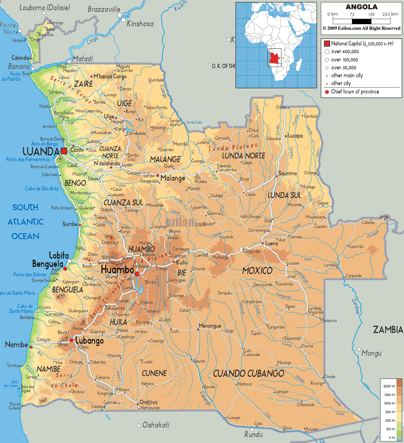
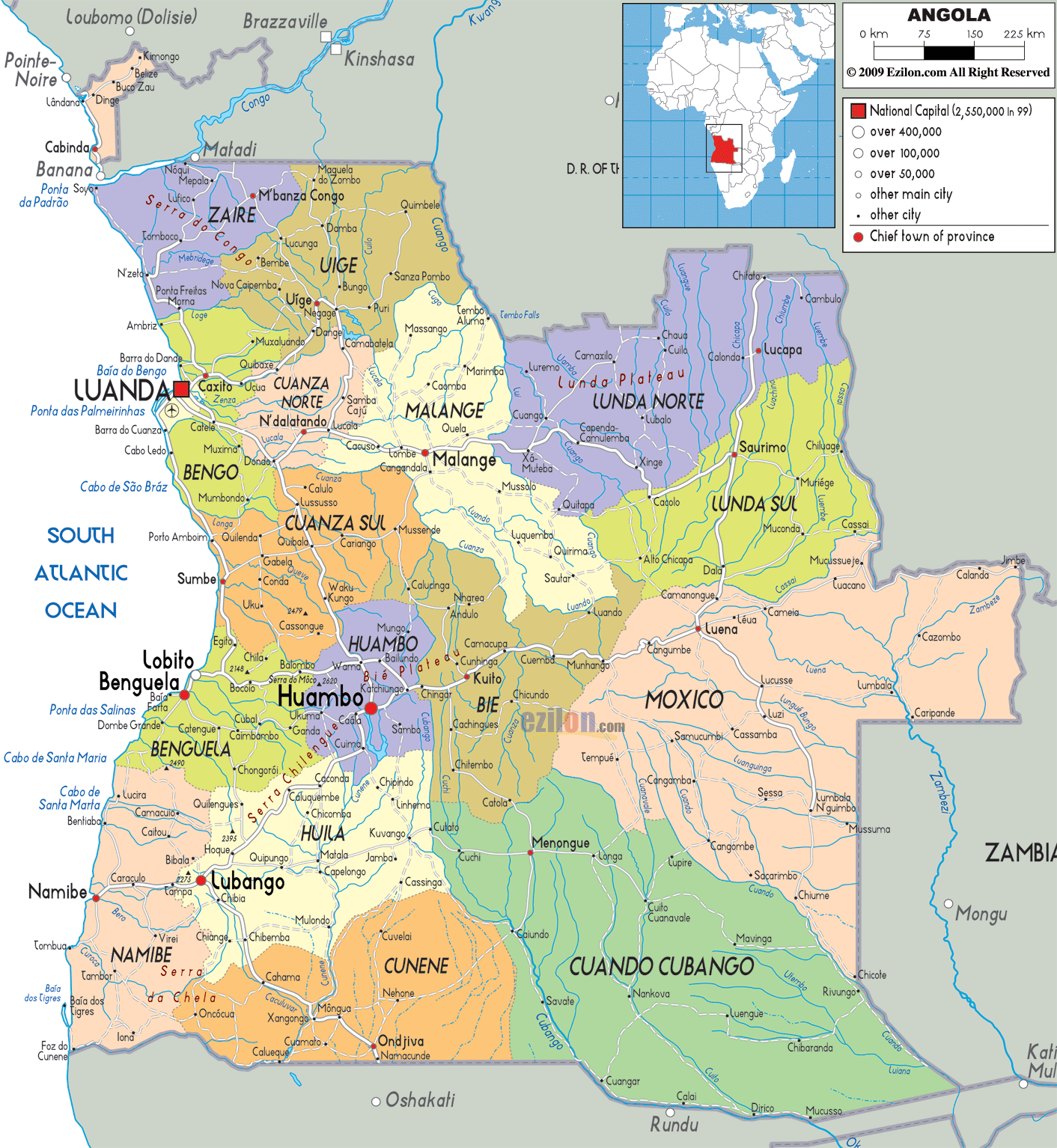
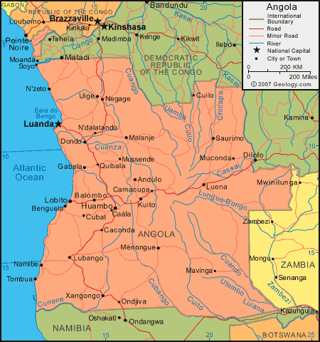
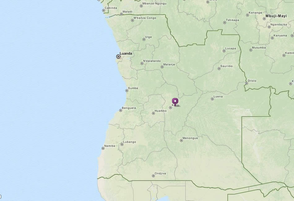
Angola has about 30 cities. Largest 10 by population: Luanda, N'dalatando, Huambo, Lobito, Benguela, Kuito, Lubango, Malanje, Namibe, Soyo.
What are the major geographical features of Angola ?
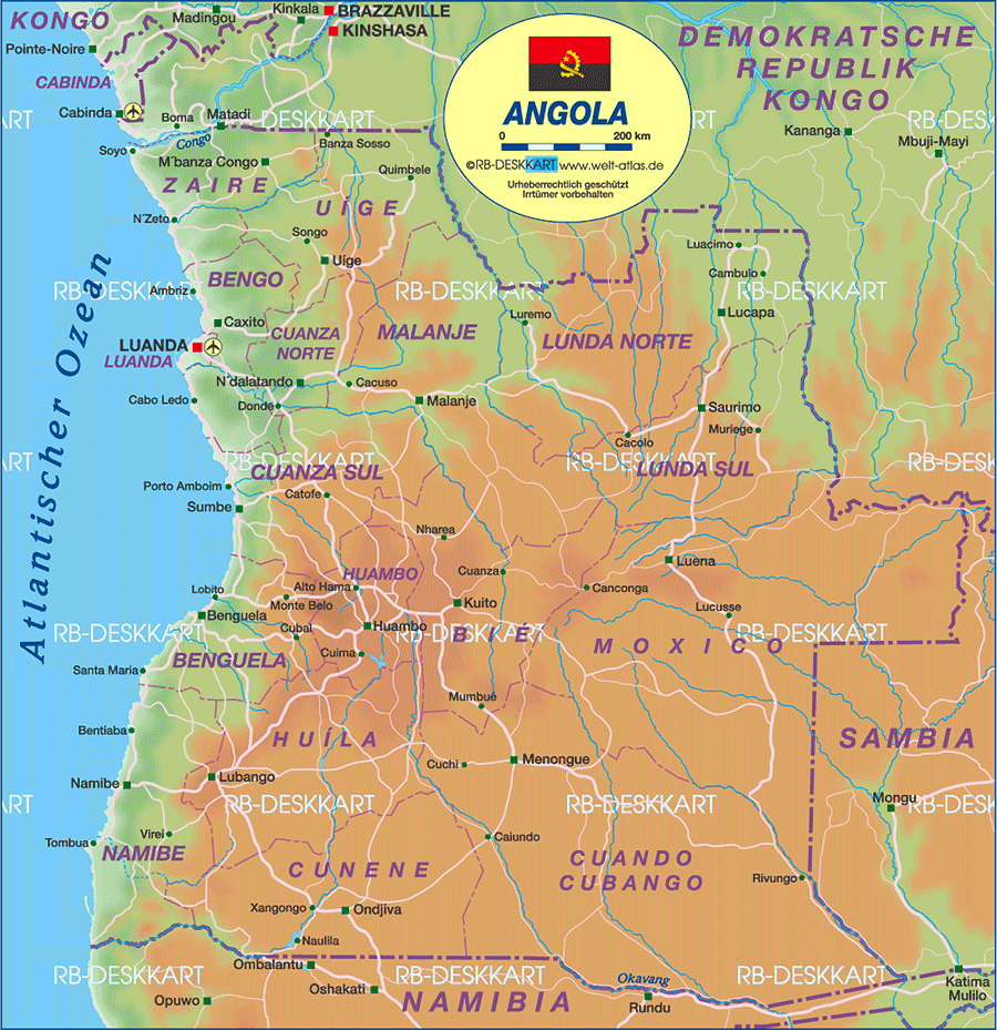
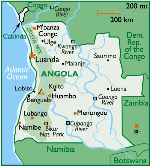
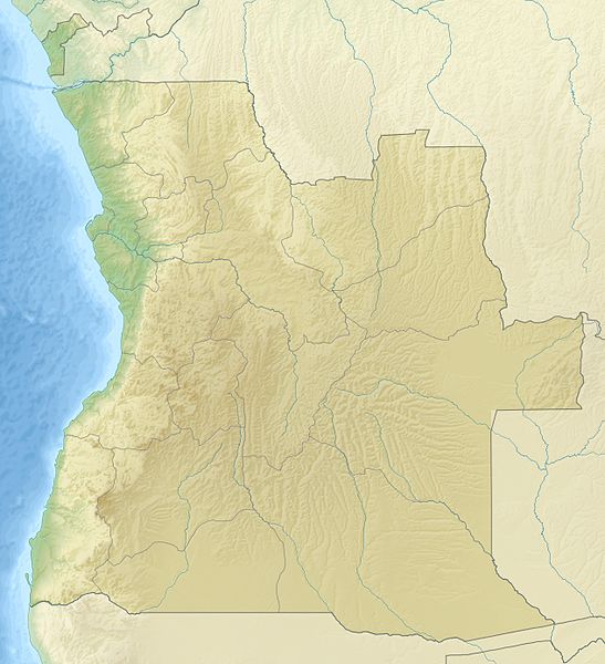
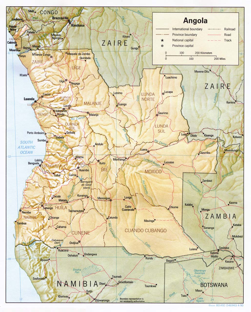
Angola, in southern Africa, has a varied geography that includes a narrow coastal plain, a broad inland plateau, and mountain ranges such as the Serra da Chela. Rivers like the Cuanza and Cunene cross the country. The interior features savannas and highlands, while the coast borders the Atlantic Ocean.
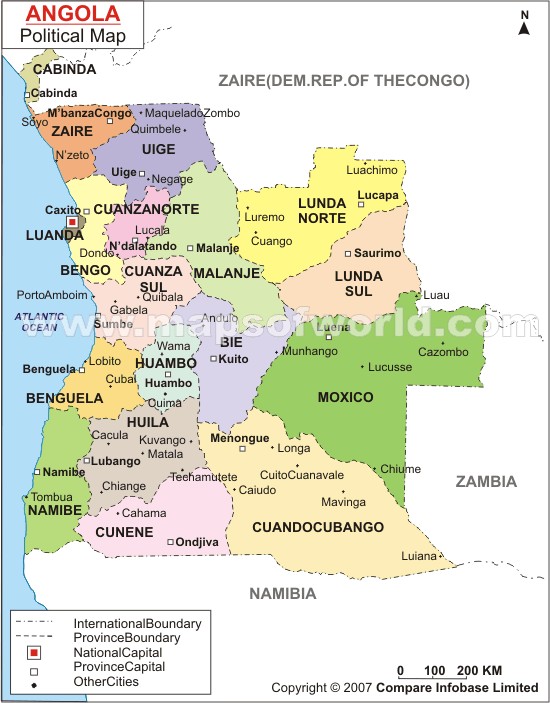
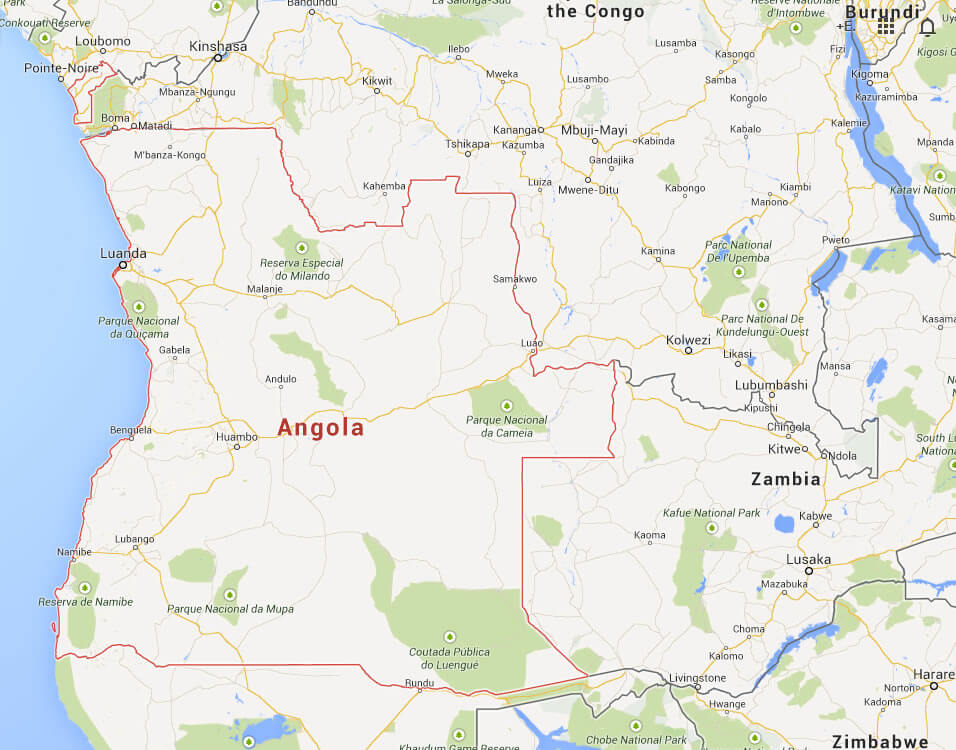
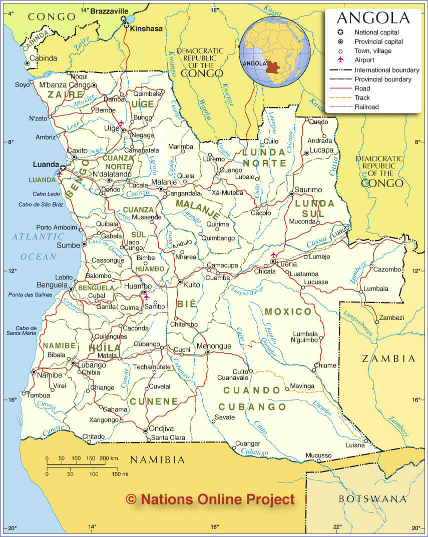
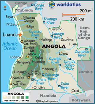
ANGOLA MAP CITIES
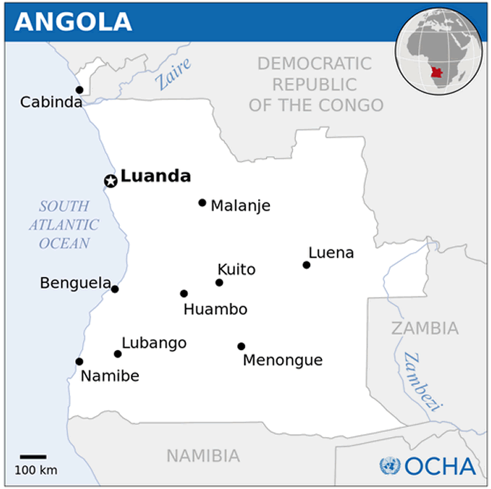
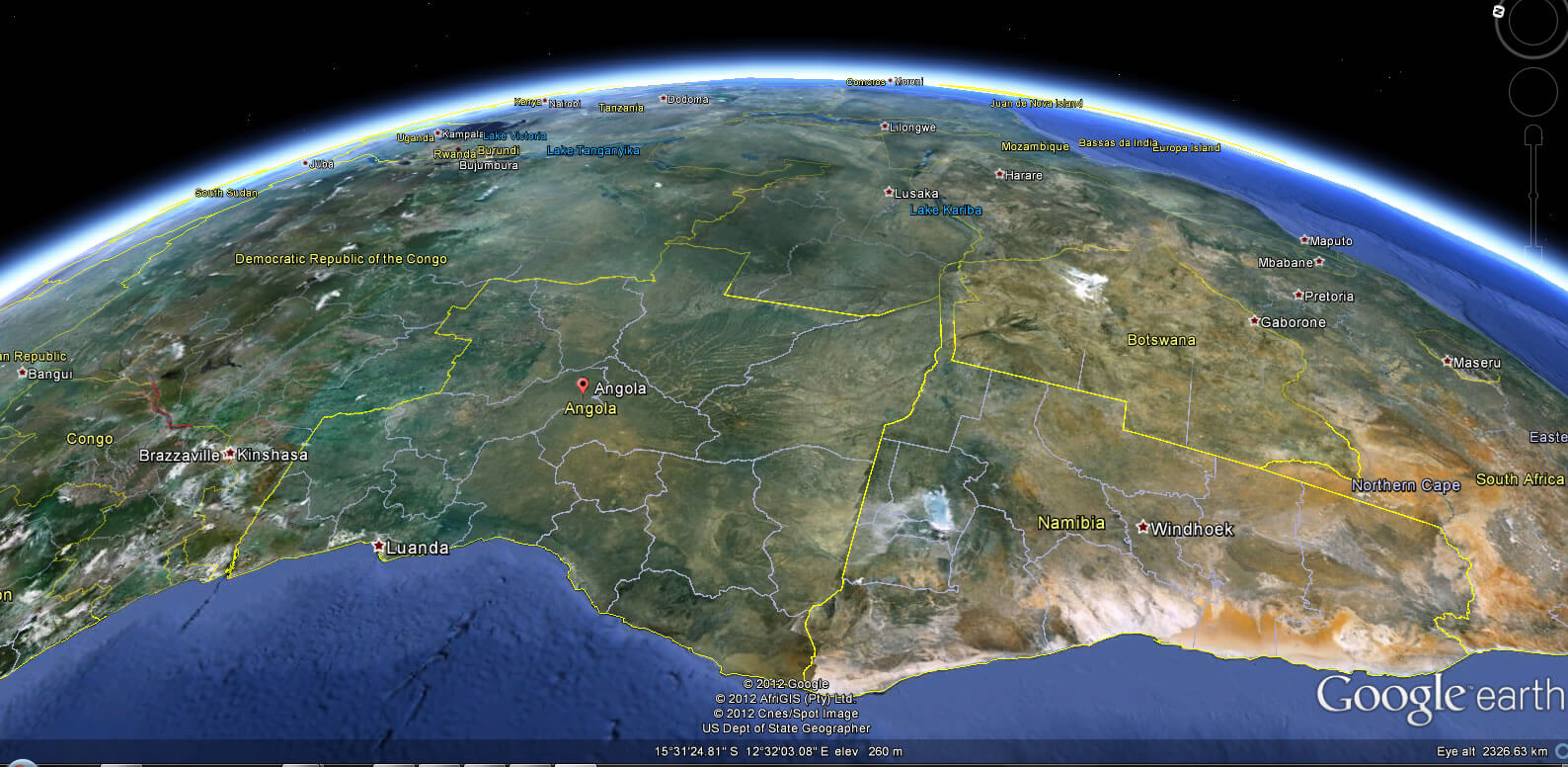
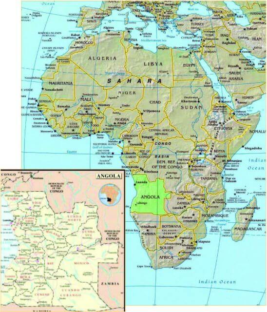
ANGOLA LOCATION MAP
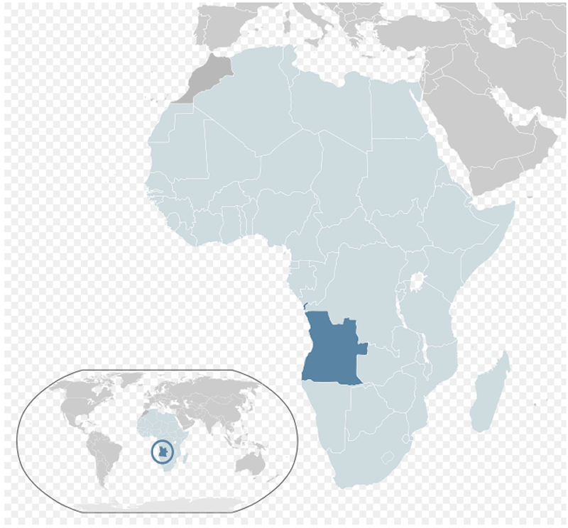
WHERE IS ANGOLA IN THE WORLD
Can I download a high-resolution map of Angola ?
Yes. Download high-resolution political and physical maps of Angola for personal or educational use. Redistribution is subject to the terms of our license.
- Capital :
Luanda
- Population :
18,498,000
- GDP :
$100.948 billion (61st)
- Per Capita :
$5,144 (91st)
- Calling Code :
+244
- Jobless Rate :
26.00%
- Time Zone :
+1
With interactive Angola Map, view regional highways maps, road situations, transportation, lodging guide, geographical map, physical maps and more information. On Angola Map, you can view all states, regions, cities, towns, districts, avenues, streets and popular centers' satellite, sketch and terrain maps.
From Savannahs to Cities: Mapping Angola's Multifaceted Landscapes
Please subscribe on "World Guide" channnel on Youtube at youtube.com/c/WorldGuide
For more about Angola >>
A Collection of Angola Maps and Angola Satellite Images
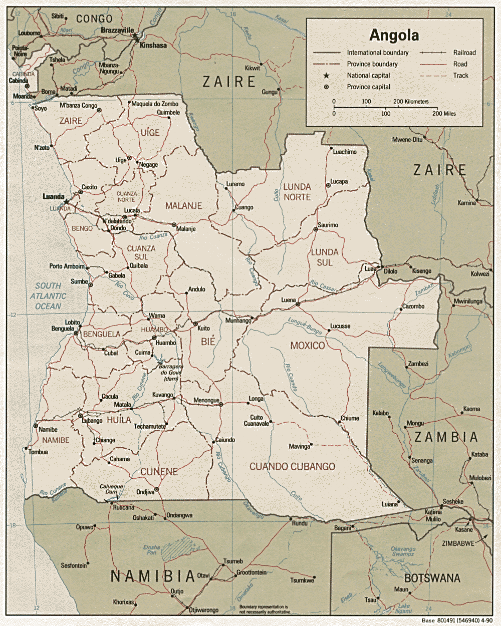
ANGOLA MAP CITIES
ANGOLA LOCATION MAP
WHERE IS ANGOLA IN THE WORLD
ANGOLA EARTH MAP
ANGOLA MAP
ANGOLA ATLAS
ANGOLA CITIES MAP
ANGOLA GOOGLE MAP
ANGOLA MAP
ANGOLA MAP AFRICA
ANGOLA MAP PHYSICAL
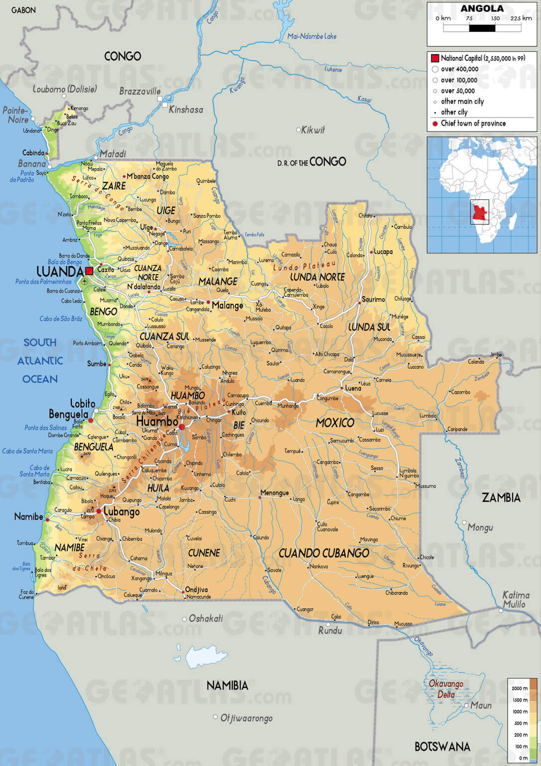
ANGOLA PHYSICAL MAP
ANGOLA POLITICAL MAP
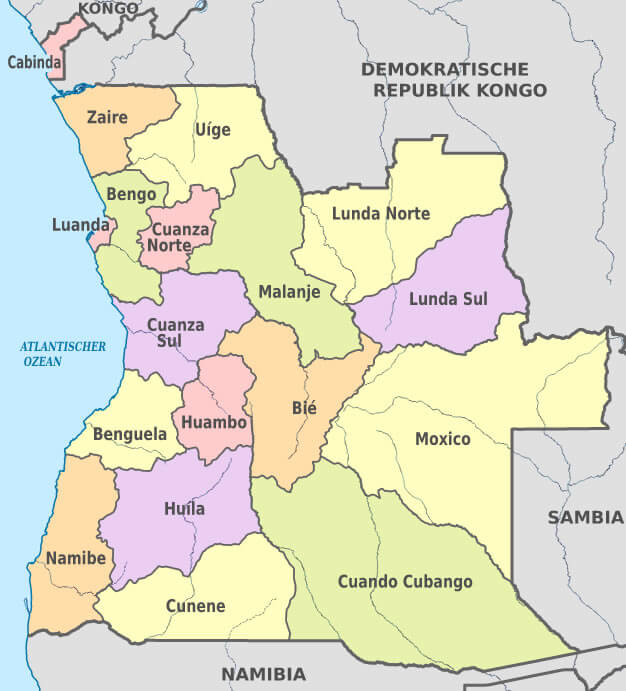
ANGOLA PROVINCES MAP
ANGOLA RELIEF MAP
ANGOLA RIVER MAP
ANGOLA ROAD MAP
MAP OF ANGOLA
PHYSICAL MAP OF ANGOLA
POLITICAL MAP OF ANGOLA
Author: Arif Cagrici
