Comoros Map FQA
How many cities are in Comoros ?
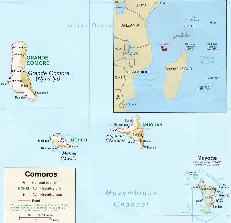
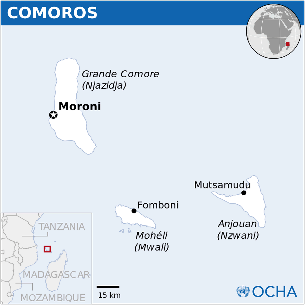
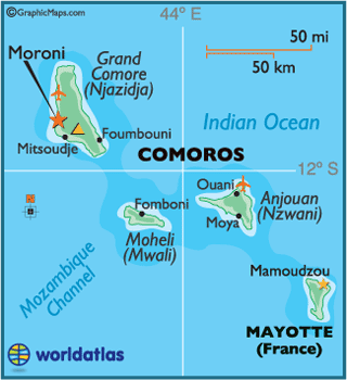
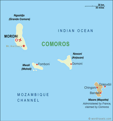
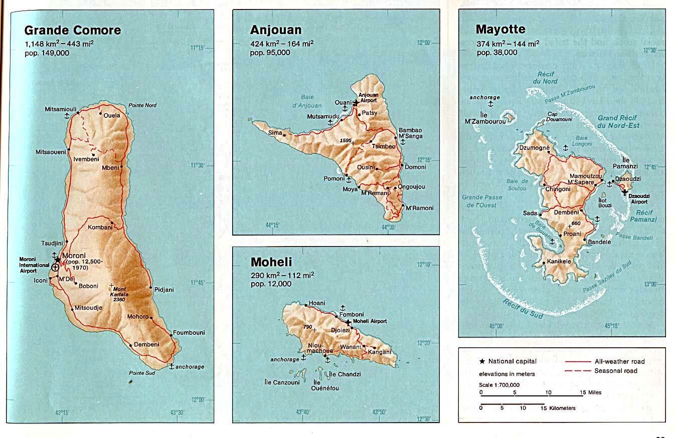
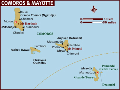
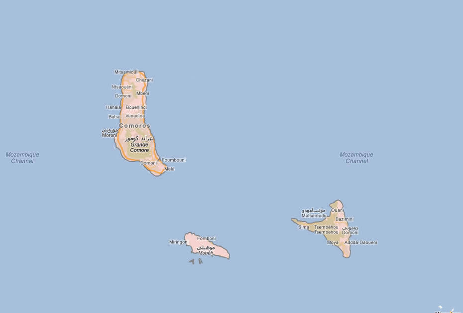
The Comoros has a few towns. The main ones are: Moroni, Mutsamudu, Fomboni, and Domoni.
What are the major geographical features of Comoros ?
The Comoros is an island nation in the Indian Ocean made up of volcanic islands. It has rugged mountains, coastal plains, and Mount Karthala, an active volcano on Grande Comore.
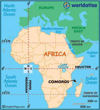
MAP OF COMOROS
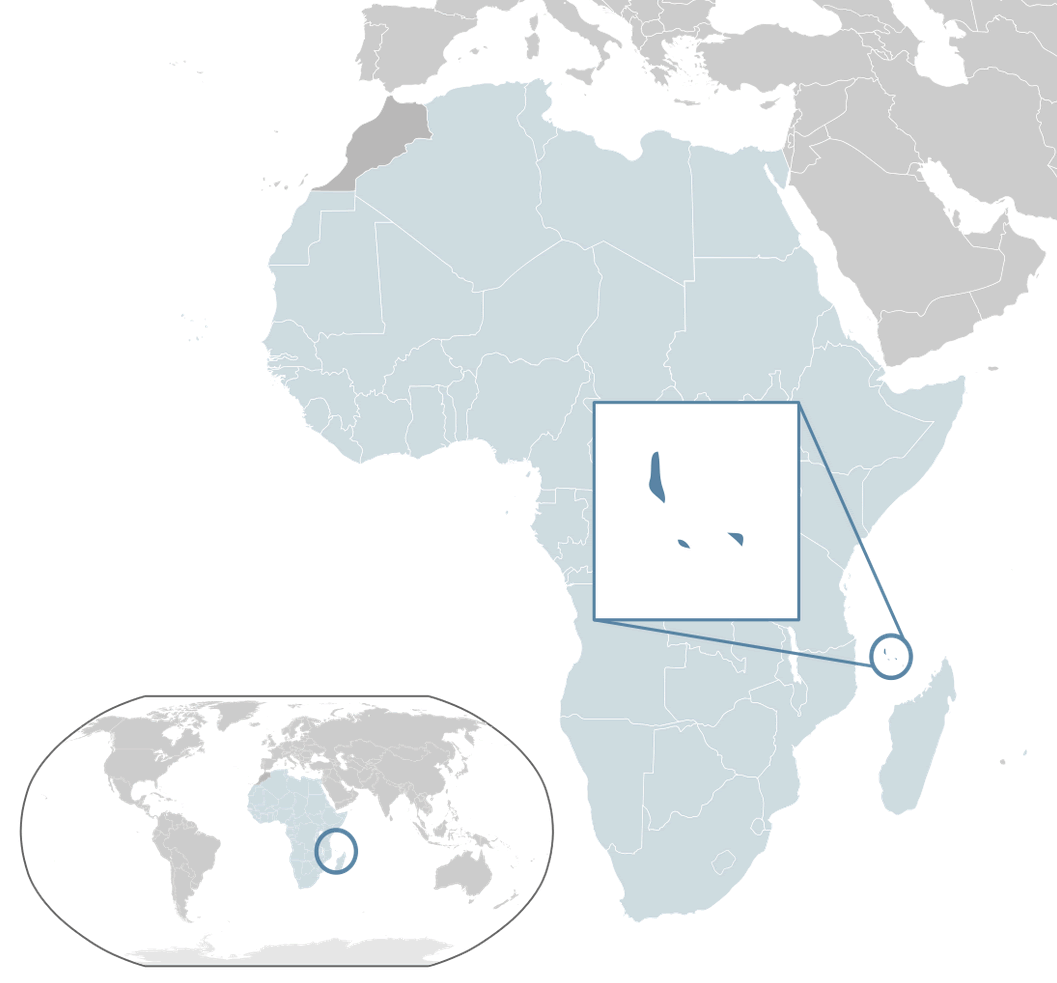
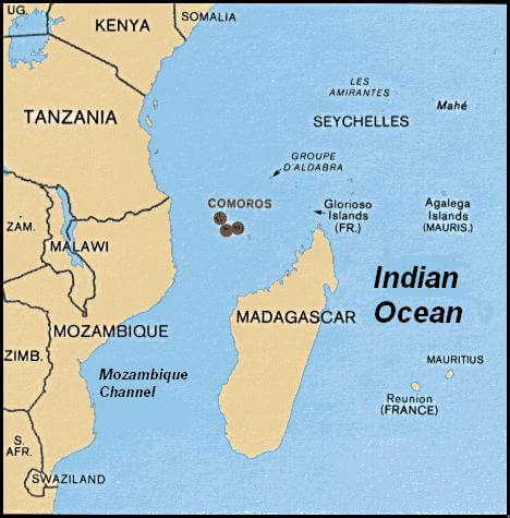
COMOROS LOCATION MAP
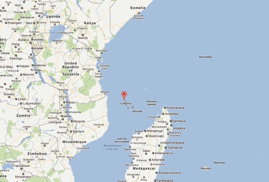
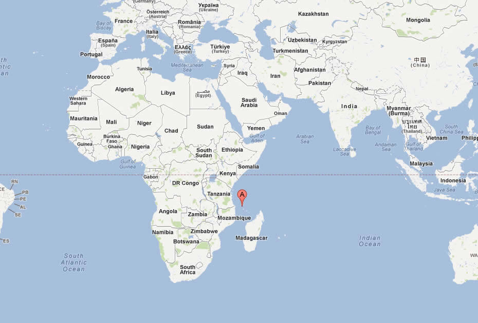
WHERE IS COMOROS IN THE WORLD
Can I download a high-resolution map of Comoros ?
Yes. Download high-resolution political and physical maps of Comoros for personal or educational use. Redistribution is subject to the terms of our license.
- Capital :
Moroni
- Population :
798,000
- GDP :
$595 million (177th)
- Per Capita :
$858 (155th)
- Calling Code :
+269
- Jobless Rate :
13.50%
- Time Zone :
+3
With interactive Comoros Map, view regional highways maps, road situations, transportation, lodging guide, geographical map, physical maps and more information. On Comoros Map, you can view all states, regions, cities, towns, districts, avenues, streets and popular centers' satellite, sketch and terrain maps.
For more about Comoros >>
A Collection of Comoros Maps and Comoros Satellite Images
MAP OF COMOROS
COMOROS LOCATION MAP
WHERE IS COMOROS IN THE WORLD
COMOROS ISLANDS MAP
COMOROS MAP INDIAN OCEAN
COMOROS POLITICAL MAP
COMOROS MAP

COMOROS MAP
COMOROS MAP AFRICA
COMOROS MAYOTTE MAP
MAP OF COMOROS AFRICA
MAP OF COMOROS WORLD
MAP OF COMOROS
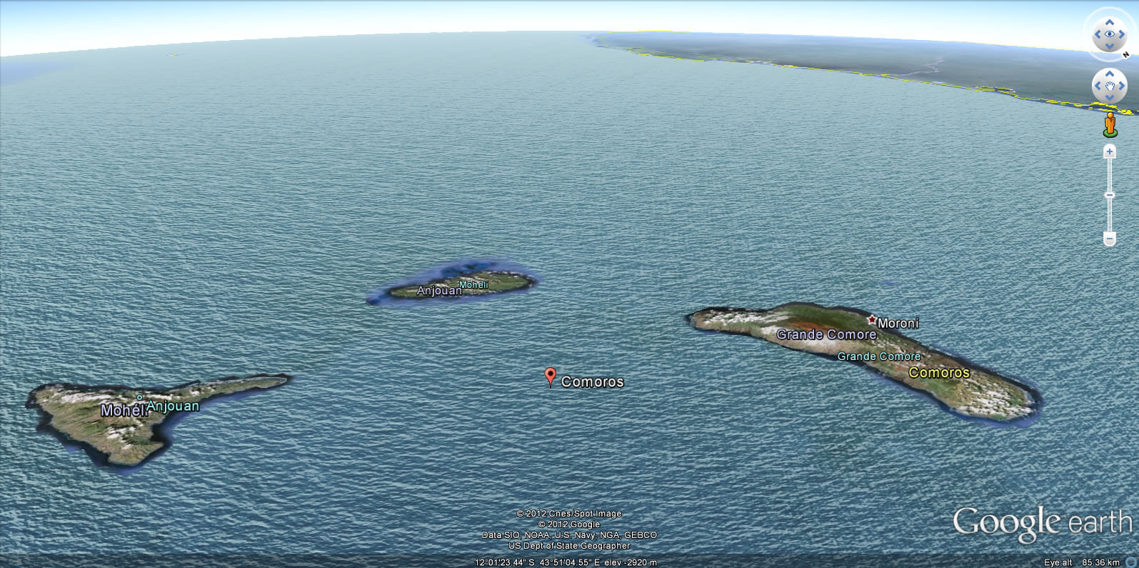
COMOROS EARTH MAP
Author: Arif Cagrici
