Cote d'Ivoire Map FQA
How many cities are in Cote d'Ivoire ?
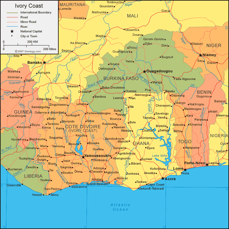
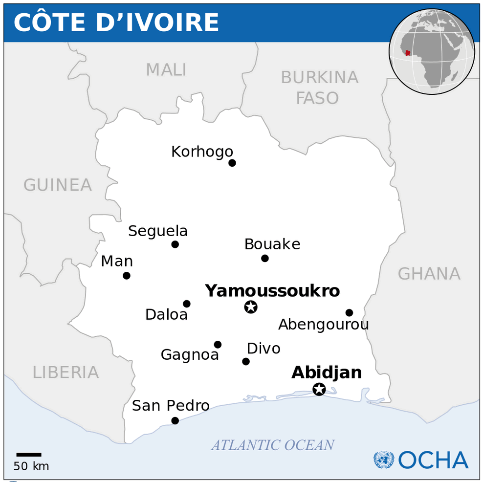
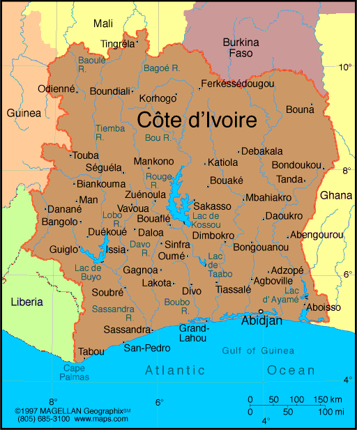
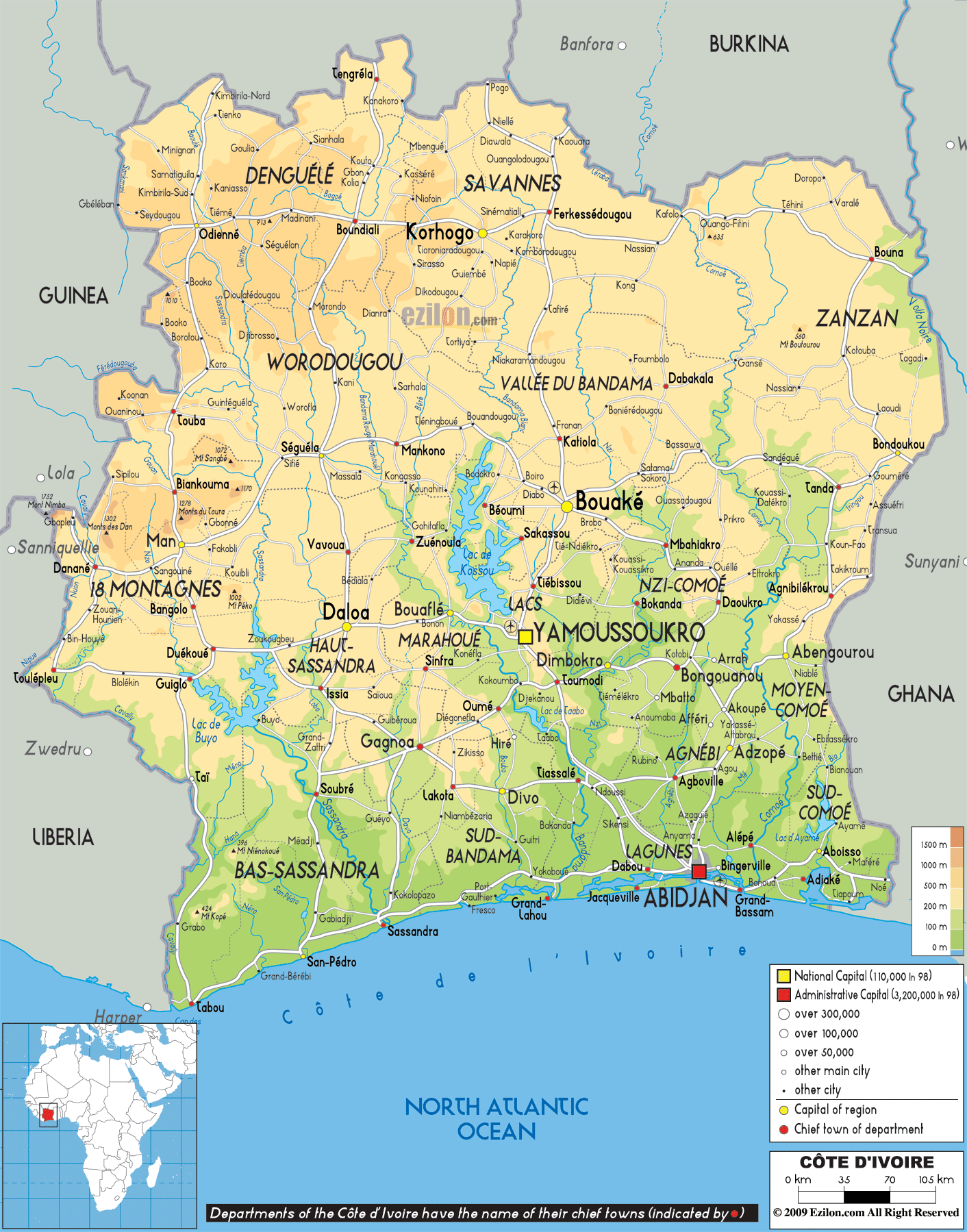
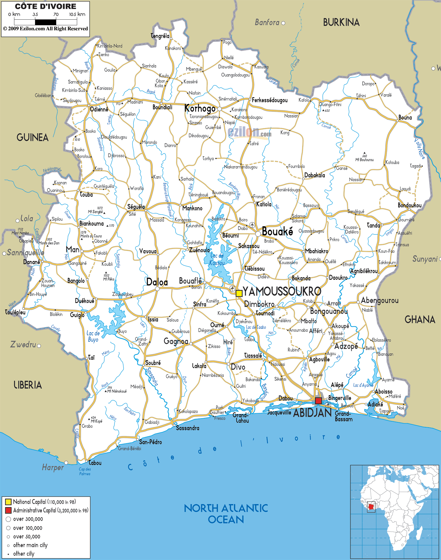
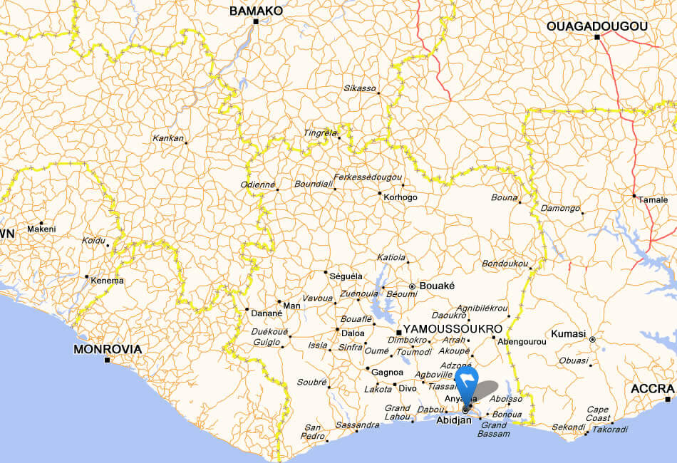
Côte d'Ivoire has more than 10 major cities. The largest by population are: Abidjan; Bouaké; Daloa; Yamoussoukro; San-Pédro; Korhogo; Man; Divo; Gagnoa; Abengourou.
What are the major geographical features of Cote d'Ivoire ?
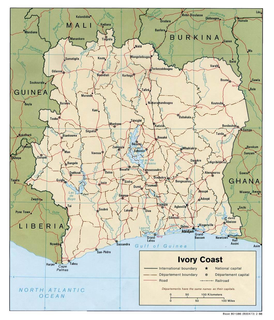
Côte d'Ivoire in West Africa has coastal lagoons, rainforests in the south, savannas in the north, and mountain ranges such as Mount Nimba. The Bandama and Comoé are major rivers.
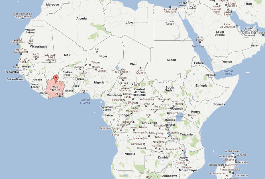
MAP OF COTE D'IVOIRE
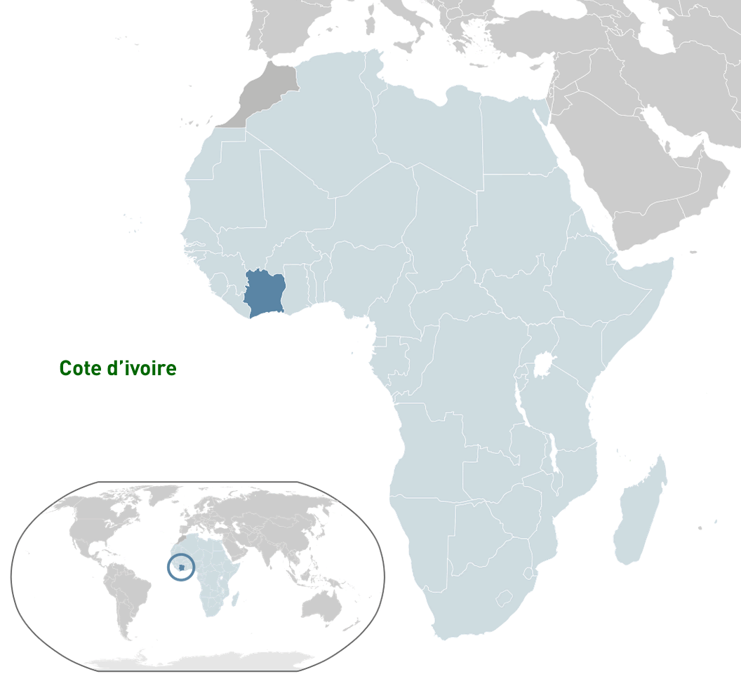
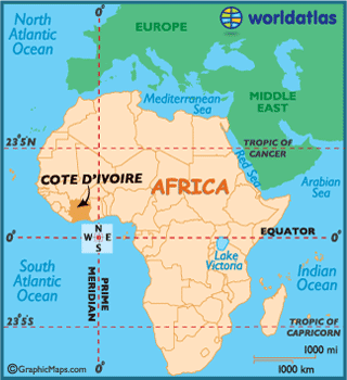
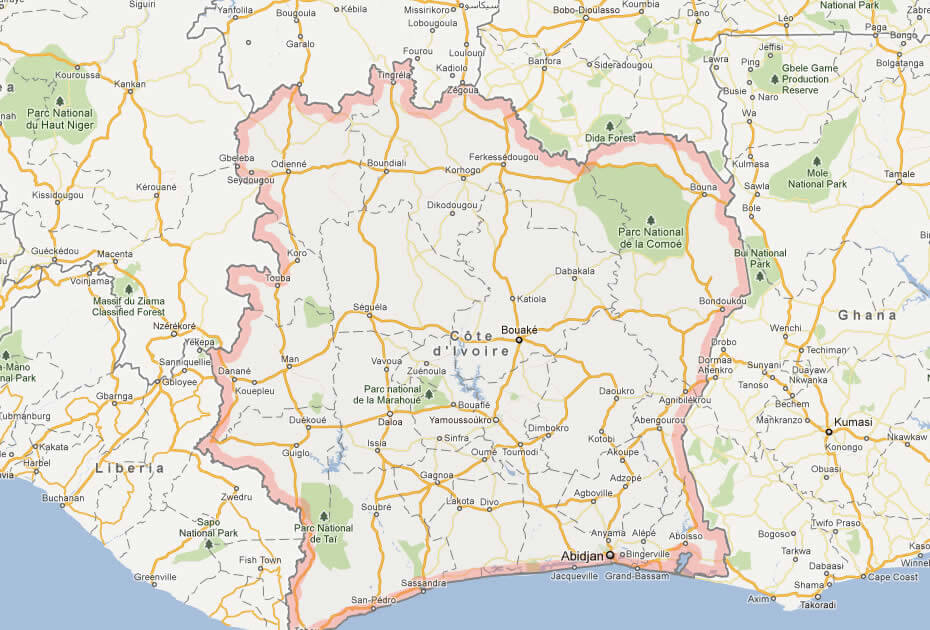
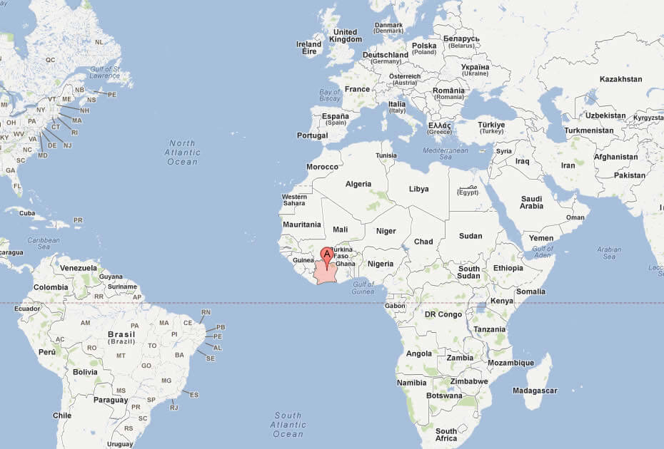
WHERE IS COTE D'IVOIRE IN THE WORLD
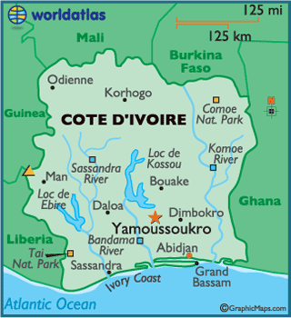
MAJOR CITIES MAP OF COTE D'IVOIRE
Can I download a high-resolution map of Cote d'Ivoire ?
Yes. Download high-resolution political and physical maps of Cote d'Ivoire for personal or educational use. Redistribution is subject to the terms of our license.

- Capital :
Yamoussoukro
- Population :
20,617,068
- GDP :
$24.096 billion
- Per Capita :
$1,062
- Calling Code :
+225
- Jobless Rate :
15.70%
- Time Zone :
+0
With interactive Cote d'Ivoire Map, view regional highways maps, road situations, transportation, lodging guide, geographical map, physical maps and more information. On Cote d'Ivoire Map, you can view all states, regions, cities, towns, districts, avenues, streets and popular centers' satellite, sketch and terrain maps.
A Collection of Cote d'Ivoire Maps and Cote d'Ivoire Satellite Images
MAP OF COTE D'IVOIRE
WHERE IS COTE D'IVOIRE IN THE WORLD
MAJOR CITIES MAP OF COTE D'IVOIRE
COTE D'IVOIRE LOCATION MAP
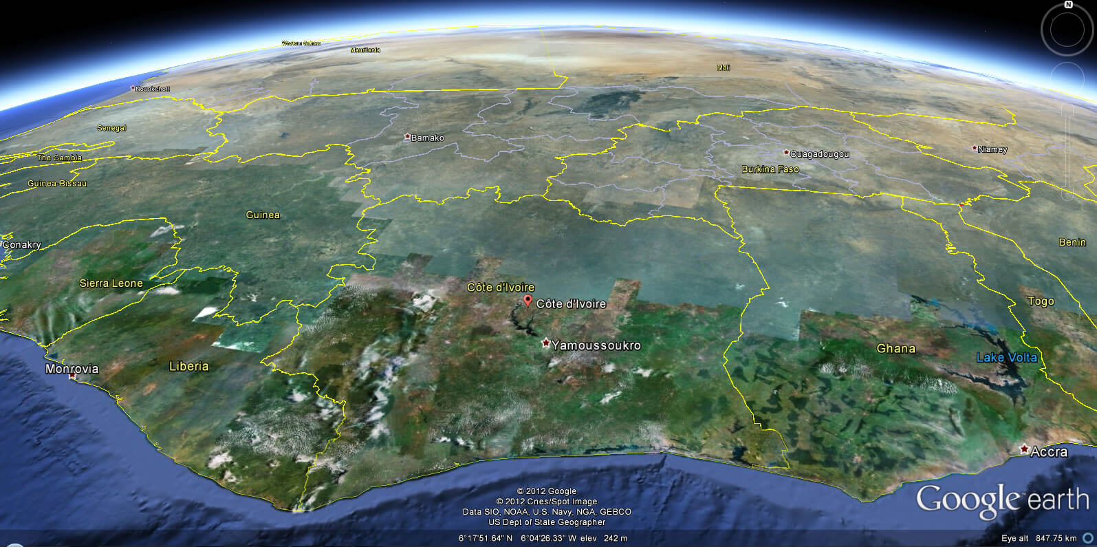
COTE D'IVOIRE EARTH MAP
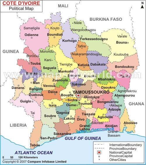
COTE DLVORIE POLITICAL MAP
COTE D'IVOIRE

COTE D'IVOIRE AFRICA MAP
COTE D'IVOIRE MAP
COTE D'IVOIRE POLITICAL MAP
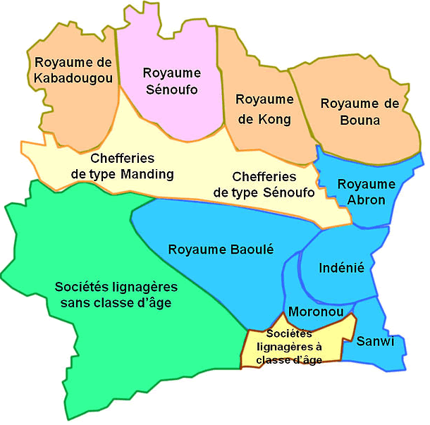
COTE D'IVOIRE REGIONS MAP
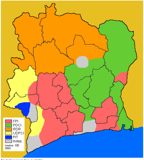
COTED'IVOIRE ELECTIONS 2002
CÔTE D'IVOIRE MAP
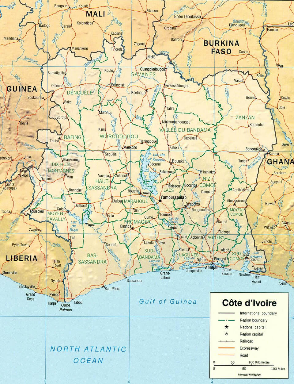
IVORY COAST PHYSICAL MAP
IVORY COAST ROAD MAP
IVORY COAST
MAP OF COTE D'IVOIRE
MAP OF IVORY COAST AFRICA
MAP OF IVORY COAST WORLD
MAP COTE D'IVOIRE
Author: Arif Cagrici
Largest Cities' Map of Cote d'Ivoire
