Cuba Map FQA
How many cities are in Cuba ?
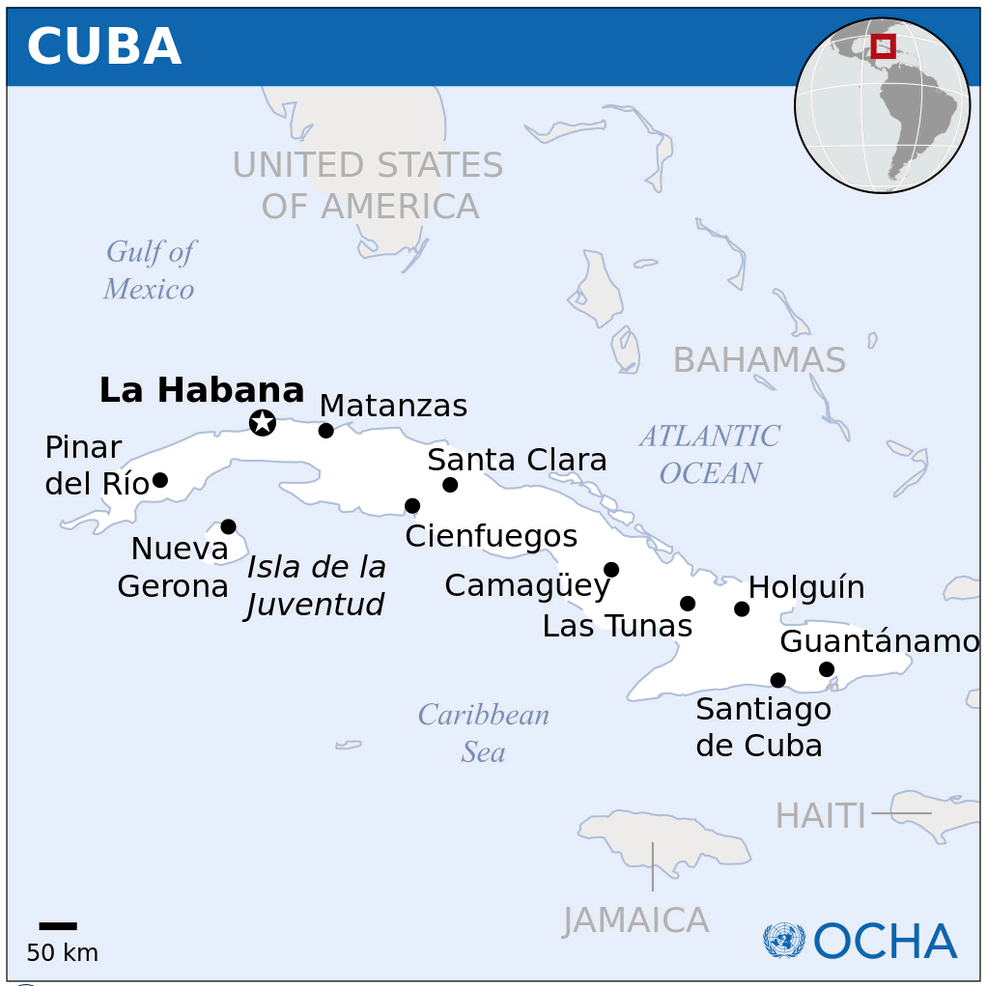
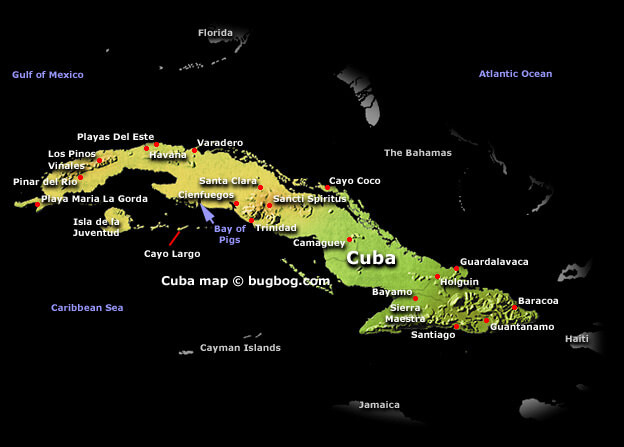
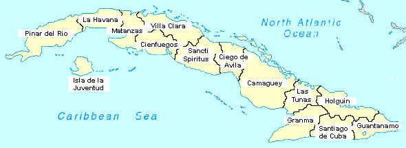
Cuba has more than 100 cities. The 10 largest are: Havana, Santiago de Cuba, Camagüey, Holguín, Guantánamo, Santa Clara, Las Tunas, Bayamo, Cienfuegos, and Pinar del Río.
What are the major geographical features of Cuba ?
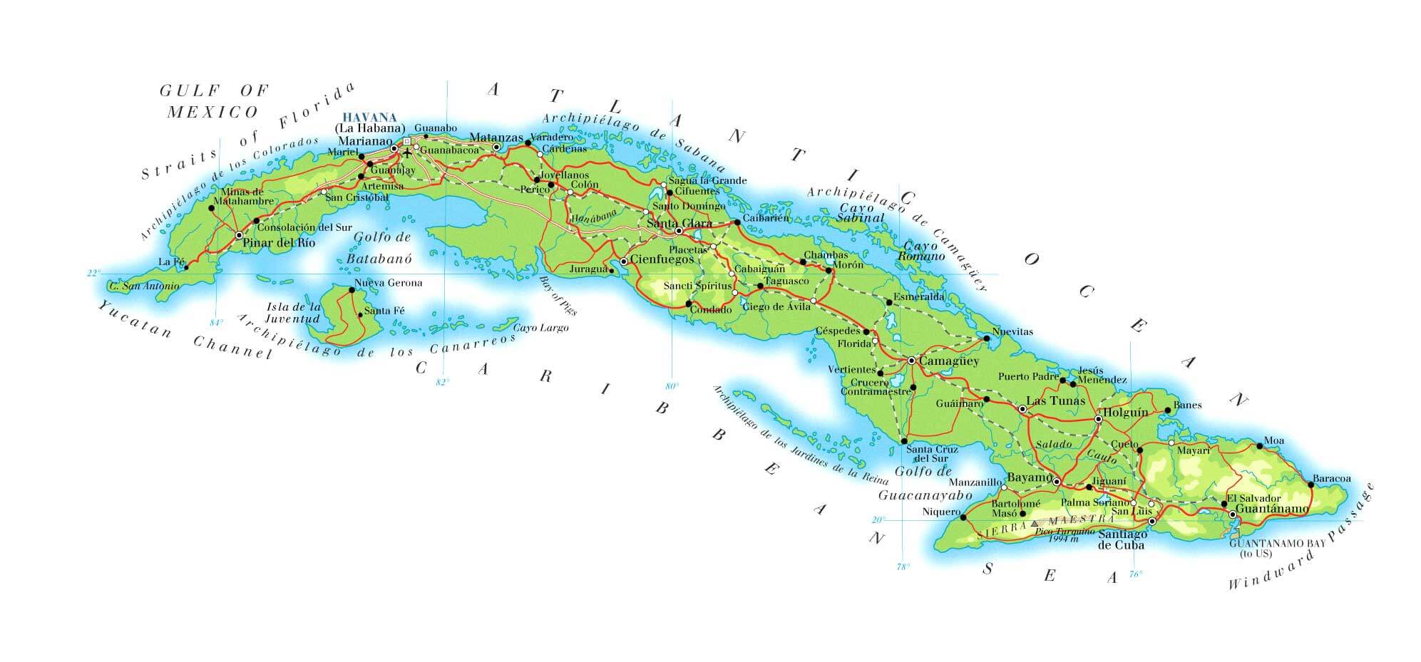
Cuba is the largest island in the Caribbean. Its geography includes mountains such as the Sierra Maestra, rolling plains, fertile valleys, and extensive coastlines.
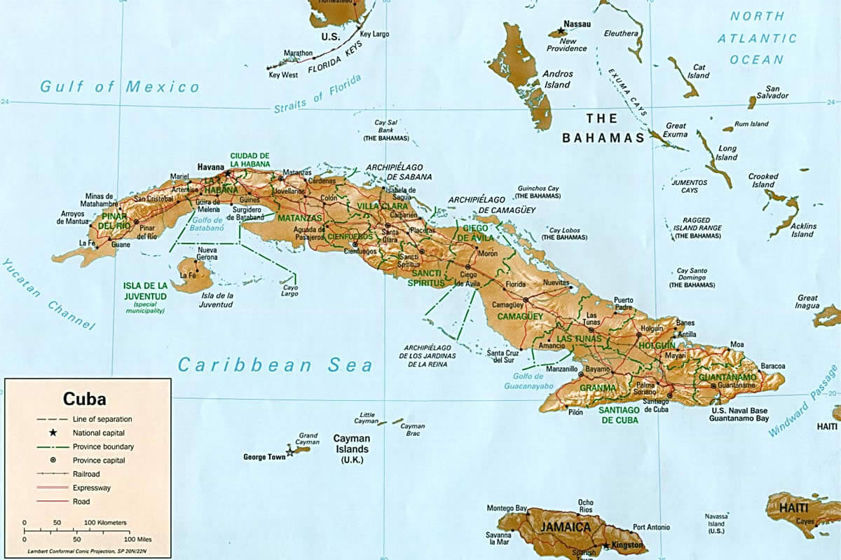
MAP OF CUBA

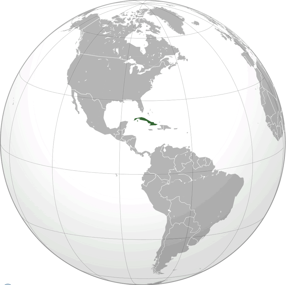
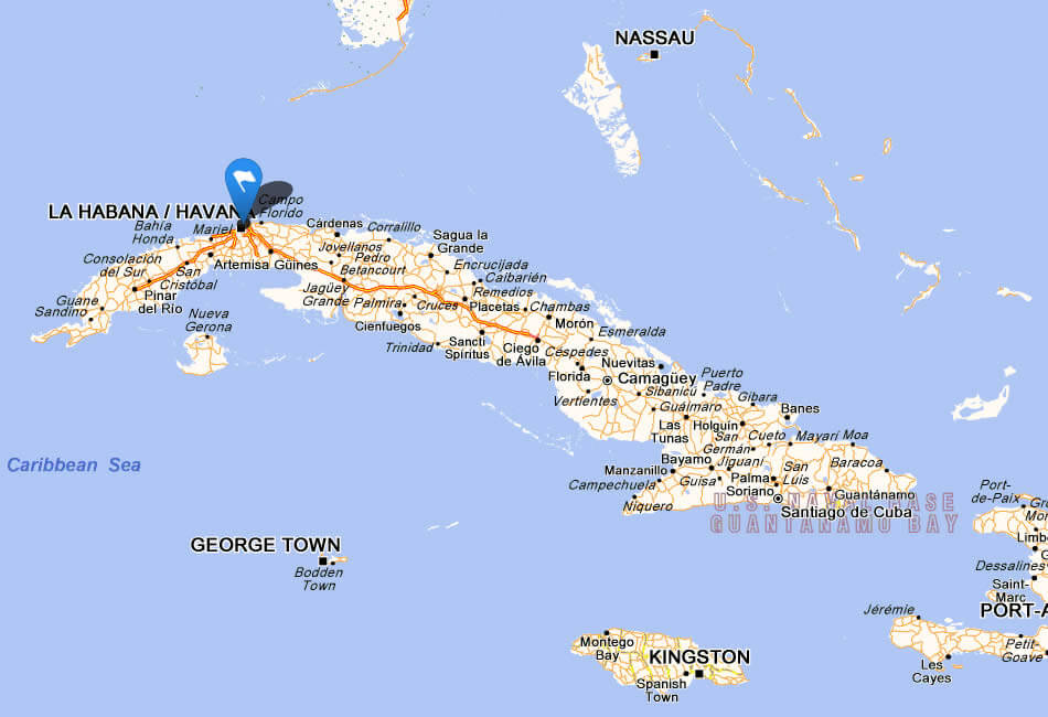
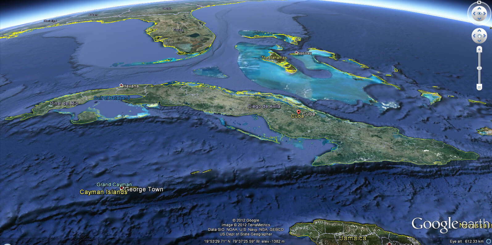
CUBA LOCATION MAP
WHERE IS CUBA IN THE WORLD
Can I download a high-resolution map of Cuba ?
Yes. Download high-resolution political and physical maps of Cuba for personal or educational use. Redistribution is subject to the terms of our license.
- Capital :
Havana
- Population :
11,163,934
- GDP :
$68.715 billion (63rd)
- Per Capita :
$6,106 (88th)
- Calling Code :
+53
- Jobless Rate :
2.50%
- Time Zone :
-5
With interactive Cuba Map, view regional highways maps, road situations, transportation, lodging guide, geographical map, physical maps and more information. On Cuba Map, you can view all states, regions, cities, towns, districts, avenues, streets and popular centers' satellite, sketch and terrain maps.
For more about Cuba >>
A Collection of Cuba Maps and Cuba Satellite Images
MAP OF CUBA
CUBA LOCATION MAP
WHERE IS CUBA IN THE WORLD
CITIES MAP CUBA
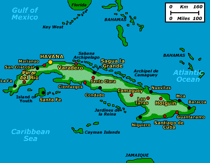
CUBA MAP
CUBA LAND MAP
CUBA MAP
CUBA MAP
CUBA PHYSICAL MAP
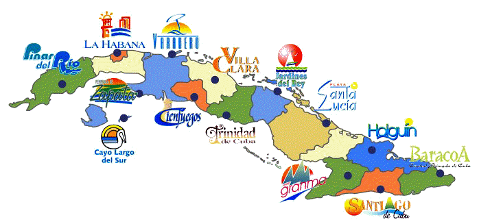
CUBA PROVINCES MAP
CUBA REGIONS MAP
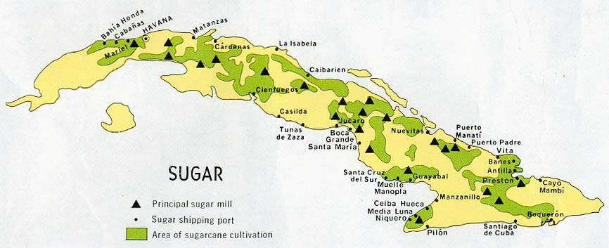
CUBA SUGAR MAP
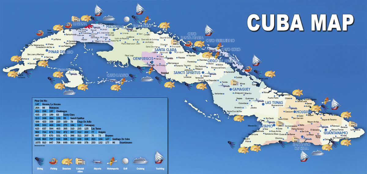
CUBA TOURISM MAP
MAP CUBA
MAP OF CUBA
MAP OF CUBA
CUBA EARTH MAP
Author: Arif Cagrici
