Djibouti Map FQA
How many cities are in Djibouti ?
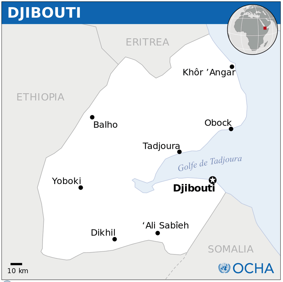
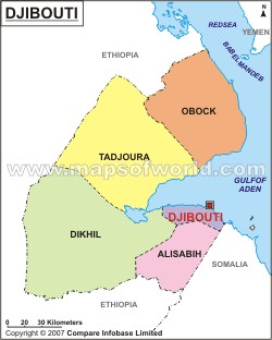
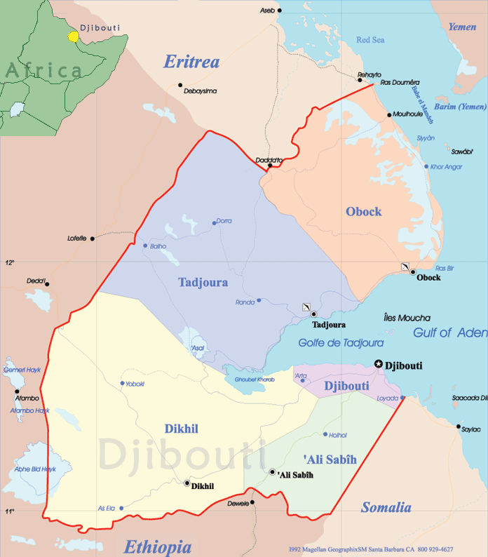
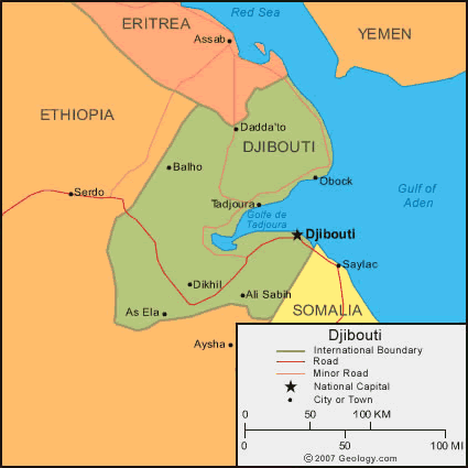
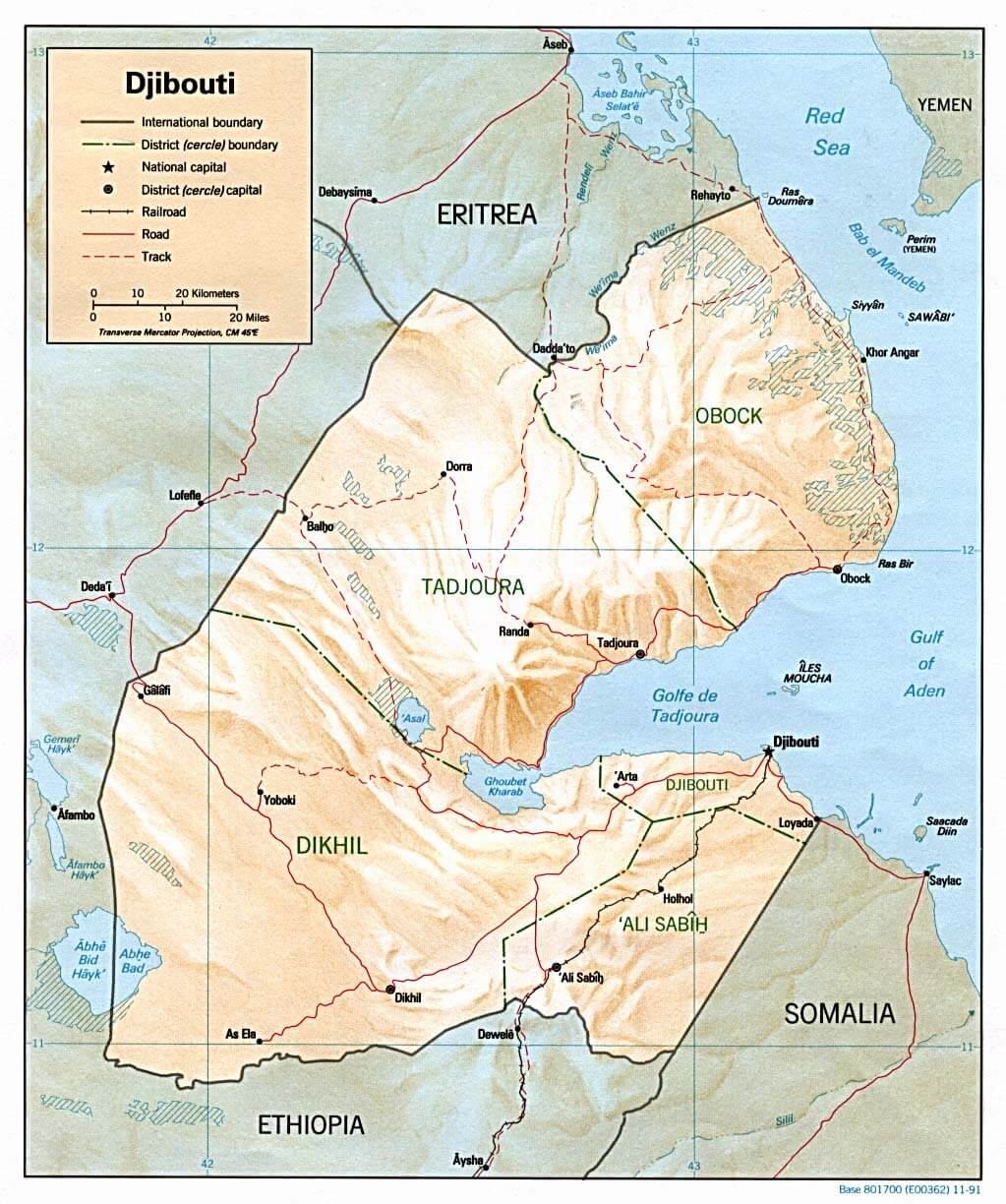
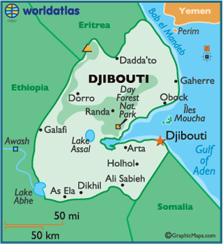
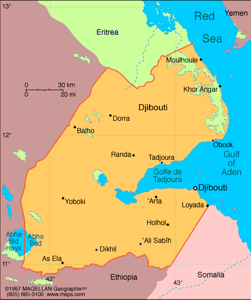
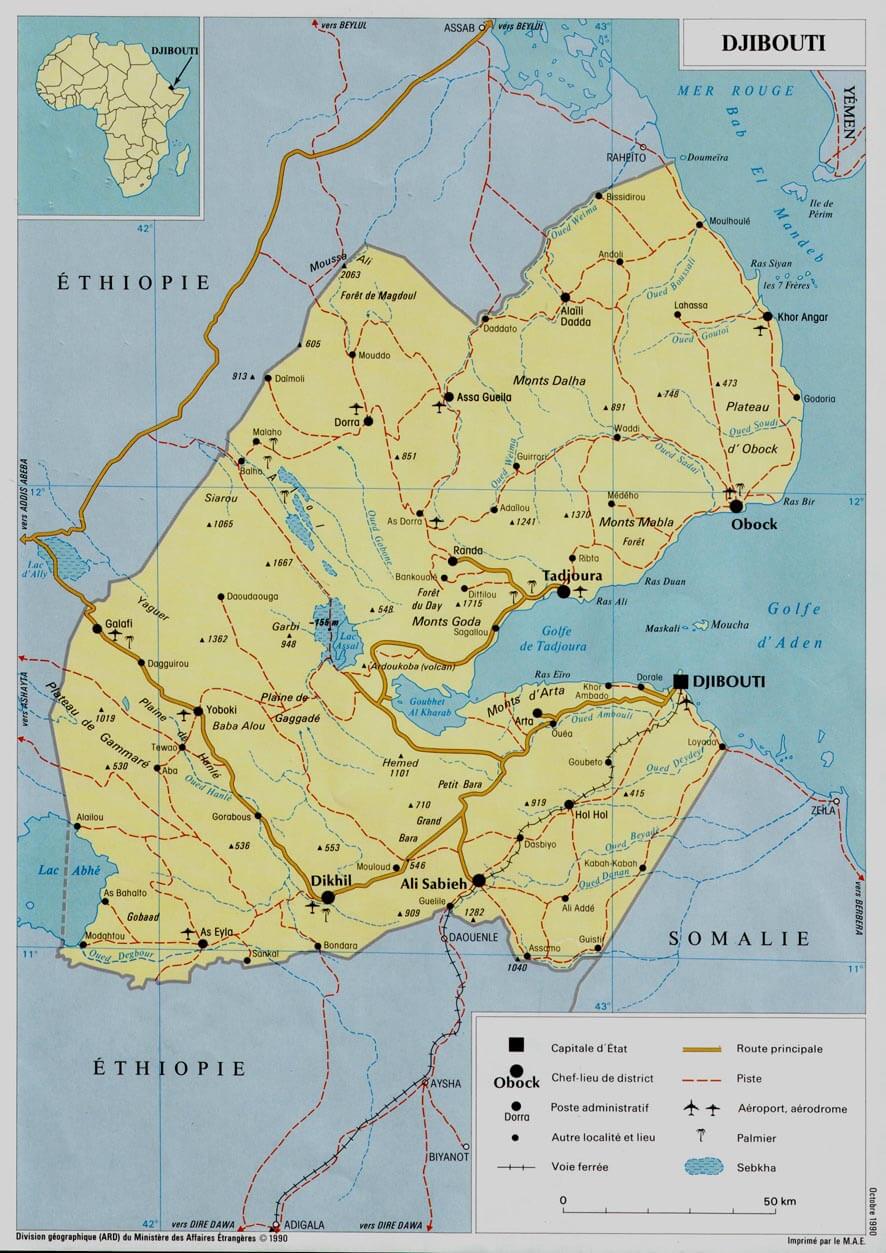
Djibouti is a small country with a few main towns. The largest are: Djibouti City, Ali Sabieh, Tadjourah, Obock, and Dikhil.
What are the major geographical features of Djibouti ?
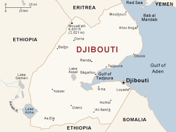
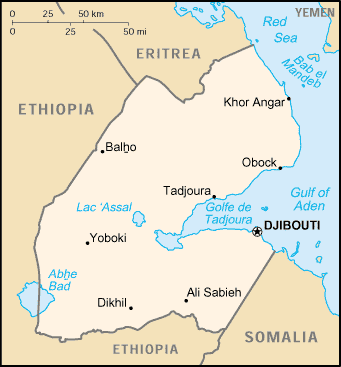
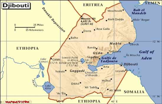
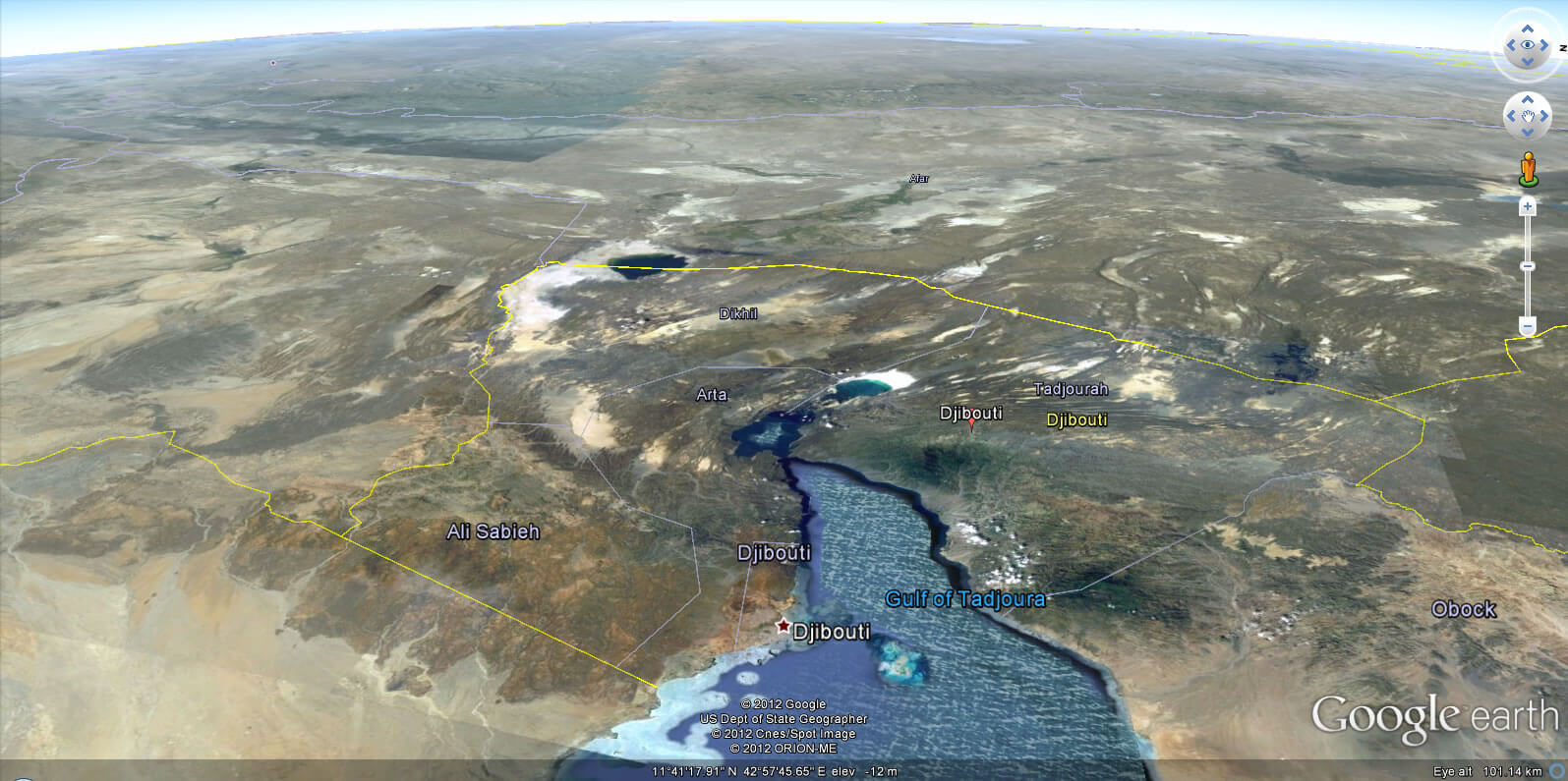
Djibouti in the Horn of Africa has arid plateaus, volcanic mountains, and coastal plains. Notable features include Lake Assal, the lowest point in Africa, and the Gulf of Tadjoura.
MAP OF DJIBOUTI

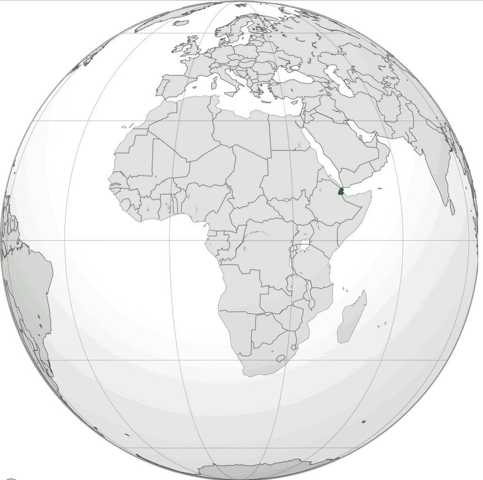
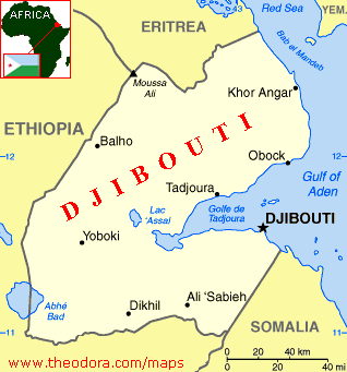
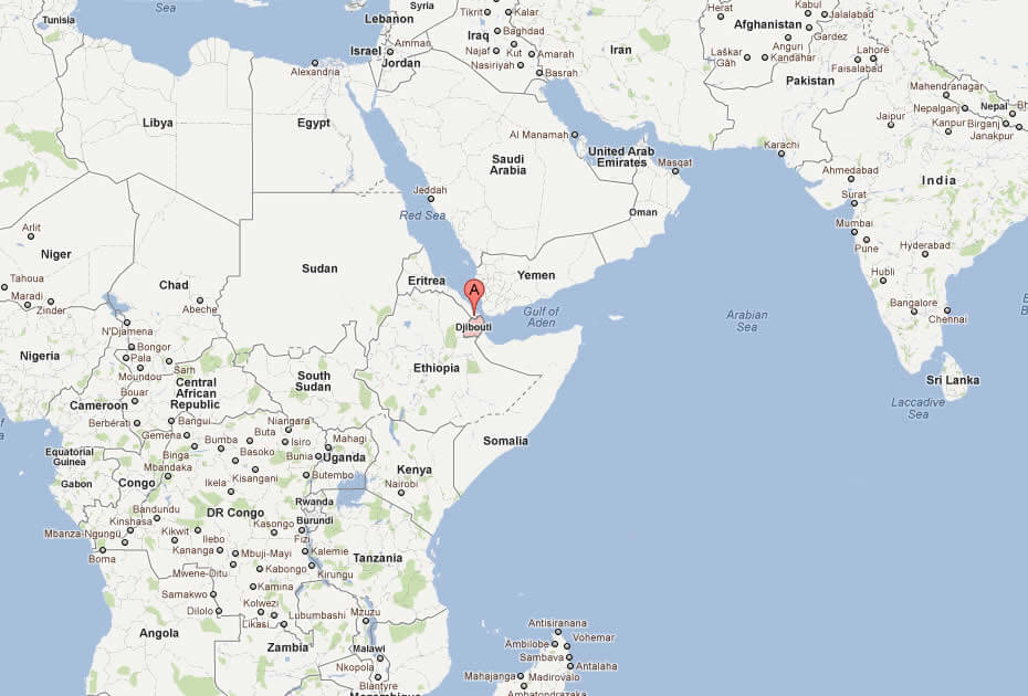
DJIBOUTI LOCATION MAP
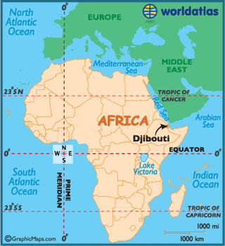
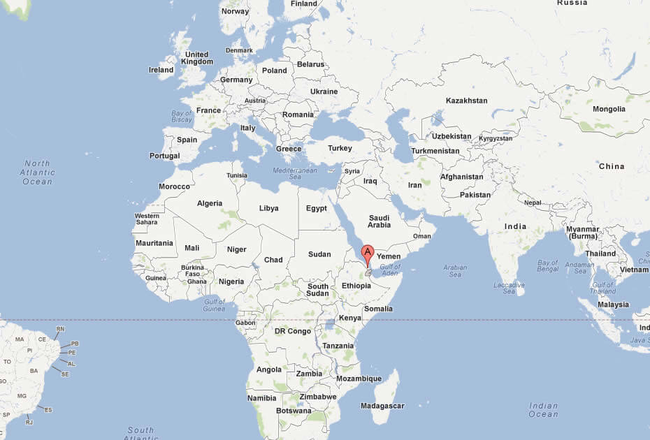
WHERE IS DJIBOUTI IN THE WORLD
Can I download a high-resolution map of Djibouti ?
Yes. Download high-resolution political and physical maps of Djibouti for personal or educational use. Redistribution is subject to the terms of our license.
- Capital :
Djibouti
- Population :
923,000
- GDP :
$2.231 billion
- Per Capita :
$2,641
- Calling Code :
+653
- Jobless Rate :
59.50%
- Time Zone :
+3
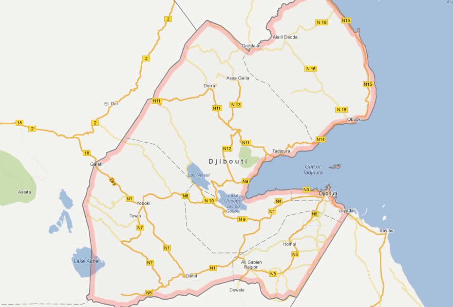
With interactive Djibouti Map, view regional highways maps, road situations, transportation, lodging guide, geographical map, physical maps and more information. On Djibouti Map, you can view all states, regions, cities, towns, districts, avenues, streets and popular centers' satellite, sketch and terrain maps.
For more about Djibouti >>
A Collection of Djibouti Maps and Djibouti Satellite Images
MAP OF DJIBOUTI

DJIBOUTI LOCATION MAP
WHERE IS DJIBOUTI IN THE WORLD
CITIES MAP OF DJIBOUTI
DJIBOUTI CITIES MAP
DJIBOUTI MAP
DJIBOUTI MAP
DJIBOUTI POLITICAL MAP
DJIBOUTI MAP
DJIBOUTI
DJIBOUTI MAP
DJIBOUTI MAP AFRICA
DJIBOUTI PHYSICAL MAP
MAP OF AFRICA
MAP OF DJIBOUTI
MAP OF WORLD
MAP DJIBOUTI
POLITICAL MAP OF DJIBOUTI
ROAD MAP OF DJIBOUTI
DJIBOUTI EARTH MAP
Author: Arif Cagrici
