England Map FQA
How many cities are in England ?
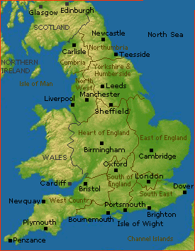
England has 55 official cities. The largest by population are: London; Birmingham; Leeds; Sheffield; Manchester; Liverpool; Bristol; Newcastle; Sunderland; Wolverhampton.
What are the major geographical features of England ?
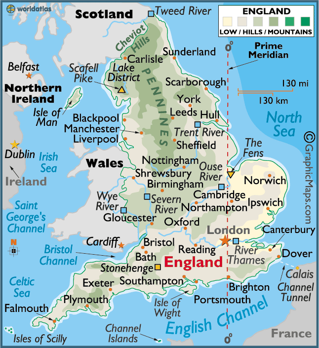
England consists mostly of rolling plains, low hills, and fertile valleys. It also has rivers such as the Thames and Severn, and upland areas including the Pennines and Lake District.
ENGLAND MAP
KESWICK ENGLAND 2009

WHERE IS ENGLAND IN THE WORLD

Can I download a high-resolution map of England ?
Yes. Download high-resolution political and physical maps of England for personal or educational use. Redistribution is subject to the terms of our license.

- Capital :
London
- Population :
53,013,000
- GDP :
$2.68 trillion
- Per Capita :
$50,566
- Calling Code :
+44
- Jobless Rate :
N/A
- Time Zone :
+0
With interactive England Map, view regional highways maps, road situations, transportation, lodging guide, geographical map, physical maps and more information. On England Map, you can view all states, regions, cities, towns, districts, avenues, streets and popular centers' satellite, sketch and terrain maps.
For more about England >>
A Collection of England Maps and England Satellite Images
ENGLAND MAP
KESWICK ENGLAND 2009
WHERE IS ENGLAND IN THE WORLD
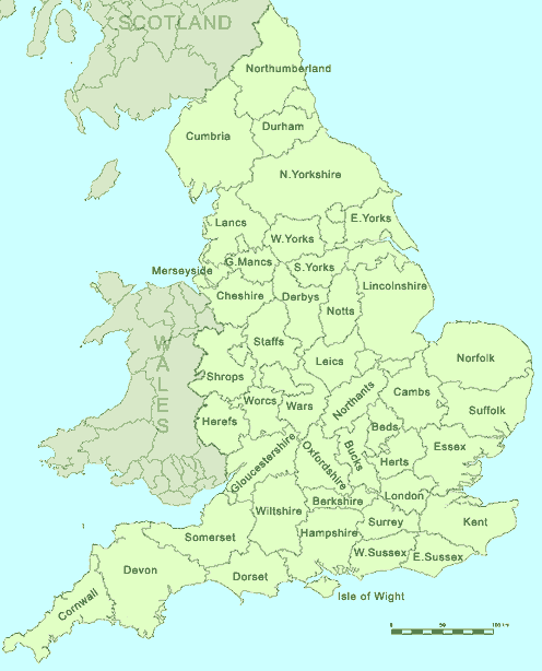
ENGLAND COUNTIES MAP
MAP OF ENGLAND
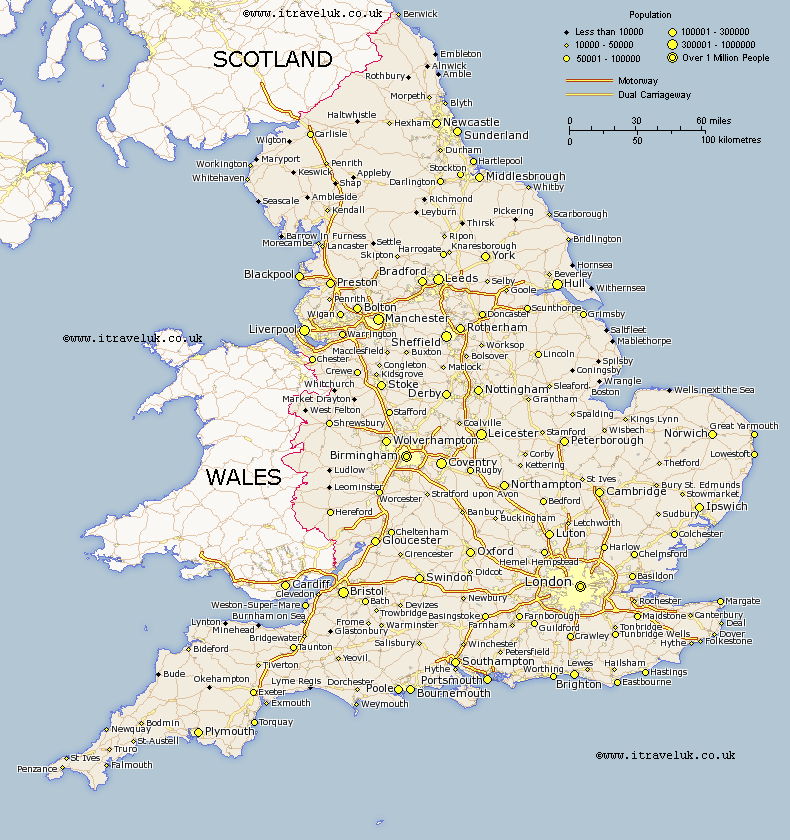
ENGLAND CITIES MAP
ENGLAND MAP
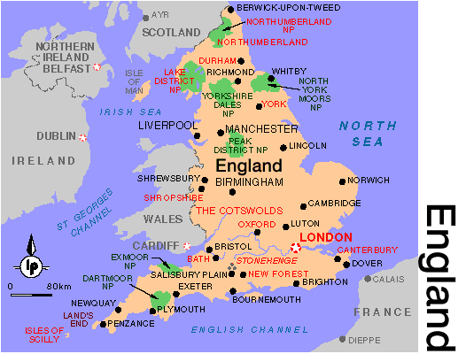
ENGLAND REGIONS MAP

ENGLAND

ENGLAND COUNTY MAP

Author: Arif Cagrici
Largest Cities' Map of England
