Falkland Islands Map FQA
How many cities are in Falkland Islands ?
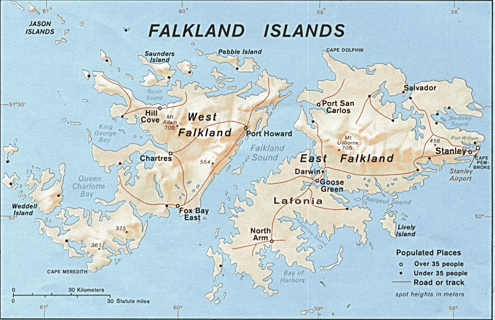
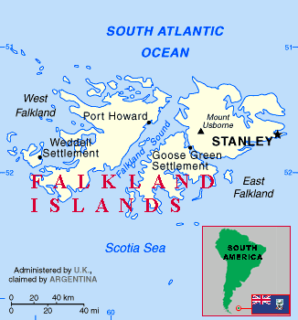
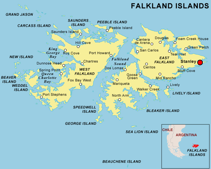
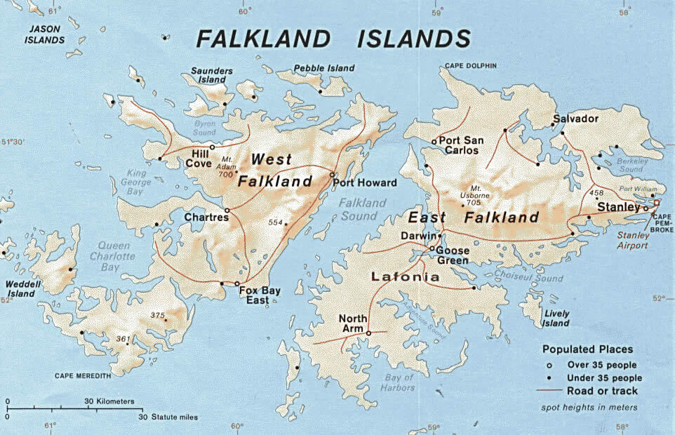
The Falkland Islands have no large cities. The main settlement is Stanley, with smaller villages such as Goose Green, Port Howard, Fox Bay, and Darwin.
What are the major geographical features of Falkland Islands ?
The Falkland Islands, a British Overseas Territory in the South Atlantic, consist of rugged, hilly islands with cliffs and fjords. The terrain is mostly grasslands used for sheep farming, with few trees and a cool maritime climate.
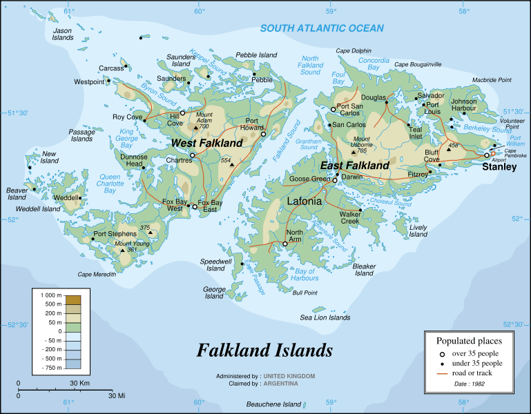
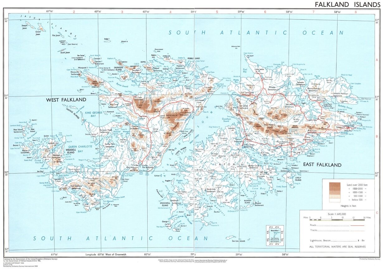
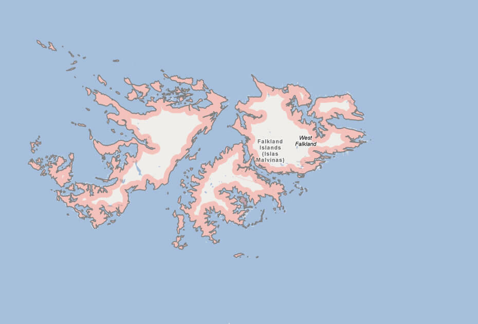
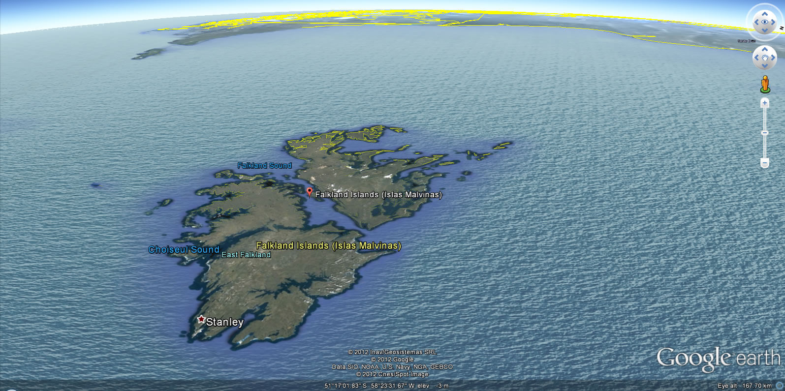
MAP OF FALKLAND ISLANDS

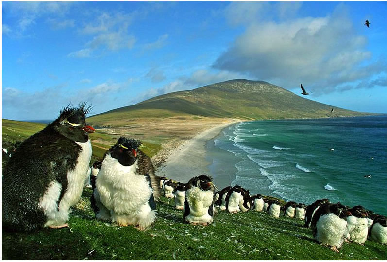
FALKLAND ISLANDS PENGUINS
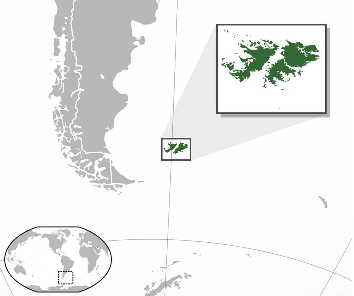
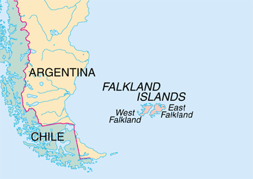
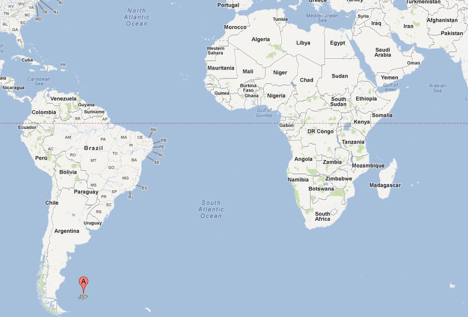
WHERE IS FALKLAND ISLANDS IN THE WORLD
Can I download a high-resolution map of Falkland Islands ?
Yes. Download high-resolution political and physical maps of Falkland Islands for personal or educational use. Redistribution is subject to the terms of our license.
- Capital :
Stanley
- Population :
2,841
- GDP :
$75 million (223rd)
- Per Capita :
$55,400 (7th)
- Calling Code :
+500
- Jobless Rate :
N/A
- Time Zone :
-4
With interactive Falkland Islands Map, view regional highways maps, road situations, transportation, lodging guide, geographical map, physical maps and more information. On Falkland Islands Map, you can view all states, regions, cities, towns, districts, avenues, streets and popular centers' satellite, sketch and terrain maps.
A Collection of Falkland Islands Maps and Falkland Islands Satellite Images
MAP OF FALKLAND ISLANDS
FALKLAND ISLANDS PENGUINS
WHERE IS FALKLAND ISLANDS IN THE WORLD
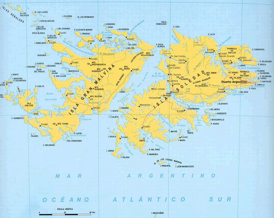
FALKLAND ISLANDS MAP
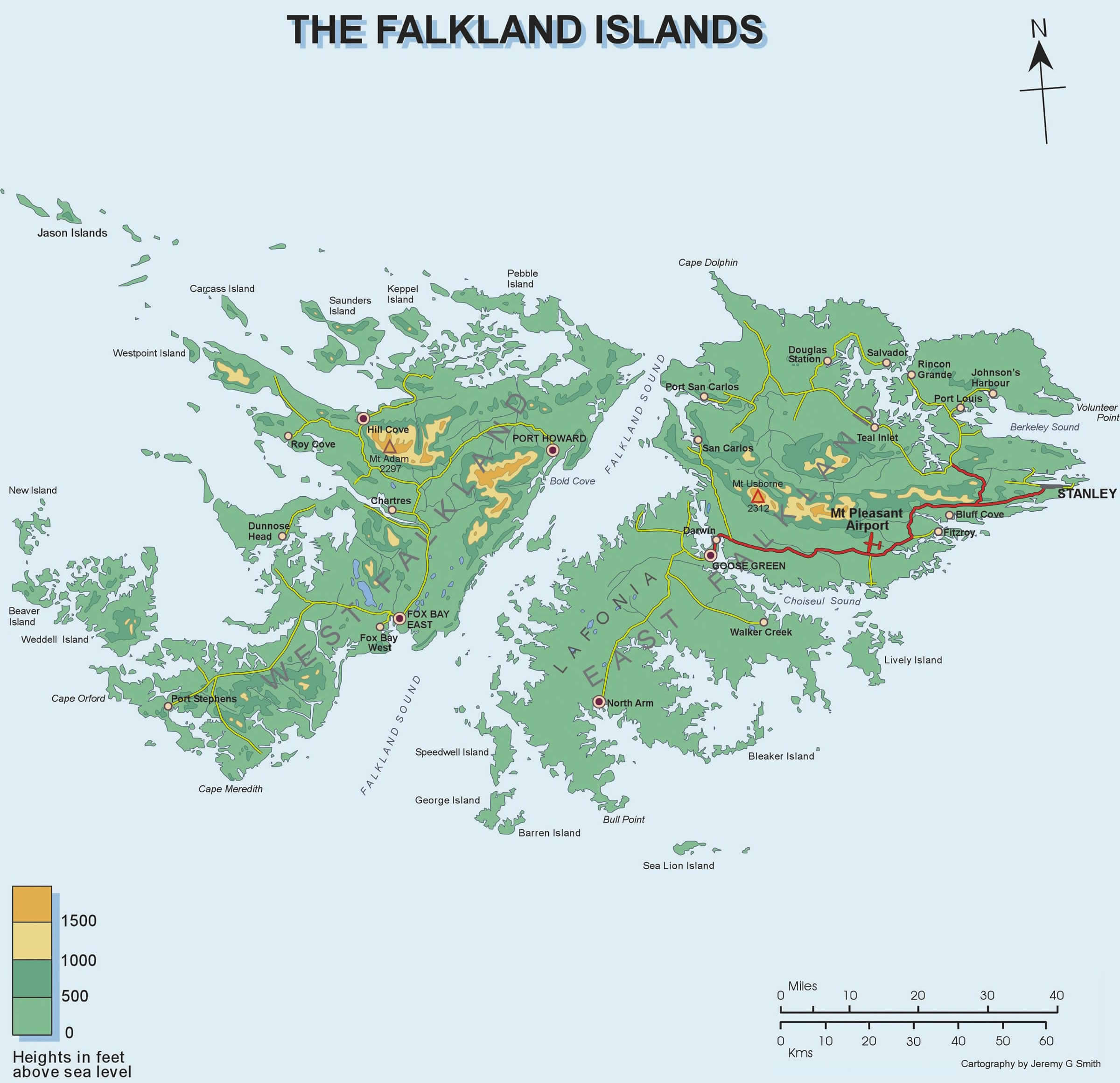
FALKLAND ISLANDS PHYSICAL MAP
FALKLAND ISLANDS MAP
FALKLAND ISLANDS MAP
FALKLAND ISLANDS MAP
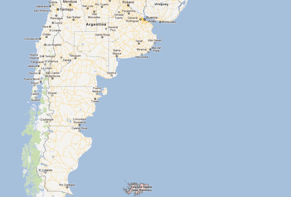
FALKLAND ISLANDS MAP SOUTH AMERICA
FALKLAND ISLANDS MAPS
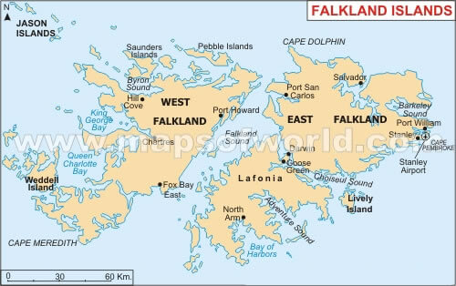
FALKLAND ISLANDS POLITICAL MAP
MAP OF FALKLAND ISLANDS ARGENTINA
MAP OF FALKLAND ISLANDS WORLD
MAP OF FALKLAND ISLANDS
MAP FALKLAND ISLANDS
FALKLAND ISLANDS EARTH MAP
Author: Arif Cagrici
