Faroe Islands Map FQA
How many cities are in Faroe Islands ?
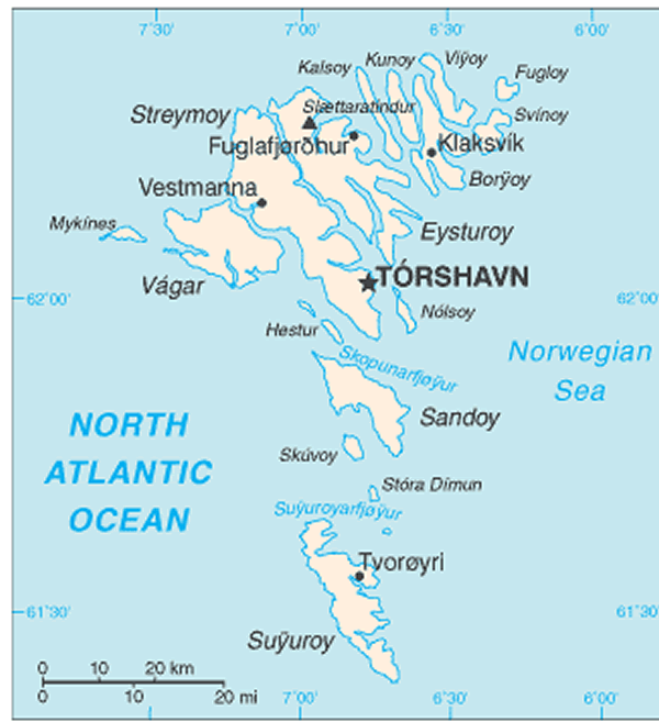
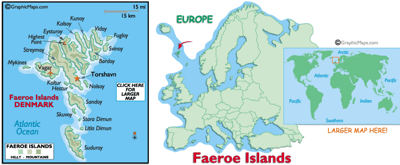
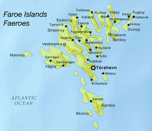
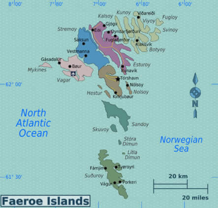
The Faroe Islands have no large cities, only towns and villages. The main ones are: Tórshavn, Klaksvík, Runavík, Tvøroyri, Fuglafjør?ur, Vestmanna, Sandavágur, Sørvágur, Kollafjør?ur, and Hoyvík.
What are the major geographical features of Faroe Islands ?
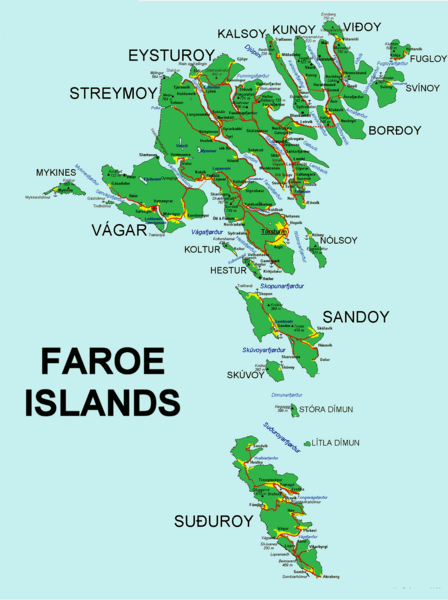
The Faroe Islands, located in the North Atlantic, are a rugged archipelago of 18 volcanic islands. They feature steep cliffs, narrow fjords, rolling green hills, and a subpolar maritime climate.
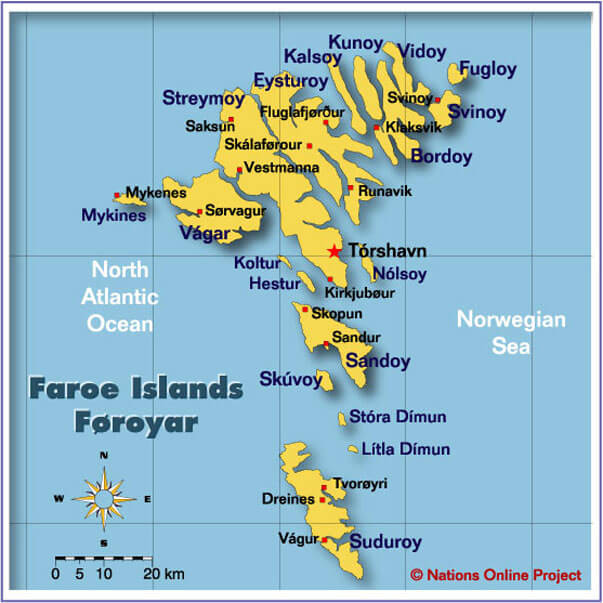
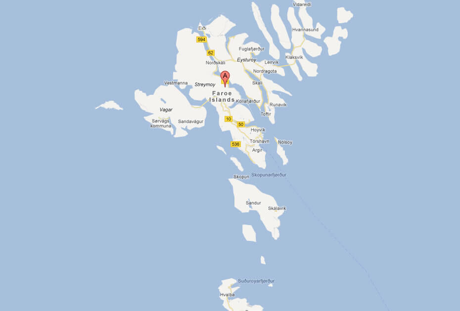
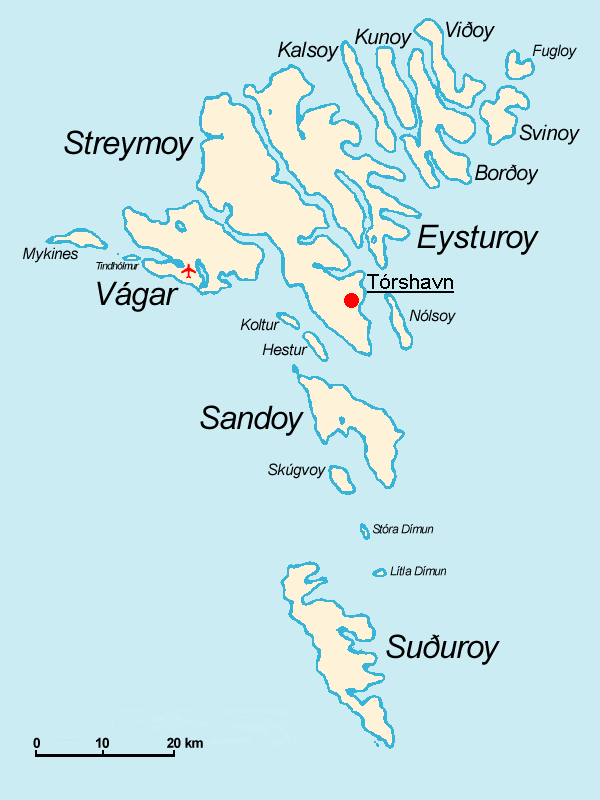
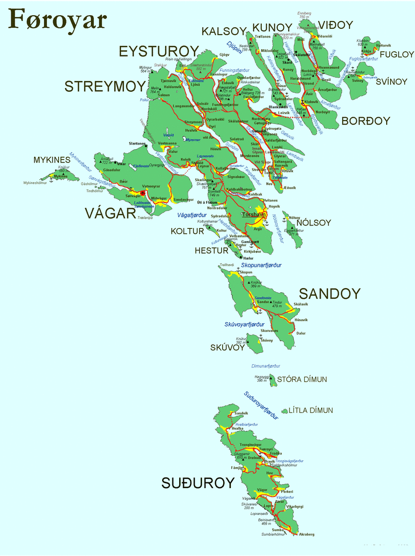
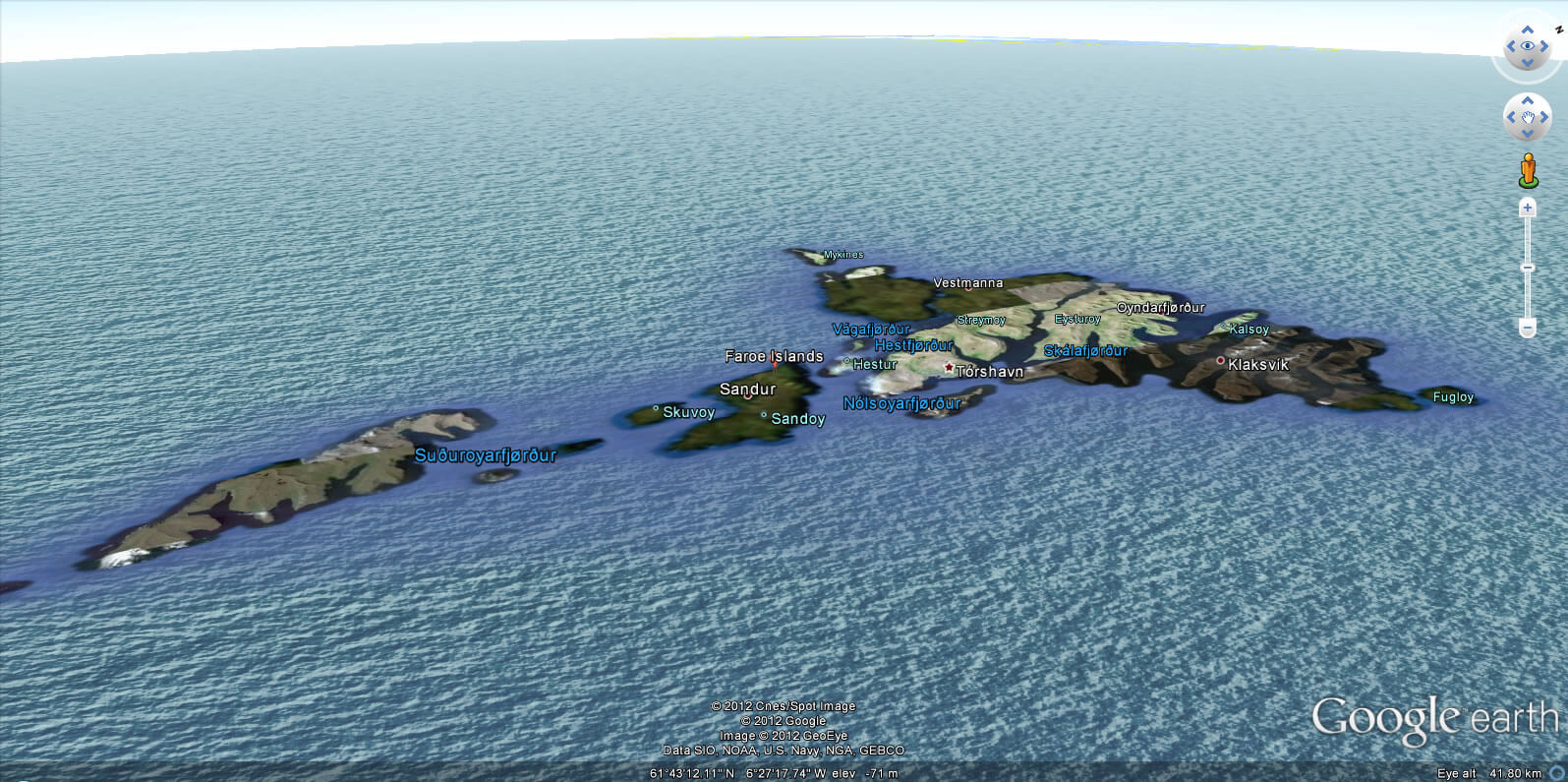
MAP OF FAROE ISLANDS

MAP OF THE FAROE ISLANDS TORSHAVN
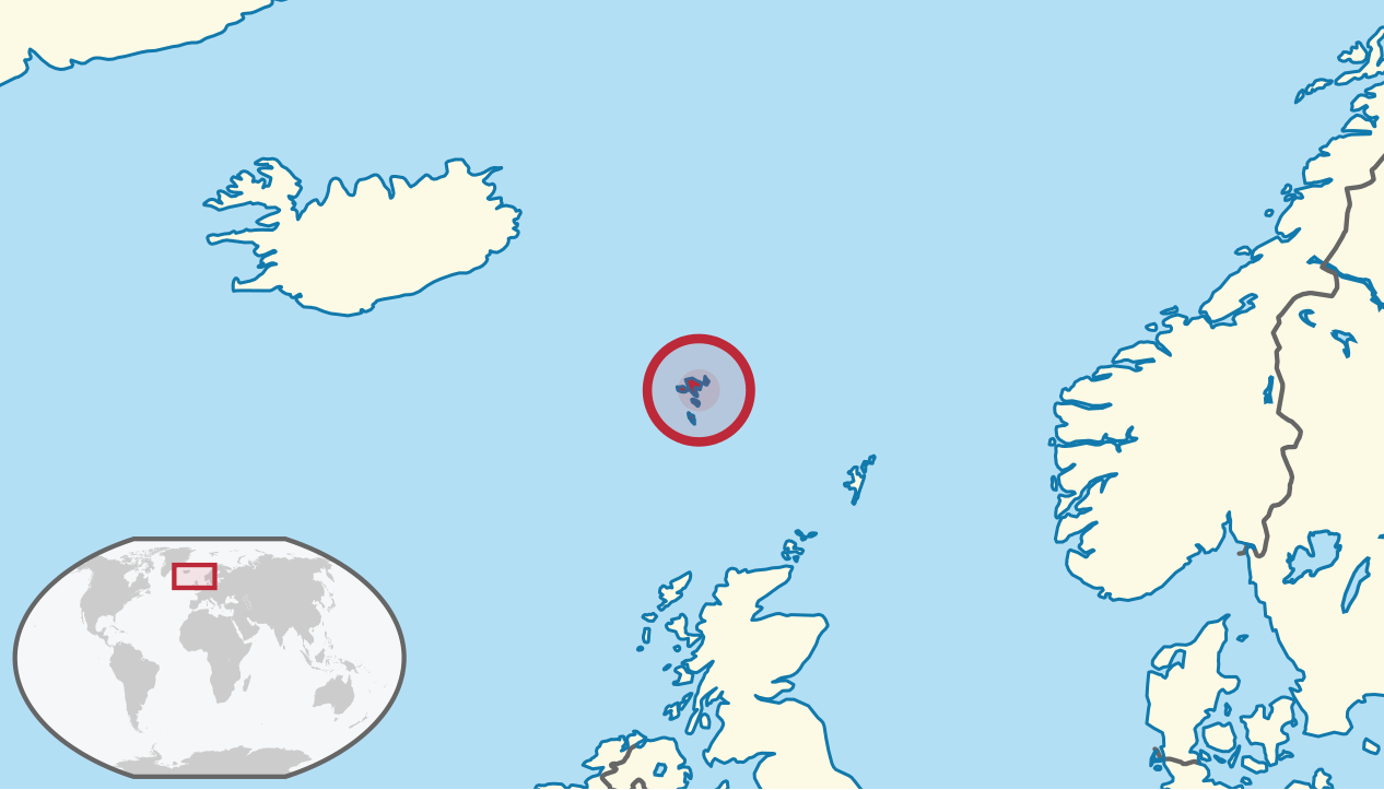
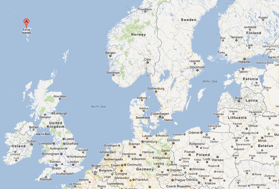
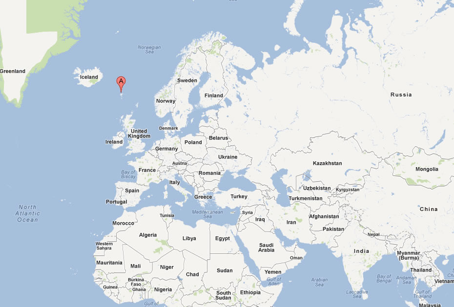
WHERE IS FAROE ISLANDS IN THE WORLD
Can I download a high-resolution map of Faroe Islands ?
Yes. Download high-resolution political and physical maps of Faroe Islands for personal or educational use. Redistribution is subject to the terms of our license.
- Capital :
Torshavn
- Population :
49,267
- GDP :
$2.45 billion
- Per Capita :
$50,300
- Calling Code :
+298
- Jobless Rate :
N/A
- Time Zone :
+0
With interactive Faroe Islands Map, view regional highways maps, road situations, transportation, lodging guide, geographical map, physical maps and more information. On Faroe Islands Map, you can view all states, regions, cities, towns, districts, avenues, streets and popular centers' satellite, sketch and terrain maps.
A Collection of Faroe Islands Maps and Faroe Islands Satellite Images
MAP OF FAROE ISLANDS

MAP OF THE FAROE ISLANDS TORSHAVN
WHERE IS FAROE ISLANDS IN THE WORLD
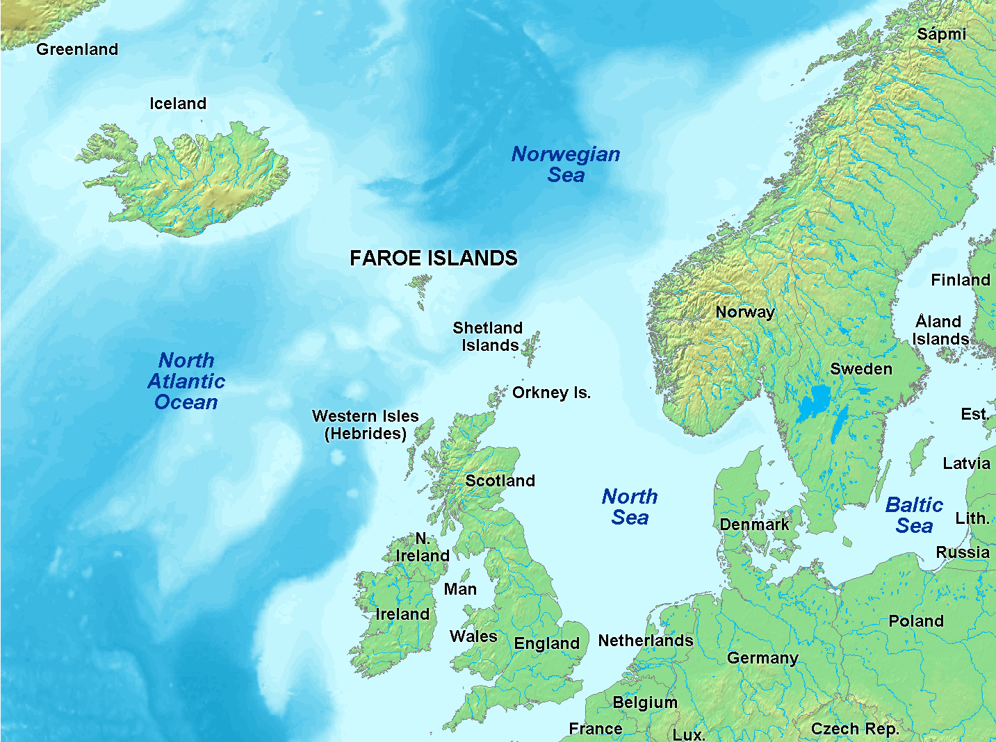
FAROE ISLANDS DENMARK MAP
FAROE ISLANDS MAP
FAROE ISLANDS MAP

FAROE ISLANDS MAP
FAROE ISLAND MAP
MAP OF FAROE ISLANDS EUROPE
MAP OF FAROE ISLANDS WORLD
MAP OF FAROE ISLANDS
MAP OF FAROE ISLANDS
MAP OF FAROE ISLANDS EUROPE
MAP OF THE FAROE ISLANDS
PHYSICAL MAP OF FAROE ISLANDS

POLITICAL MAP OF FAROE ISLANDS
FAROE ISLANDS EARTH MAP
Author: Arif Cagrici
