Fiji Map FQA
How many cities are in Fiji ?
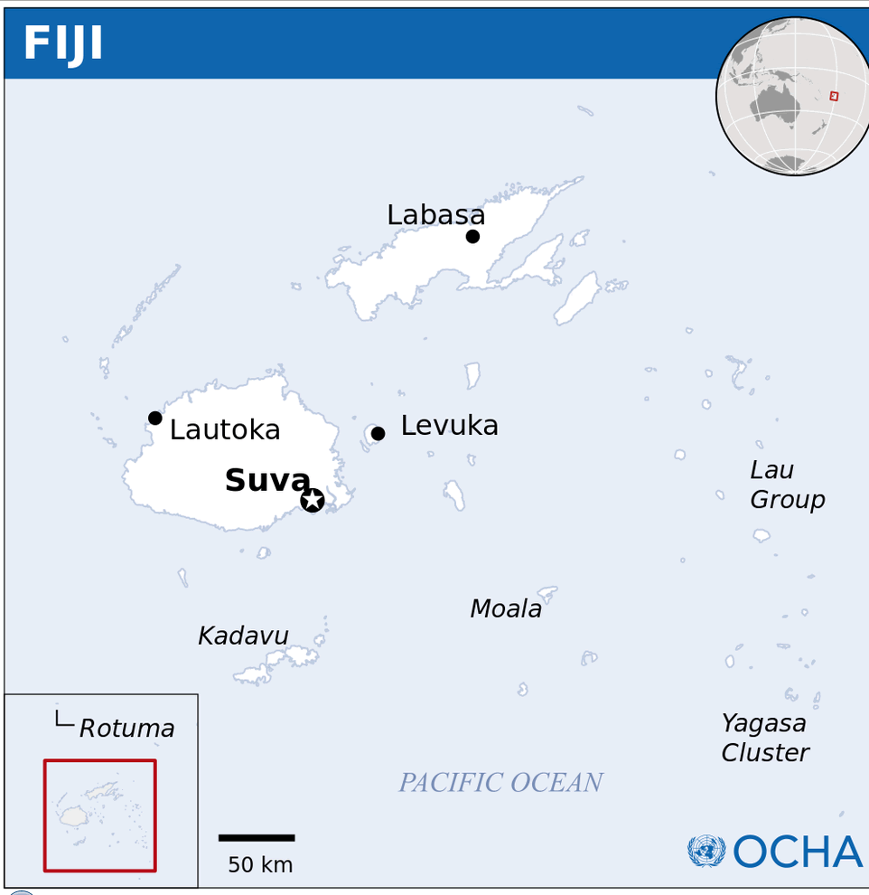
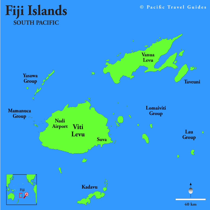
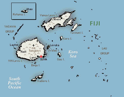
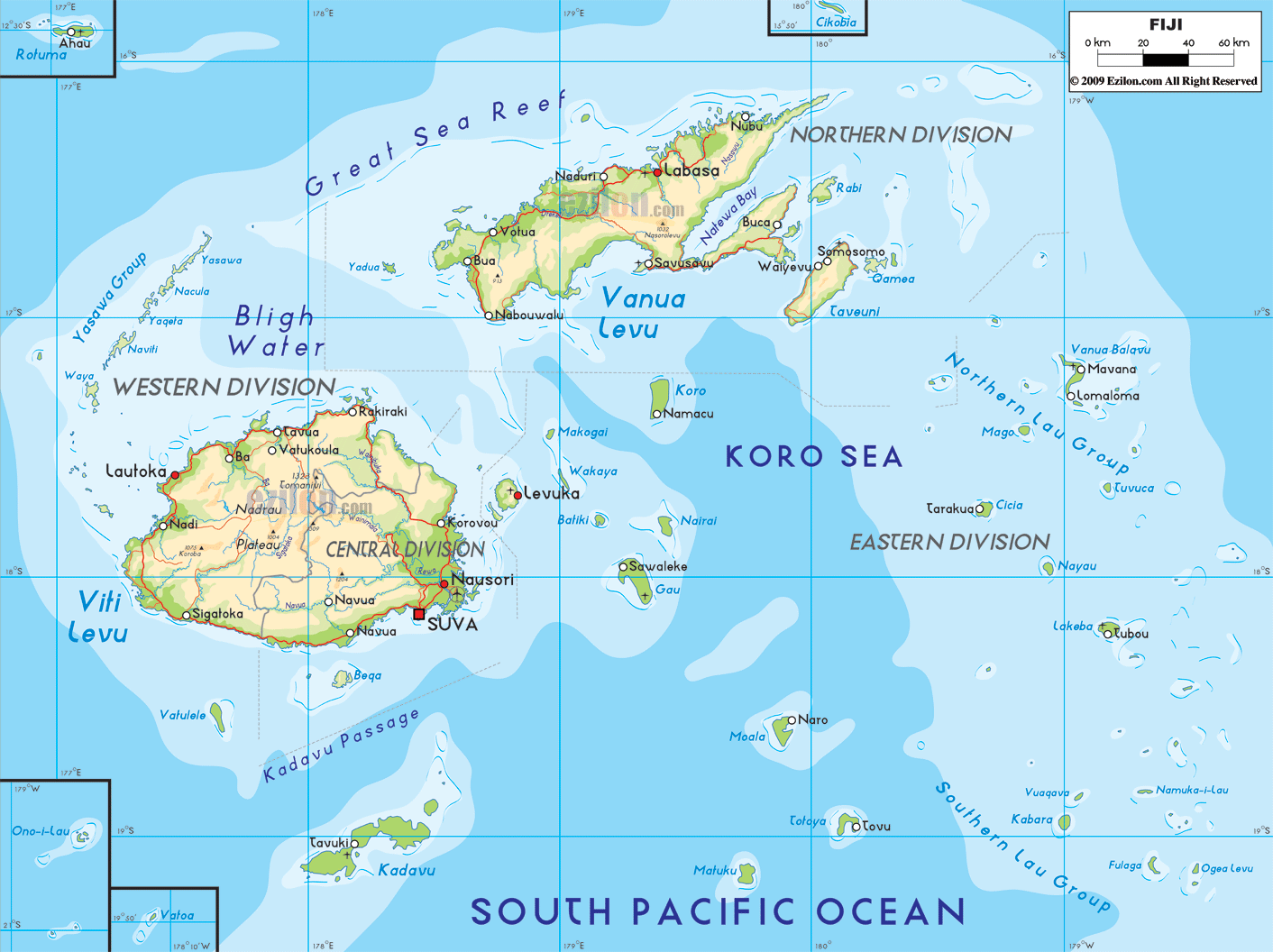
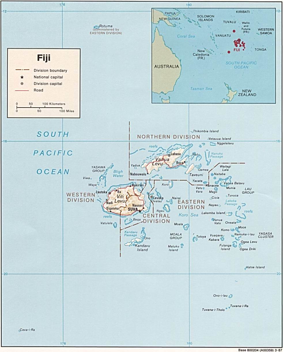
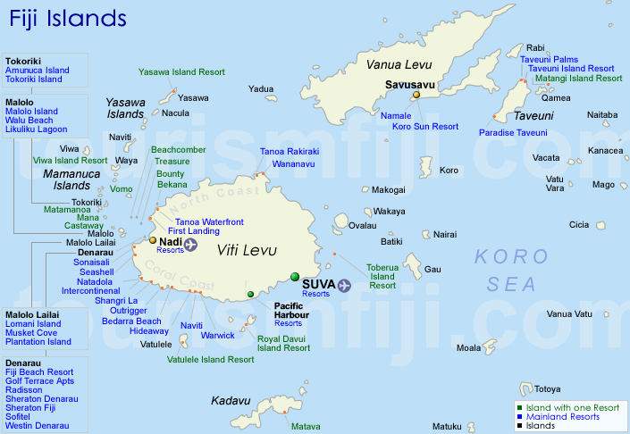
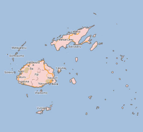
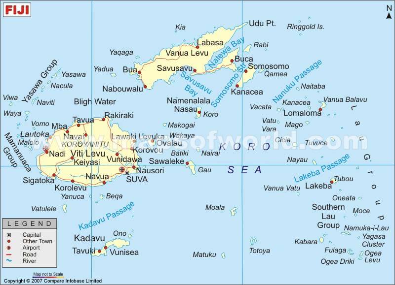
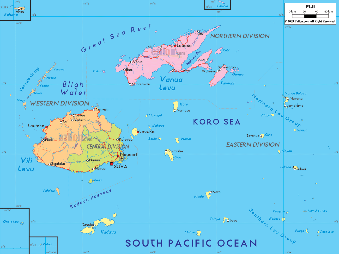
Fiji has several towns and cities. The 10 largest are: Suva, Lautoka, Nadi, Labasa, Ba, Levuka, Sigatoka, Rakiraki, Nausori, and Savusavu.
What are the major geographical features of Fiji ?
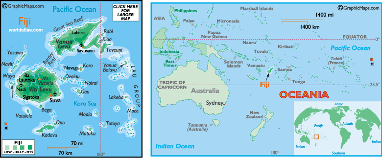
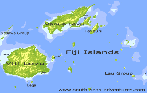
Fiji is an island nation in the South Pacific composed of volcanic islands. It has mountains, tropical forests, coral reefs, and coastal plains. Viti Levu and Vanua Levu are the two largest islands.
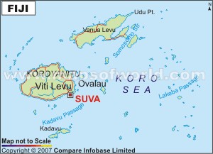
MAP OF FIJI

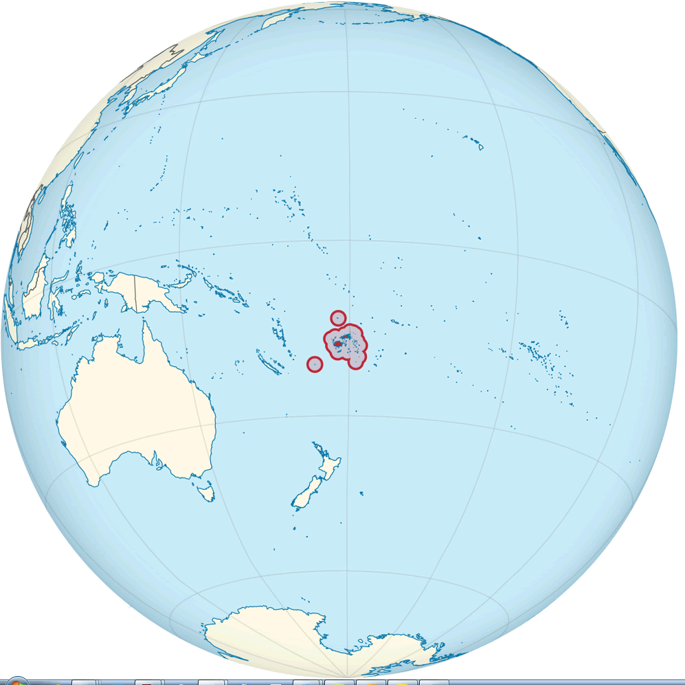
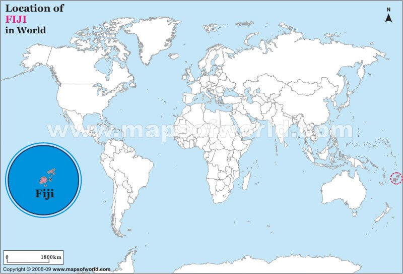
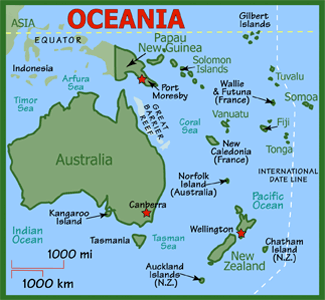
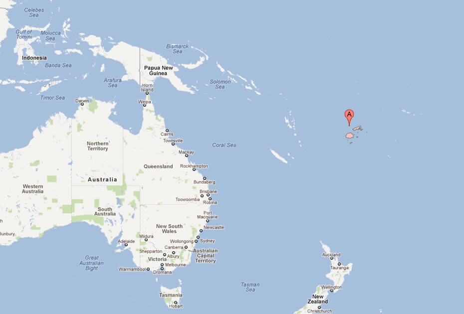
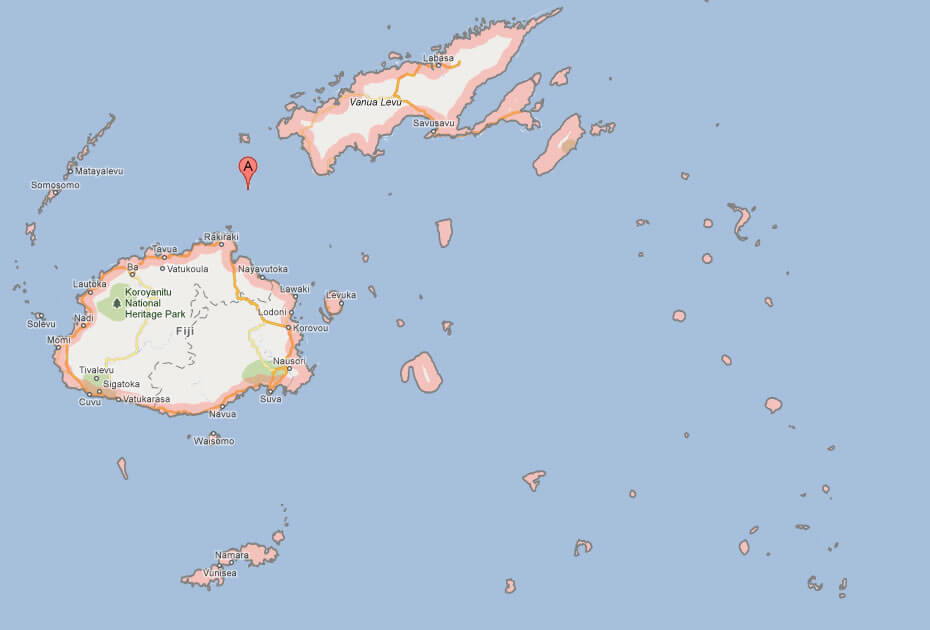
FIJI LOCATION MAP
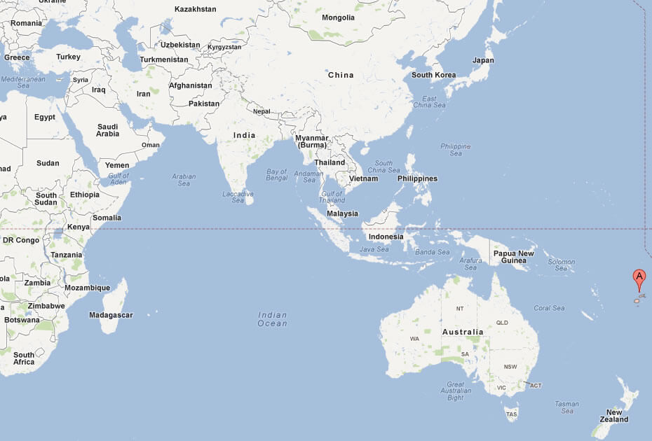
WHERE IS FIJI IN THE WORLD
Can I download a high-resolution map of Fiji ?
Yes. Download high-resolution political and physical maps of Fiji for personal or educational use. Redistribution is subject to the terms of our license.
- Capital :
Suva
- Population :
849,000
- GDP :
$3.546 billion
- Per Capita :
$3,965
- Calling Code :
+679
- Jobless Rate :
7.00%
- Time Zone :
+12
With interactive Fiji Map, view regional highways maps, road situations, transportation, lodging guide, geographical map, physical maps and more information. On Fiji Map, you can view all states, regions, cities, towns, districts, avenues, streets and popular centers' satellite, sketch and terrain maps.
For more about Fiji >>
A Collection of Fiji Maps and Fiji Satellite Images
MAP OF FIJI
FIJI LOCATION MAP
WHERE IS FIJI IN THE WORLD
FIJI ISLANDS MAP SOUTH PACIFIC
FIJI MAP
FIJI PHYSICAL MAP
FIJI POLITICAL MAP
FIJI ISLANDS MAP
FIJI MAP WORLD
FIJI MAP
FIJI ISLANDS MAP
FIJI MAP

FIJI MAP
FIJI MAP AUSTRALIA
FIJI POLITIC MAP
MAP OF FIJI ISLAND AUSTRALIA
MAP OF FIJI ISLAND WORLD
MAP OF FIJI
MAP FIJI

MAP OF FIJI SUVA
POLITICAL MAP OF FIJI
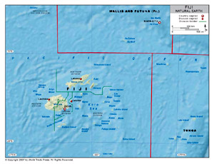
FIJI EARTH MAP
Author: Arif Cagrici
