Honduras Map
Navigate Honduras Map, Honduras countries map, satellite images of the Honduras, Honduras largest cities maps, political map of Honduras, driving directions and traffic maps.
Honduras Map FQA
How many cities are in Honduras ?
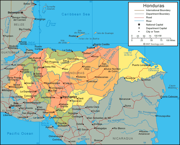
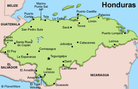
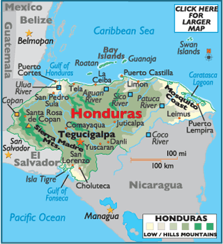
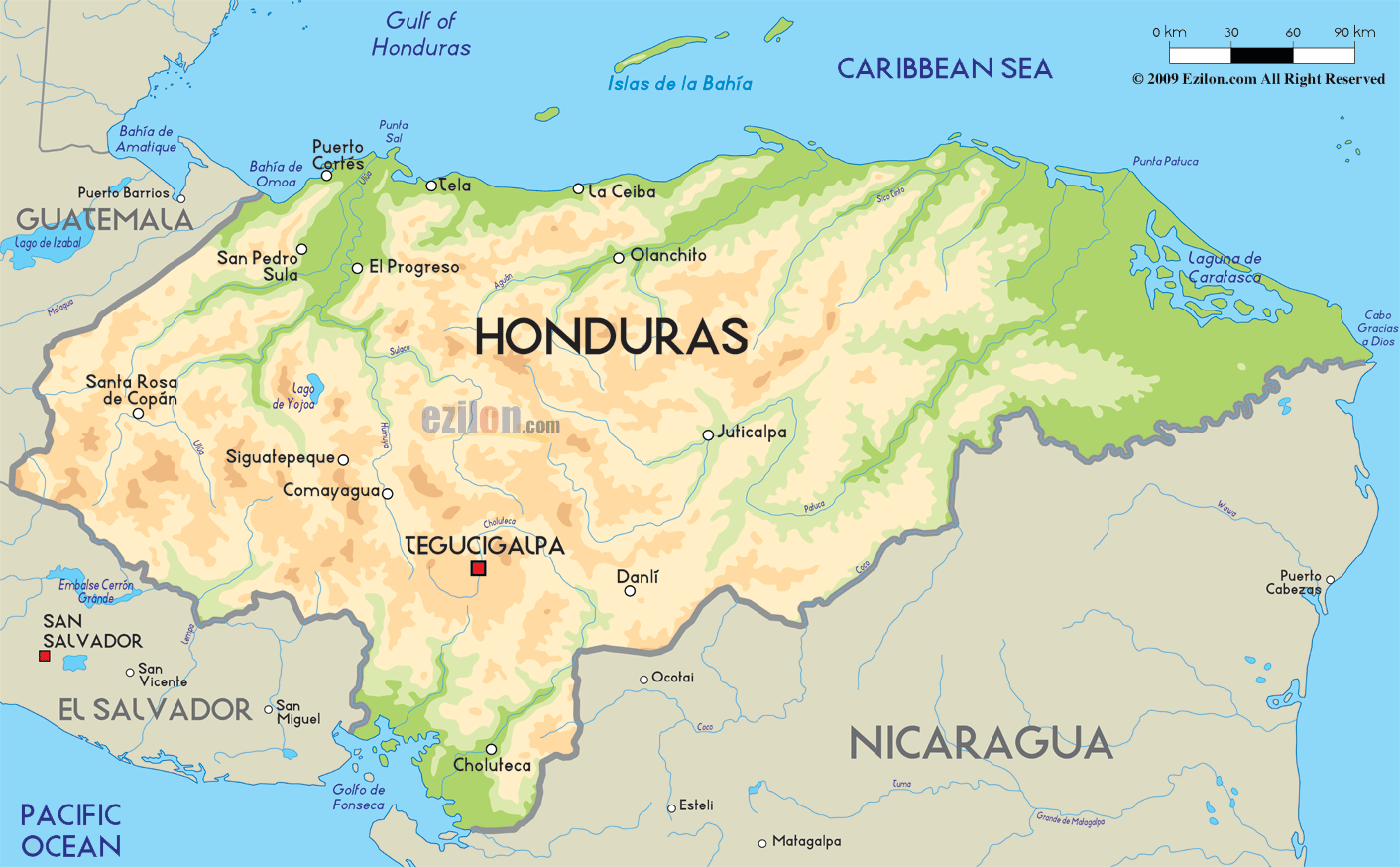
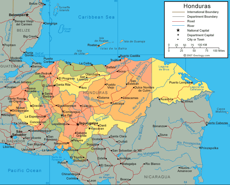
Honduras has more than 30 cities. The 10 largest are: Tegucigalpa, San Pedro Sula, Choloma, La Ceiba, El Progreso, Choluteca, Comayagua, Puerto Cortés, Danlí, and Juticalpa.What are the major geographical features of Honduras ?
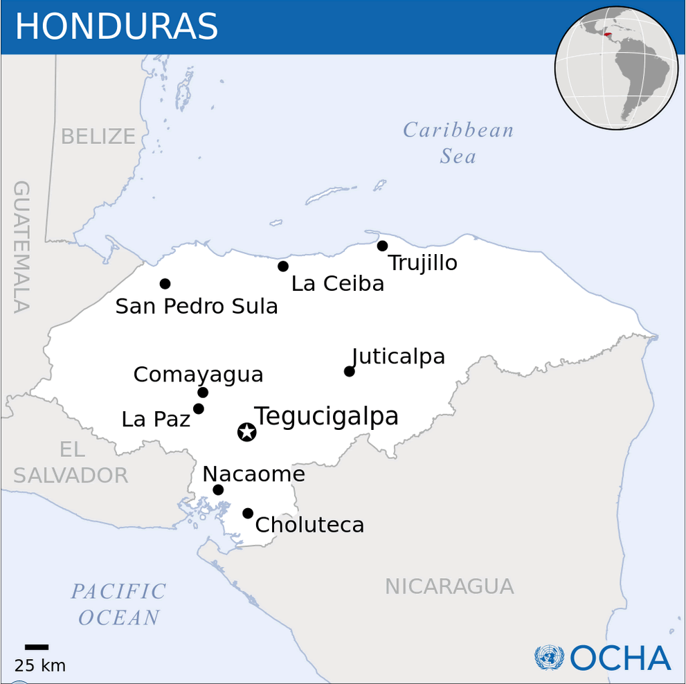
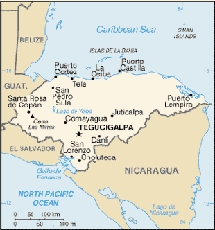
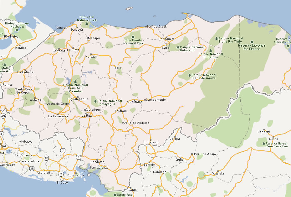
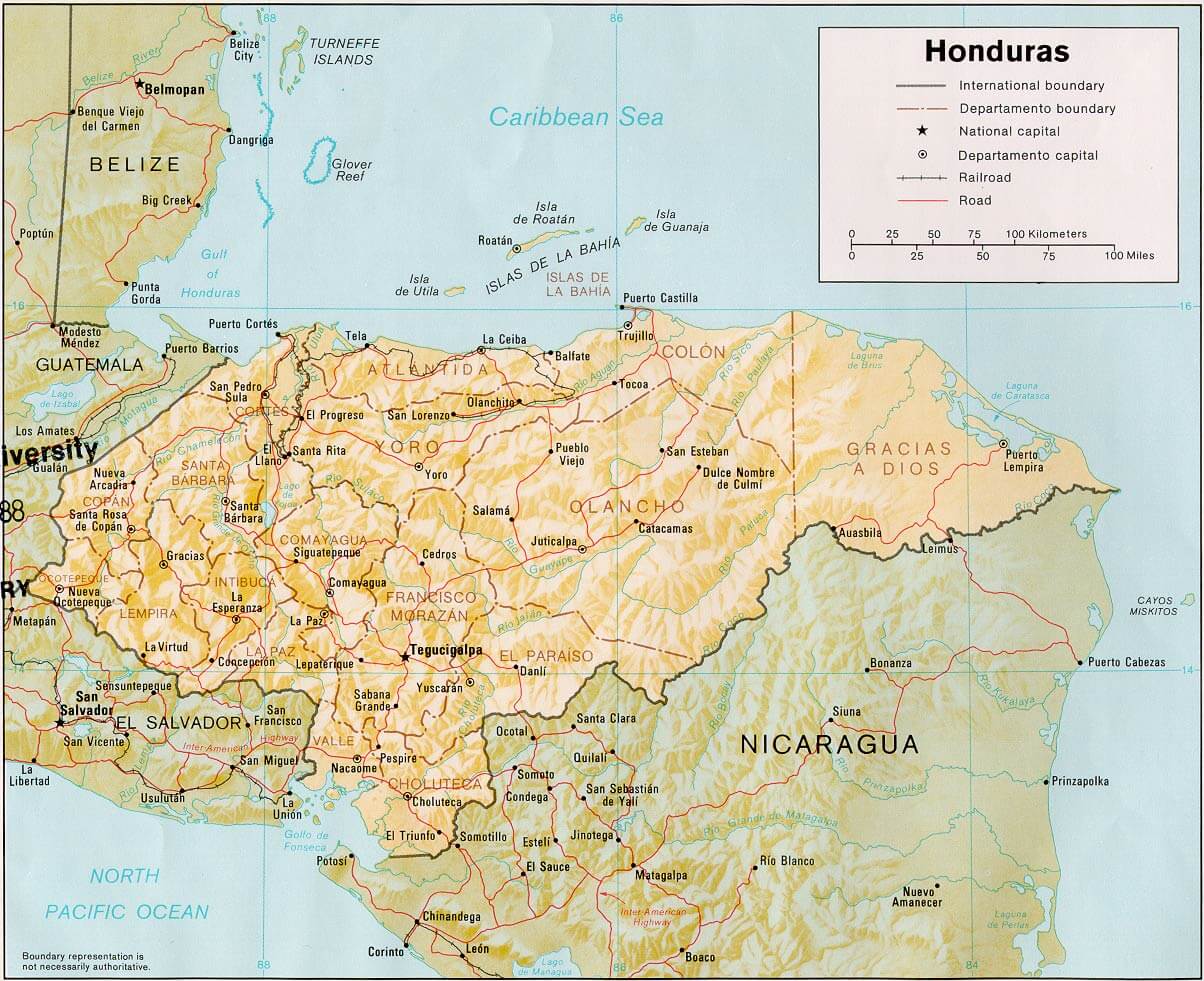
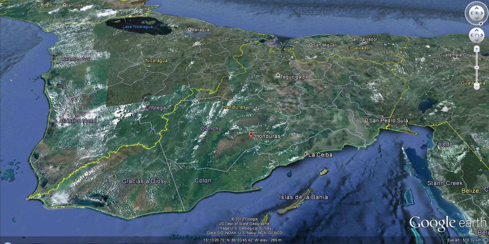
Honduras is a Central American country with mountainous terrain, river valleys, and coastal lowlands. It has Caribbean and Pacific coastlines, with features such as the Mosquito Coast and the Bay Islands.MAP OF HONDURAS


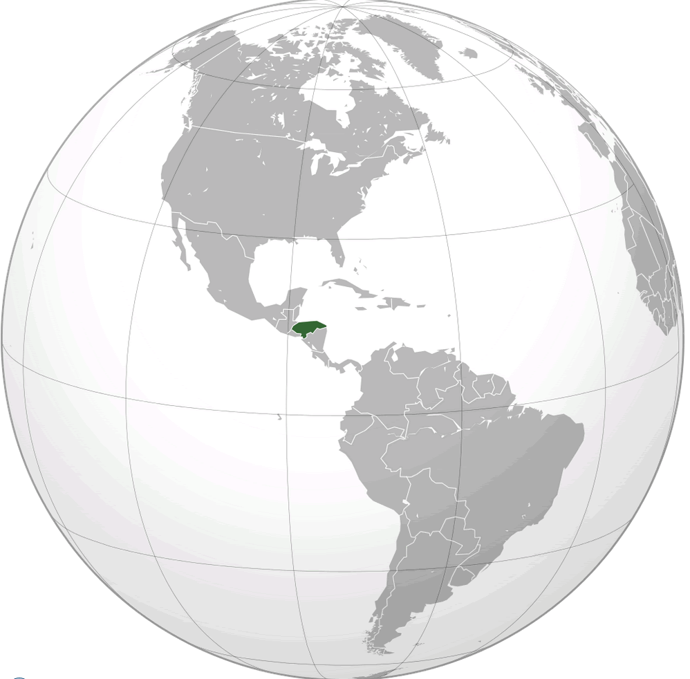
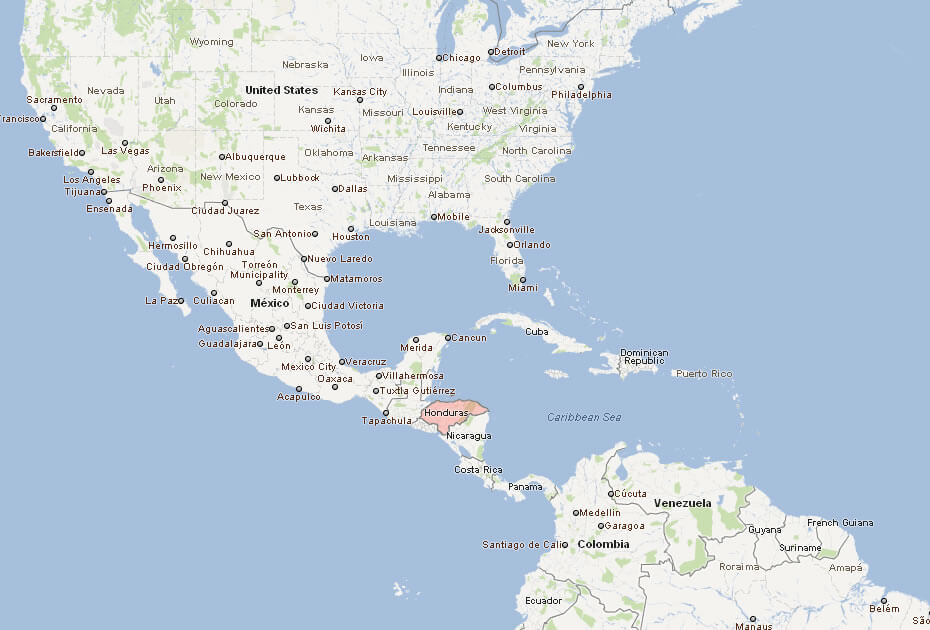
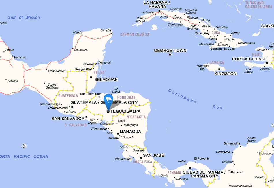
HONDURAS LOCATION MAP
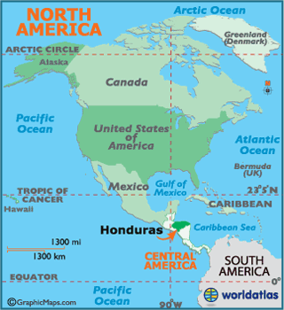
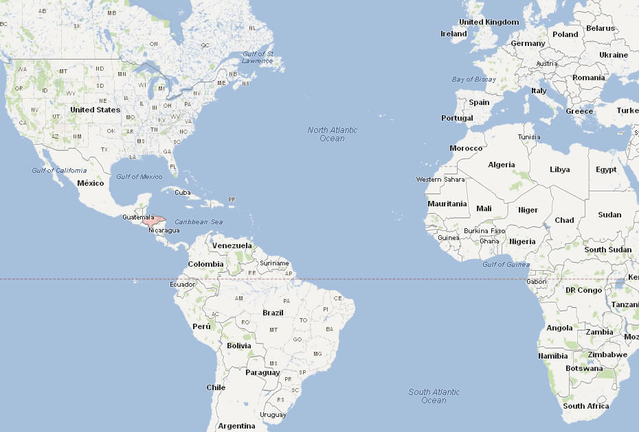
WHERE IS HONDURAS IN THE WORLD
Can I download a high-resolution map of Honduras ?
Yes. Download high-resolution political and physical maps of Honduras for personal or educational use. Redistribution is subject to the terms of our license.
- Capital : Tegucigalpa
- Population : 8,249,574
- GDP : $17.381 billion
- Per Capita : $2,115
- Calling Code : +504
- Jobless Rate : 3.90%
- Time Zone : -6
For more about Honduras >>
A Collection of Honduras Maps and Honduras Satellite Images
MAP OF HONDURAS
HONDURAS LOCATION MAP
WHERE IS HONDURAS IN THE WORLD
CITIES MAP OF HONDURAS
HONDURAS MAP
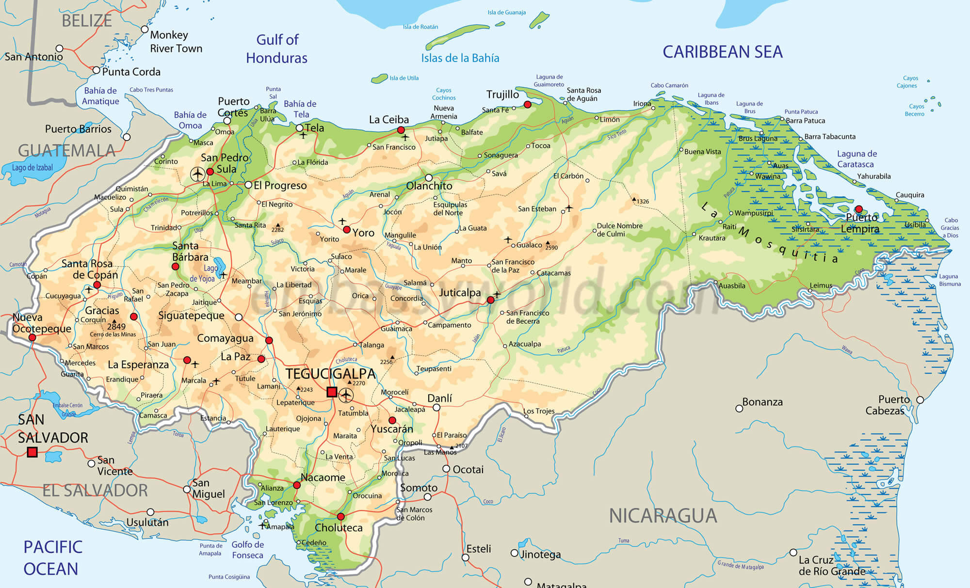
HONDURAS PHYSICAL MAP
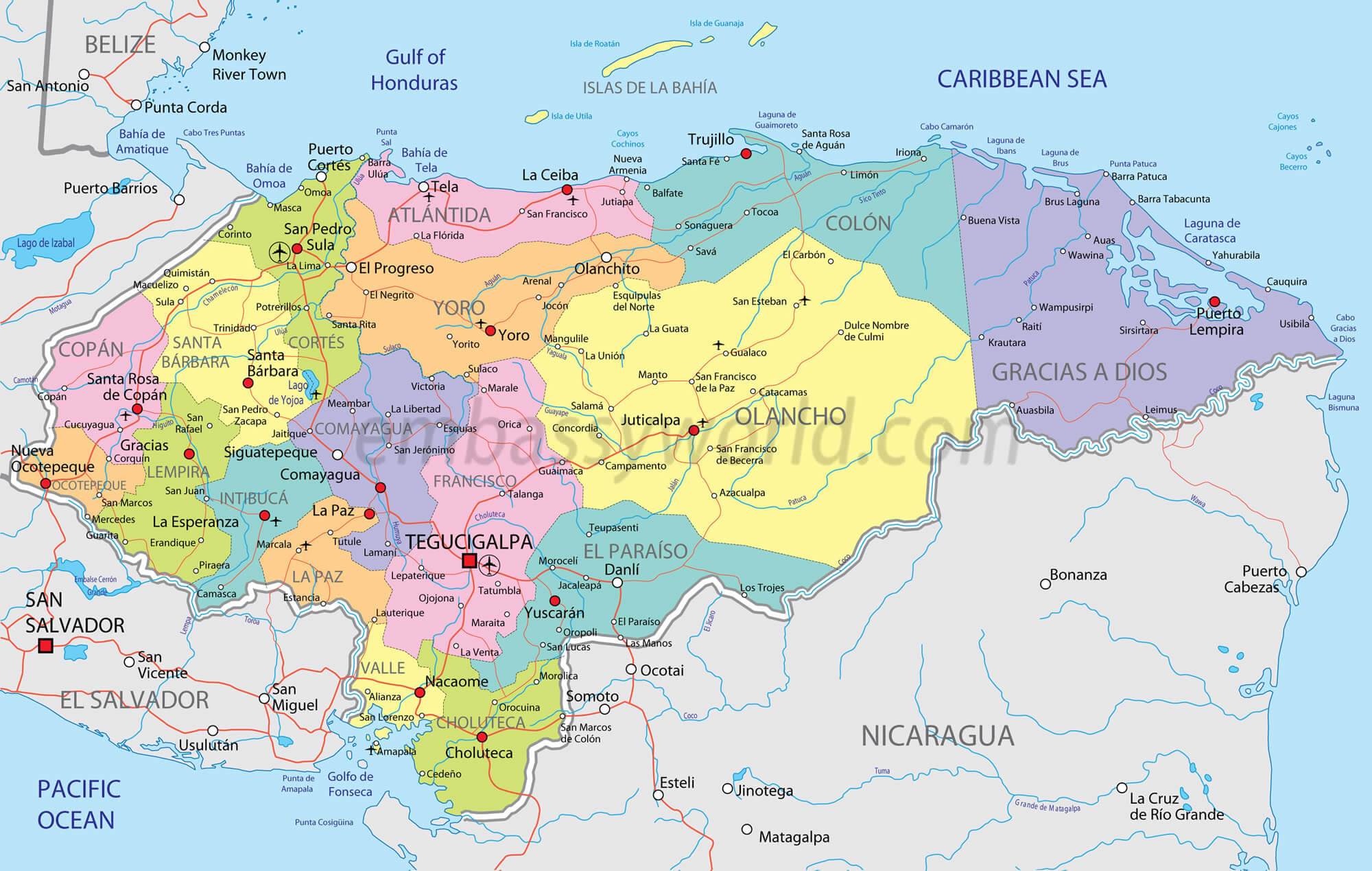
HONDURAS POLITICAL MAP
HONDURAS REGIONS MAP
HONDURAS MAP
HONDURAS MAP
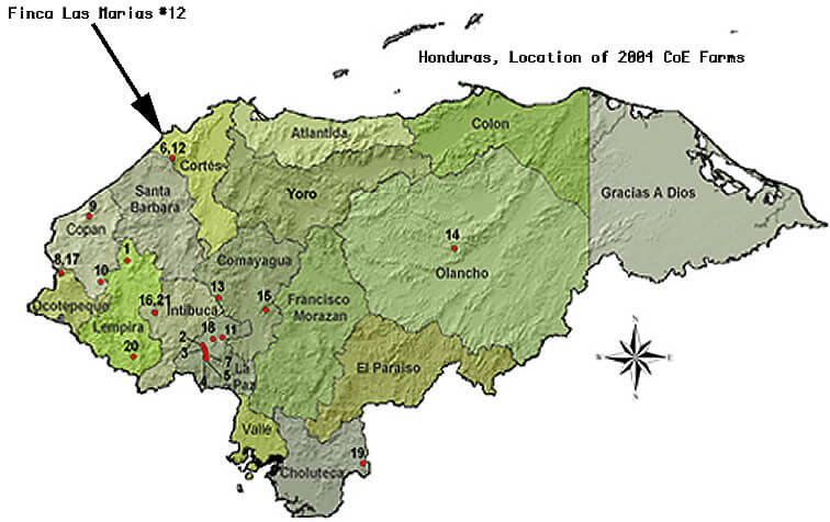
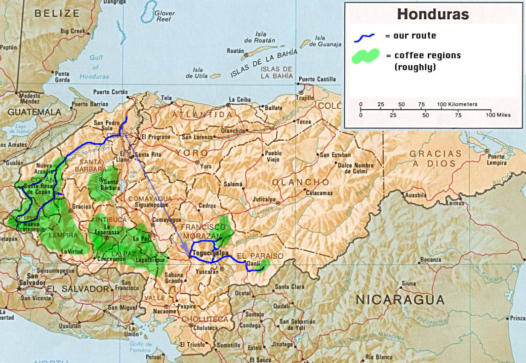
HONDURAS MAP COFFEE REGIONS
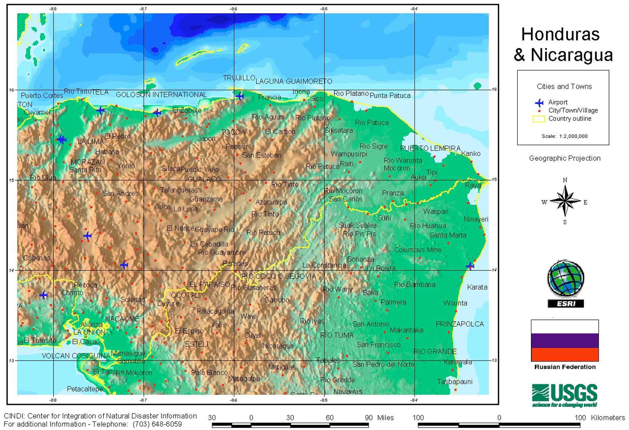
HONDURAS MAP NICARAGUA
HONDURAS PHYSICAL MAP
MAP OF HONDURAS CENTRAL AMERICA
MAP OF HONDURAS WORLD
MAP OF HONDURAS
MAP HONDURAS
PHYSICAL MAP OF HONDURAS
REGIONAL MAP OF HONDURAS
HONDURAS EARTH MAP
- Head of Performance Marketing
- Head of SEO
- Linkedin Profile: linkedin.com/in/arifcagrici