- Capital :
Seoul
- Population :
50,004,441
- GDP :
$1.151 trillion (15th)
- Per Capita :
$23,020 (32nd)
- Calling Code :
+82
- Jobless Rate :
2.90%
- Time Zone :
+9
With interactive South Korea Map, view regional highways maps, road situations, transportation, lodging guide, geographical map, physical maps and more information. On South Korea Map, you can view all states, regions, cities, towns, districts, avenues, streets and popular centers' satellite, sketch and terrain maps.
A Collection of South Korea Maps
Map of South Korea
Map of South Korea - Republic of Korea - vector map
South Korea Administrative Map

Administrative map of South Korea with provinces.
South Korea Political Map
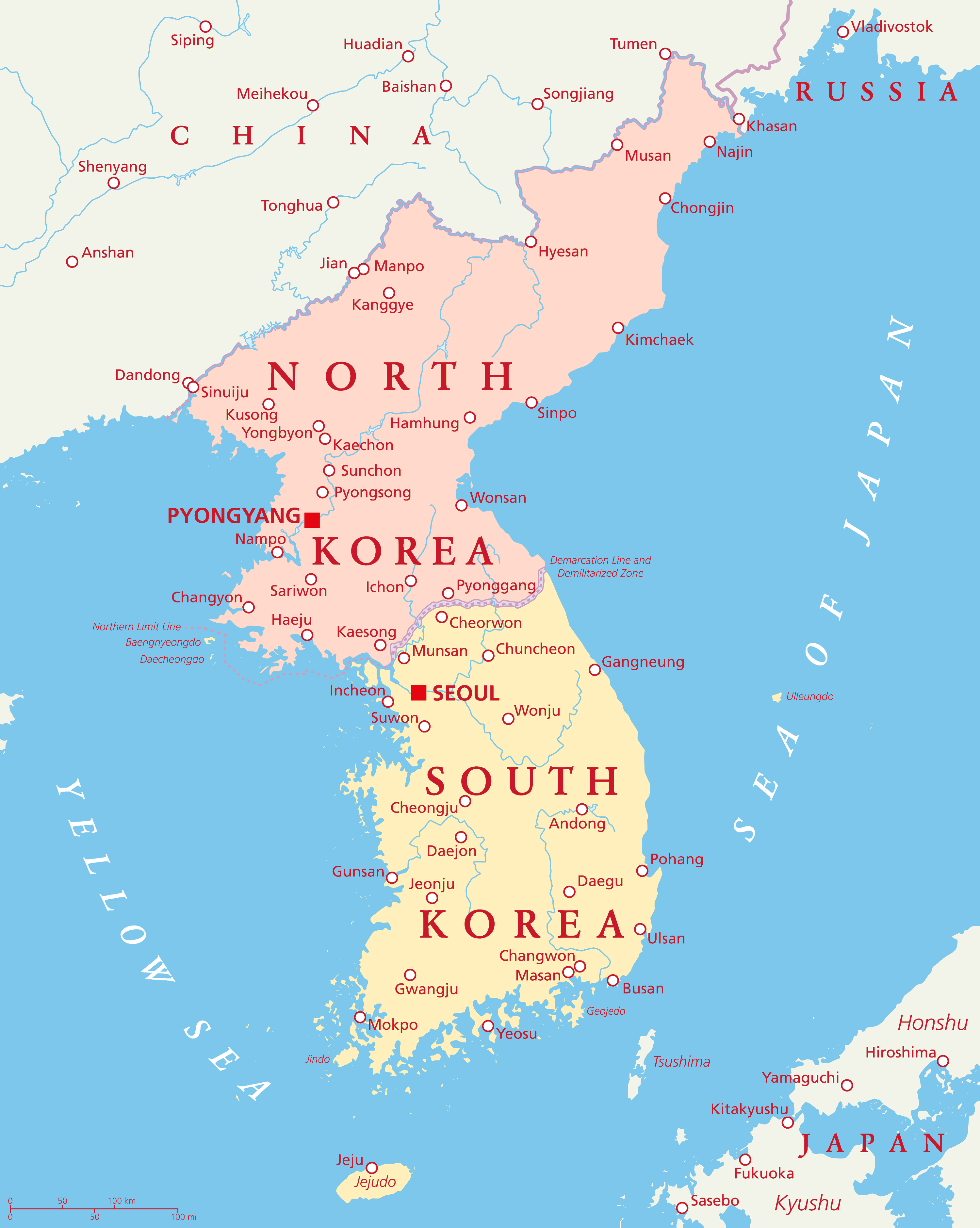
North Korea and South Korea political map with capitals Pyongyang and Seoul. Korean peninsula, national borders, important cities, rivers and lakes. English labeling and scaling.
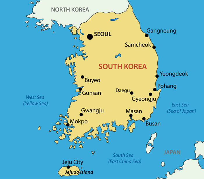
South Korea Map
South Korea political map with capital Seoul, national borders, important cities, rivers and lakes. English labeling and scaling.
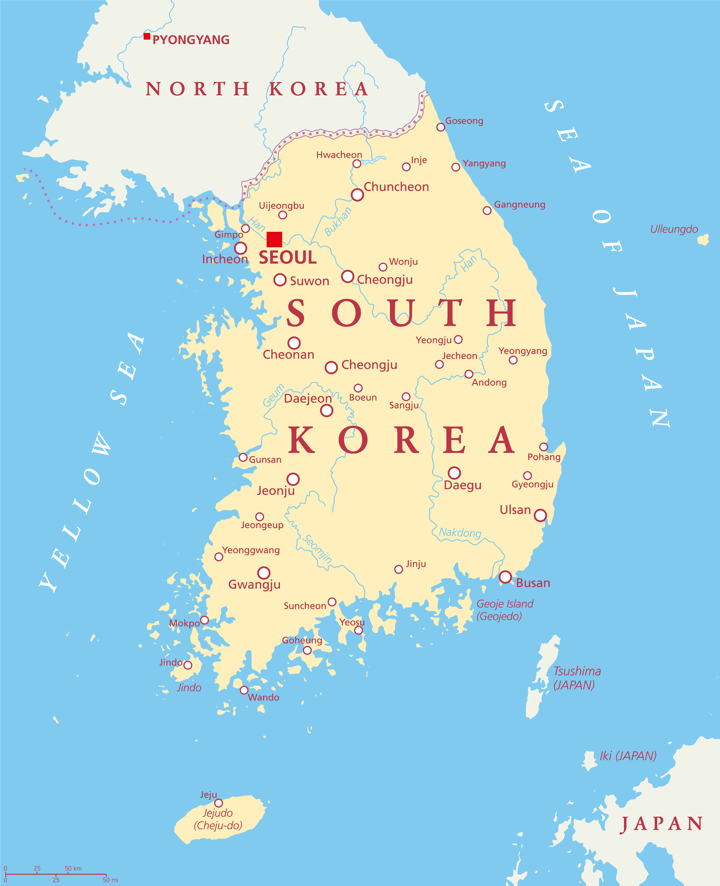
Physical Map of South Korea
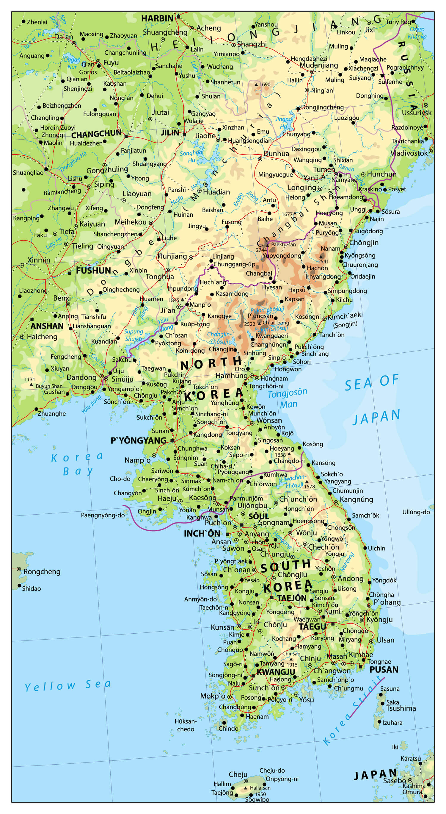
Korean Peninsula large detailed physical map with roads, railroads, water objects, cities and capitals.