
- Capital :
Bangkok
- Population :
66,720,153
- GDP :
$377.158 billion
- Per Capita :
$5,850
- Calling Code :
+66
- Jobless Rate :
0.56%
- Time Zone :
+7
With interactive Thailand Map, view regional highways maps, road situations, transportation, lodging guide, geographical map, physical maps and more information. On Thailand Map, you can view all states, regions, cities, towns, districts, avenues, streets and popular centers' satellite, sketch and terrain maps.
A Collection of Thailand Maps
Map of Thailand
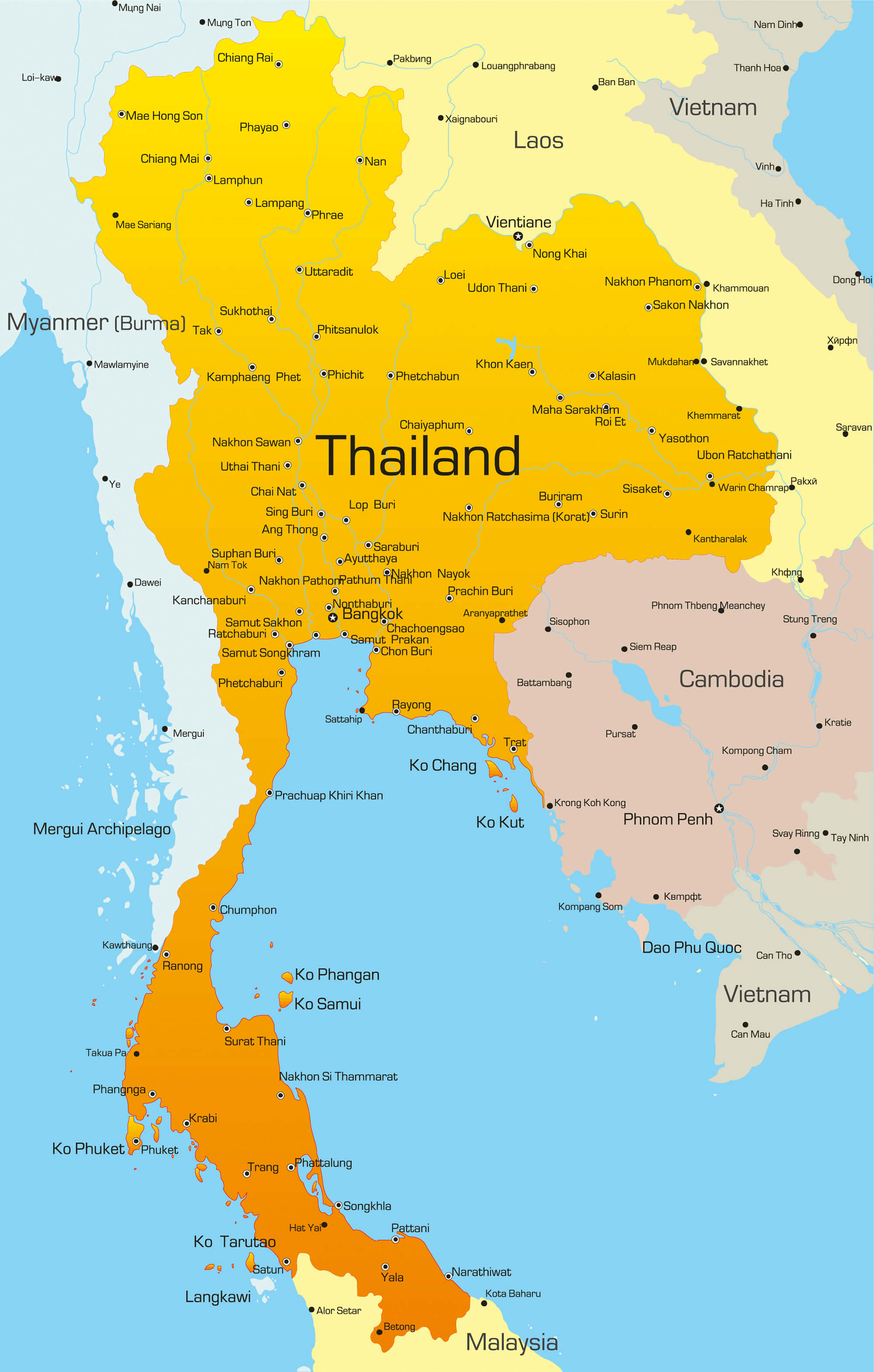
Vector map of Thailand country.
Thailand Map
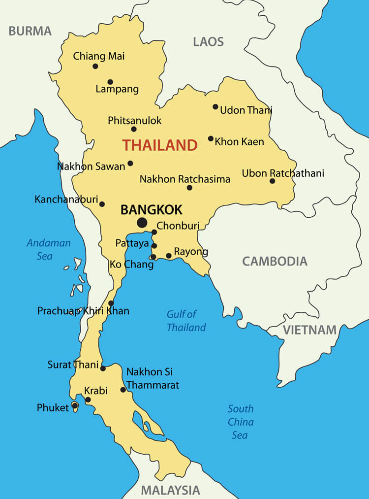
Thailand Map with main cities. Kingdom of Thailand - vector map.
Thailand Administrative Map
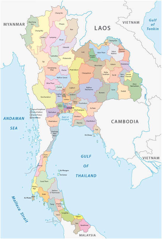
Thailand Administrative Map with provinces.
Thailand Travel Map
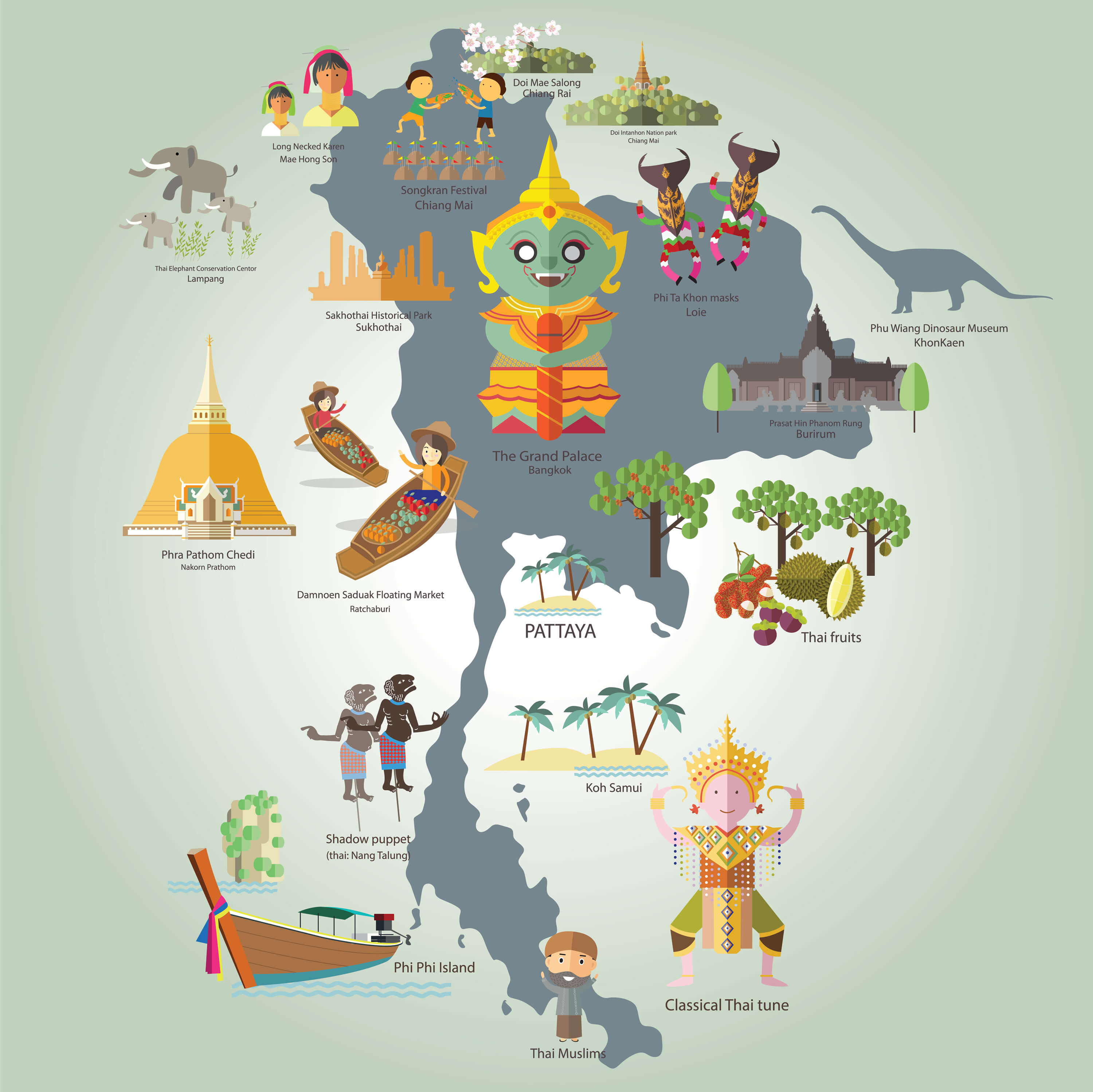
Thailand Travel Map with with touristic destinations.
Thailand Satellite Map
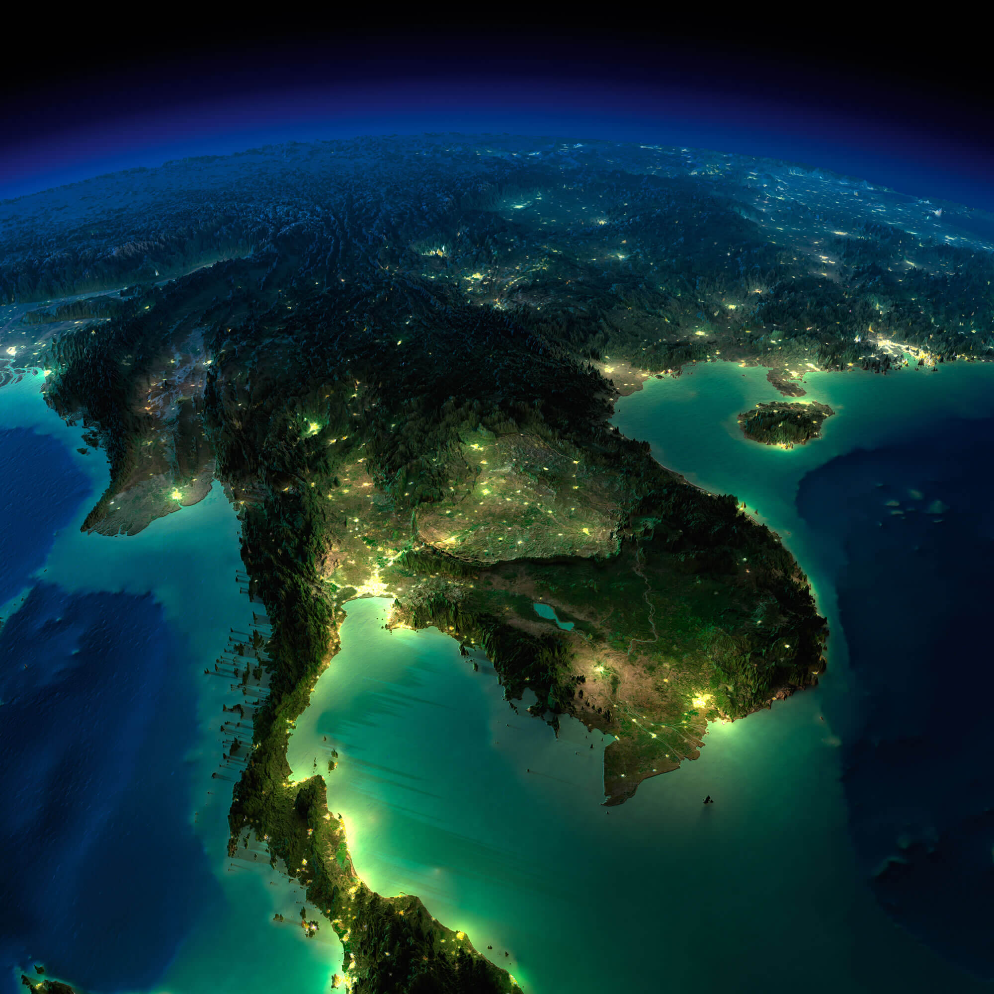
Highly detailed Earth, illuminated by moonlight. The glow of cities sheds light on the exaggerated terrain and translucent water. Asia, Indochina peninsula.
Thailand Indochina Peninsula Map
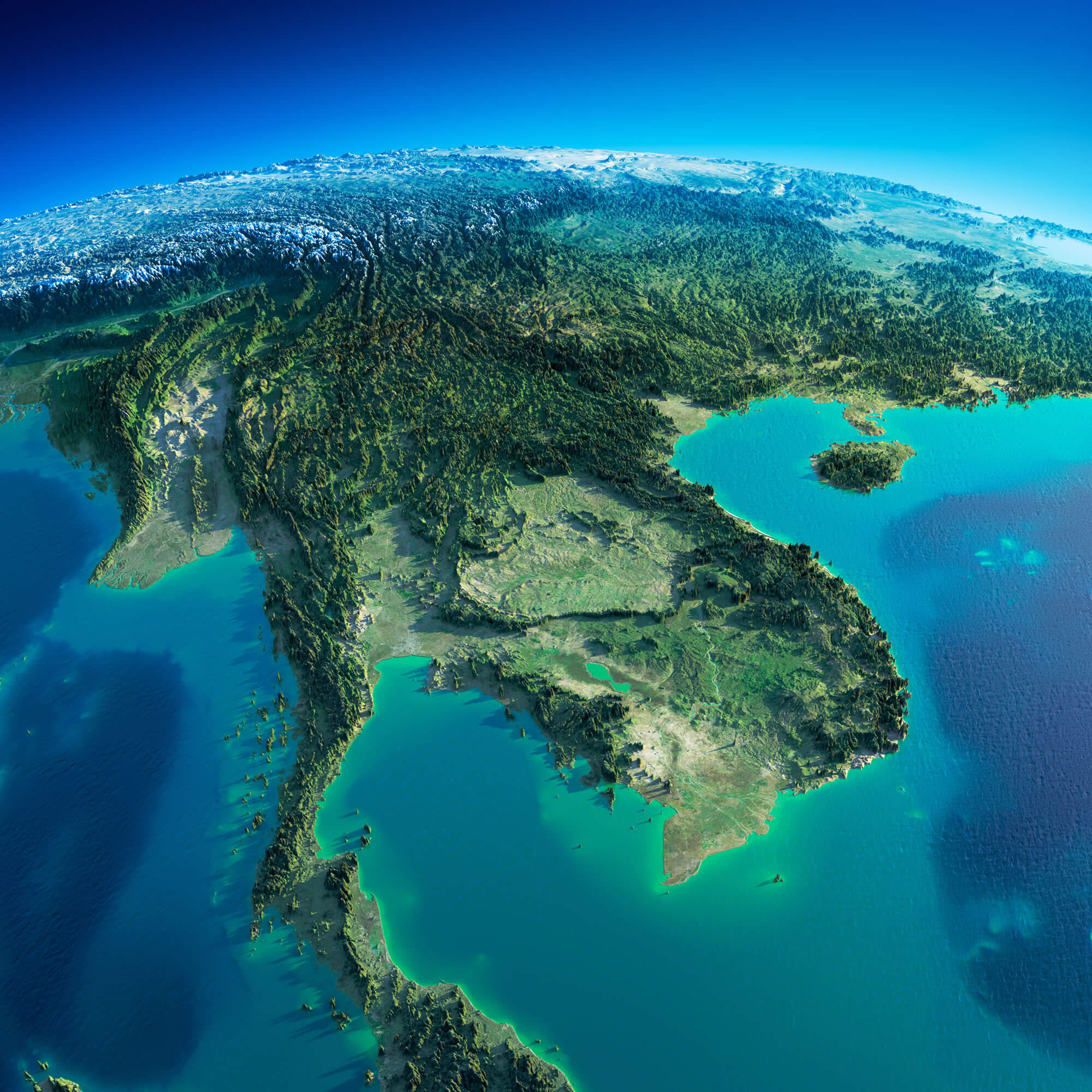
Highly detailed planet Earth in the morning. Exaggerated precise relief lit morning sun. Detailed Earth. Indochina peninsula.