Map of United Kingdom, United Kingdom
Navigate United Kingdom map, United Kingdom country map, satellite images of United Kingdom, United Kingdom largest cities, towns maps, political map of United Kingdom, driving directions, physical, atlas and traffic maps in United Kingdom.
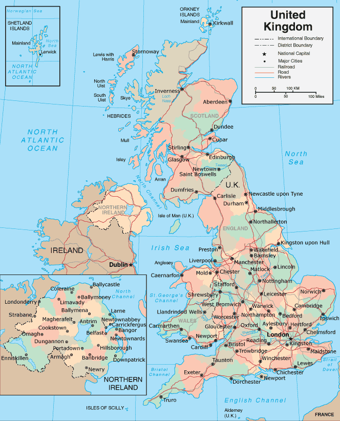
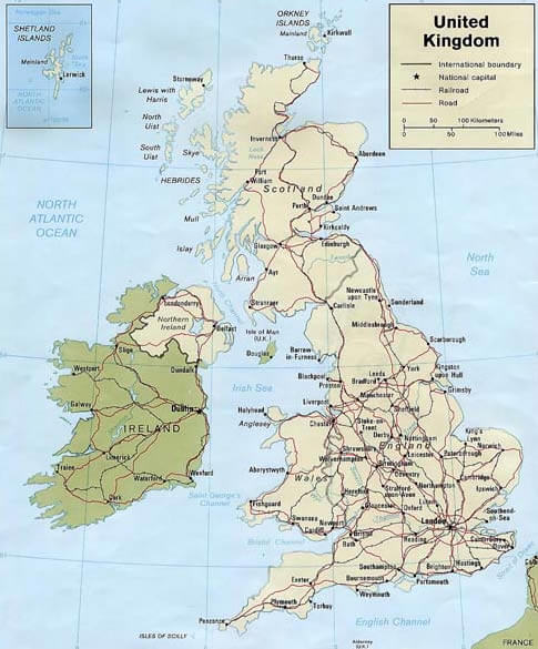
MAP OF UK
United Kingdom City Maps
Aberdeen Belfast Birmingham Blackburn Bolton Bradford Bristol Cardiff Coventry Derby Edinburgh Glasgow Huddersfield Ipswich Kingston Upon Hull Leeds Leicester Liverpool London Manchester Middlesbrough Newcastle Northampton Norwich Oxford Peterborough Plymouth Portsmouth Reading Sheffield Southampton Stoke on Trent Sunderland Swansea Walsall Watford West Bromwich Wolverhampton York Homeland Homeland Homeland Homeland Park Nottingham Dudley Luton Preston Milton Keynes Bournemouth Southend on Sea Swindon Dundee Poole Blackpool Telford Stockport Brighton Slough Gloucester Rotherham Newport Cambridge Exeter Eastbourne Sutton Coldfield Colchester Oldham St Helens Woking Crawley Chelmsford Basildon Cheltenham Gillingham Worthing Rochdale Solihull Worcester Derry Southport Basingstoke Bath Maidstone Harlow Grimsby Darlington Hartlepool Lincoln Hastings Birkenhead Halifax Hemel Hempstead South Shields Bedford St Albans Stevenage Wigan Warrington Chester Stockton on Tees Gateshead Weston super Mare High Wycombe Wakefield Redditch Newcastle under Lyme Paisley East Kilbride Chatham Burnley Salford Scunthorpe Hove Carlisle Tamworth Barnsley Harrogate Lisburn Bracknell Nuneaton Chesterfield Mansfield Guildford Gosport Aylesbury Lowestoft Doncaster Crewe Shrewsbury Ellesmere Port Cannock Grays Stafford Waterlooville Torquay Kingswood Bognor Regis Newtownabbey Rugby Royal Leamington Spa Bury Royal Tunbridge Wells Runcorn Rhondda Bootle Ashford Maidenhead Wallasey Margate Bangor Taunton Aldershot Great Yarmouth Farnborough Bebington Dartford Hereford Fareham Littlehampton Widnes Stourbridge Kidderminster Cheshunt Halesowen Loughborough Sale Dewsbury Morley Washington UK Gravesend Eastleigh Crosby Clacton on Sea Kettering Livingston Dunstable Macclesfield Barry StainesA Collection of United Kingdom Maps and United Kingdom Satellite Images
MAP OF UK
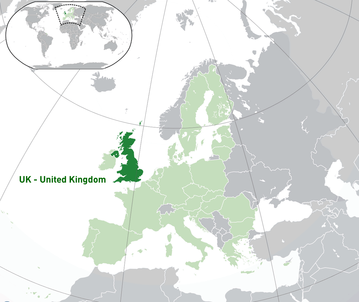
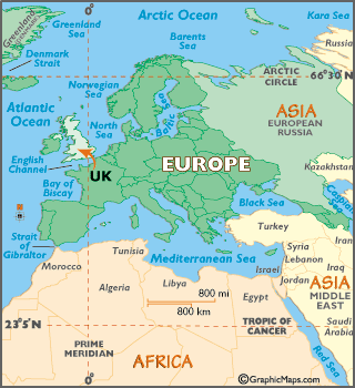
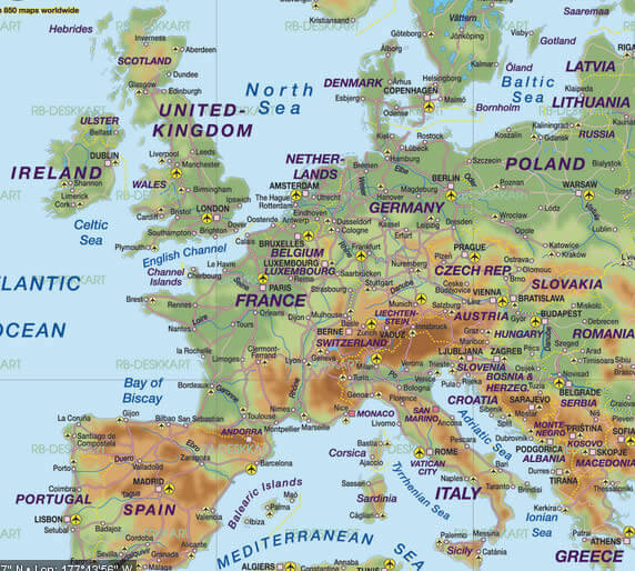
WHERE IS UNITED KINGDOM IN THE WORLD
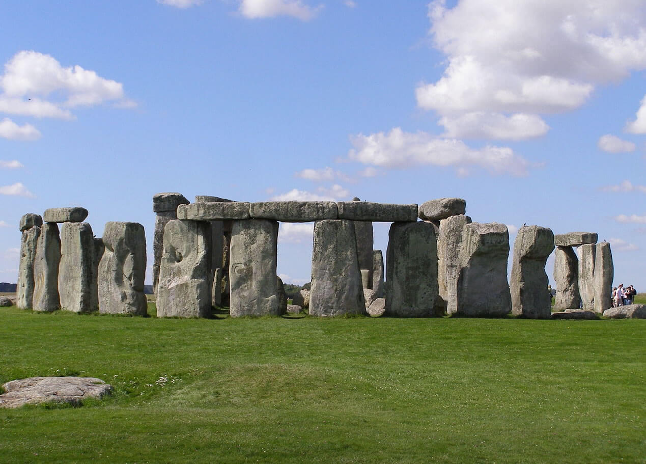
STONEHENGE WILTSHIRE UNITED KINGDOM 2500 BC
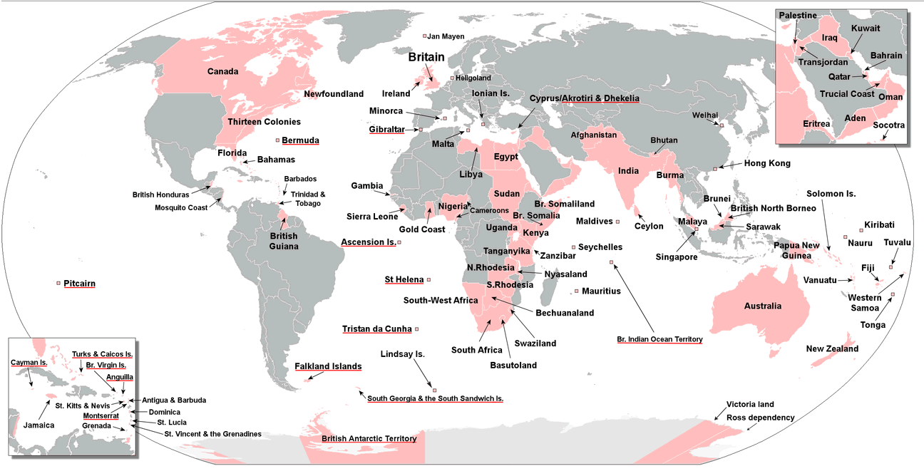
BRITISH EMPIRE UNITED KINGDOM MAP
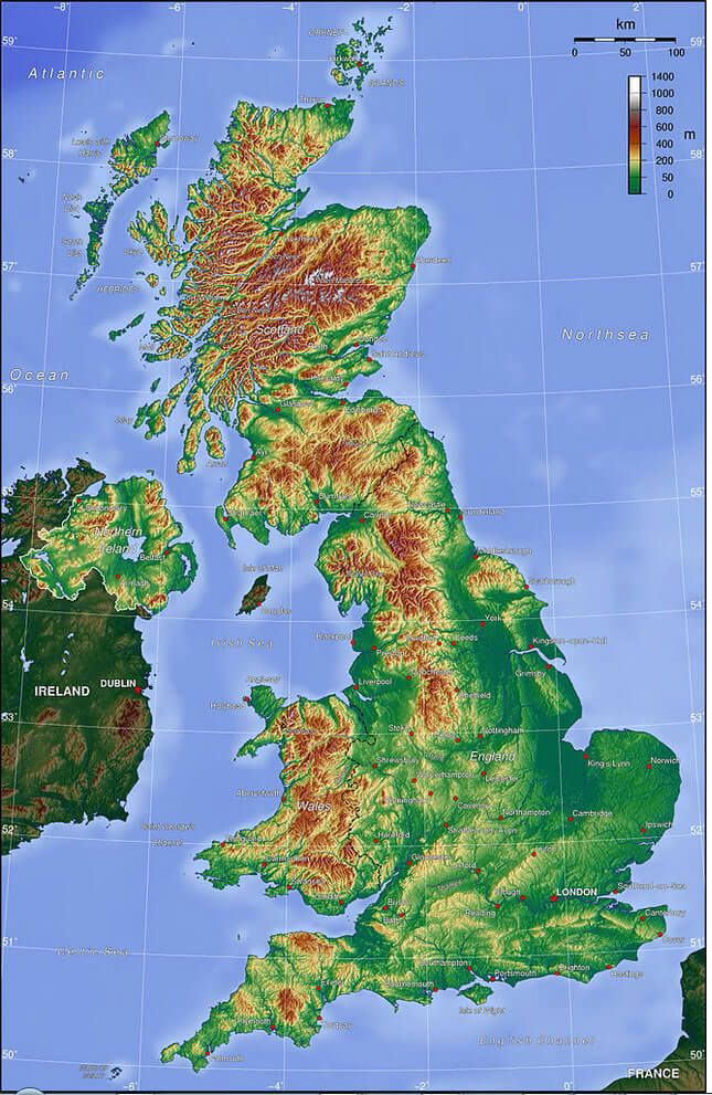
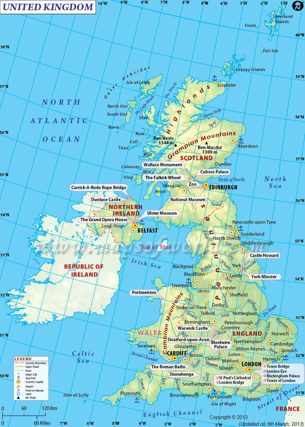
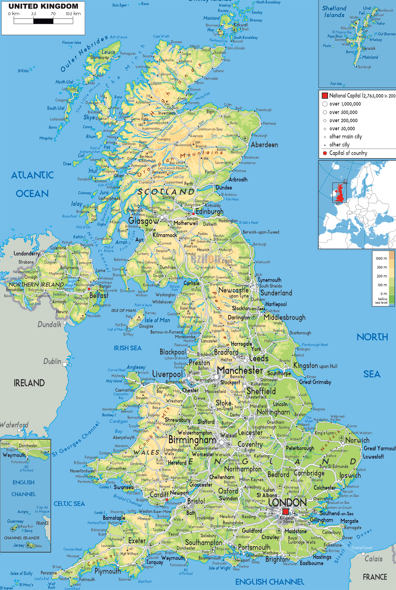
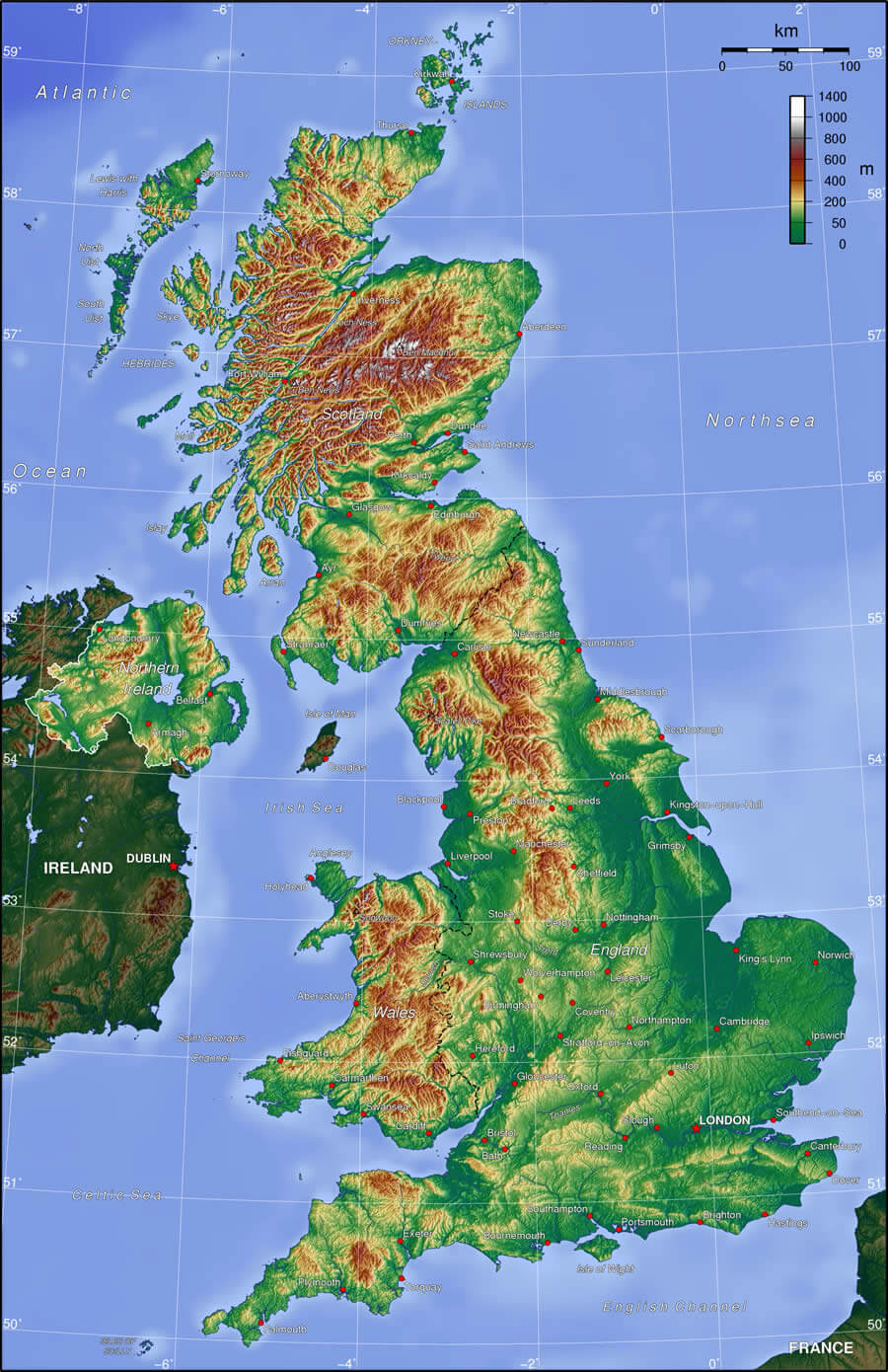
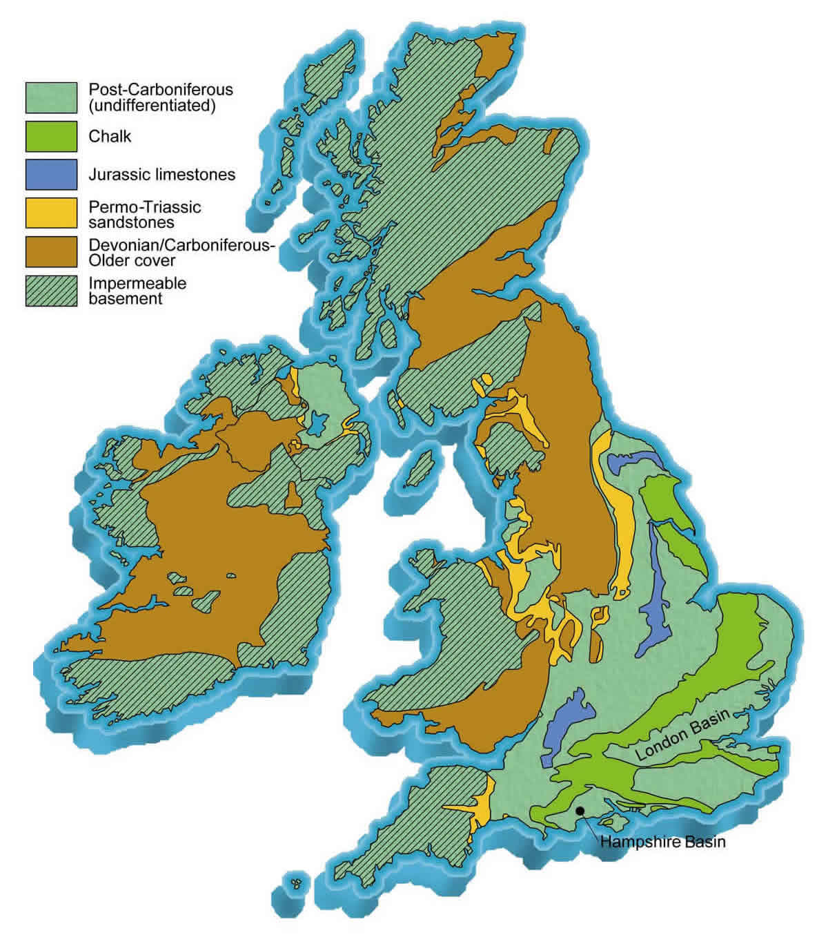
UK TOPOGRAPHIC MAP
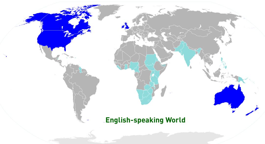
ENGLISH SPEAKING WORLD MAP
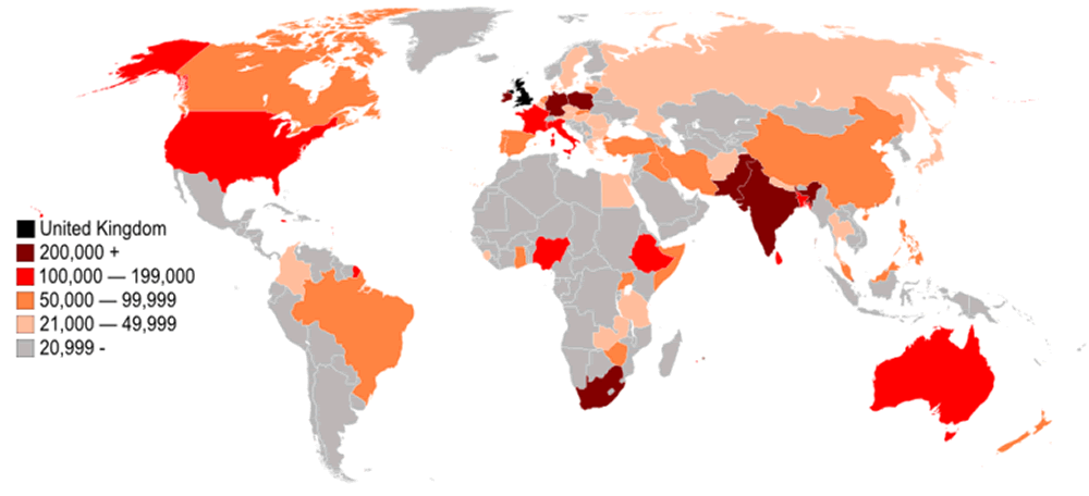
UNITED KINGDOM FOREIGN BORN POPULATION BY COUNTRY MAP
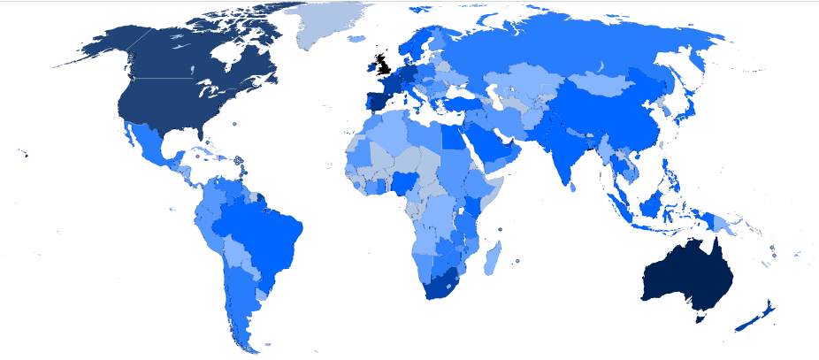
BRITISH CITIZENS LIVING OVERSEAS BY COUNTRY 2006 MAP
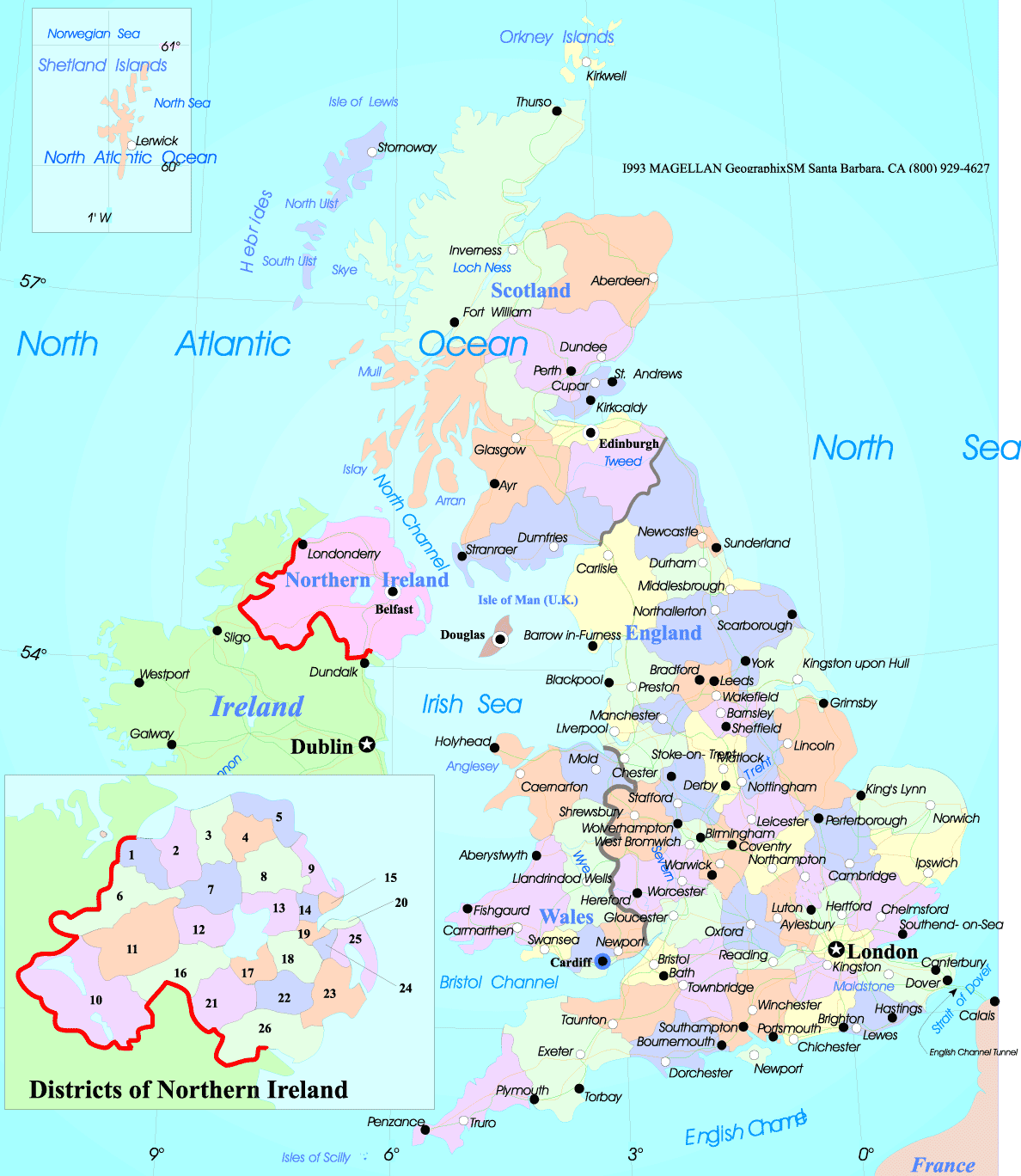
ENGLAND MAP
ENGLAND MAP
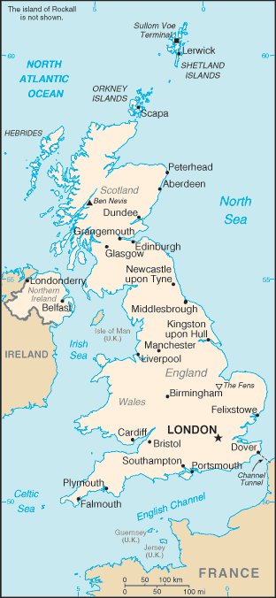
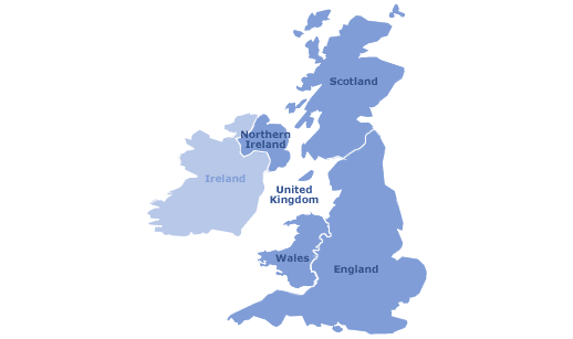
MAP OF UNITED KINGDOM
MAP OF ENGLAND
MAP OF UNITED KINGDOM
MAP OF UNITED KINGDOM
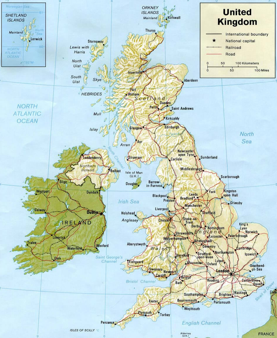
MAP UNITED KINGDOM
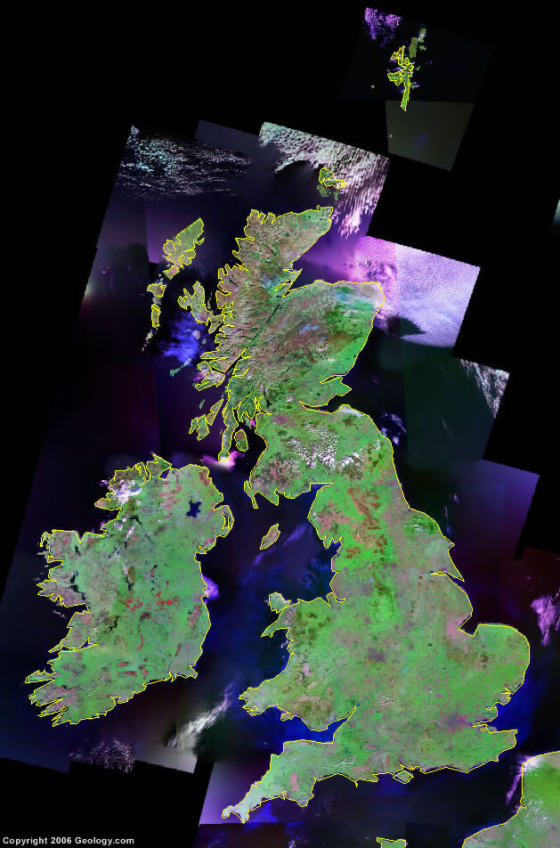
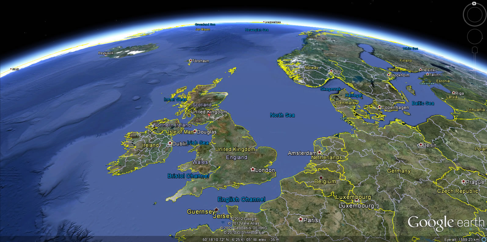
SATELLITE IMAGE OF UNITED KINGDOM
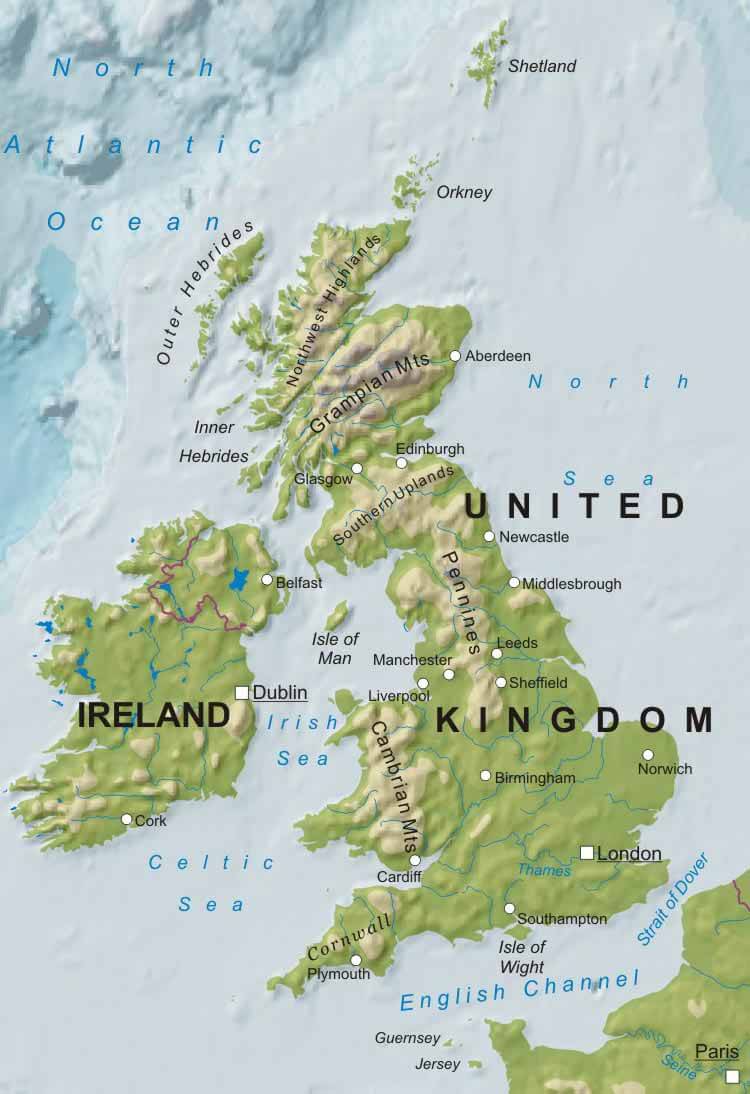
TOPOGRAPHIC MAP OF UNITED KINGDOM
UK MAP
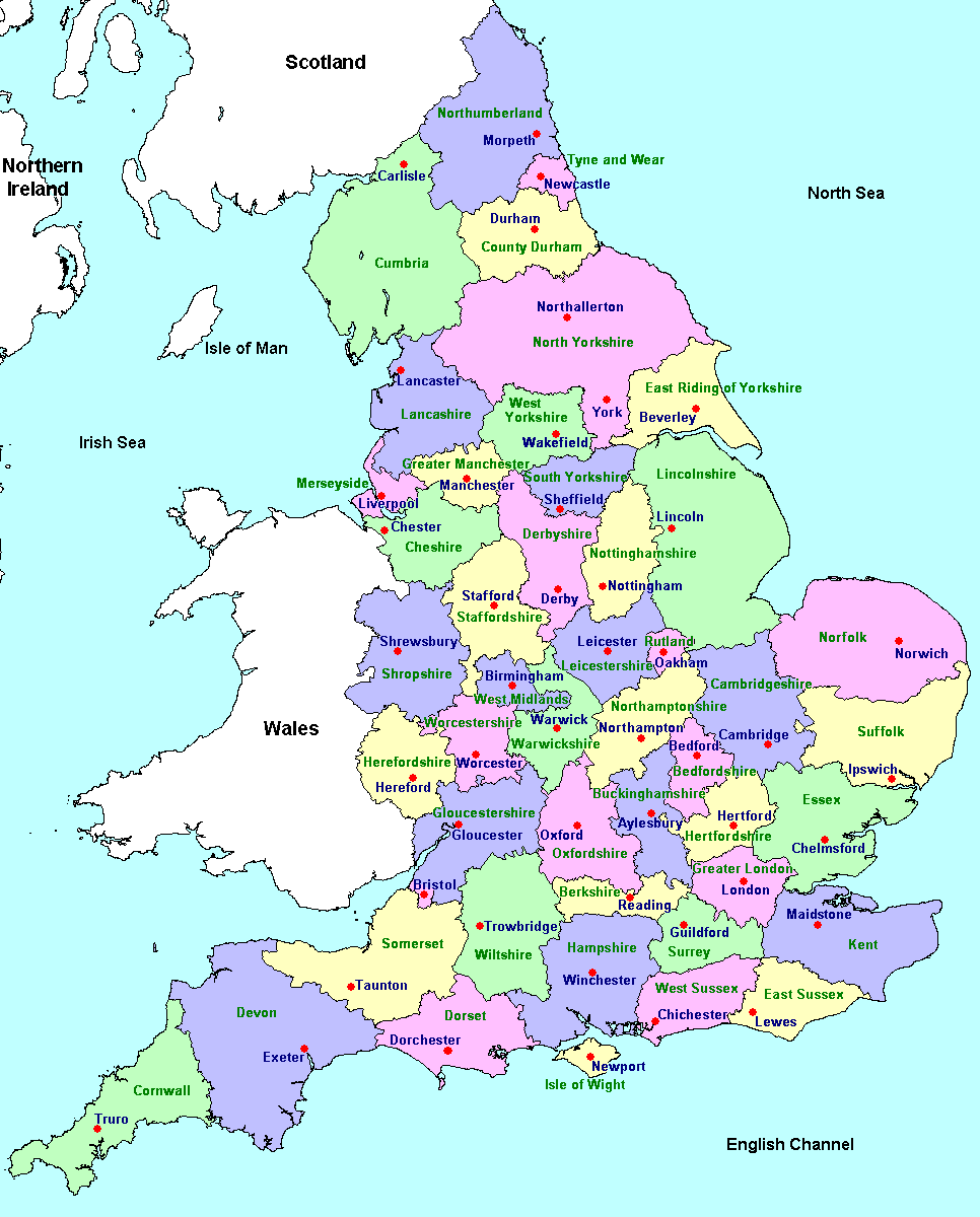
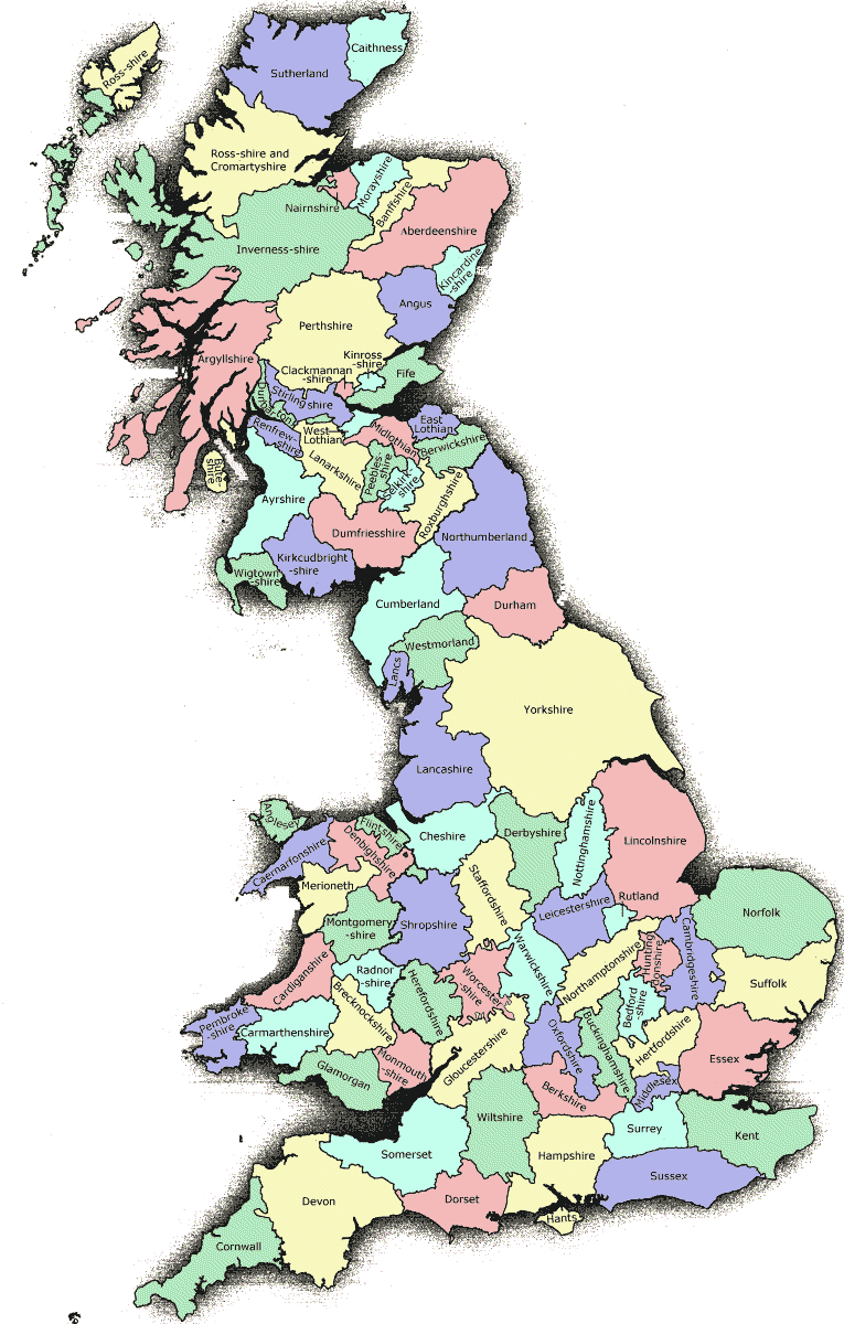
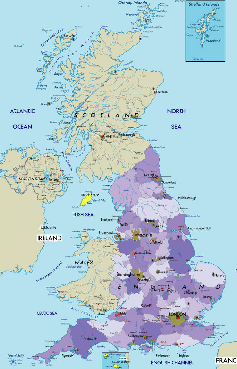
UK COUNTIES MAP
UK EU MAP
UK MAP
UK PHYSICAL MAP
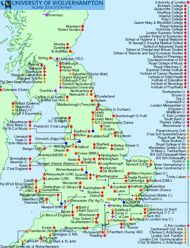
UK UNIVERSITIES MAP
UNITED KINGDOM MAP
UNITED KINGDOM CITIES MAP
UNITED KINGDOM EUROPE MAP
UNITED KINGDOM GEOGRAPHIC MAP
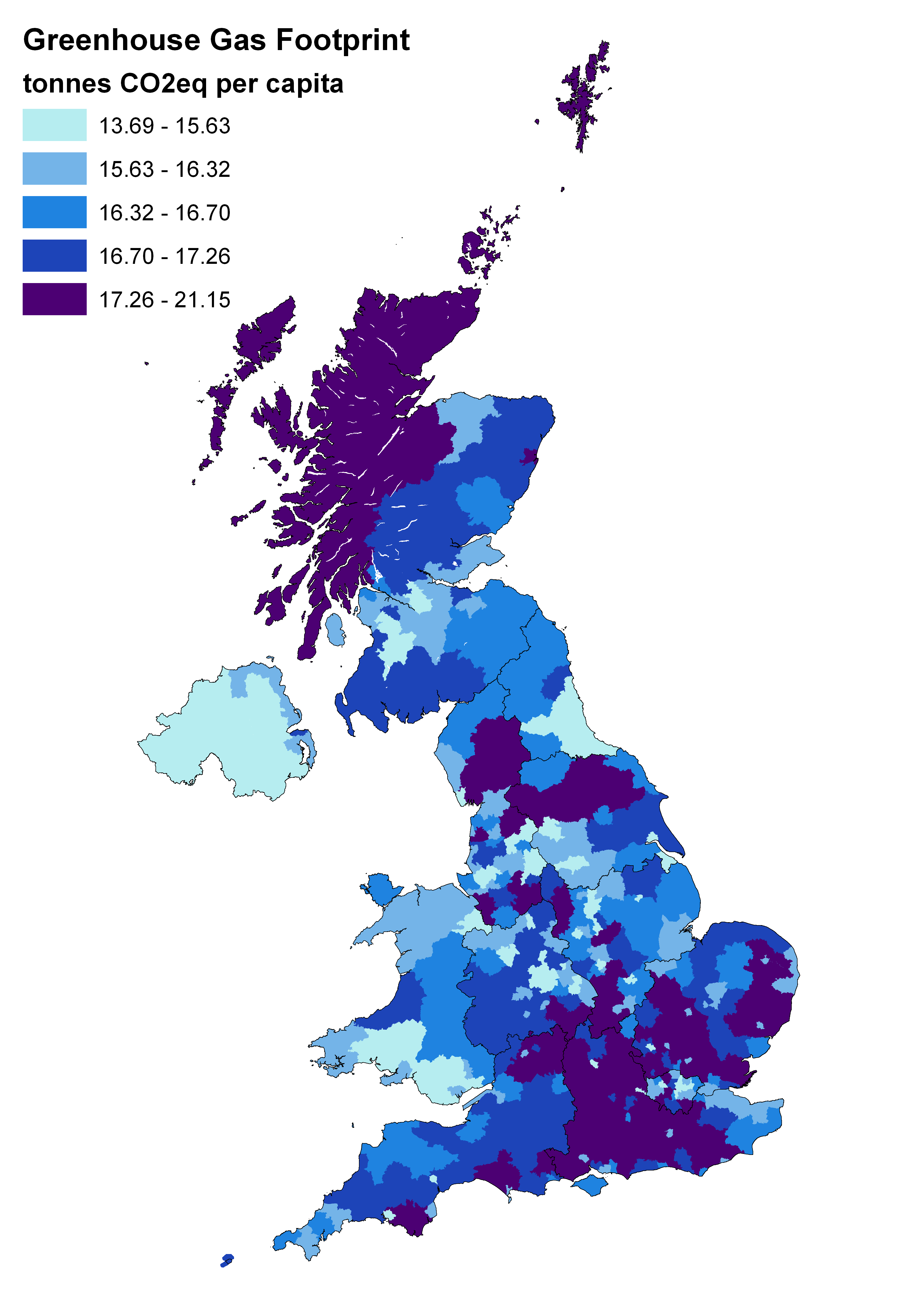
UNITED KINGDOM GREENHOUSE MAP
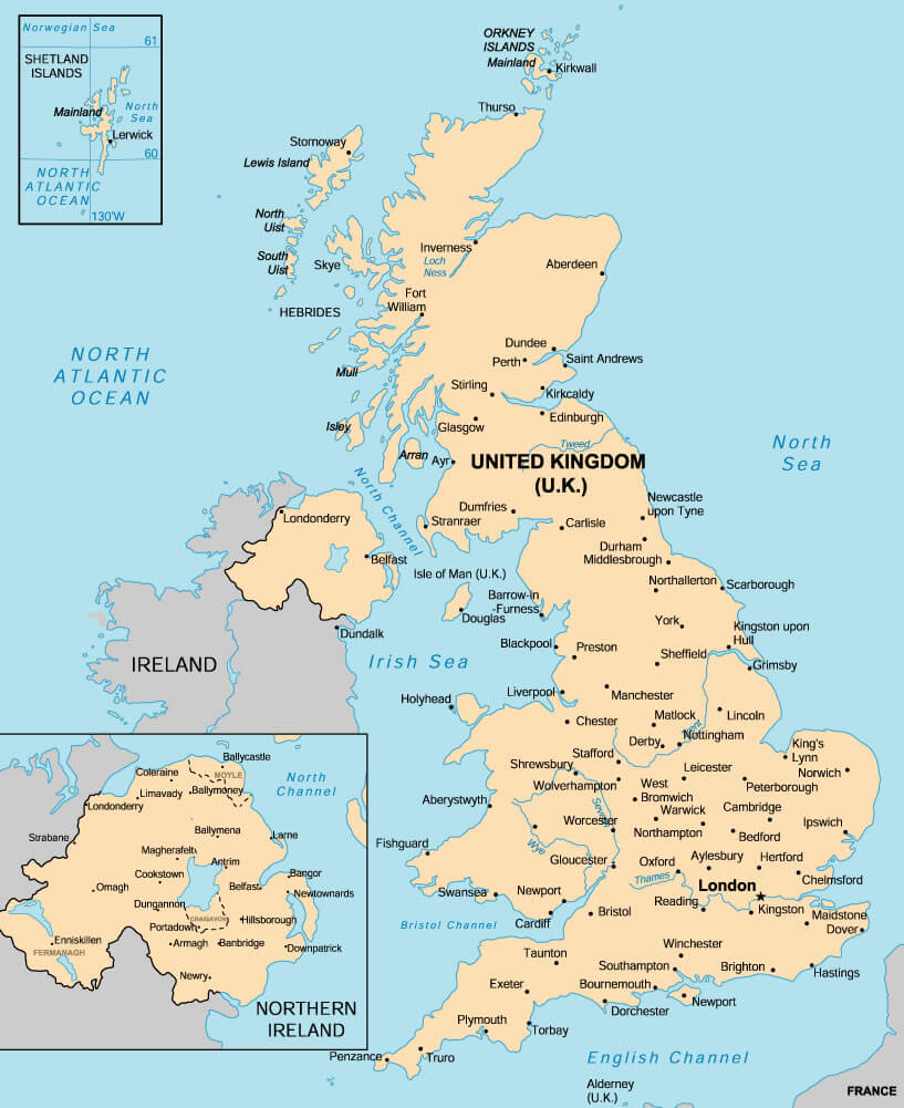
UNITED KINGDOM MAP
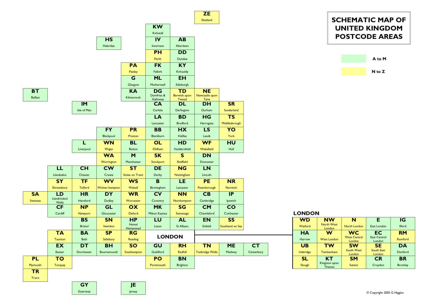
UNITED KINGDOM POSTCODE MAP
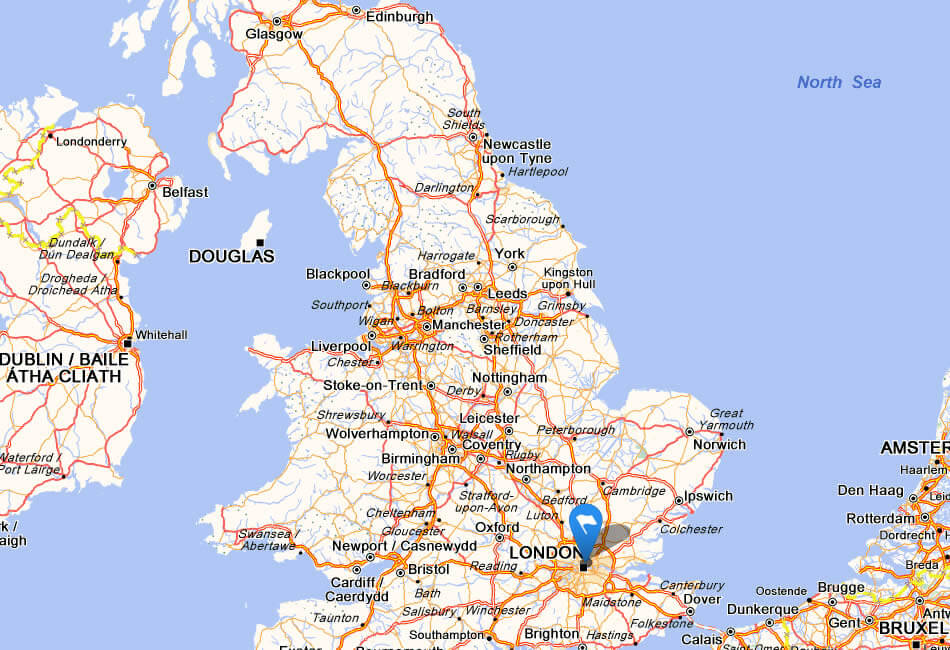
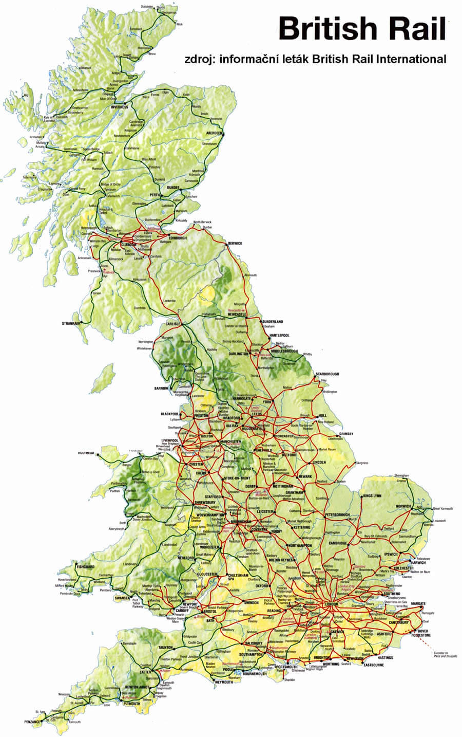
UNITED KINGDOM RAIL MAP
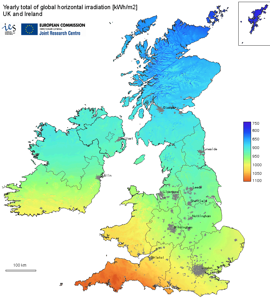
UNITED KINGDOM SOLAR RADIATION MAP
UNITED KINGDOM EARTH MAP
See Also
United Kingdom Google Map, Street Views, Maps Directions, Satellite Images
WorldMap1.com offers a collection of United Kingdom map, google map, United Kingdom atlas, political, physical, satellite view, country infos, cities map and more map of United Kingdom.