Map of Brazil, Brazil
Navigate Brazil map, Brazil country map, satellite images of Brazil, Brazil largest cities, towns maps, political map of Brazil, driving directions, physical, atlas and traffic maps in Brazil.
MAP OF BRAZIL

Brazil City Maps
Sao Paulo Rio de Janeiro Salvador Fortaleza Belo Horizonte Brasilia Curitiba Manaus Recife Belem Porto Alegre Goiania Guarulhos Campinas Sao LuisA Collection of Brazil Maps and Brazil Satellite Images
MAP OF BRAZIL
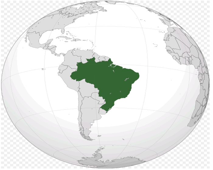
WHERE IS BRAZIL IN THE WORLD
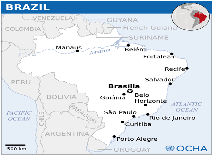
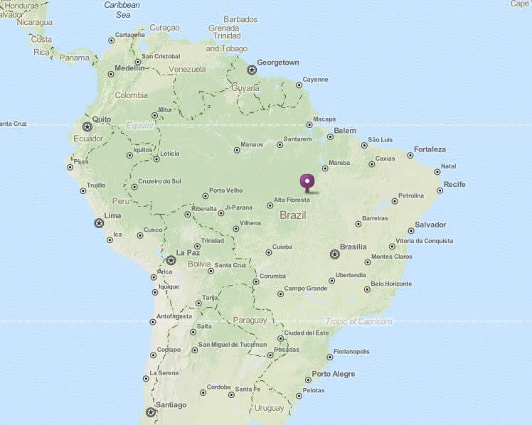
BRAZIL LOCATION MAP
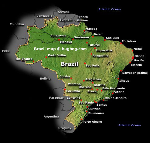
BRAZIL MAP
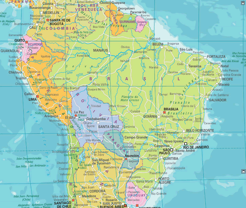
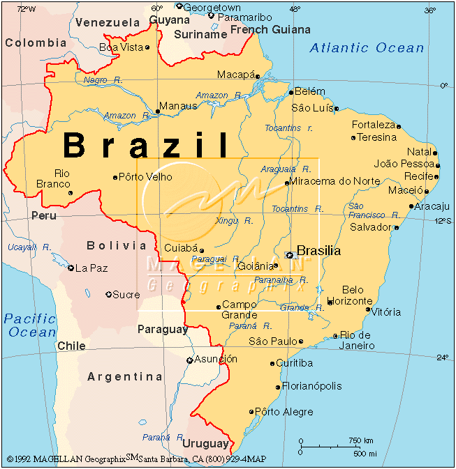
BRAZIL MAP
BRAZIL SATELLITE MAP
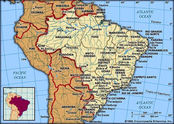
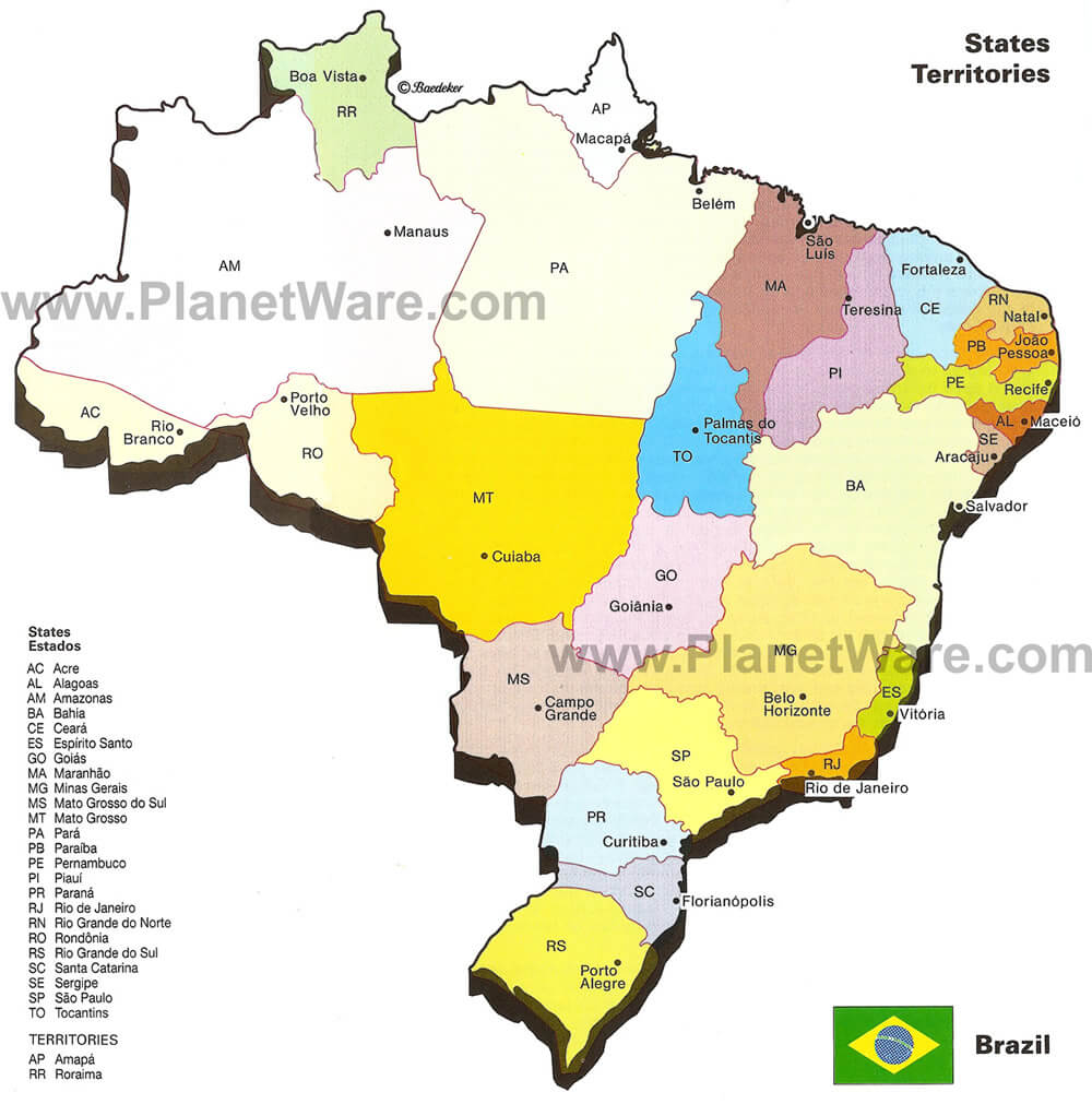
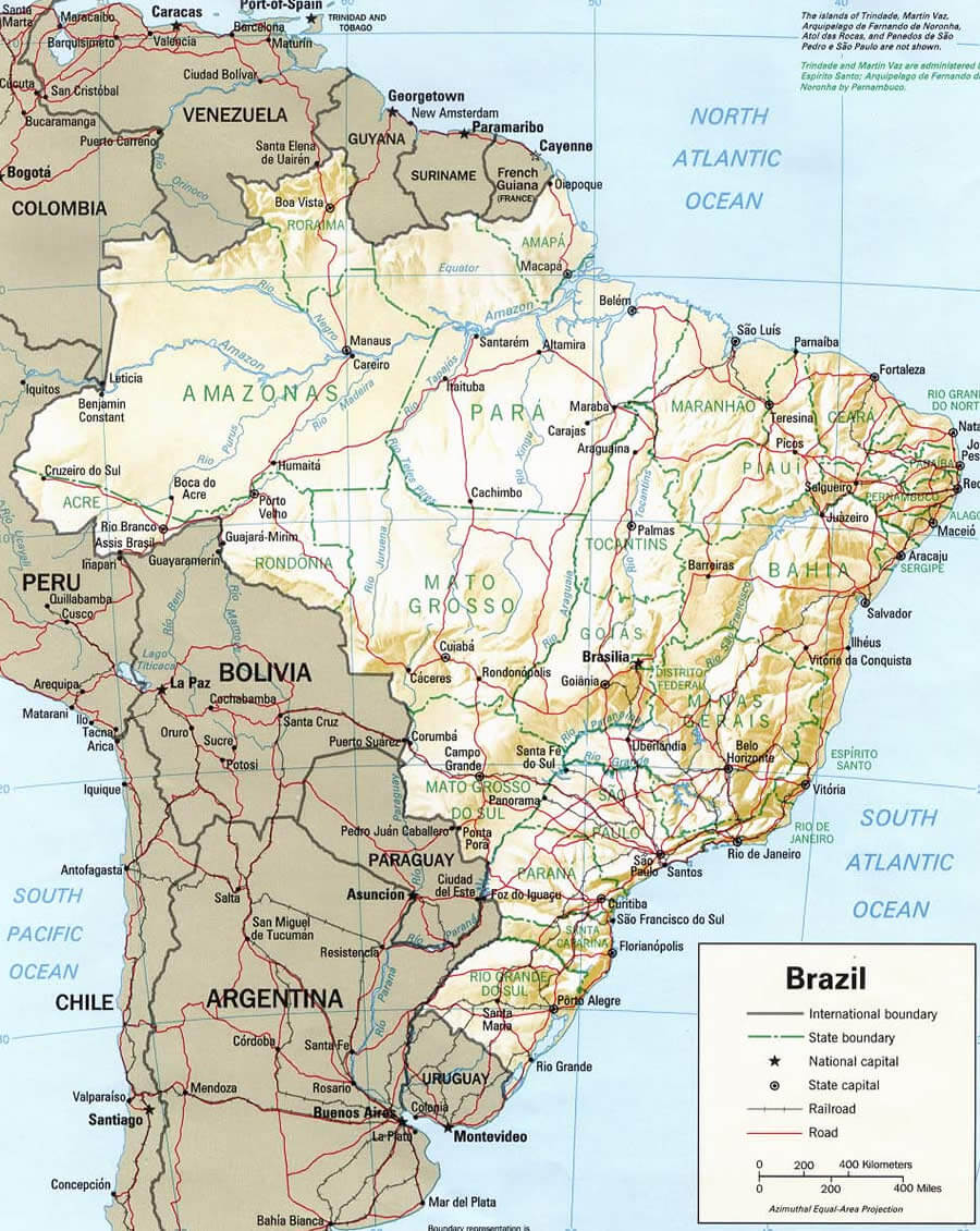
BRAZIL STATE MAP
BRAZIL CITIES MAP
BRAZIL MAP
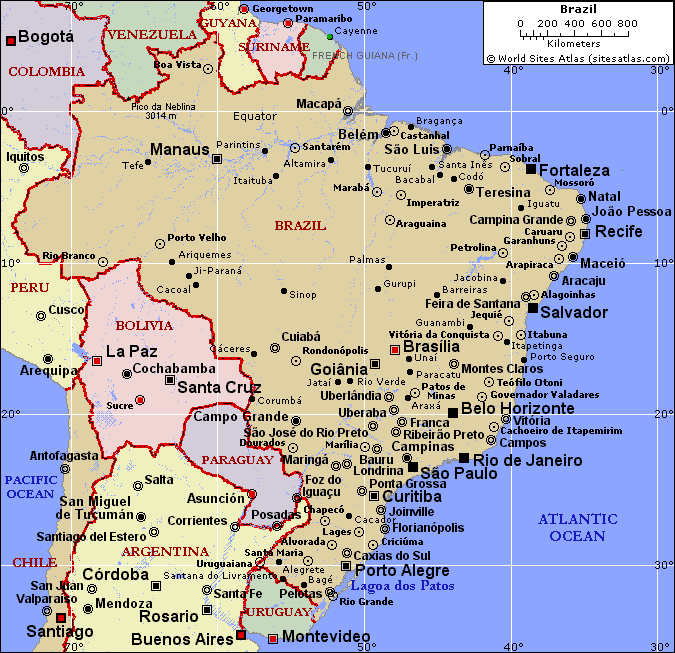
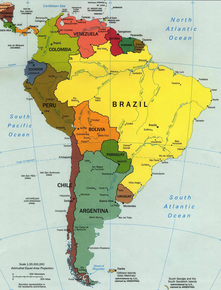
BRAZIL MAP SOUTH AMERICA
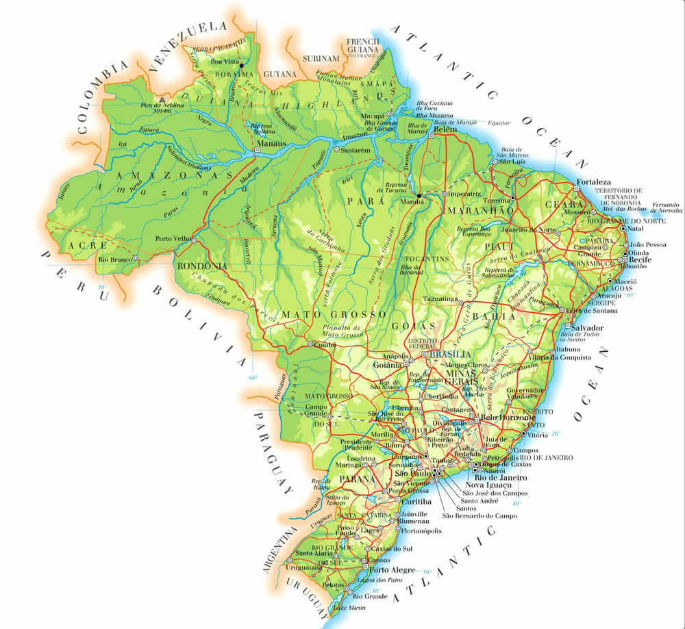
BRAZIL PHYSICAL MAP
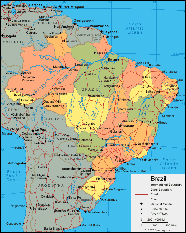
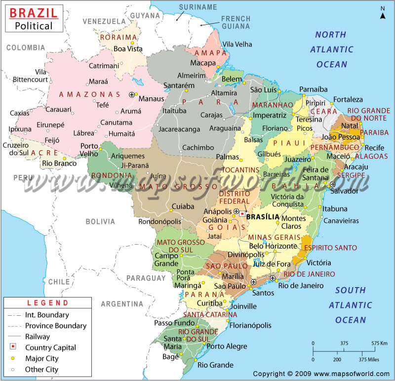
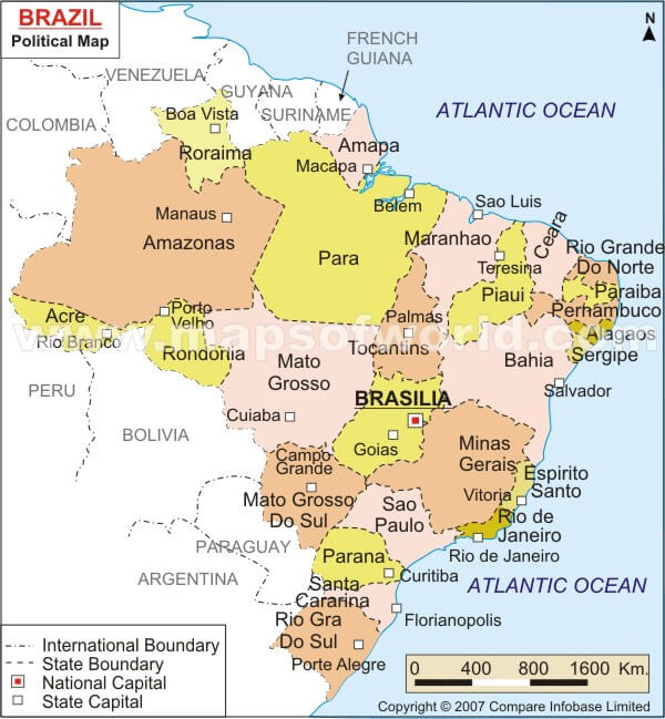
BRAZIL POLITICAL MAP
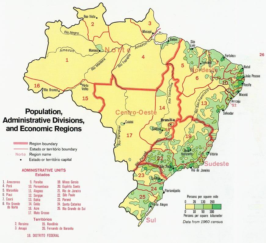
BRAZIL POPULATION MAP
MAP OF BRAZIL
MAP OF BRAZIL
MAPS OF BRAZIL
POLITICAL BRAZIL MAP
REGIONS MAP OF BRAZIL
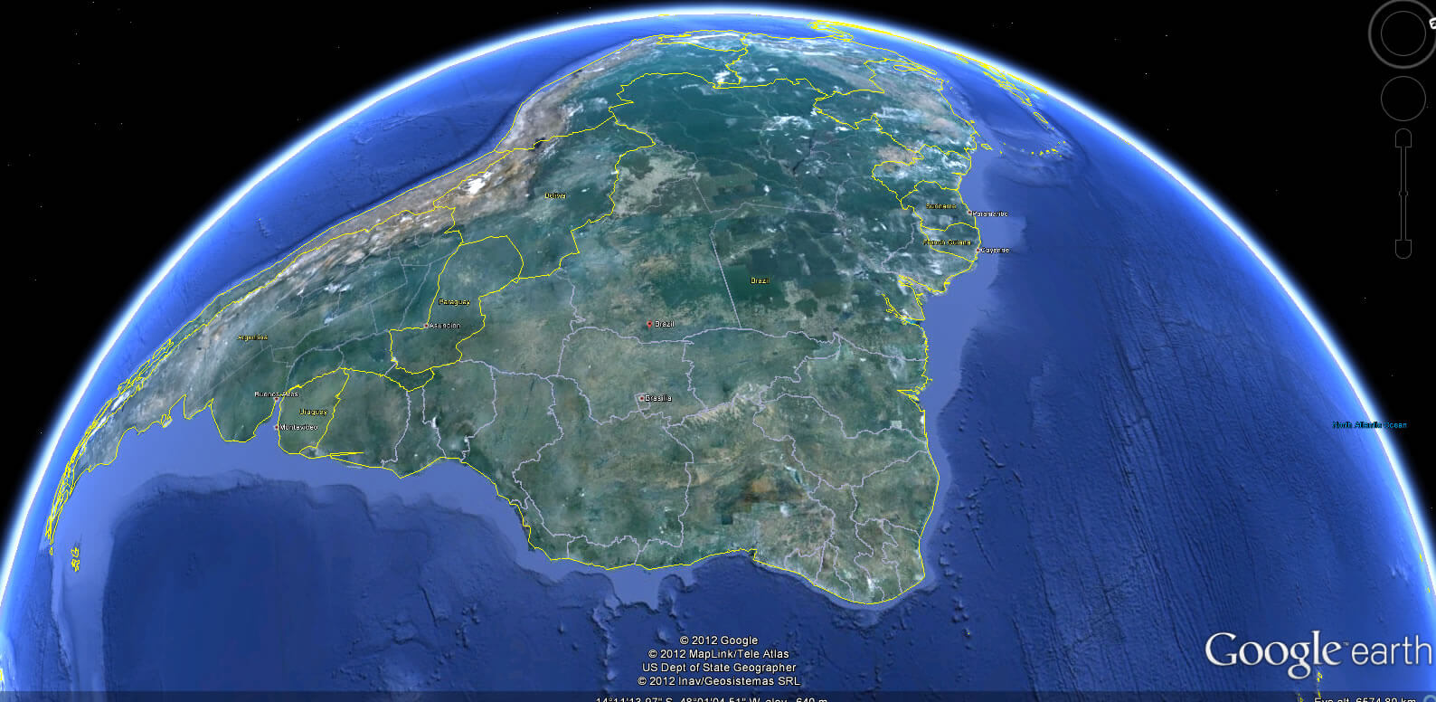
SATELLITE IMAGE OF BRAZIL

BRAZIL EARTH MAP
The 10 Best Places Visit for Rio de Janeiro
Please subscribe on "World Guide" channnel on Youtube at youtube.com/c/WorldGuide
Immerse Yourself in Sao Paulo 10 Best Unforgettable Attractions
The 10 Best Places Visit for Rio de Janeiro
Please subscribe on "World Guide" channnel on Youtube at youtube.com/c/WorldGuide
Immerse Yourself in Sao Paulo 10 Best Unforgettable Attractions
See Also
Brazil Google Map, Street Views, Maps Directions, Satellite Images
WorldMap1.com offers a collection of Brazil map, google map, Brazil atlas, political, physical, satellite view, country infos, cities map and more map of Brazil.