Map of Denmark, Denmark
Navigate Denmark map, Denmark country map, satellite images of Denmark, Denmark largest cities, towns maps, political map of Denmark, driving directions, physical, atlas and traffic maps in Denmark.
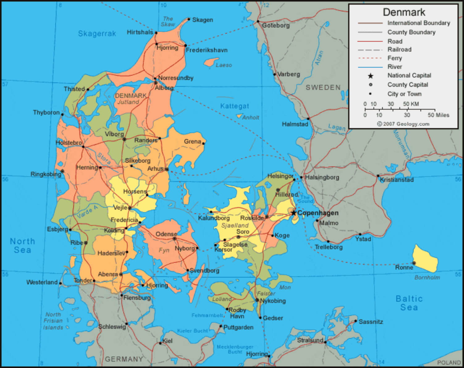
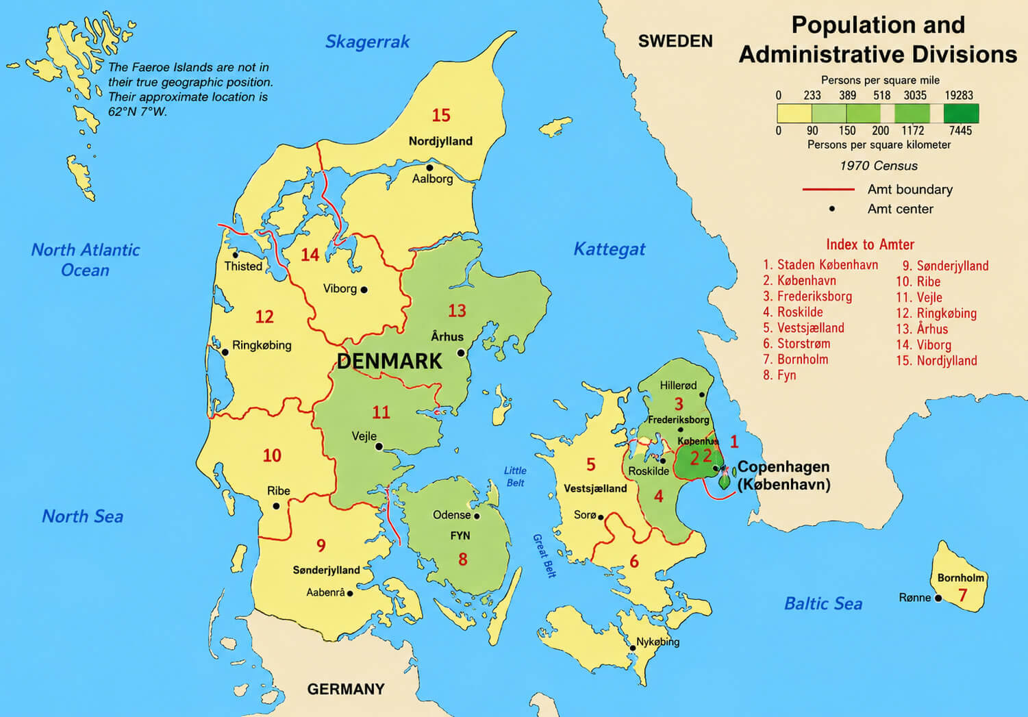
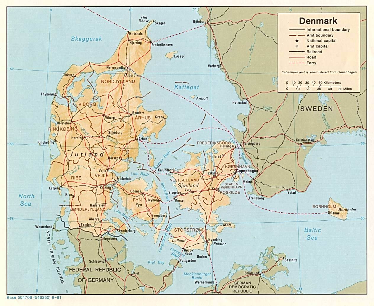
DENMARK ADMINISTRATIVE MAP
Denmark City Maps
Copenhagen Arhus Odense Aalborg Esbjerg Randers Kolding Horsens Vejle Roskilde Herning Silkeborg Naestved Frederiksberg Gentofte Gladsaxe Lyngby Taarbaek Hvidovre Helsingor Greve Strand Tarnby Fredericia Ballerup Rodovre Viborg Koge Holstebro Brondby Taastrup Slagelse Hillerod Albertslund Sonderborg Svendborg Herlev Holbak Hjorring Horsholm Frederikshavn Glostrup Haderslev Norresundby Ringsted Olstykke Stenlose SkiveA Collection of Denmark Maps and Denmark Satellite Images
DENMARK ADMINISTRATIVE MAP
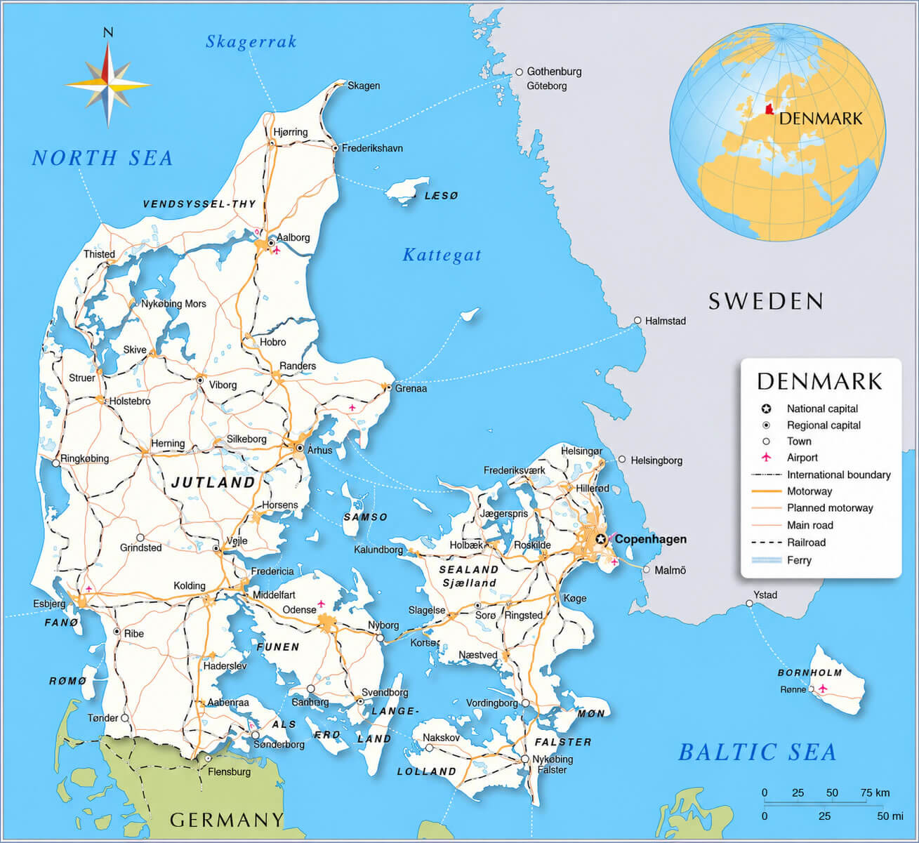
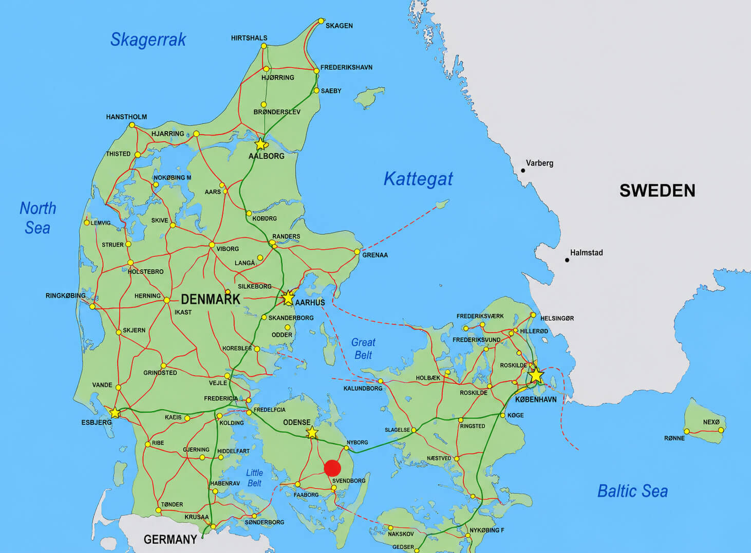
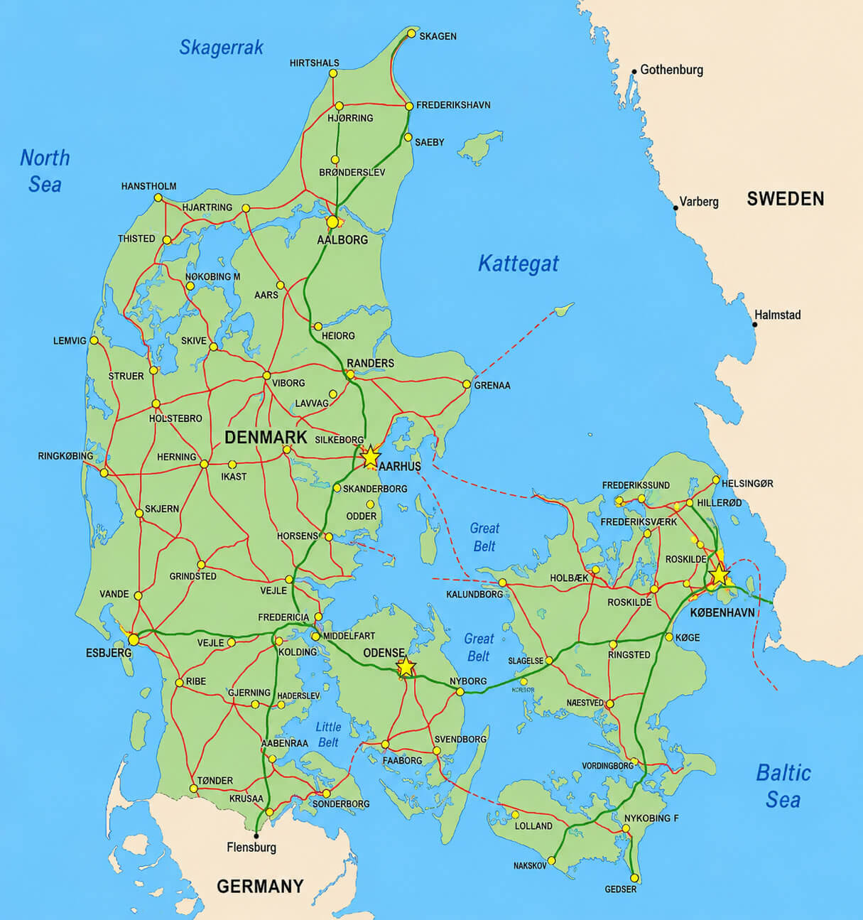
DENMARK HIGHWAYS MAP
ADMINISTRATIVE MAP OF DENMARK
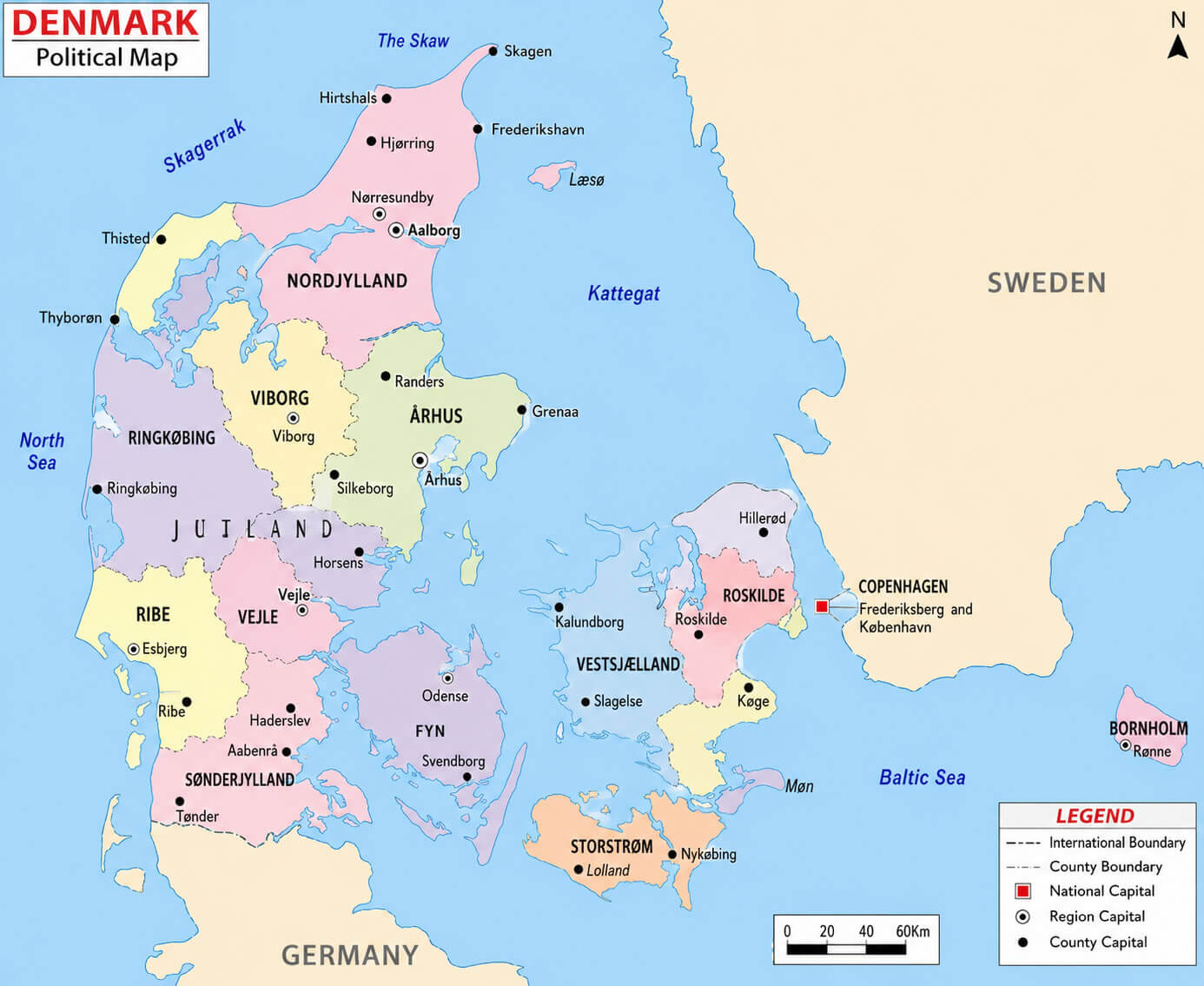
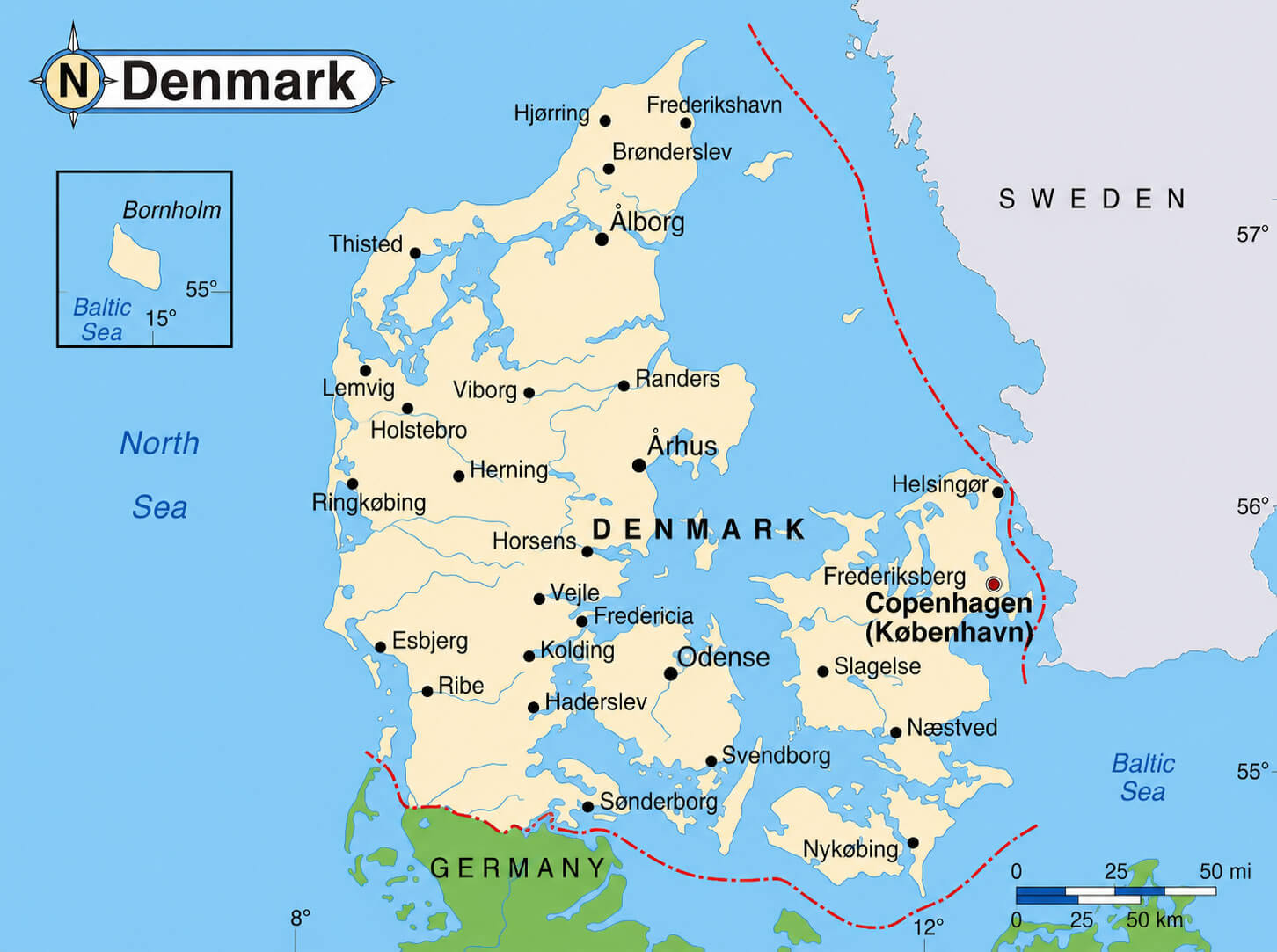
DENMARK POLITICAL MAP
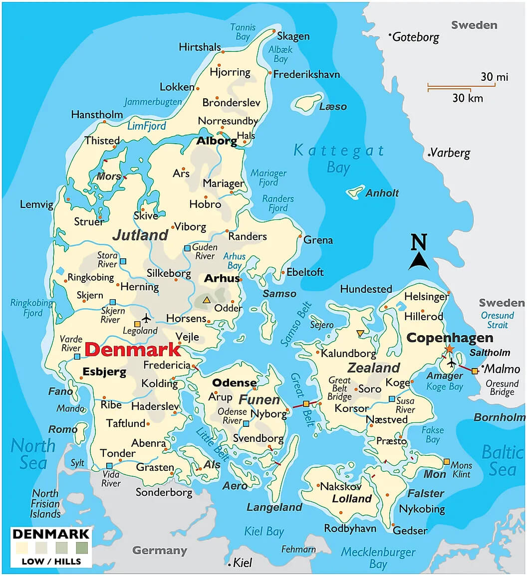
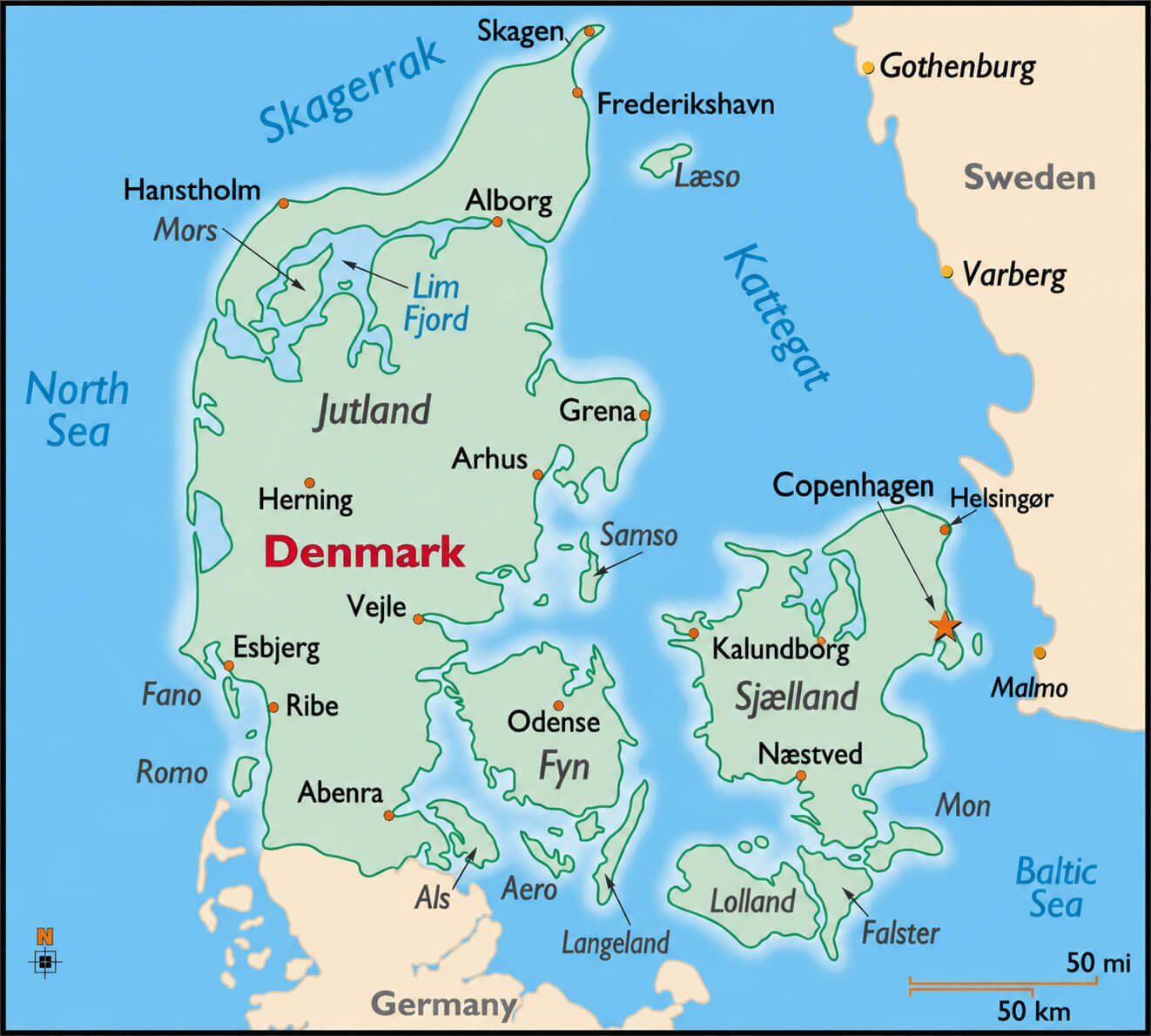
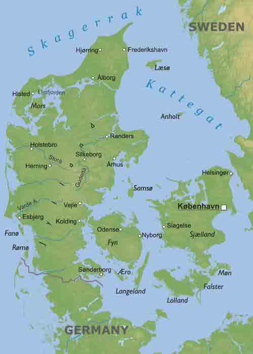
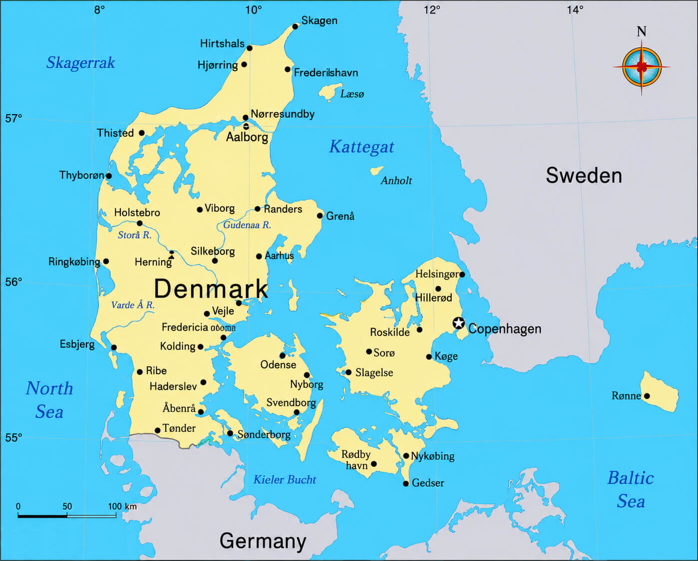
DENMARK PHYSICAL MAP WITH CITIES
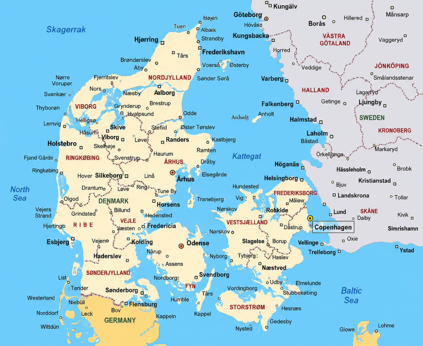
DENMARK REGIONS MAP
DENMARK ROAD MAP WITH CITIES
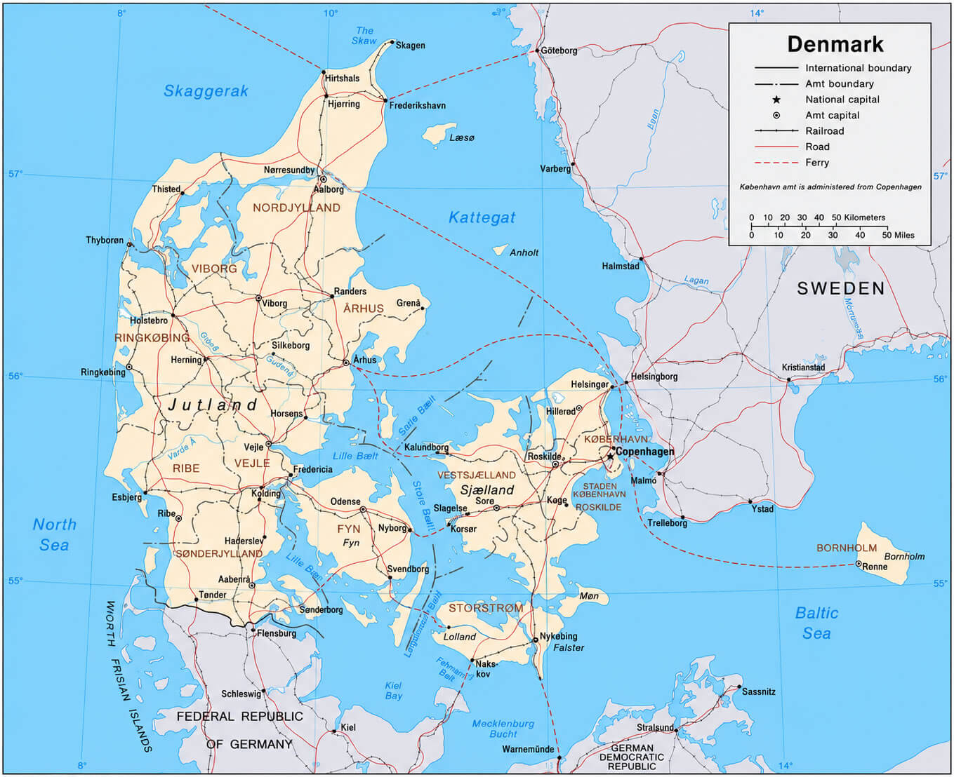
DENMARK ROAD MAP
DENMARK CITIES MAP
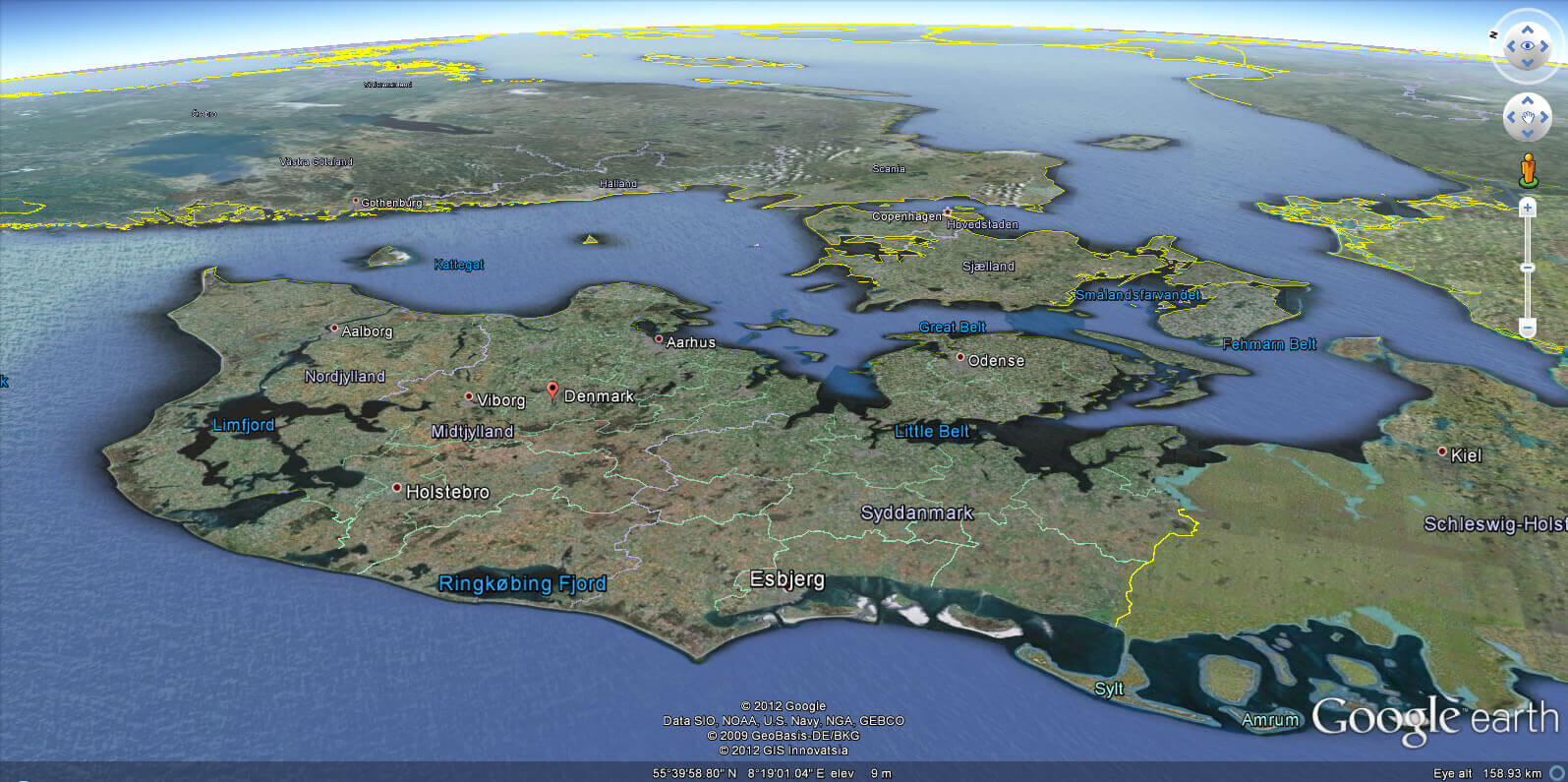
DENMARK EARTH MAP
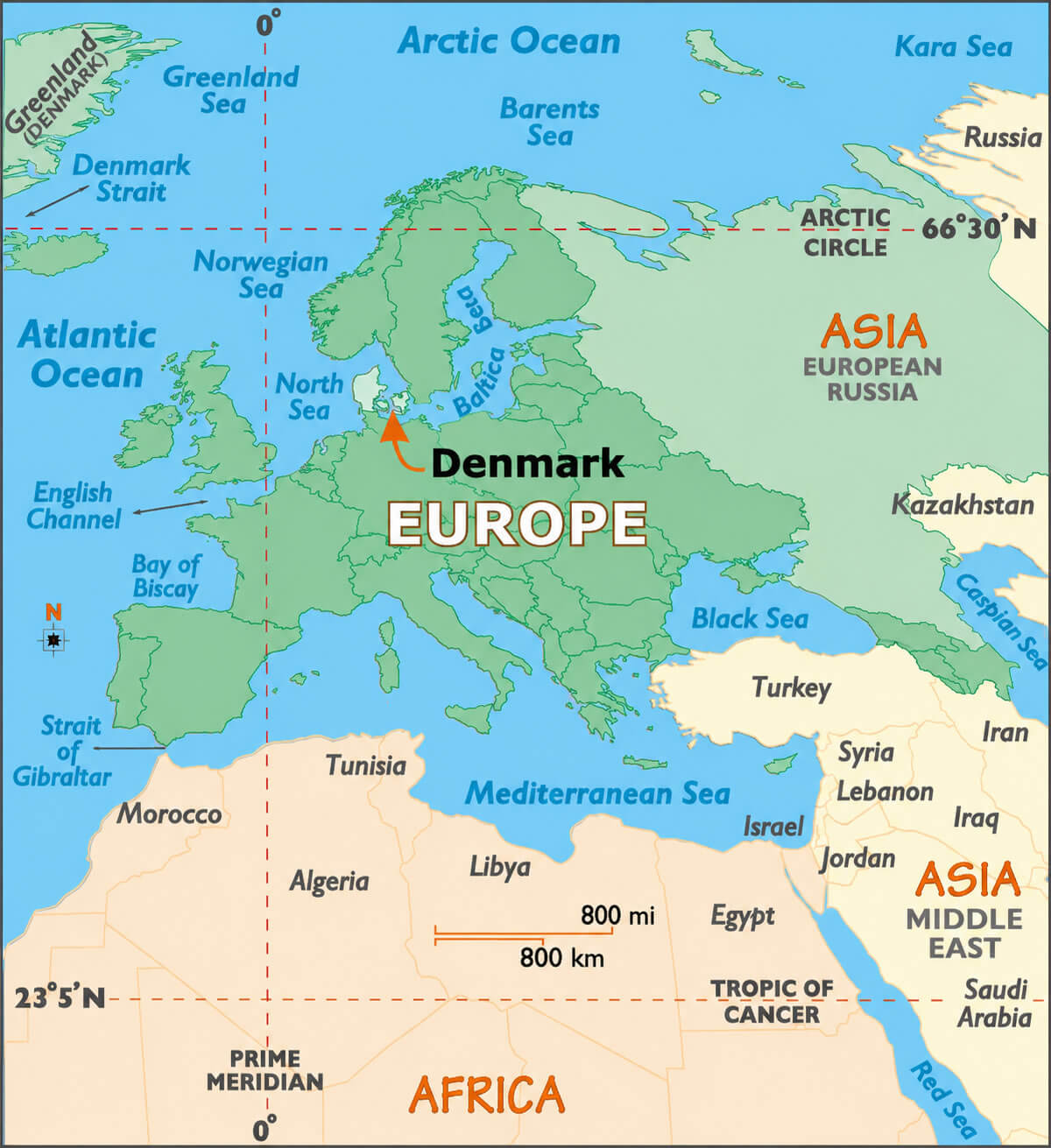
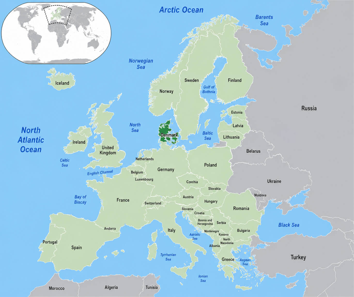
DENMARK IN EUROPE MAP
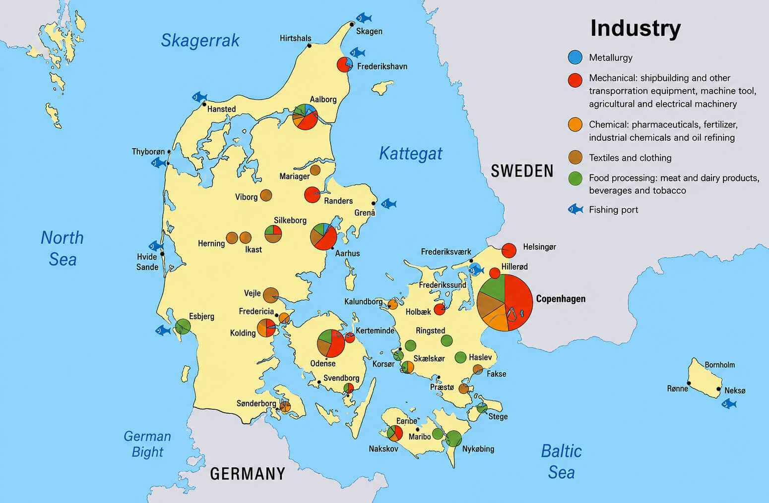
DENMARK INDUSTRY MAP
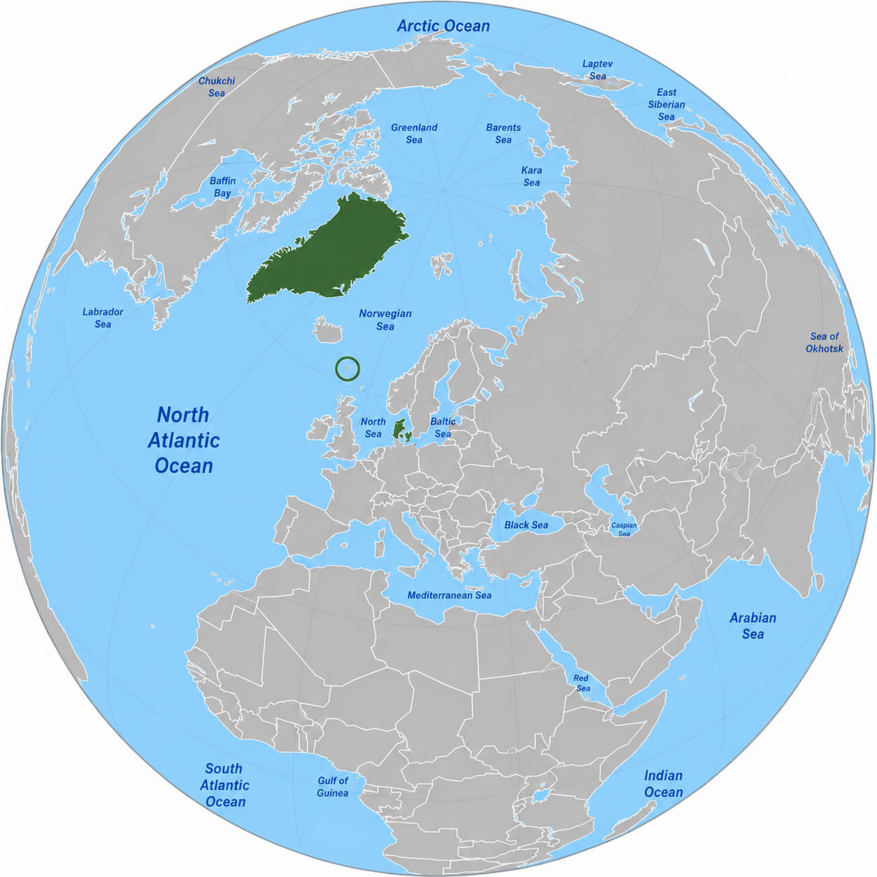
DENMARK LOCATION ON EUROPE MAP
DENMARK MAJOR CITIES MAP
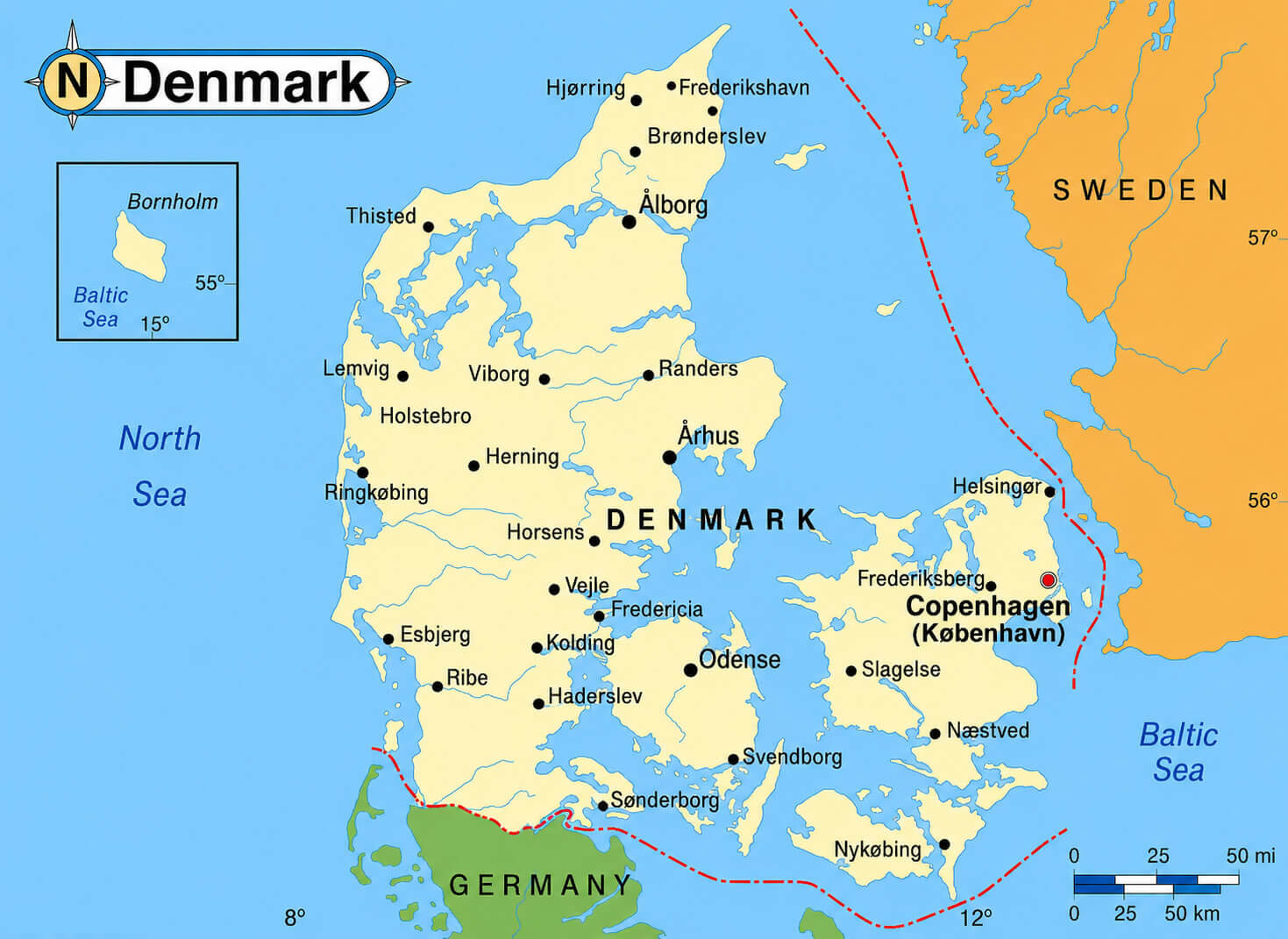
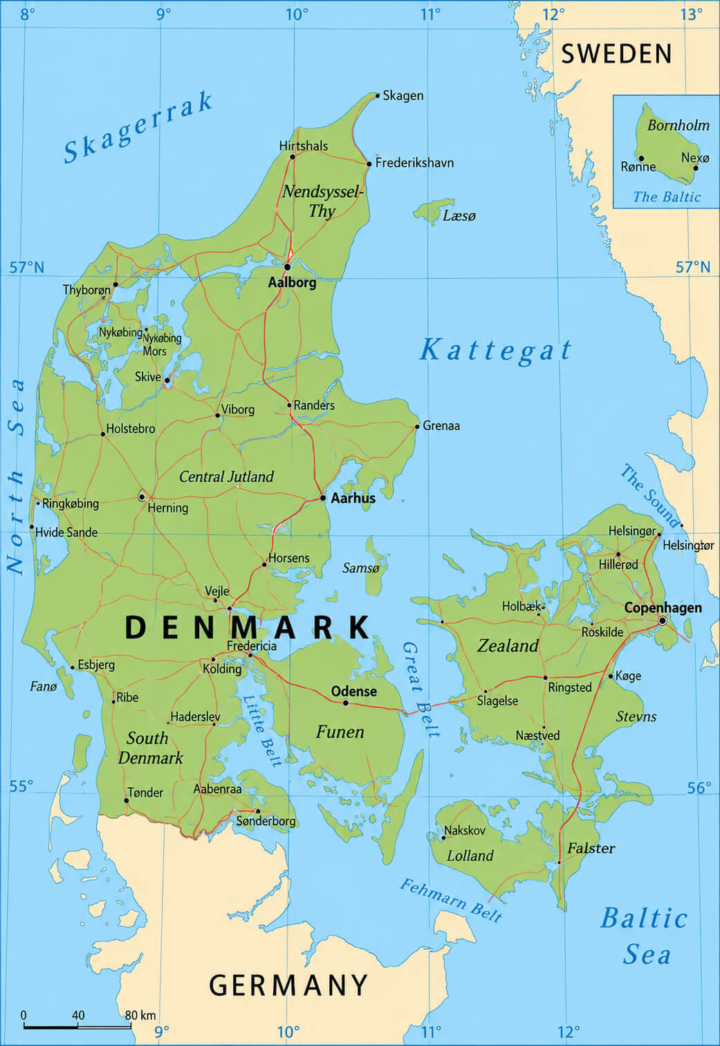
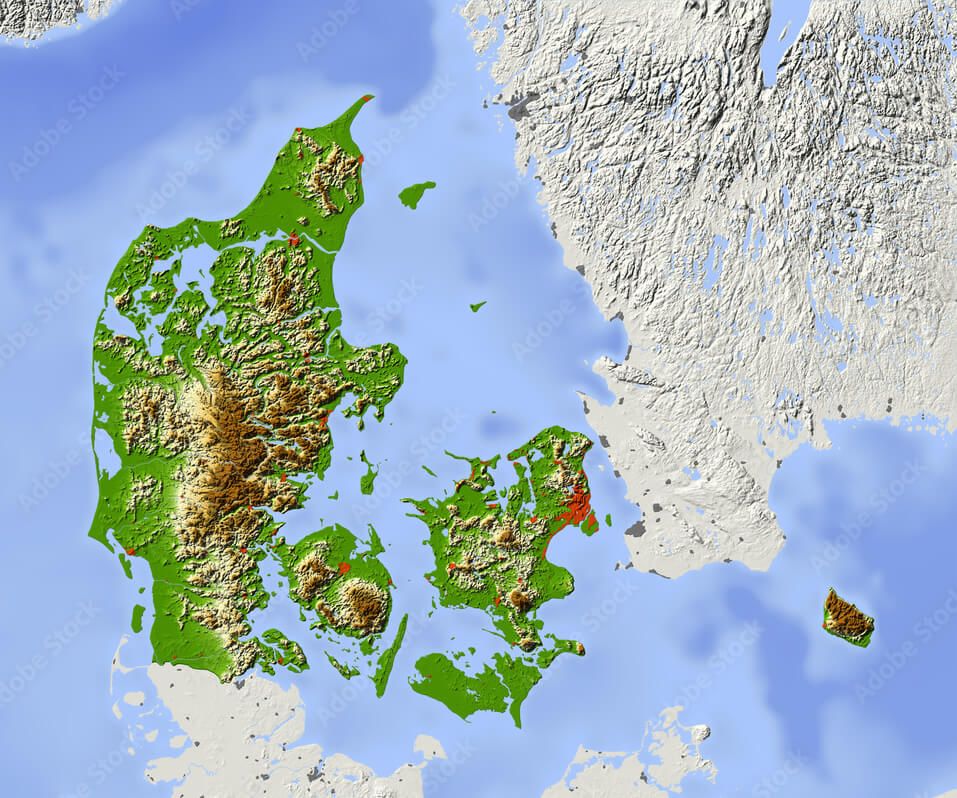
DENMARK PHYSICAL MAP
DENMARK POLITICAL BOUNDARIES MAP
DENMARK POPULATION MAP
DENMARK ROUTES MAPS WITH MAIN CITIES
DENMARK TERRAIN MAP
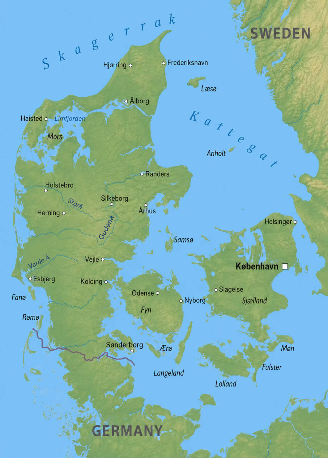
DENMARK TOPOGRAPHY MAP
DENMARK TRANSPORTATION MAP
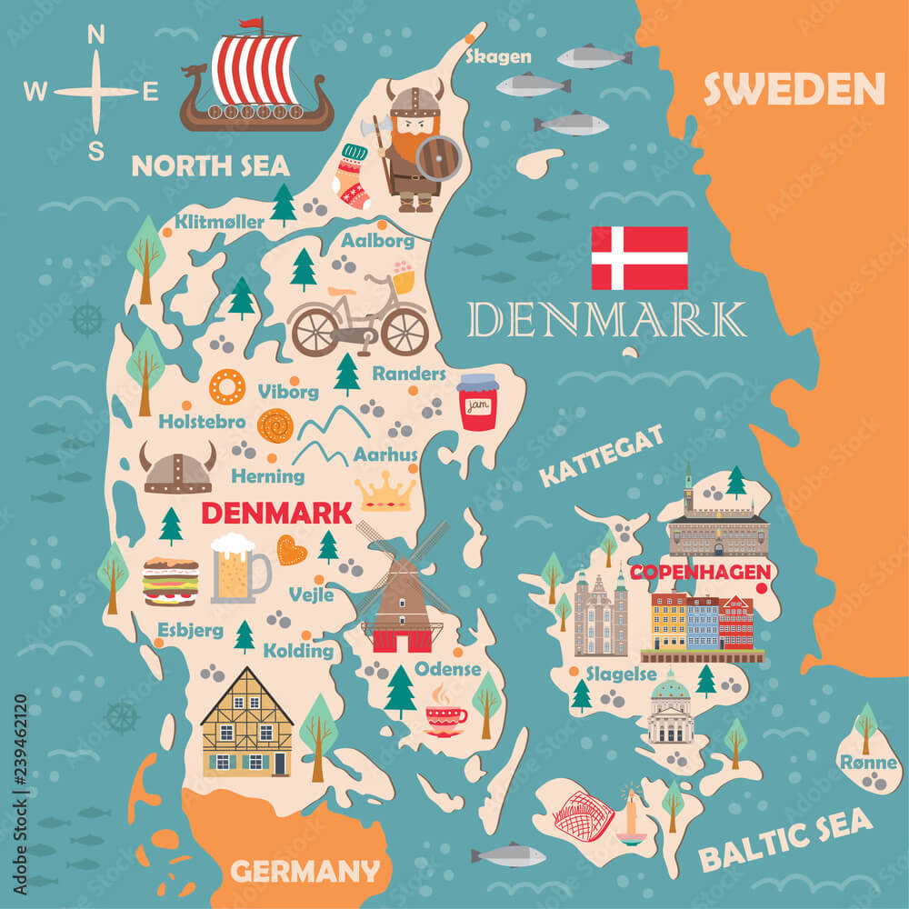
DENMARK TRAVEL MAP
DENMARK VINTAGE PHYSICAL MAPS
PHYSICAL MAP OF DENMARK
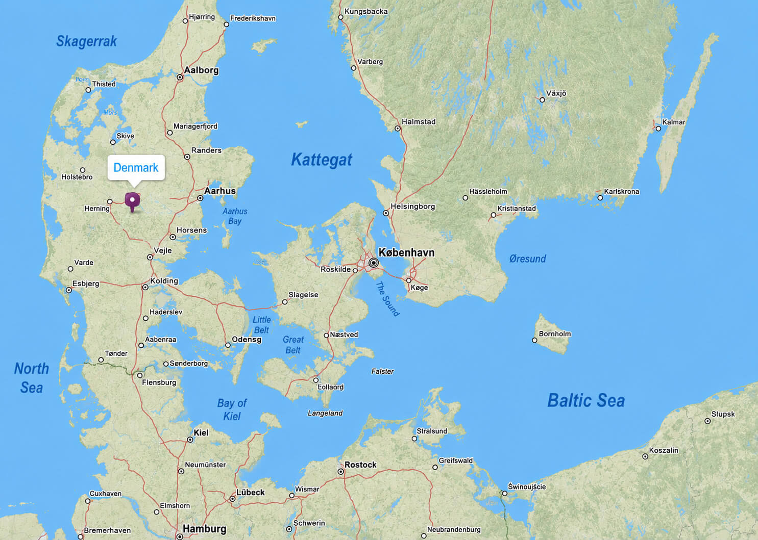
WHERE IS DENMARK ON THE WORLD MAP
Exploring the Heart of Denmark: Copenhagen's 10 Best Spots
Please subscribe on "World Guide" channnel on Youtube at youtube.com/c/WorldGuide
Exploring the Heart of Denmark: Copenhagen's 10 Best Spots
Please subscribe on "World Guide" channnel on Youtube at youtube.com/c/WorldGuide
See Also
Denmark Google Map, Street Views, Maps Directions, Satellite Images
WorldMap1.com offers a collection of Denmark map, google map, Denmark atlas, political, physical, satellite view, country infos, cities map and more map of Denmark.