Map of Haiti, Haiti
Navigate Haiti map, Haiti country map, satellite images of Haiti, Haiti largest cities, towns maps, political map of Haiti, driving directions, physical, atlas and traffic maps in Haiti.
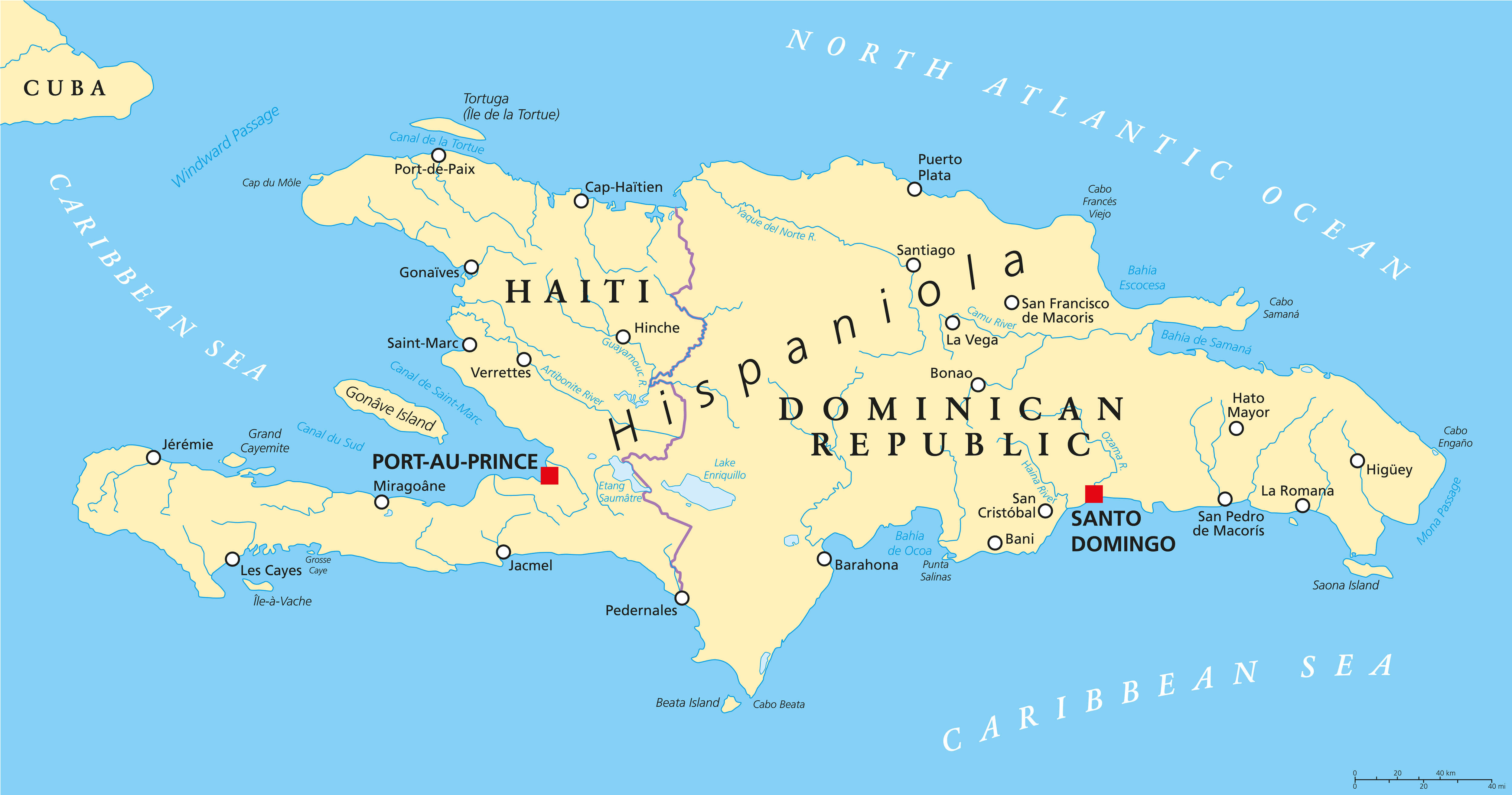
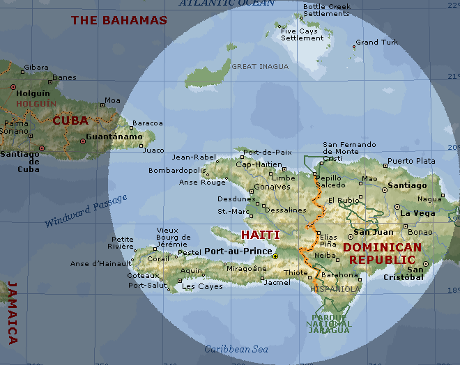
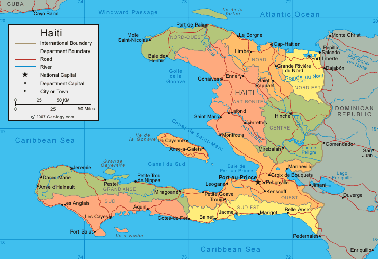
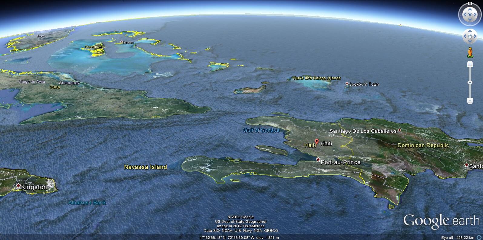
POLITICAL MAP HAITI DOMINICAN REPUBLIC
Haiti City Maps
Jeremie Les Cayes Jackmel Port au PrinceA Collection of Haiti Maps and Haiti Satellite Images
POLITICAL MAP HAITI DOMINICAN REPUBLIC
MAP OF HAITI
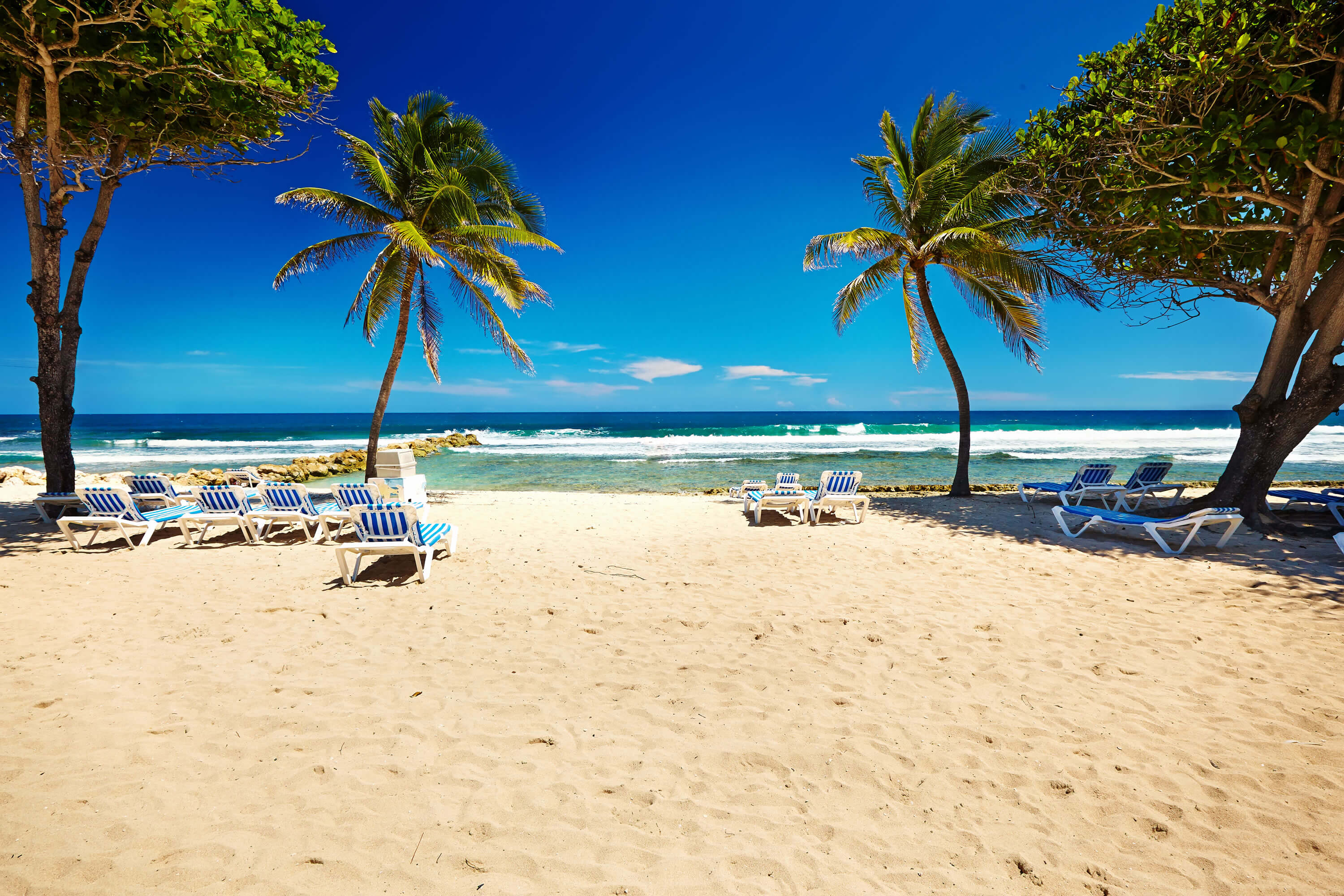
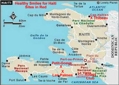
HAITI CARIBBEAN BEACH
HAITI LOCATION MAP
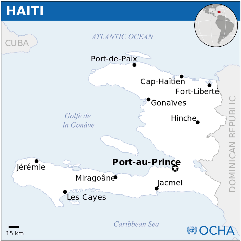
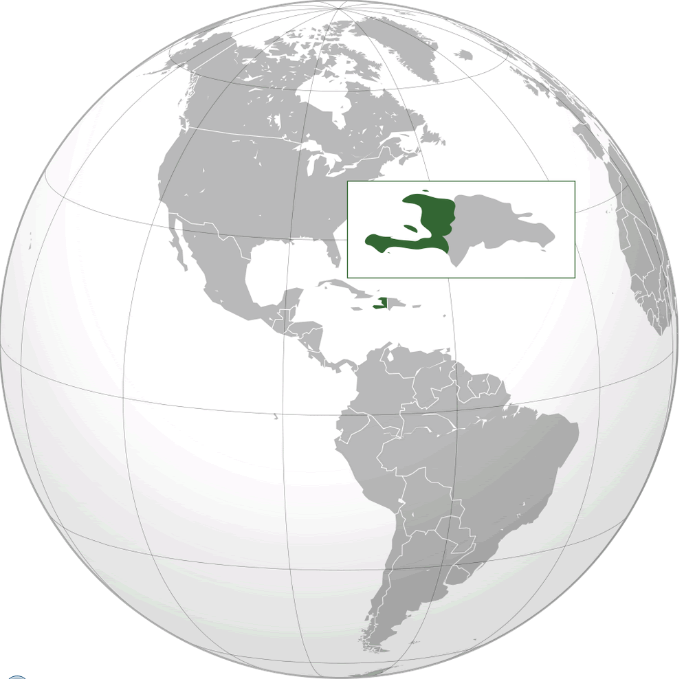
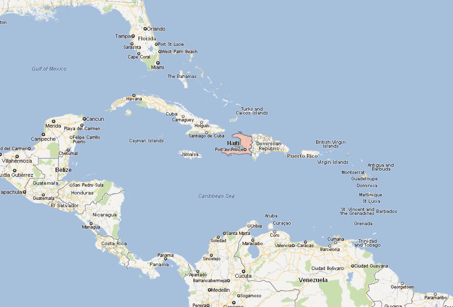
WHERE IS HAITI IN THE WORLD
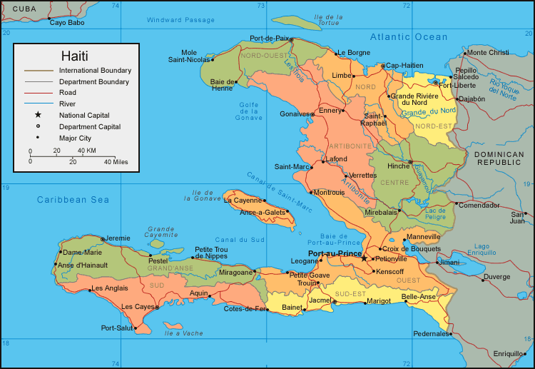
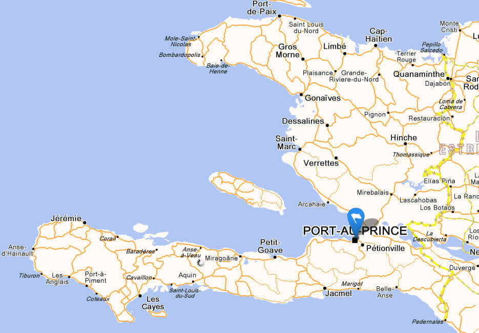
HAITI CITIES MAP
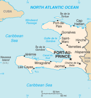
HAITI MAP
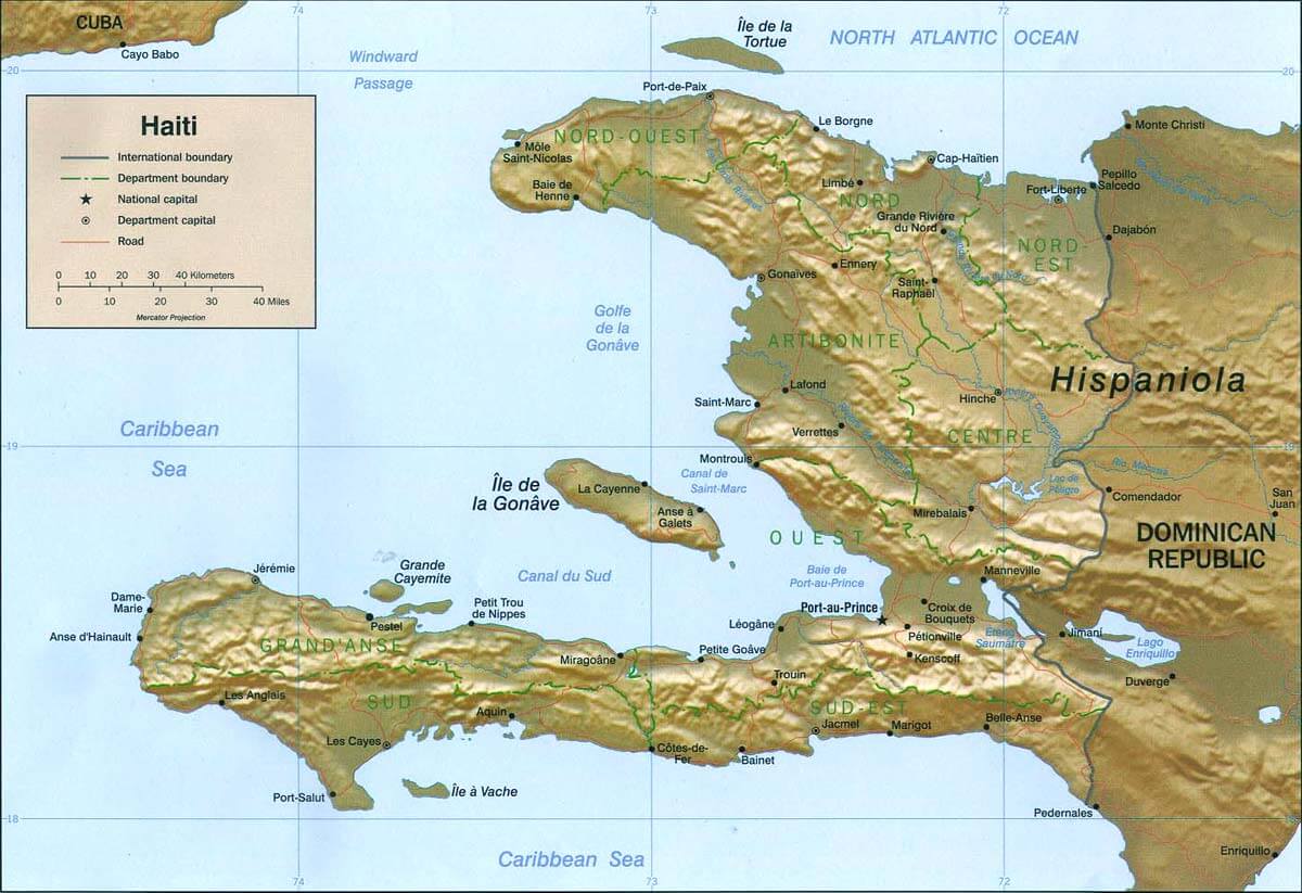
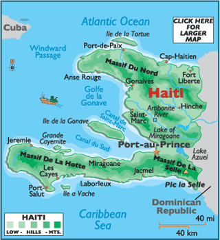
HAITI PHYSICAL MAP
HAITI CITIES MAP
HAITI MAP
HAITI MAP
HAITI MAP
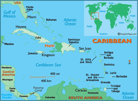
MAP OF HAITI CARIBBEAN
MAP OF HAITI WORLD

MAP OF HAITI
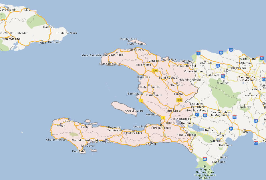
MAP HAITI
PHYSICAL MAP OF HAITI

POLITICAL MAP OF HAITI
HAITI EARTH MAP
See Also
Haiti Google Map, Street Views, Maps Directions, Satellite Images
WorldMap1.com offers a collection of Haiti map, google map, Haiti atlas, political, physical, satellite view, country infos, cities map and more map of Haiti.