Map of Iran, Iran
Navigate Iran map, Iran country map, satellite images of Iran, Iran largest cities, towns maps, political map of Iran, driving directions, physical, atlas and traffic maps in Iran.
MAP OF IRAN
Iran City Maps
Ahvaz Isfahan Karaj Kerman Bakhtaran Mashhad Orumieh Qom Rasht Shiraz Tabriz Tehran ZahedanA Collection of Iran Maps and Iran Satellite Images
MAP OF IRAN
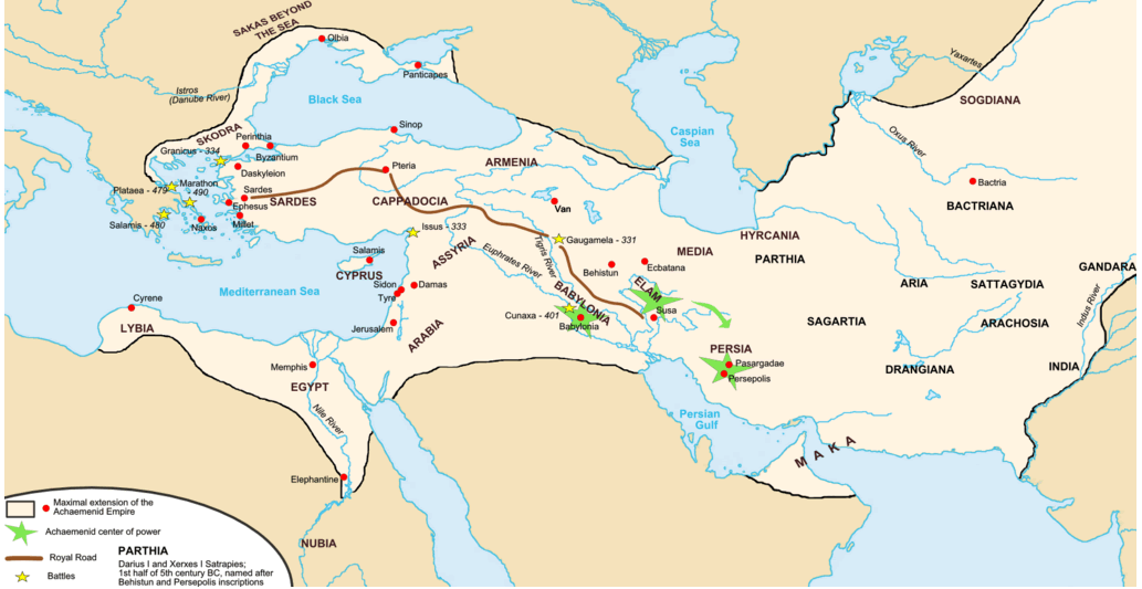
ACHAEMENID EMPIRE MAP DARIUS IRAN
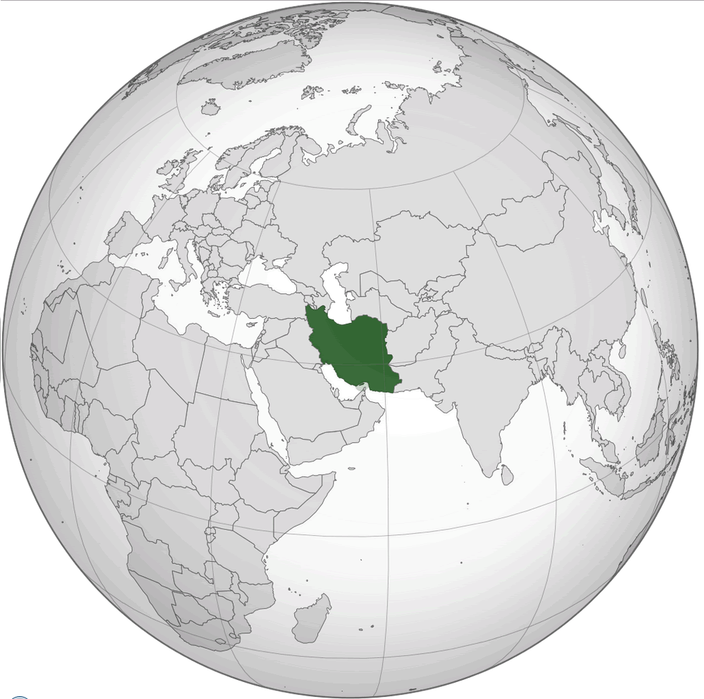
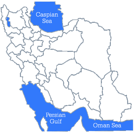
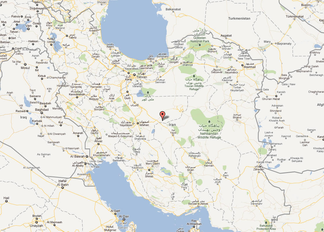
IRAN LOCATION MAP
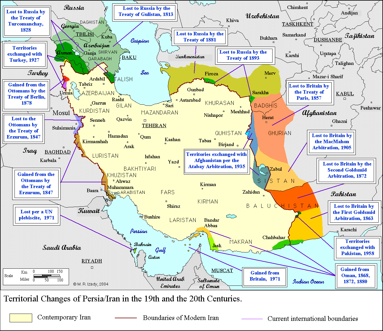
BOUNDARIES OF IRAN MAP
EMPTY IRAN MAP
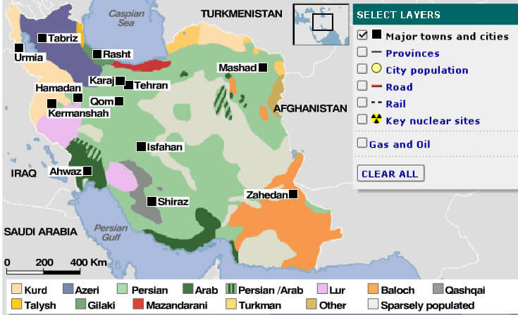
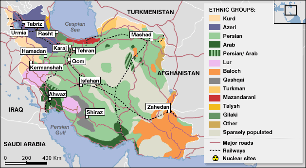
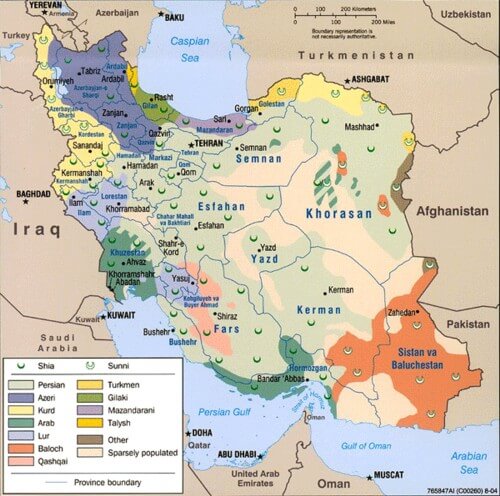
ETHNIC GROUPS MAP OF IRAN
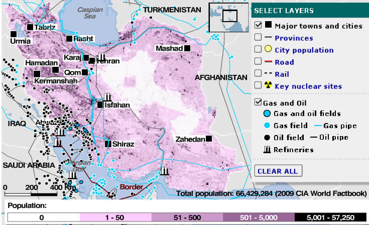
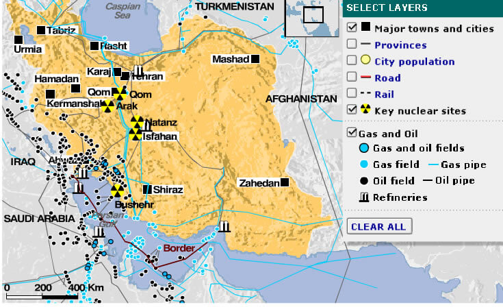
GAS OIL MAP OF IRAN
IRAN ETHNIC GROUPS
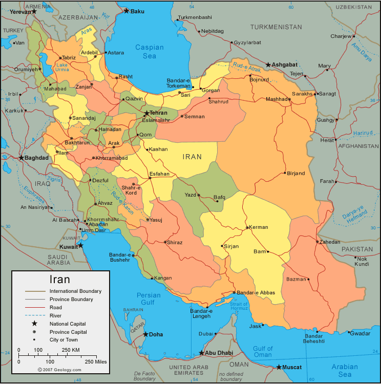
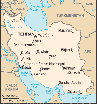
IRAN MAP
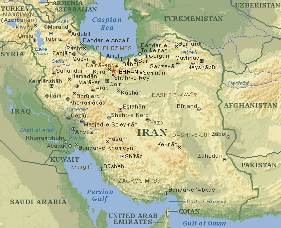
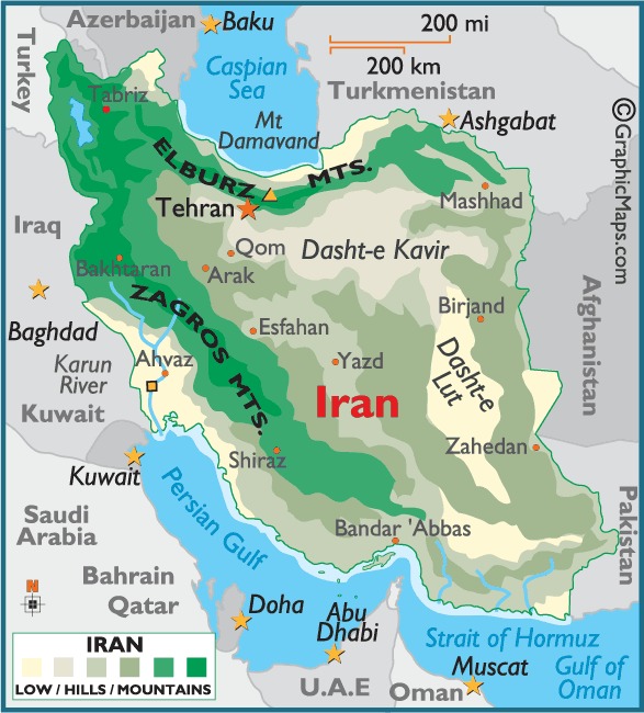
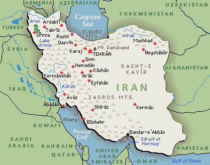
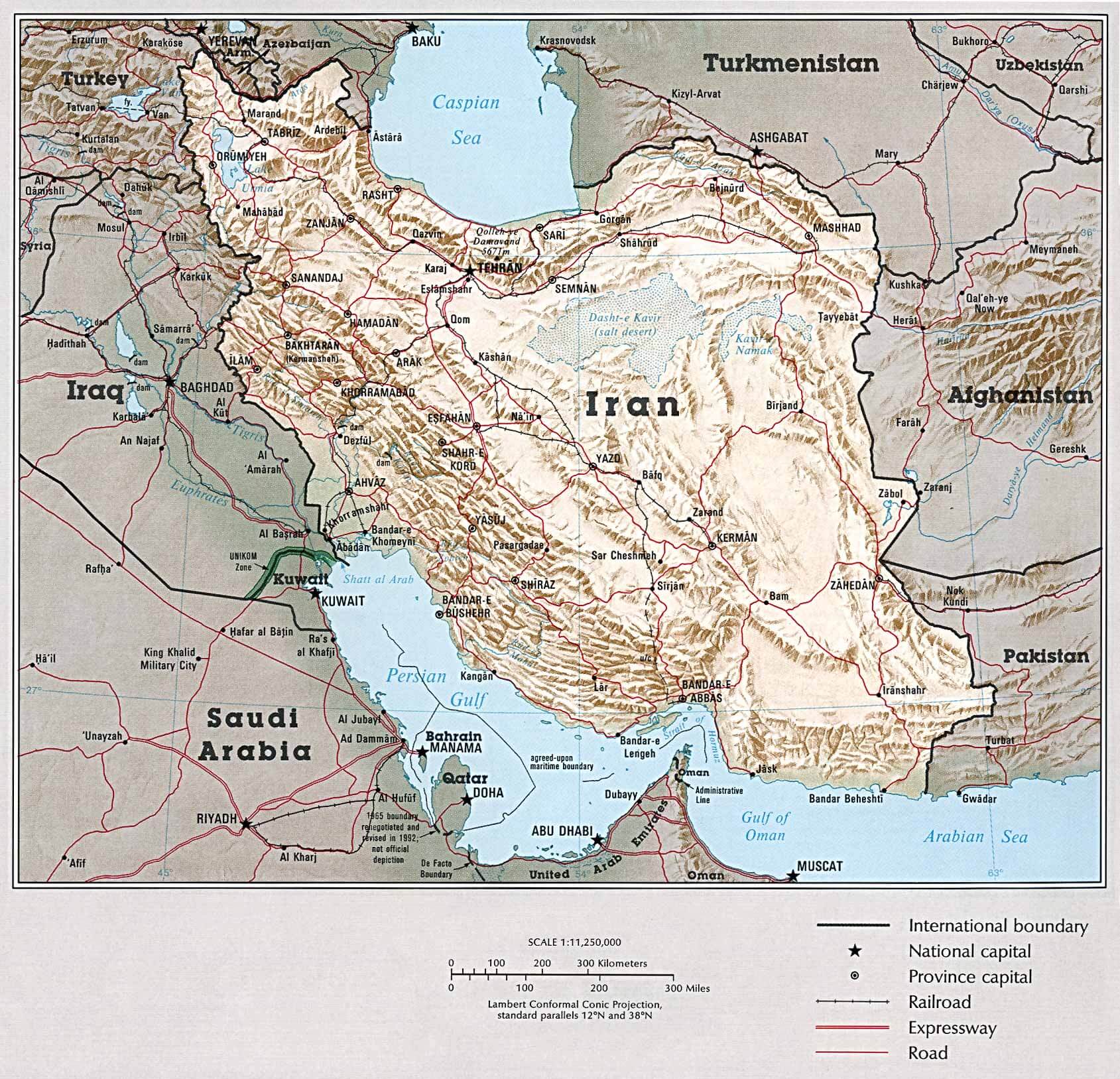
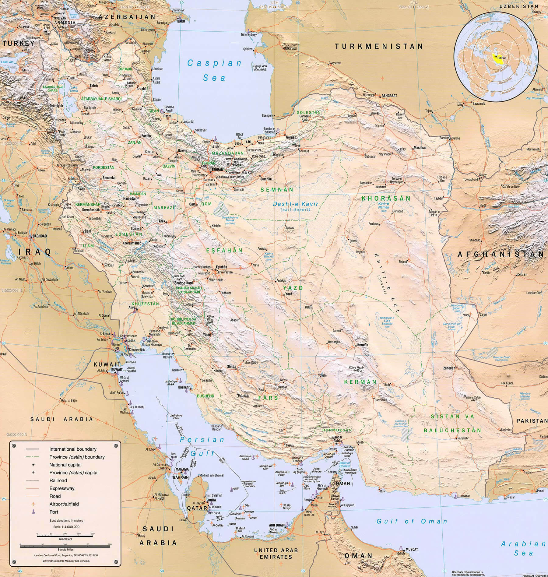
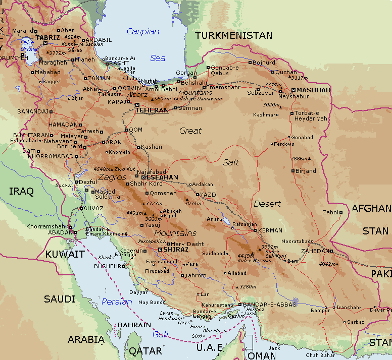
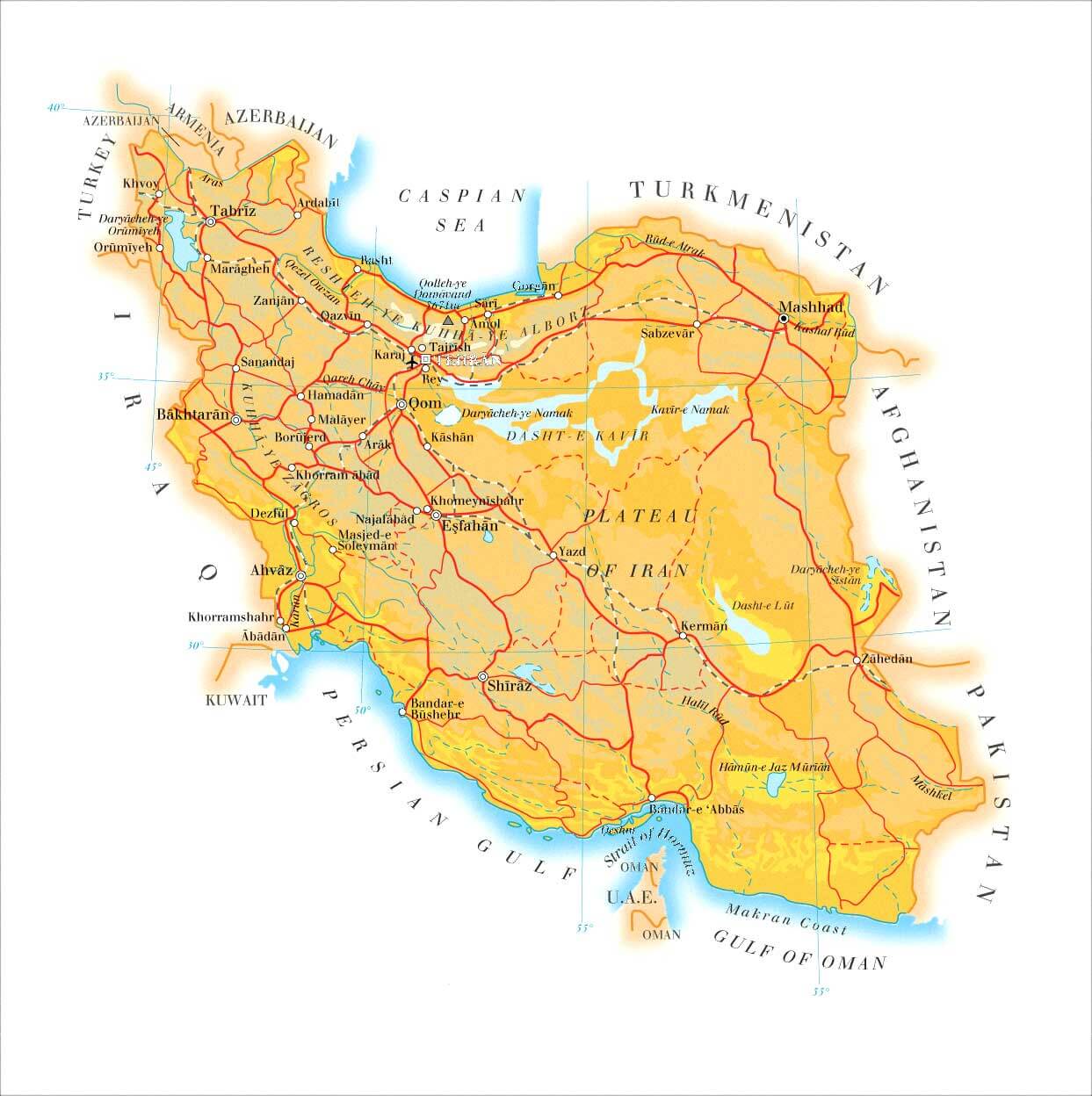
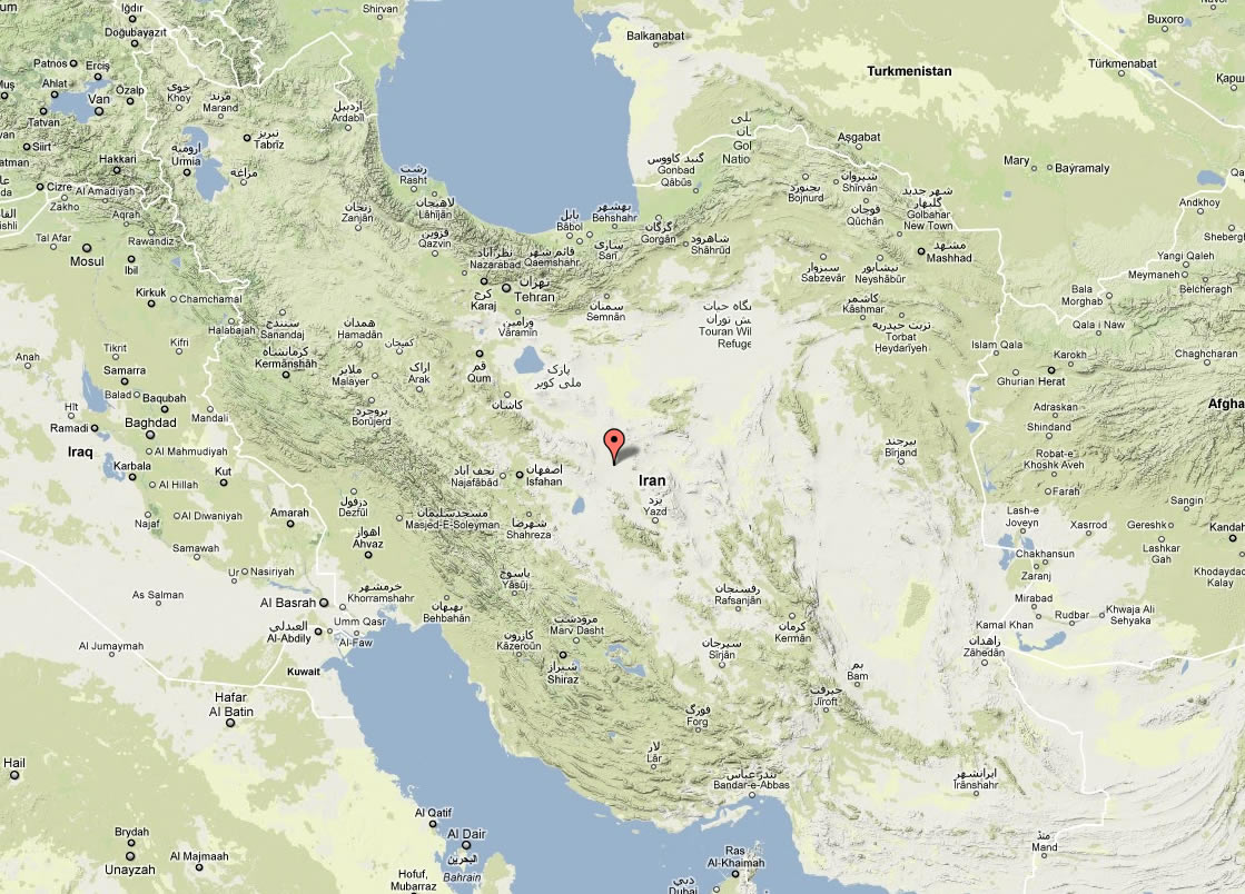
IRAN PHYSICAL MAP
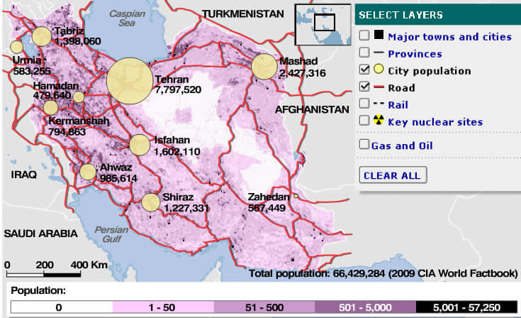
IRAN CITIES MAP
IRAN ETHNIC GROUPS MAP
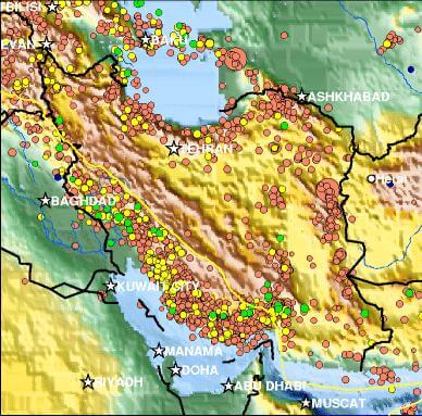
IRAN FAULT ACTIVITY MAP
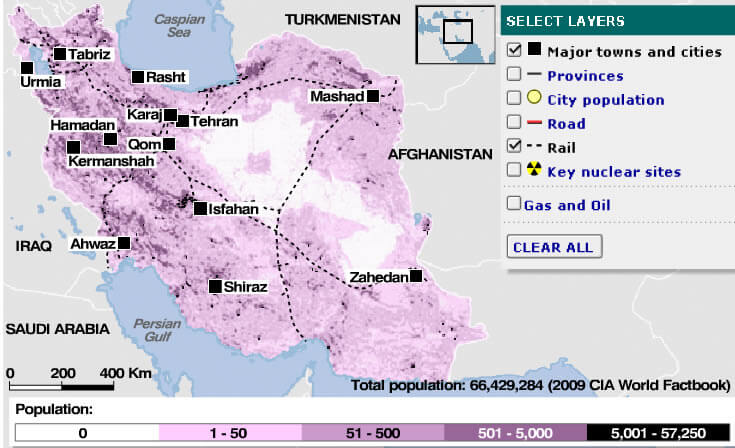
IRAN MAJOR TOWNS MAP
IRAN MAP
IRAN MAP COLORFUL
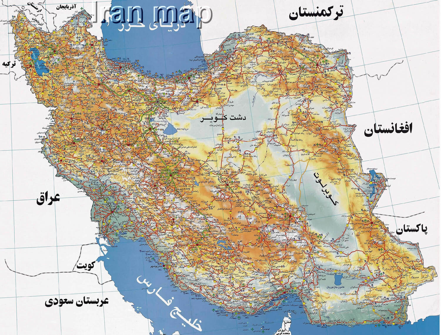
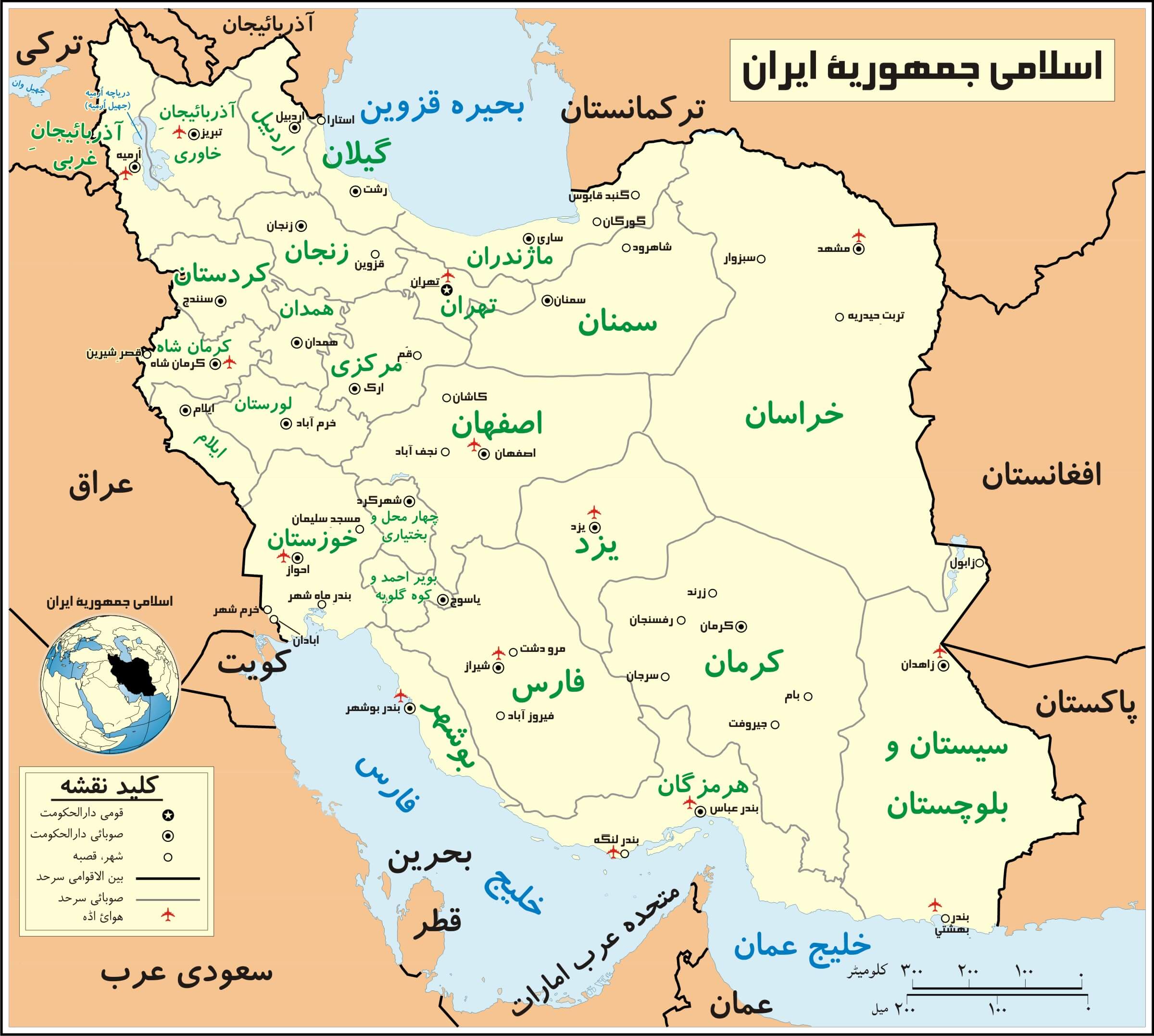
IRAN MAP IN PERSIAN
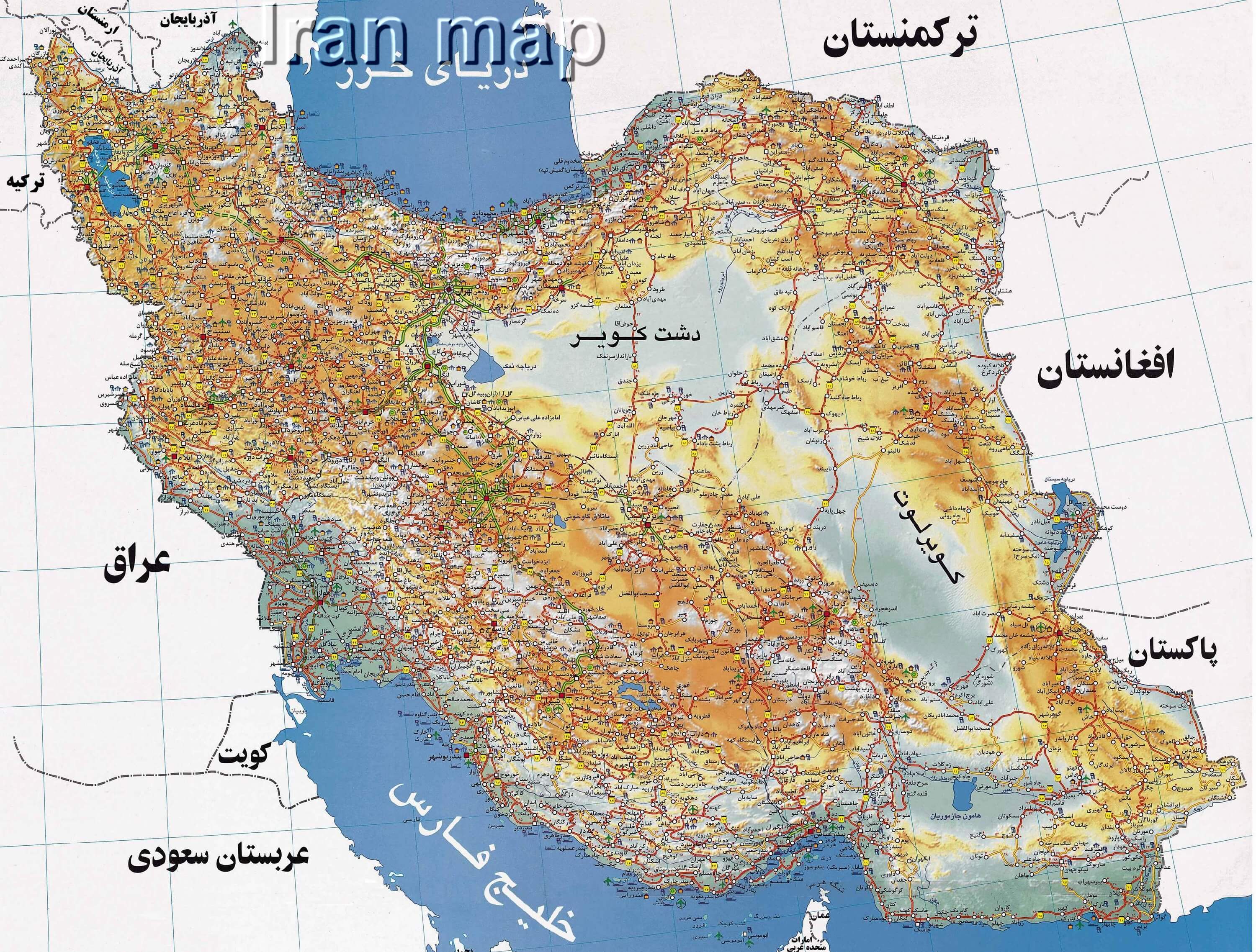
IRAN MAP IN PERSIAN B
IRAN MAPS
IRAN OUTLINE MAP
IRAN PHYSICAL MAP
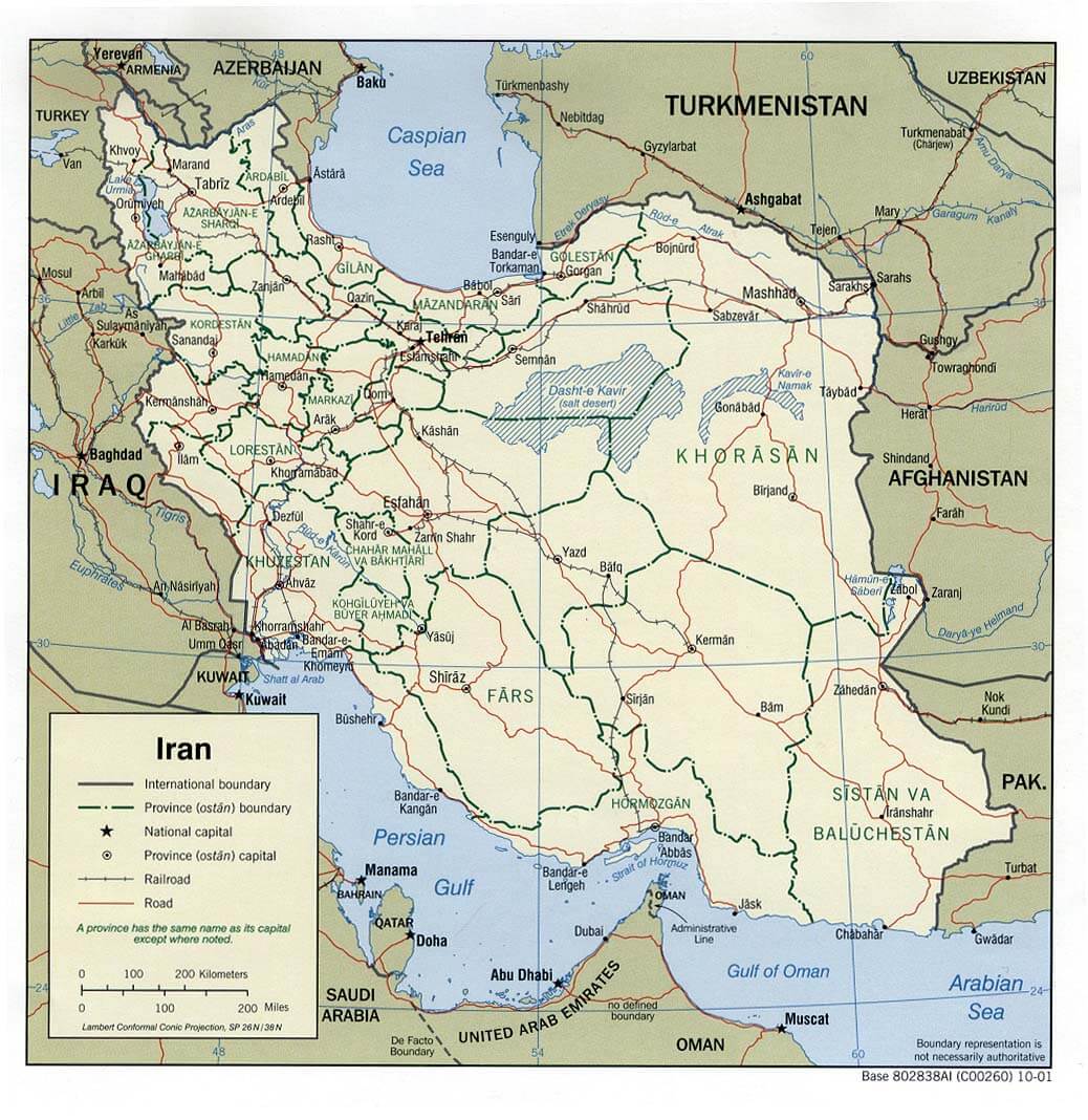
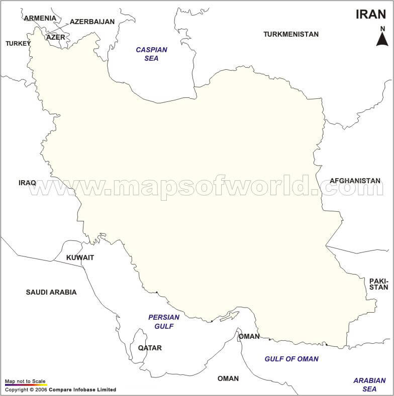
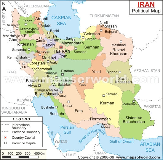
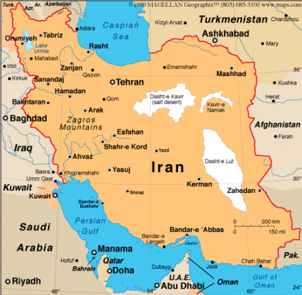
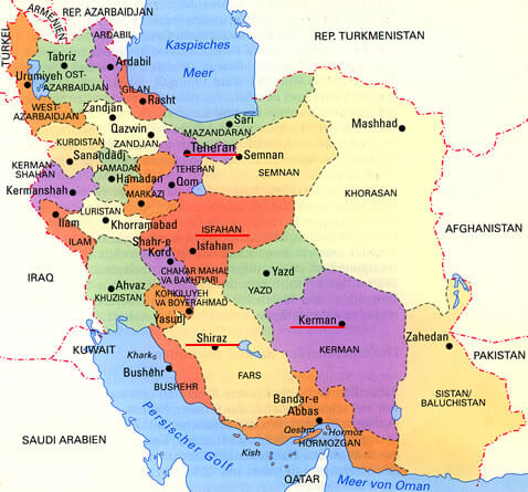
IRAN POLITICAL MAP
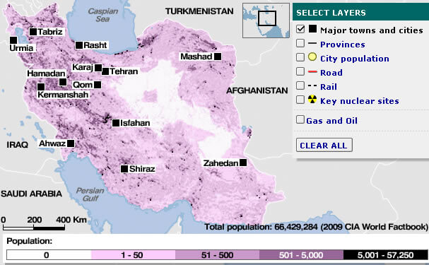
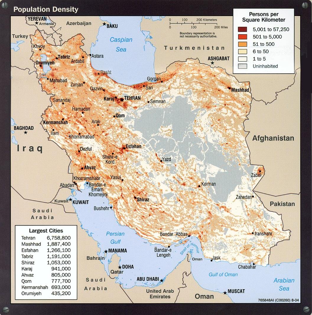
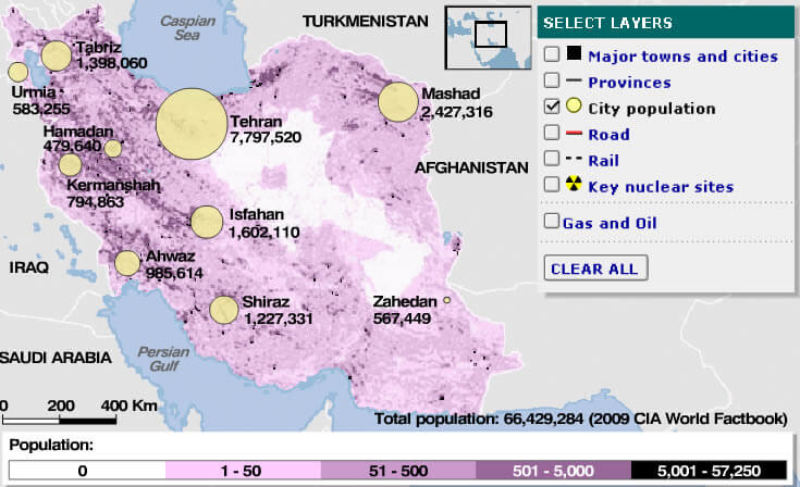
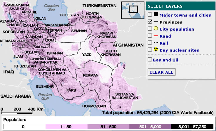
IRAN POPULATION DENSITY MAP
IRAN RAIL MAP
IRANMAP
LAND MAP OF IRAN
MAP OF IRAN
MAP IRAN
MAP OF IRAN
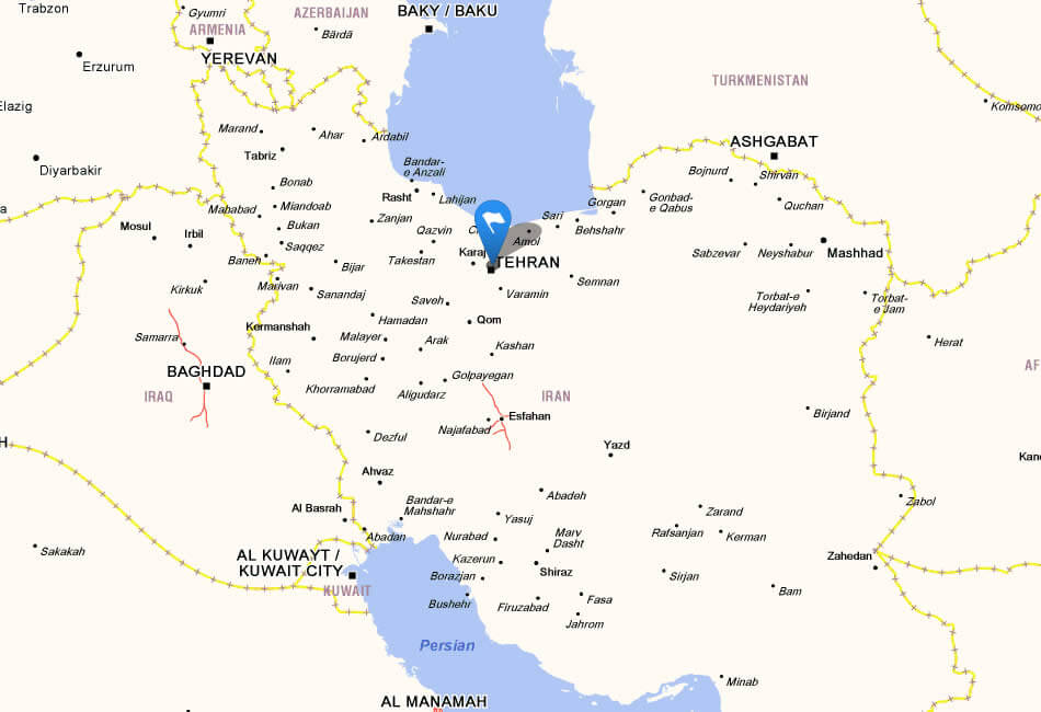
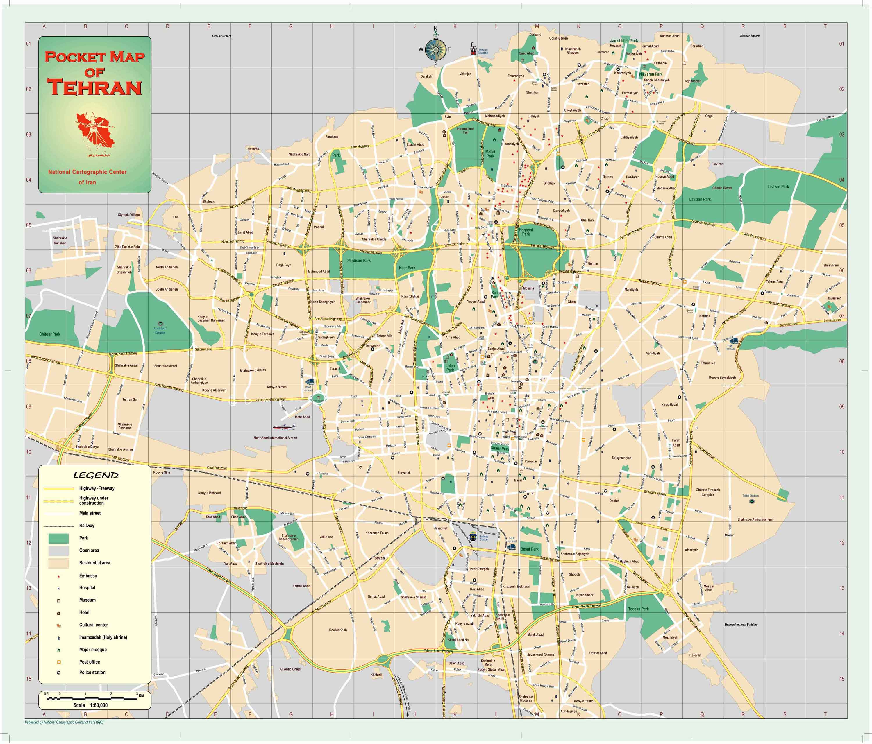
MAP OF TEHRAN IRAN
MAPS OF IRAN
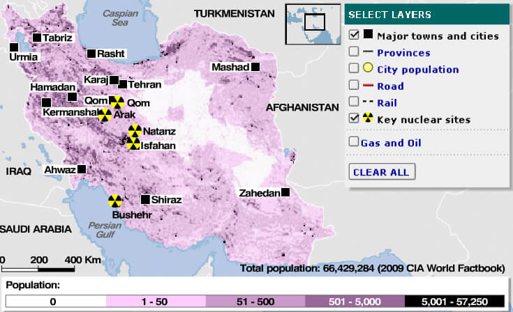
NUCLEAR MAP OF IRAN
PERSIAN IRAN MAP
PHYSICAL MAP IRAN
POLITICAL IRAN MAP
POPULATION MAP OF IRAN
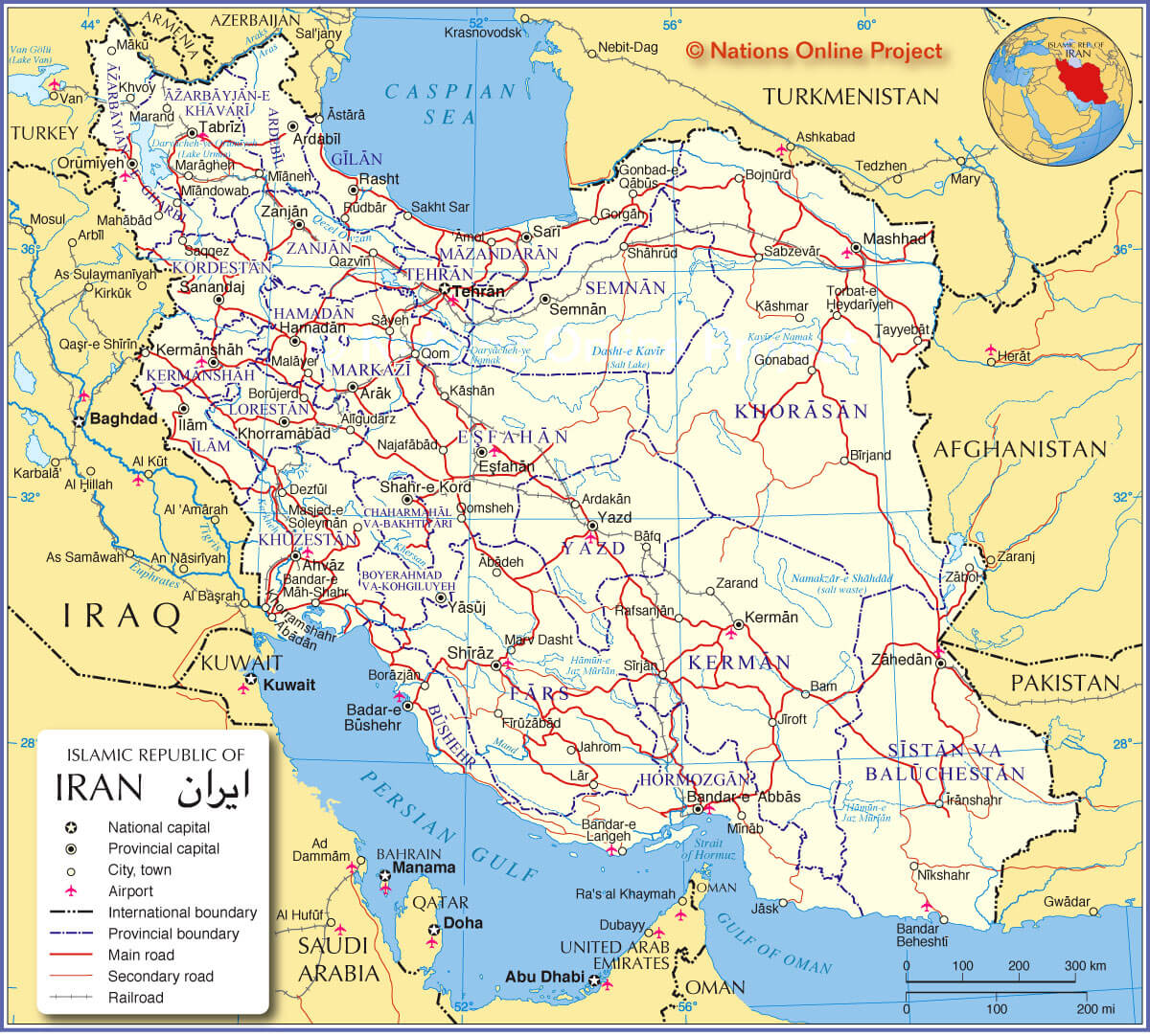
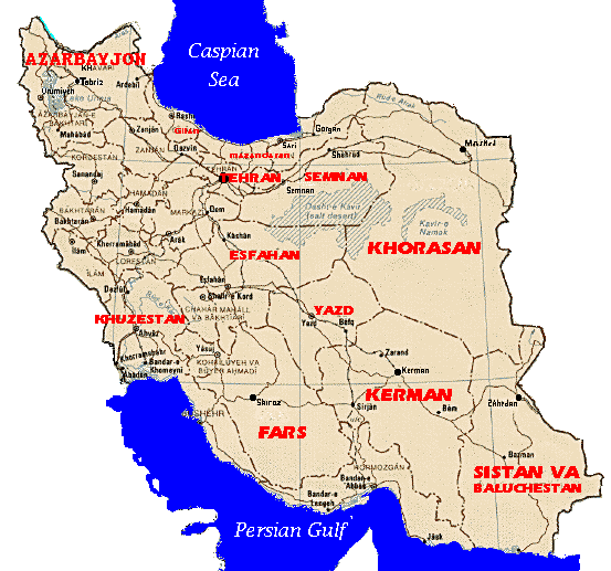
PROVINCES MAP OF IRAN
RAIL MAP OF IRAN
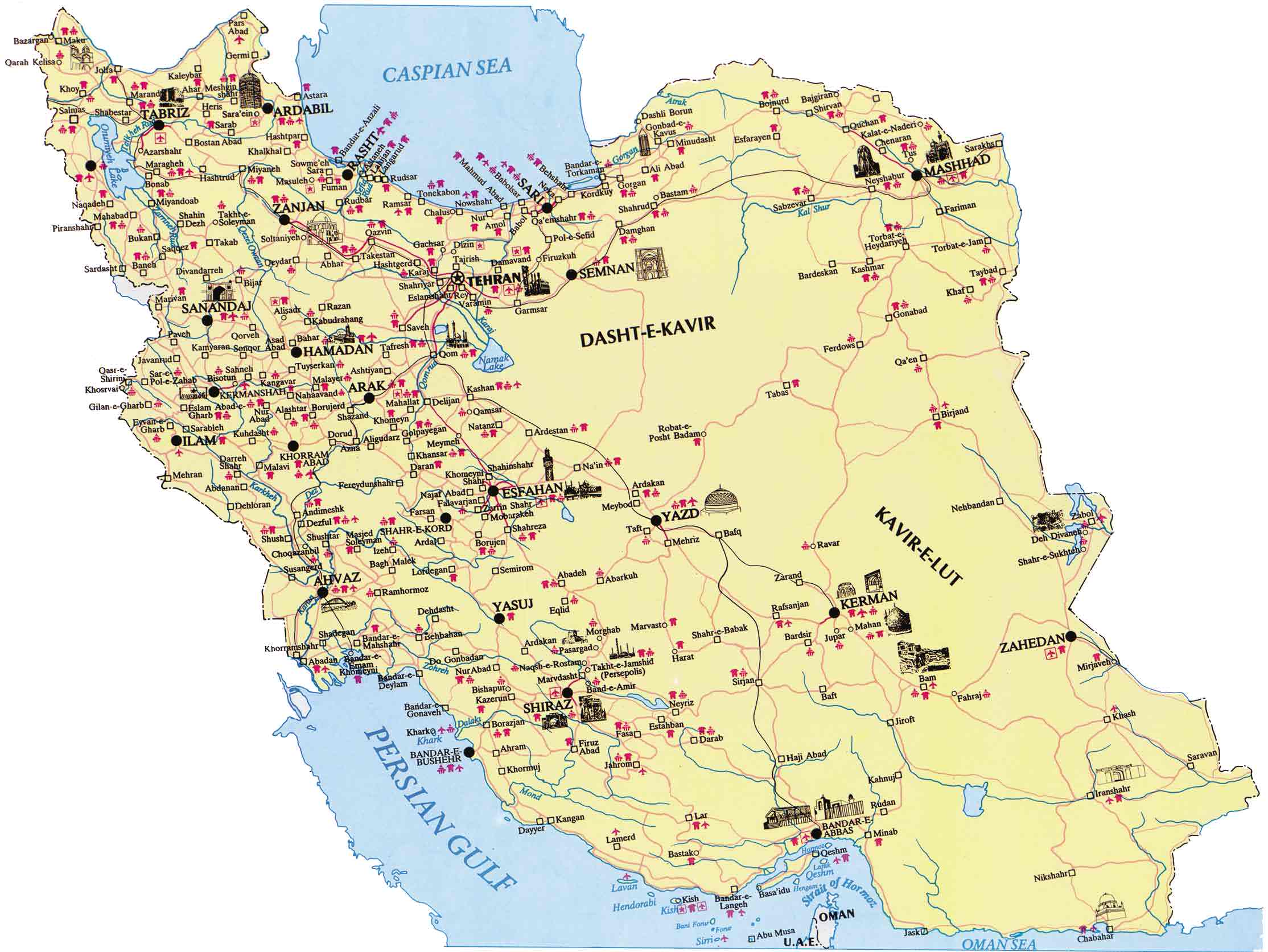
ROAD MAP OF IRAN
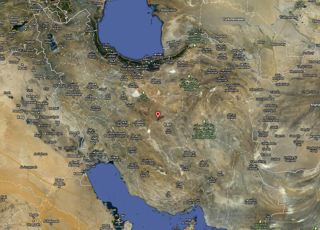
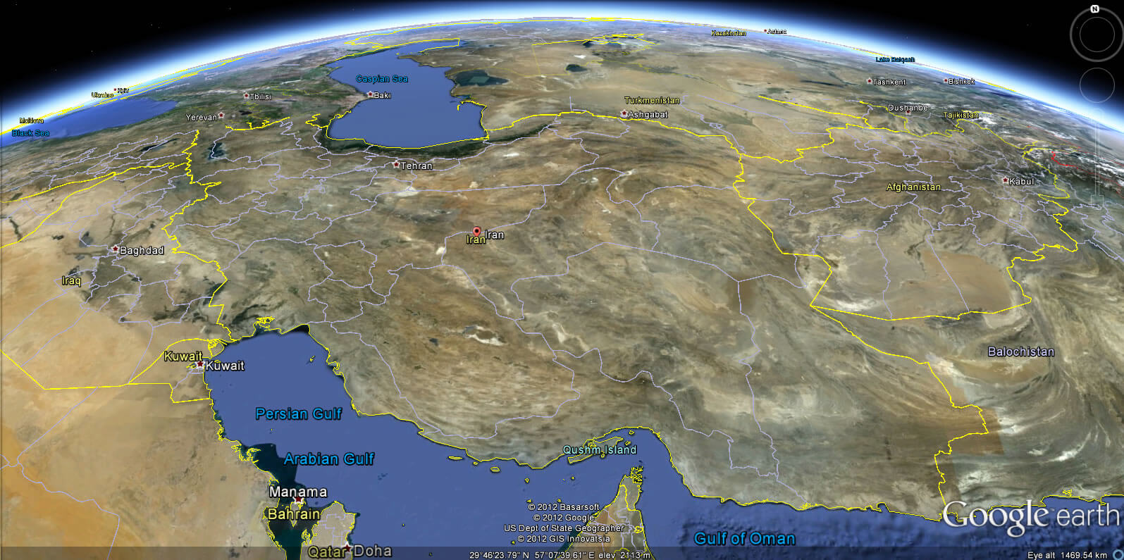
SATELLITE IMAGE OF IRAN
SKETCH OF IRAN
TOPOGRAPHIC MAP OF IRAN
IRAN EARTH MAP
See Also
Iran Google Map, Street Views, Maps Directions, Satellite Images
WorldMap1.com offers a collection of Iran map, google map, Iran atlas, political, physical, satellite view, country infos, cities map and more map of Iran.